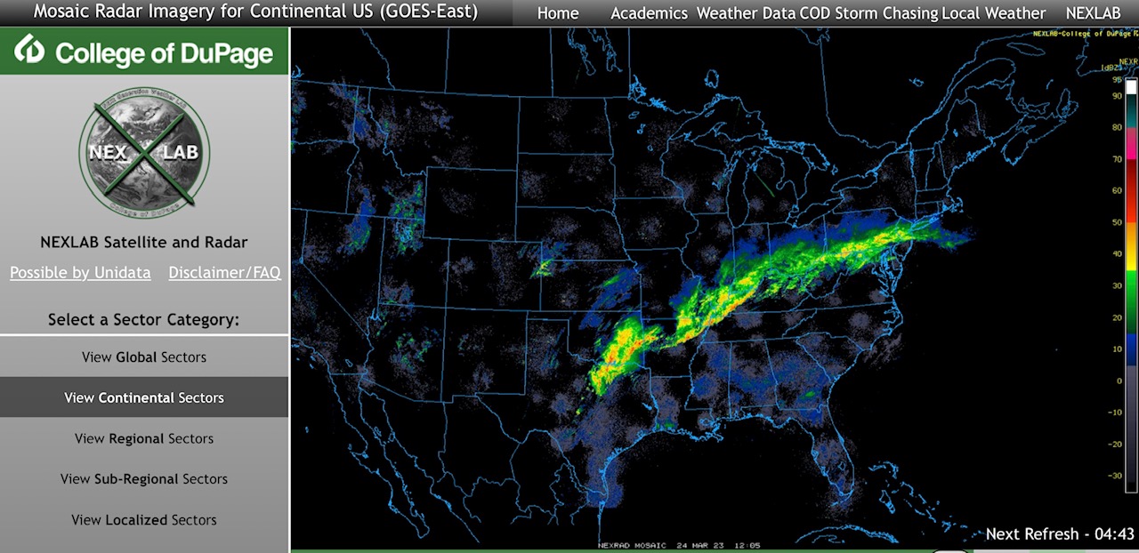
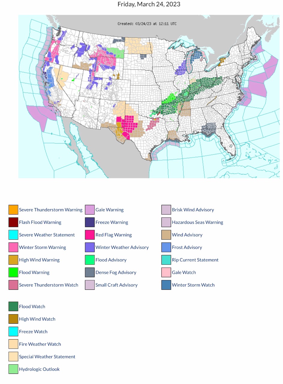
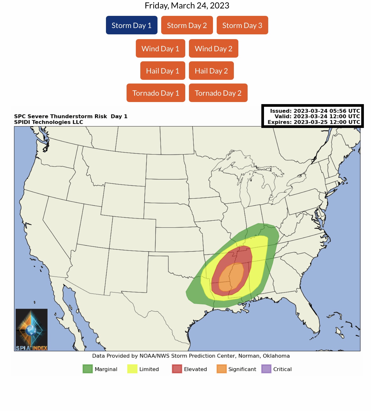
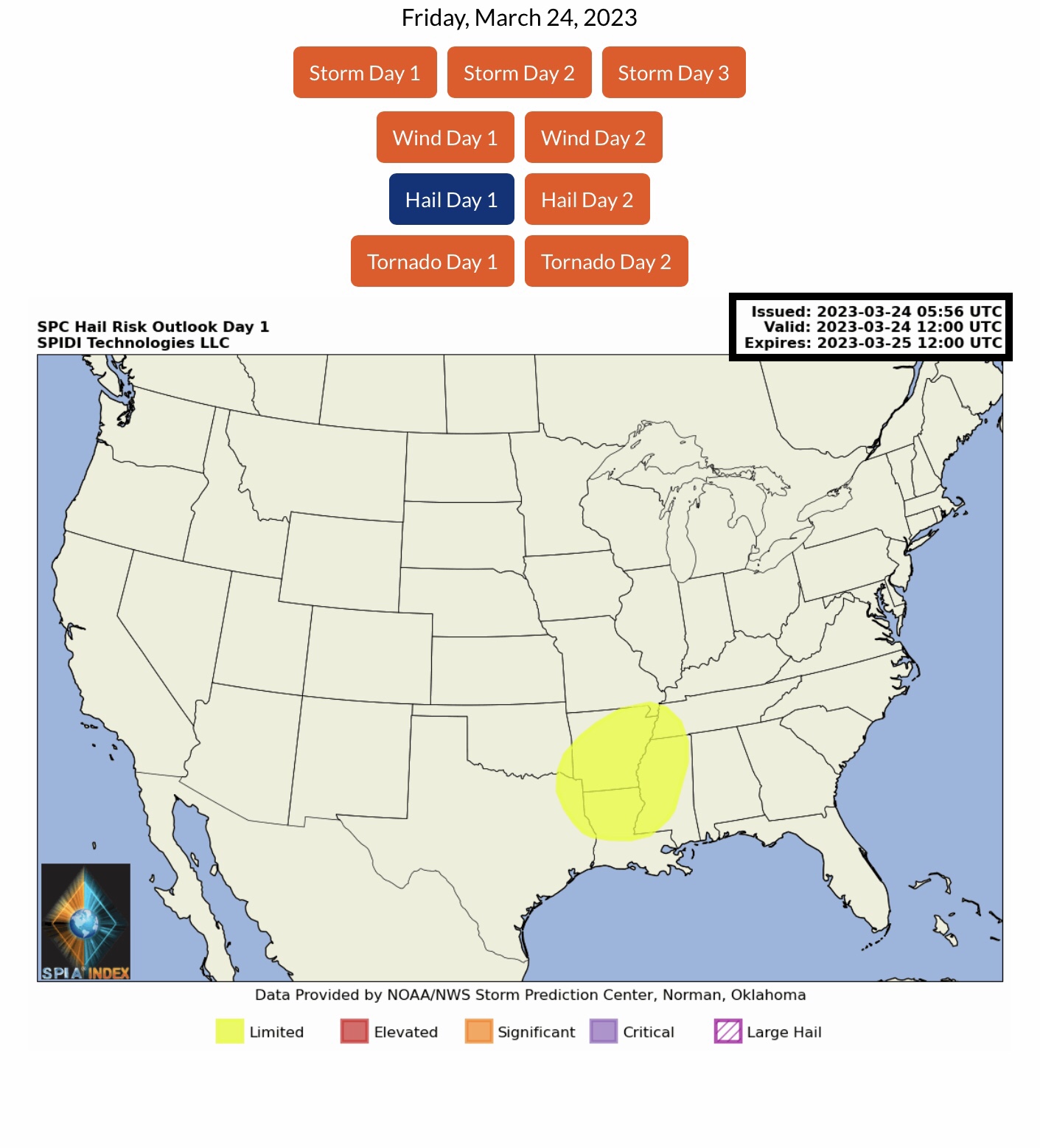
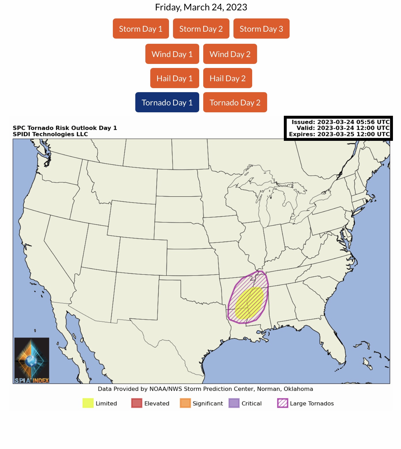
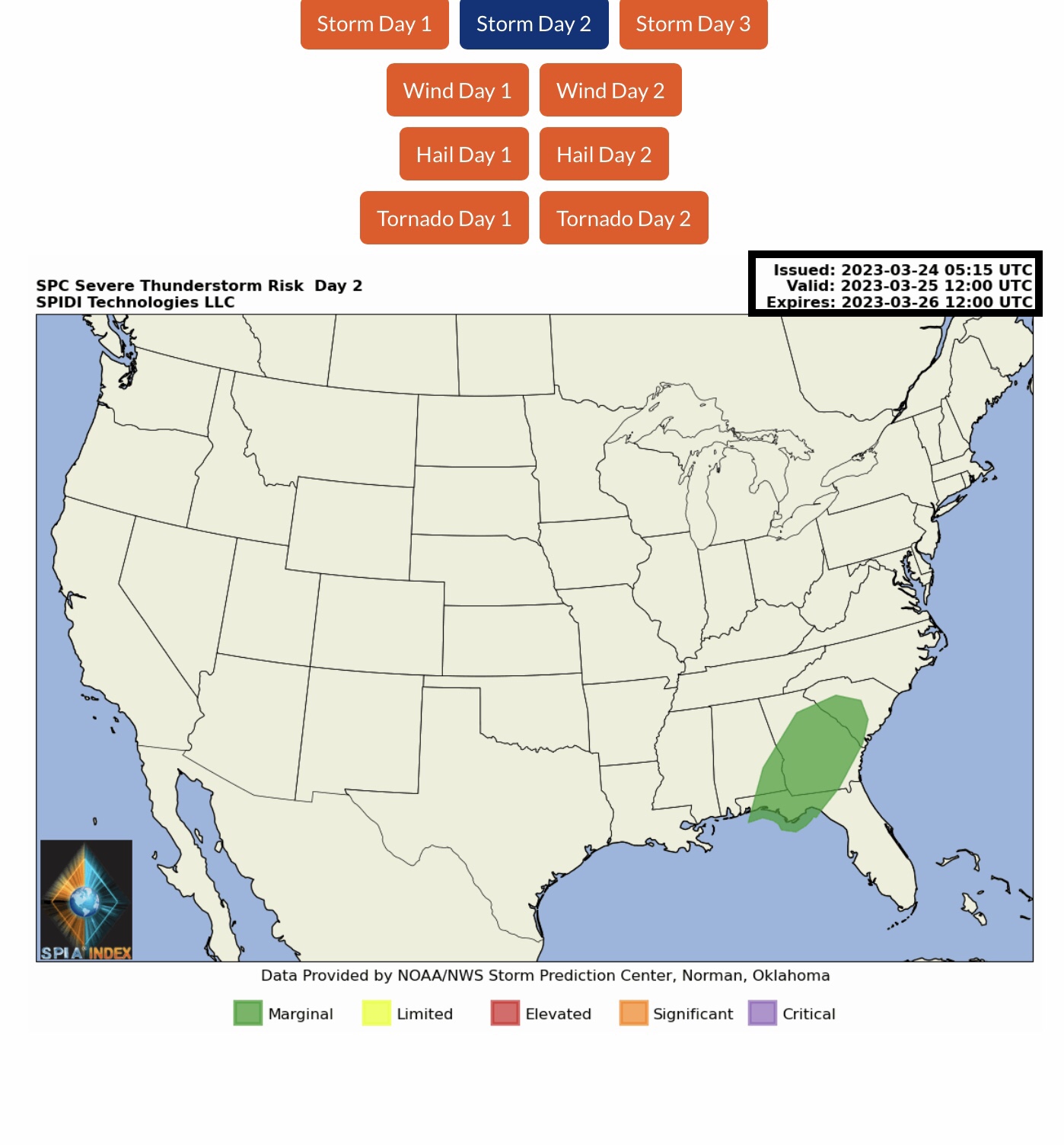
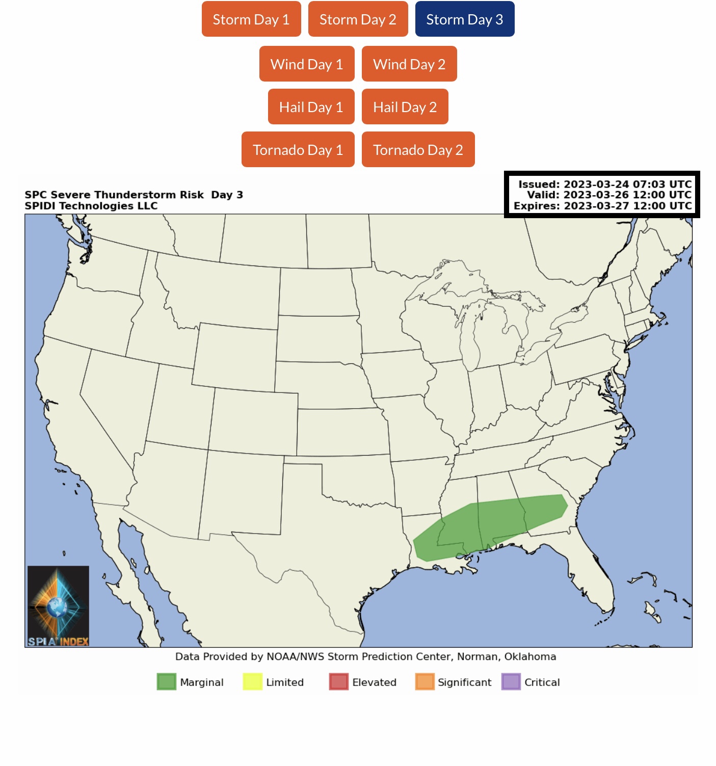
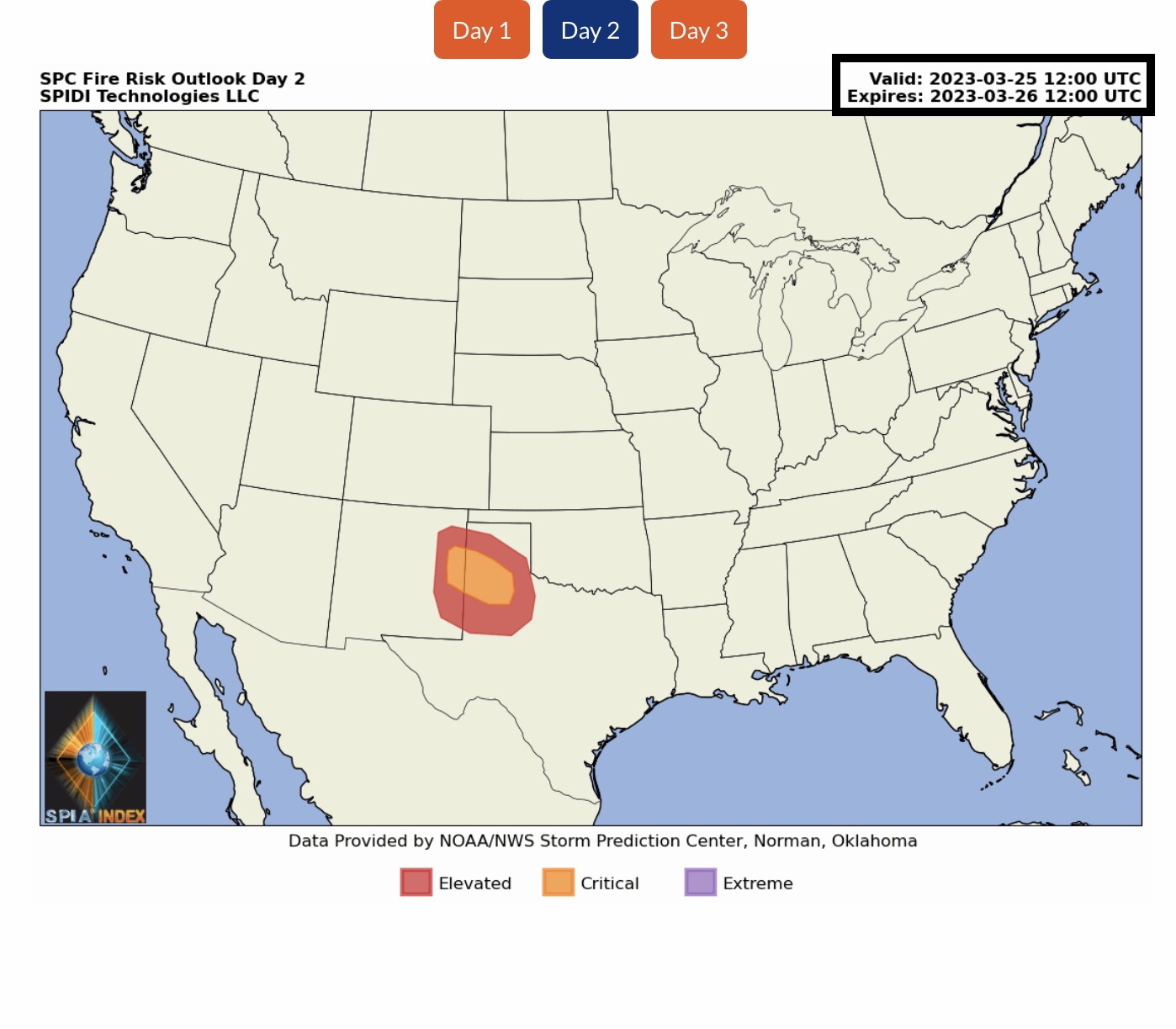
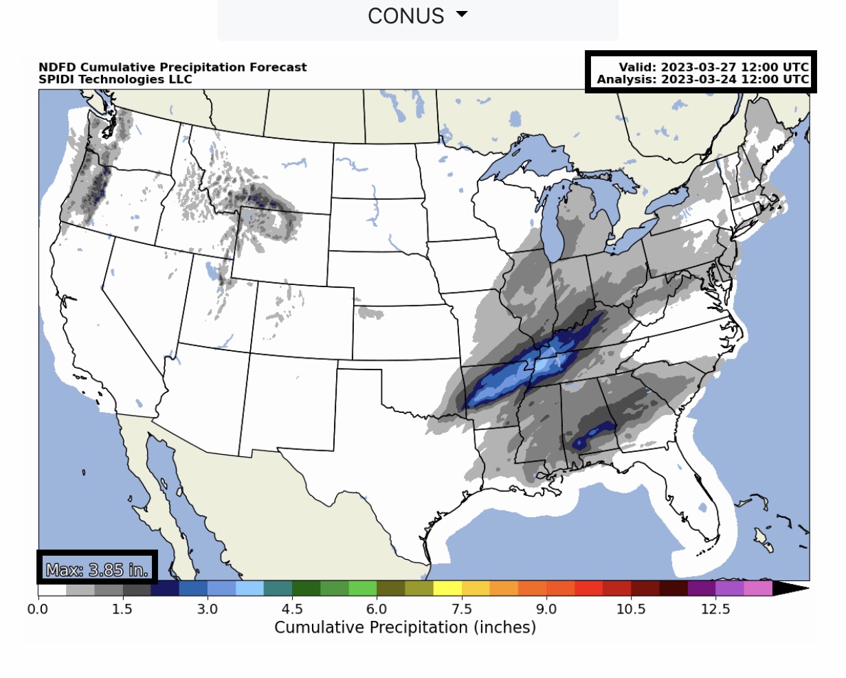
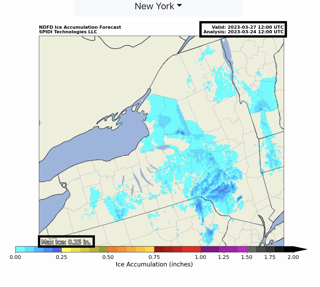
Current COD Mosaic Radar. Current NWS Watches, Warnings & Advisories. ELEVATED to SIGNIFICANT Severe Thunderstorm Risk today (Friday, 3/24/23) parts AR, MO, KY, TN, LA, MS & AL. Includes ELEVATED High Wind & Severe Gusts Risk, Hail Risk, and LIMITED Risk for TORNADOES and LARGE TORNADOES. ELEVATED to CRITICAL Fire Risk, Days 1 & 2, parts NM & TX. Flood & Flash Flood Risks parts AR, MO, KY & TN. Max ICE in NWS Grids: 0.34” parts MI. SPIA Index Levels 1 & 2, MI
Sidney Sperry 24 Mar 2023 13:02 UTC
FYI…

Severe Thunderstorms with the possibility of High Winds of 60 to 80 mph, with severe Gusts to 85+ mph, Hail, and some Large Tornadoes likely across parts AR, MO, KY, TN, LA, MS & AL today into early Saturday morning.

Freezing rain and ice accumulation possible on Saturday across north-central MI and southeastern NY, northeastern PA. Max ice in current NWS forecast grids: 0.34” in parts MI, 0.25” parts NY & PA. SPIA Index Ice Impact Forecast: Levels 1 & 2 parts MI, NY & PA.

Sid Sperry

 Show/hide attachments