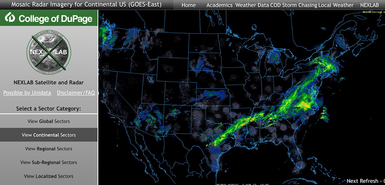
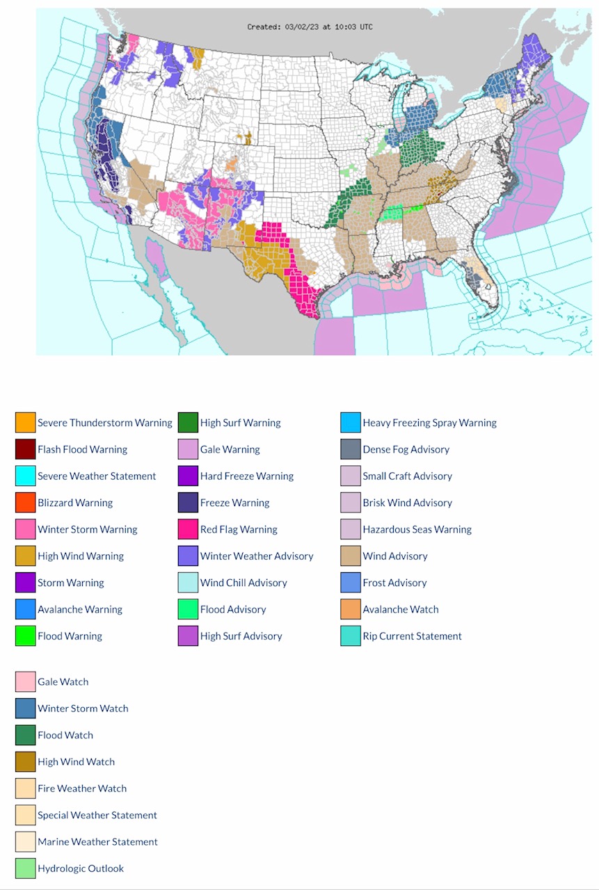
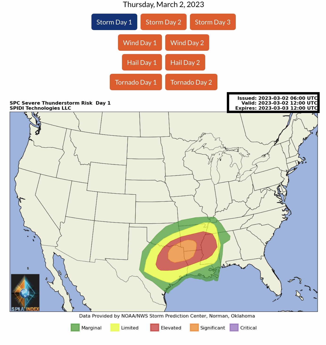
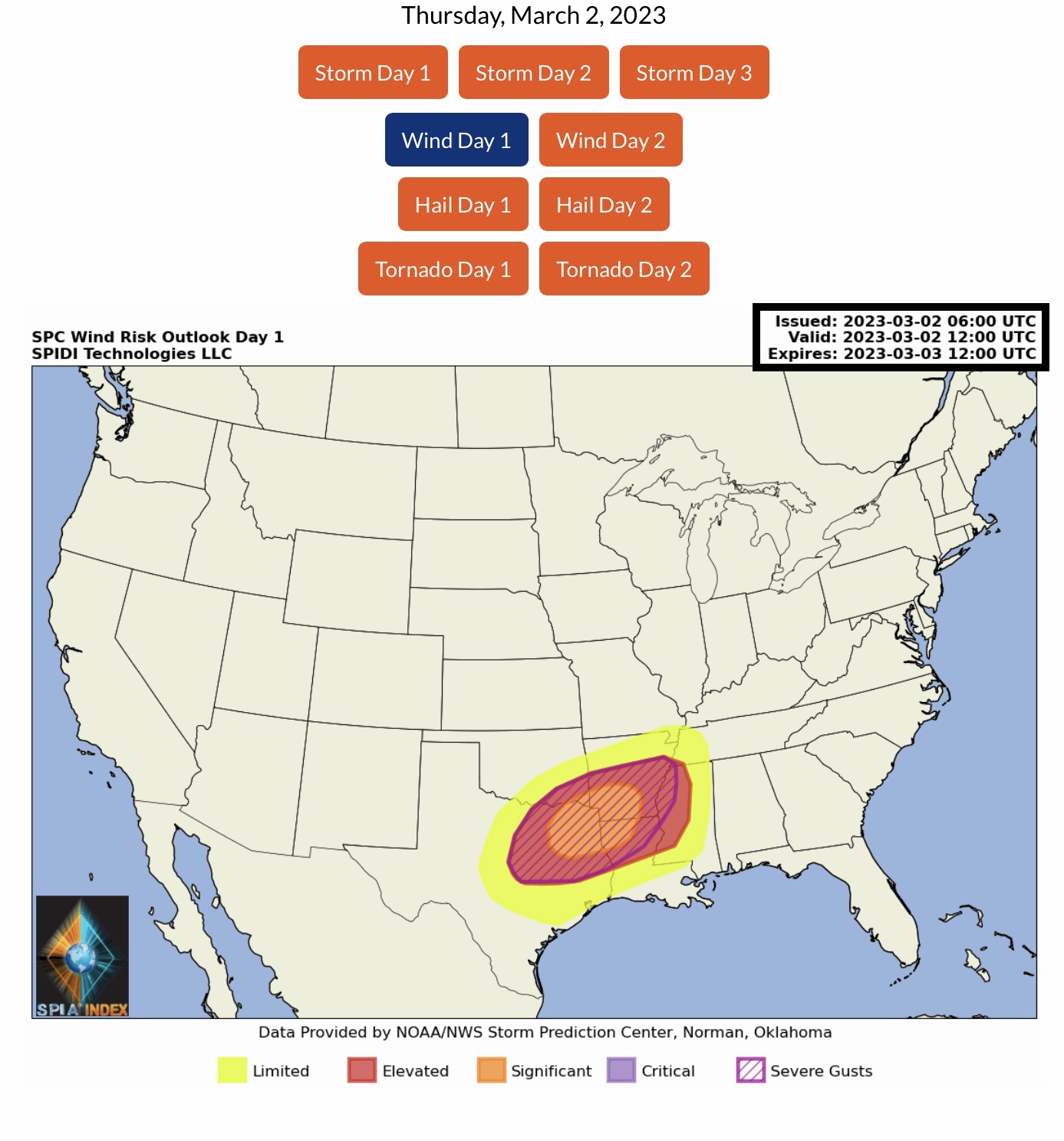
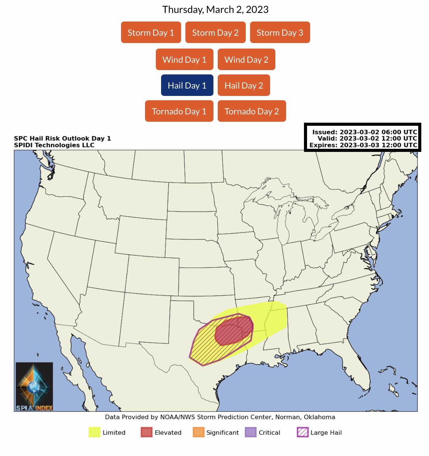
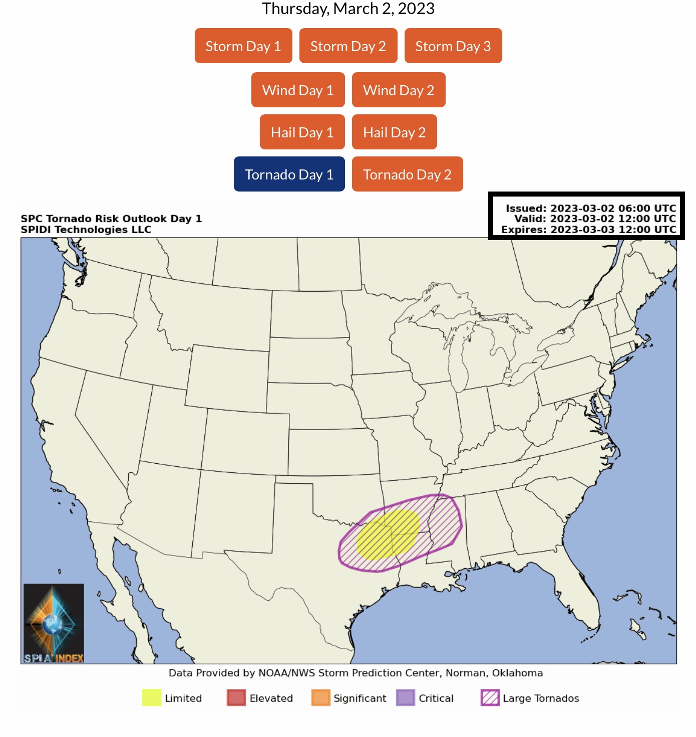
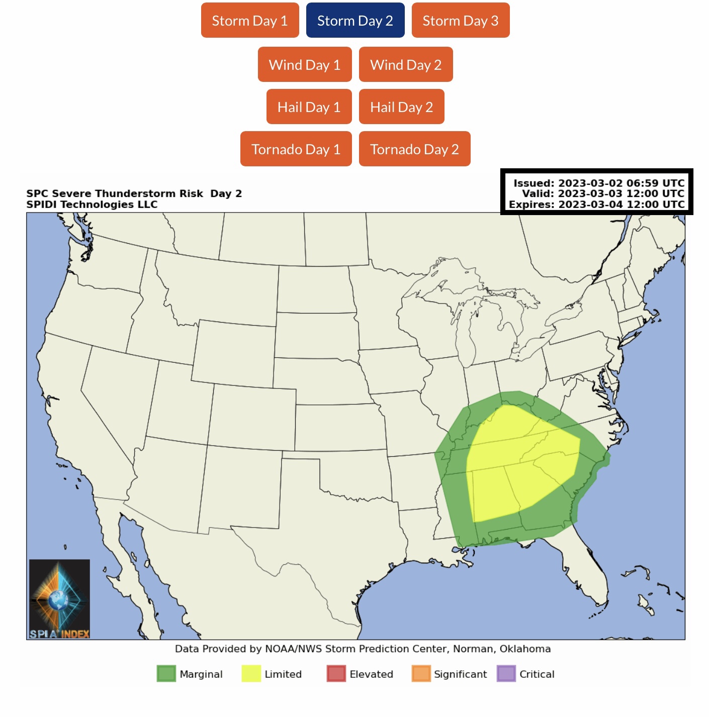
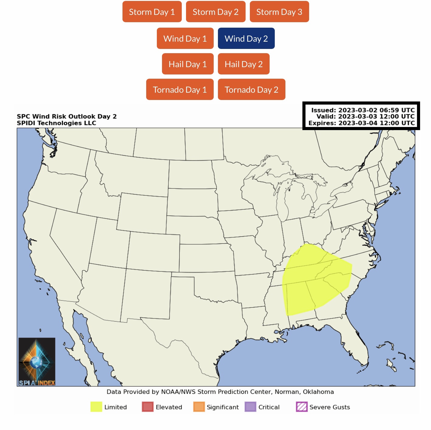
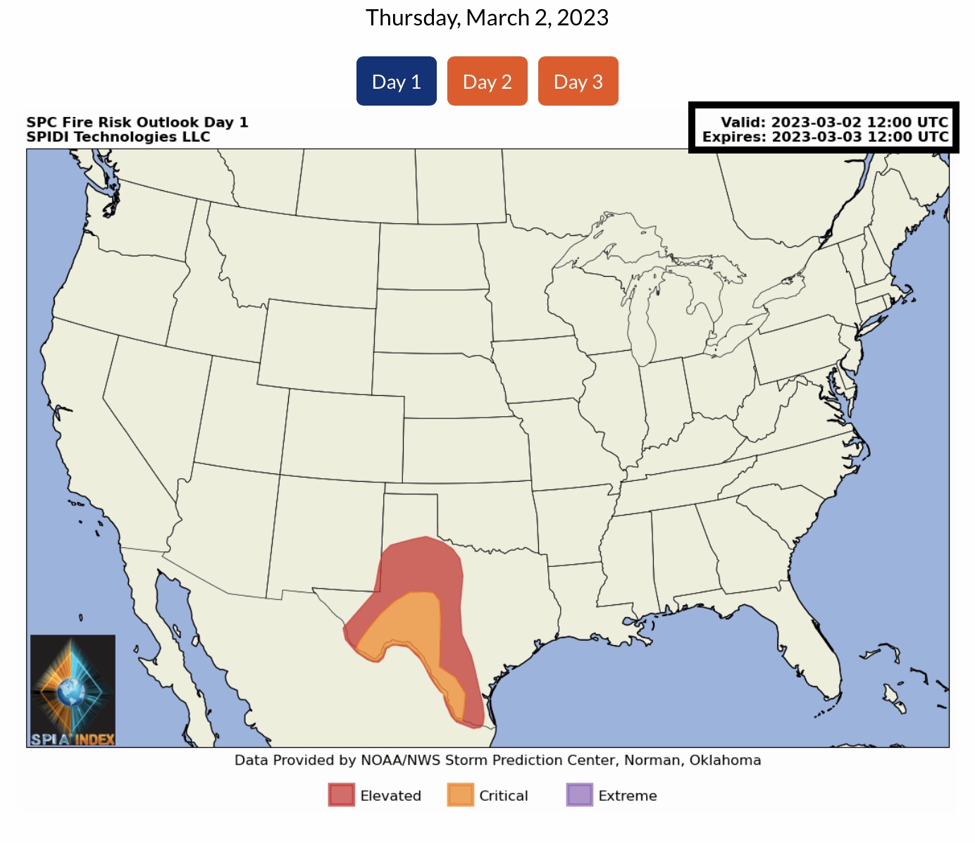
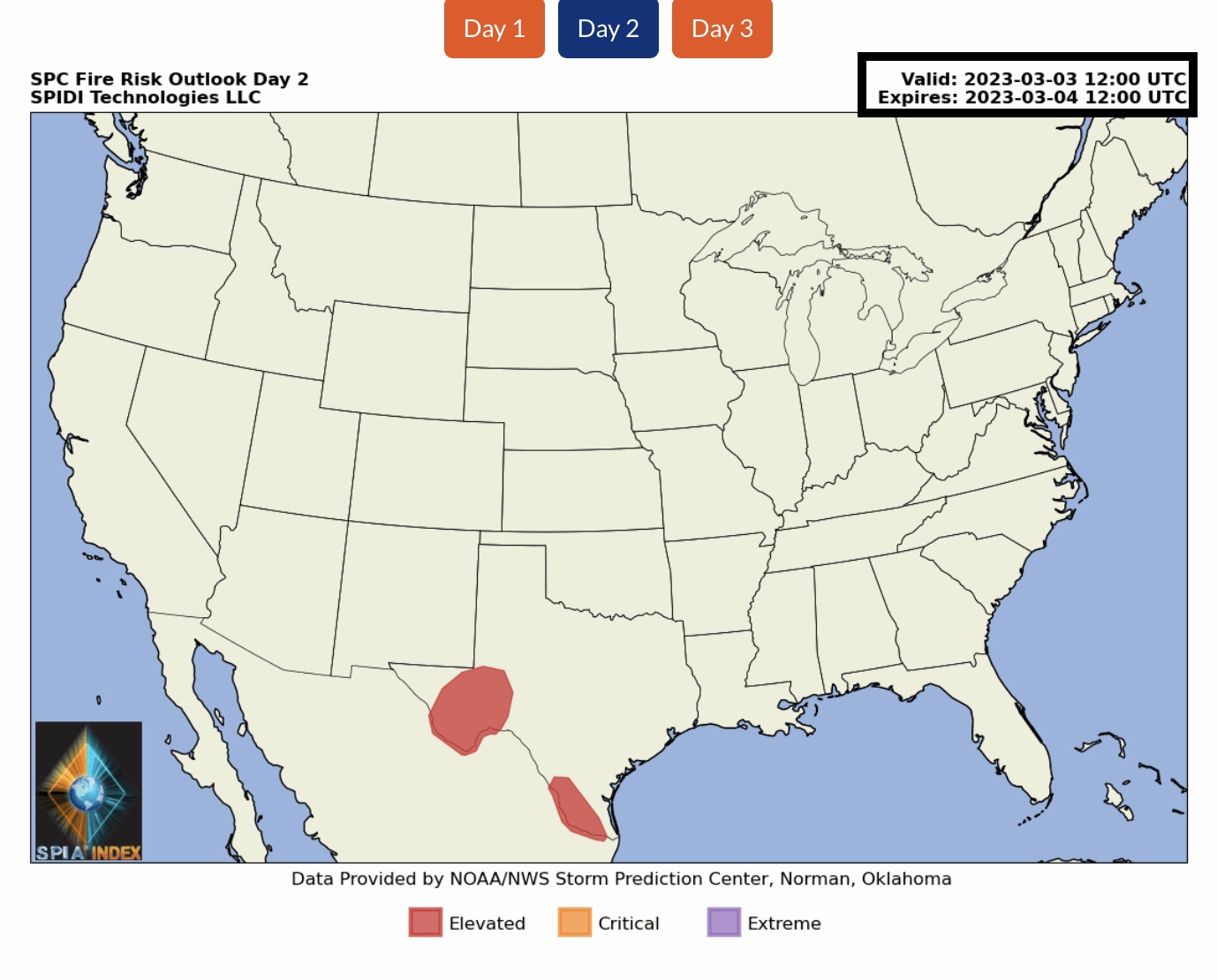
Current COD Mosaic Radar as of 4:30am CST 3/2/23. Current NWS Watches, Warnings & Advisories. LIMITED to ELEVATED to SIGNIFICANT Severe Thunderstorm Risk, Day 1 (today, Thursday, 3/2/23), parts OK, TX, AR, LA, MS, AL, TN & MO. Includes High Winds Risk, Large Hail Risk & Large Tornadoes Risk. LIMITED Severe Thunderstorm Risk, Day 2 (Friday), parts IN, KY, VA, NC, TN, MS, AL, GA & SC. Includes High Winds Risk. ELEVATED to CRITICAL Fire Risk, Day 1, TX.
Sidney Sperry 02 Mar 2023 11:15 UTC
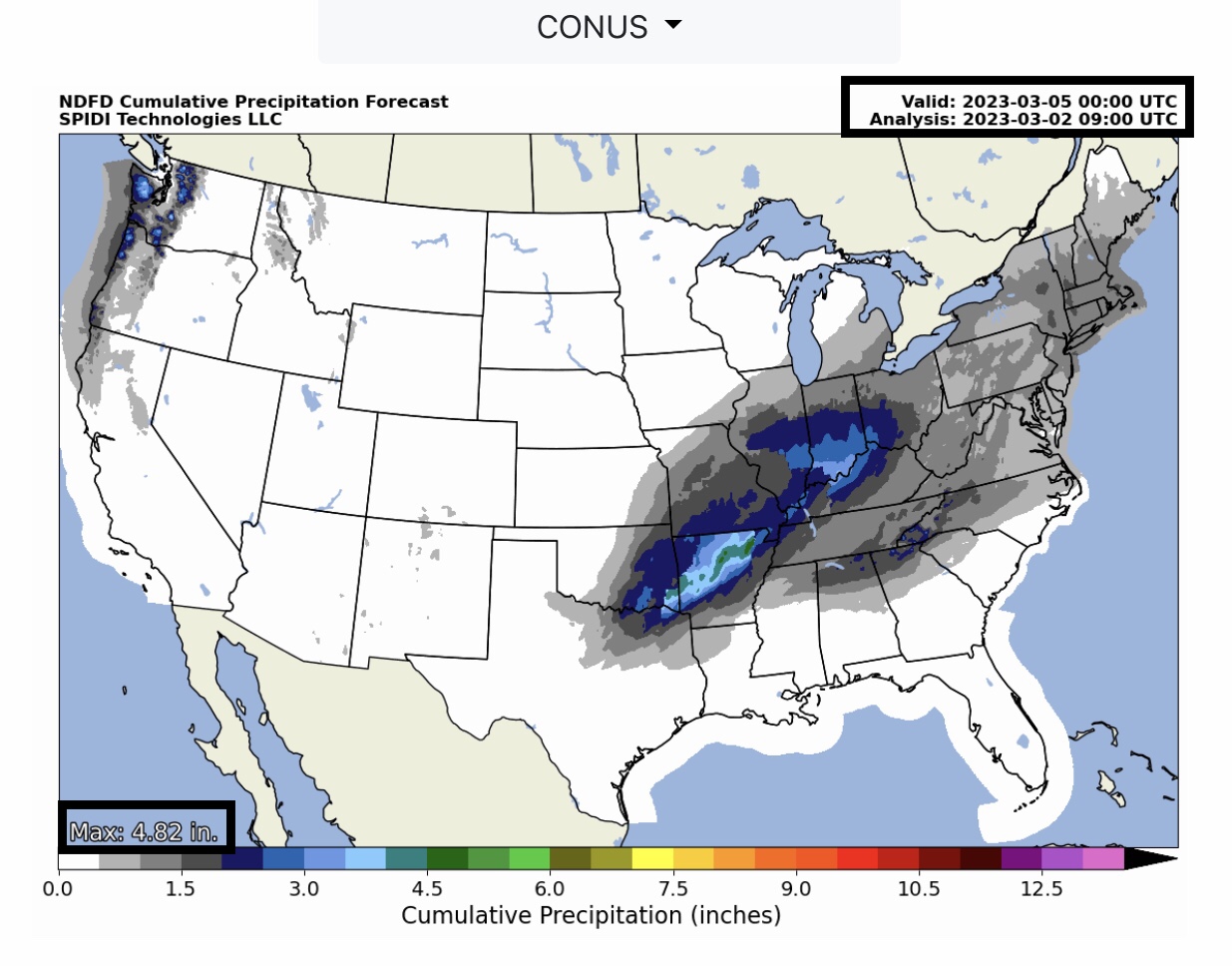
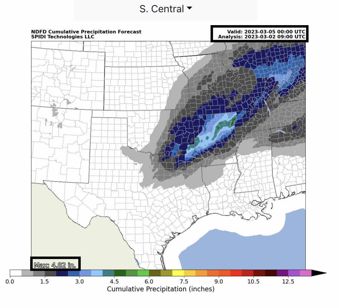
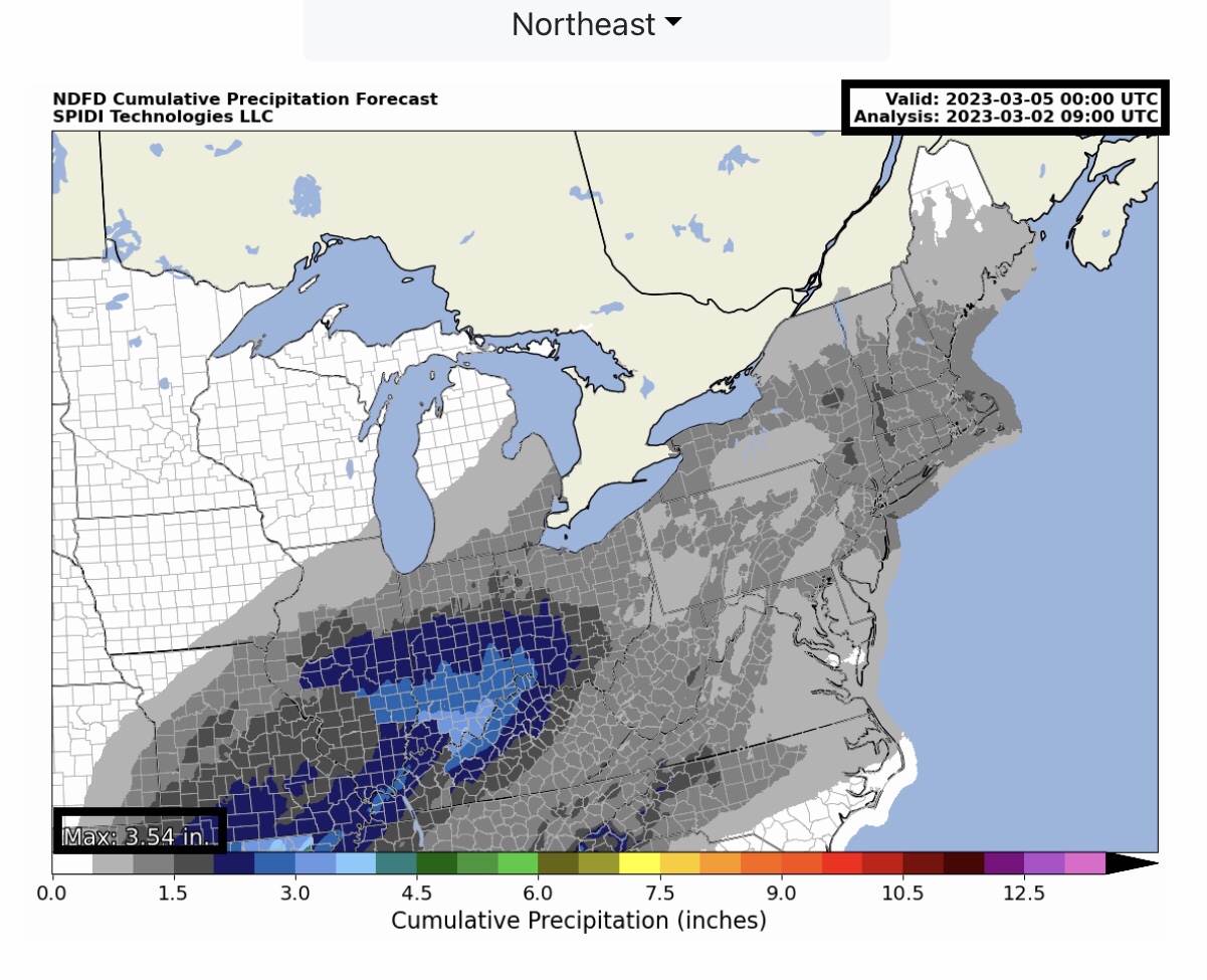
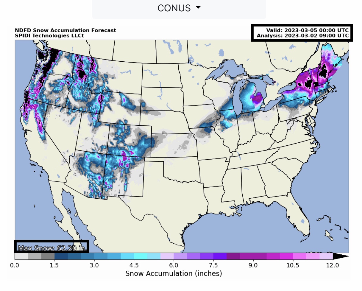
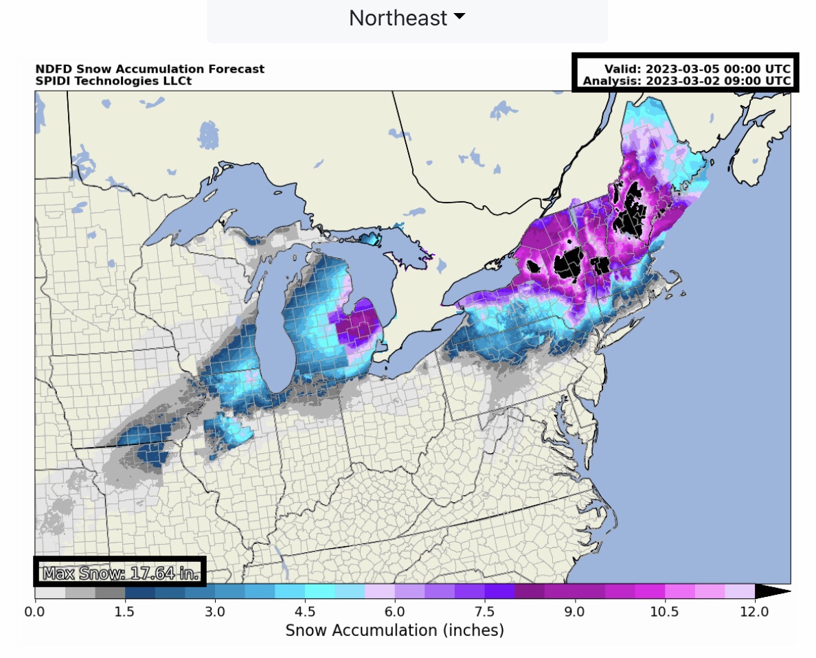
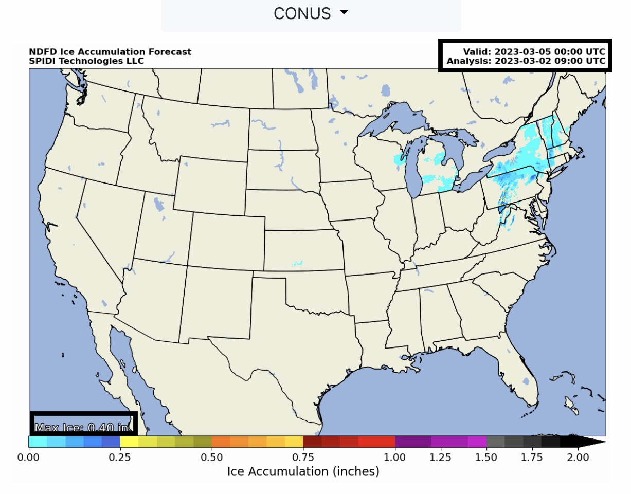
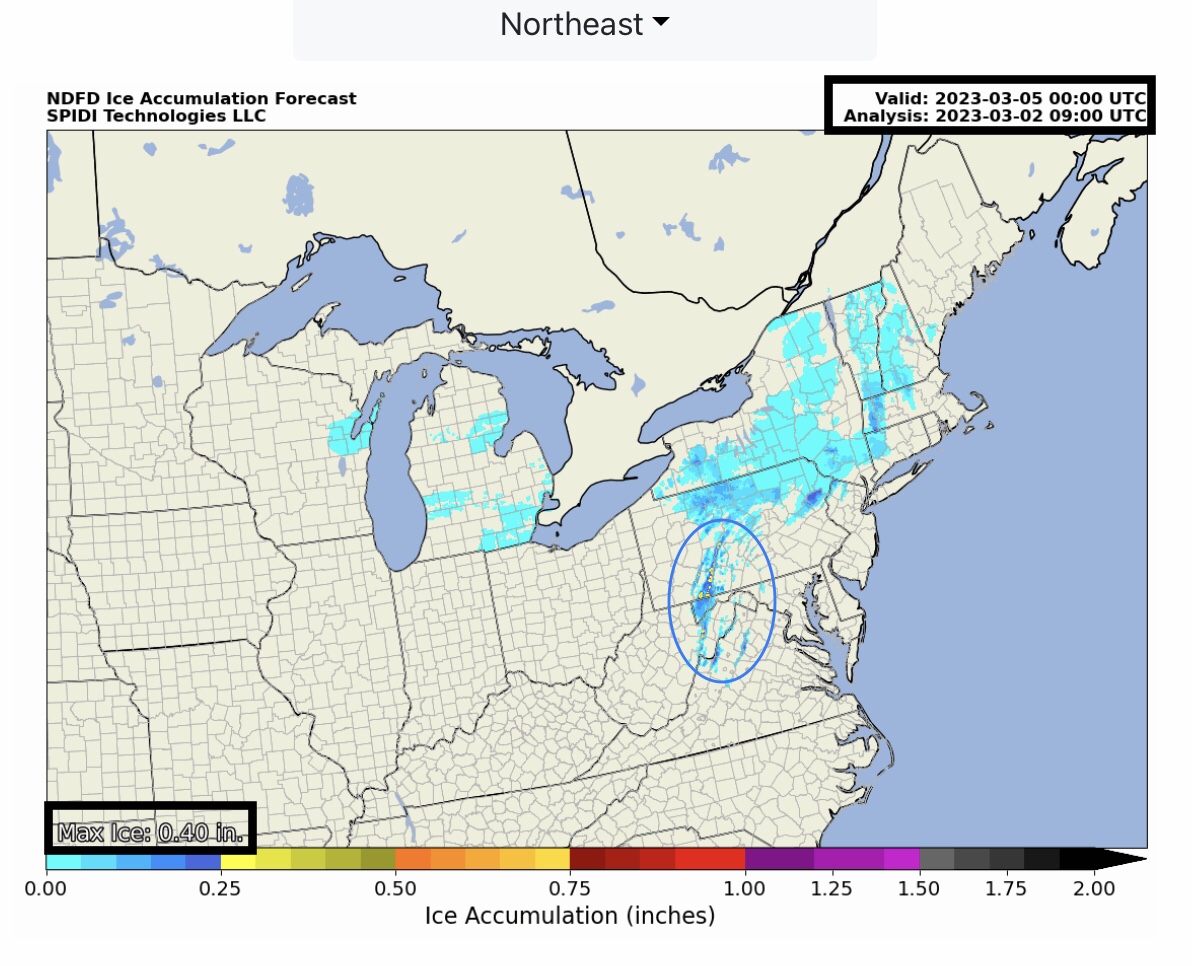
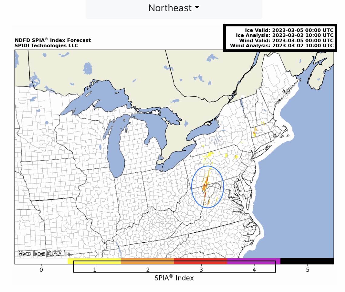
Heavy rainfall is expected across parts of MO, OK, TX, LA, IN, OH, KY, TN, MS, AL, GA, VA, NC & SC over the next 72-hrs, leading to Flood Watches and Flash Flood Warnings. Up to 5” of rain is possible in parts OK & AR, and from 2.5” to 4” in parts MO, IL, IN, OH, KY, TN, NC, SC & GA. Note High Wind Warnings for parts southeastern KY, eastern TN, and far western VA. Moderate Freezing Rain & Ice Accumulations up to 0.40” possible across parts eastern WV and southwestern PA. The current SPIA Index Forecast is at Levels 1 thru 4 in parts eastern WV, the MD panhandle, and southwestern PA. Levels 1 & 2 in parts southern NH. From 5” up to 17” snow possible over next 72-hrs in parts IL, WI, MI, NY, PA, VT, NH, MA, CT & ME. - Sid Sperry

 Show/hide attachments