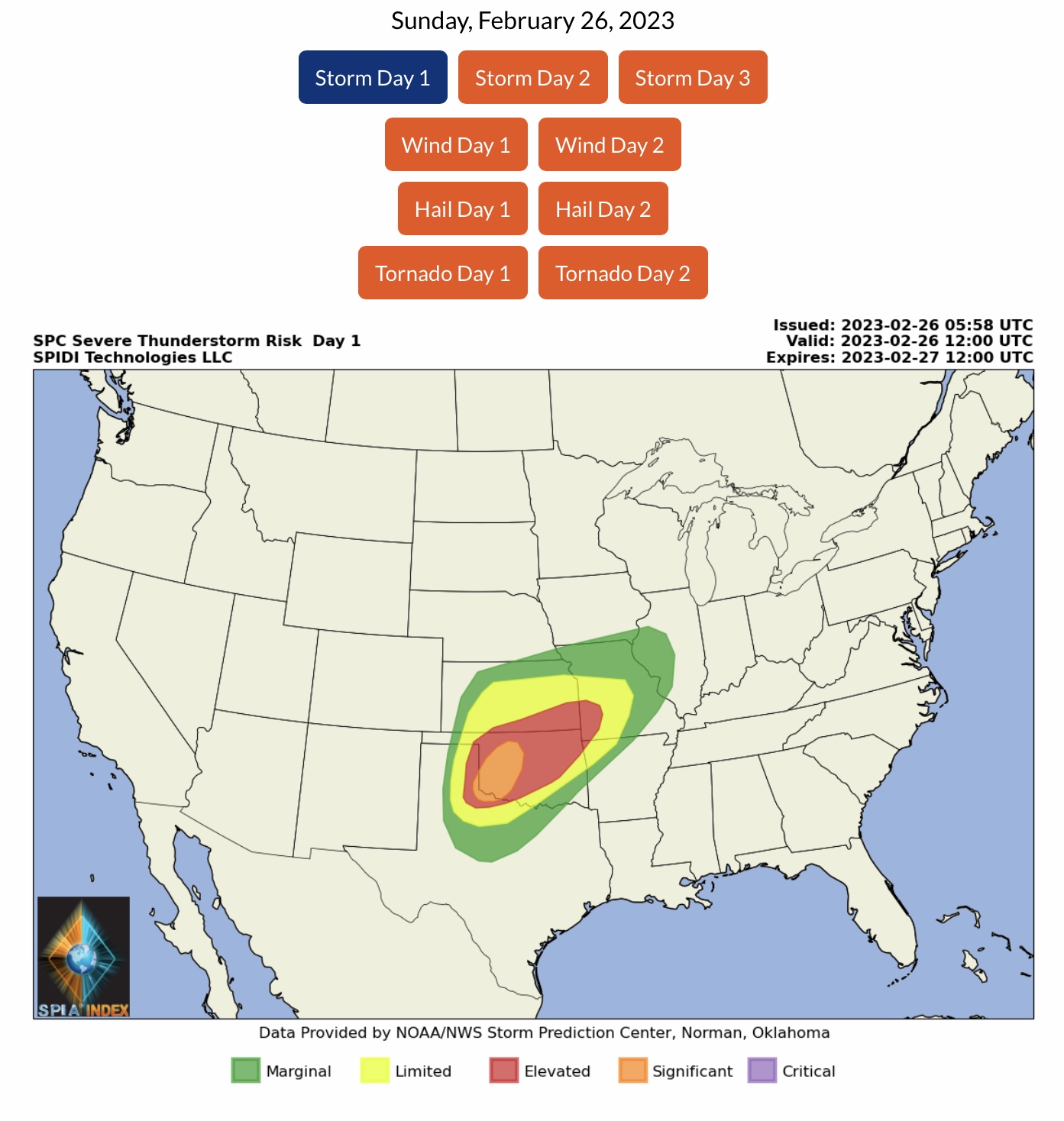
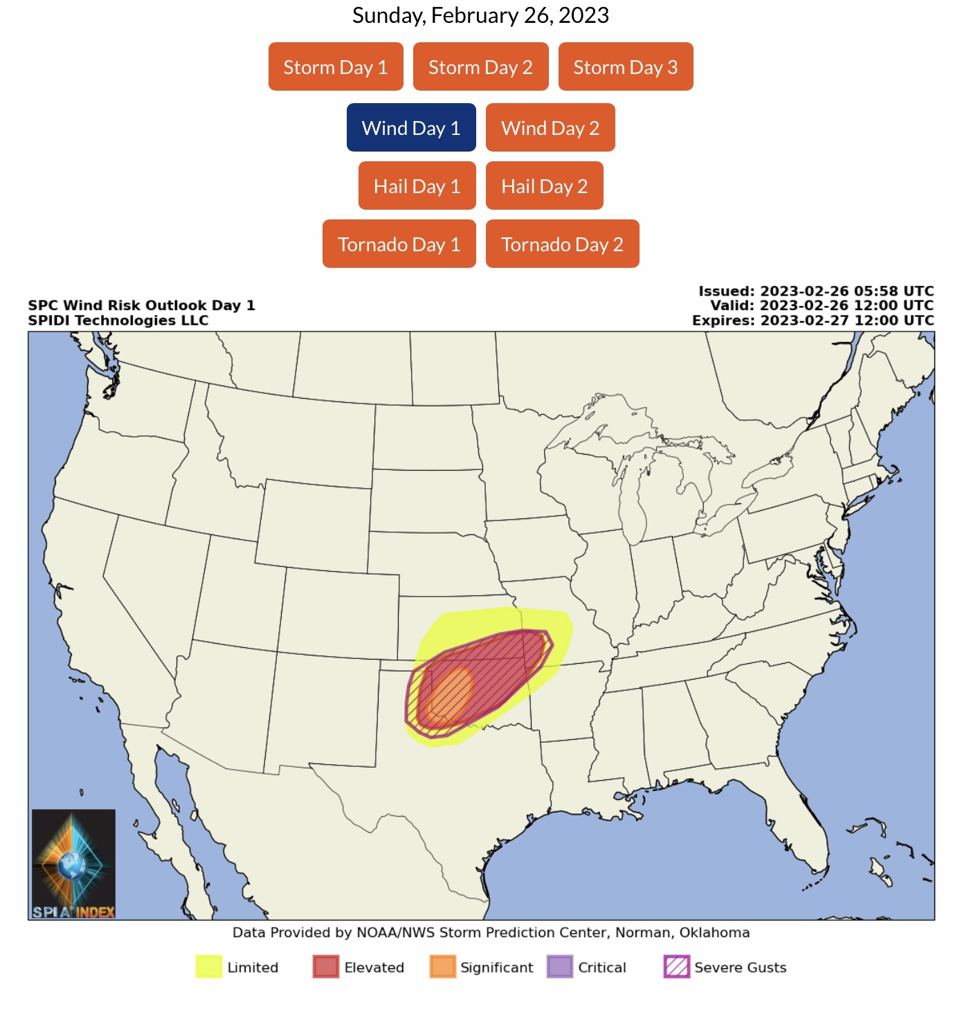
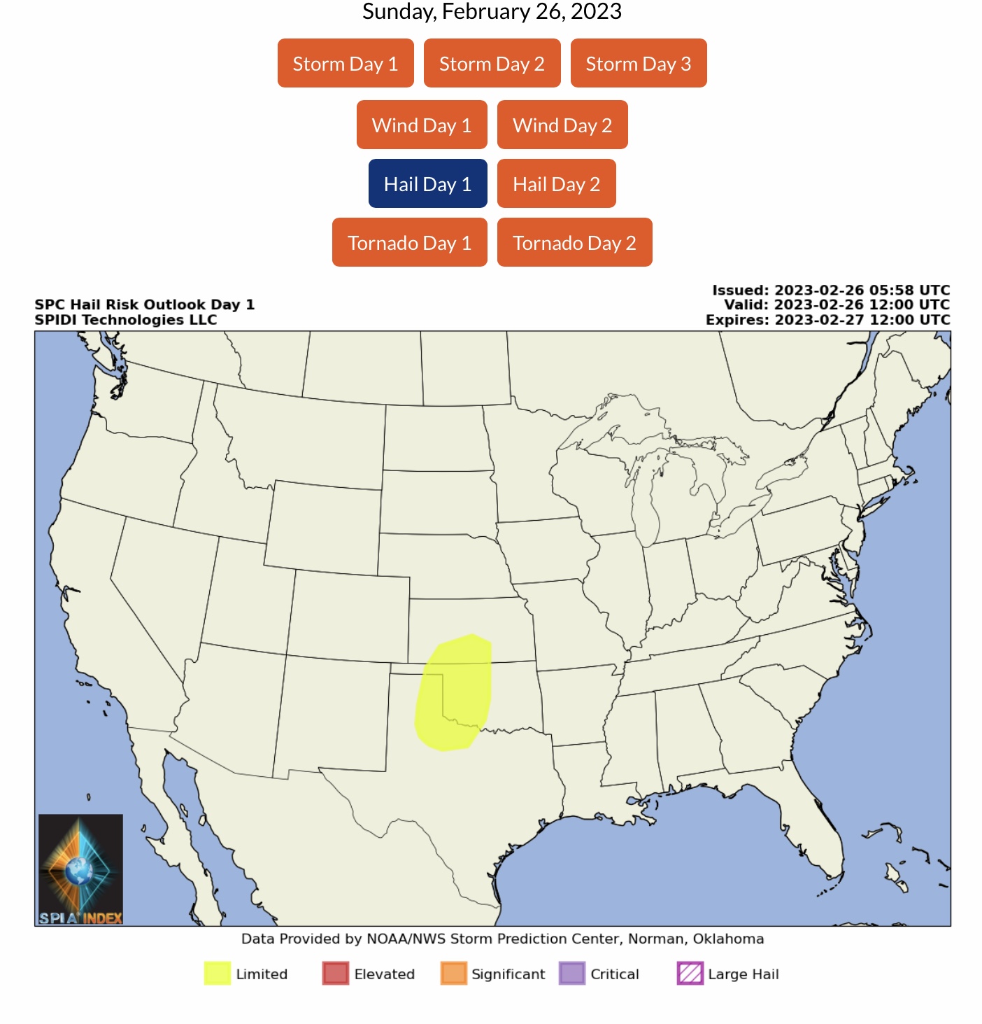
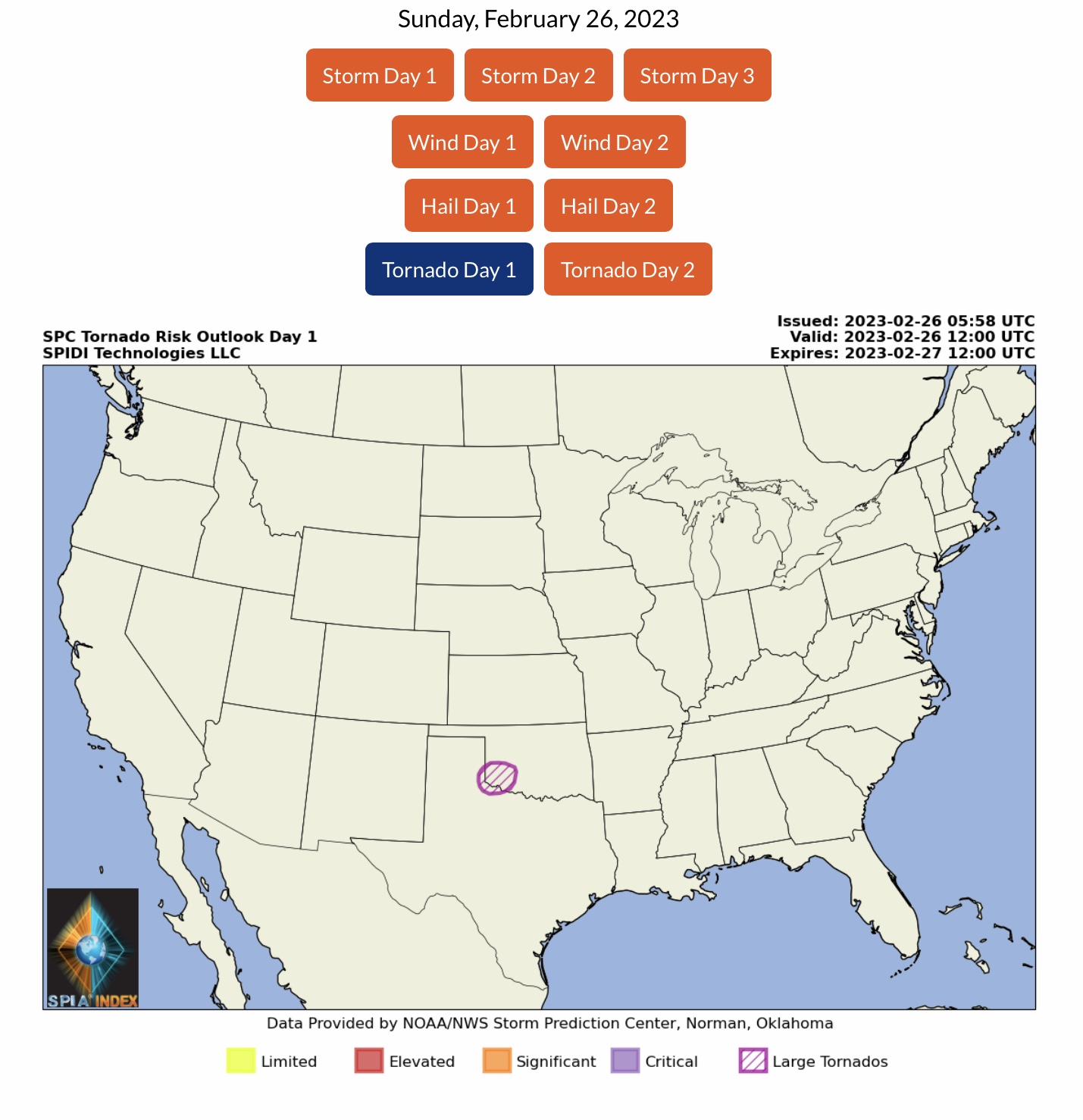
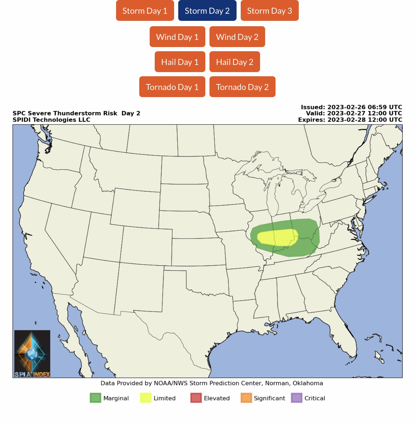
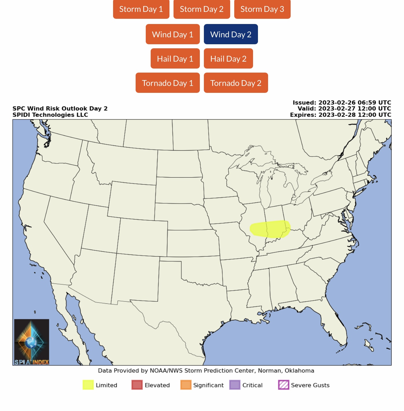
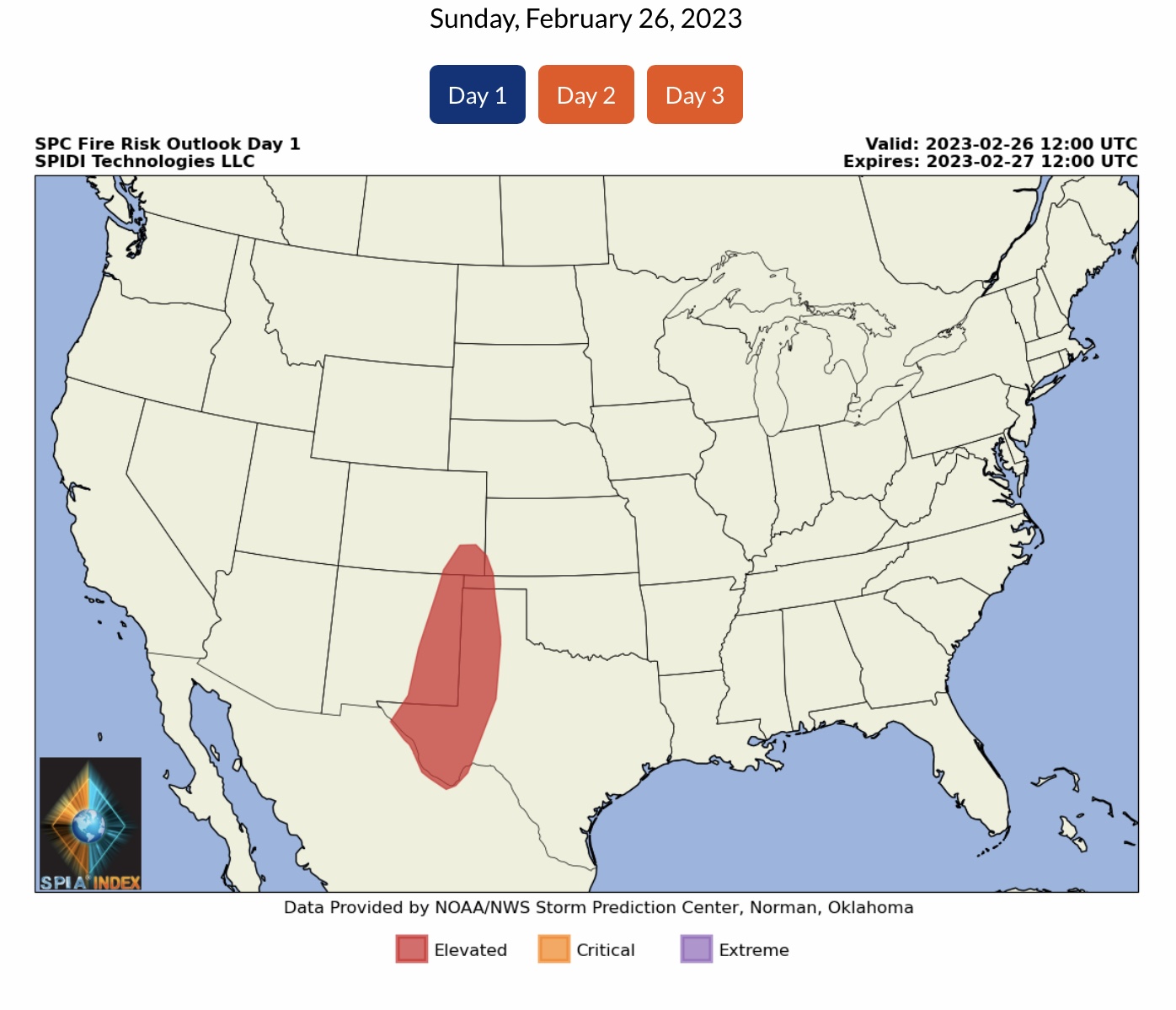
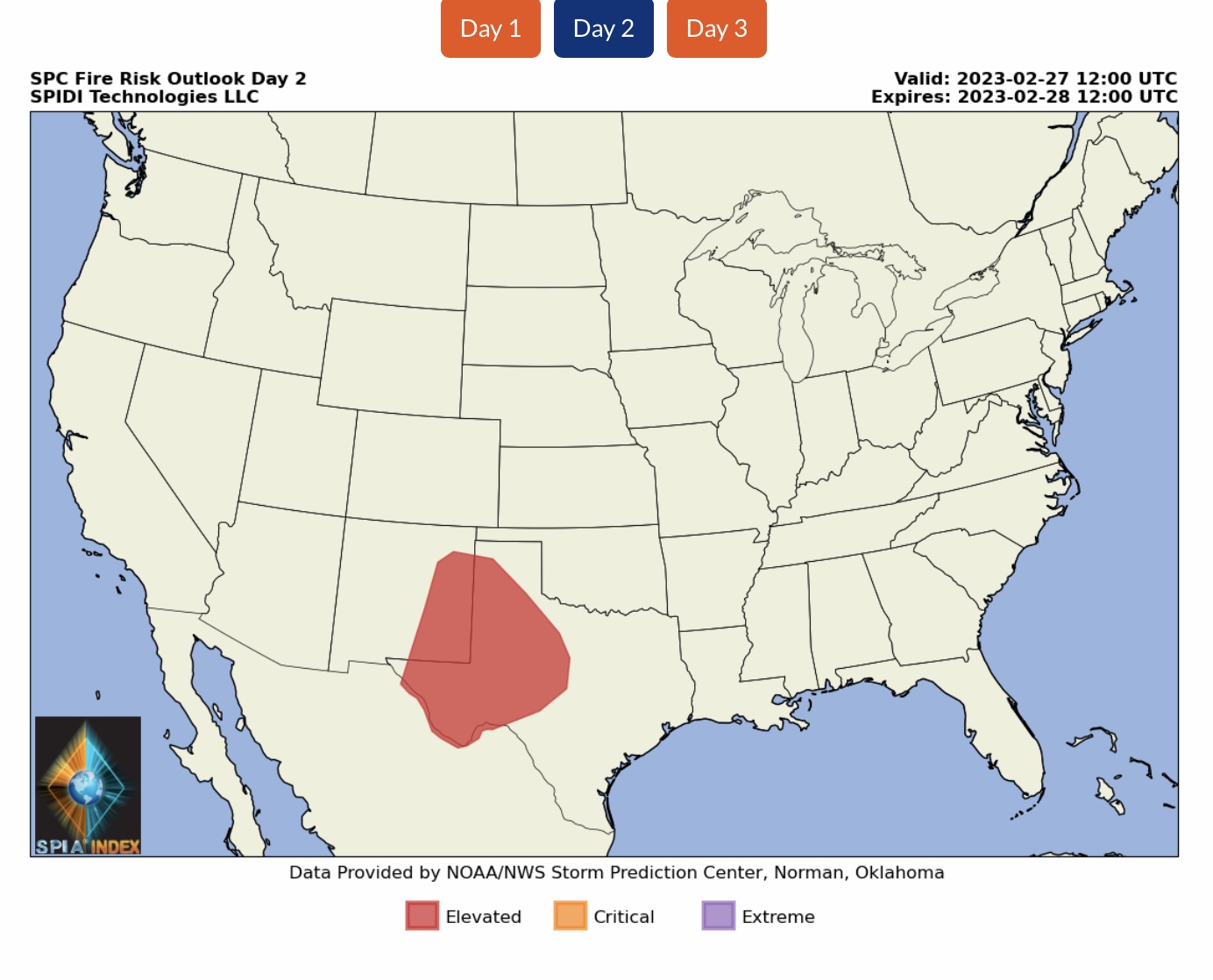
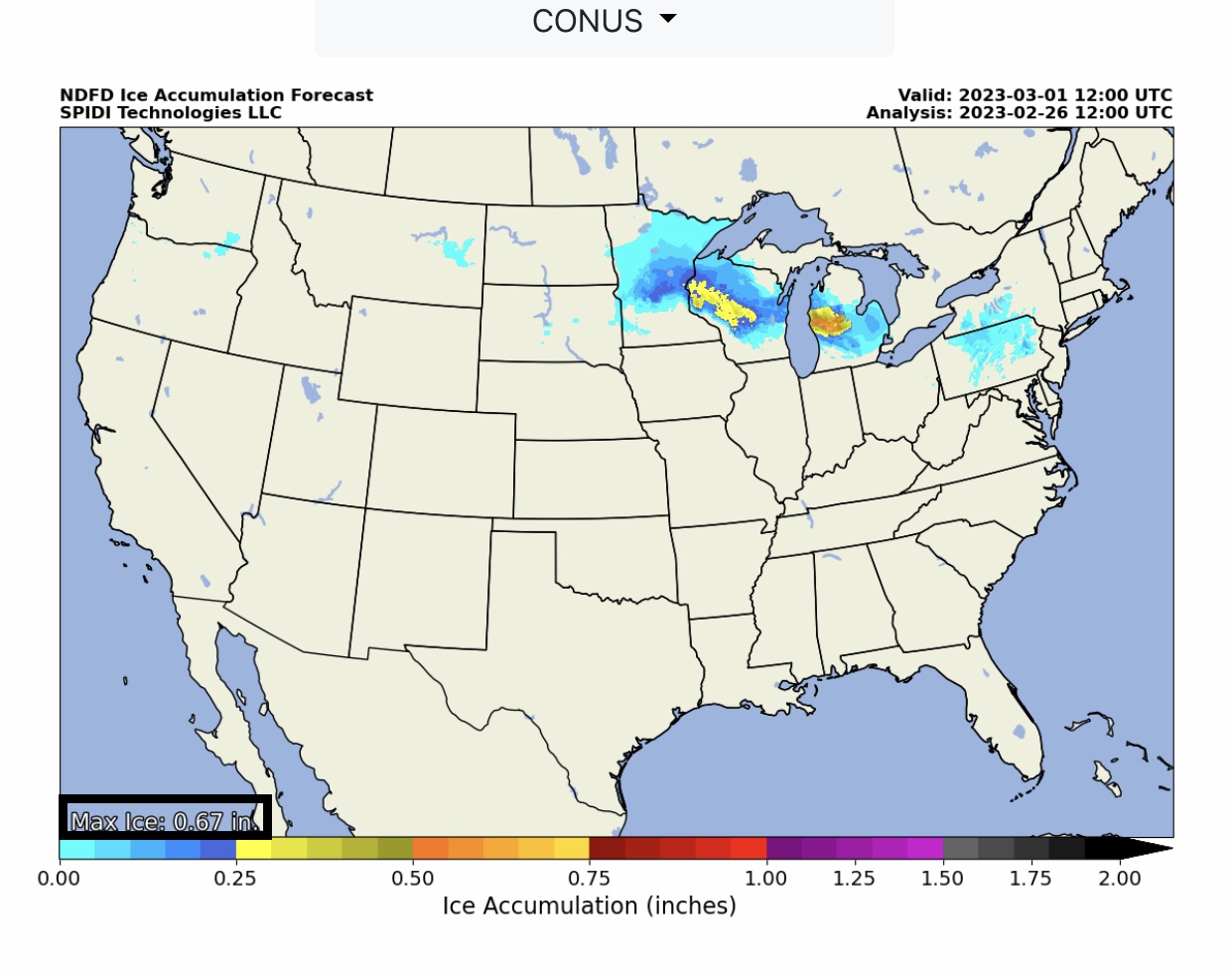
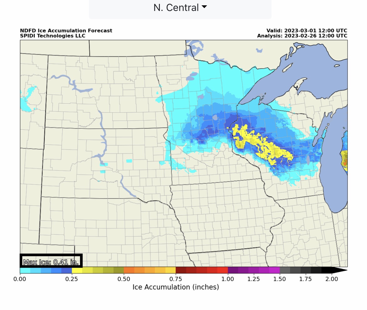
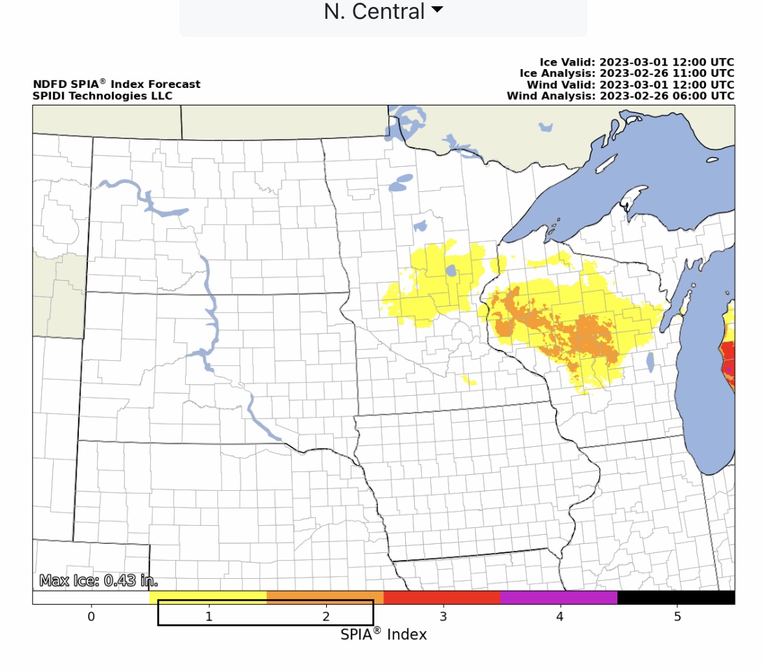
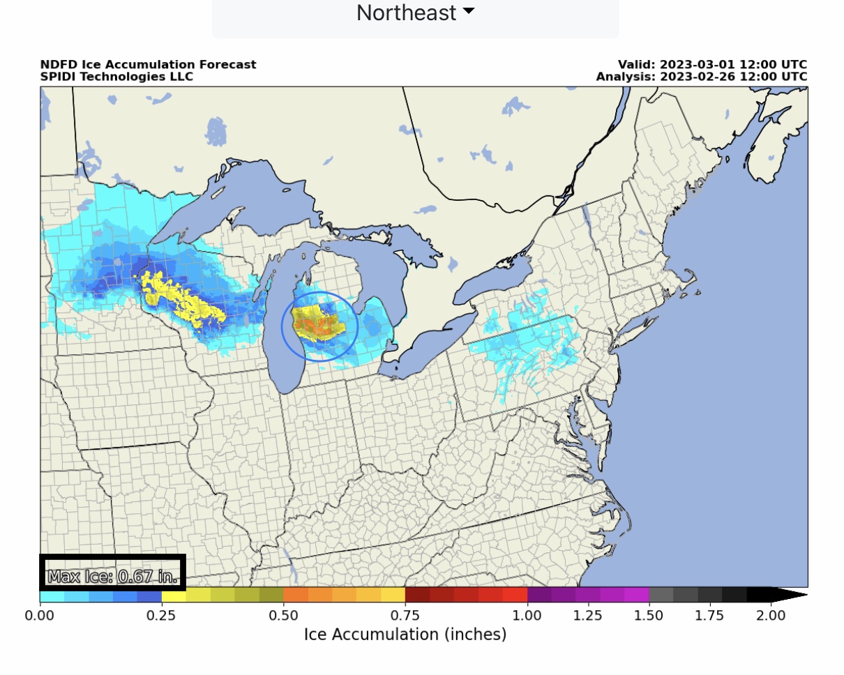
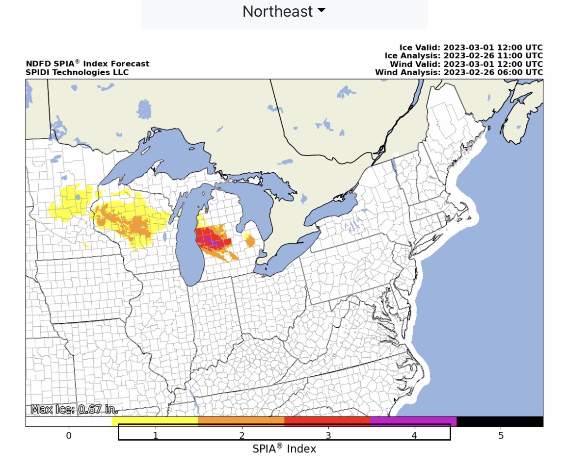
ELEVATED to SIGNIFICANT Severe Thunderstorm Risk today (Sunday, 2/26/23) thru 6am CST Monday, 2/27/23 for parts TX, OK, KS & MO. Includes High Winds and Severe Wind Gusts, Hail to Golf Ball size, and some Large Tornadoes are possible. LIMITED Severe Thunderstorm Risk, Day 2, parts IL, IN, OH & KY; includes High Wind Risk. ELEVATED Fire Risk, Days 1 & 2, parts CO, NM, KS, OK & TX. Ice Storm possible early Monday into Tuesday for parts MN, WI & MI. Max Ice in grids: 0.67” parts west-central MI. Current SPIA Index Ice Impact Forecast: Levels 1 thru 4.
Sidney Sperry 26 Feb 2023 12:56 UTC
FYI…

Parts of Wisconsin and Michigan could receive from 1/2” up to 7/10” ice early Monday into Tuesday. The current SPIA Index Ice Impact Forecast is at Level 1 in MN, Levels 1 & 2 in parts WI, and Levels 1 thru 4 in parts west-central MI.

Severe Thunderstorms likely late today into early Monday across parts TX, OK, KS & MO. Risks include sustained winds of 50-55 mph, gusts to 80 mph, golf ball size hail, and some tornadoes and large tornadoes are possible in southwest OK. Severe Thunderstorm Risk moves into parts IL, IN, OH and KY on Monday into Tuesday AM.

Individual state ice forecasts and SPIA Index forecasts to be sent to potentially impacted states shortly. - Sid Sperry
Sid Sperry

Sent from my iPad

 Show/hide attachments