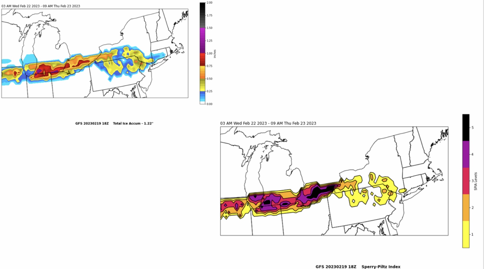
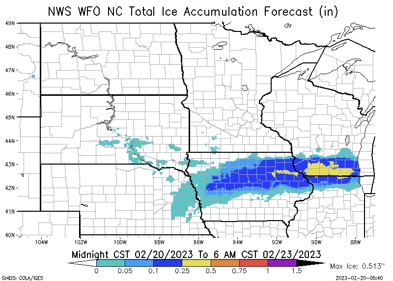
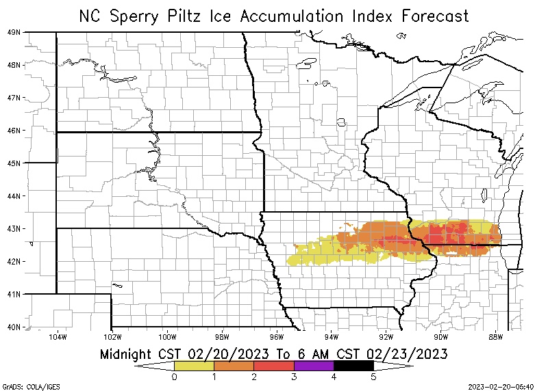
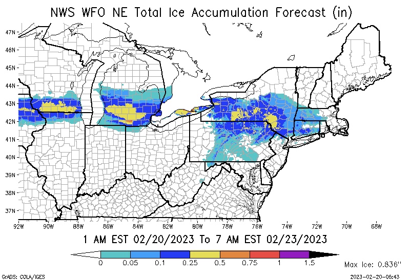
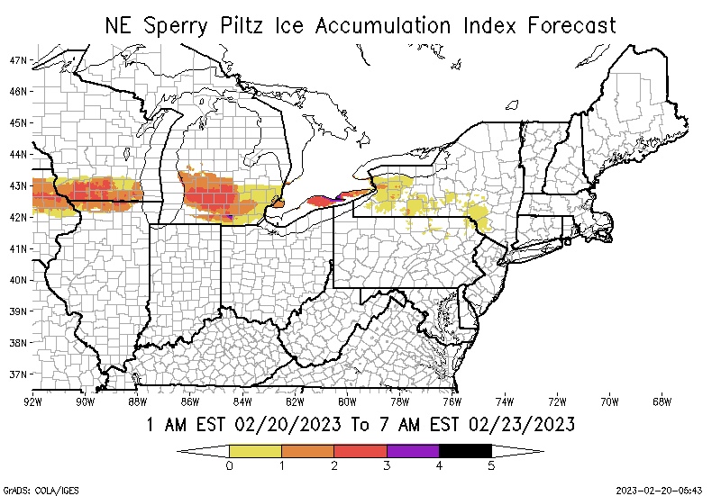
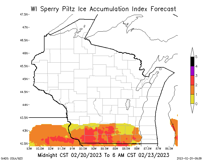
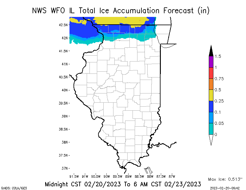
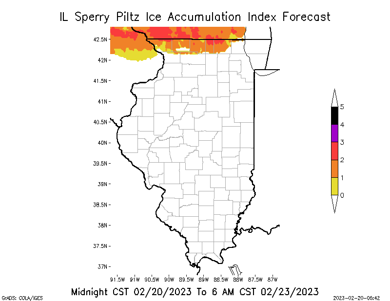
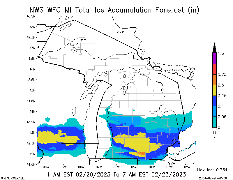
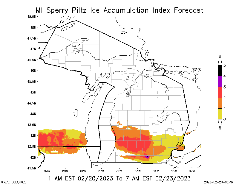
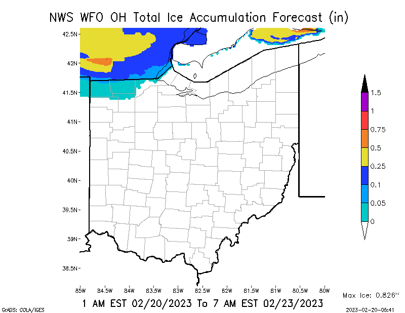
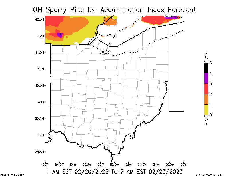
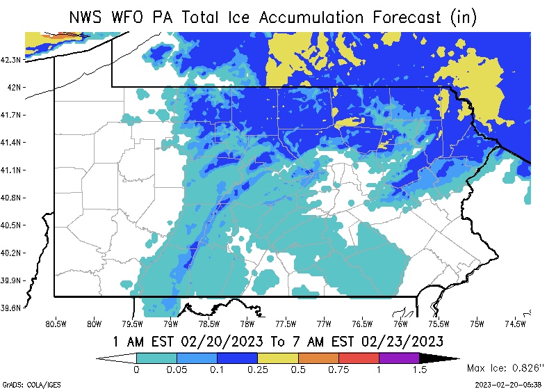
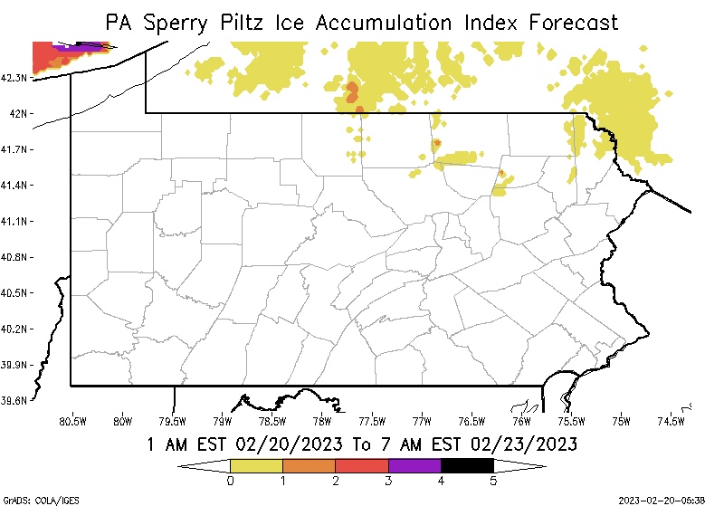
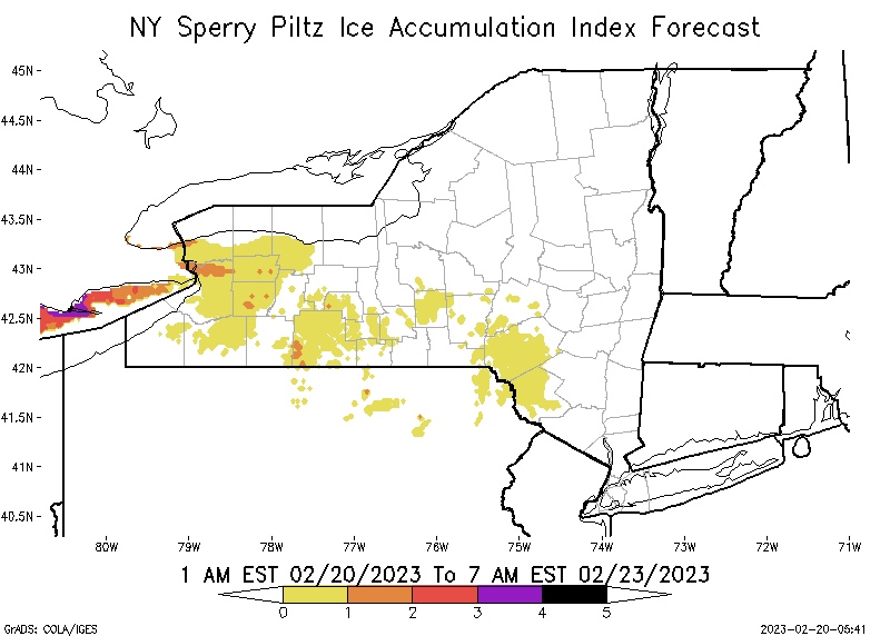
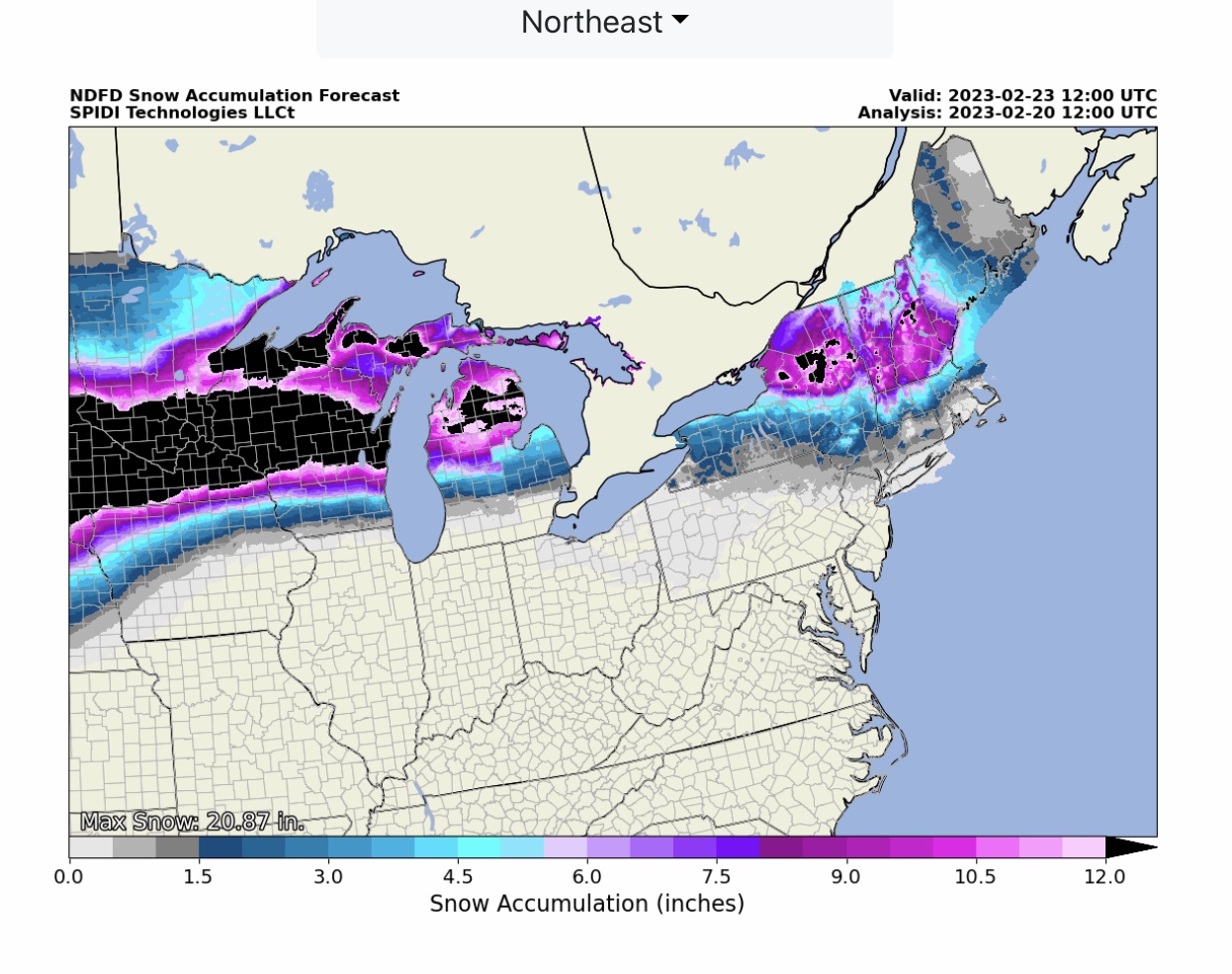
Significant Ice & Snow Storm possible Wednesday & Thursday across parts North Central and Northeast Regions. Max Ice in NWS Forecast Grids currently at 0.836” and the current SPIA Index Ice Impact Forecast is at Levels 1 thru 5. Potential for damaging infrastructure impacts in parts IA, WI, IL, MI, OH, PA & NY…
Sidney Sperry 20 Feb 2023 12:50 UTC
FYI… potential exists for a major ice storm across northern IA, southern WI, northern IL, southern MI, northern IN, northern OH, northern PA and southern NY.
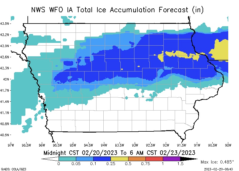
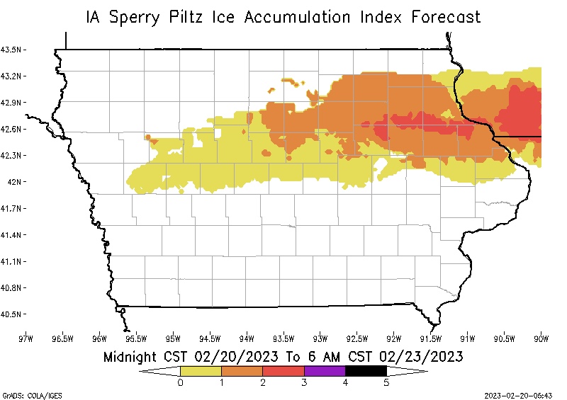
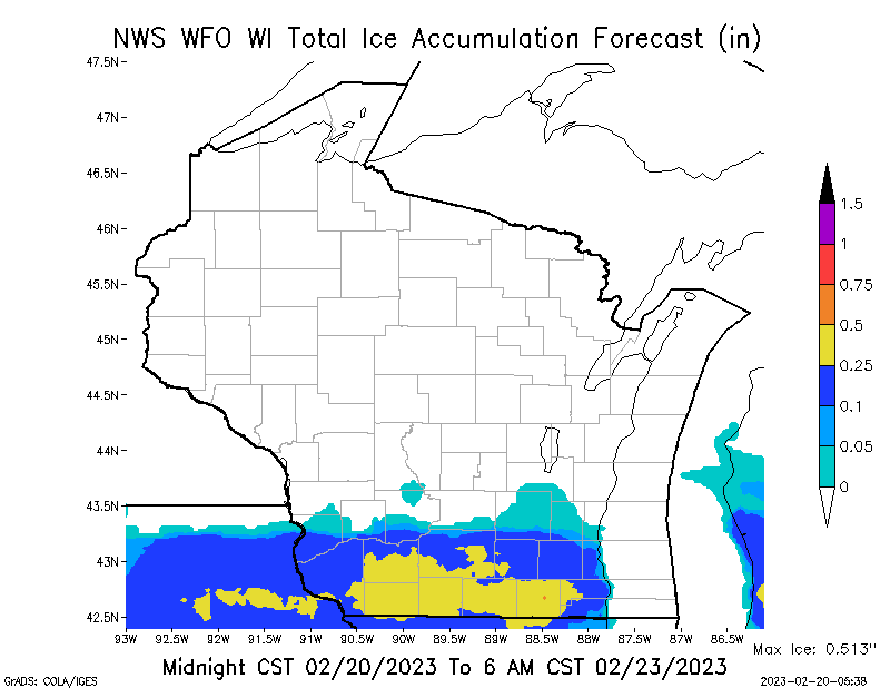
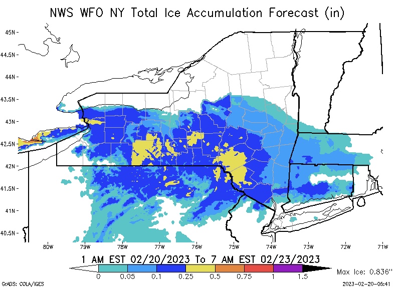
Max ICE in the NWS grids is currently at 0.836”. GFS models (first graphic) are forecasting up to 1.22” of ice. The current SPIA Index Ice Impact Forecast is at Levels 1 thru 5 in parts IA, WI, IL, MI, OH, PA & NY.
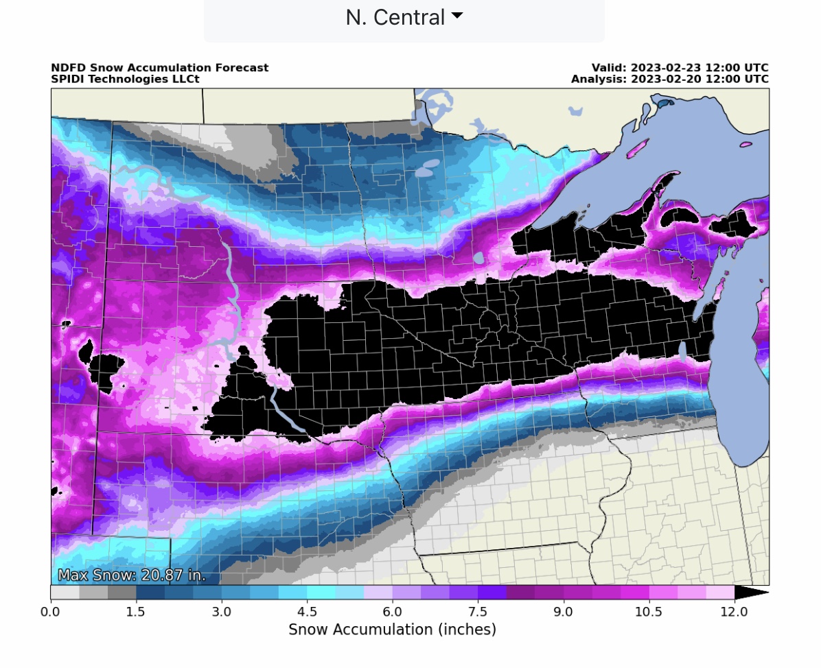
Heavy SNOW is also likely - up to 20” in some areas - across SD, MN, WI & MI. The ice path will be slightly to the south of the heavy snow path.
This storm COULD have significant impacts for Electric and Communications Utilities. Timing is late Tuesday night/early Wednesday for SD, MN & IA, then Wednesday and Thursday into early Friday as the storm moves from west to east across MI, OH, PA and NY.
Sid Sperry

 Show/hide attachments