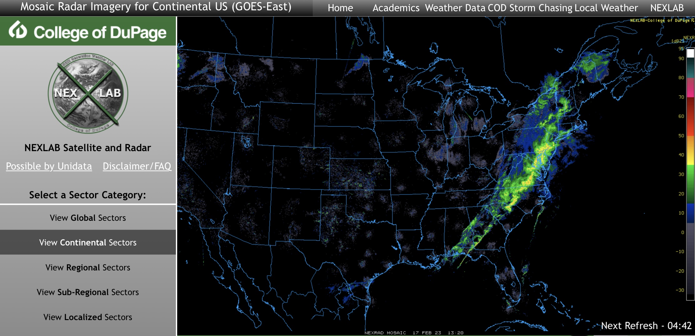
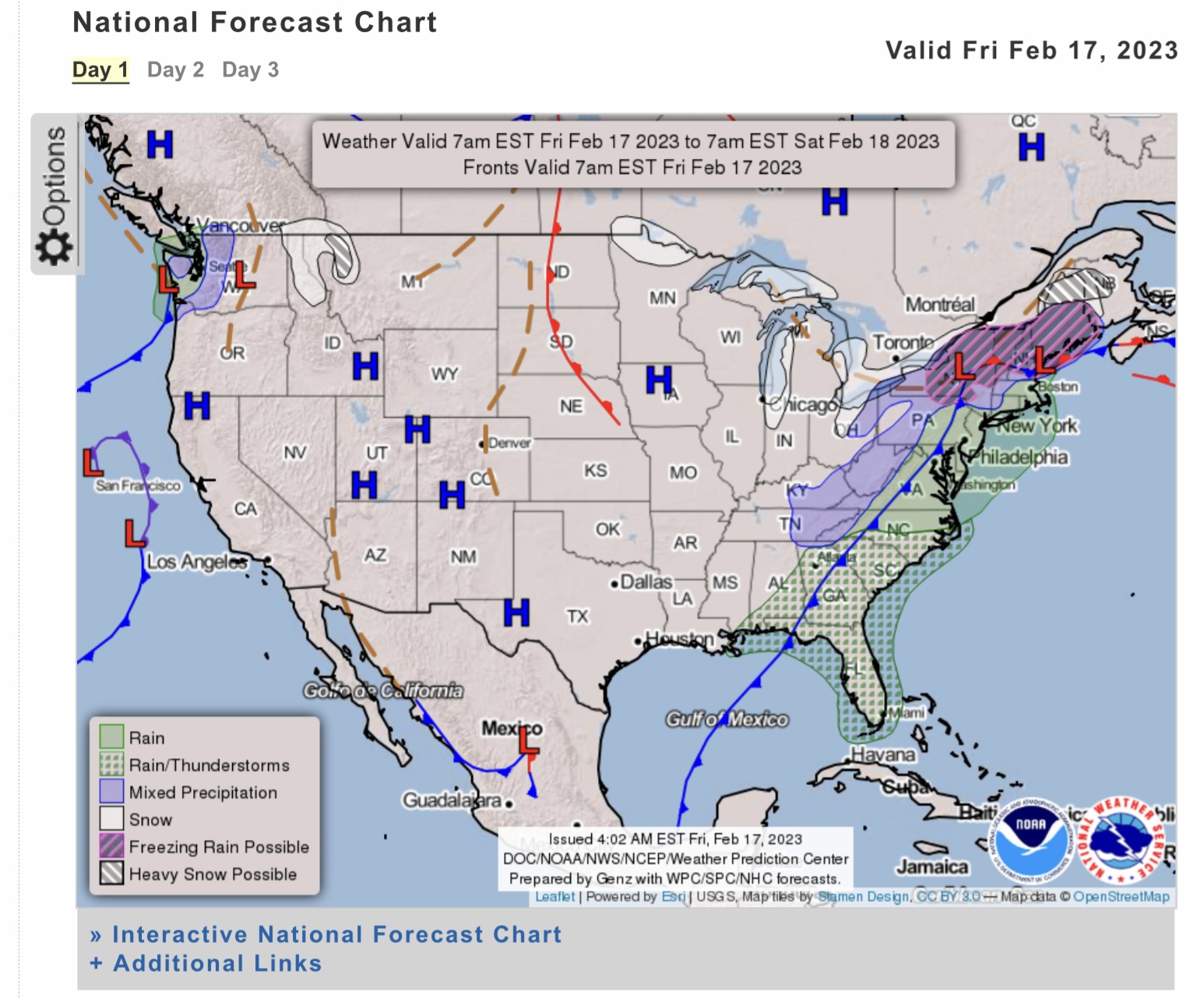
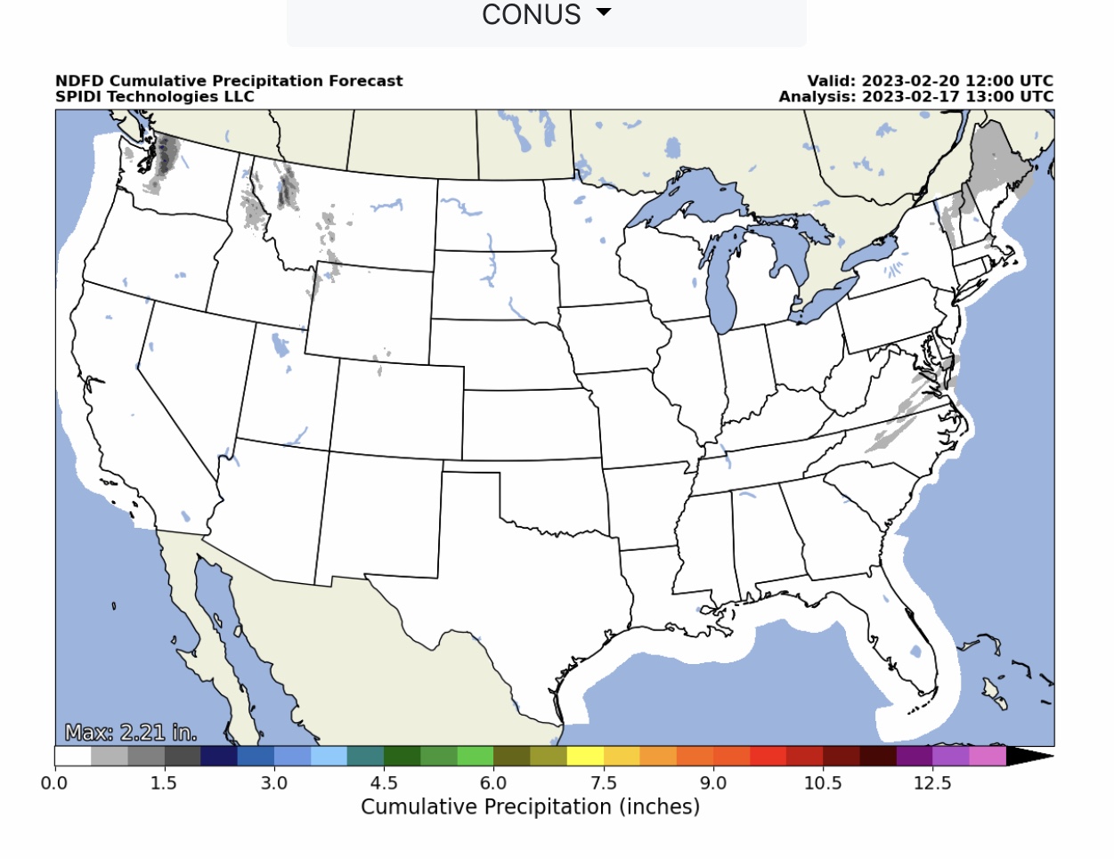
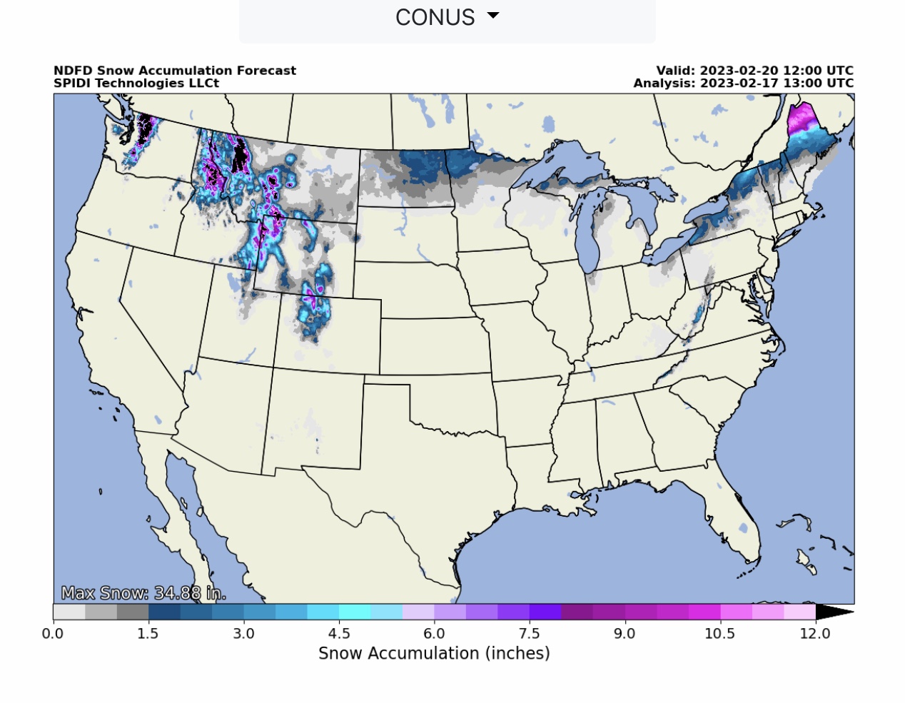
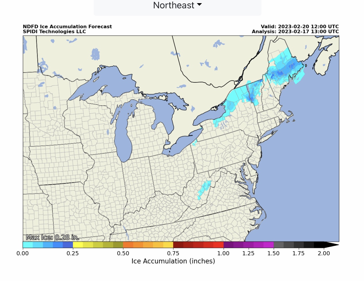
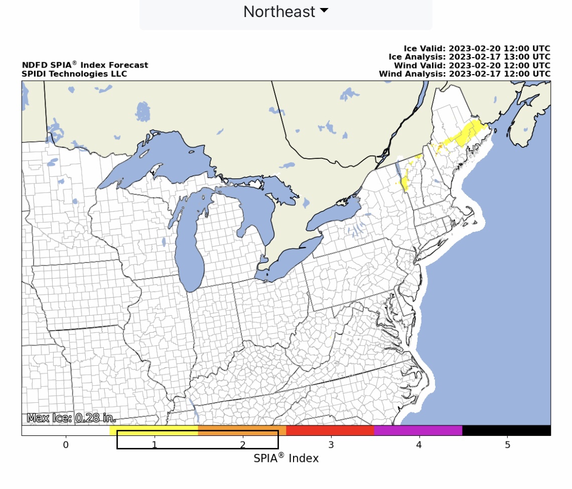
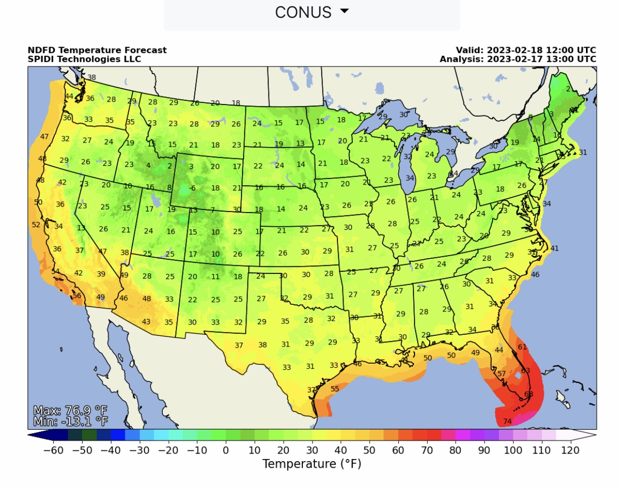
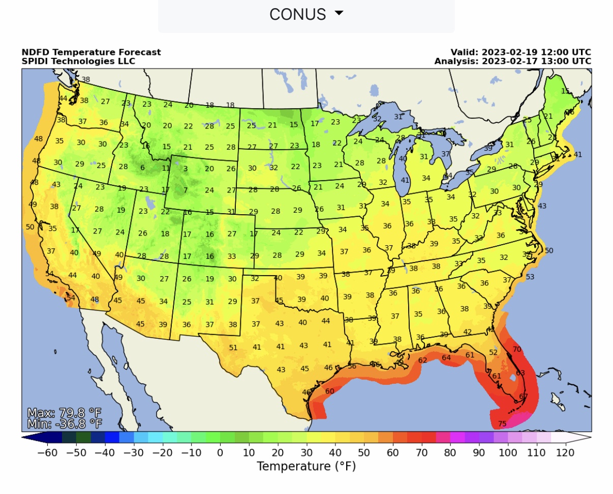
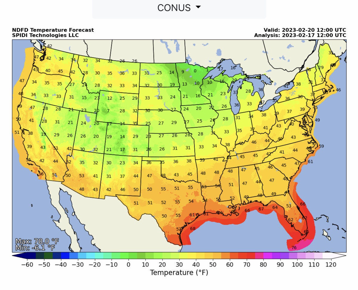
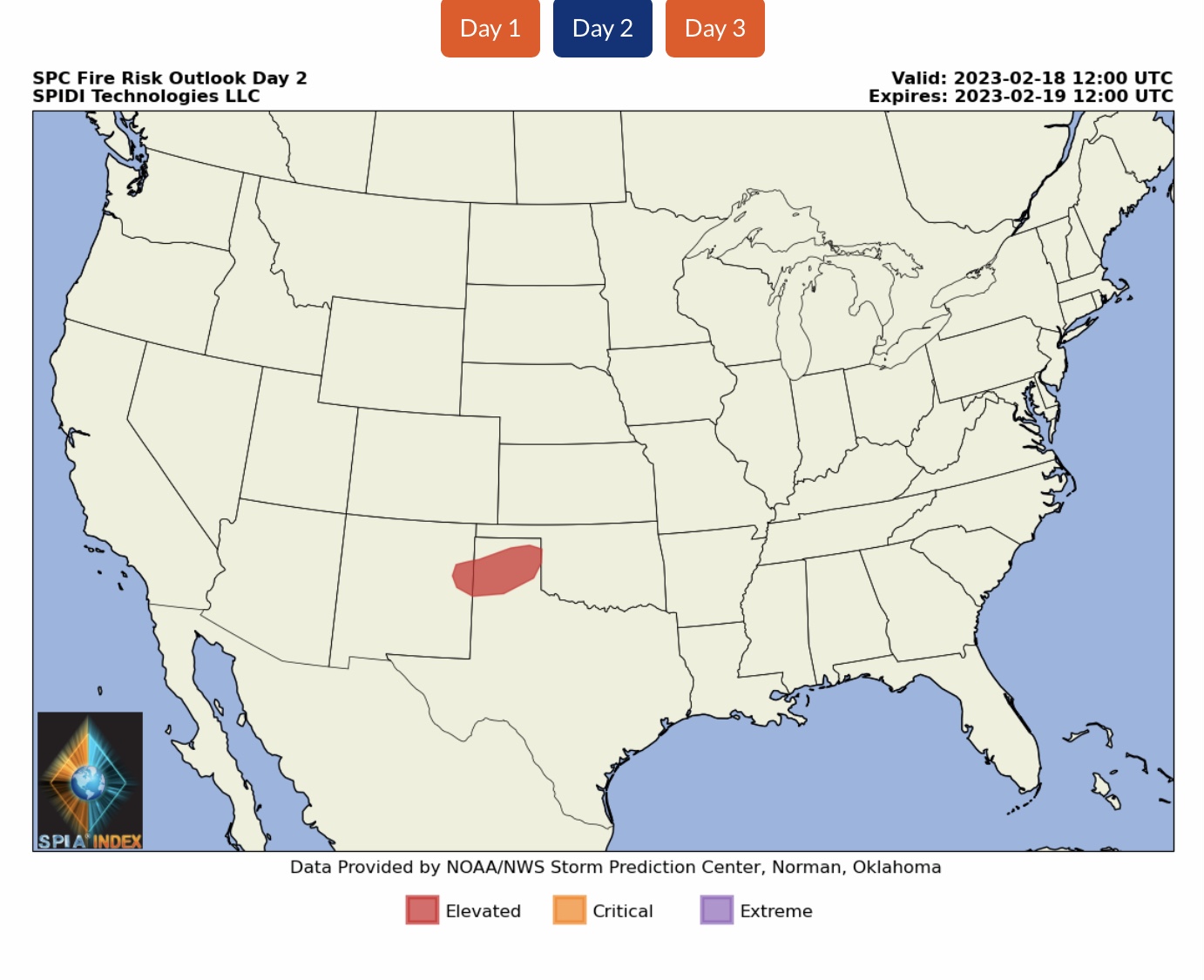
Current COD Mosaic Radar. Today’s CONUS forecast from NWS. QPF, Snow & Ice Forecasts from NWS over next 72-hours, to 6am CST Monday, 2/20/2023. SPIA Index ice impact forecast over next 72-hours, northeastern U.S. Max ice in NWS grids: 0.28” SPIA Index Levels 1 & 2 parts NY, VT, NH & ME. NWS Low Temperature Forecasts at 6am CST Saturday, Sunday & Monday, February 18-20. ELEVATED Fire Risk, Day 2 (Saturday), parts NM & TX.
Sidney Sperry 17 Feb 2023 13:48 UTC
Sid Sperry
President & CEO
SPIDI Technologies, LLC
SPIDItech.com
Cell: (405) 627-7754
Email(s): SidSperry@gmail.com  OR  Sid.Sperry@spidiweather.com

Sent from my iPad

 Show/hide attachments