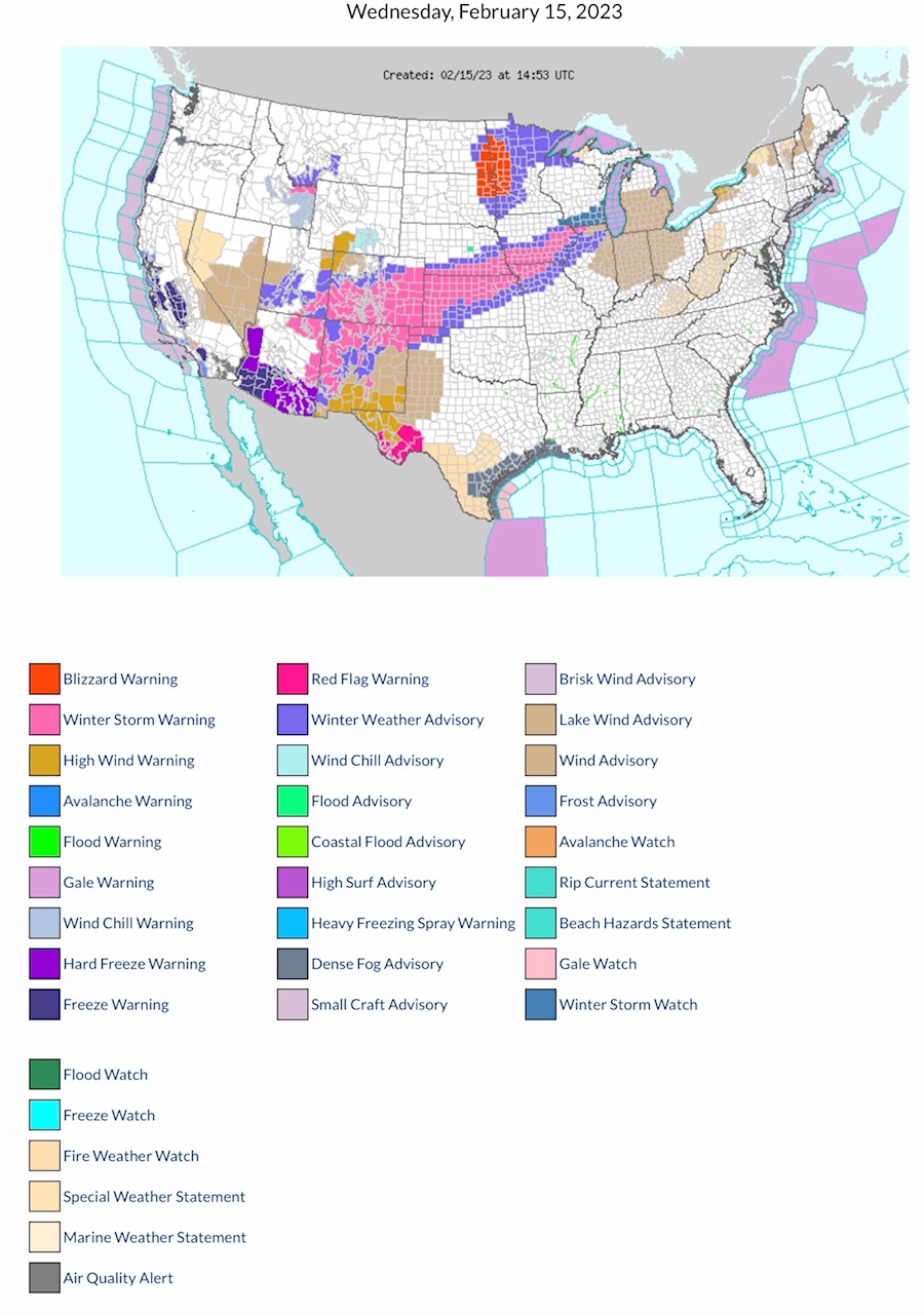
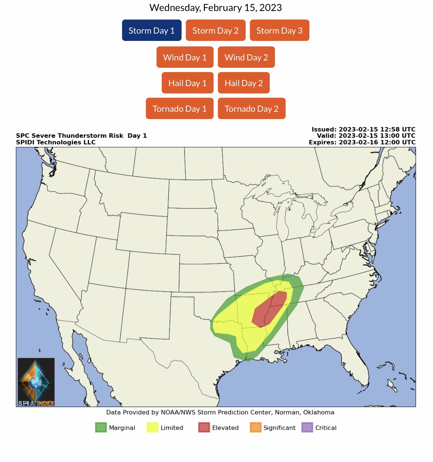
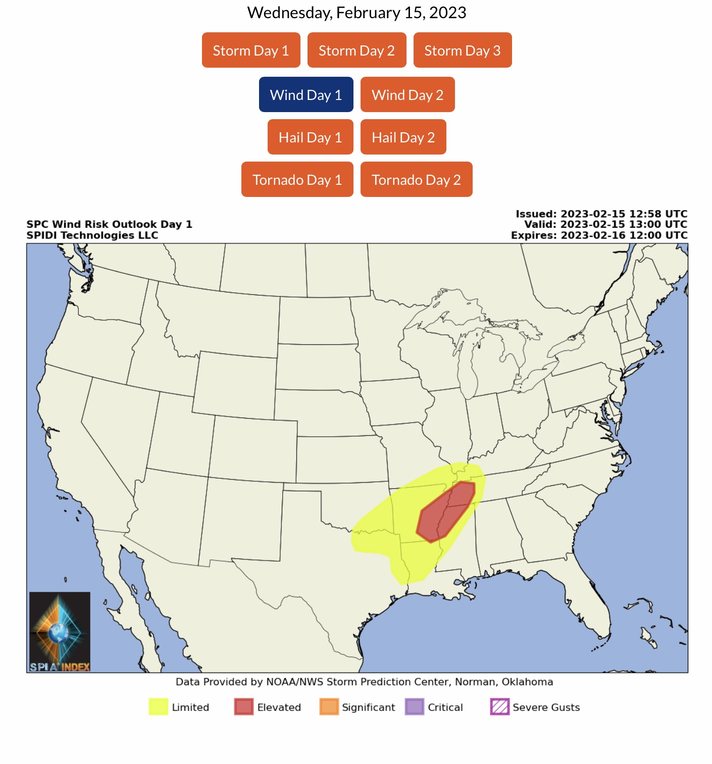
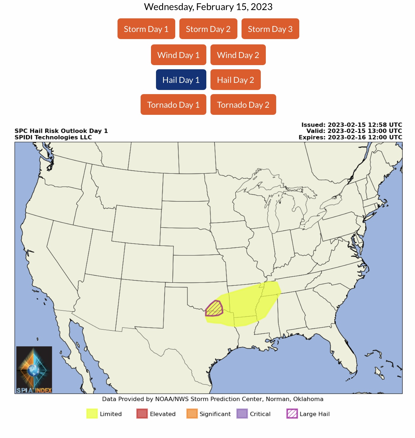
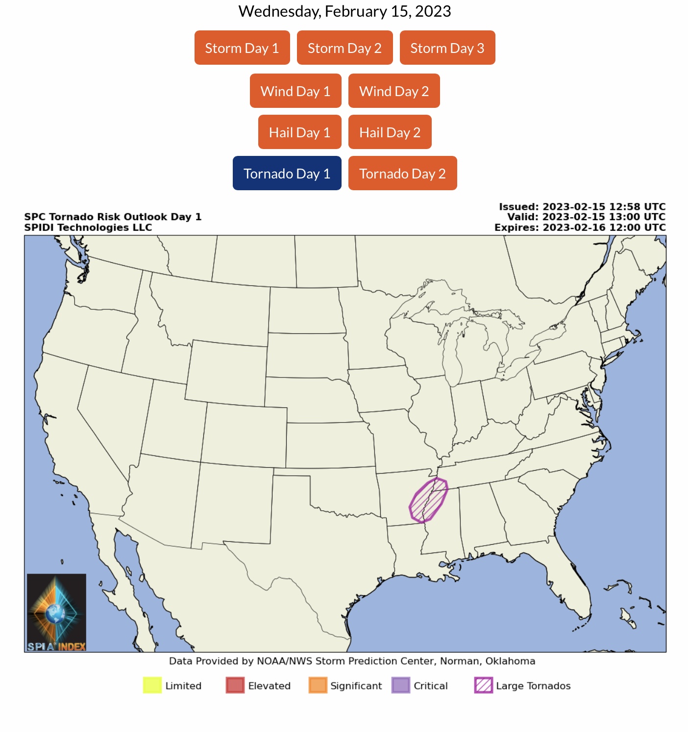
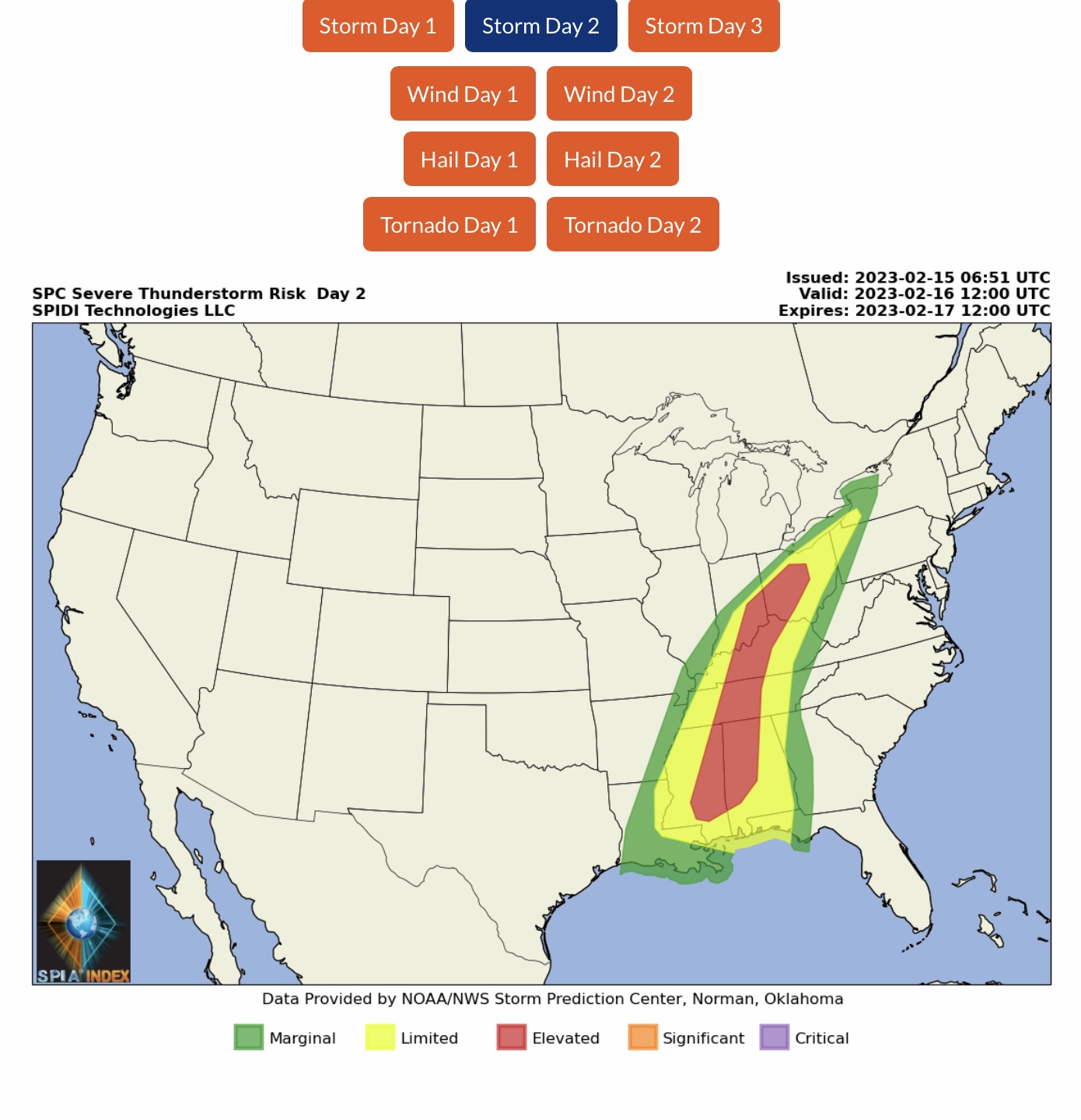
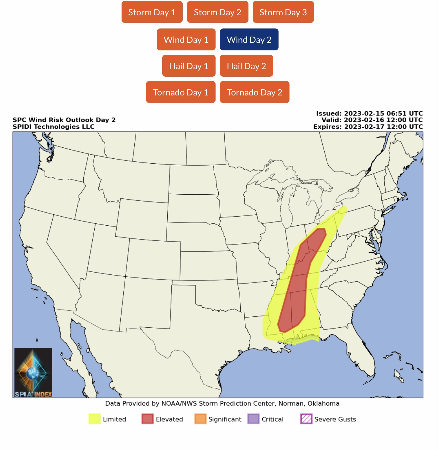
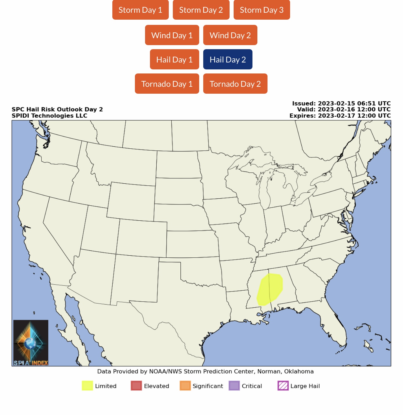
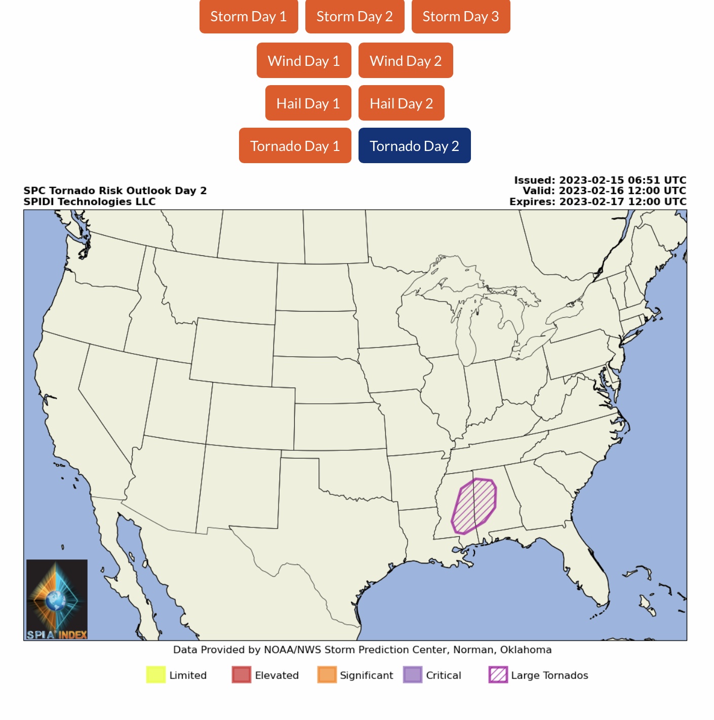
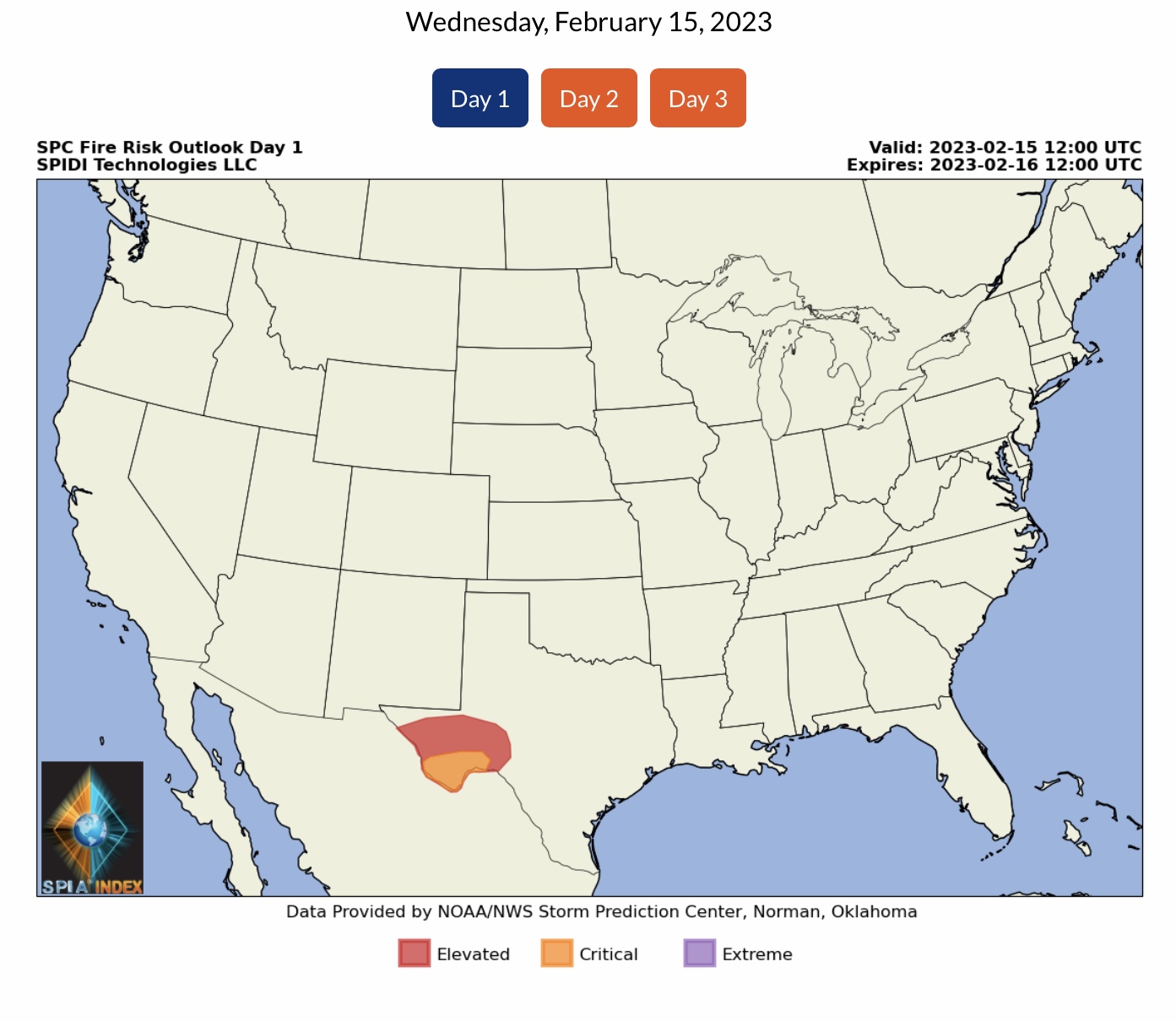
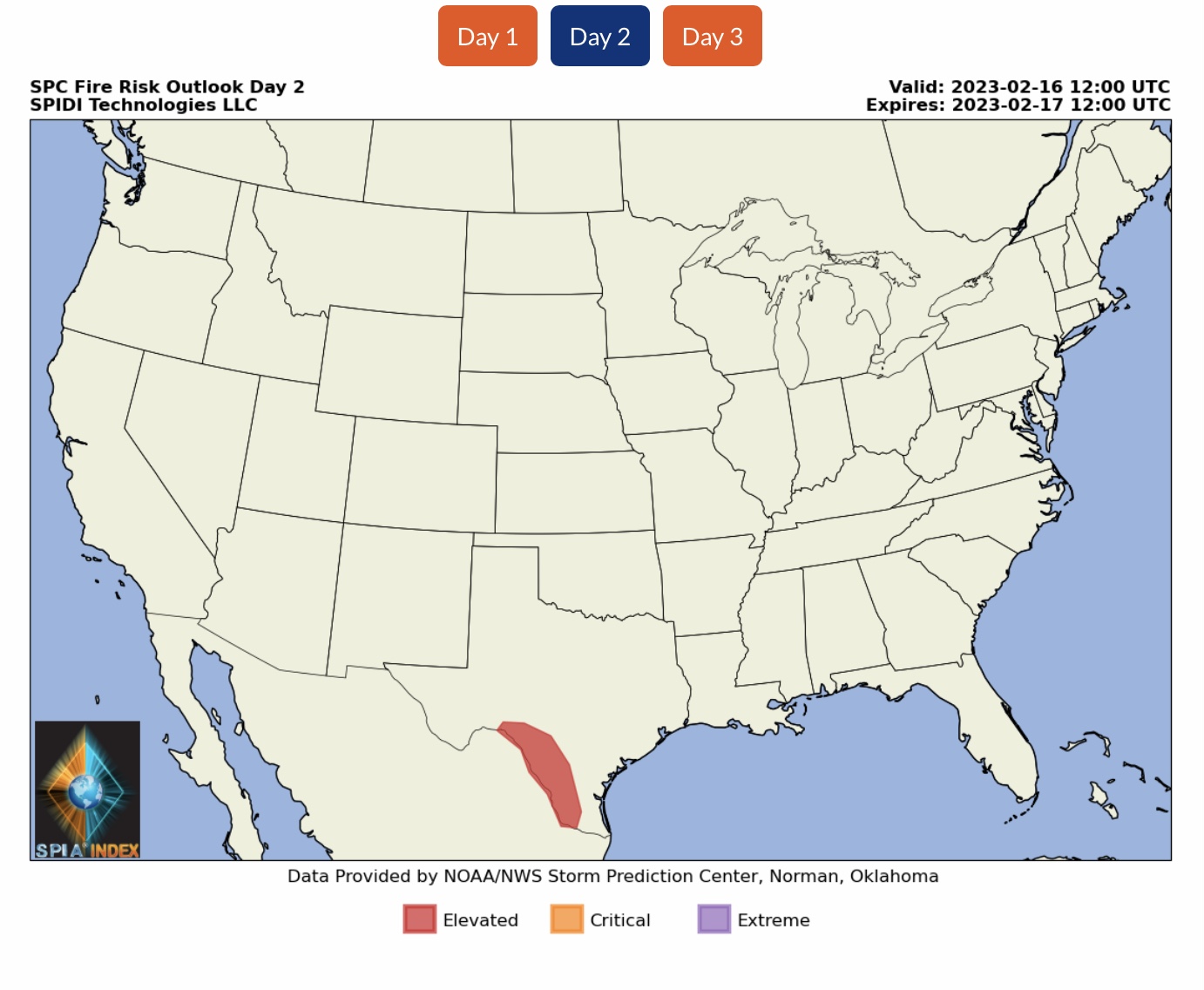
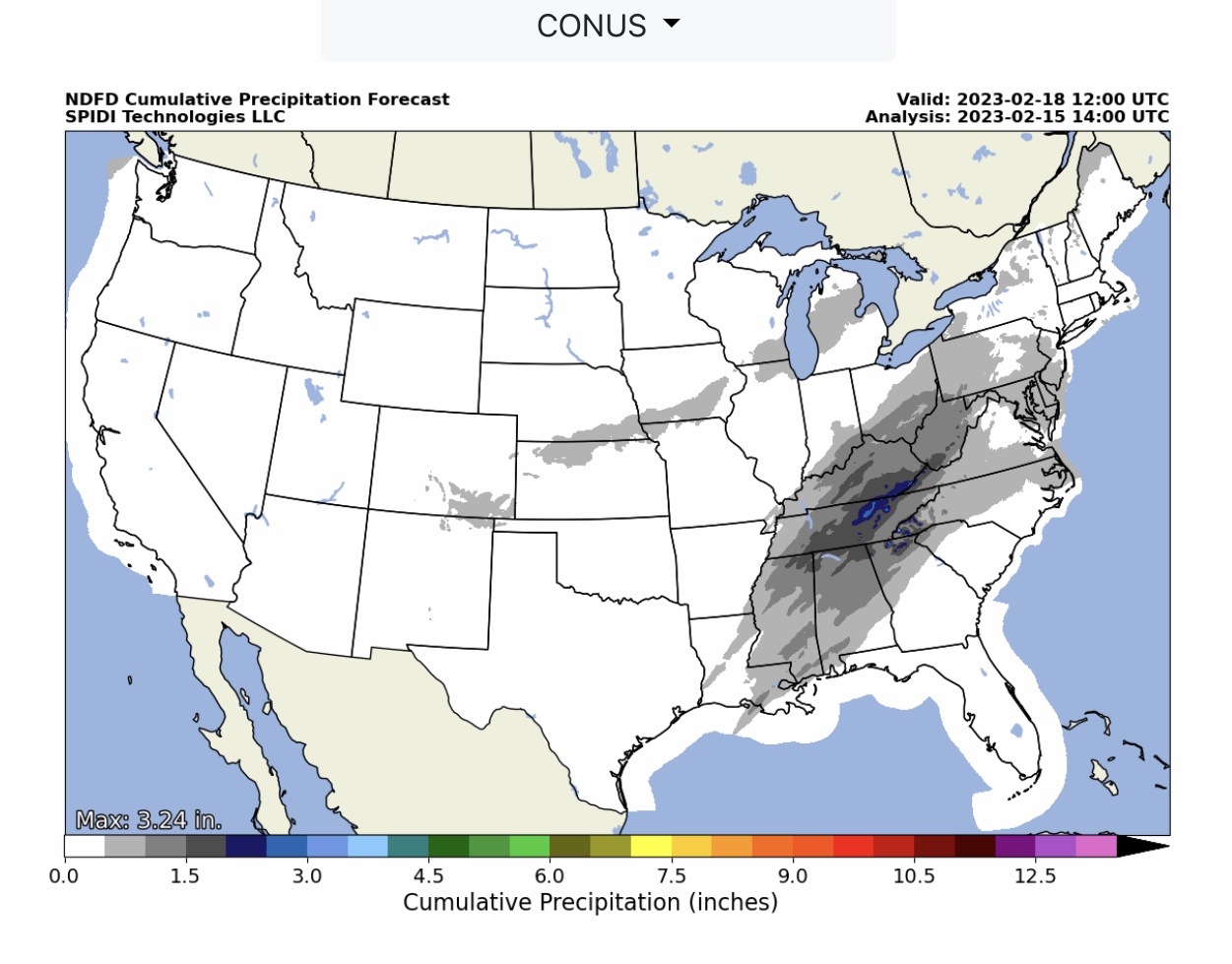
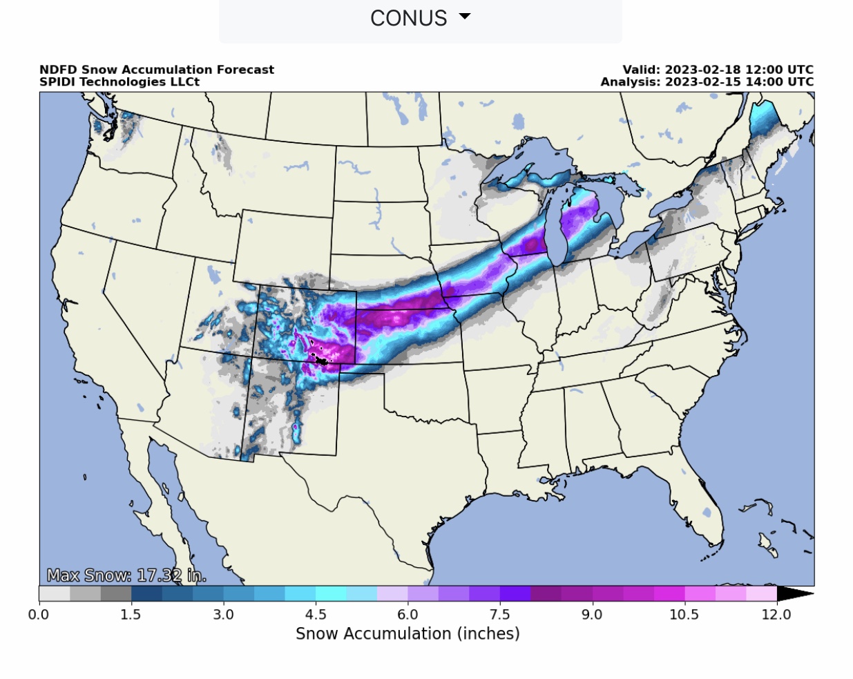
A mix of nearly all Weather Hazards over next 72-hrs across much of U.S. Blizzard Warnings today parts ND, SD, MN. Heavy SNOW next 72-hrs parts AZ, UT, CO, NM, TX, OK, KS, NE, MO, IA, IL & WI. LIMITED to ELEVATED Severe Thunderstorm Risk, Day 1, including ELEVATED High Wind Risk, Large Hail Risk & Large Tornado Risk parts OK, TX, LA, AR, MO, IL, KY, TN, MS & AL. Day 2, parts NY, PA, OH, IN, KY, TN, LA, MS, AL, FL & GA. ELEVATED to CRITICAL Fire Risk, Days 1 & 2, parts south TX.
Sidney Sperry 15 Feb 2023 15:43 UTC
FYI… special concerns for possibilities of Severe Thunderstorms with the probability of Large Tornadoes across parts AR, TN & MS today, and across parts MS & AL tomorrow.
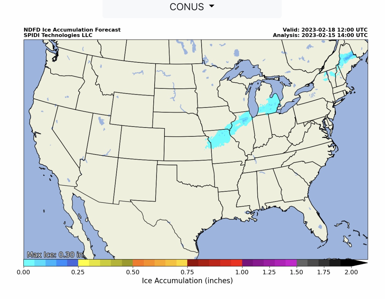
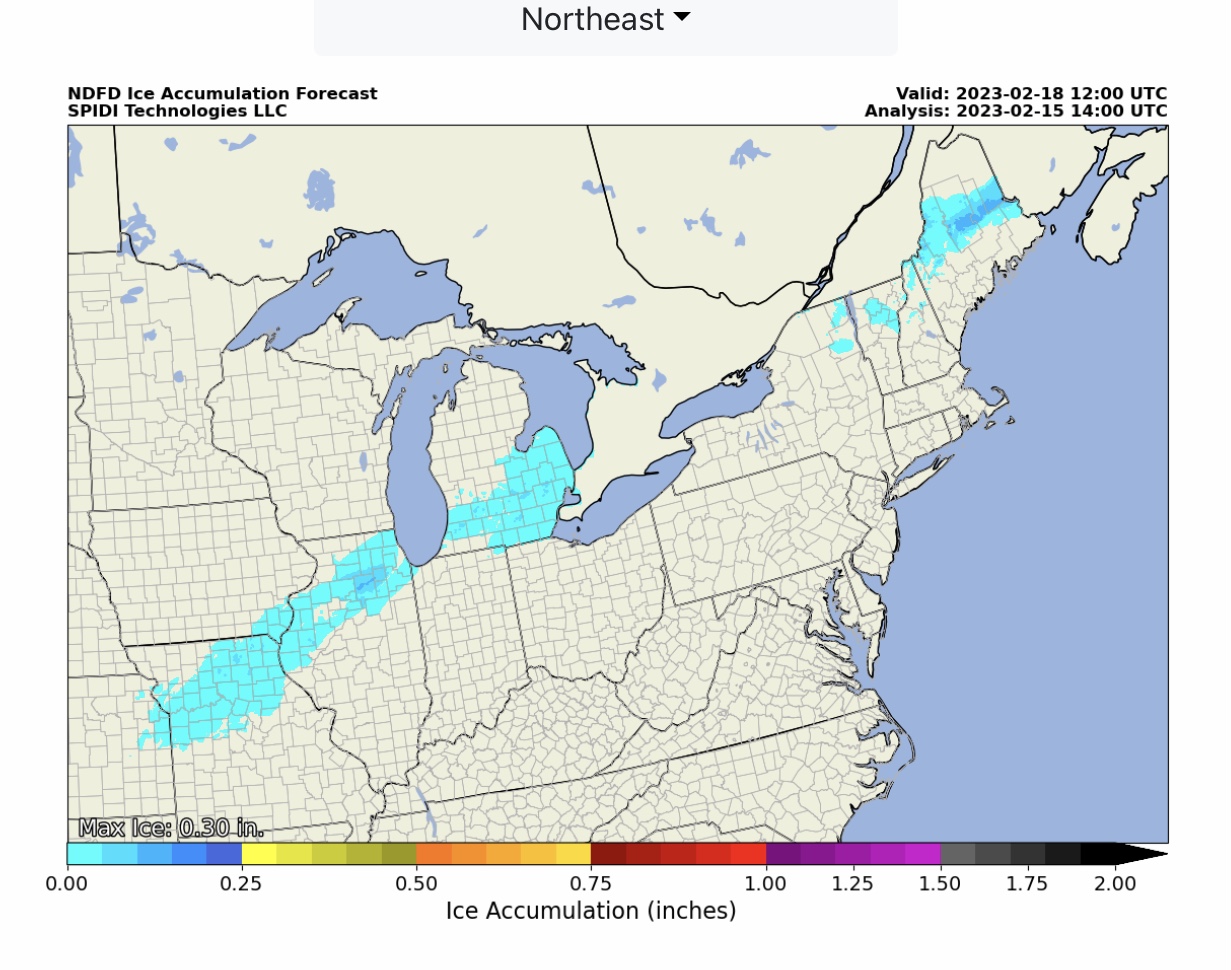
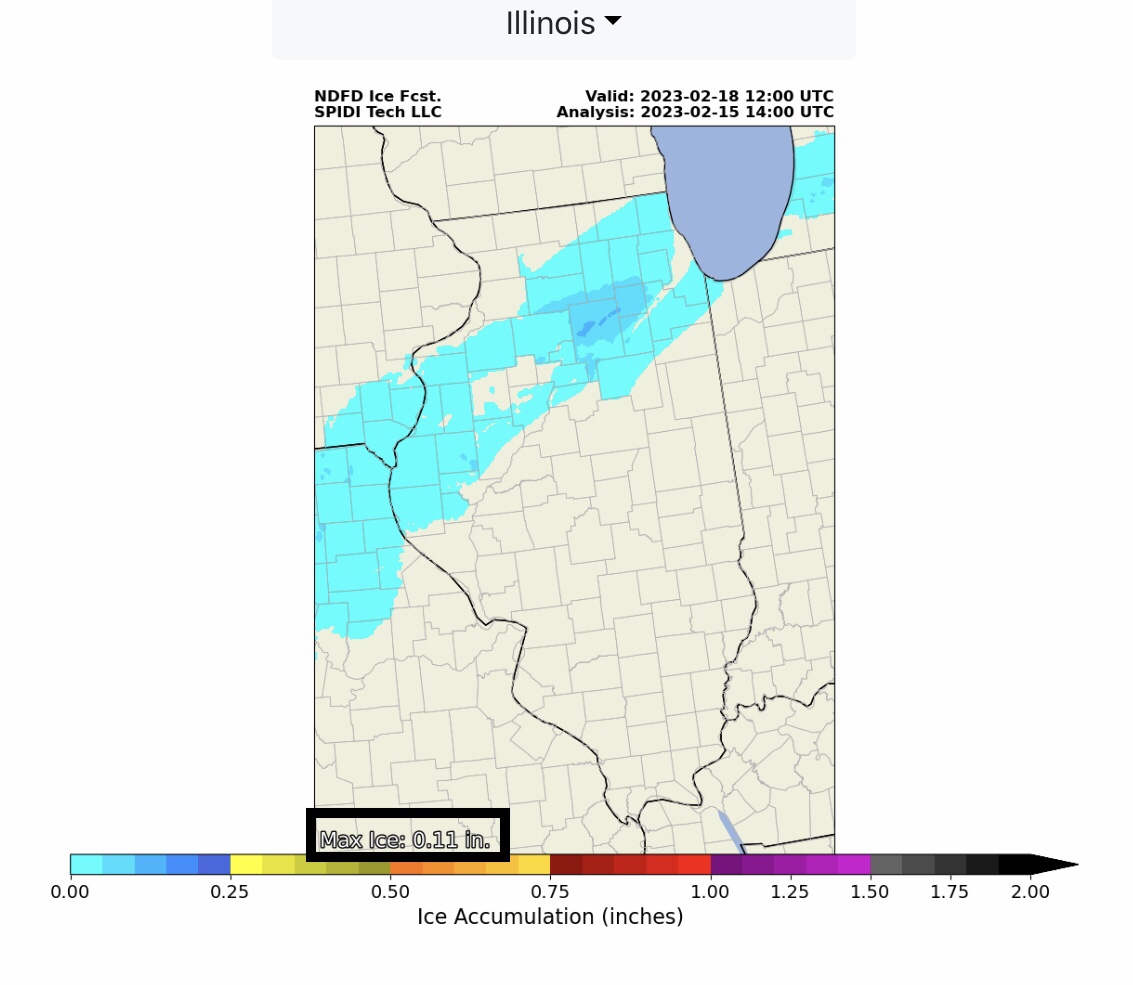
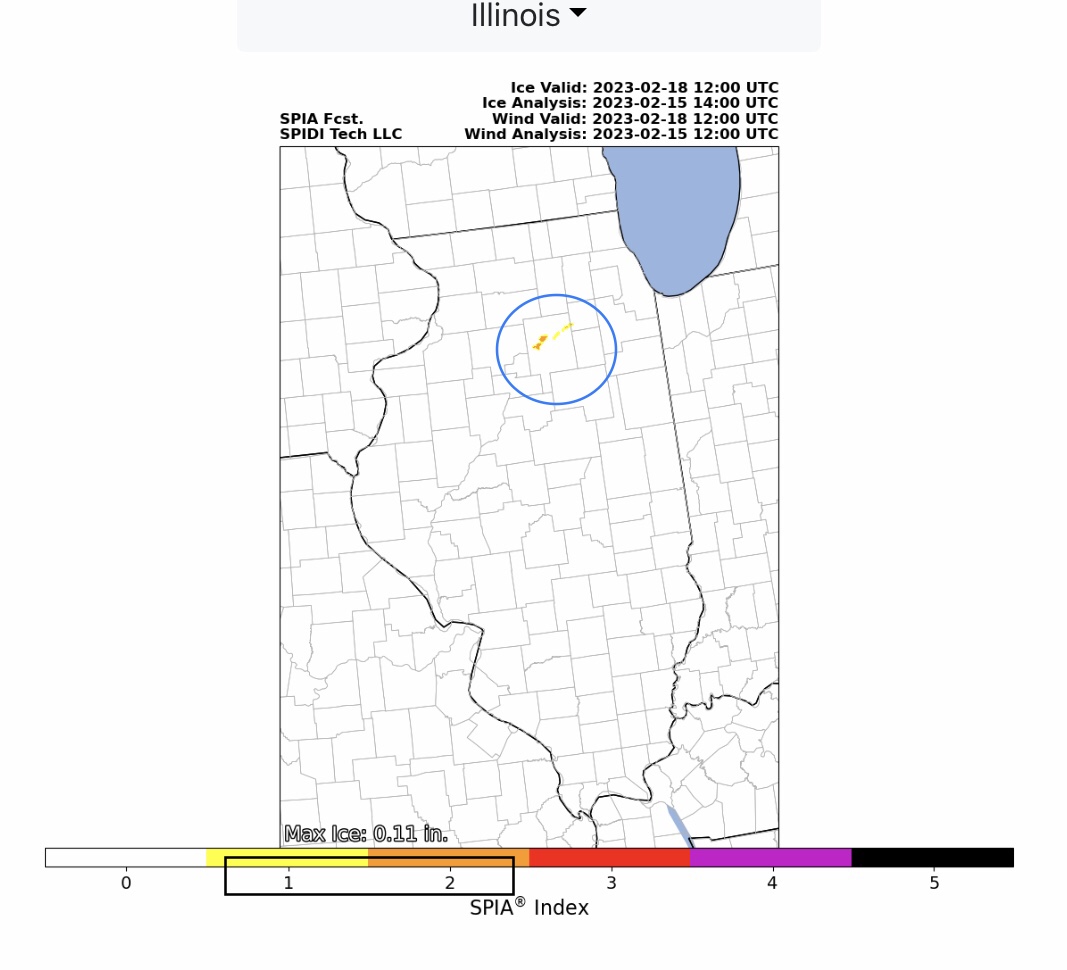
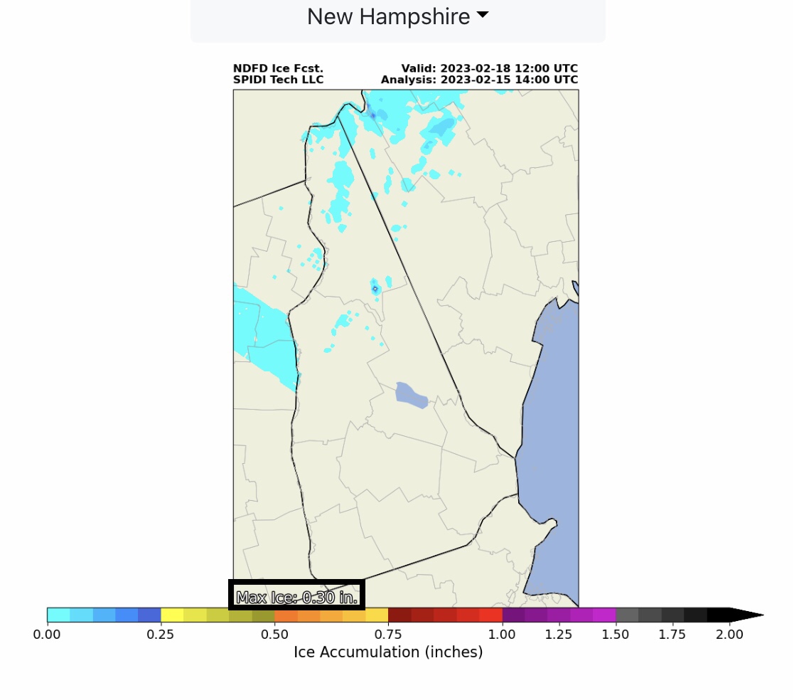
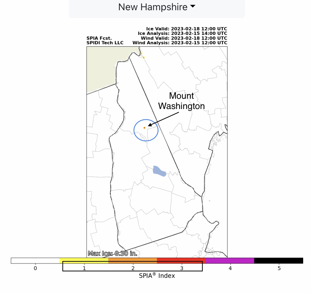
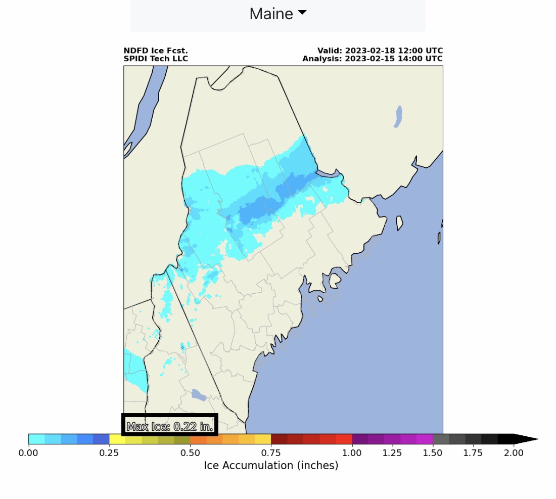
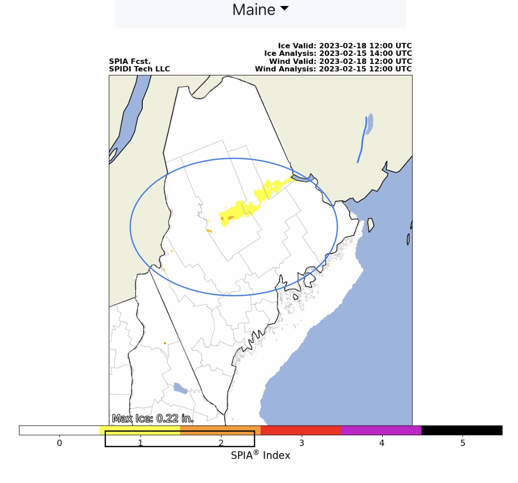
Max ice in NWS Grids: 0.30” parts NH; SPIA Index Levels 1 thru 3, parts NH. Max Ice in NWS Grids for parts IL: 0.11” with SPIA Index Levels 1 & 2 in parts northern IL. Max Ice in NWS Grids for parts ME: 0.22” with SPIA Index Levels 1 & 2.
Snow amounts from 3” up to 17” across parts UT, AZ, CO, NM, TX, OK, KS, NE, MO, IA, IL, WI, MI & northern ME over next 72-hrs.
Sid Sperry
President & CEO
SPIDI Technologies, LLC
SPIDItech.com
Cell: (405) 627-7754
Email(s): SidSperry@gmail.com  OR  Sid.Sperry@spidiweather.com

Sent from my iPad

 Show/hide attachments