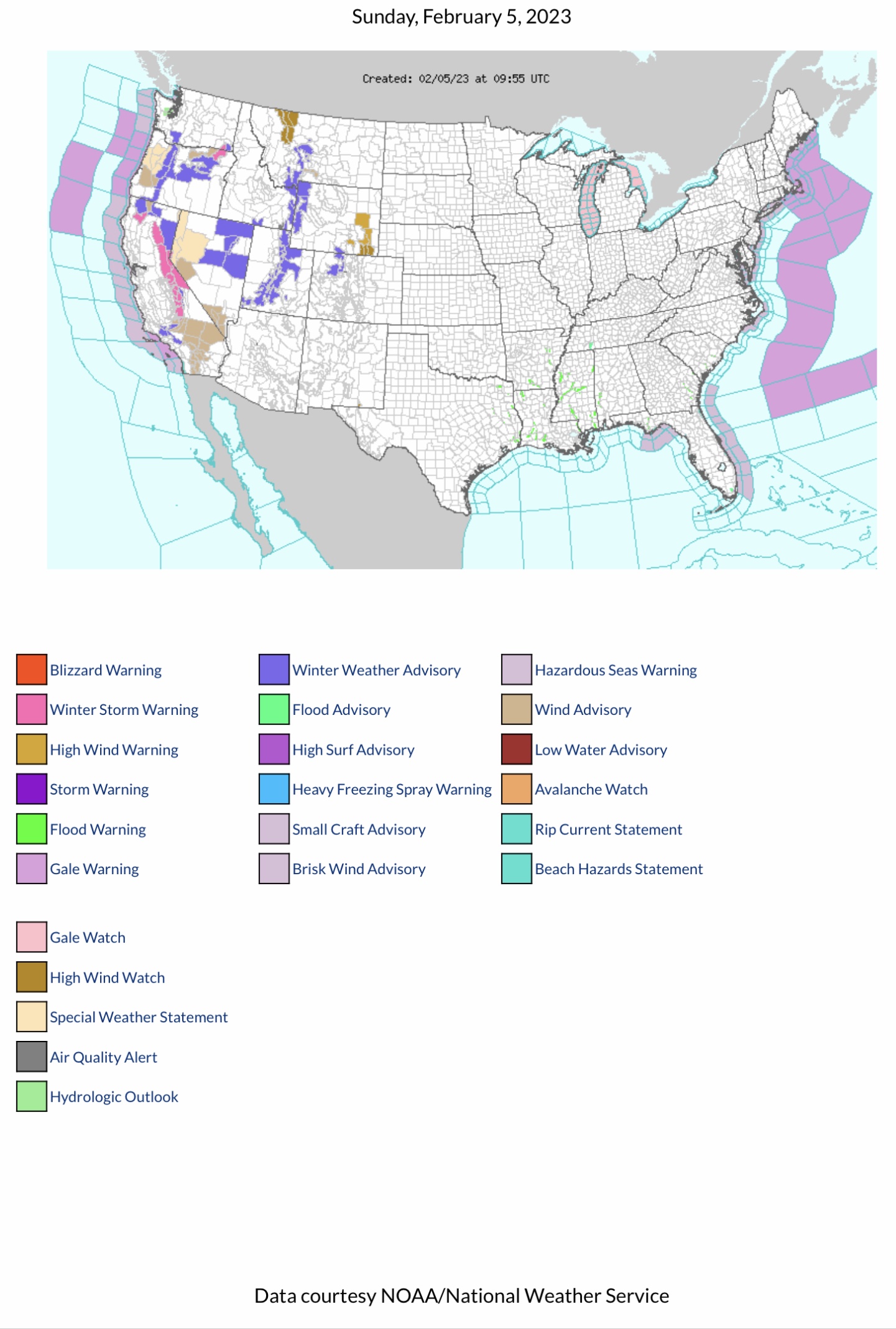
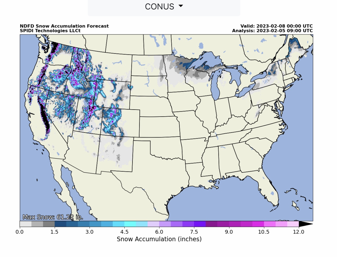
FYI… Note High Wind Warnings and Wind Advisories parts OR, CA, NV, MT & WY. Winter Storm Warnings parts WA, OR & CA. Winter Storm Advisories parts WA, OR, CA, ID, NV, MT, WY, UT & CO.
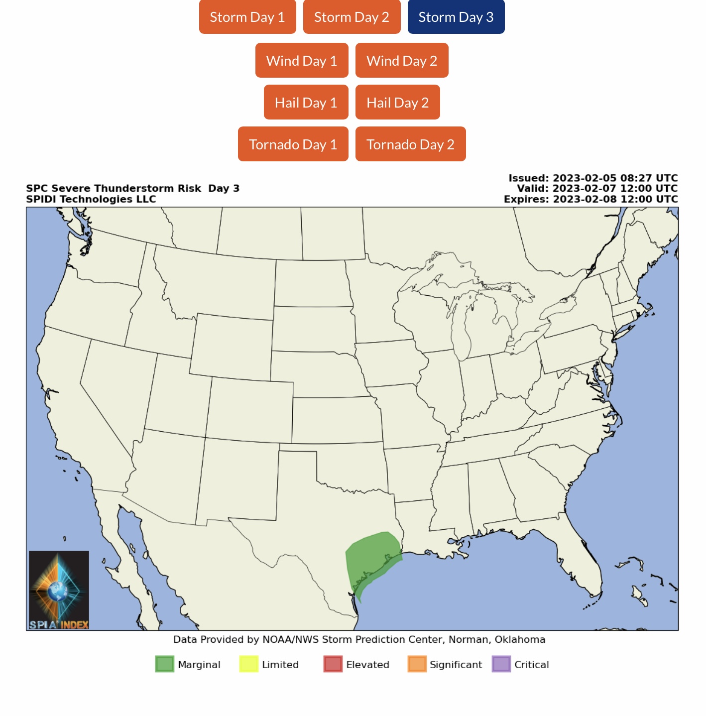
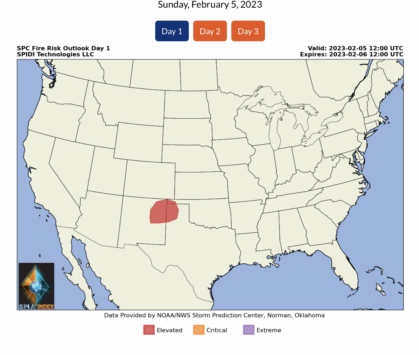
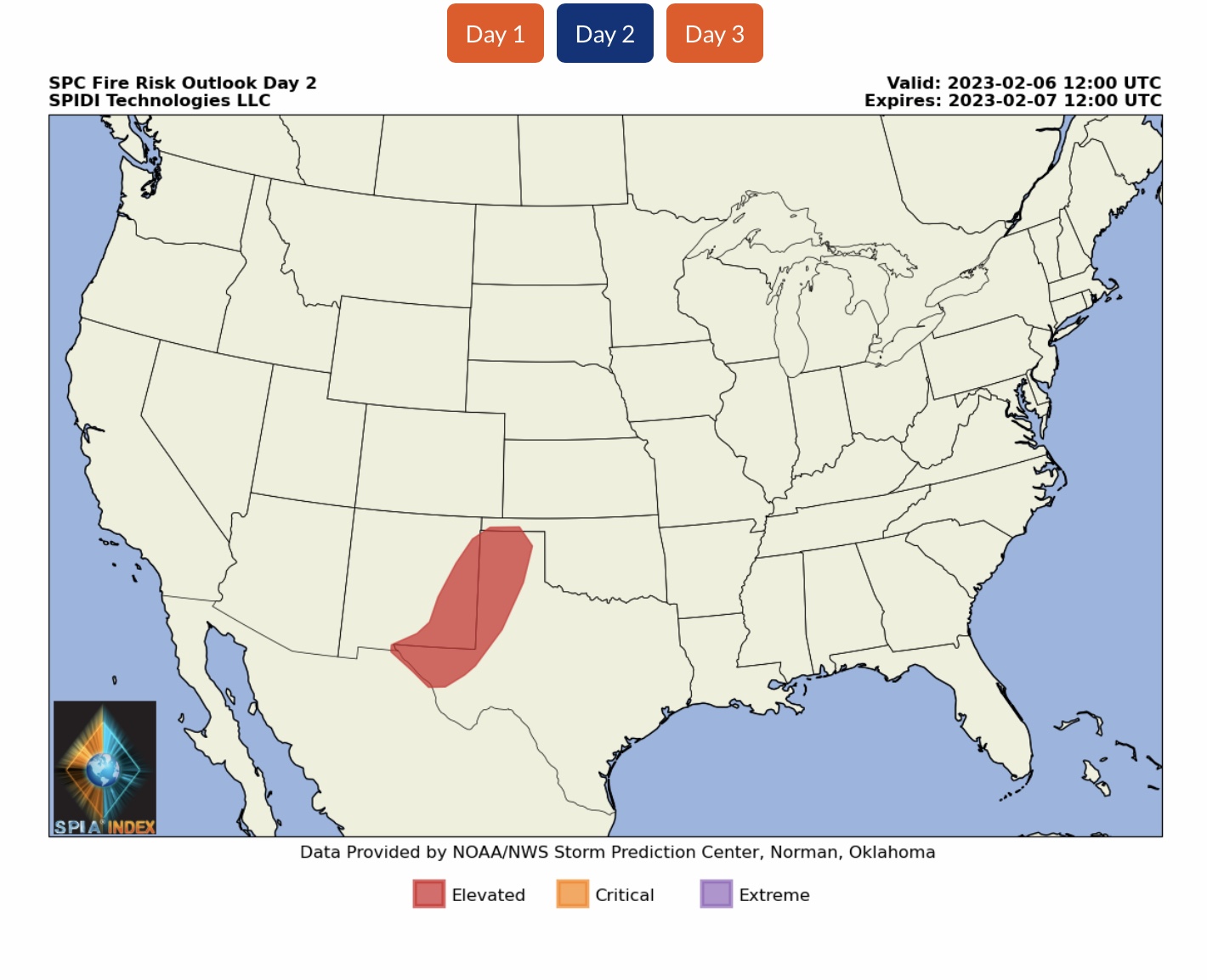
MARGINAL Severe Thunderstorm Risk, Day 3 (Tuesday into Wednesday AM), parts southeast TX. ELEVATED Fire Risk, Days 1 & 2 (Sunday thru Tuesday AM), parts NM, OK & TX.
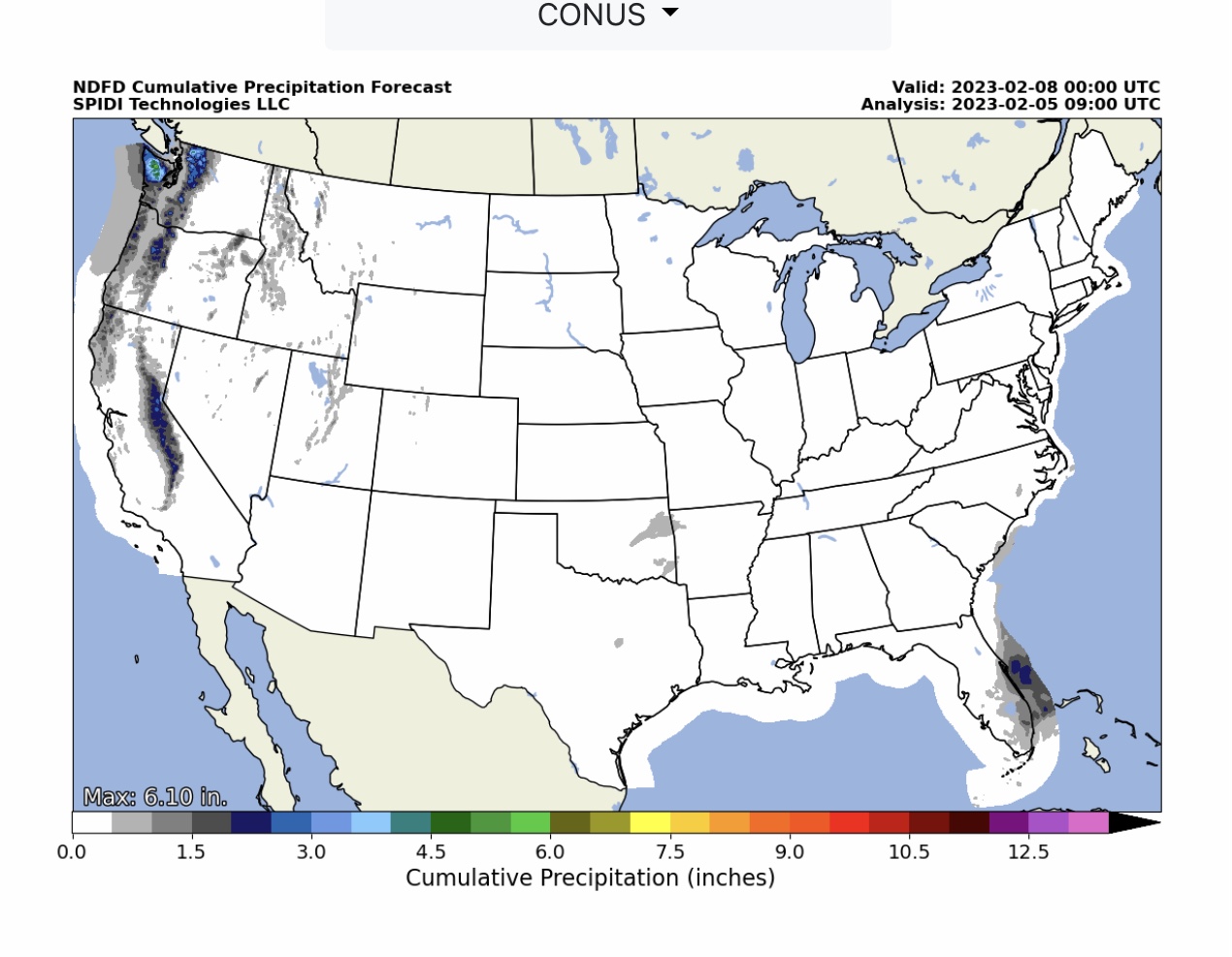
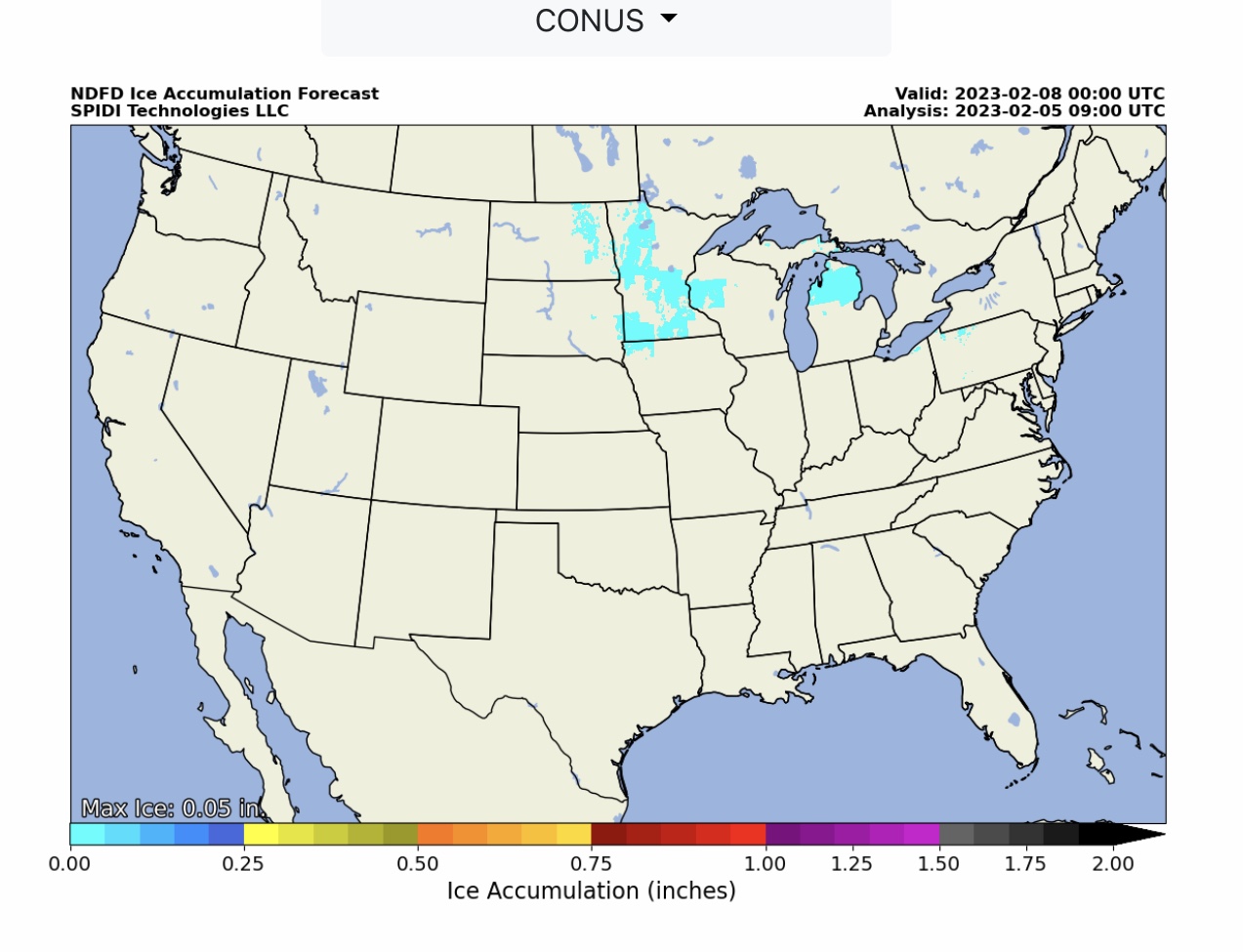
Heavy SNOW parts Northwest Region, Southwest Region, North Rockies Region, and South Rockies Region, primarily in higher elevation areas. Very light freezing rain & ice accumulation (up to 0.05”) parts ND, SD, MN, IA, WI, MI, OH & PA over next 72-hours. The SPIA Index Ice Impact Forecast is currently at Level 0.
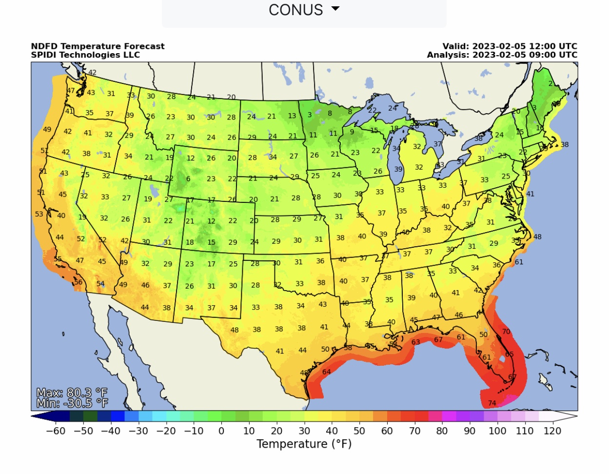
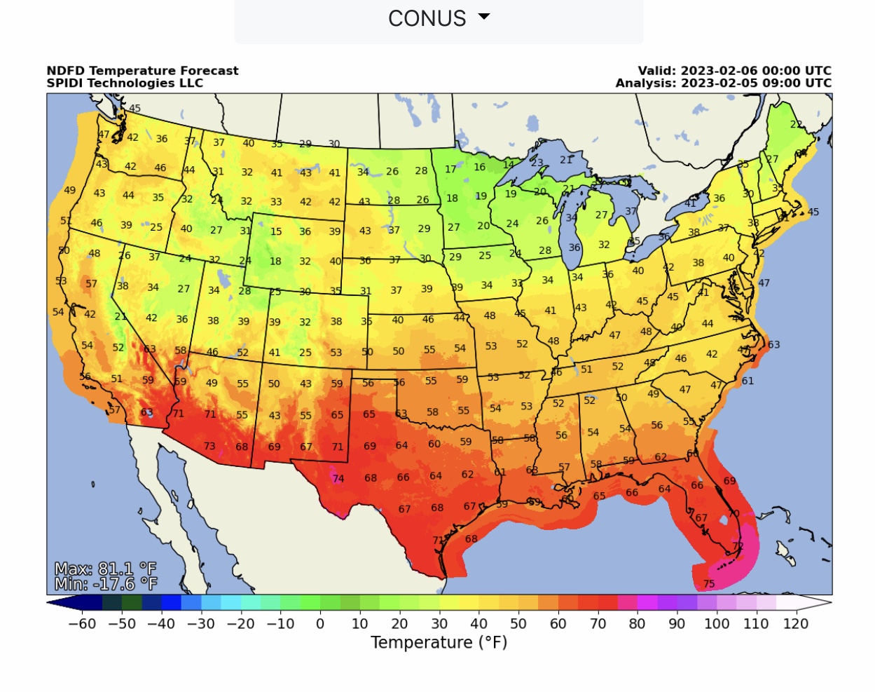
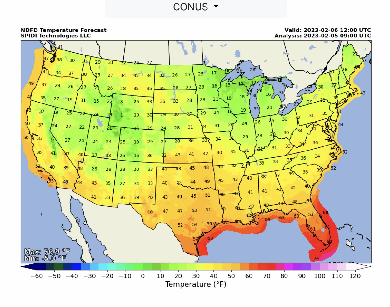
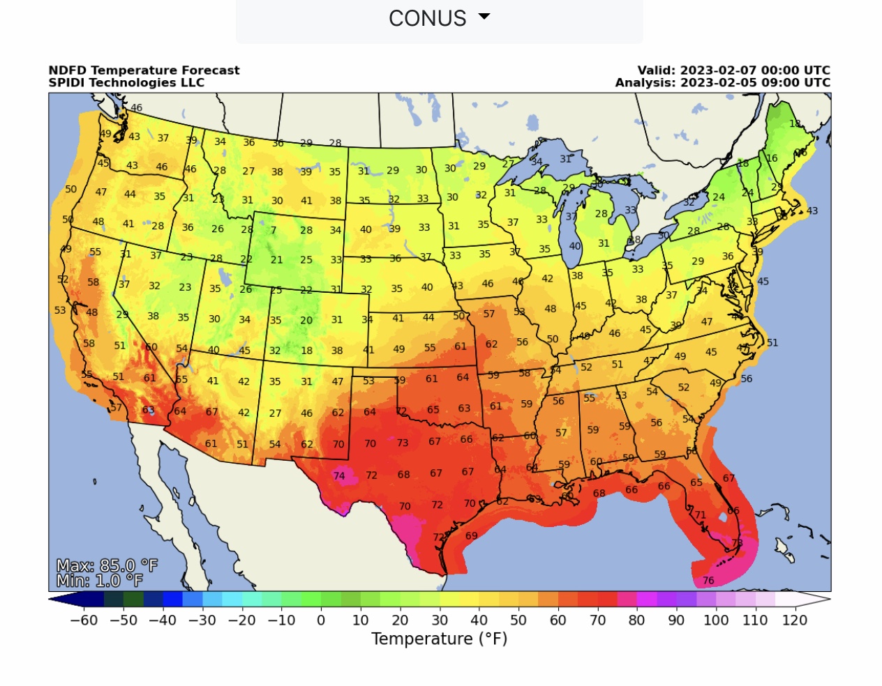
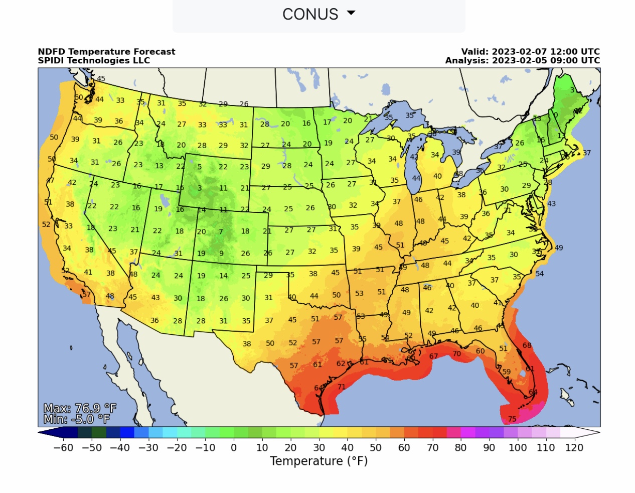
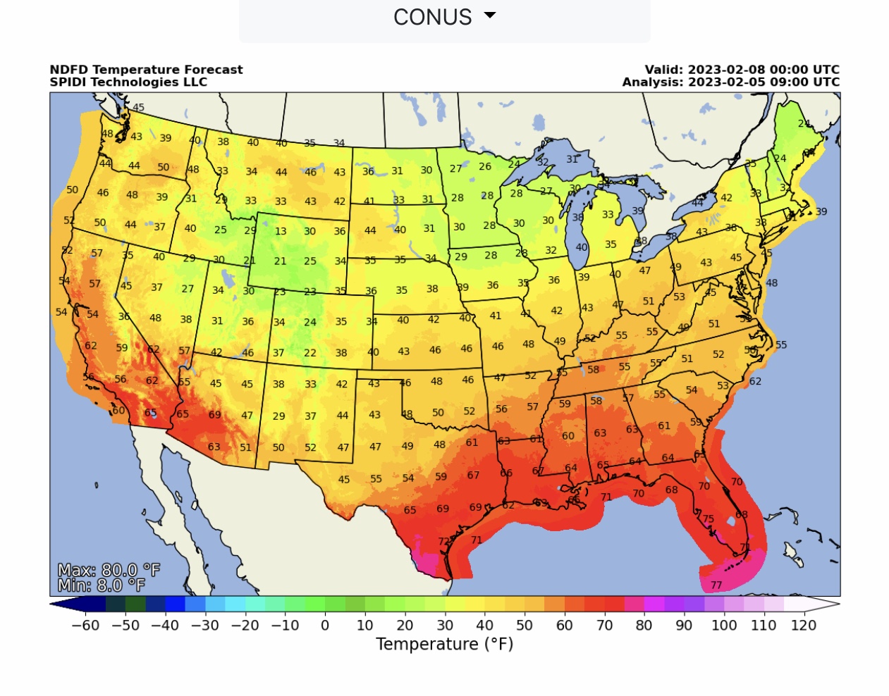
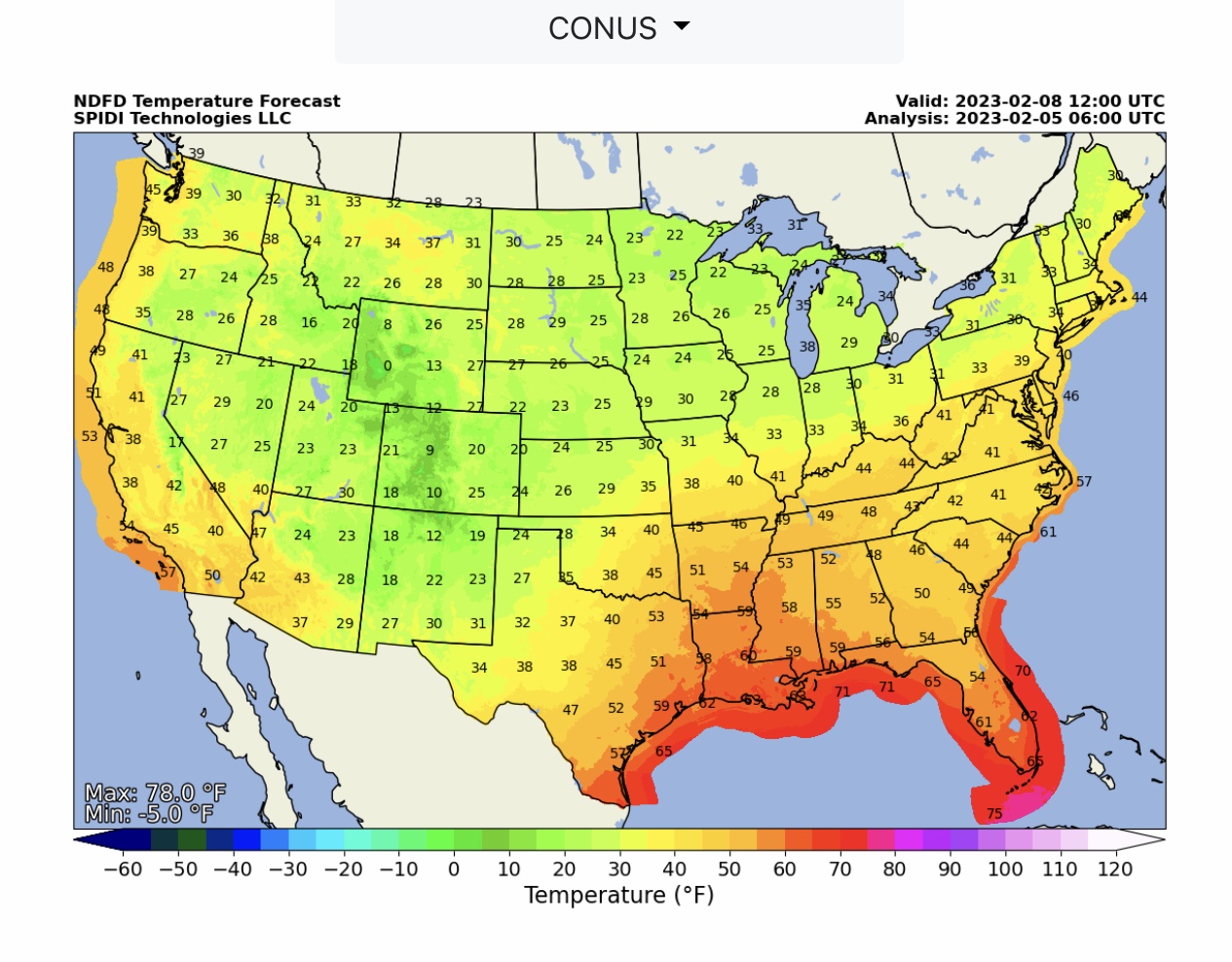
NWS Forecast Low & High Temperatures at 6:00am CST and 6:00pm CST today (Sunday, 2/5/2023) through Wednesday, 2/8/2023.

 Show/hide attachments