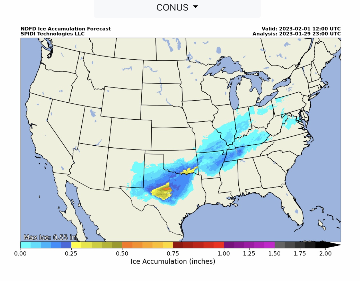
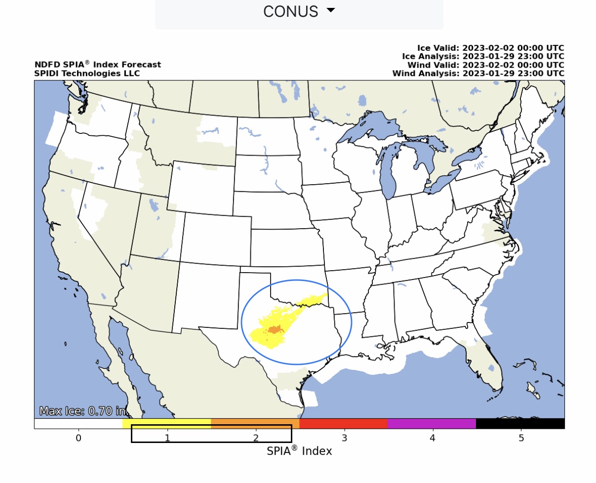
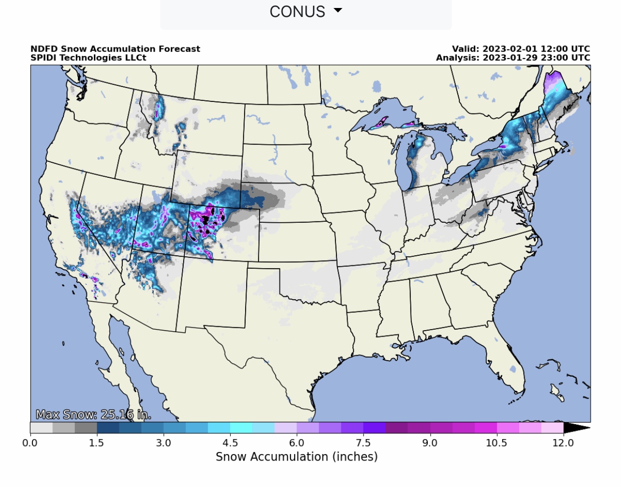
Ice amounts increasing in Texas; from 0.55” up to 0.70” in NWS Total Ice Accumulation Forecasts through 6pm Wednesday, 2/1/2023. The current SPIA Index Ice Impact Forecast is at Levels 1 & 2 in parts TX & OK.
Sidney Sperry 30 Jan 2023 00:30 UTC
FYI…

Freezing rain and ice accretion amounts are increasing in the latest NWS Forecasts. Max Ice in NWS Grids has increased in parts TX from 0.55” in the 11:00am CST NWS update to 0.70” in the NWS 5:00pm CST update that is valid thru 6pm Wednesday, 2/1/2023. The current SPIA Index Ice Impact Forecast is now at Levels 1 & 2 for parts TX & OK. Individual state’s ice and snow forecasts to follow shortly.

Sid Sperry
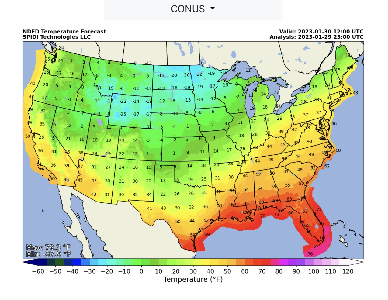
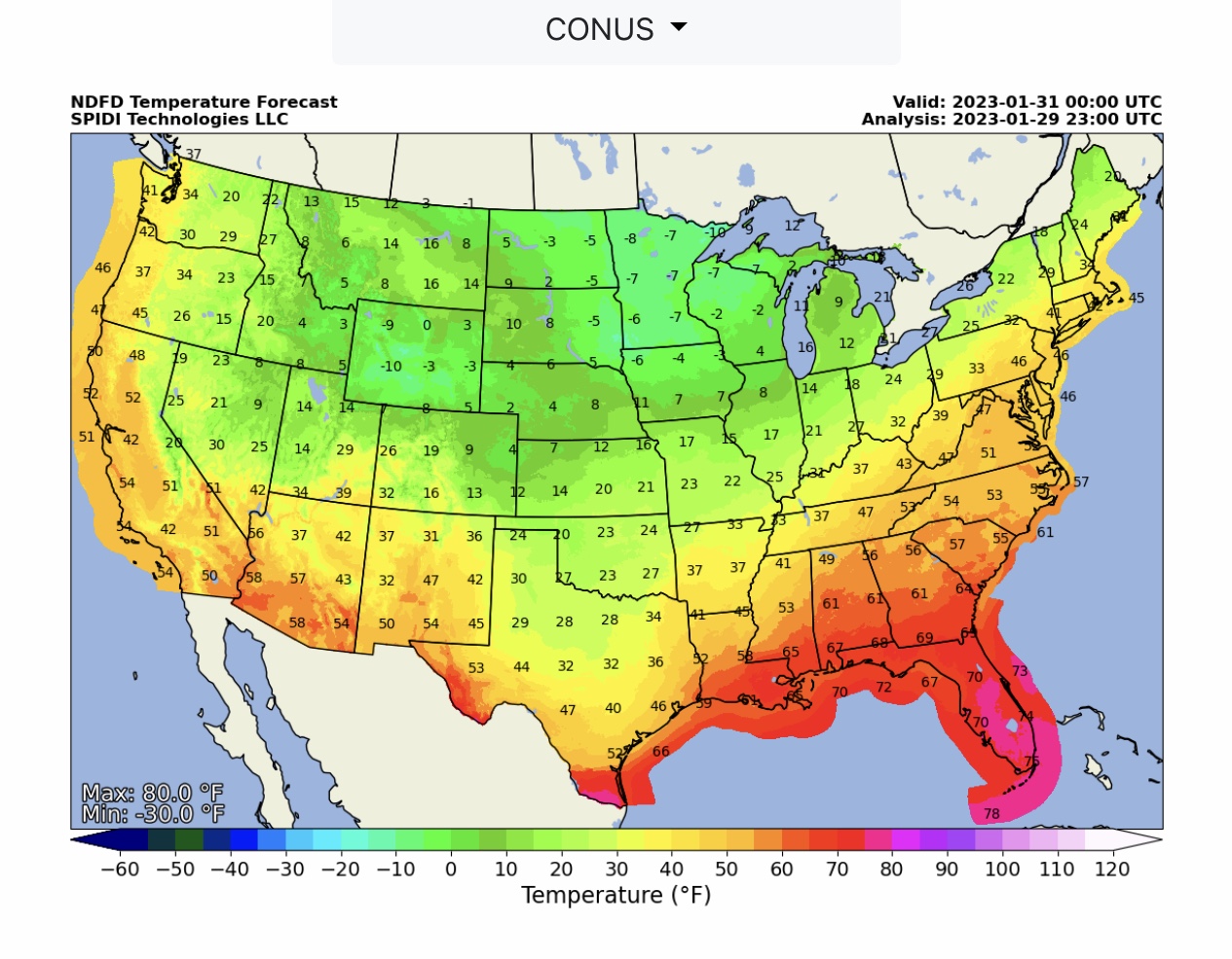
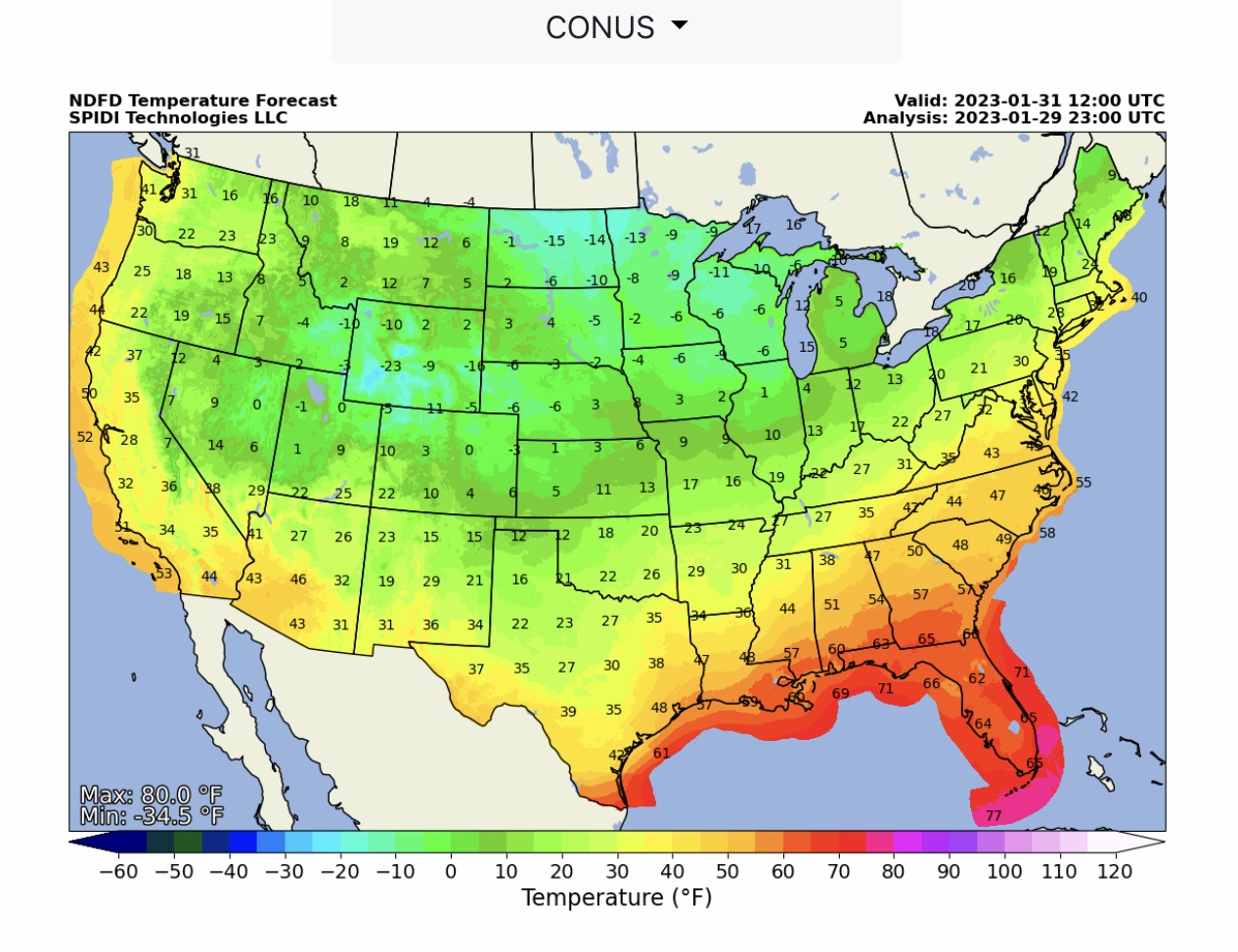
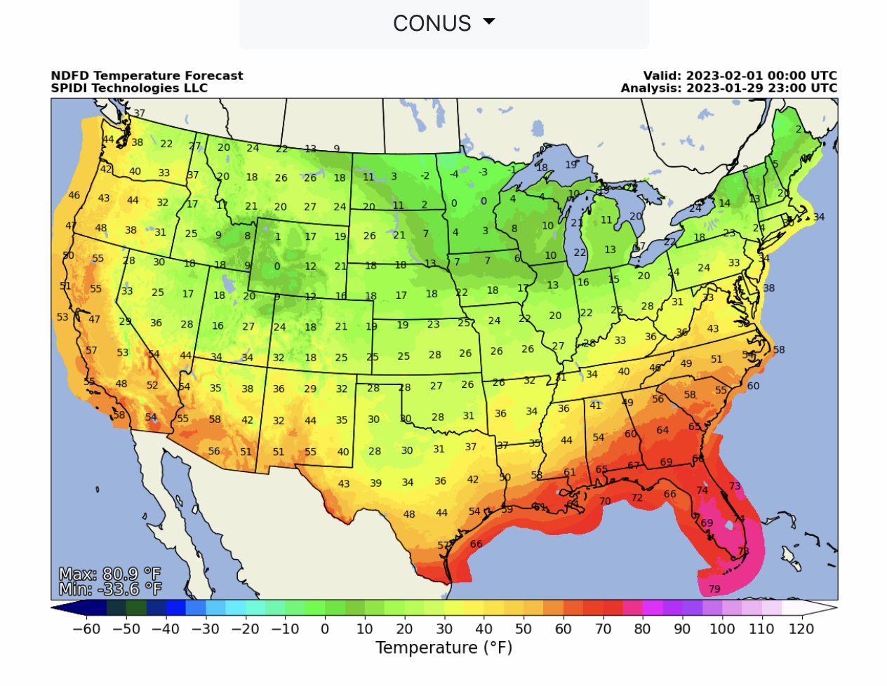
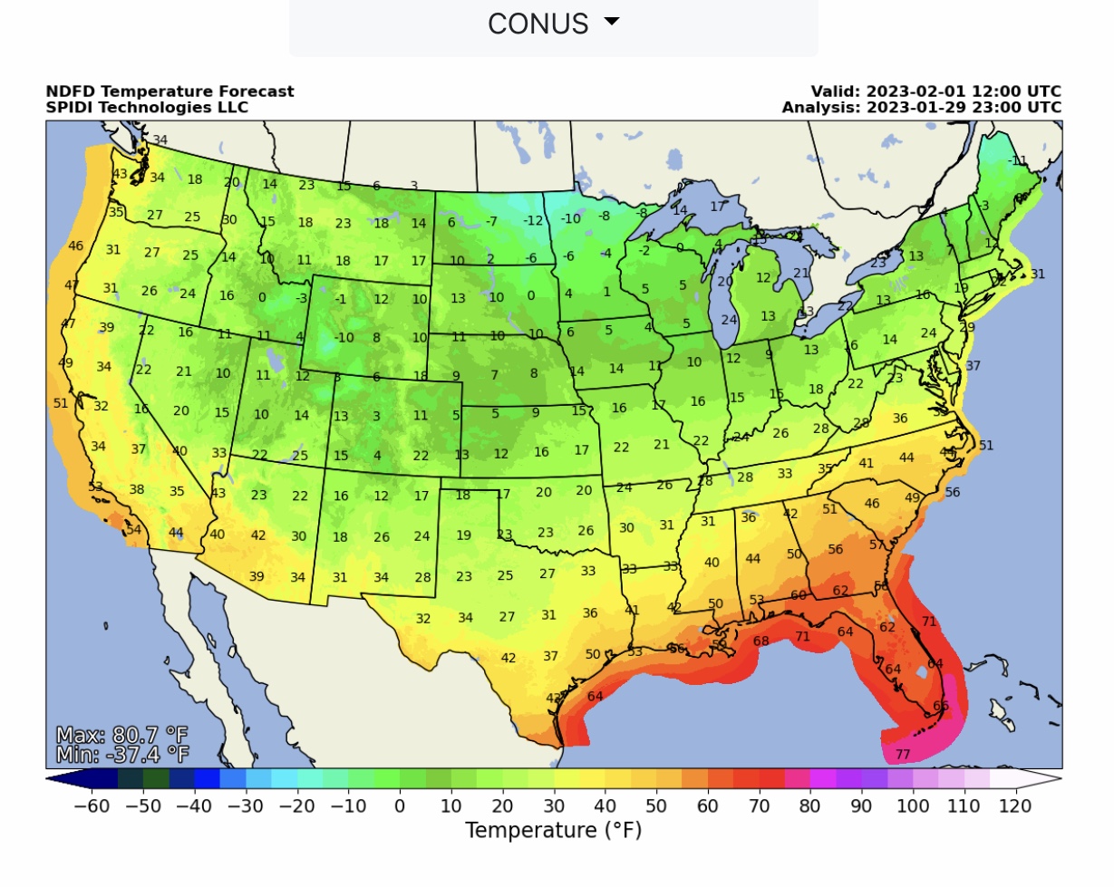
NWS Temperature Forecasts @ 6am CST & 6pm CST to 6am Wednesday, 2/1/2023.
Sid Sperry
President & CEO
SPIDI Technologies, LLC
SPIDItech.com
Cell: (405) 627-7754
Email(s): SidSperry@gmail.com  OR  Sid.Sperry@spidiweather.com

Sent from my iPad

 Show/hide attachments