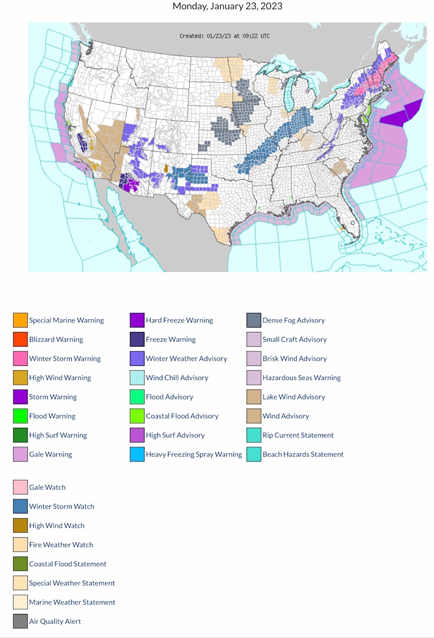
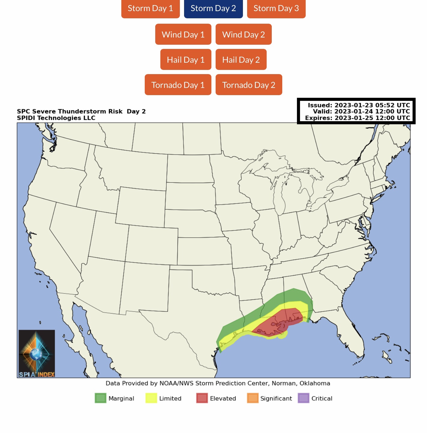
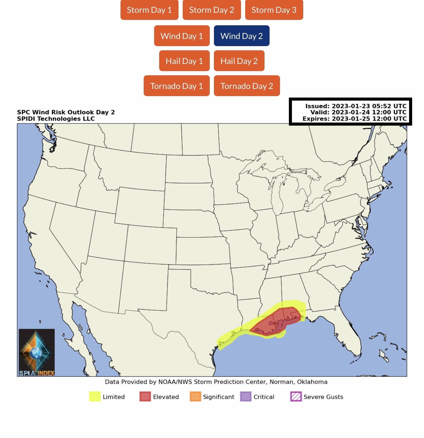
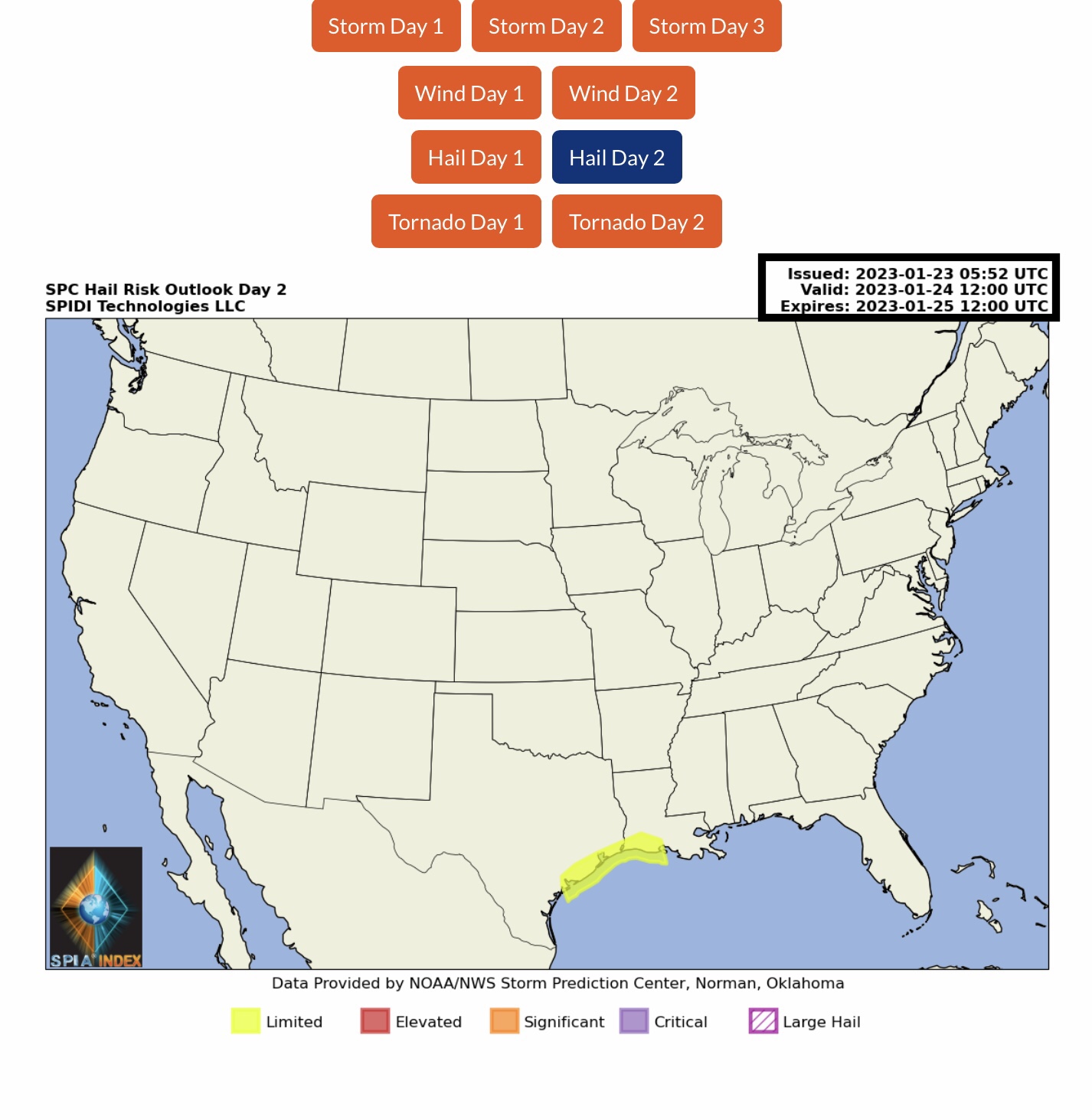
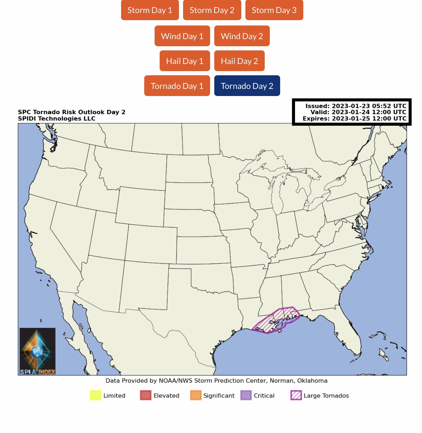
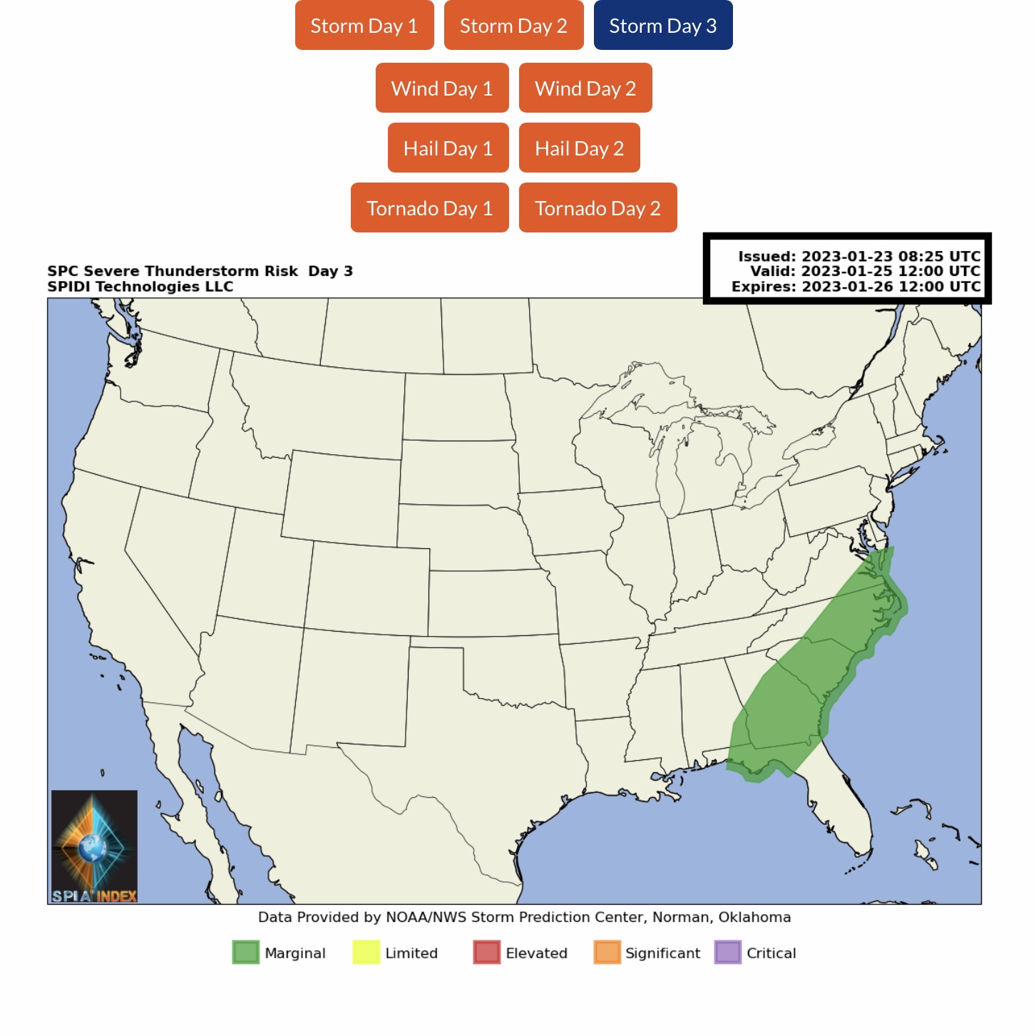
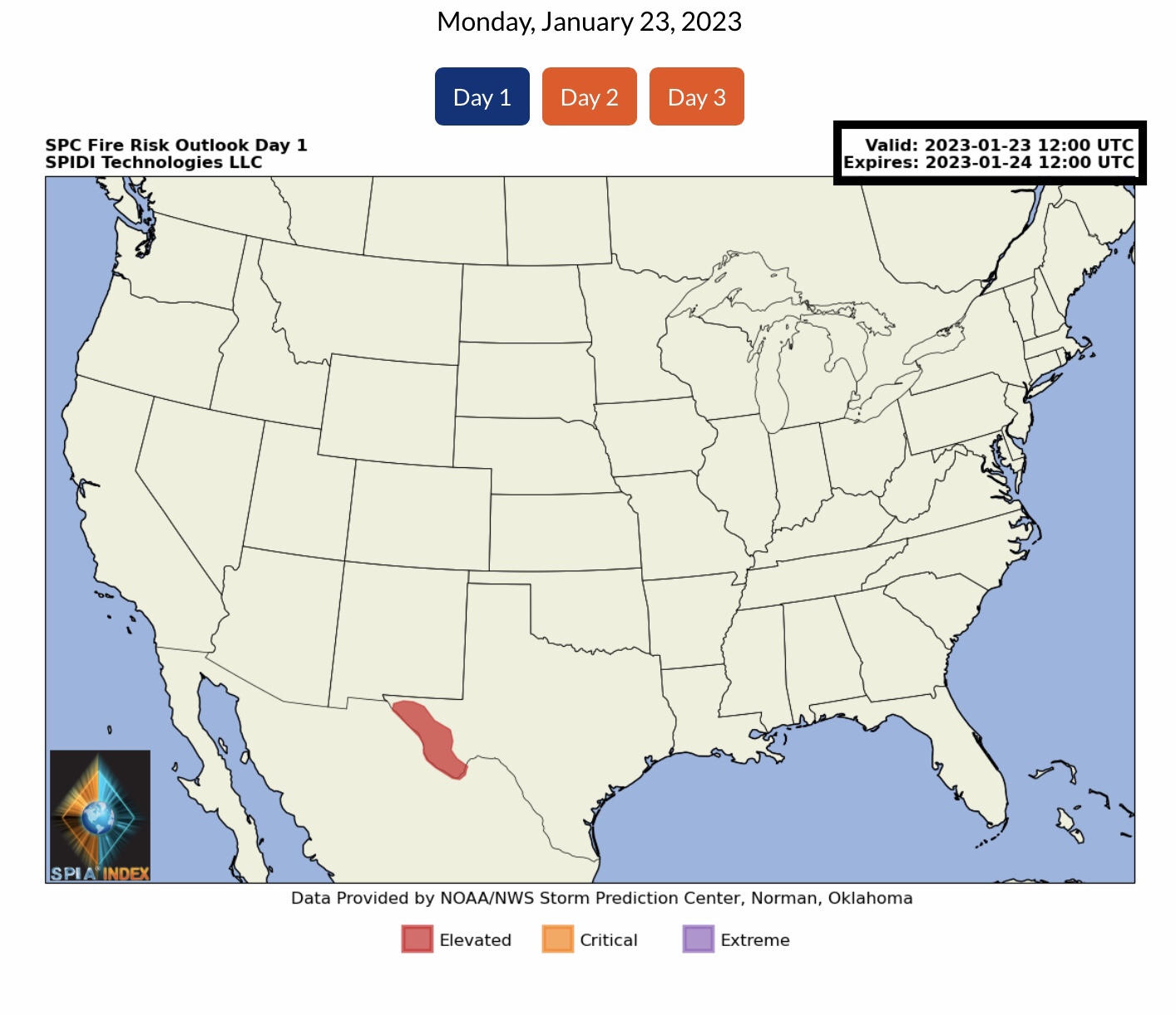
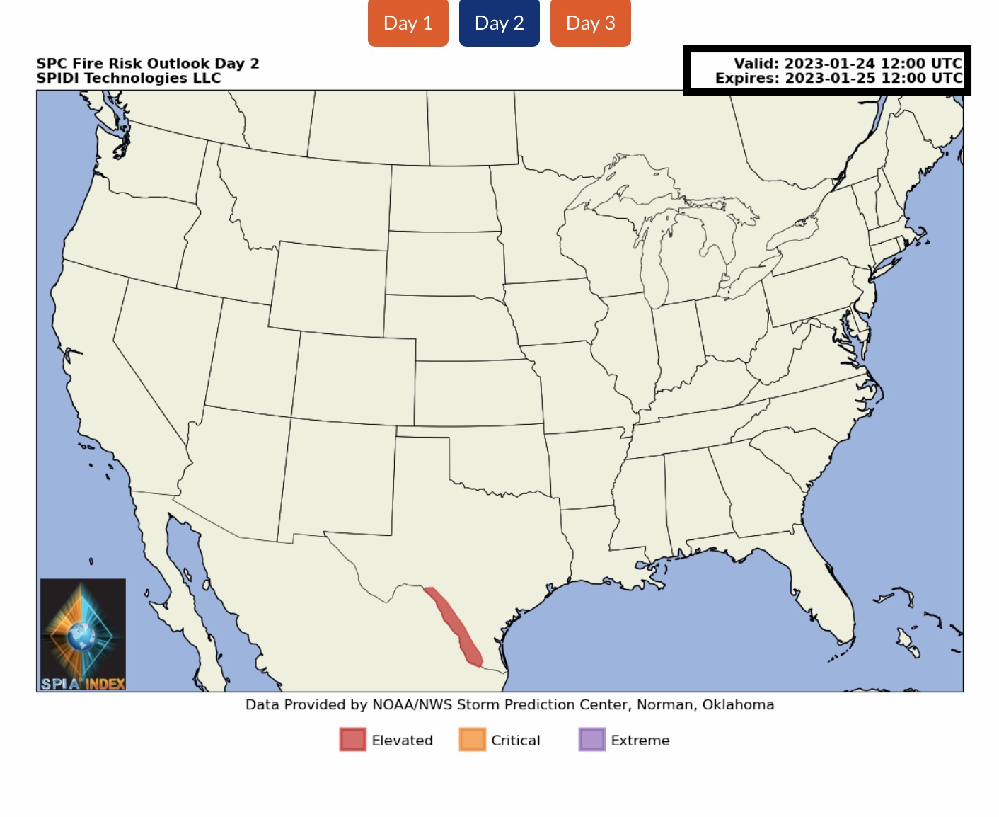
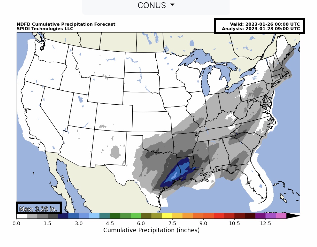
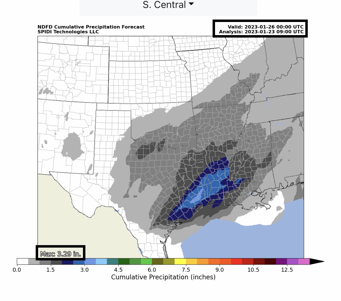
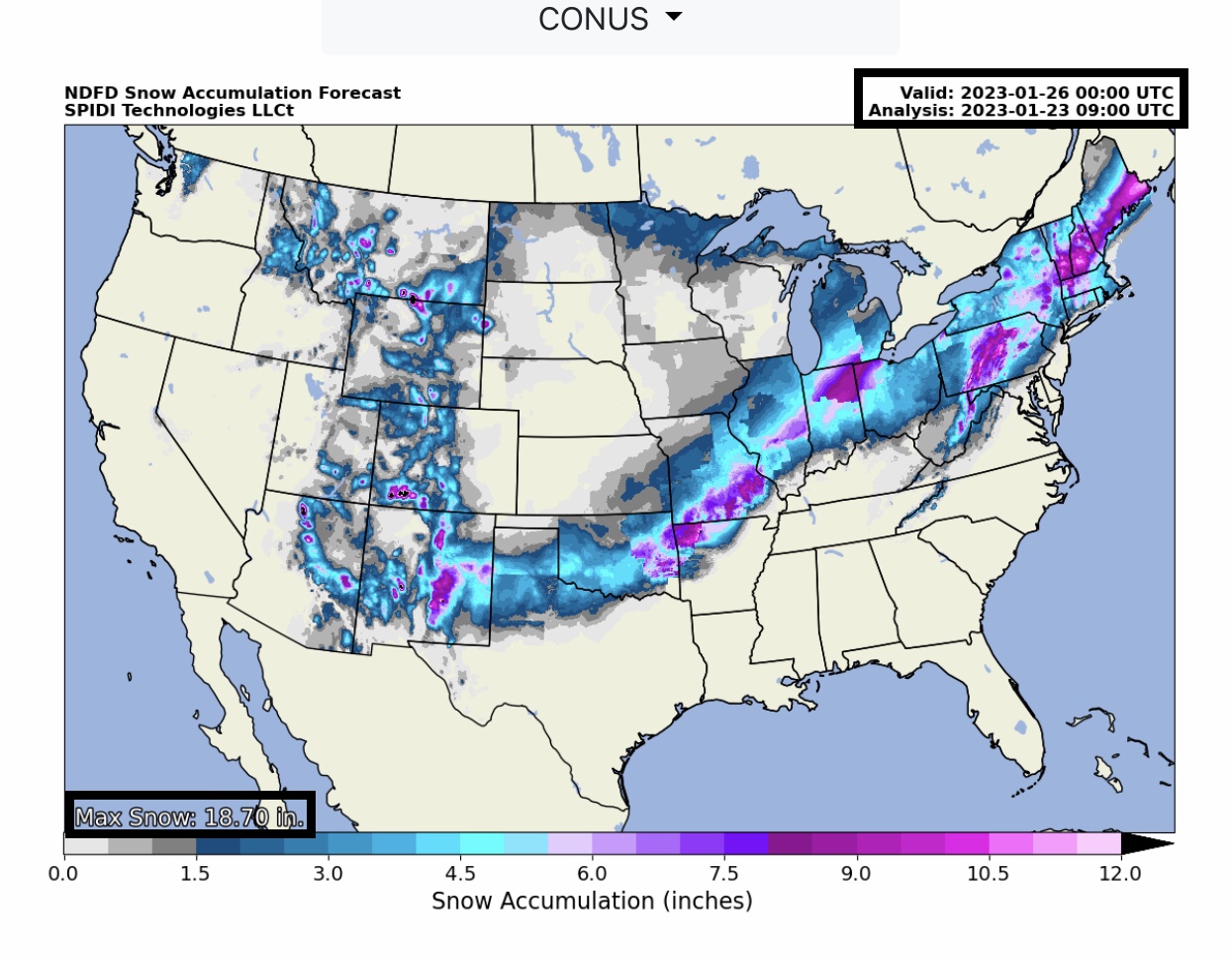
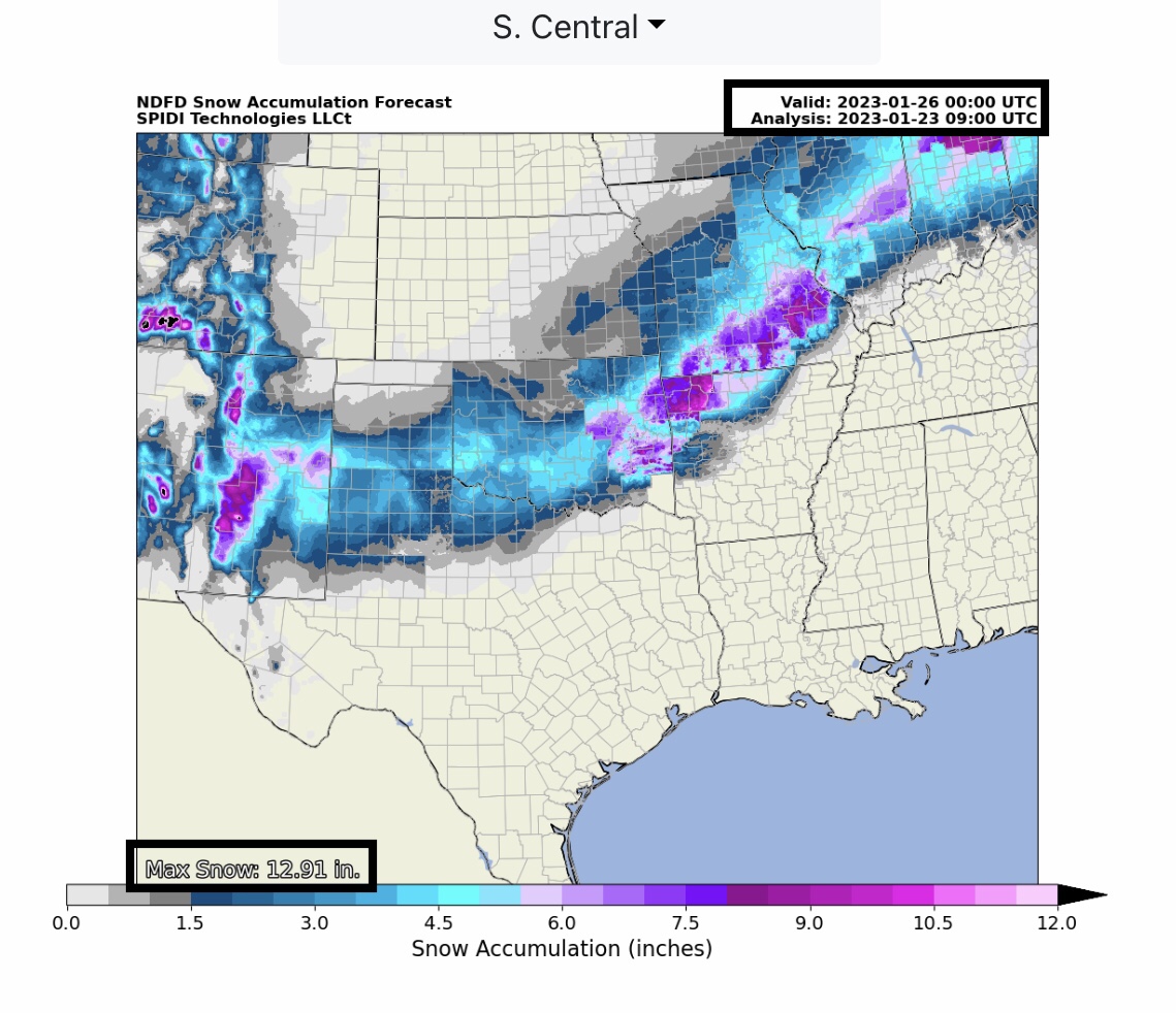
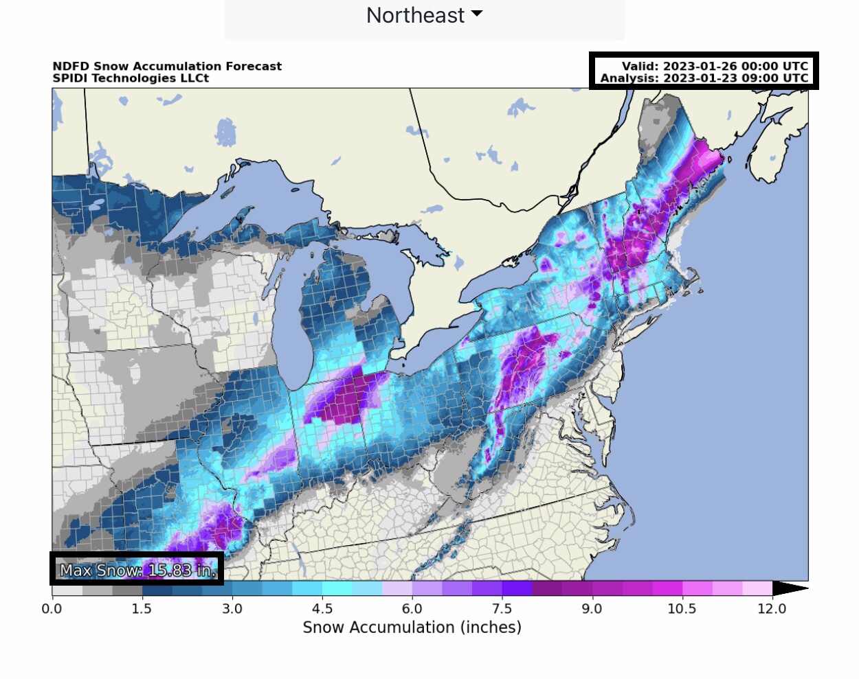
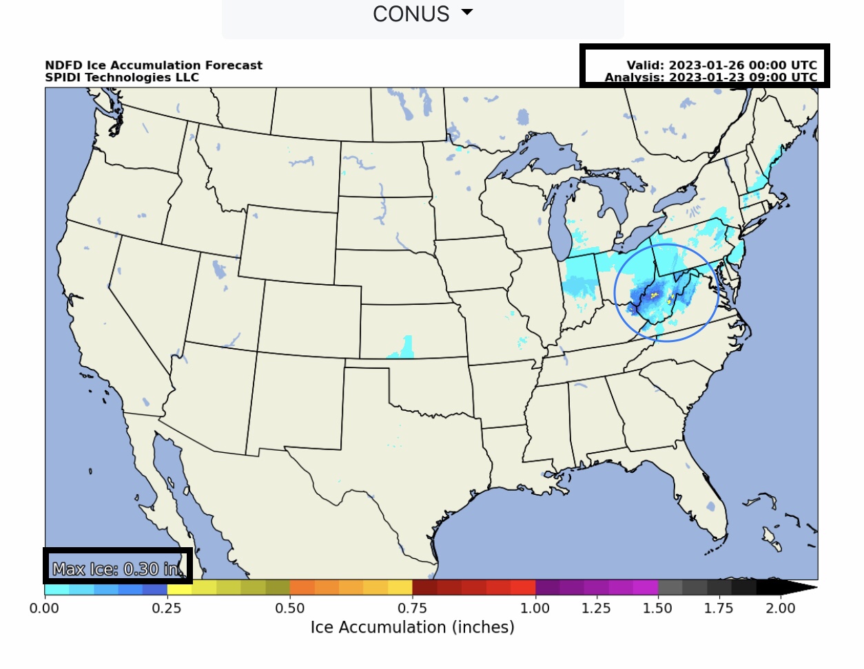
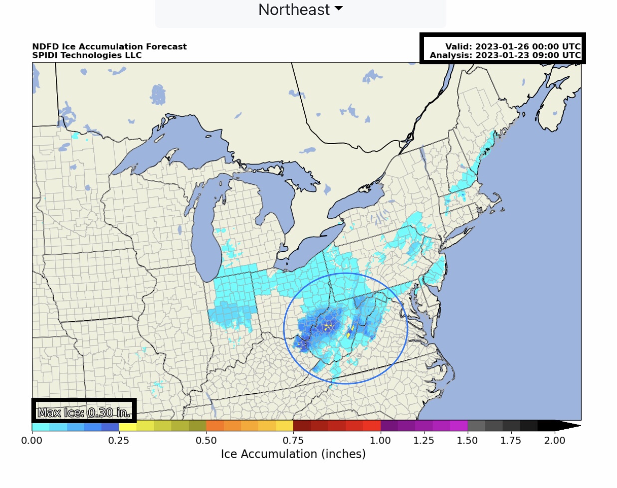
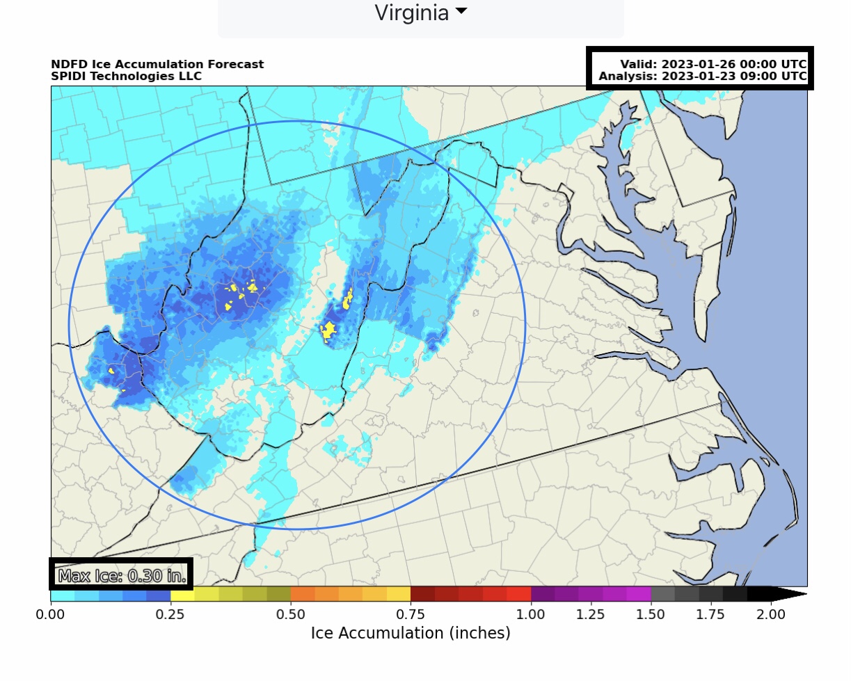
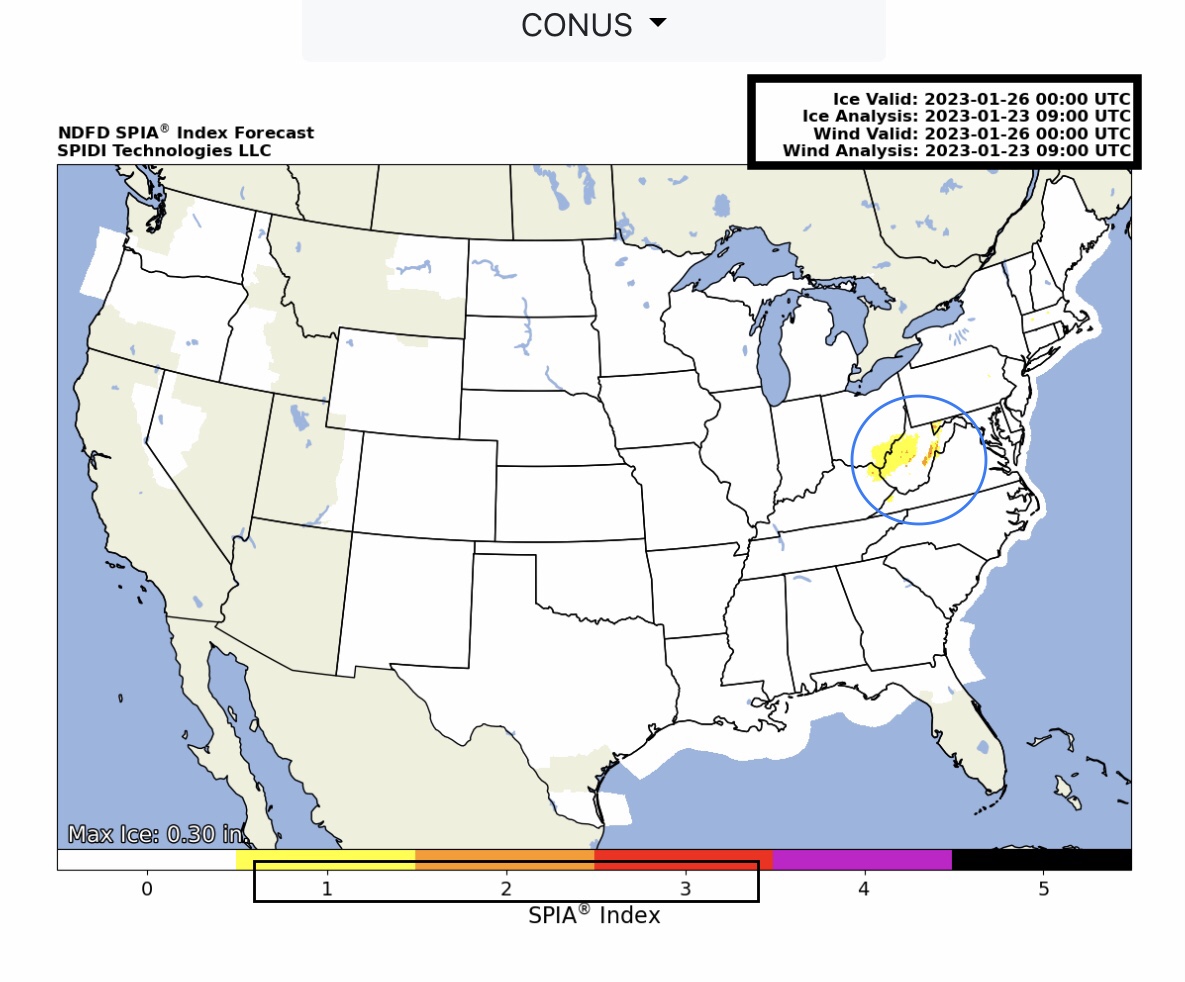
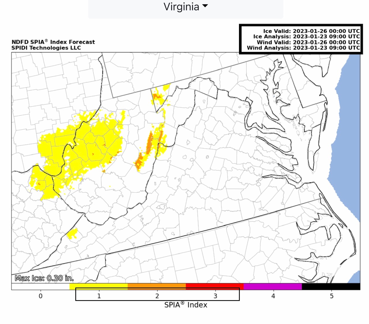
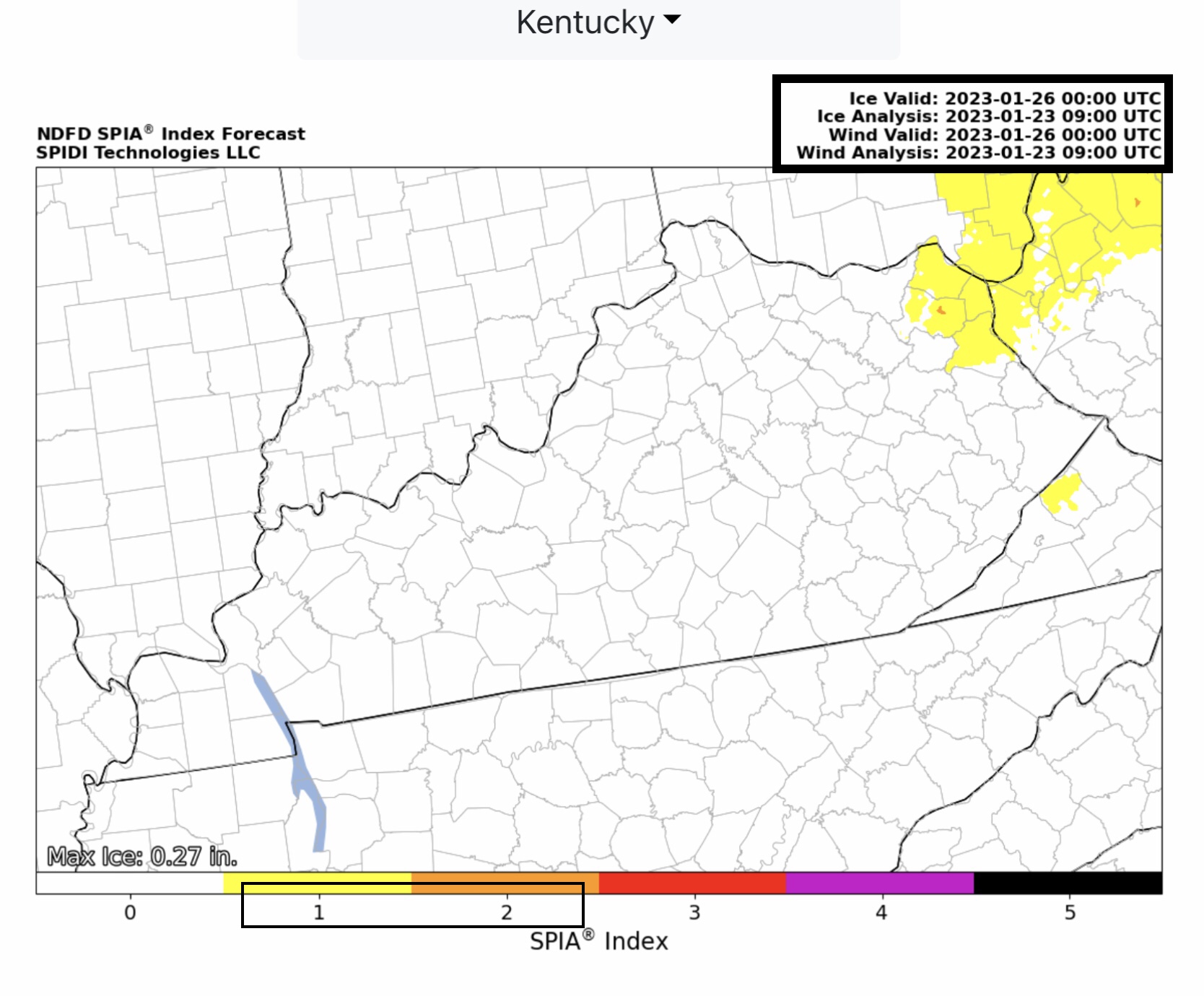
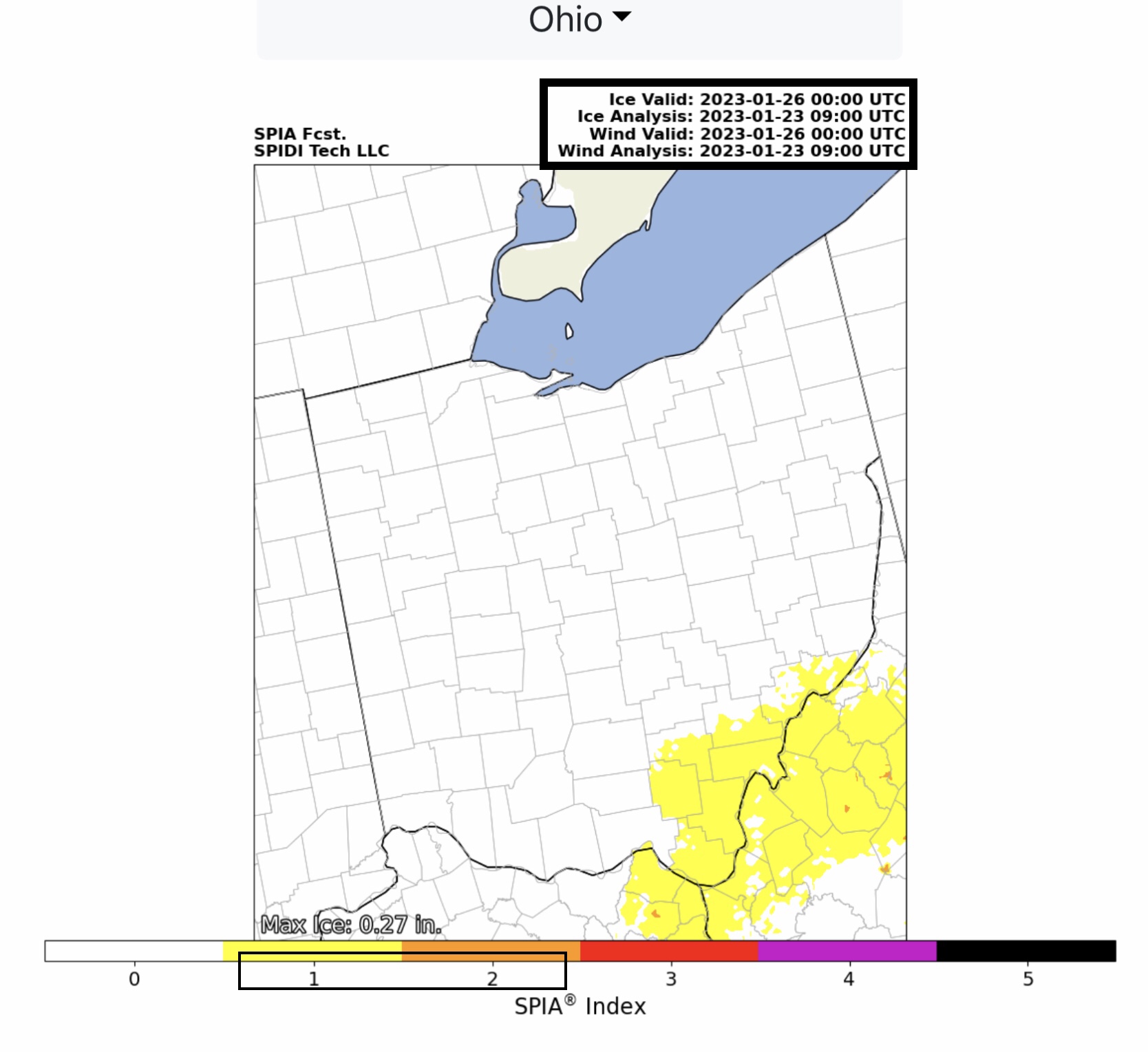
Active weather week ahead. Strong to Severe Thunderstorms w/damaging winds, hail & tornadoes possible Tuesday into Wednesday for parts TX, LA, MS, AL & FL. ELEVATED Fire Risk, parts south TX. HEAVY SNOW Monday night thru Wednesday night across parts NM, TX, OK, AR, MO, IL, IN, MI, OH, PA, WV, NY, MD, MA, VT, NH & ME. FREEZING RAIN & ICE ACCUMULATION on Tuesday thru Wednesday across parts IN, OH, KY, WV, VA, MD & PA. Max ICE in NWS grids: 0.30” parts WV. Current SPIA Index Ice Impact Forecast: Levels 1 thru 3, parts WV, KY, OH, VA & MD.
Sidney Sperry 23 Jan 2023 10:26 UTC
Sid Sperry
President & CEO
SPIDI Technologies, LLC
SPIDItech.com
Cell: (405) 627-7754
Email(s): SidSperry@gmail.com  OR  Sid.Sperry@spidiweather.com

Sent from my iPad

 Show/hide attachments