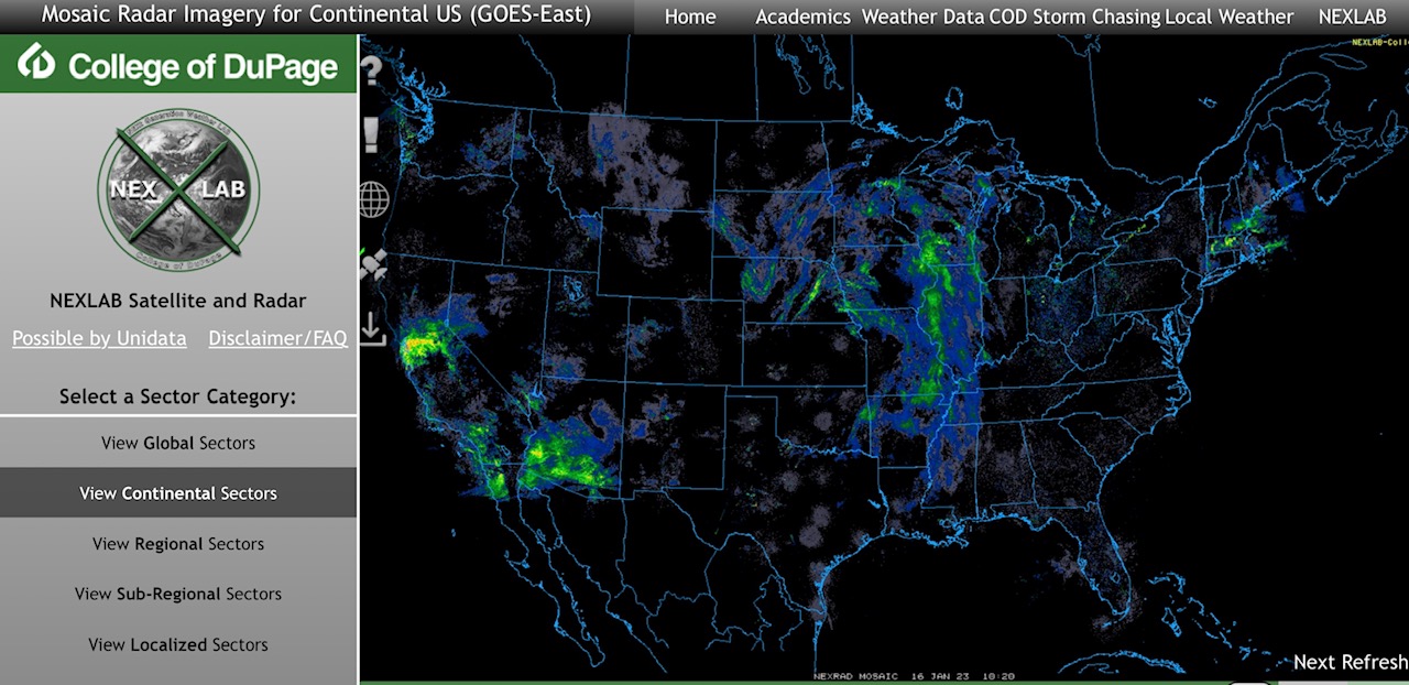
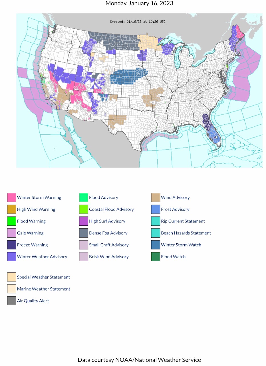
Current COD Mosaic Radar. Current NWS Watches, Warnings & Advisories. Note Winter Storm Warnings parts CA, NV, AZ, UT, CO & ME. Winter Storm Watch parts CO, WY, NE, KS & IA. Winter Weather Advisories parts MT, CA, NV, WY, UT, AZ, CO, NM, SD, MN, WI, MI Upper Peninsula, NH, MA & ME. Freeze Warnings & Frost Advisories parts GA & FL. Wind Advisories parts CA, AZ, NM, TX, OK, KS, MO & AR.
Sidney Sperry 16 Jan 2023 11:15 UTC
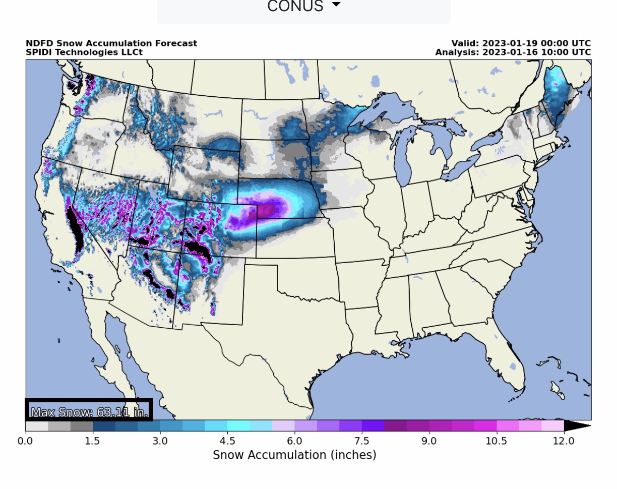
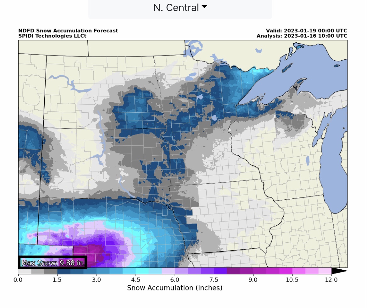
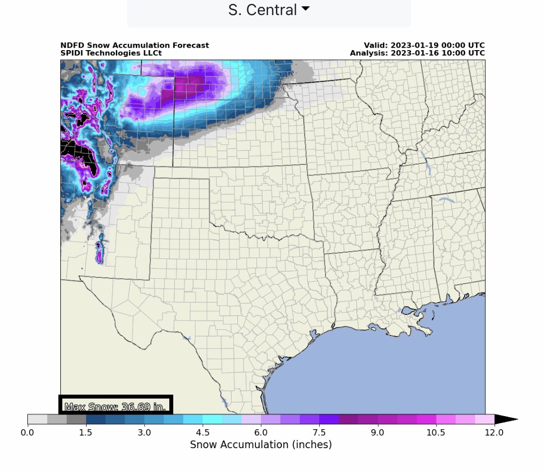
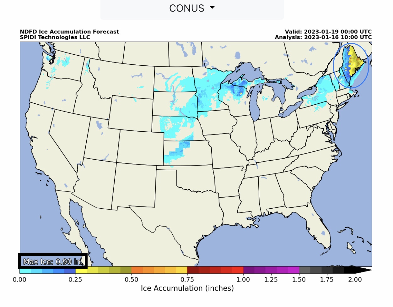
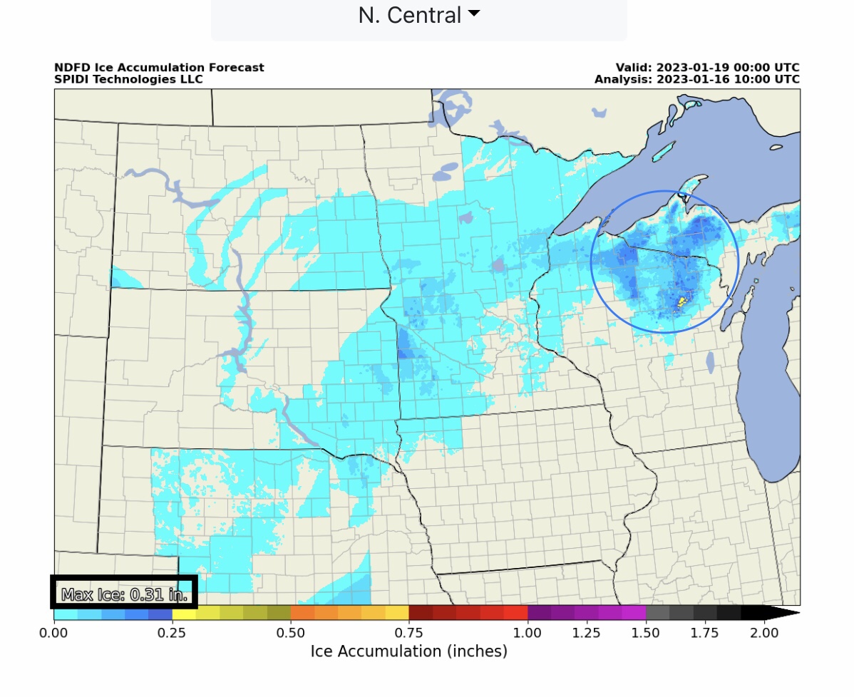
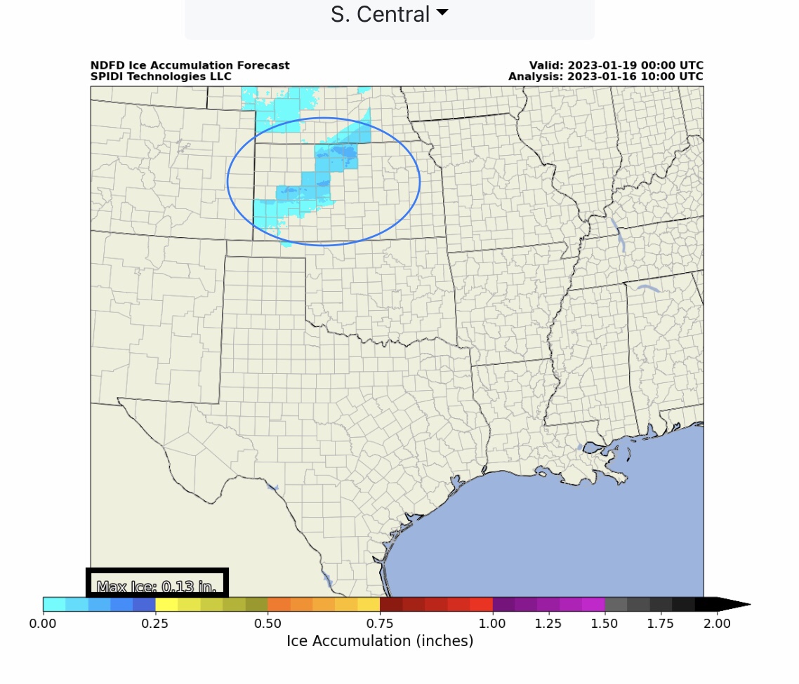
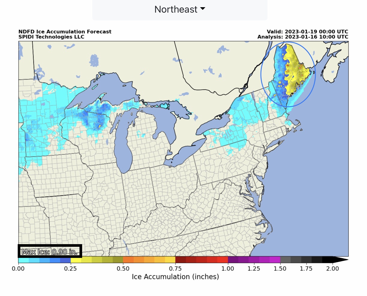
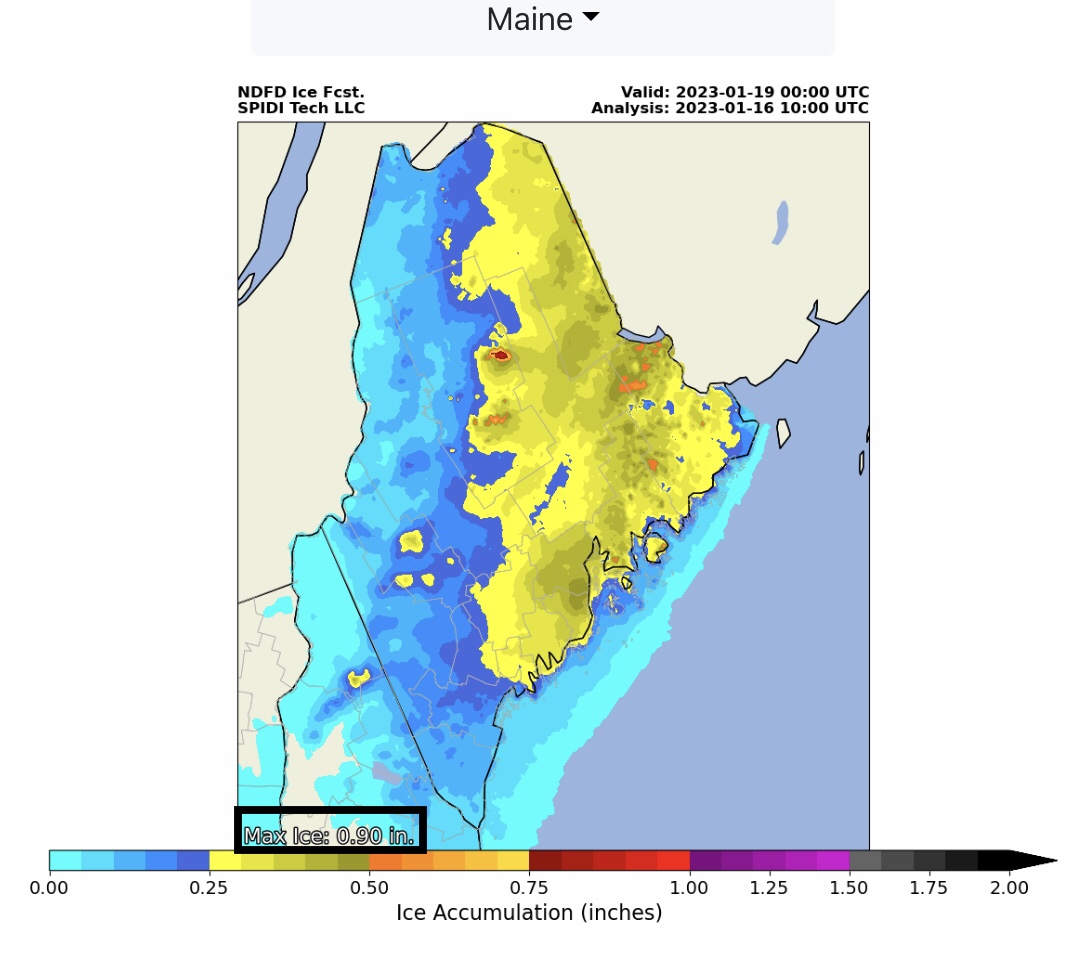
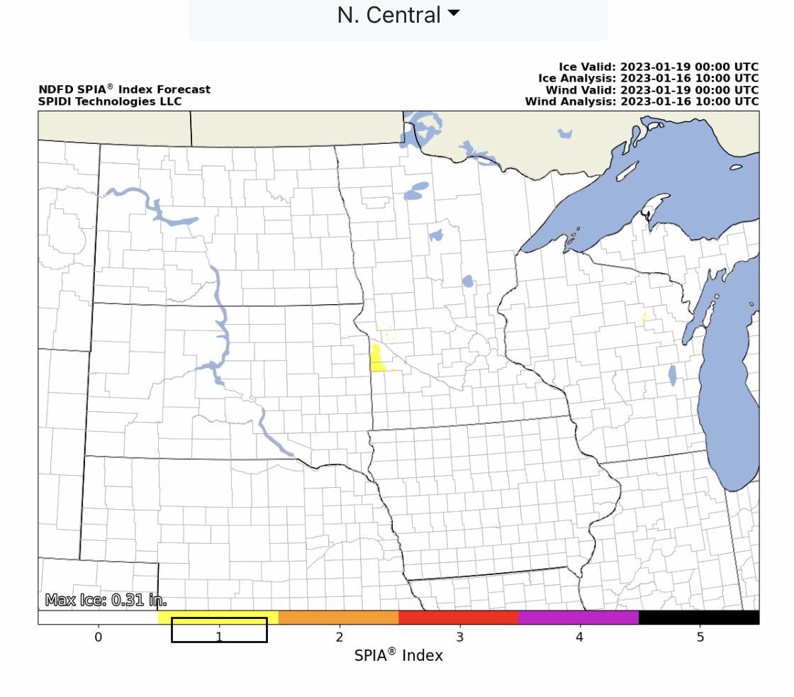
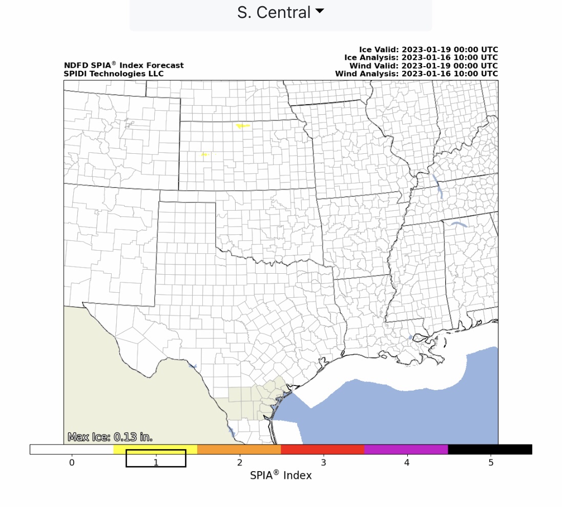
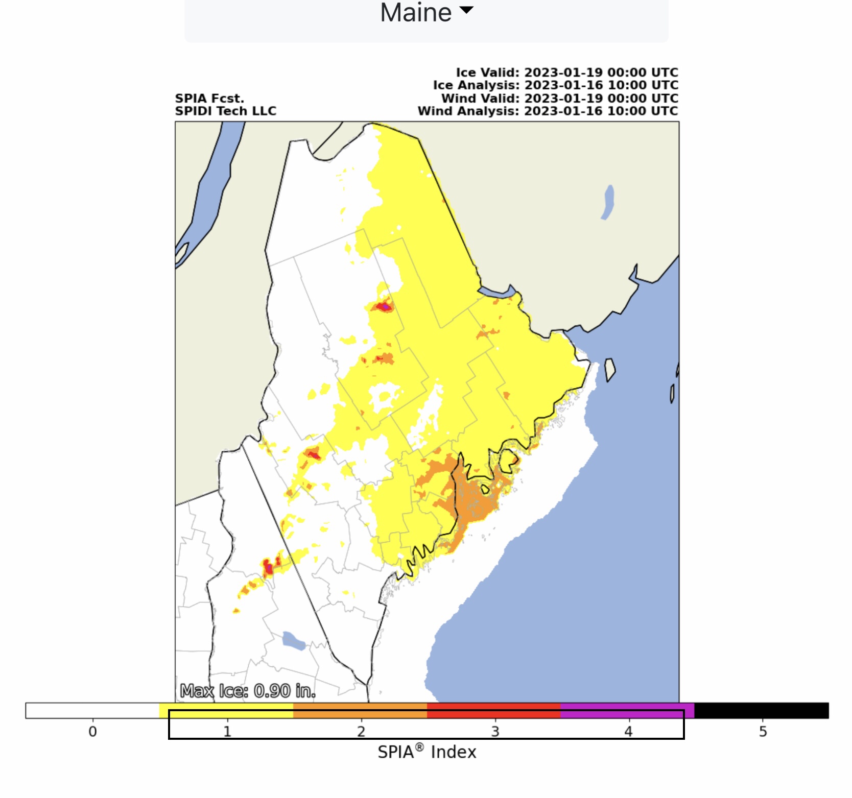
Heavy SNOW moving out of CA into North & South Rockies Regions, then into North Central and South Central Regions on Tuesday into Wednesday. Light to Moderate Ice Accumulation possible parts North Central Region, South Central Region, and Northeast Region. Max ICE in NWS Grids: 0.90” parts ME. Currents SPIA Index Ice Impact Forecast: Level 1 parts MN & KS; Levels 1 thru 4 parts NH & ME.
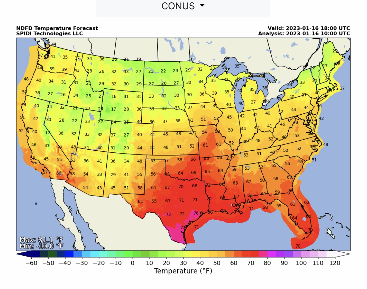
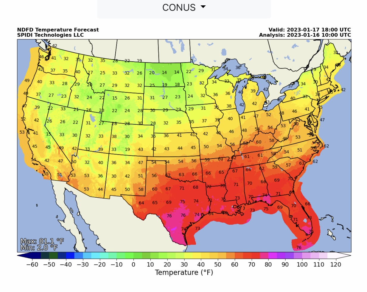
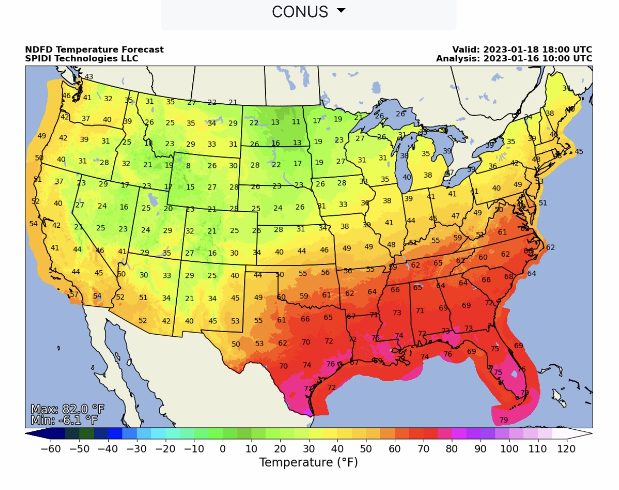
NWS High Temperature Forecasts at Noon CST today (1/16/23), Tuesday & Wednesday.
Sid Sperry
President & CEO
SPIDI Technologies, LLC
SPIDItech.com
Cell: (405) 627-7754
Email(s): SidSperry@gmail.com  OR  Sid.Sperry@spidiweather.com

Sent from my iPad

 Show/hide attachments