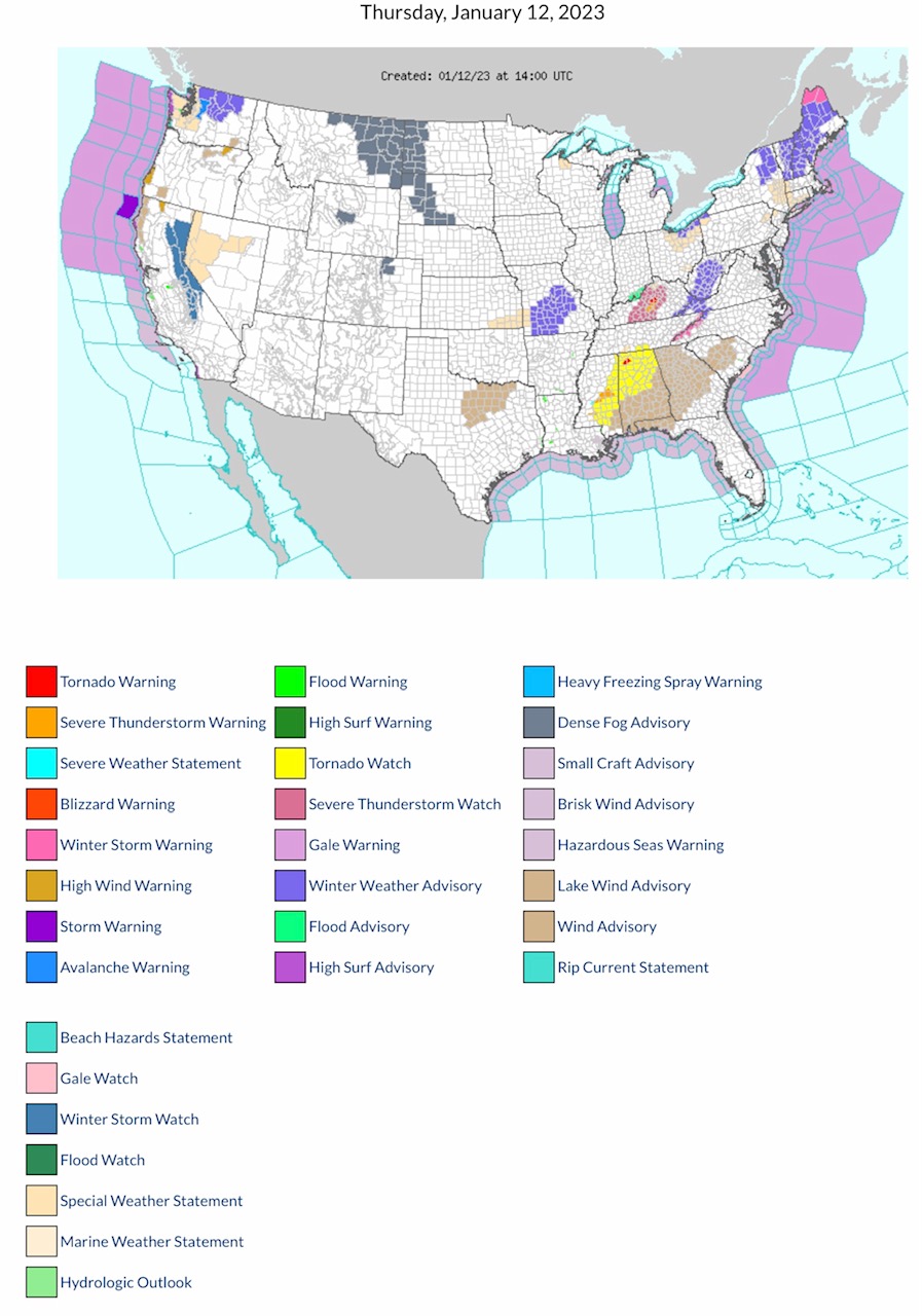
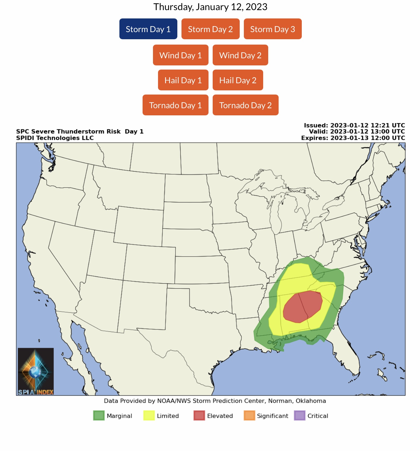
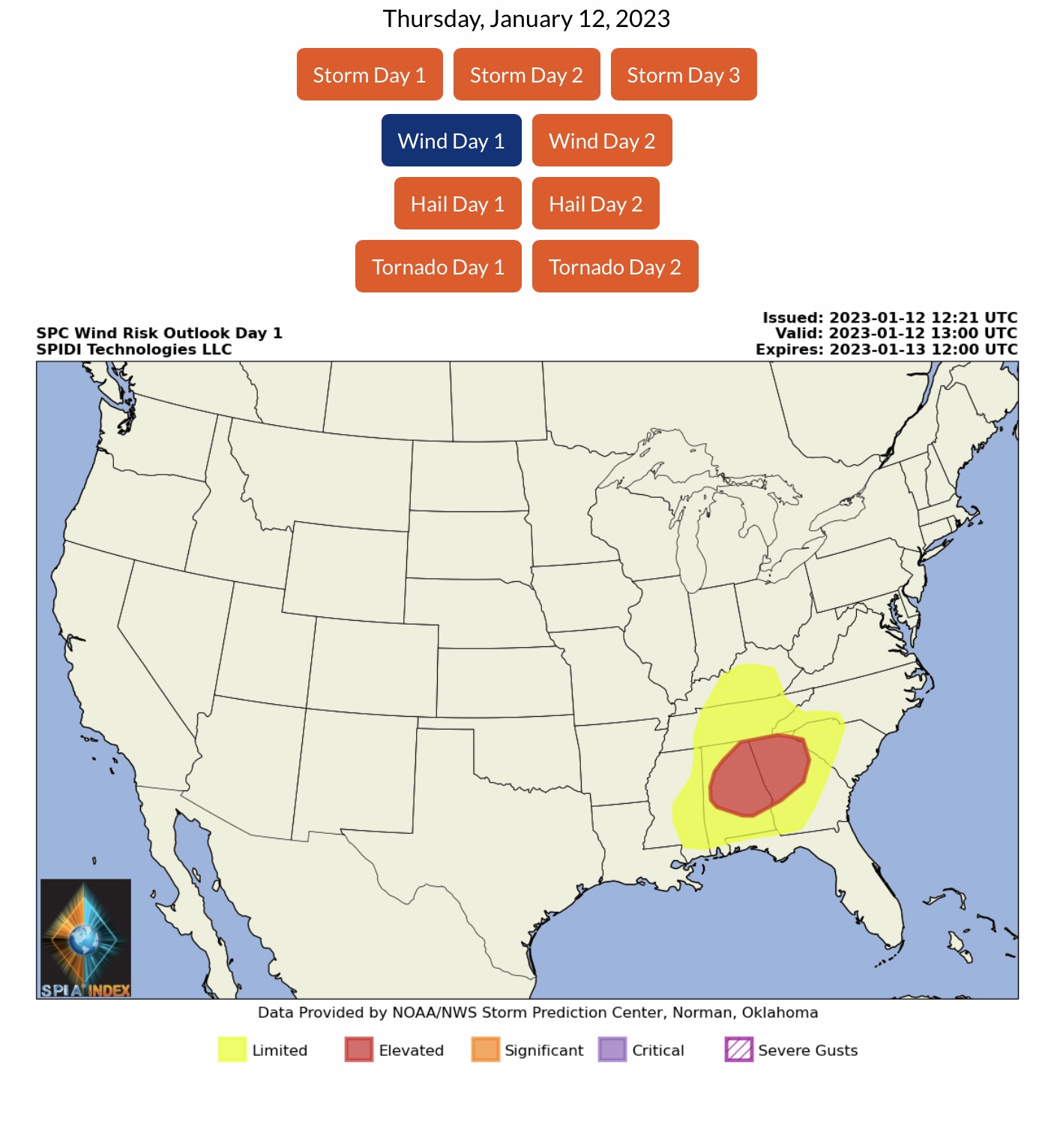
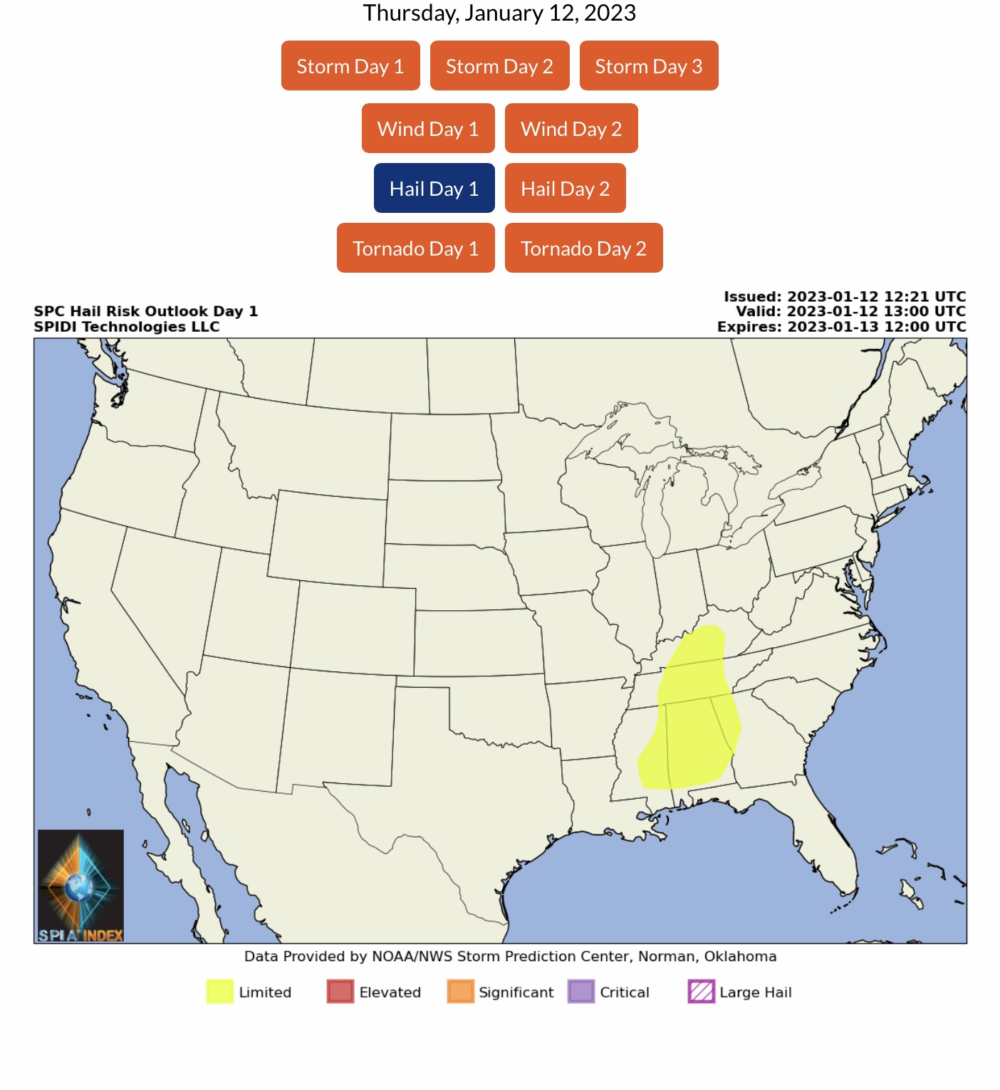
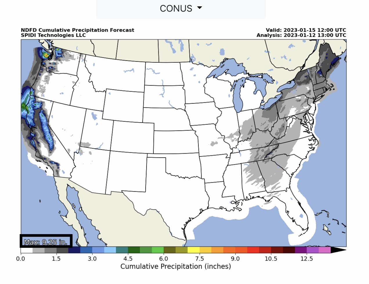
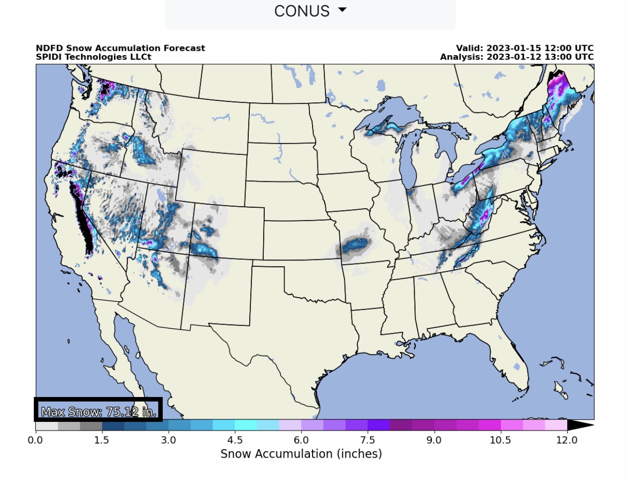
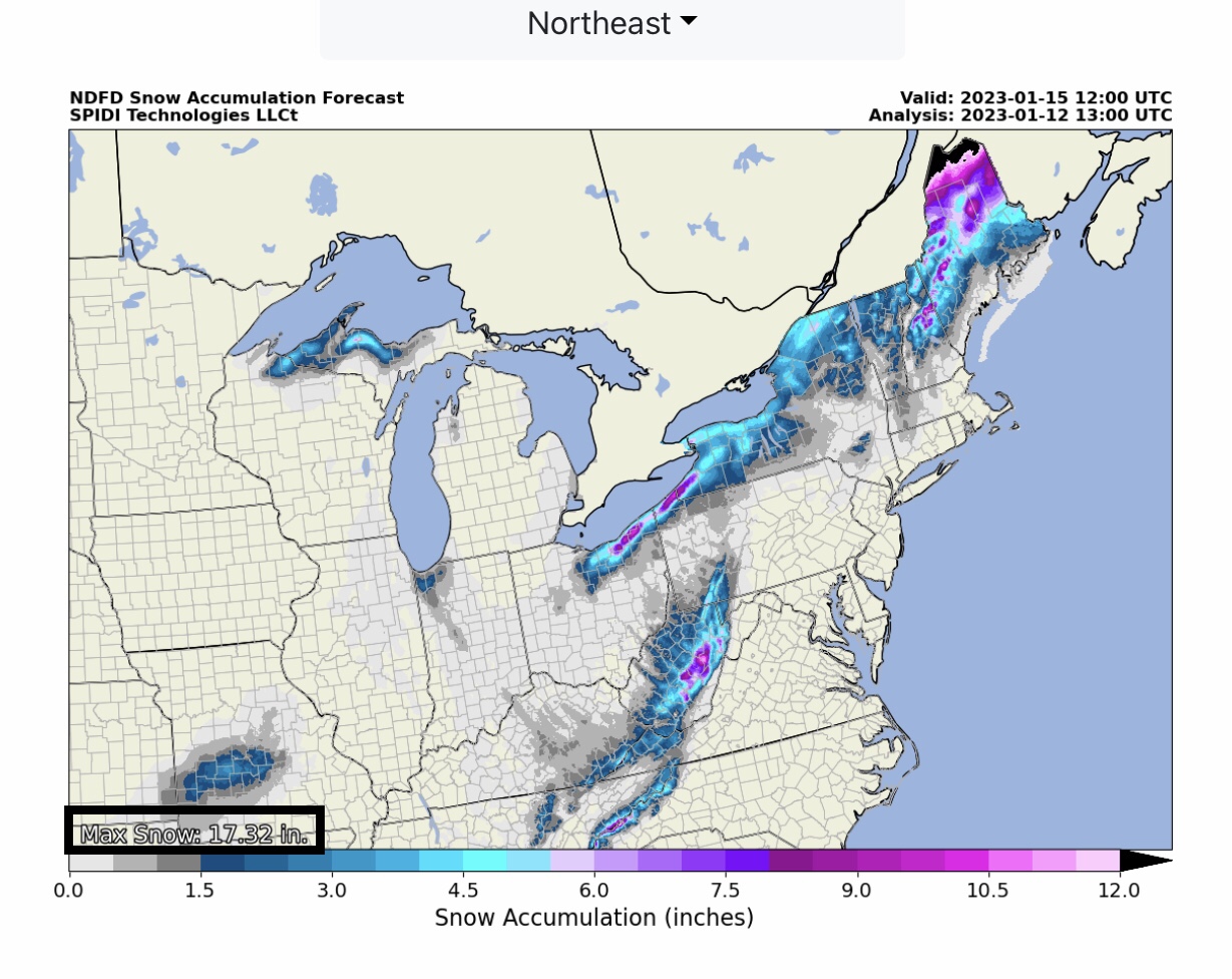
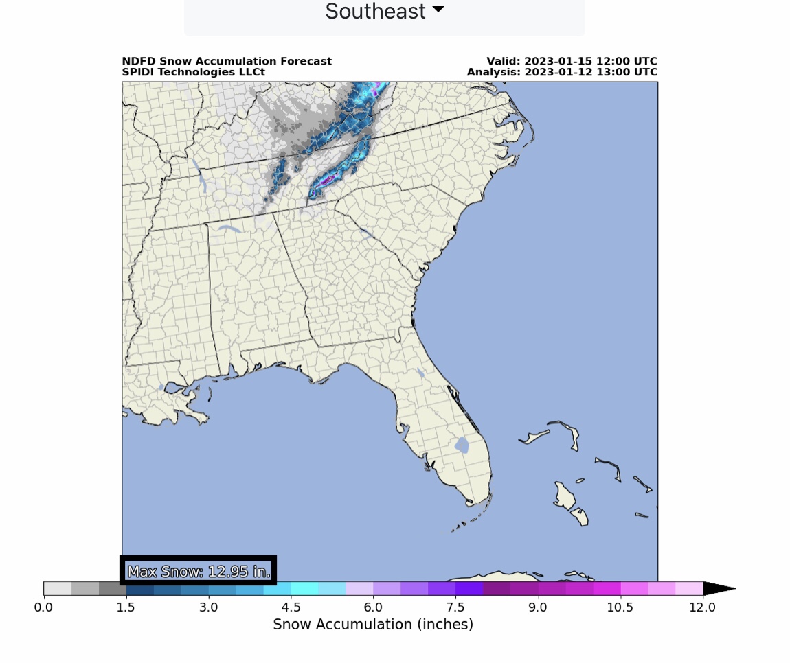
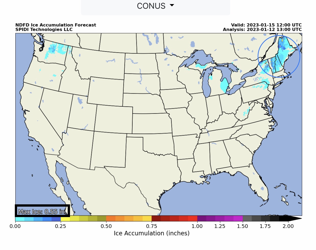
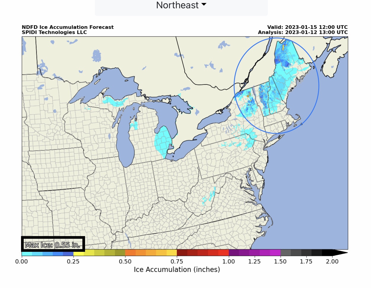
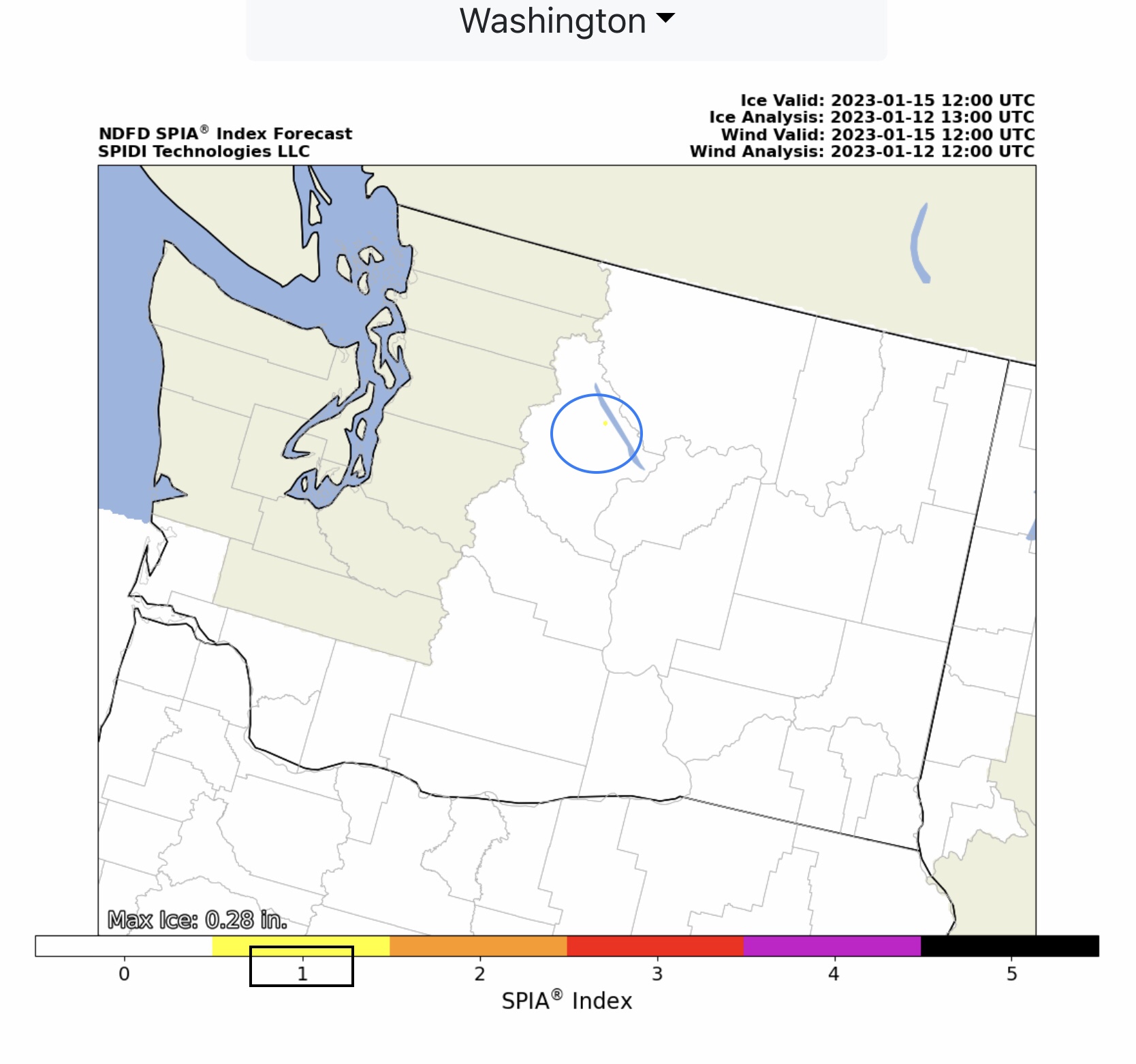
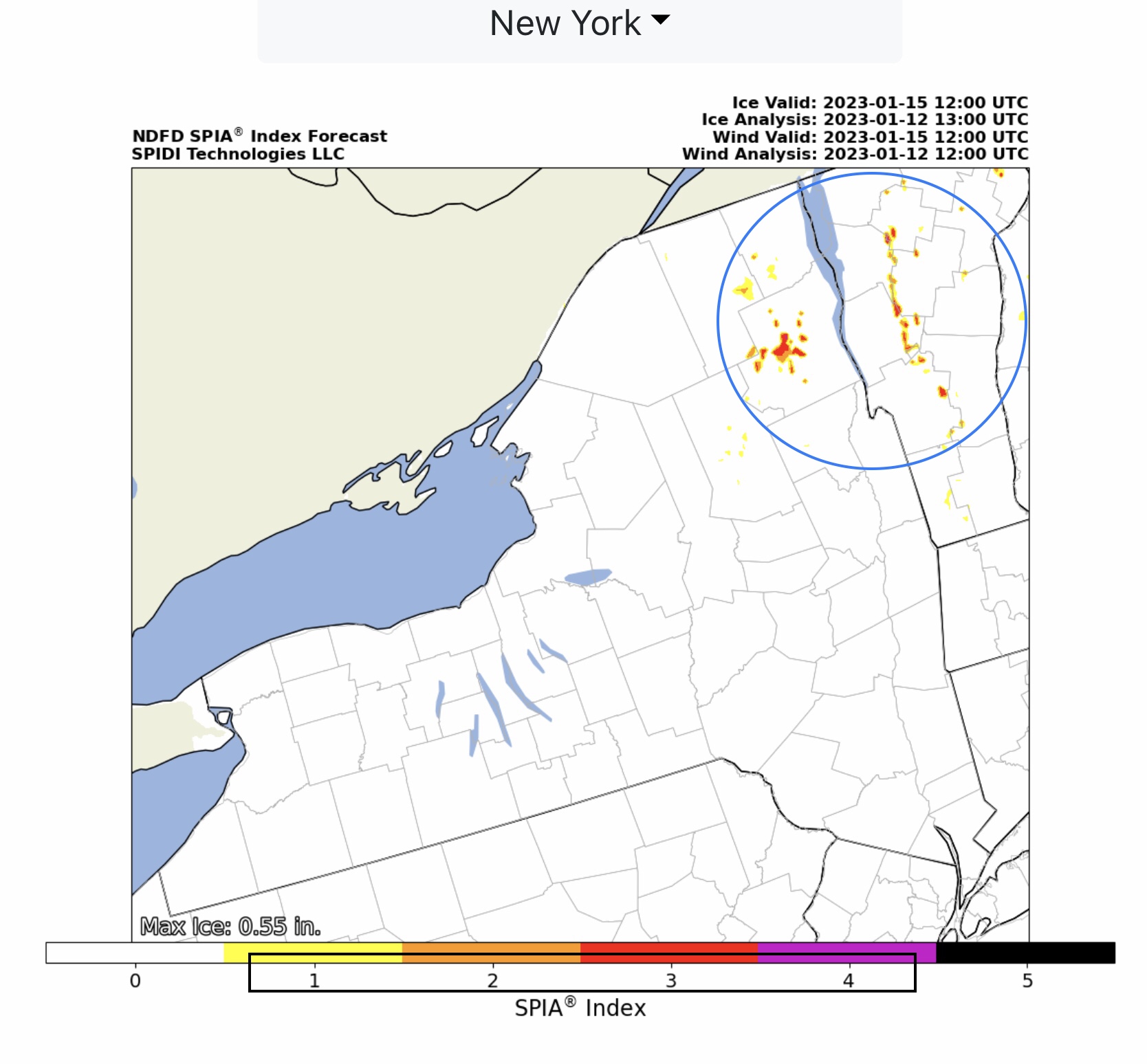
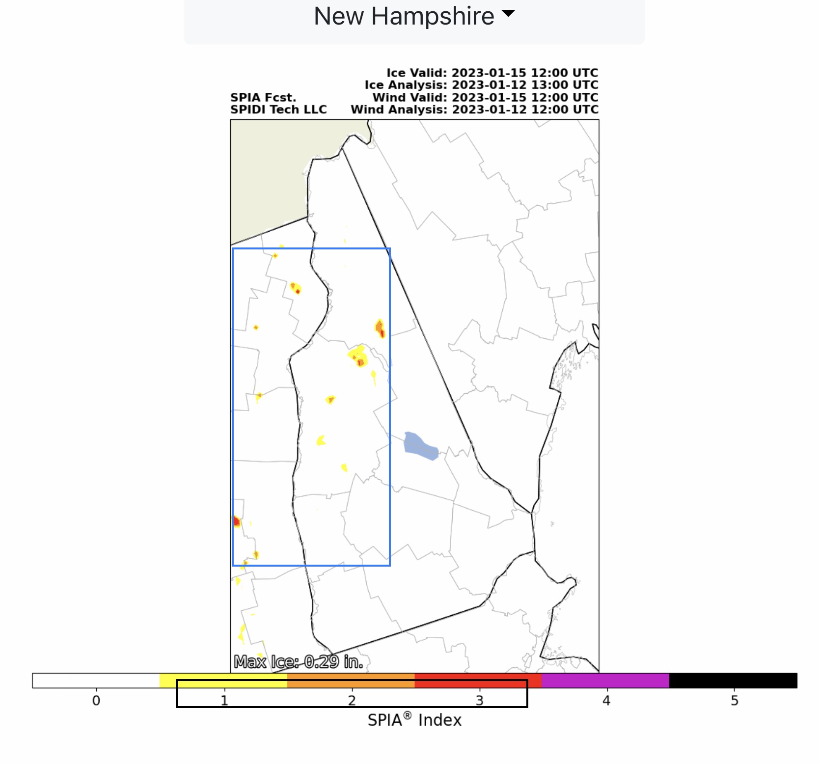
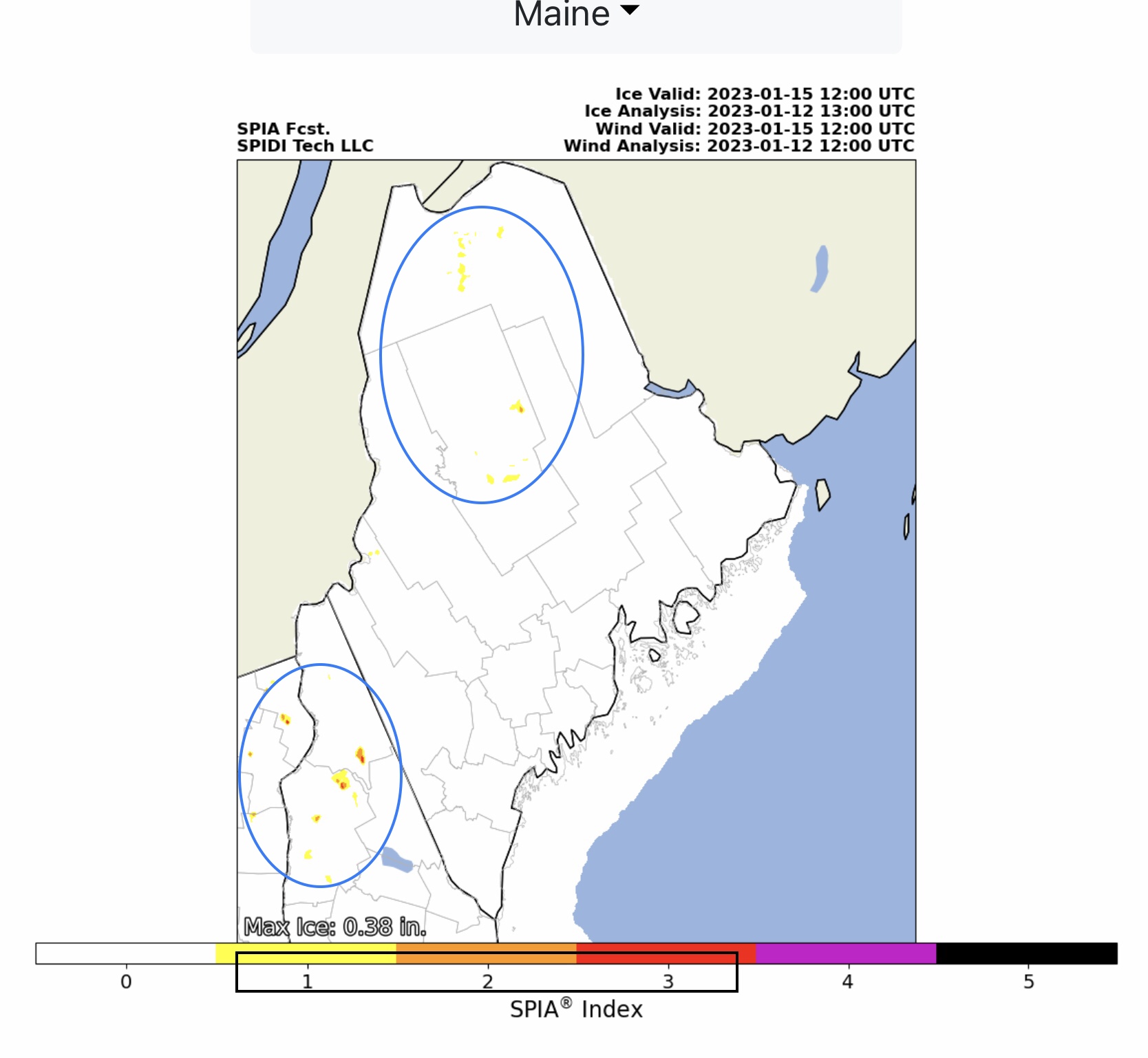
Severe Thunderstorms w/some Tornadoes possible today across parts IN, OH, KY, IL, TN, MS & AL. ELEVATED Risk for Severe Thunderstorms today, including ELEVATED High Wind Risk and LIMITED Hail Risk, parts TN, AL, GA & SC. SNOW possible Thursday night thru late Friday into early Saturday morning parts ME, NH, VT, NY, OH, PA, WV, VA, KY, TN & NC. From 2” up to 12”+ in Higher Elevation areas of TN, KY, WV, VA & NC. From 4” to 18” snow possible parts NY, VT, NH & ME. Max Ice in NWS grids: 0.55” parts NY, VT, NH. SPIA Index Ice Impact Forecast: Levels 1-4
Sidney Sperry 12 Jan 2023 14:52 UTC
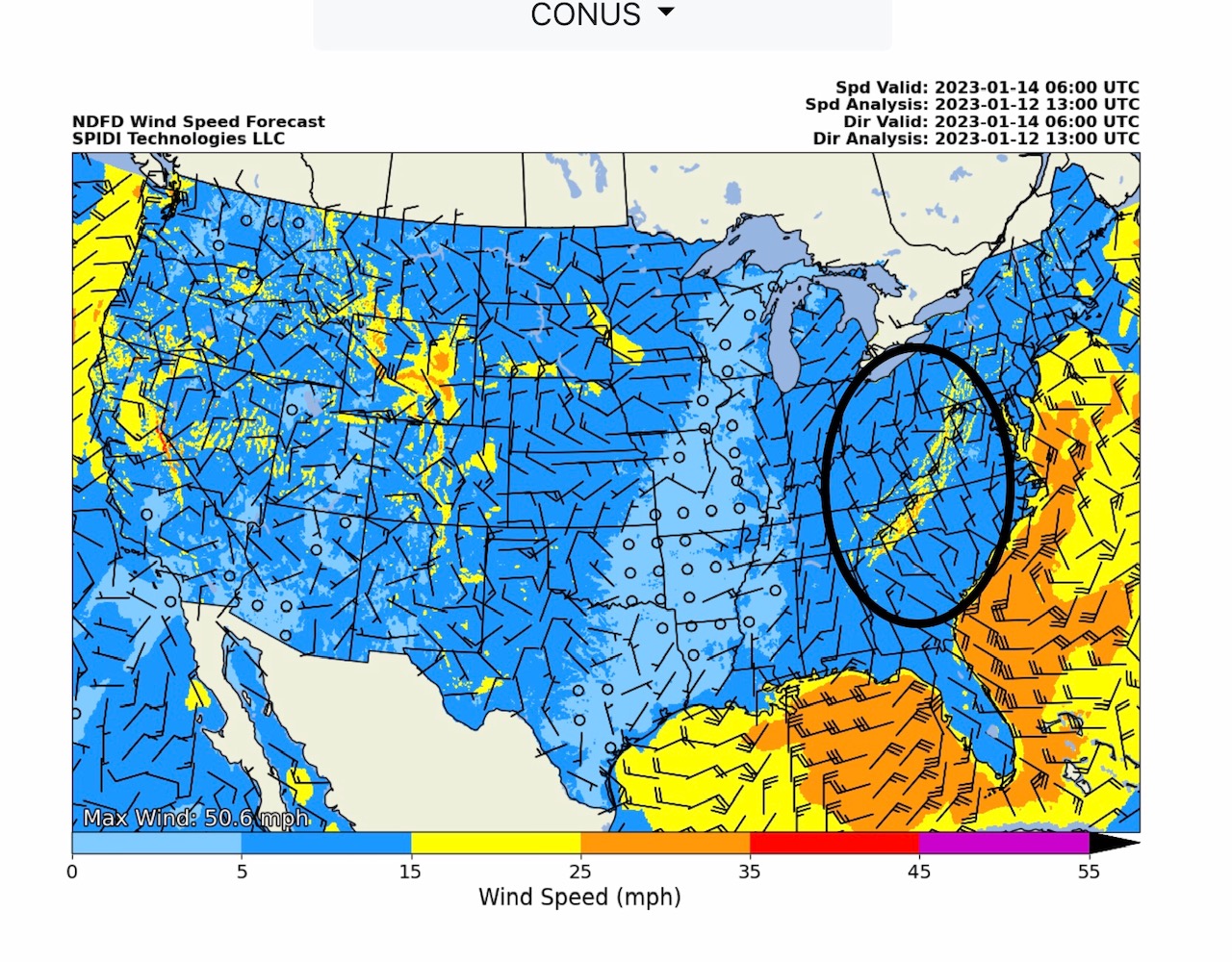
Some concern about high sustained winds of 25 up to 35 mph on Thursday evening through Saturday morning in the higher elevation areas of eastern TN, southeastern KY, eastern WV, western & southwestern VA, western NC and northeastern GA. Wind gusts from 40 to 50 mph + are possible as well. During periods of snowfall, these winds could become an issue and cause problems in these higher elevation areas.
Sid Sperry
President & CEO
SPIDI Technologies, LLC
SPIDItech.com
Cell: 405-627-7754
Email(s): SidSperry@gmail.com  OR  Sid.Sperry@spidiweather.com

Sent from my iPad

 Show/hide attachments