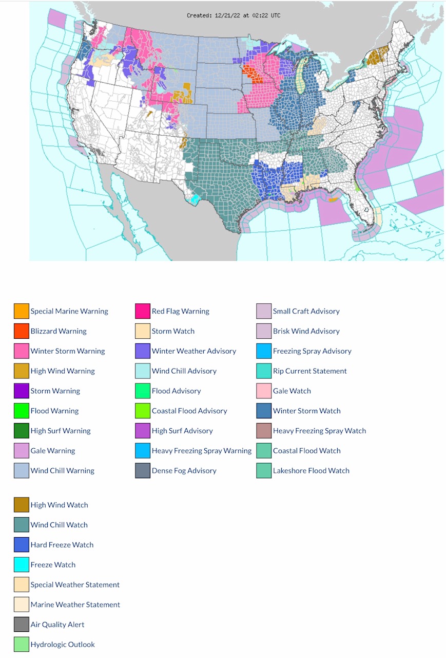
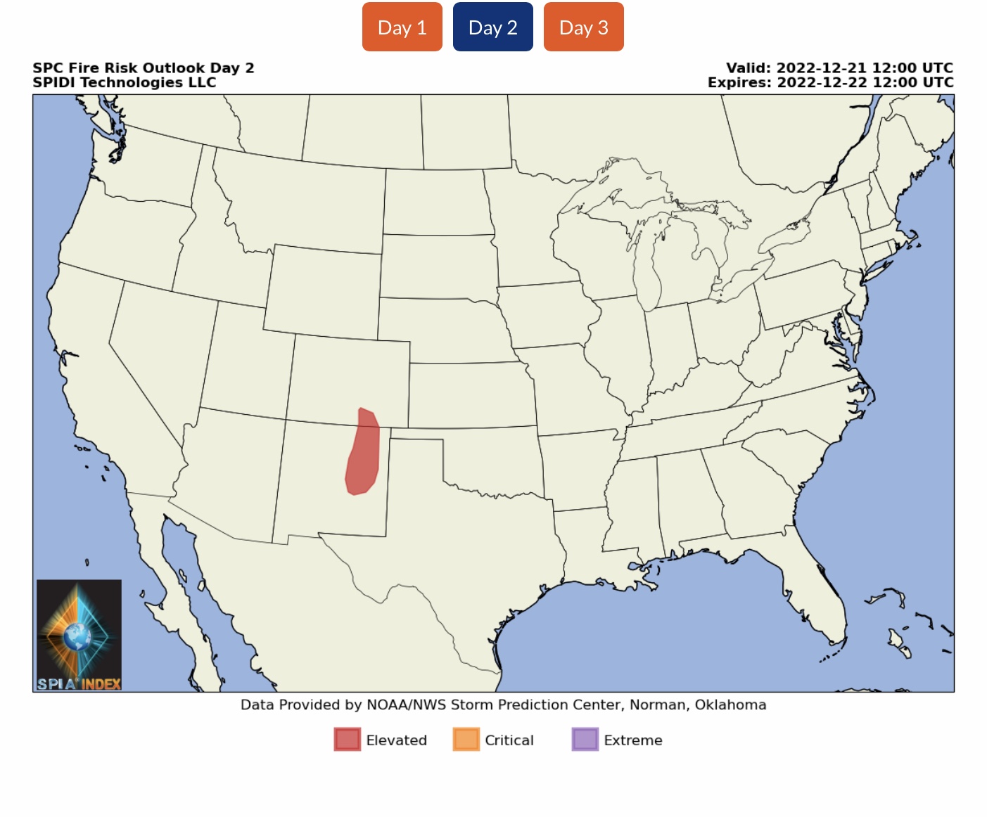
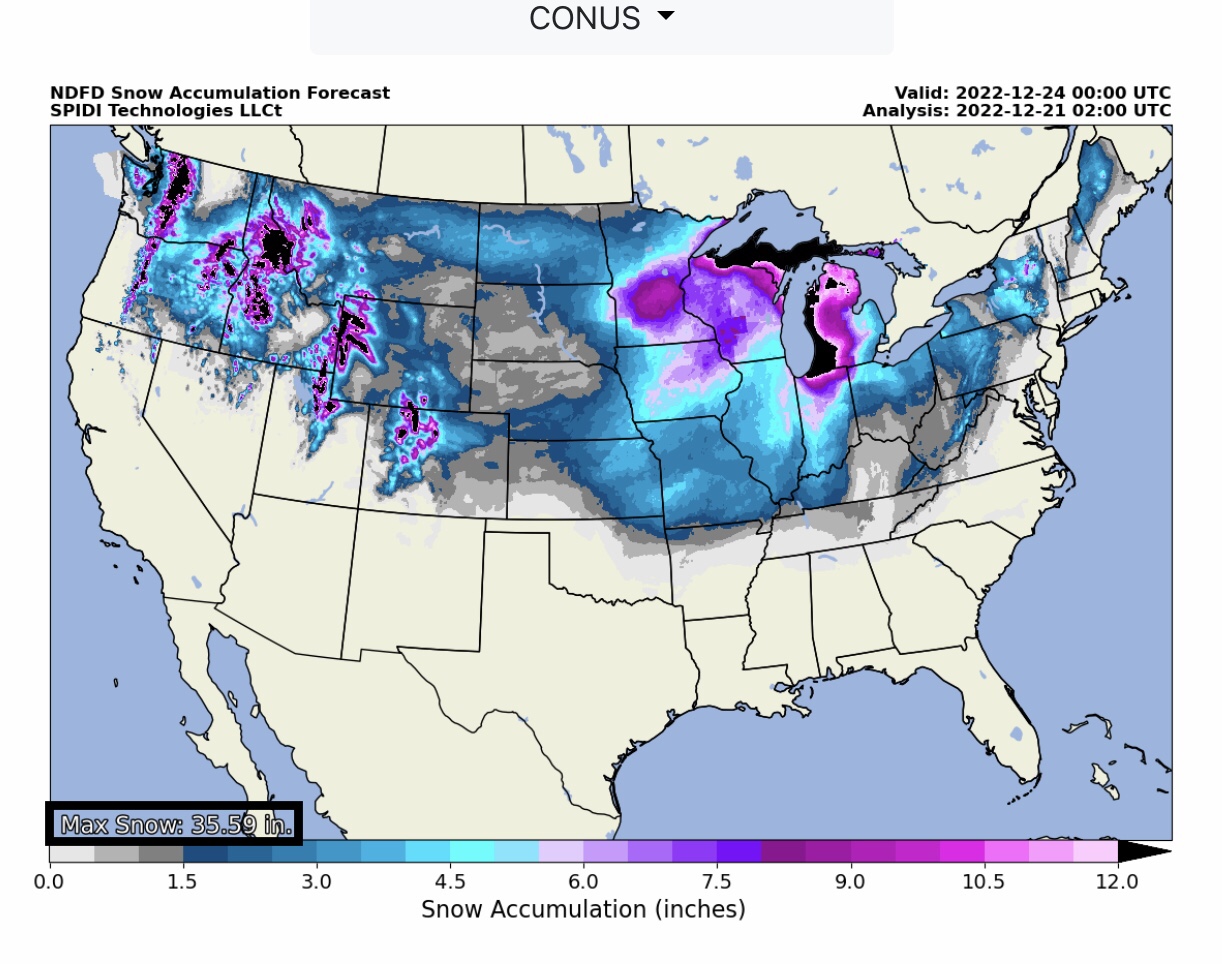
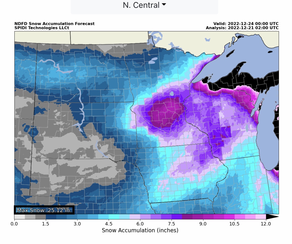
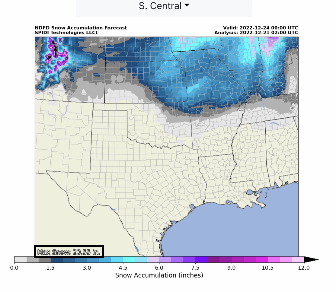
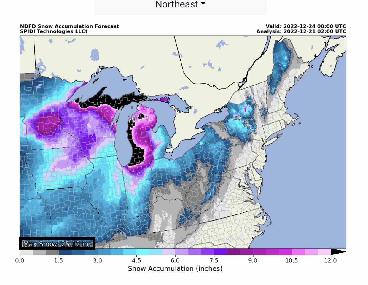
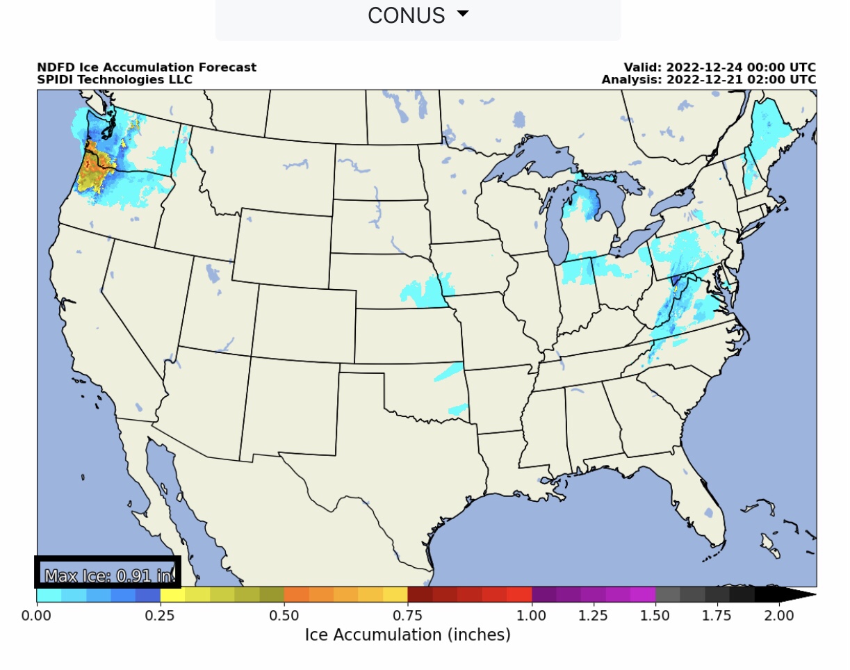
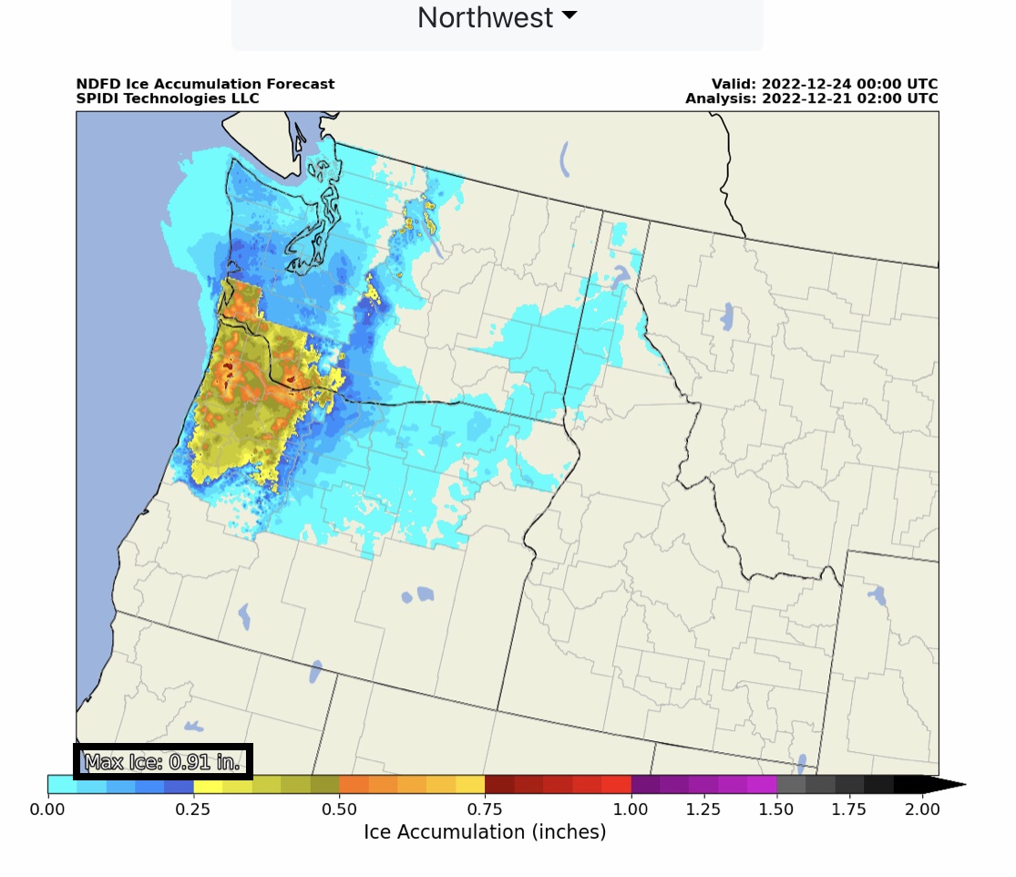
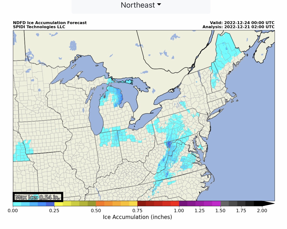
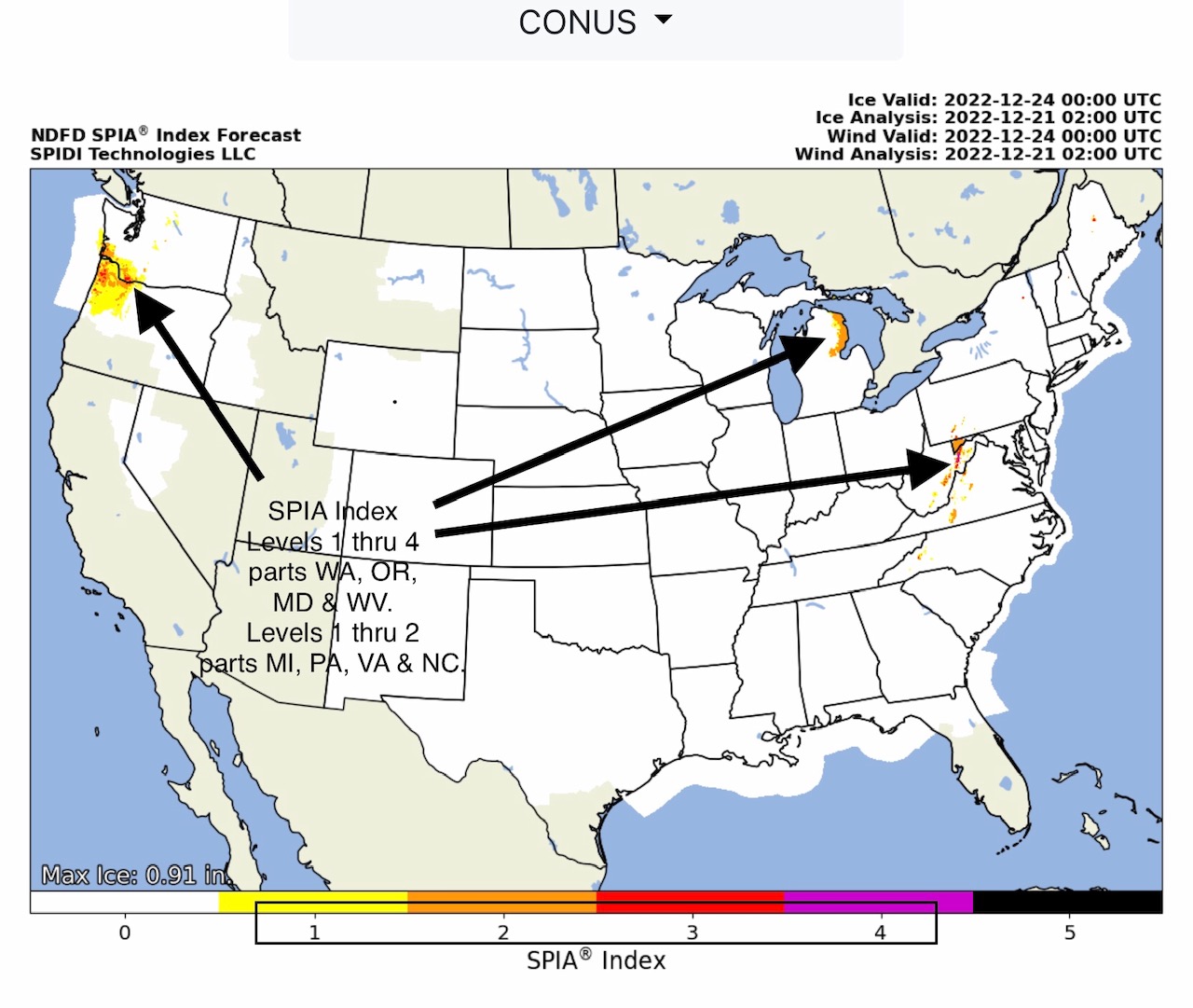
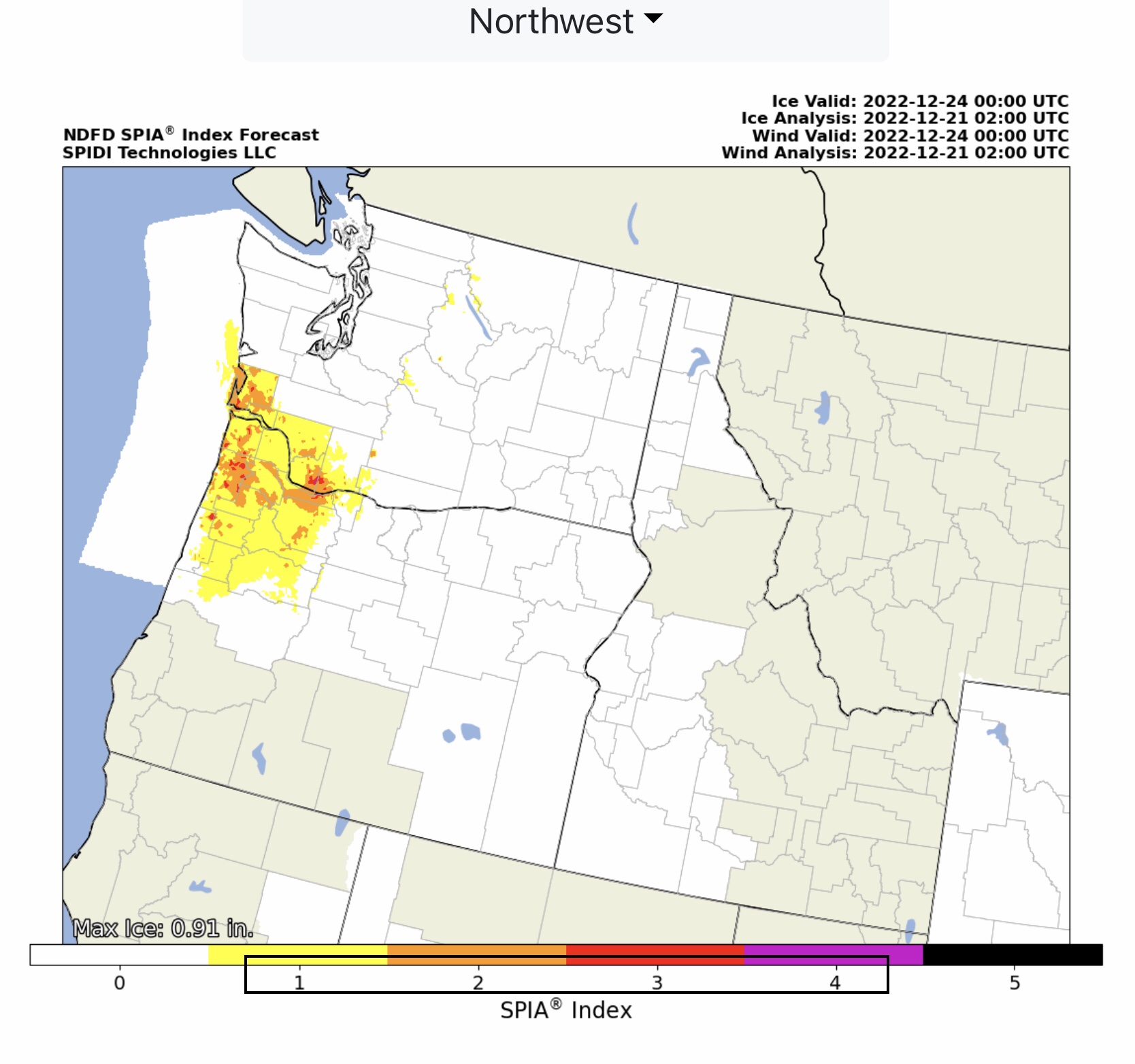
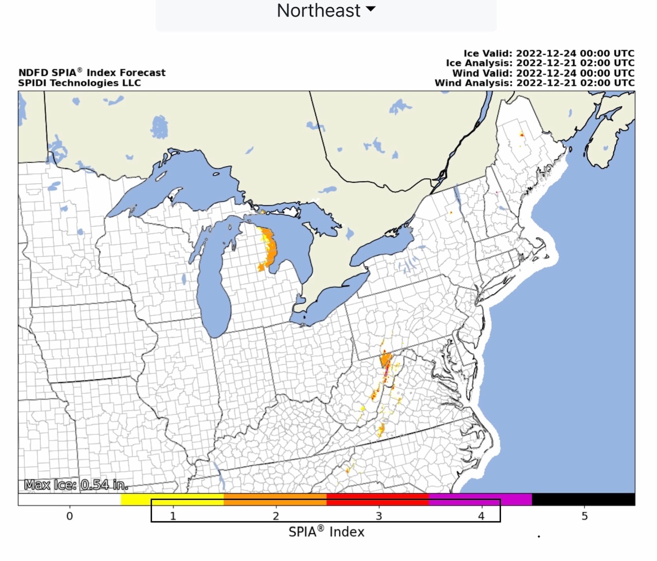
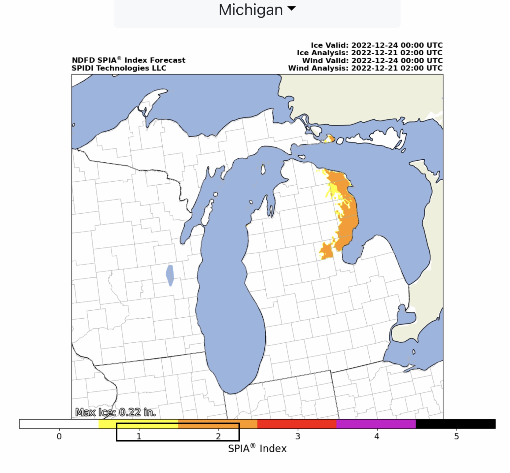
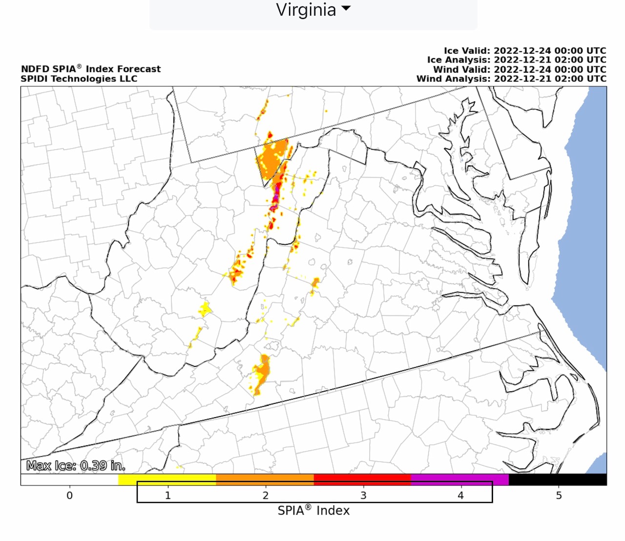
1st of 2 emails. NWS Watches, Warnings & Advisories. Winter Storm Warnings, Blizzard Warnings & Wind Chill Warnings & Advisories dominate the nation’s midsection. High Wind Warnings parts WY, UT, CO & NM. High Wind Watch parts NY, VT & NH. ELEVATED Wildfire Risk, Day 2, parts CO & NM. Heavy Snow across the northern tier of the U.S. Max Ice in NWS grids 0.91” parts WA & OR; 0.54” in parts WV. SPIA Index Ice Impact Forecast: Levels 1 thru 4 parts WA, OR, WV. Levels 1 thru 2 parts MI, PA, MD, VA & NC.
Sidney Sperry 21 Dec 2022 03:26 UTC
FYI… 2nd email to include NWS Temperature Forecasts at 6am CST for Wednesday, Thursday, Friday and Saturday, plus GFS Model Wind Chill Temperature Forecasts at 6am CST for Wednesday, December 21 through Wednesday, December 28th.

Sid Sperry

 Show/hide attachments