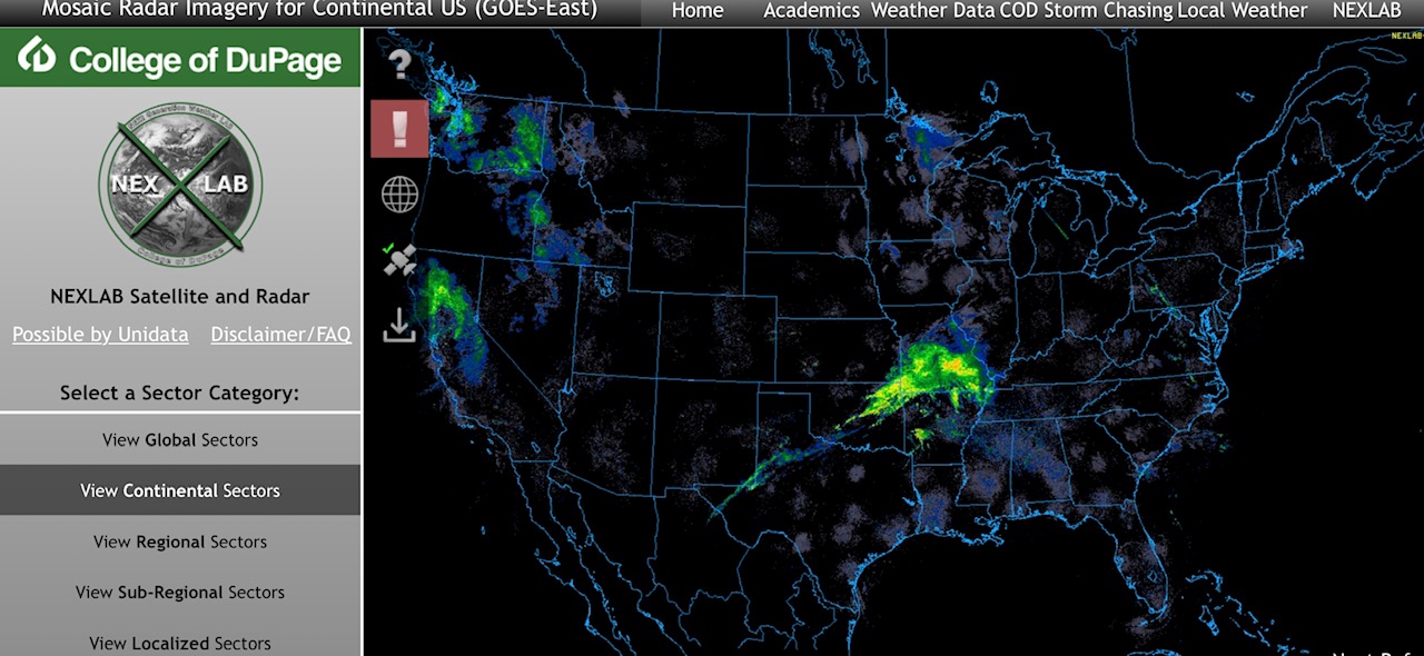
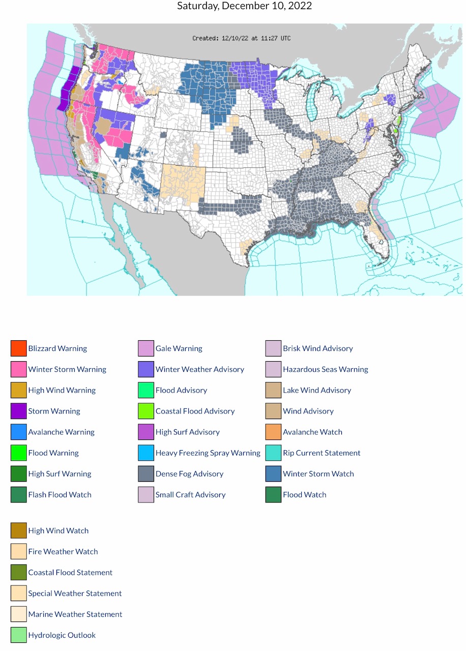
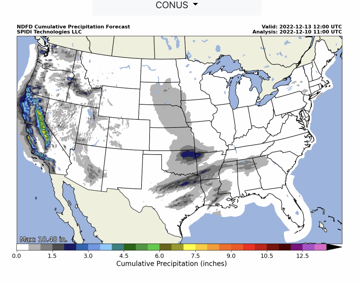
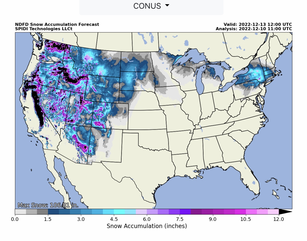
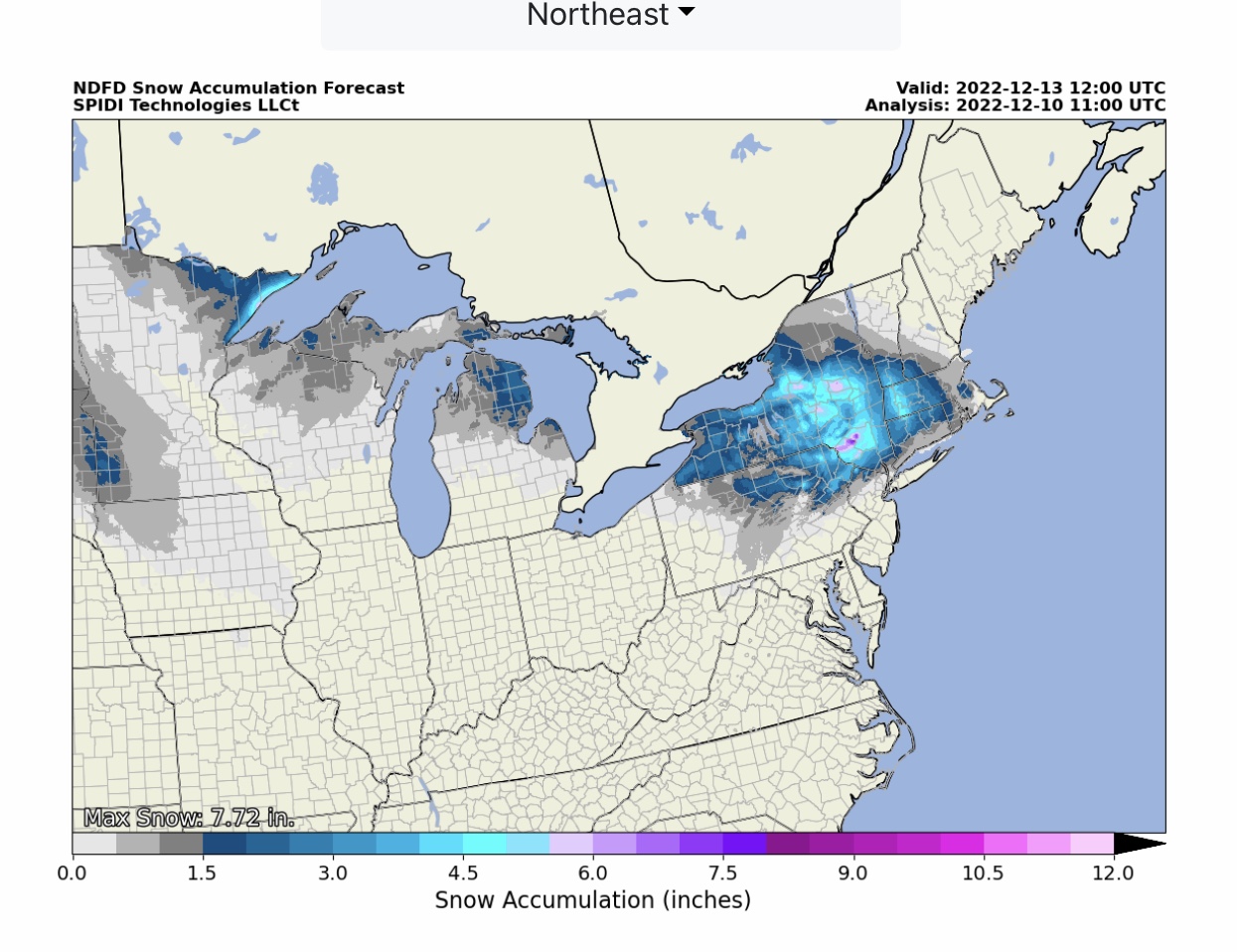
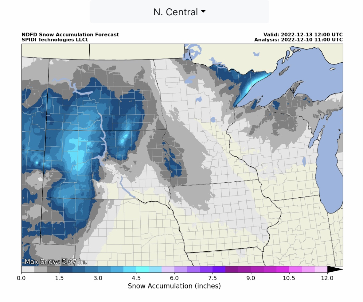
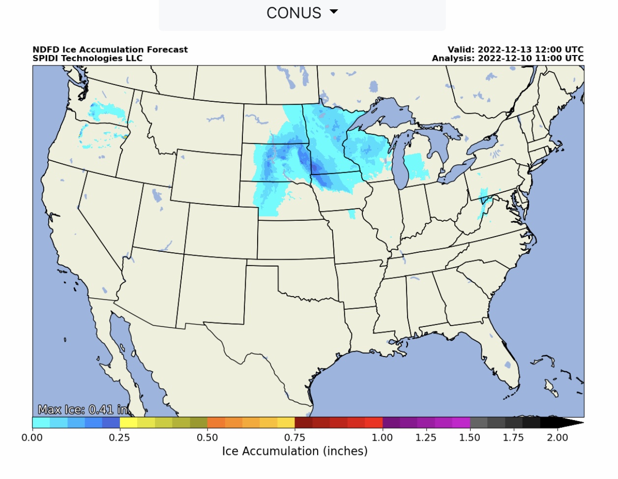
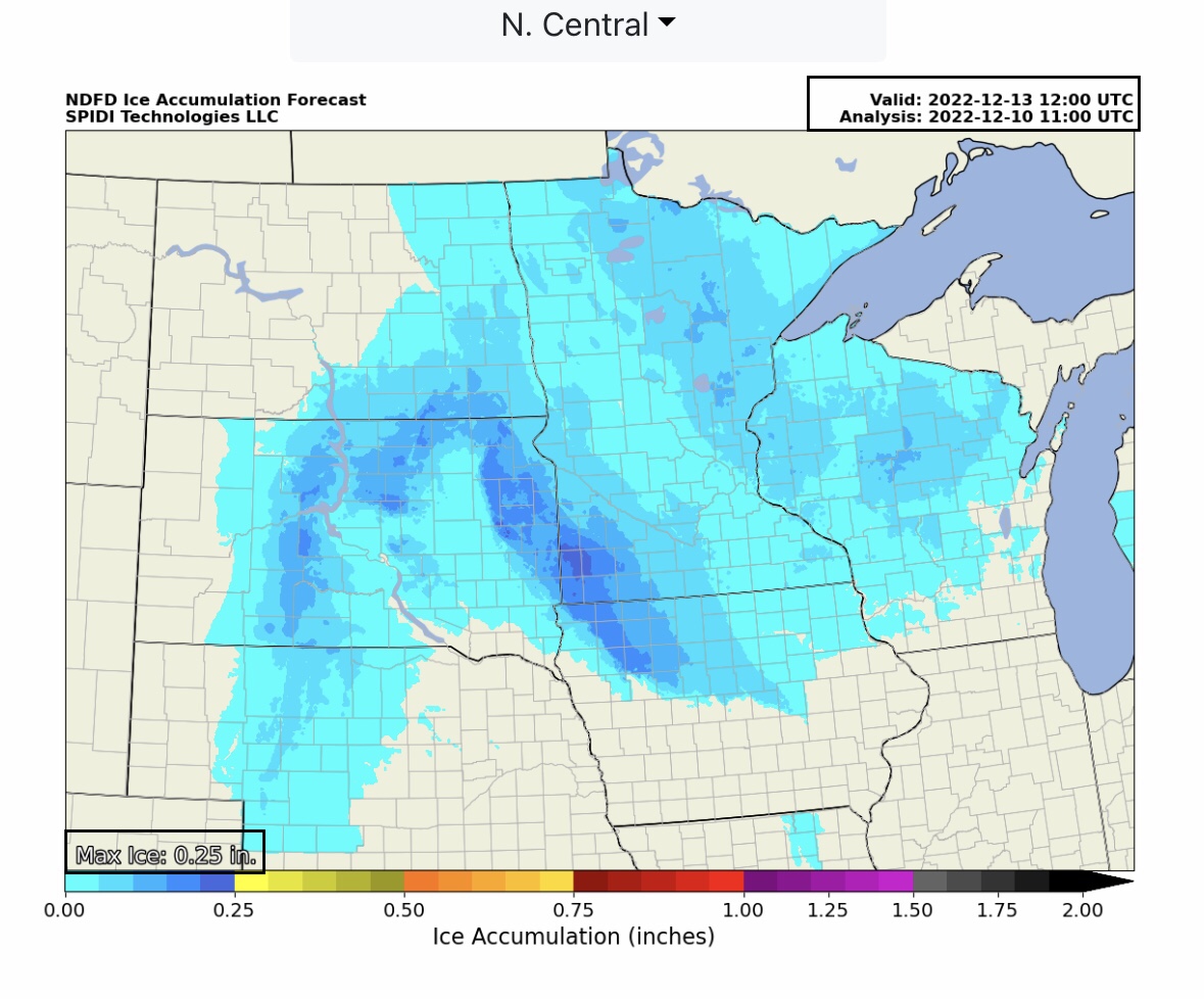
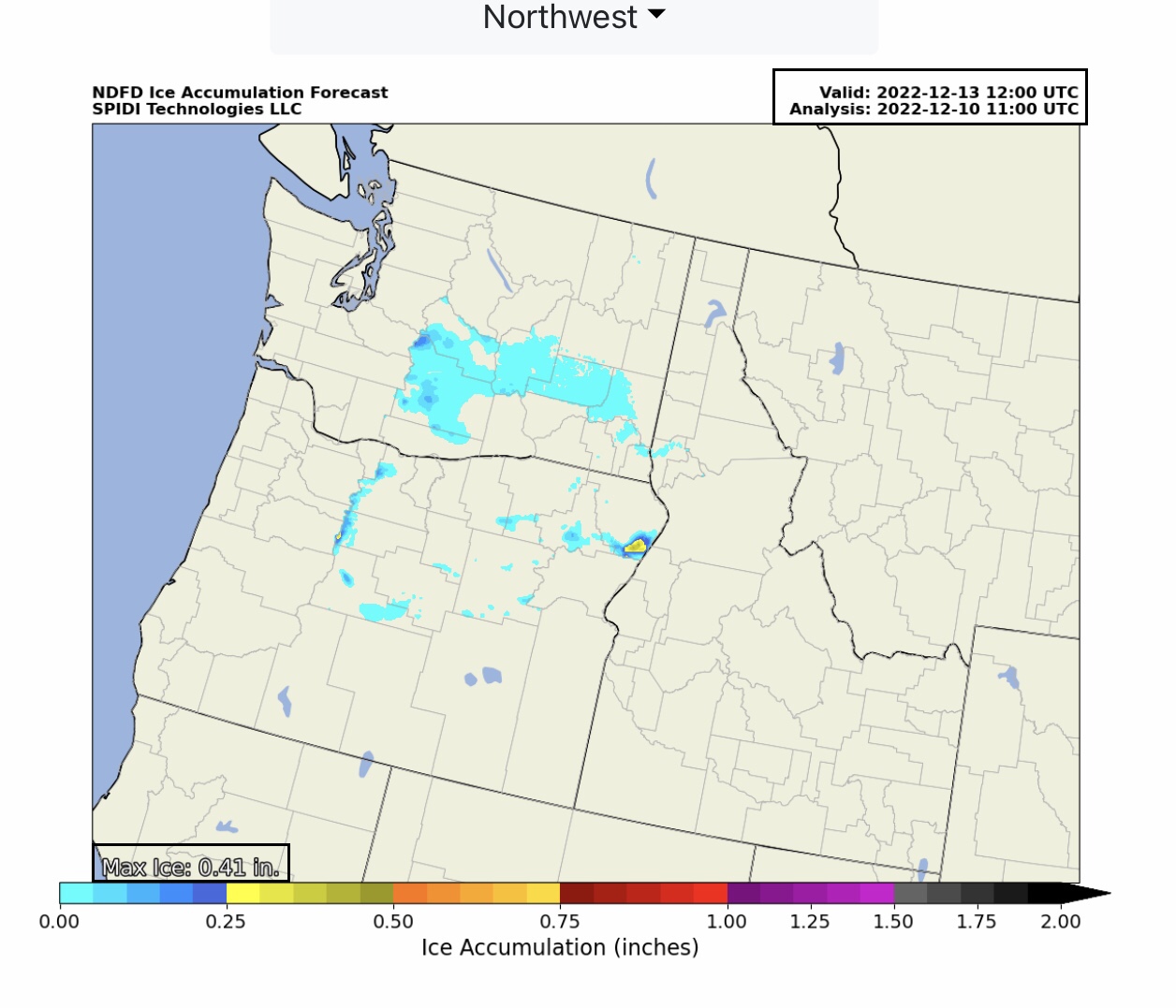
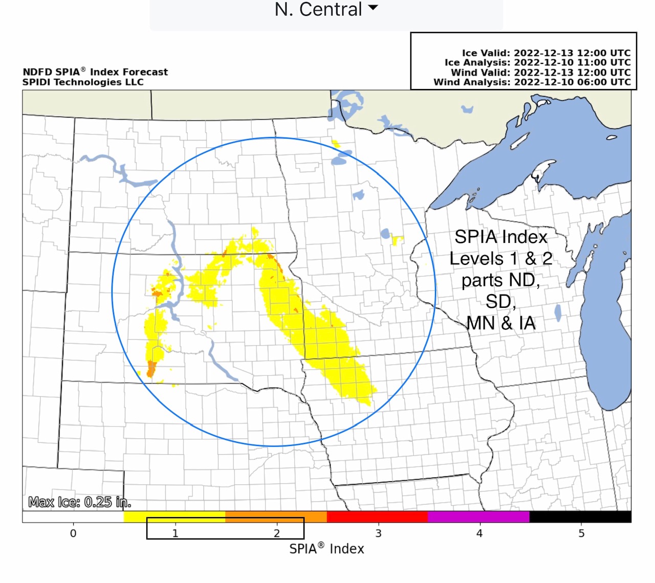
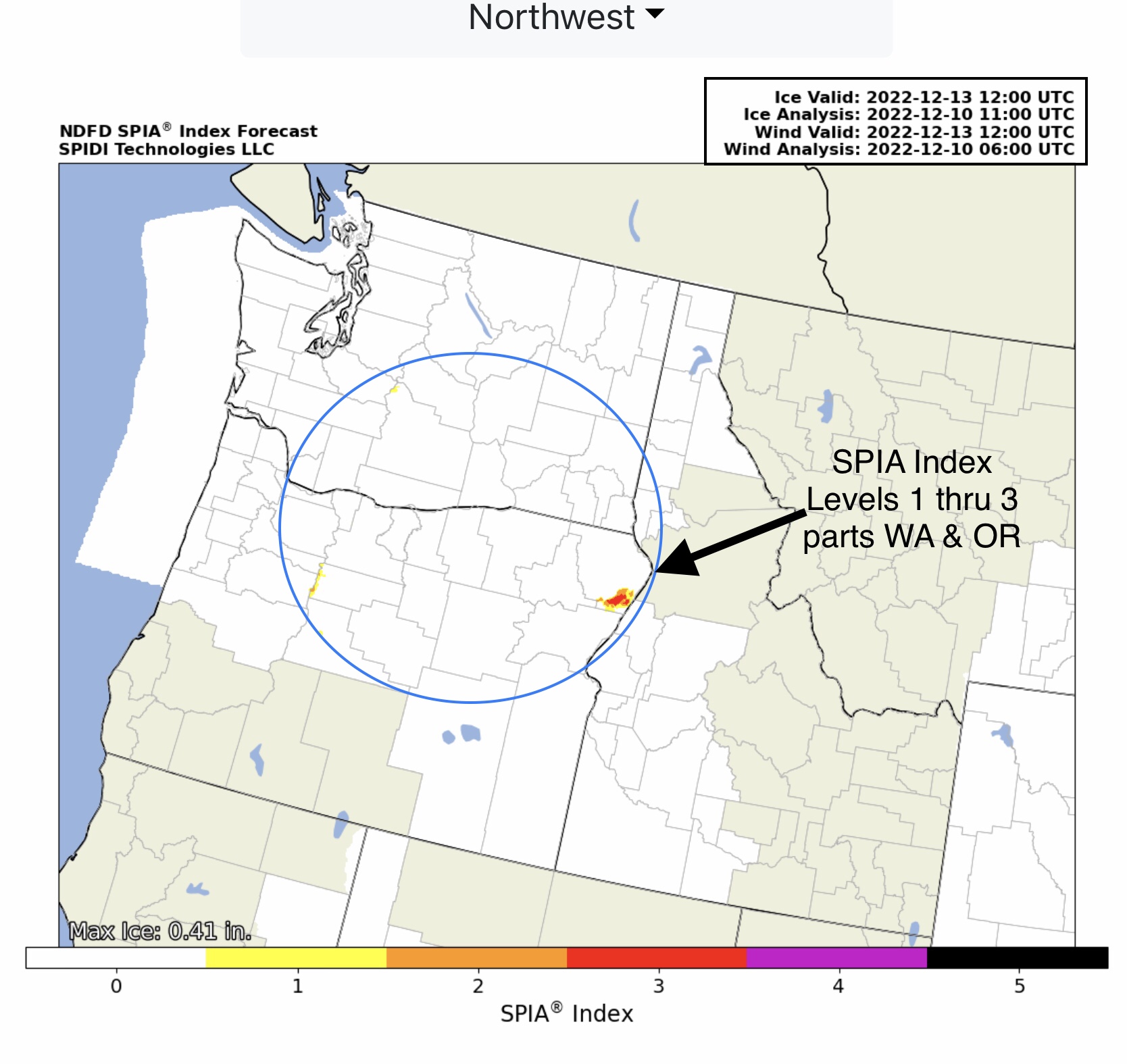
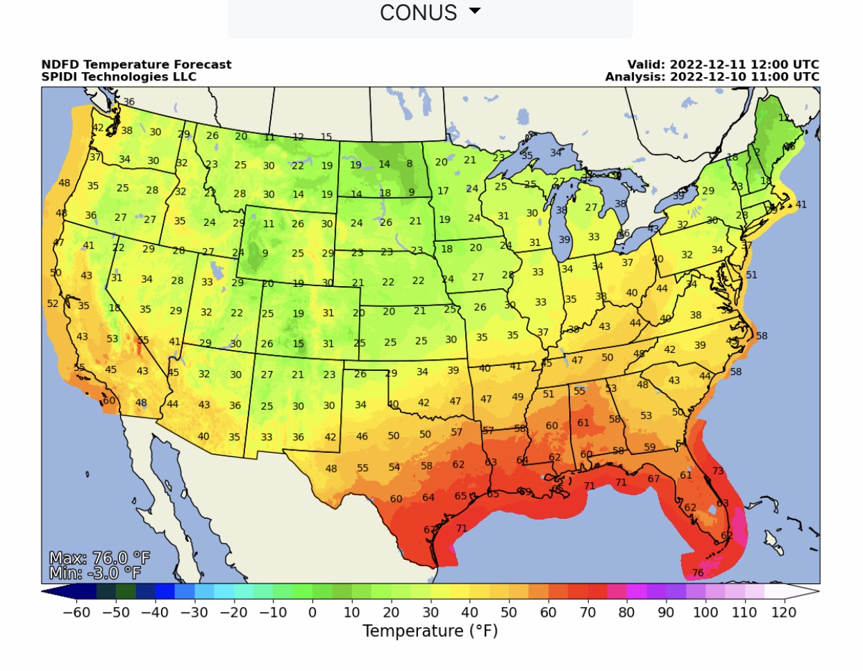
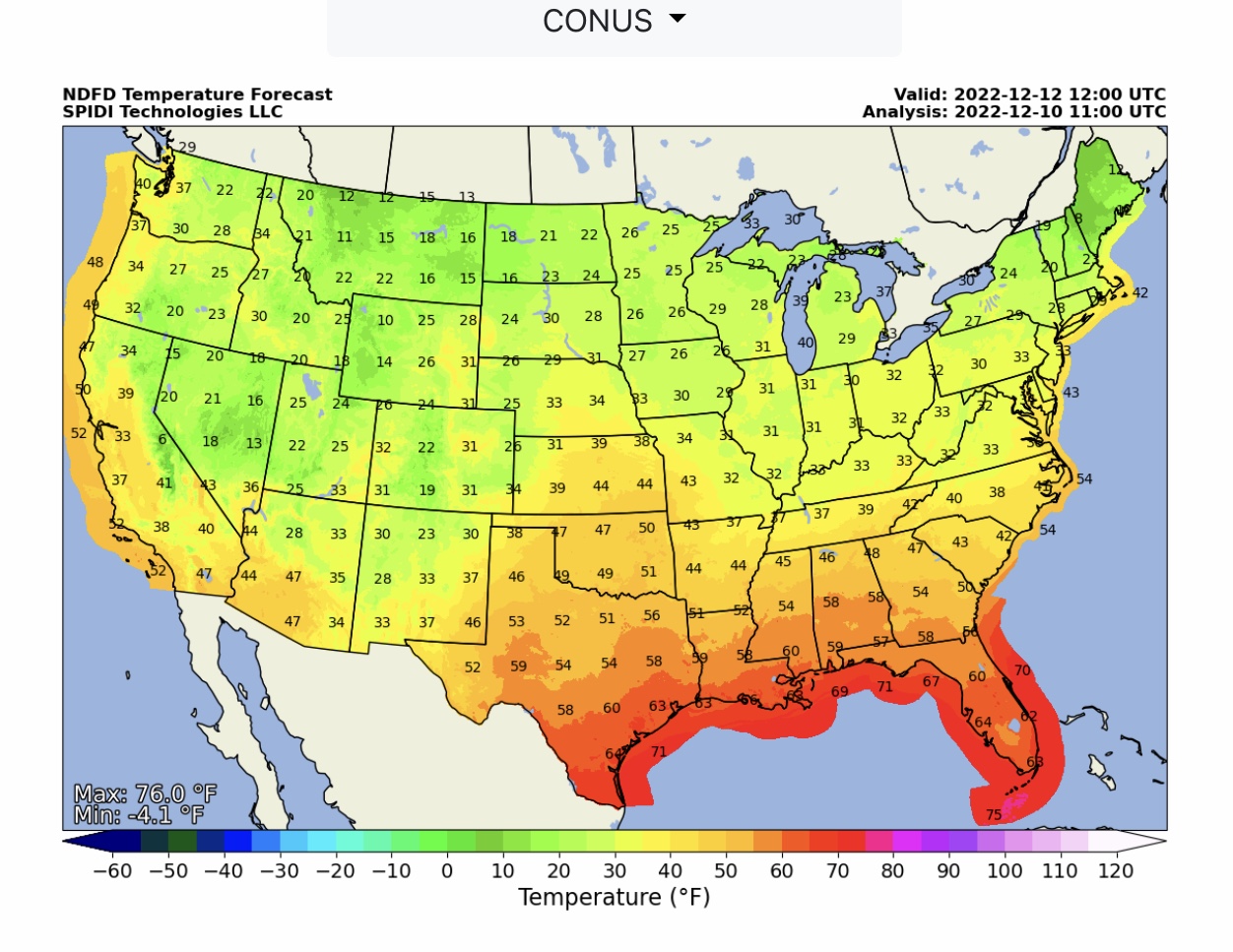
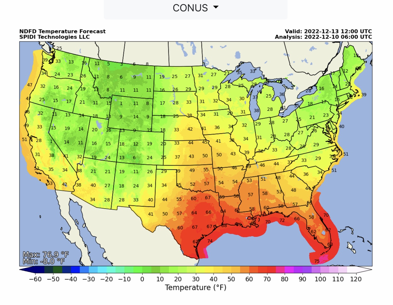
Major Winter Storm impacting western U.S. over next 72-hrs; over 100” of snow is forecast over next 3 days in the CA Sierra-Nevada Range. Showers & some brief thunderstorms today into Sunday parts OK, MO, AR into IL, KY & TN. Max ice in NWS grids is 0.25” in North Central Region & 0.41” in Northwest Region. Current SPIA Index Ice Impact Forecast is at Levels 1 & 2 in parts ND, SD, MN & IA, and at Levels 1 thru 3 in parts WA & OR. Some outages likely in both NW & N-Central areas
Sidney Sperry 10 Dec 2022 12:09 UTC
FYI… weather outlooks over next 72-hrs, through 6am Tuesday, December 13, 2022.
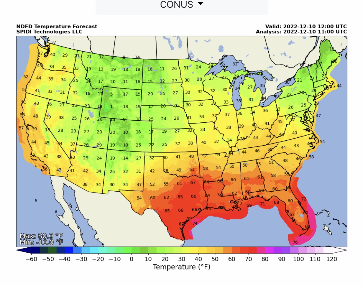
NWS Morning Low Temperature Forecasts at 6am CST for Saturday, Sunday, Monday & Tuesday.
Sid Sperry
President & CEO
SPIDI Technologies, LLC
SPIDItech.com
Cell: (405) 627-7754
Email(s): SidSperry@gmail.com  OR  Sid.Sperry@spidiweather.com

Sent from my iPad

 Show/hide attachments