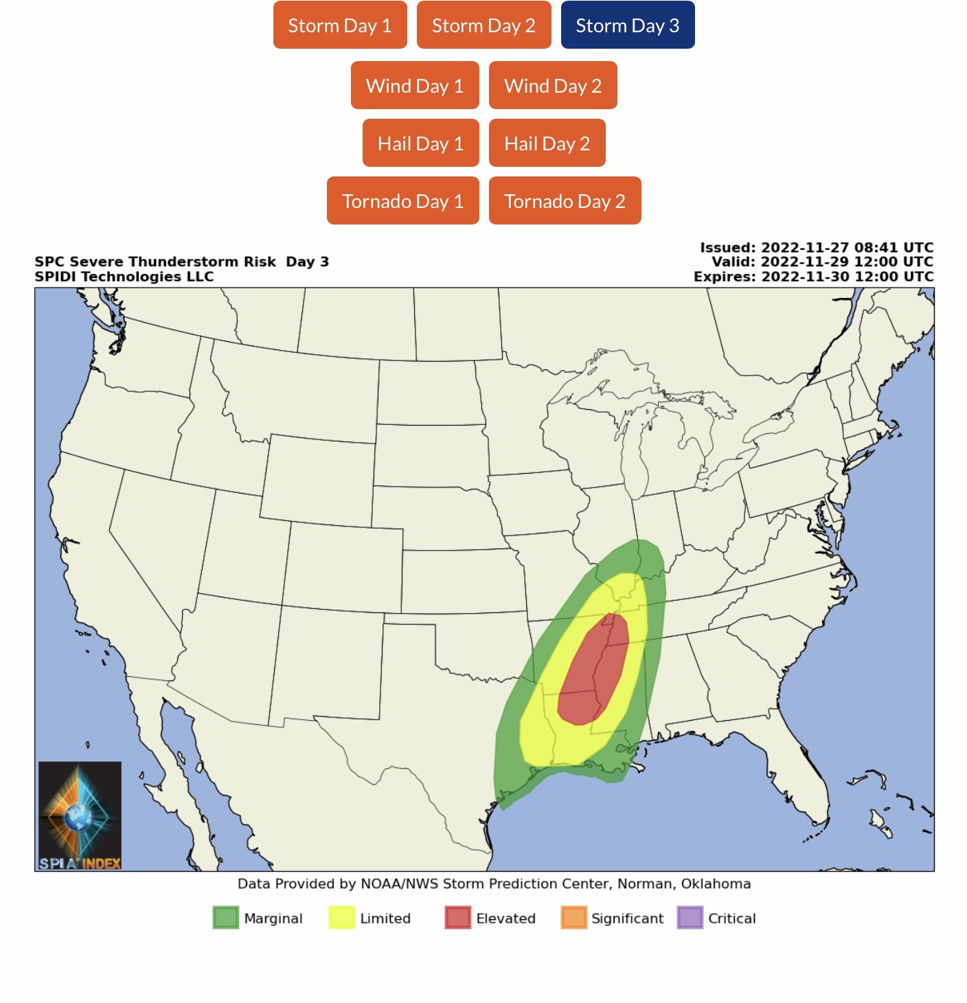
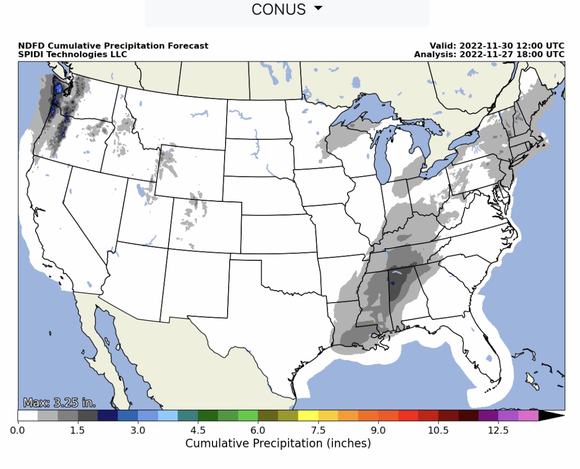
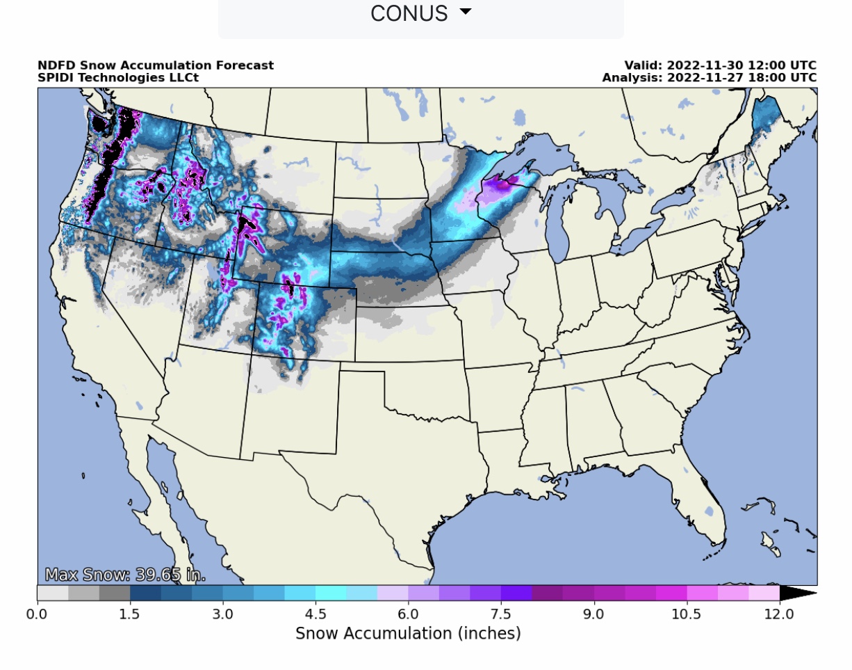
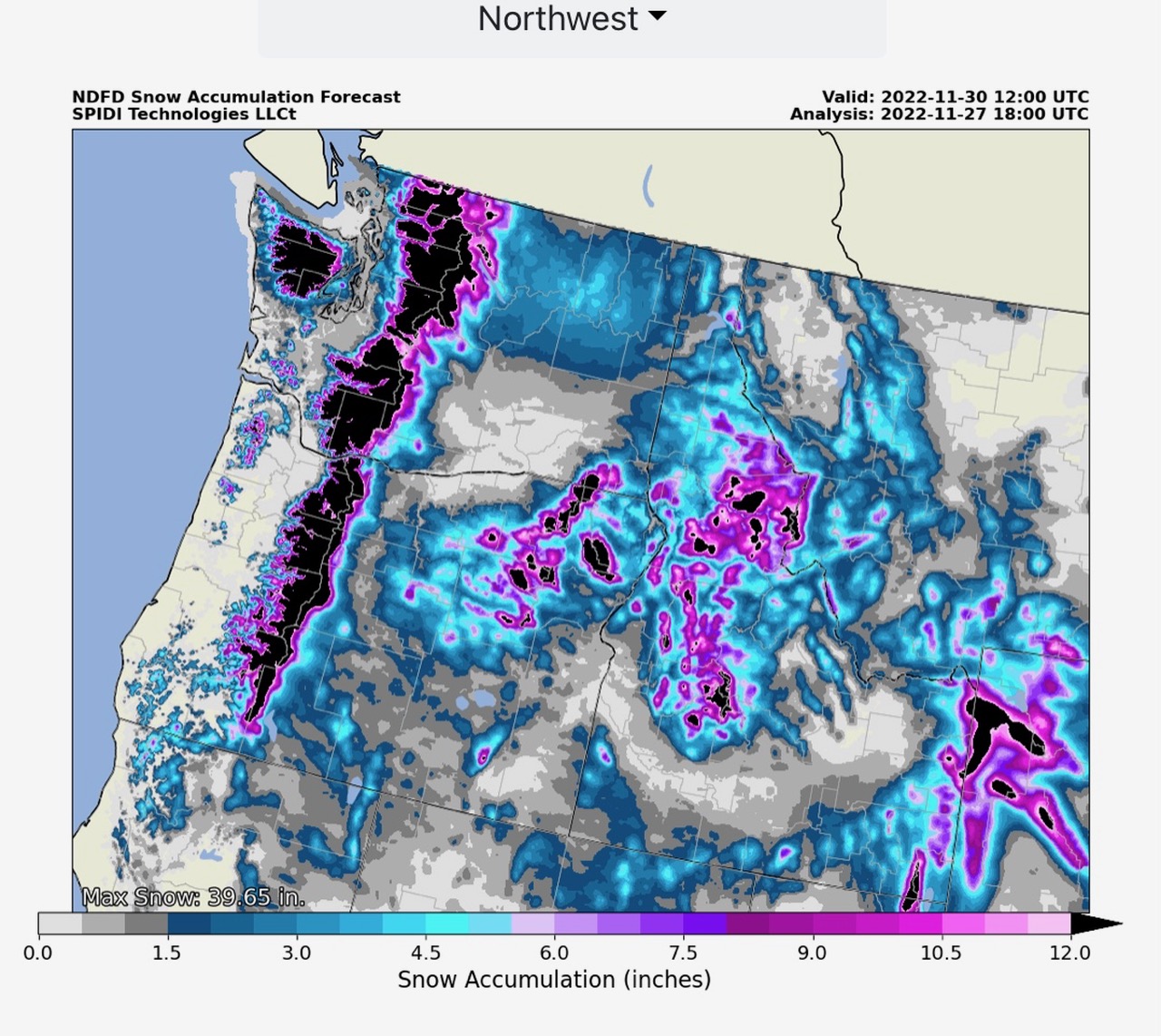
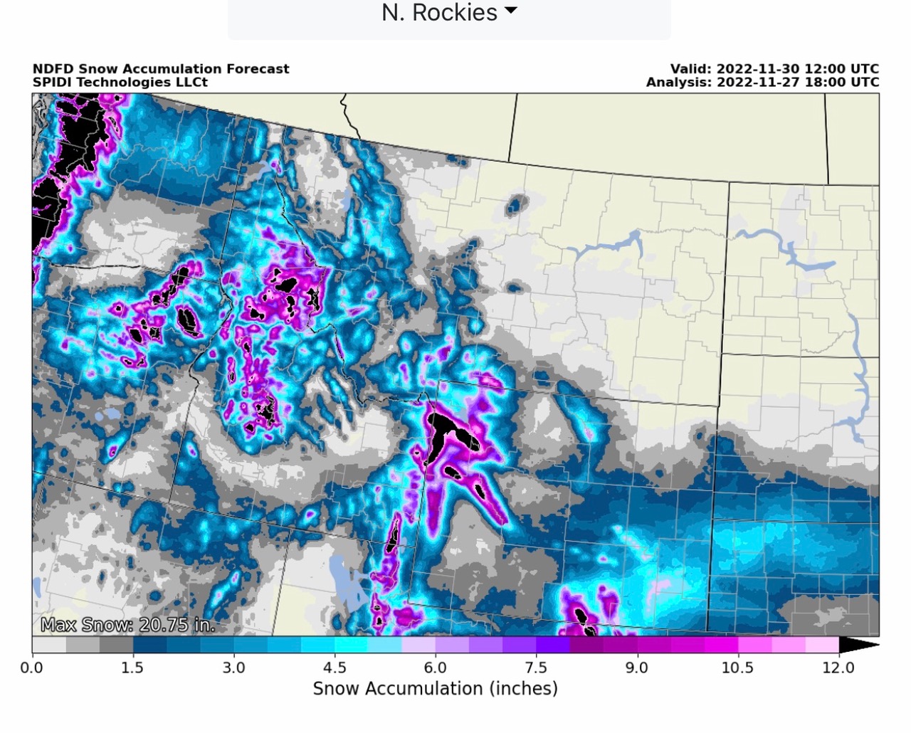
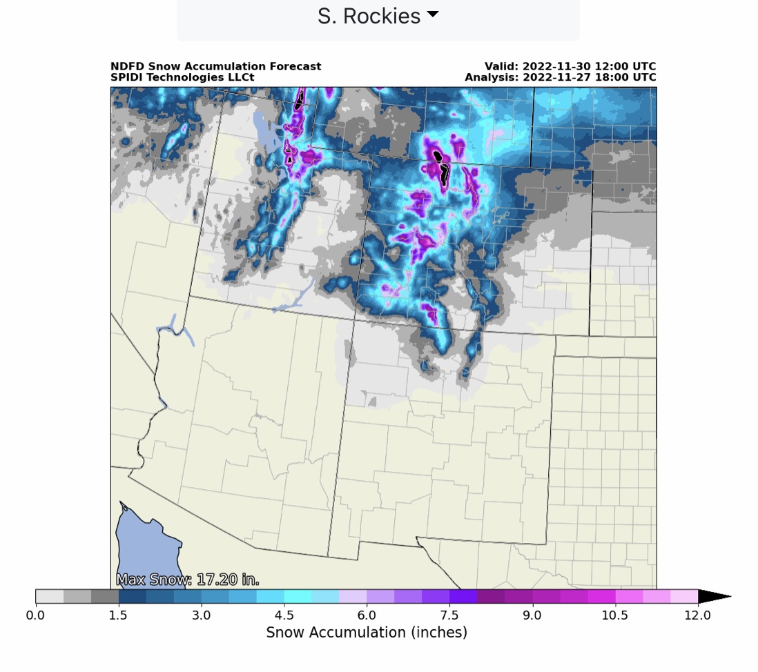
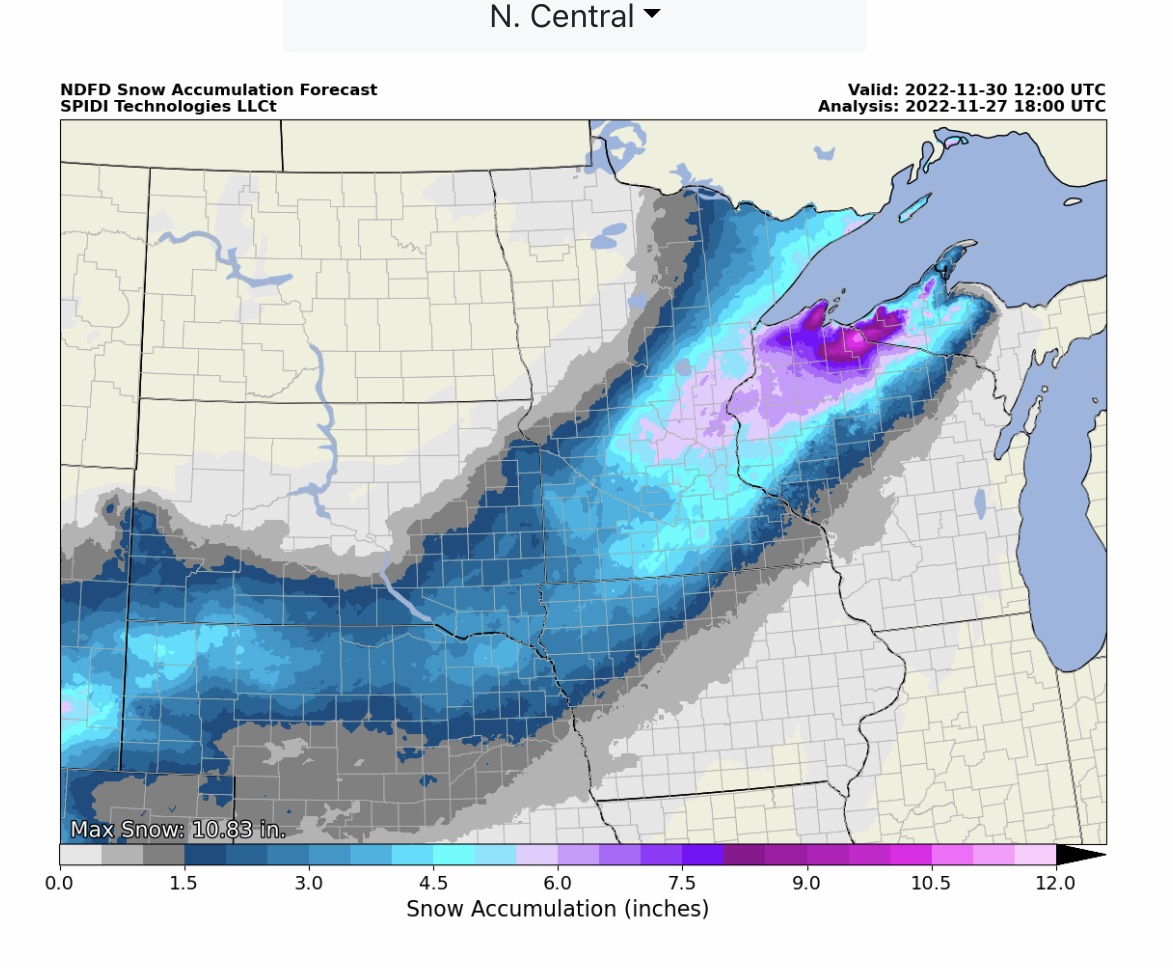
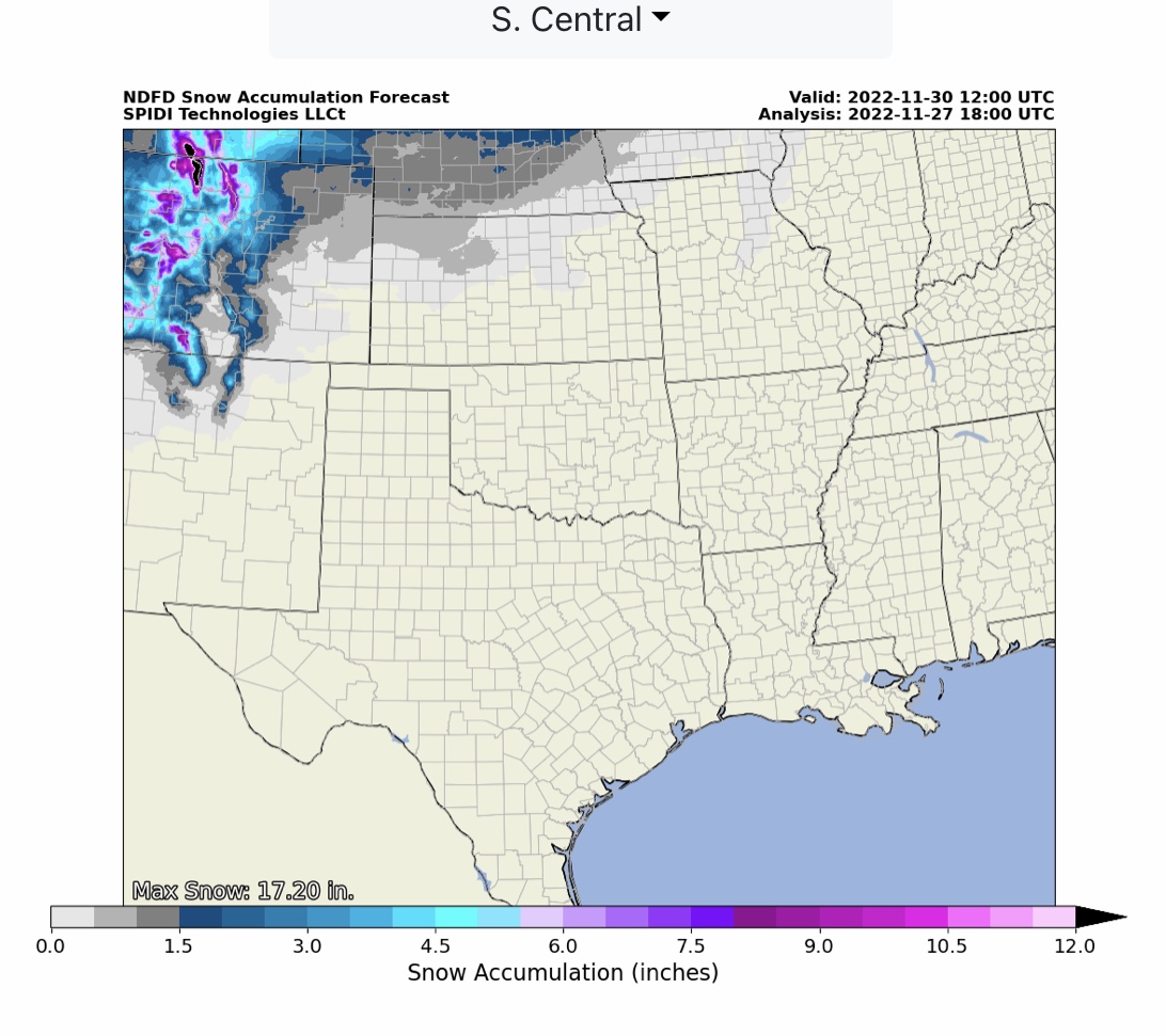
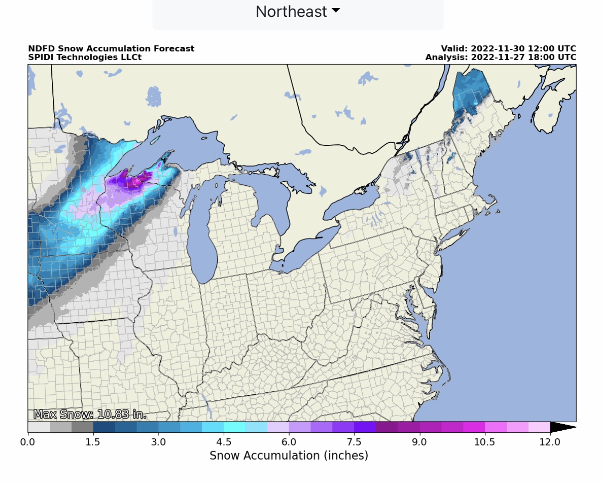
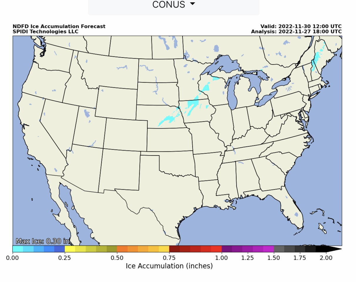
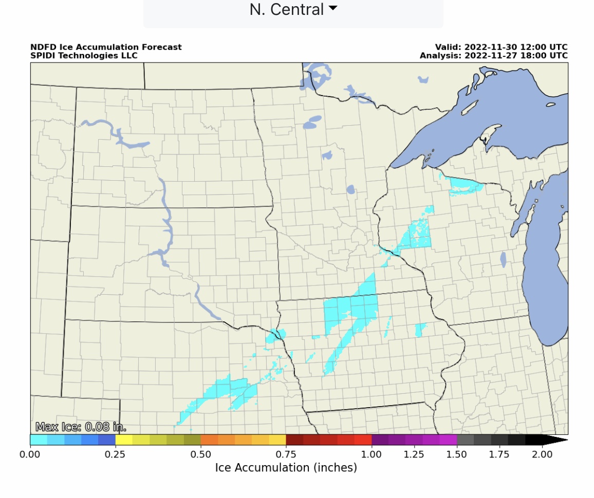
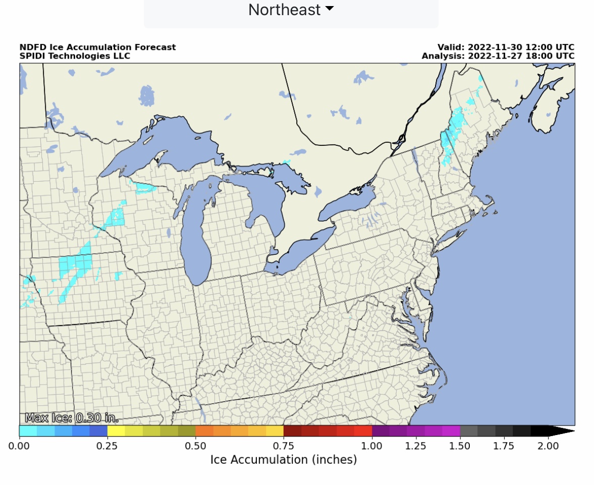
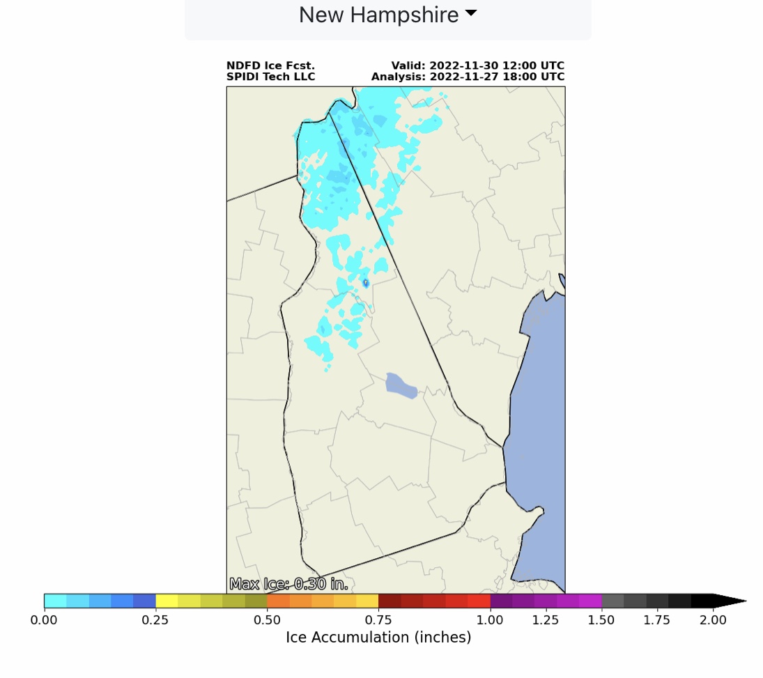
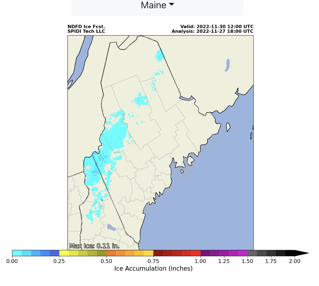
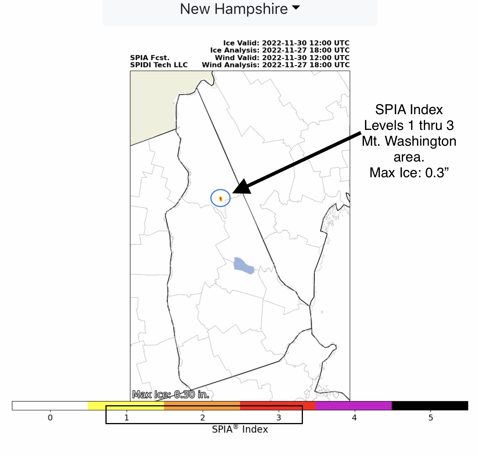
LIMITED to ELEVATED Severe Thunderstorm Risk, Day 3 (Tuesday thru Wednesday morning), parts TX, MO, AR, LA, IL, IN, KY, TN, MS & AL. High Winds, Large Hail, Heavy Rainfall, Flooding & Flash Flooding, plus some Tornadoes possible. Heavy snow parts Northwest, North Rockies, South Rockies, North Central & Northeast Regions. Light icing parts NE, IA, MN, WI, NH & ME. Max ice: 0.3”. SPIA Index Levels 1 thru 3 parts northern NH (Mt. Washington).
Sidney Sperry 27 Nov 2022 18:59 UTC
Sid Sperry
President & CEO
SPIDI Technologies, LLC
SPIDItech.com

Sent from my iPad

 Show/hide attachments