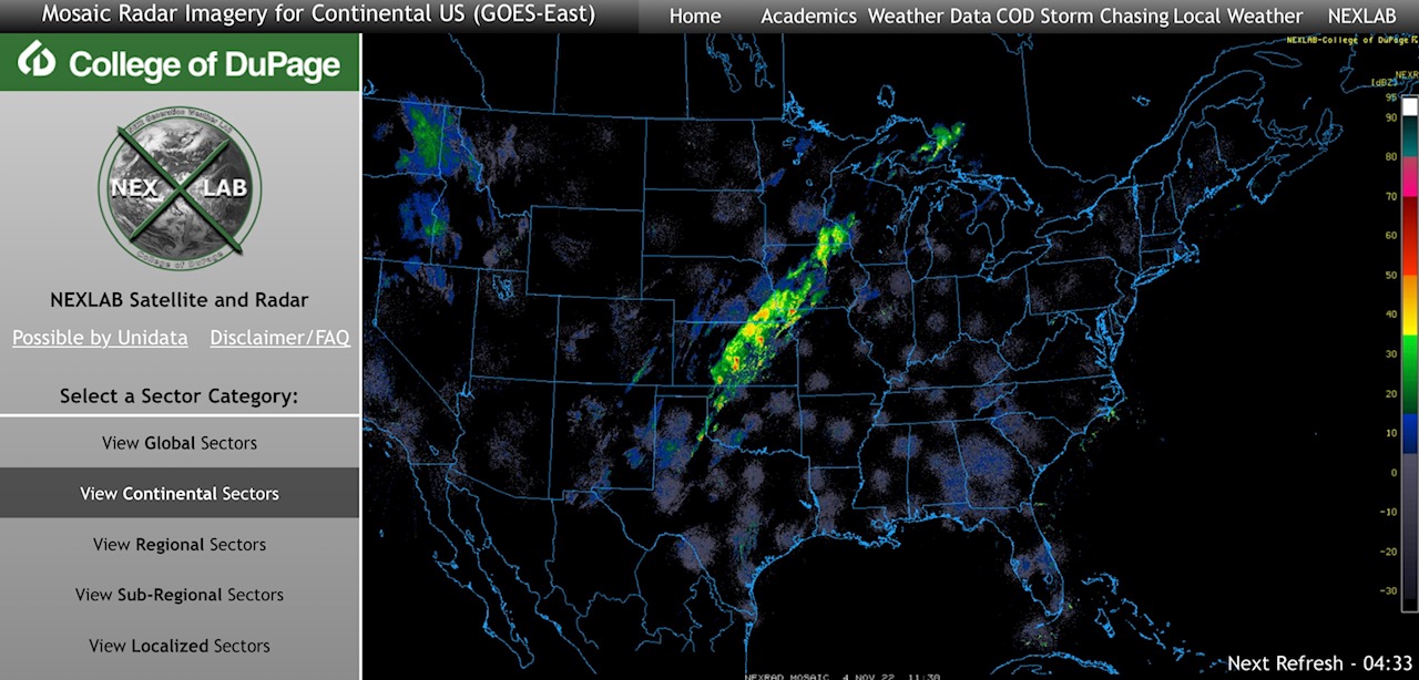
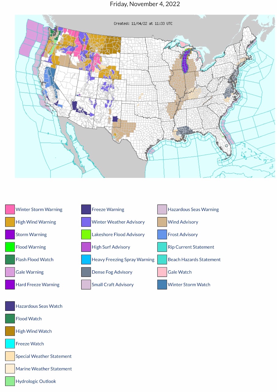
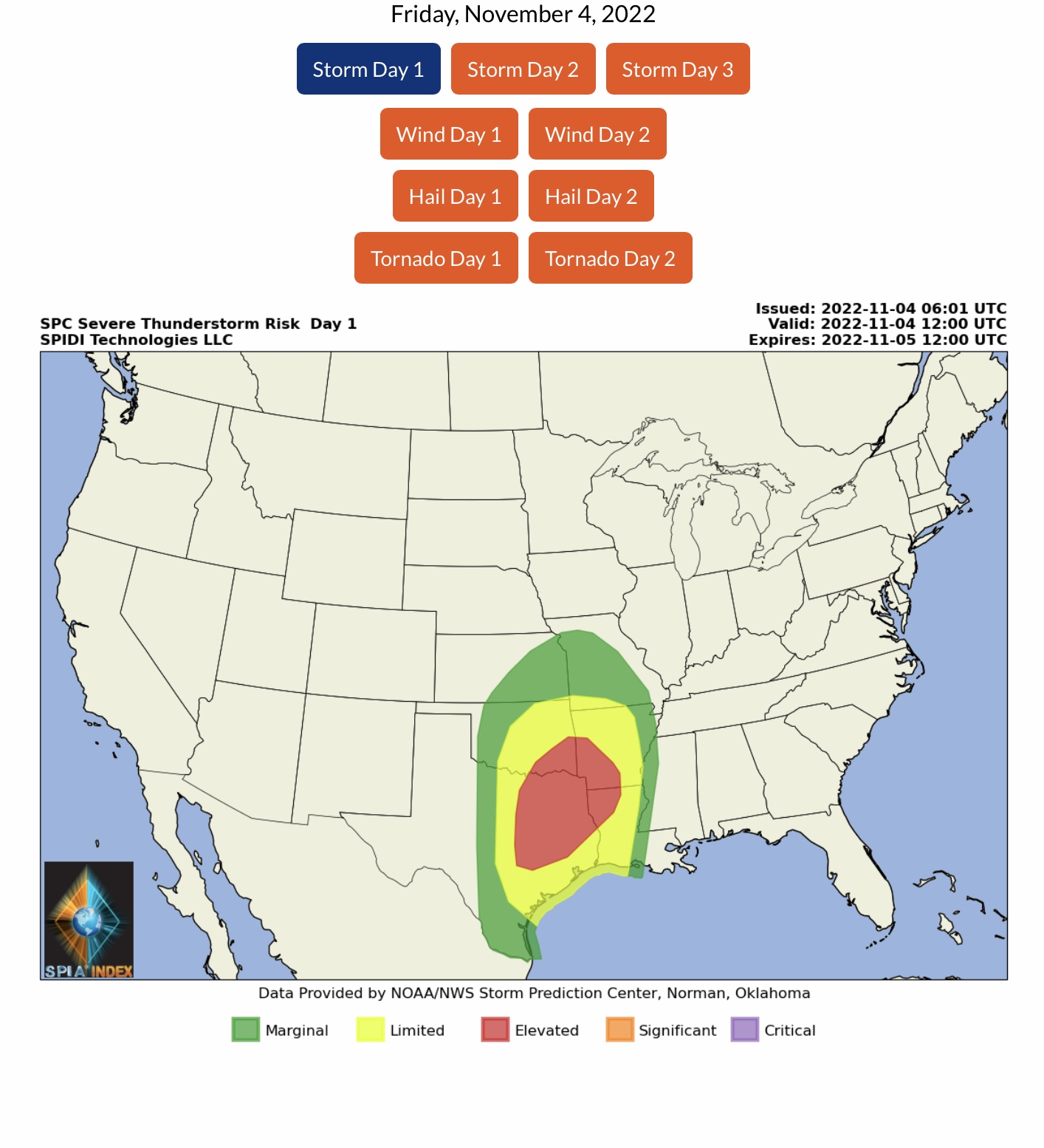
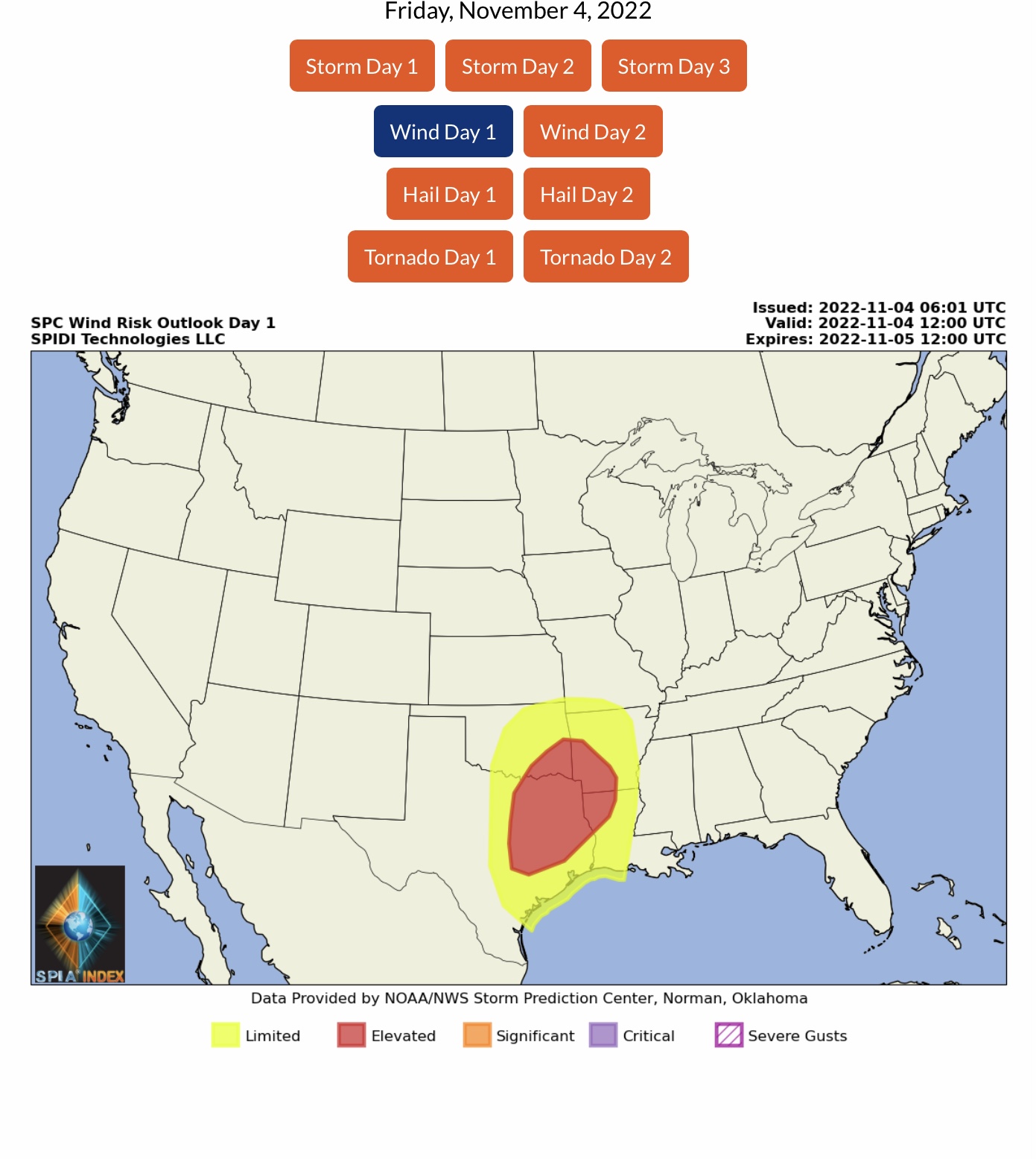
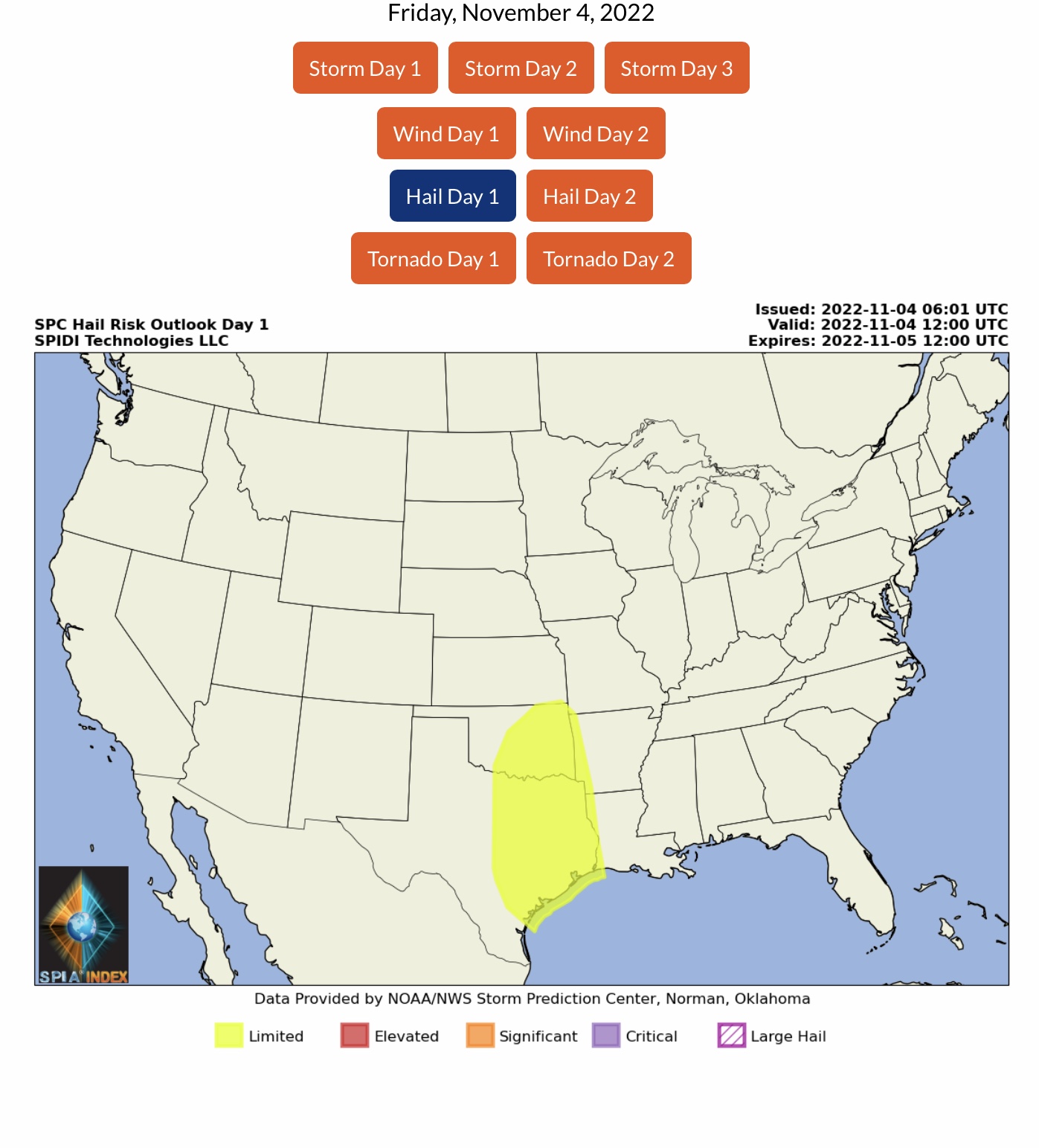
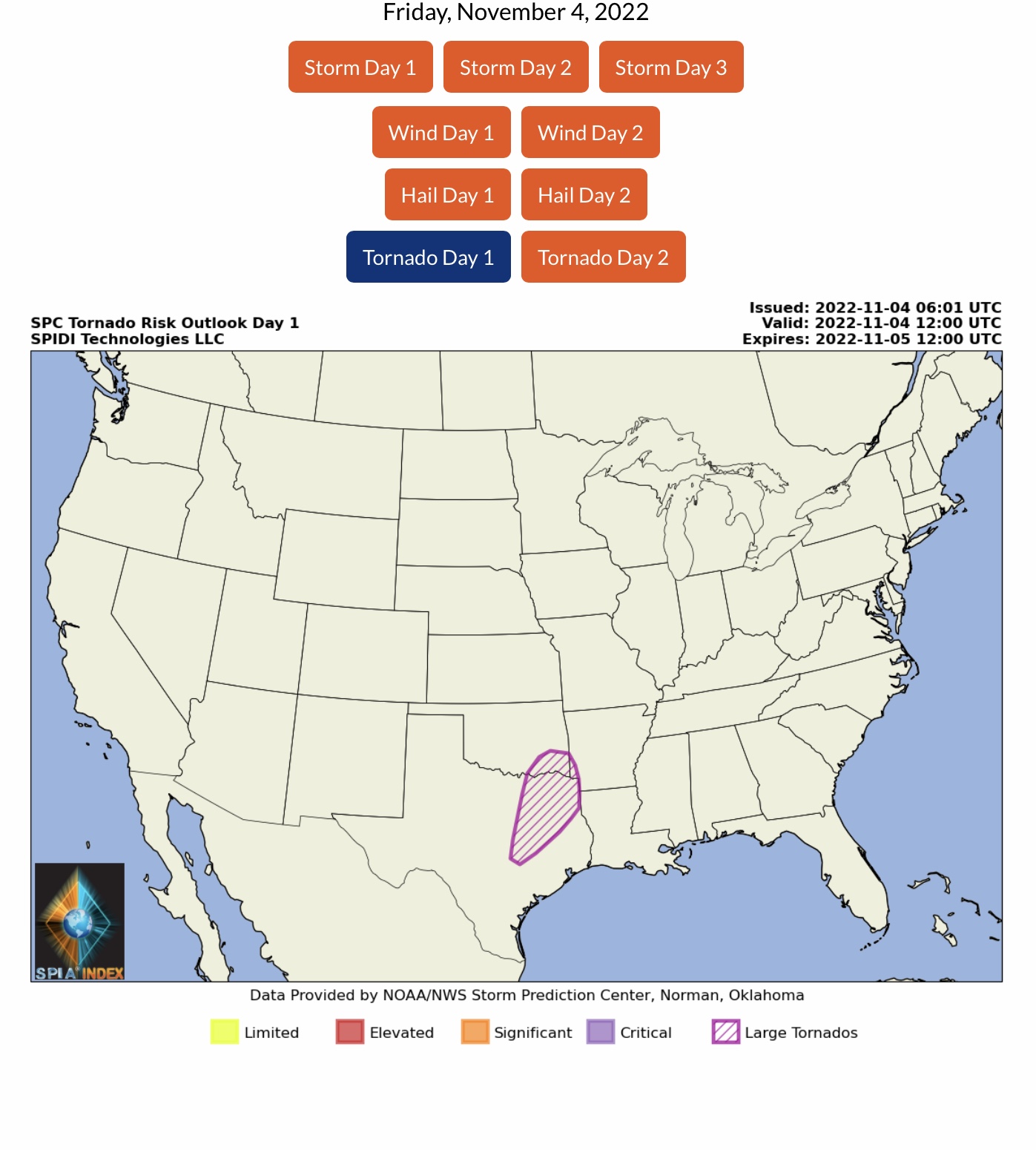
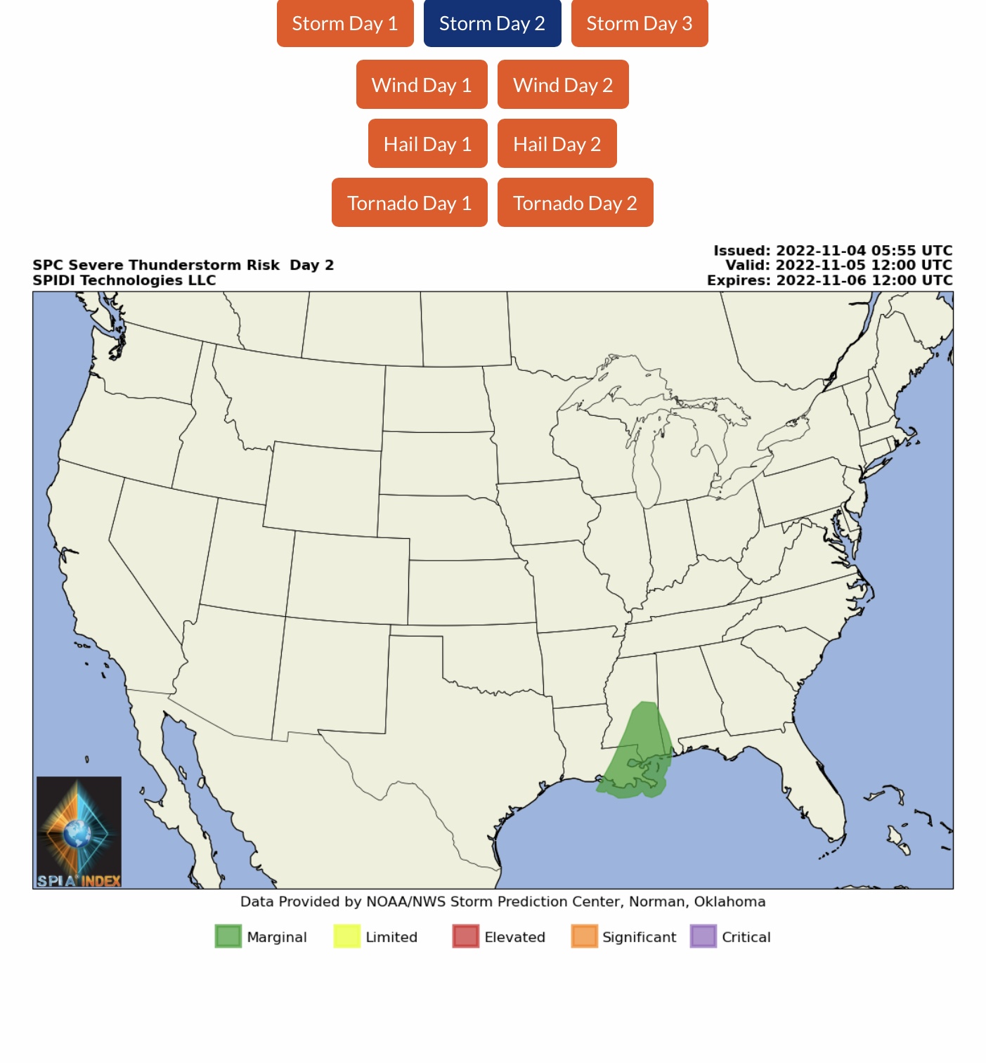
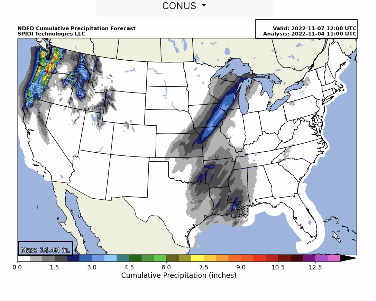
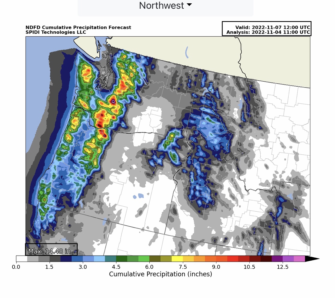
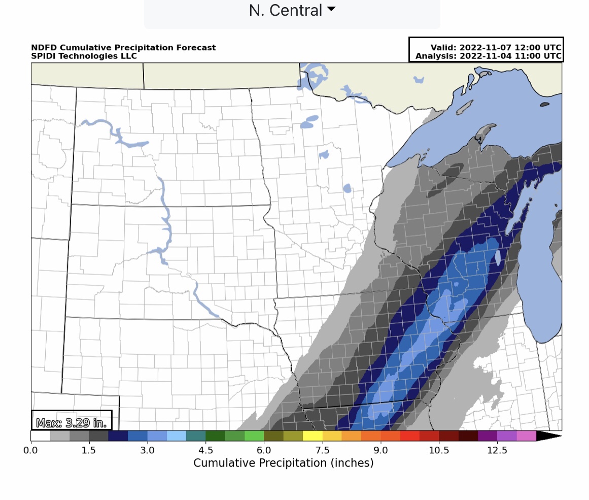
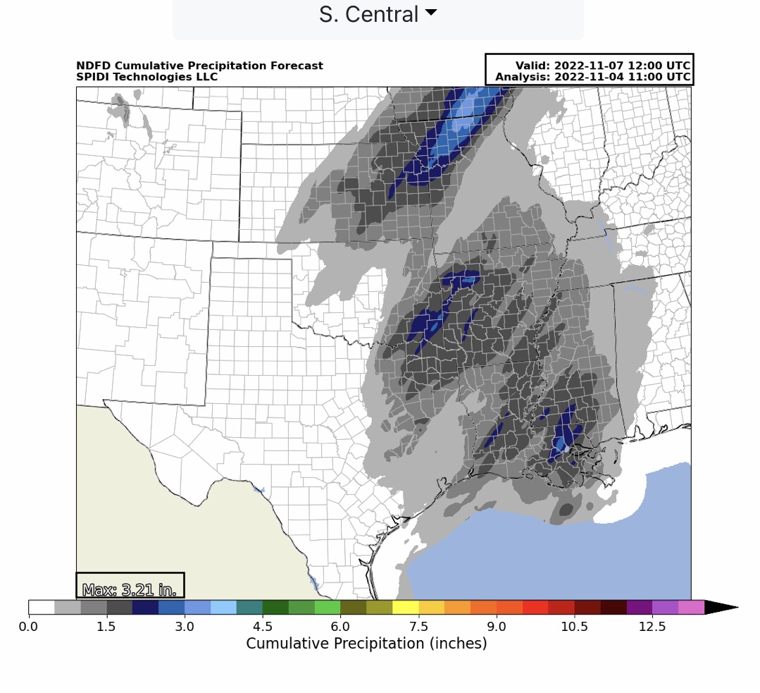
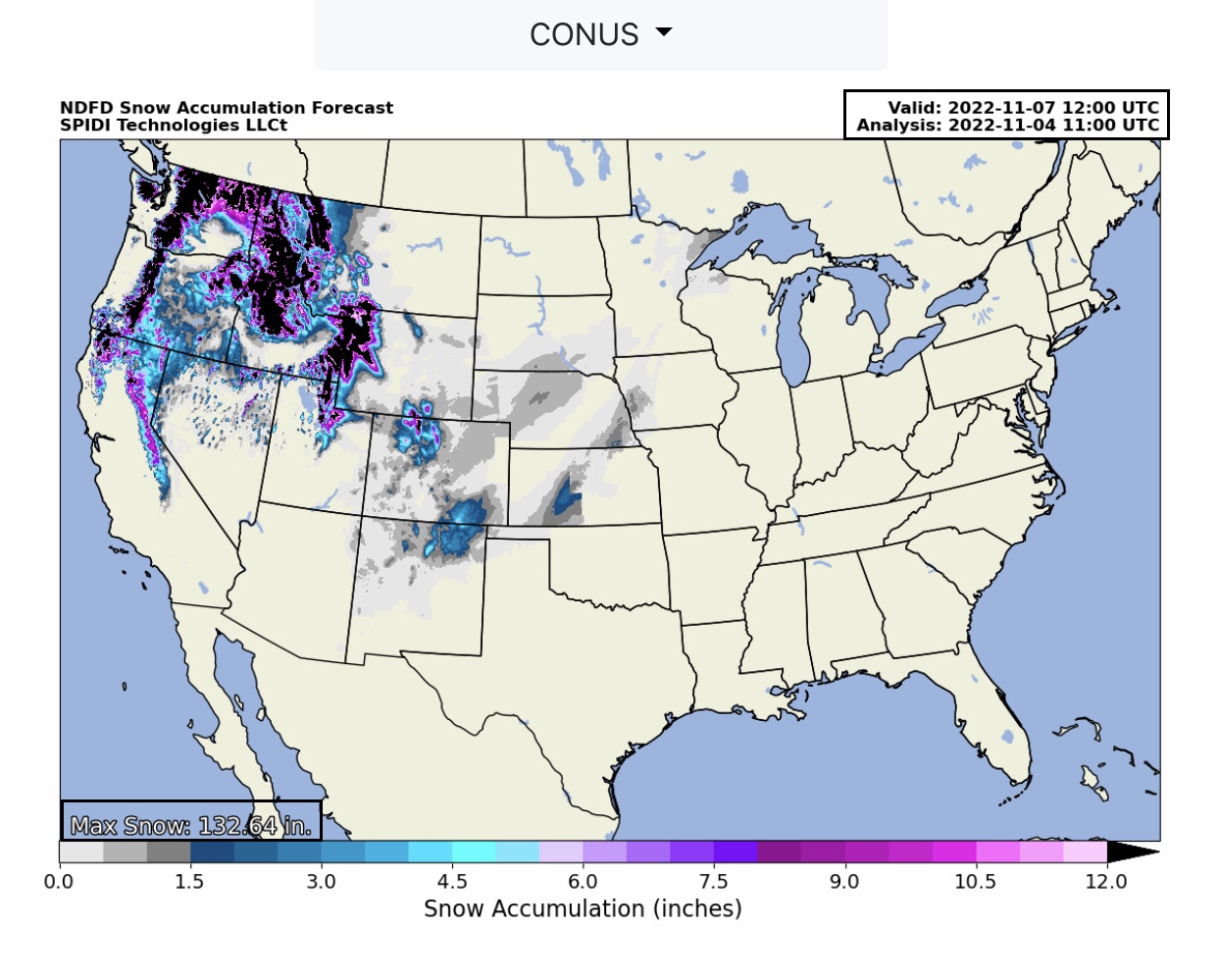
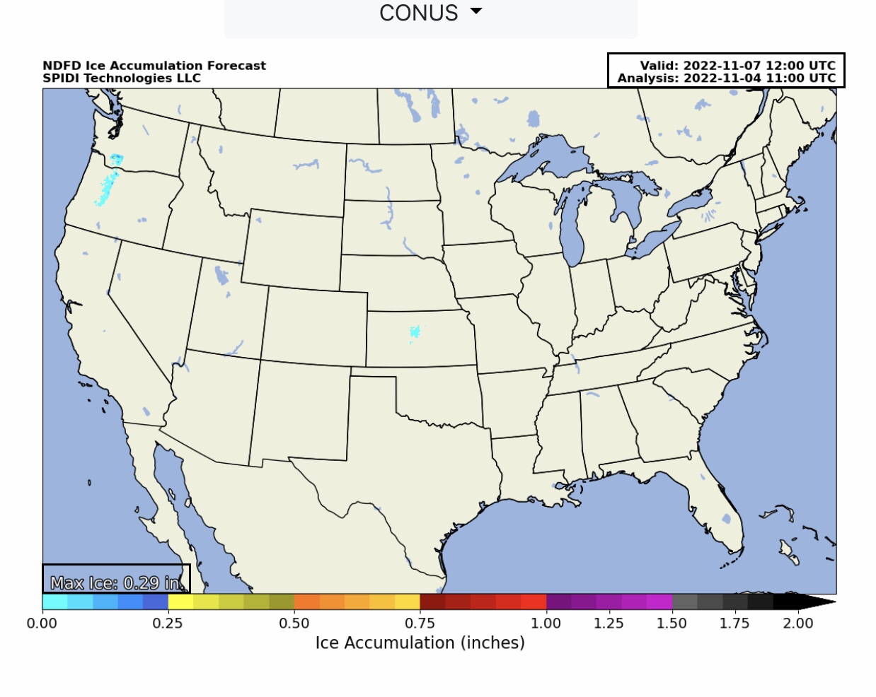
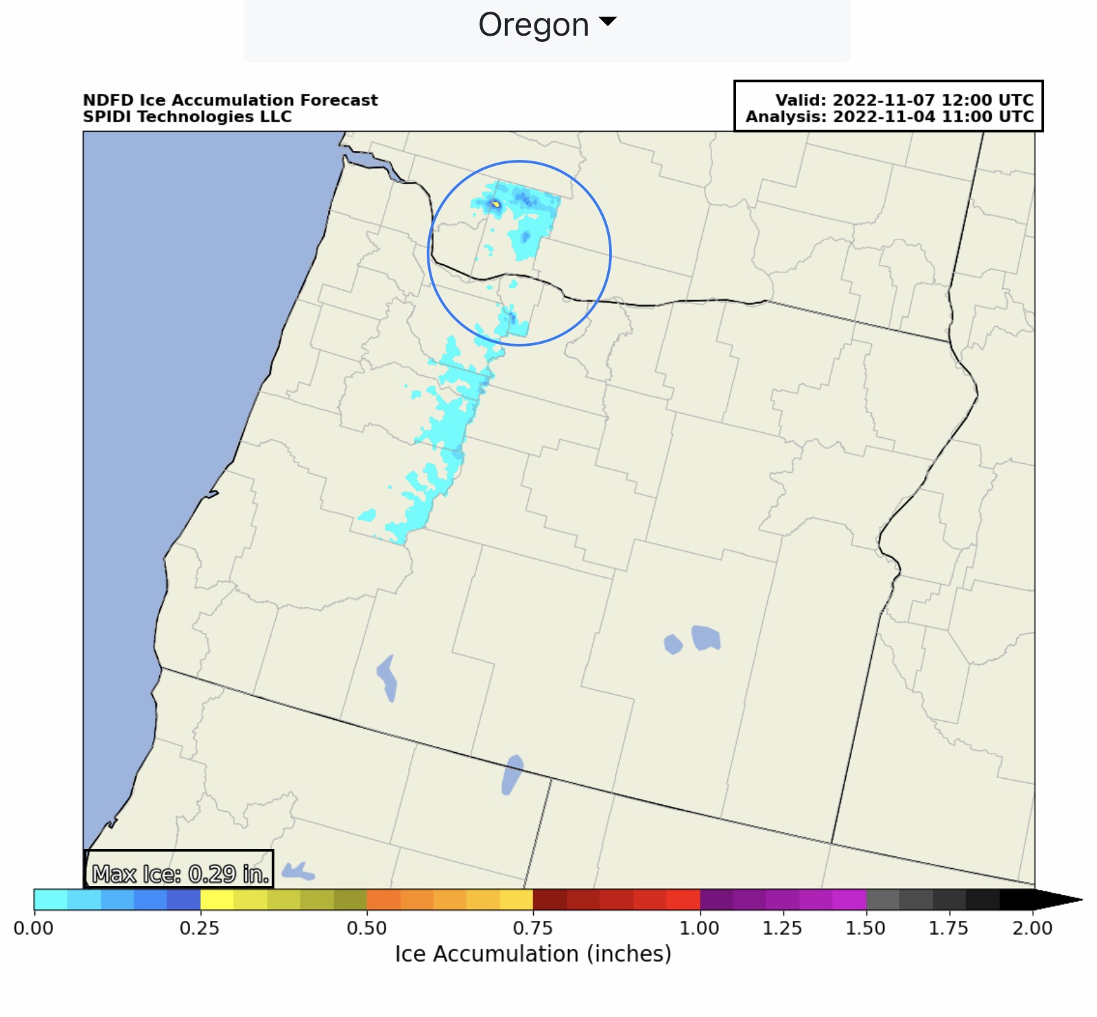
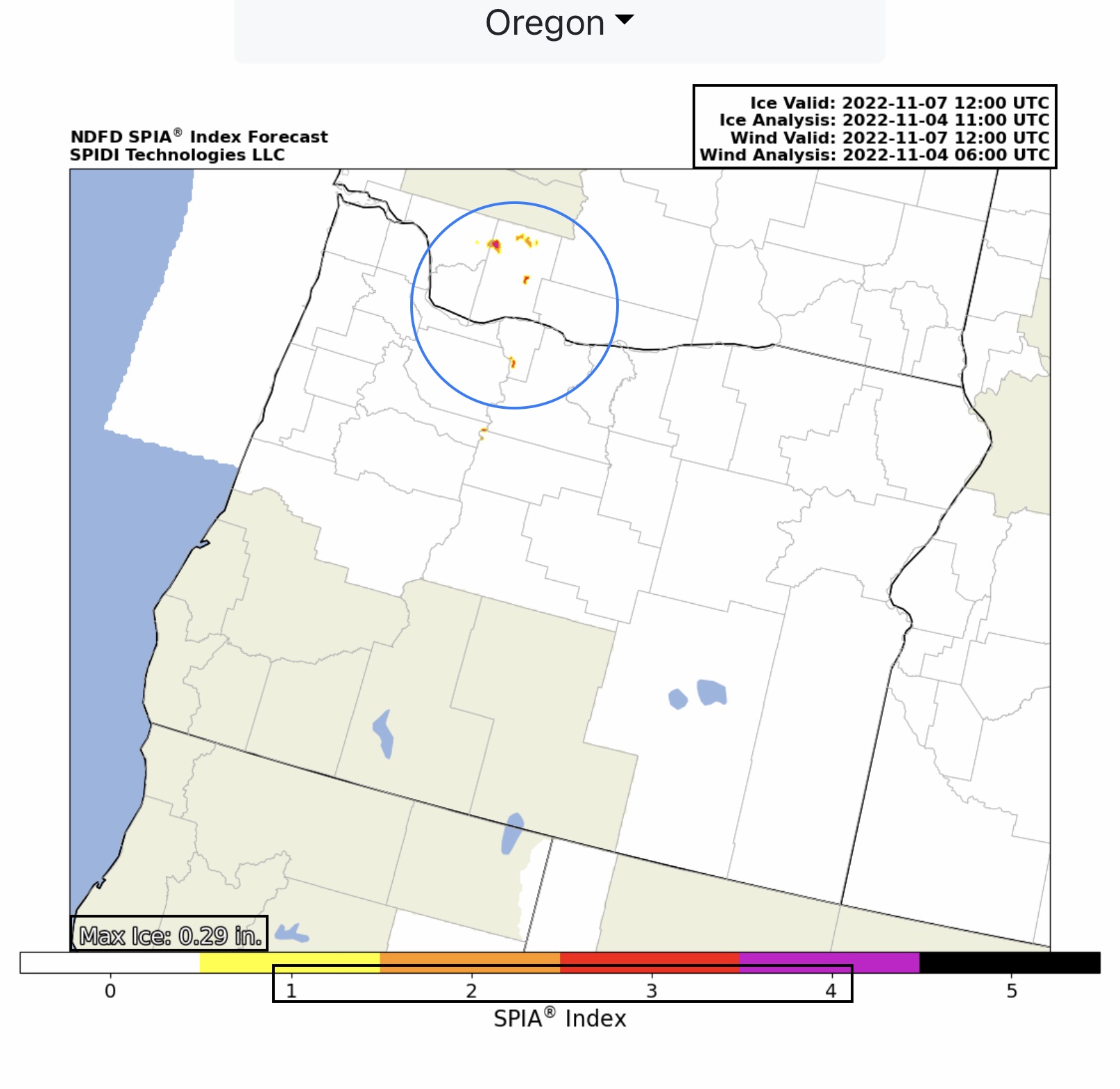
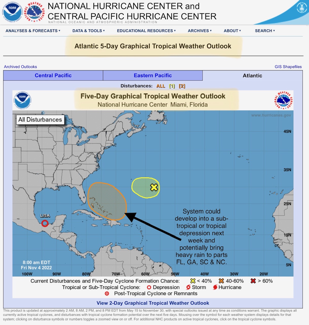
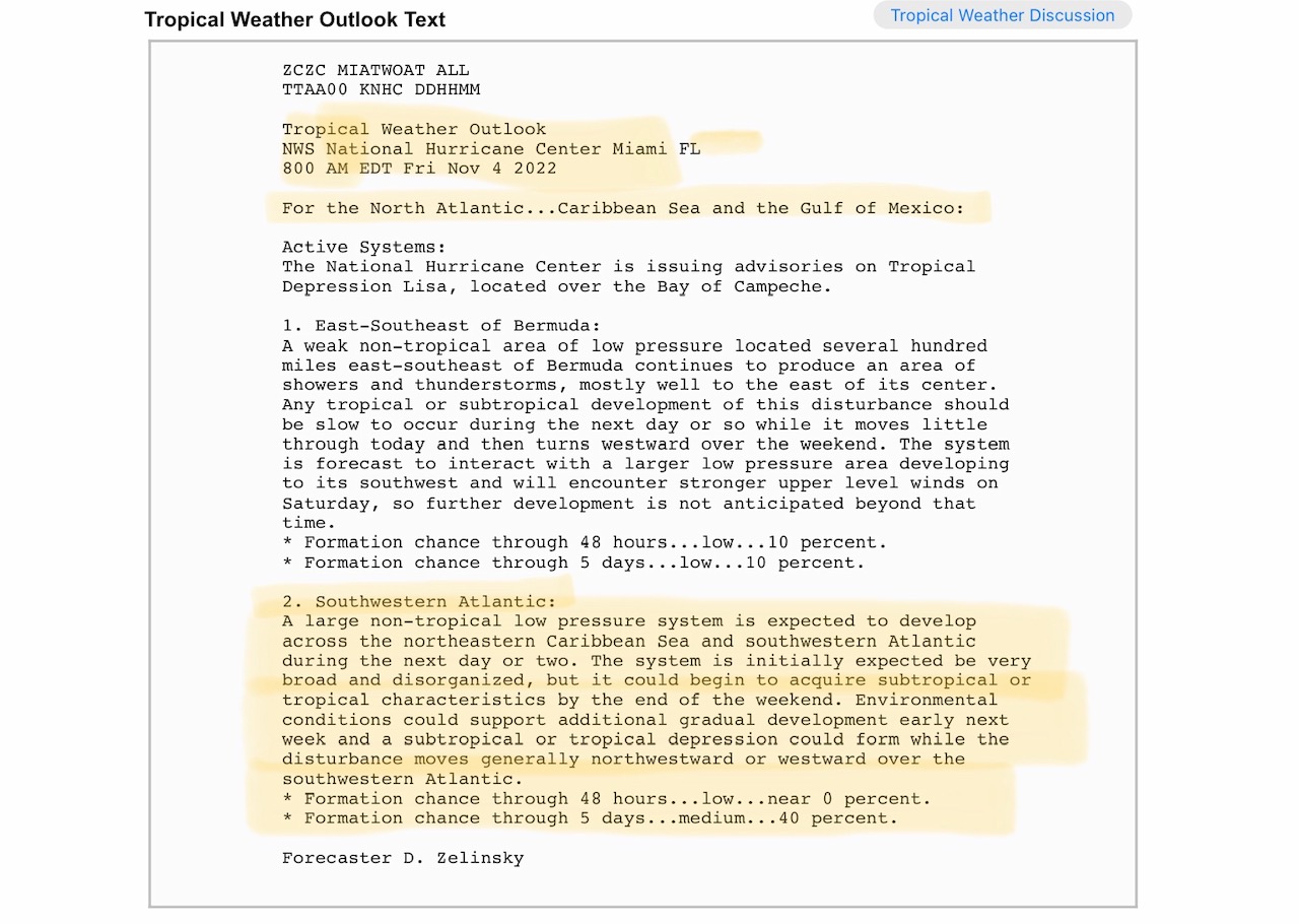
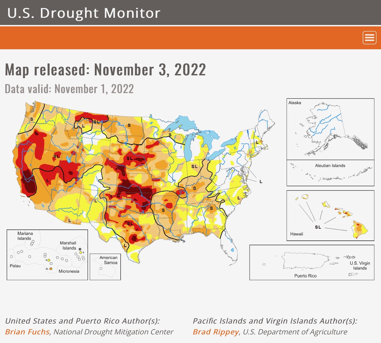
Showers & Thunderstorms today from southern MN to north TX. Heavy snow in the Northwest Region, North & South Rockies Regions. ELEVATED Severe Thunderstorm Risk, High Wind Risk, Hail Risk, and Large Tornadoes Risk parts OK, AR, TX & LA. Ice Accumulation to 0.29” parts southern WA, northern OR. SPIA Index Levels 1 thru 4. Potential sub-tropical or tropical depression could impact FL, GA, SC & NC next week. Extreme Drought persists, parts TX, OK, KS, NE, UT, CA, OR…
Sidney Sperry 04 Nov 2022 12:32 UTC
Sid Sperry
President & CEO
SPIDI Technologies, LLC
SPIDItech.com
Cell: (405) 627-7754
Email(s): SidSperry@gmail.com  OR  Sid.Sperry@spidiweather.com

Sent from my iPad

 Show/hide attachments