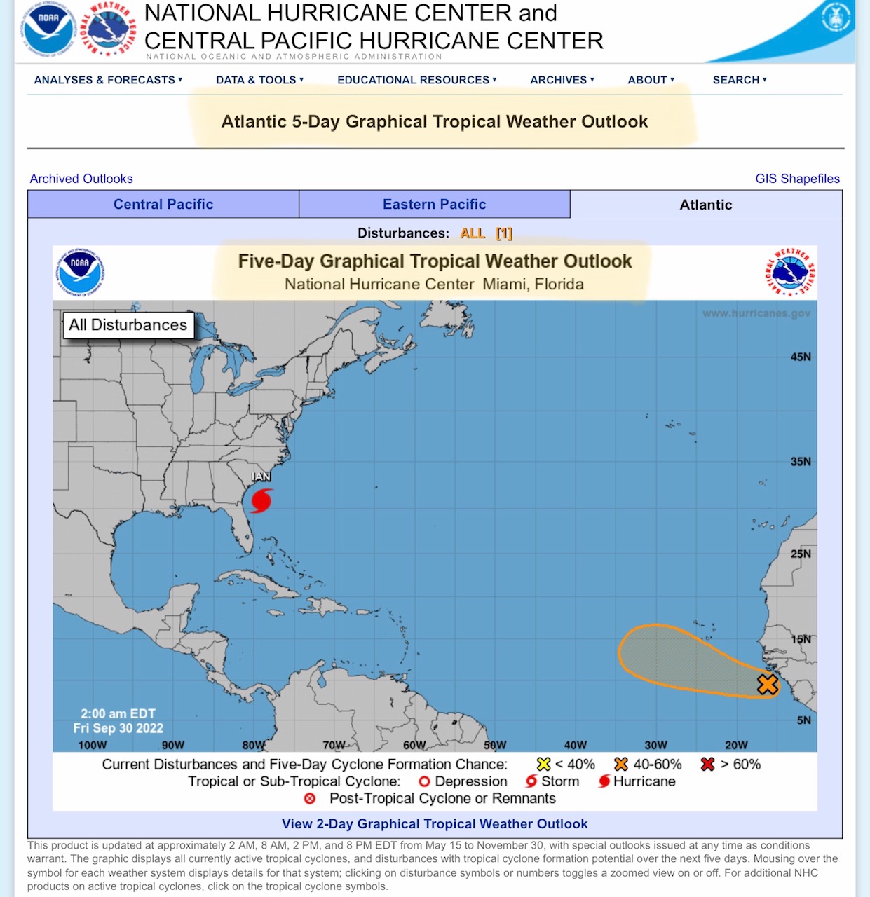
Latest (5am EDT 9/30/2022) NHC and NWS Updates…
Sidney Sperry 30 Sep 2022 10:19 UTC
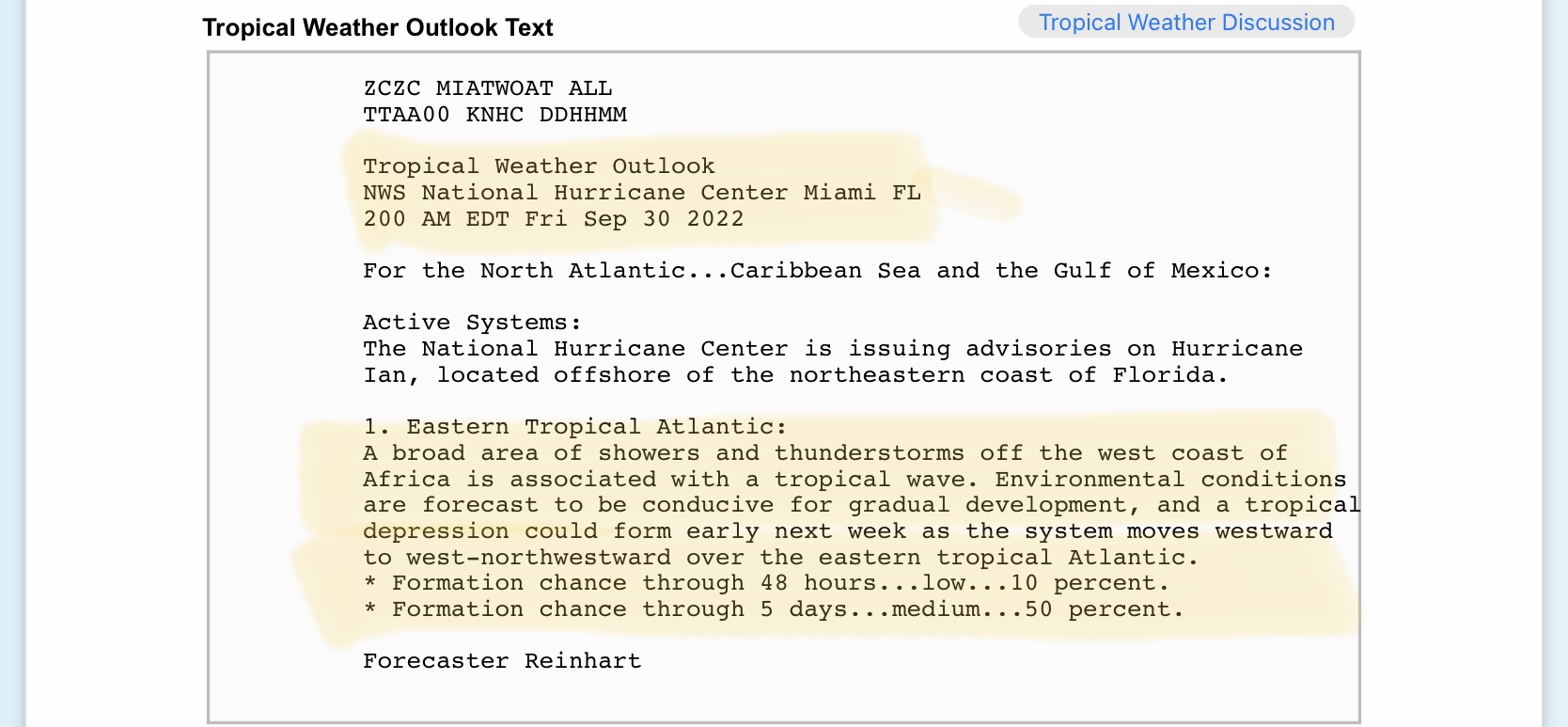
A Tropical Wave off of the African coast now given a 50% chance of development into a Tropical Depression by early next week. One to watch over next 7 to 10 days.
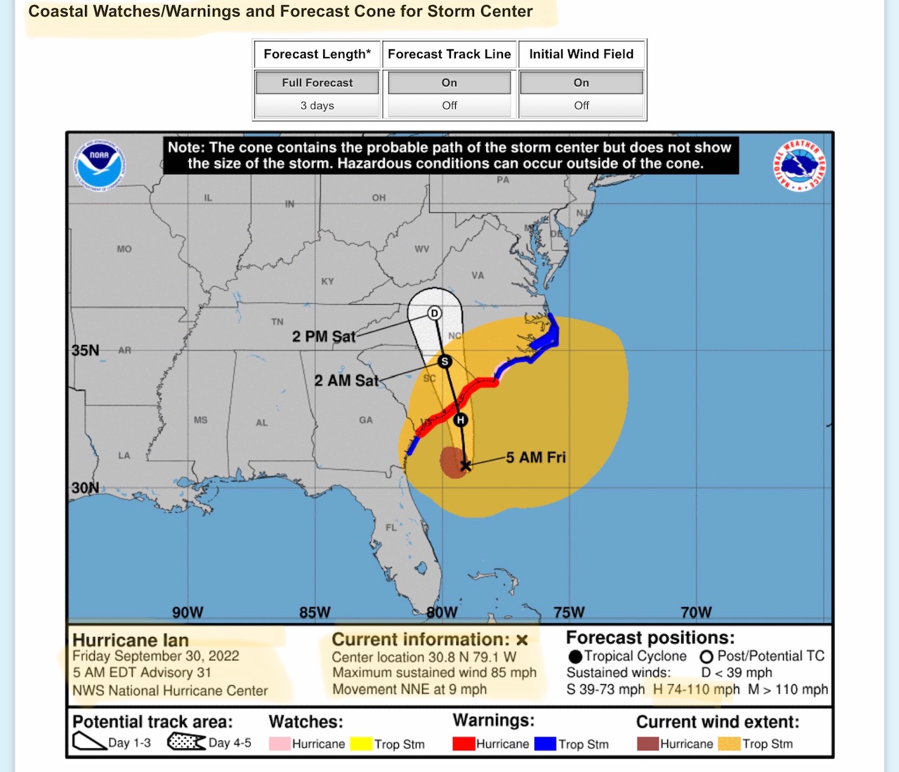
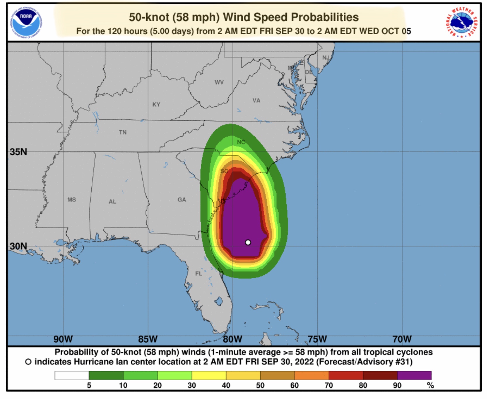
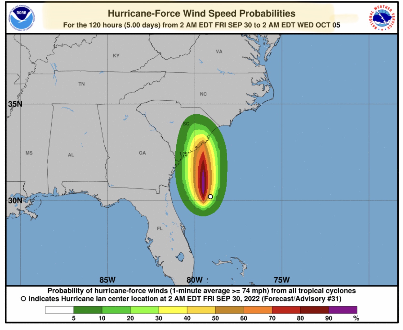
As of 5am EDT Friday, 9/30/2022, Hurricane Ian is still a Category 1 hurricane circulating about 145 miles south-southeast of Charleston, SC. Max sustained winds are 85 mph and its movement is still north-northeast at 9 mph. It is expected to turn more toward the north later this morning. Ian is forecast to make landfall later this afternoon between the Charleston-Mount Pleasant-Myrtle Beach area as a Category 1 hurricane.
Storm Surge could reach 4’ up to 7’ in the aforementioned projected landfall area today. Storm Surge Warnings and Hurricane Warnings have been issued for the entire South Carolina coastline and parts of the southeastern North Carolina coast. Tropical Storm Warnings extend to the NC-VA border and to parts of the southeast GA coast.
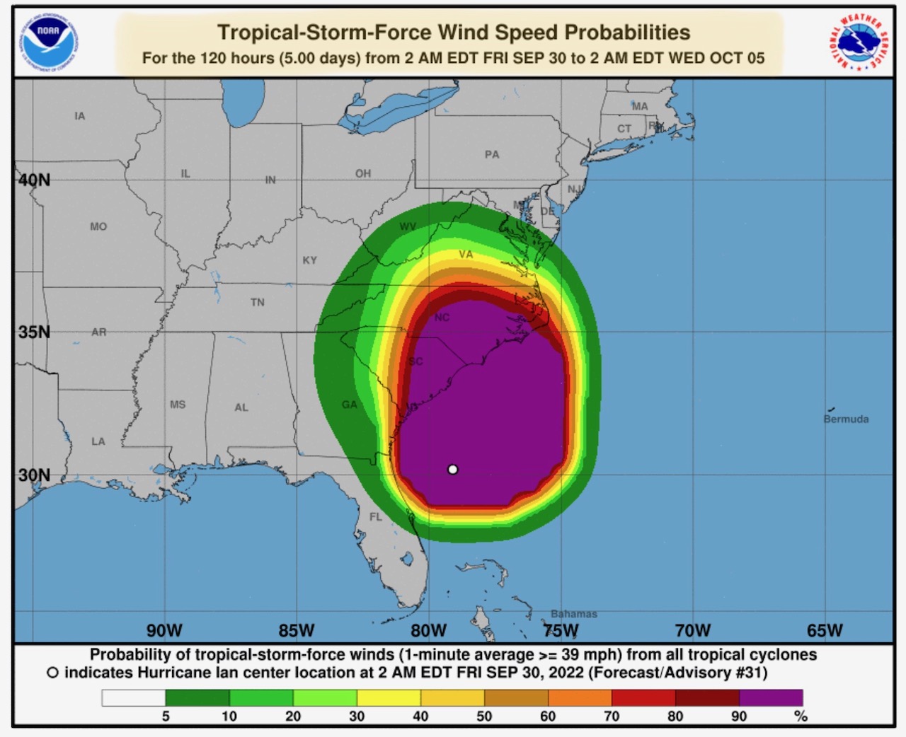
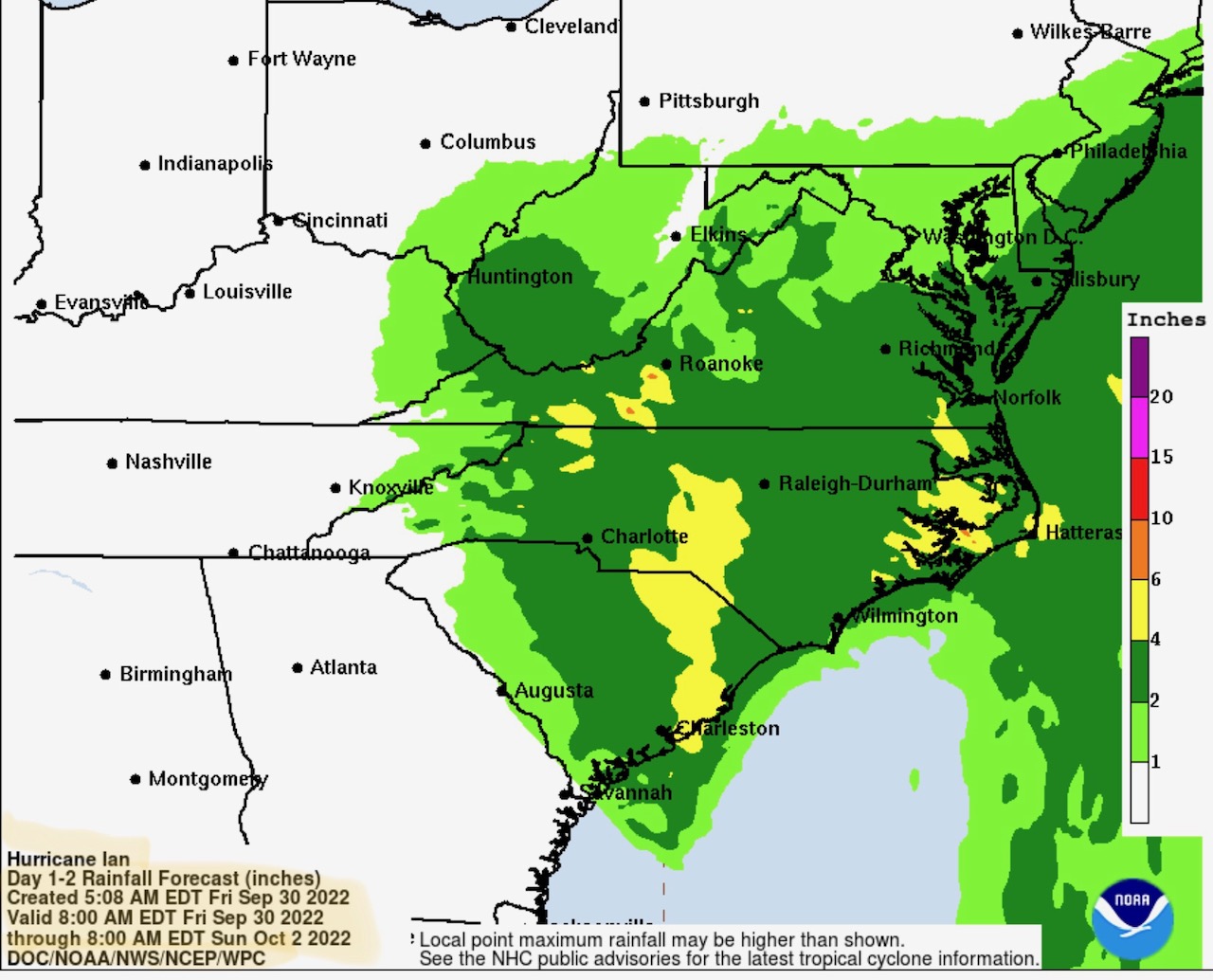
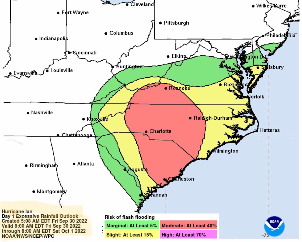
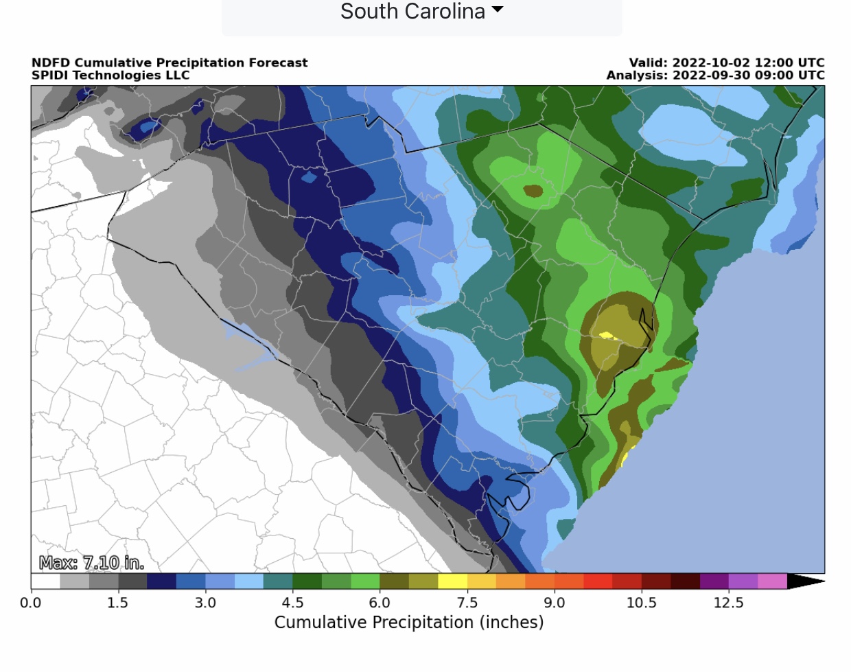
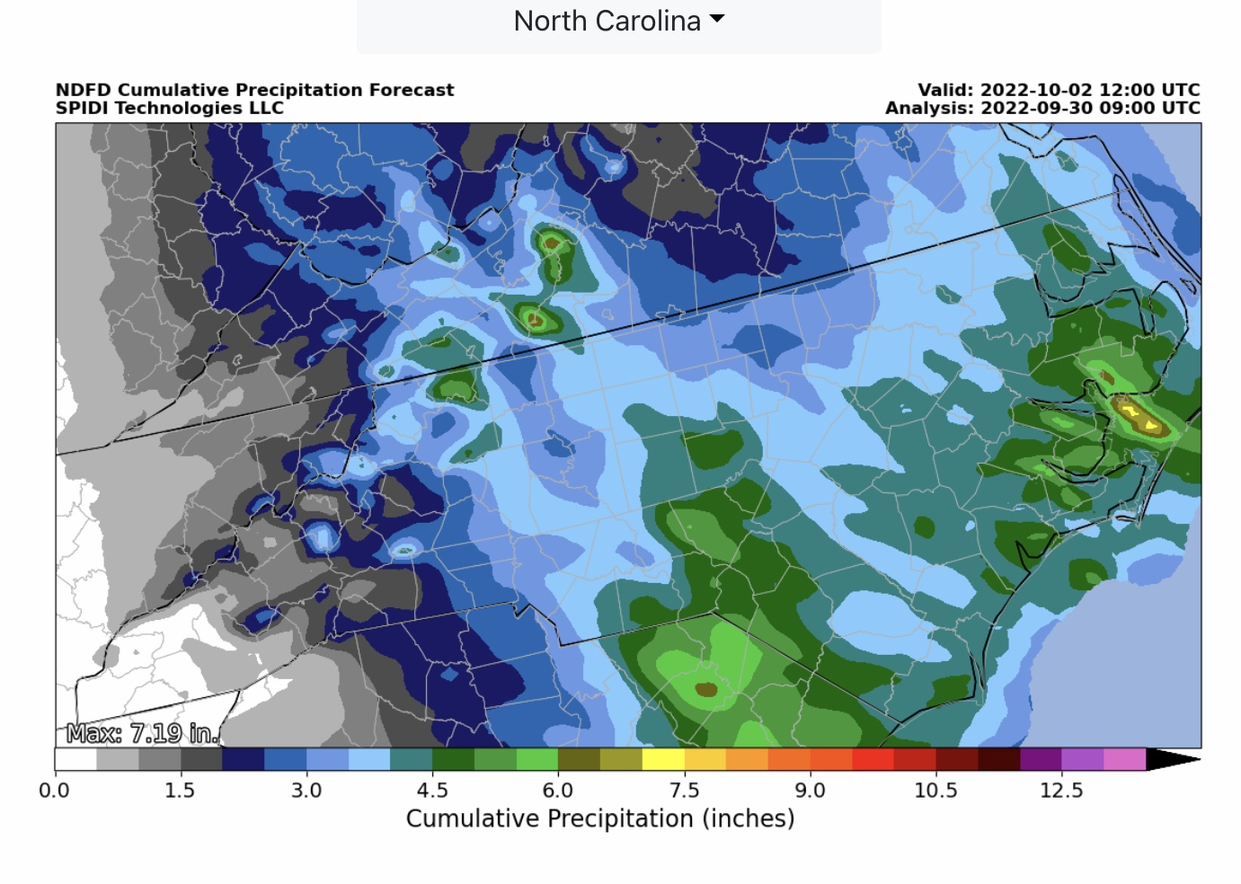
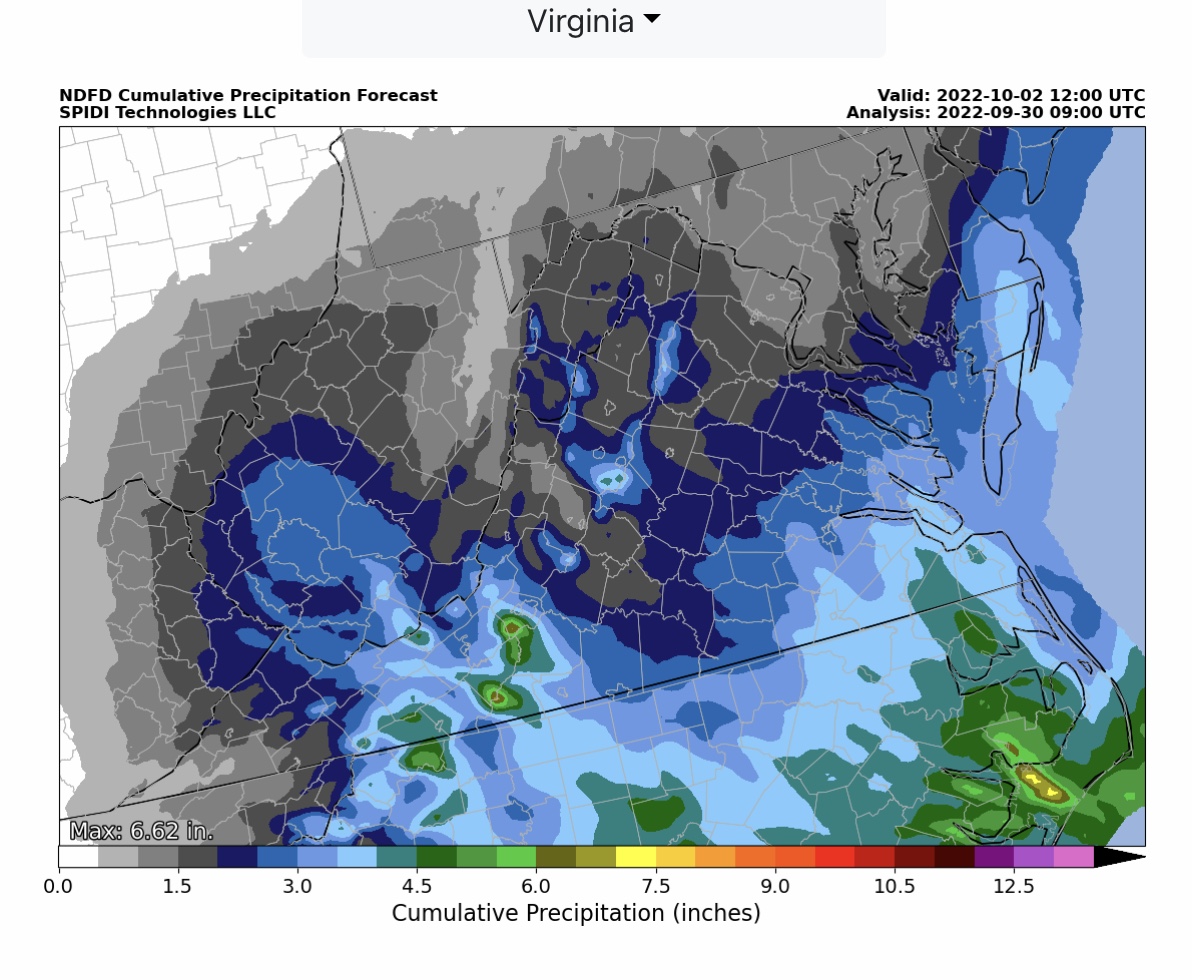
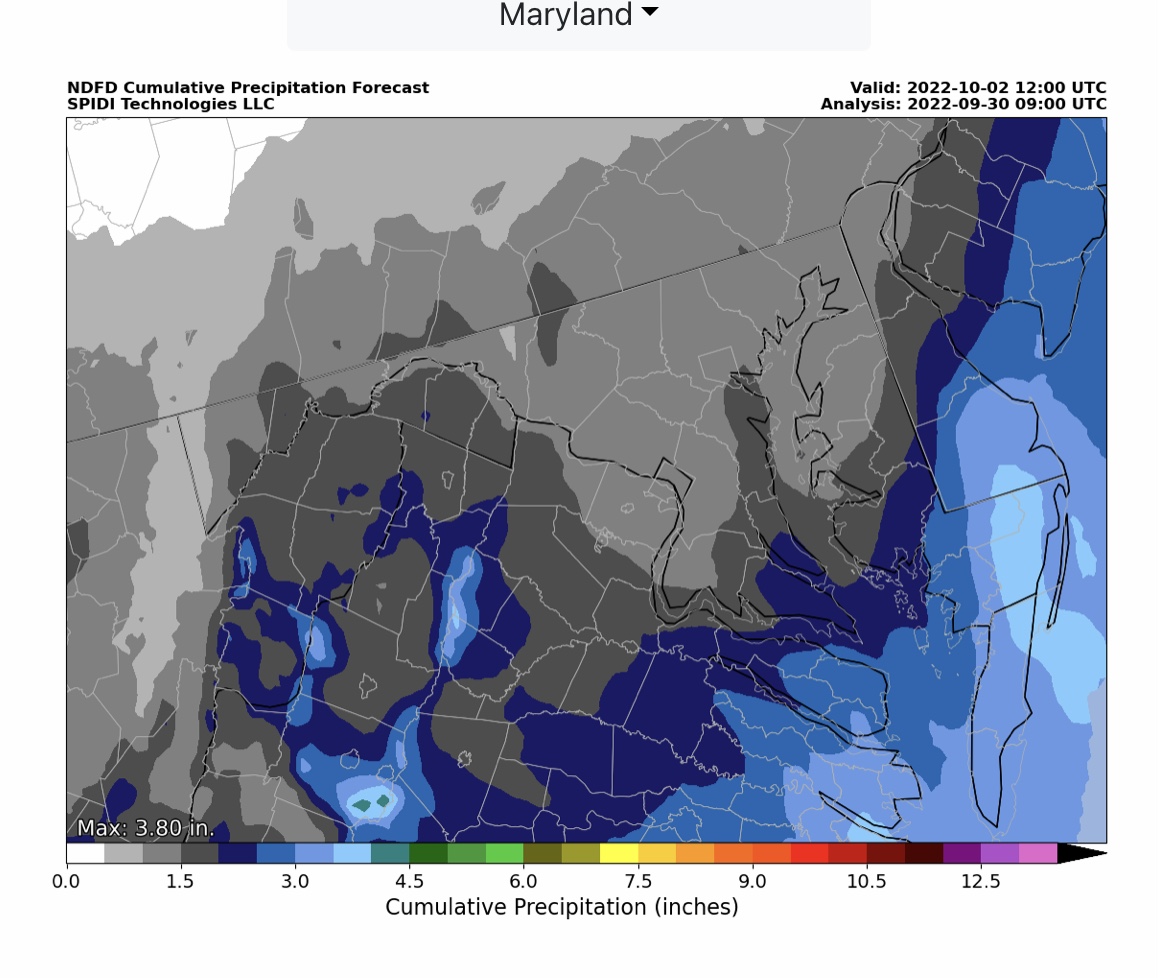
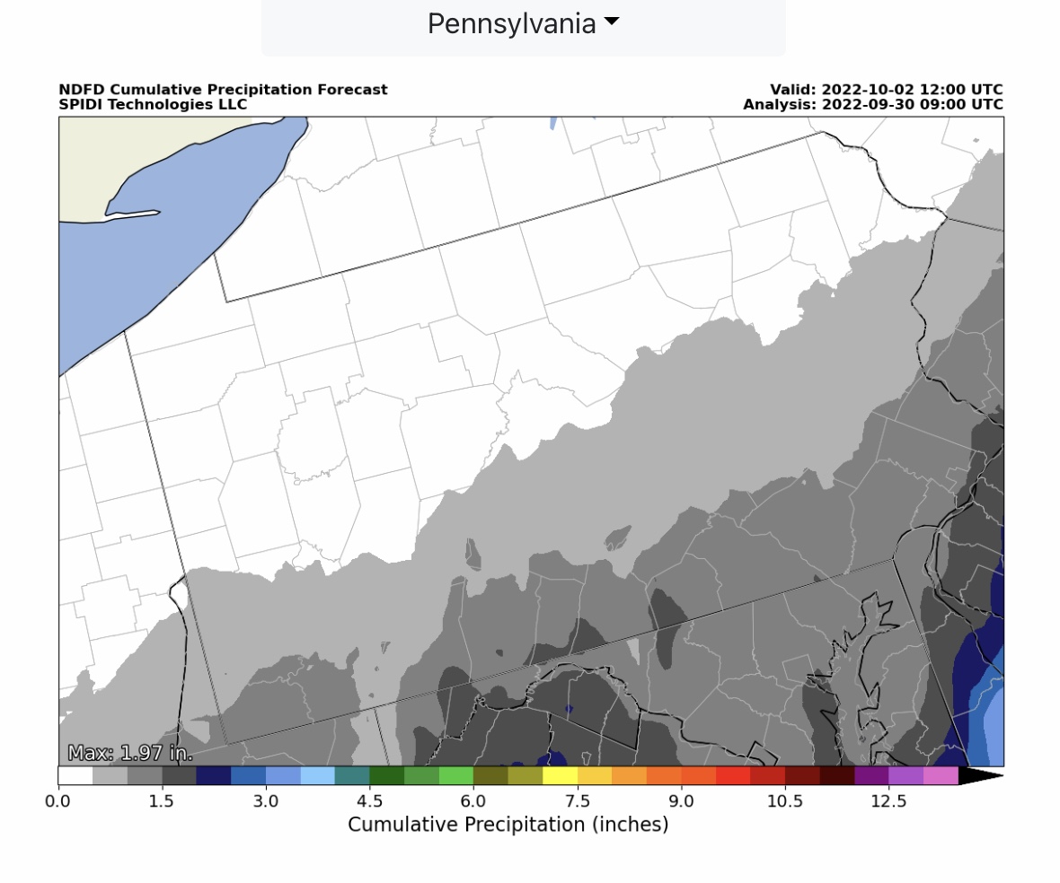
Two-day rainfall forecast totals are in the 1” to 6”+ range for parts of SC, NC, VA, MD, WV, DE, NJ, TN, KY, OH and PA. Extensive flooding and flash flooding is possible mainly in parts SC and NC and into parts southwestern VA over the next 2 days as Ian begins to fade into a post-tropical depression on Saturday evening.
Sid Sperry

 Show/hide attachments