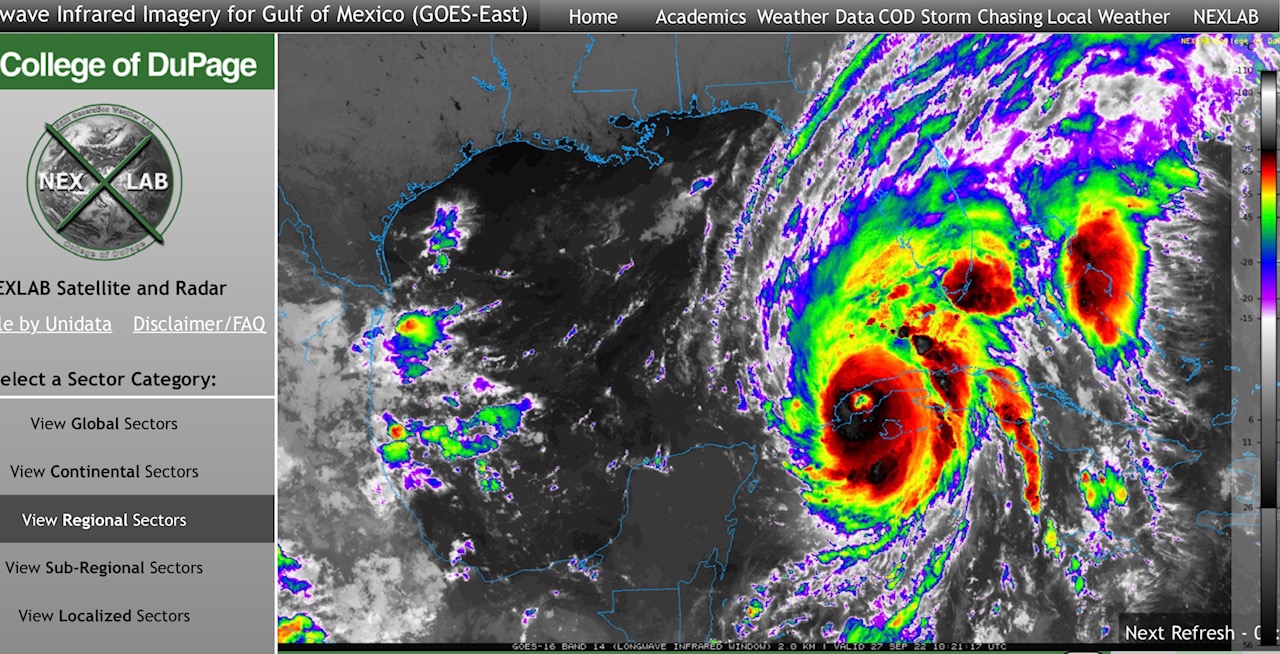
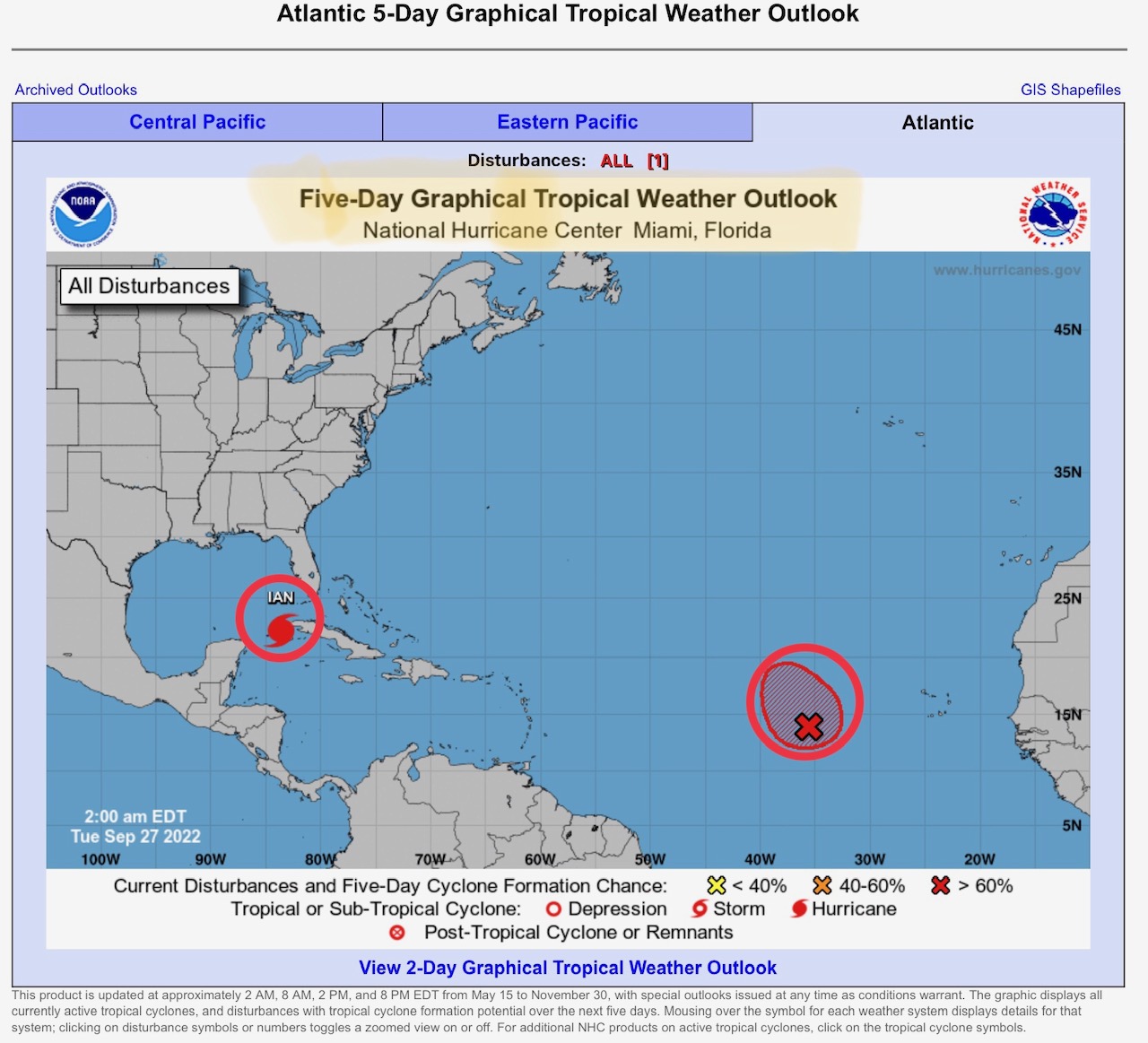
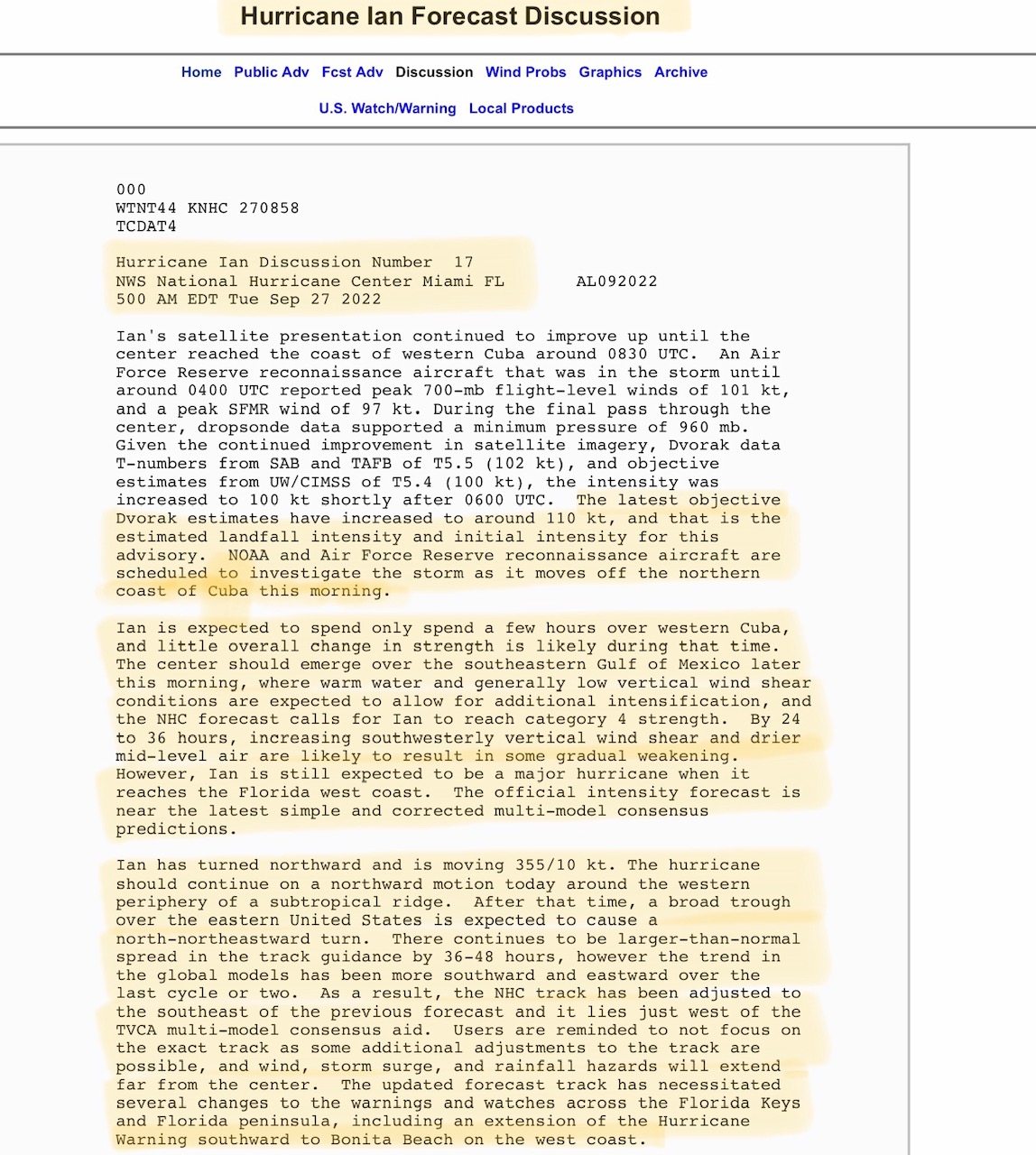
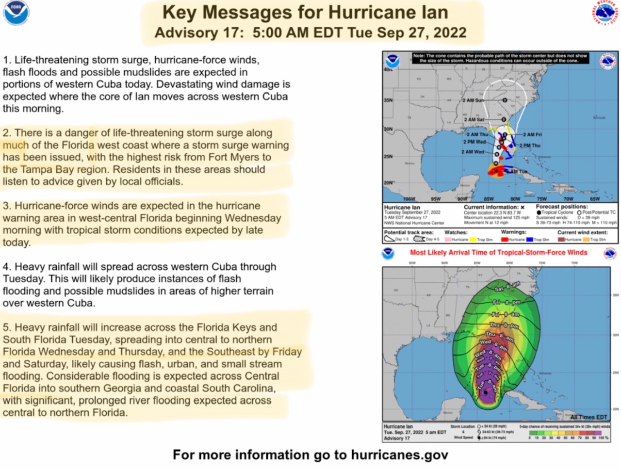
Hurricane Ian now a Category 3 Hurricane with max sustained winds of 125 mph. Landfall over Cuba already made, now moving north at 12 mph away from Cuba and into the eastern Gulf, where it is expected to intensify into a Category 4 hurricane…
Sidney Sperry 27 Sep 2022 11:16 UTC
Good morning all.
Ian is shaping up to be one of the most devastating hurricanes to hit west-central Florida and the Tampa Bay-Clearwater-St. Petersburg-Sarasota areas in the last 101 years. The last Category 3 hurricane to hit the Tampa Bay area was in 1921.
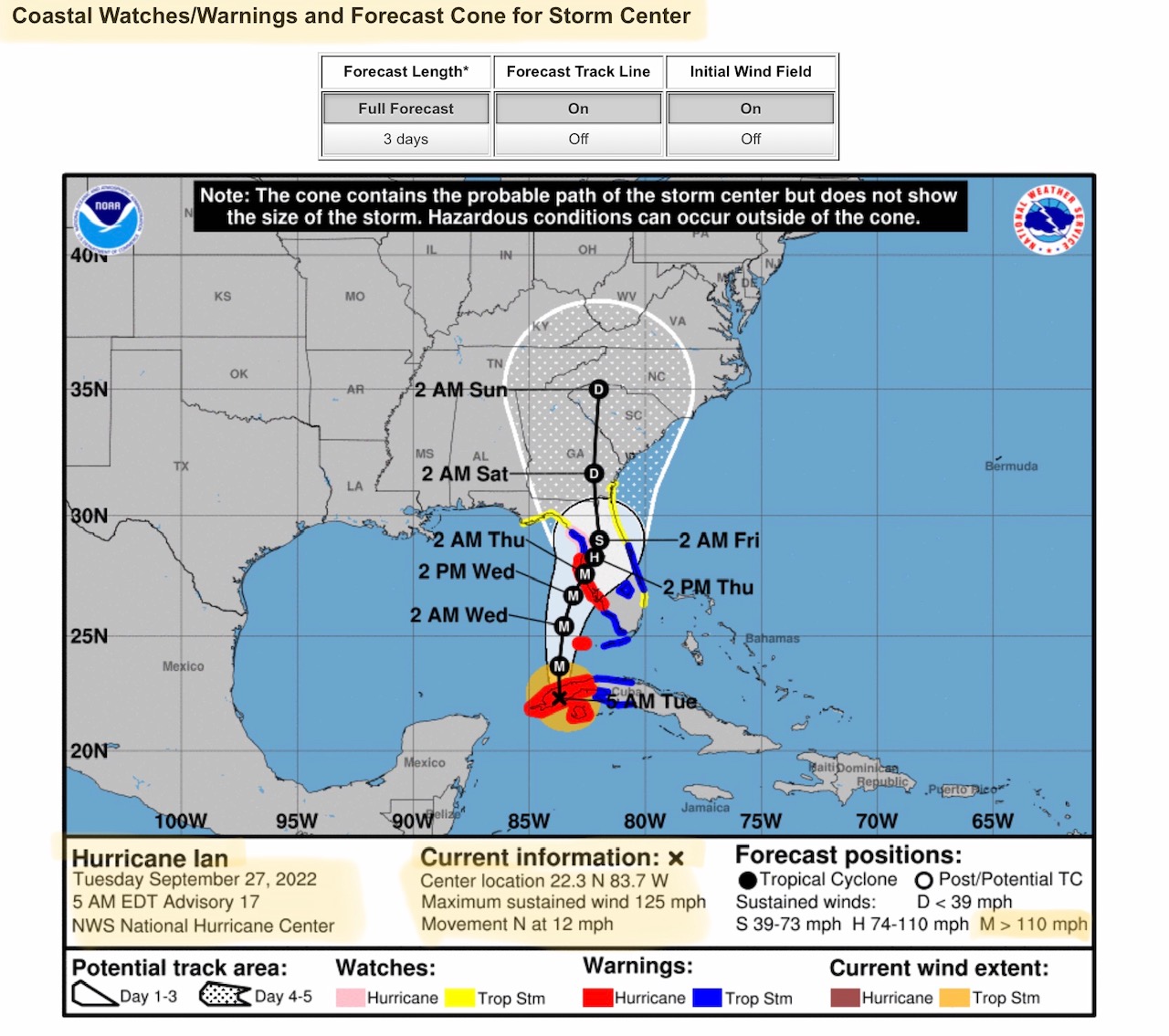
The NHC has again shifted the forecast track for Ian a bit further east, with a possible direct hit early Thursday morning on the areas and cities mentioned above. Ian will potentially be a Category 3 hurricane at landfall, or a strong Category 2 at least. The sustained wind range will be in the 90 mph to 129 mph range according to the NHC.
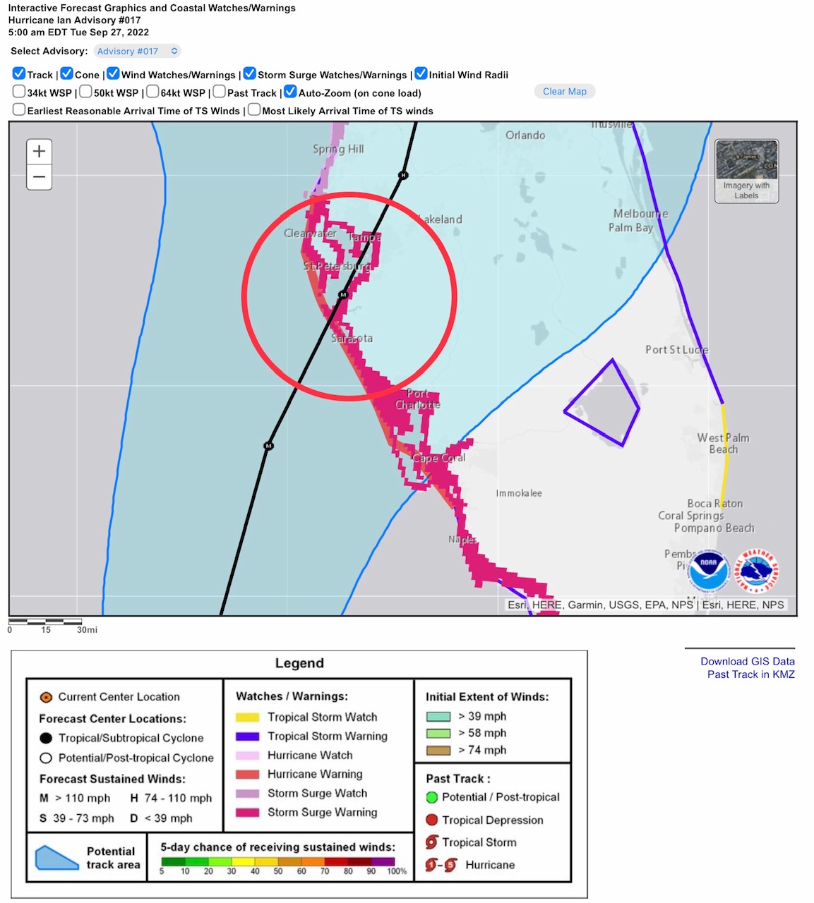
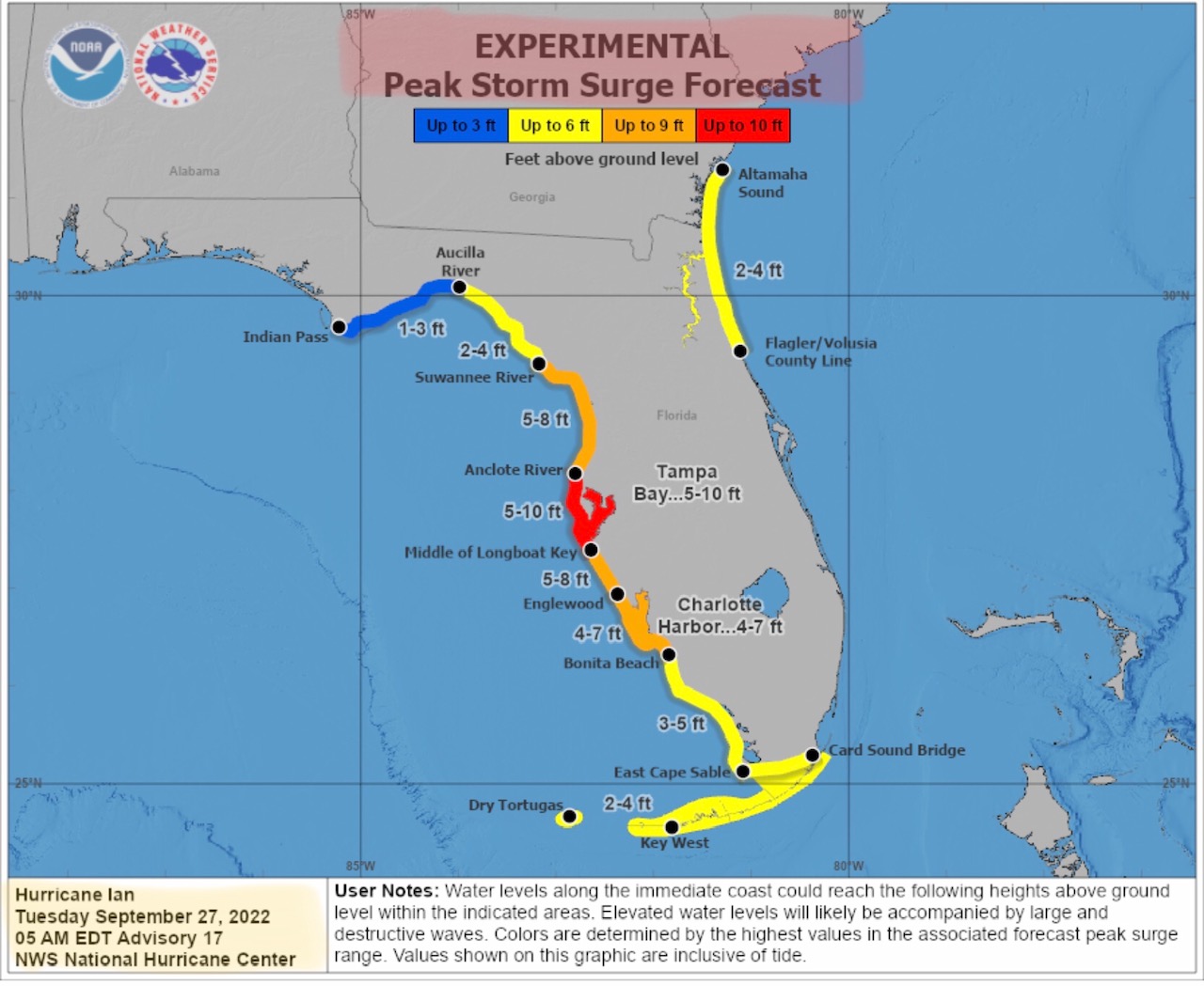
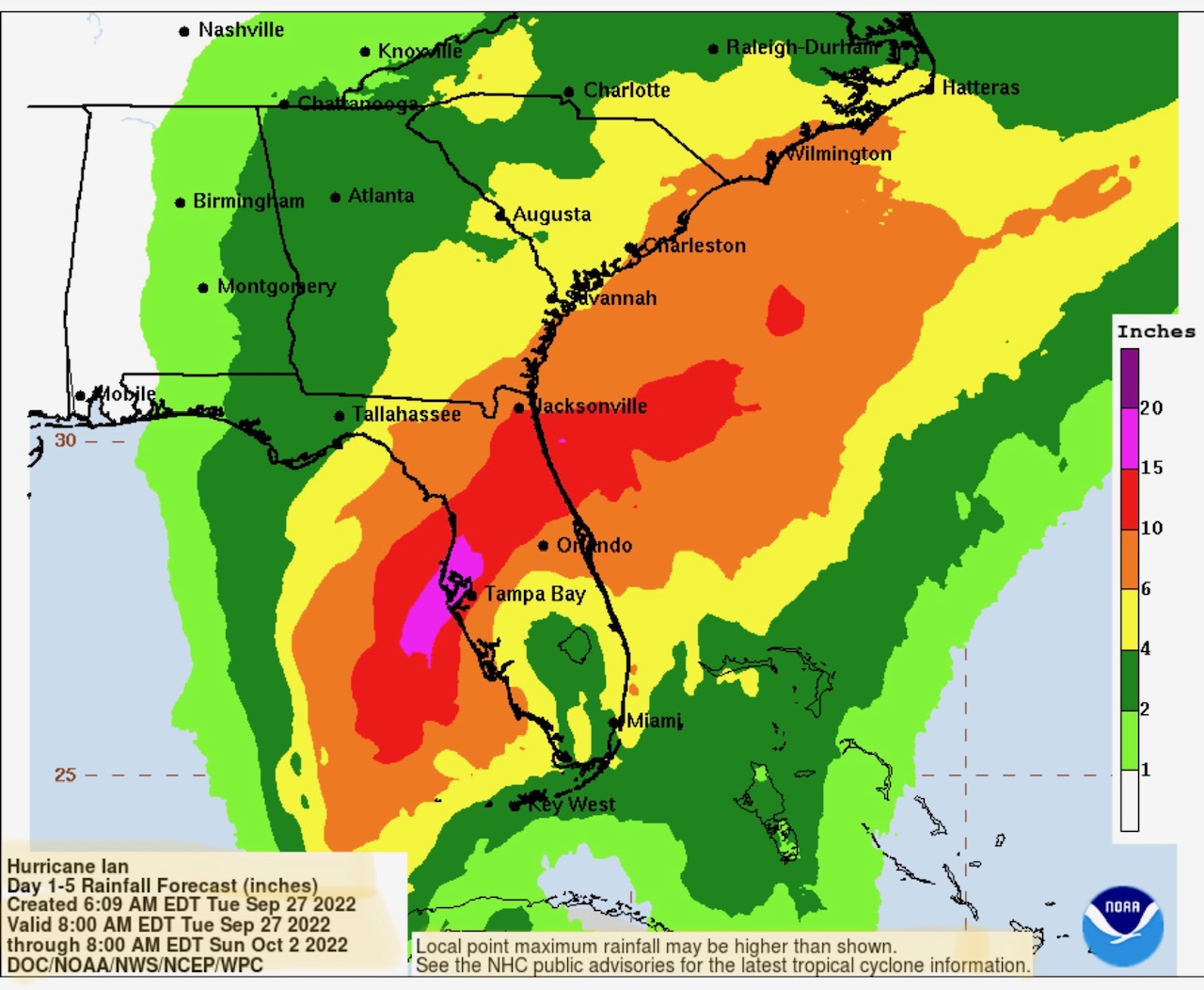
Storm surge is expected to range from 4’ to 10’ + in some areas of west-central Florida. Total rainfall amounts over the 5-day period from Tuesday through Sunday could be as high as 15” to 20”+ in some areas, adding to the storm surge danger. Storm Surge Warnings now issue from near Spring Hill, FL to south of Naples, FL. If residents in this stretch of western FL and in the designated high storm surge areas have not evacuated to safe areas outside of the high risk zones, they need to do so today according to Florida Department of Emergency Management officials.
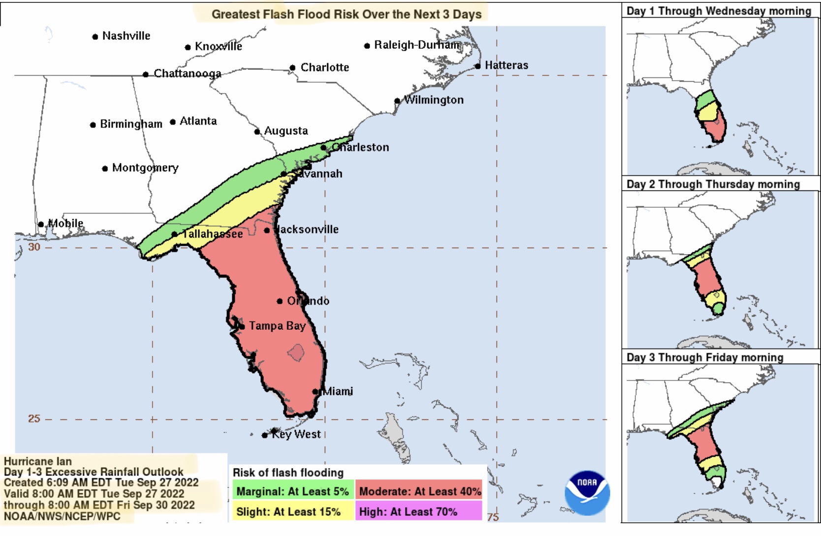
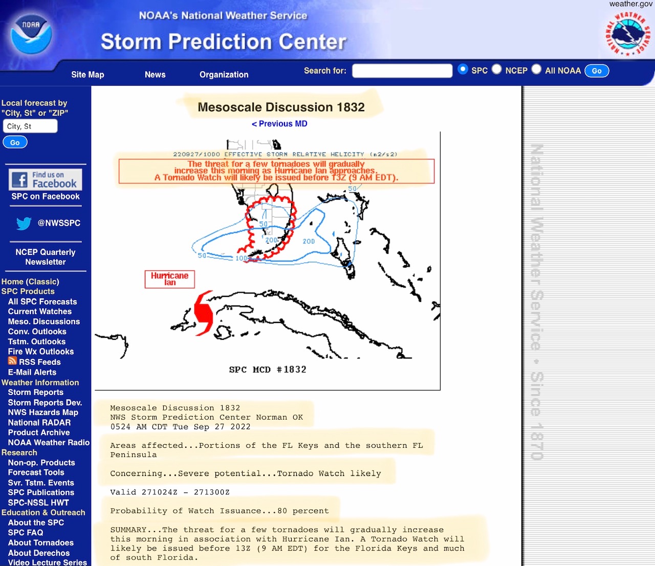
Once landfall has been made on Thursday, wind speeds will still be in the 39 mph to 73 mph range as Ian moves into northern FL and southeastern GA on Friday and early Saturday. Heavy rainfall and extensive flooding and flash flooding expected for much of FL, and parts of GA, SC, eastern TN and western and central NC, eventually impacting south-central VA and western VA with heavy rainfall of from 2” to 6” or more. Some tornadoes are also possible across FL, southern GA, and southwestern SC over the next 4 days.
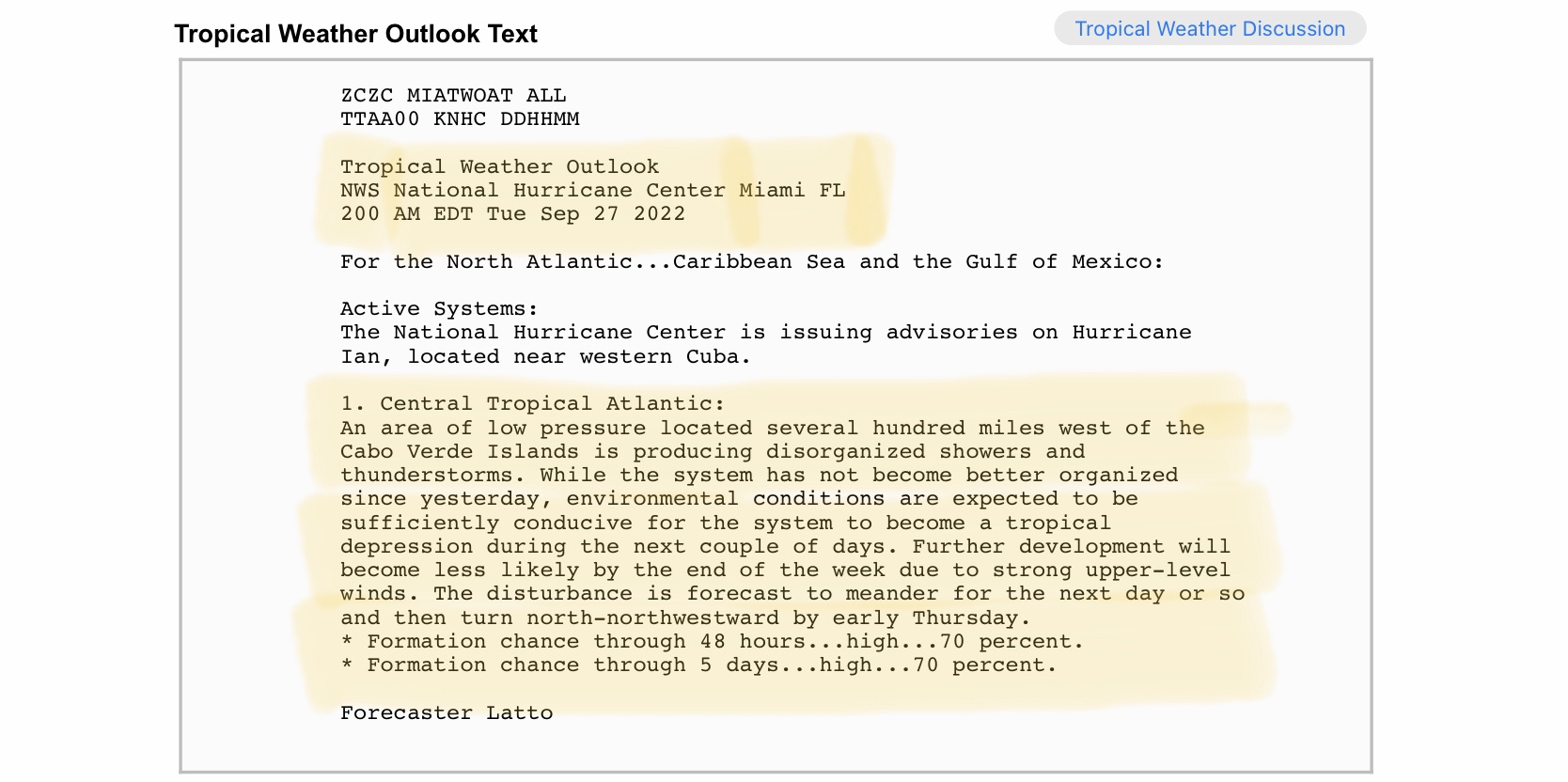
And… yet another Tropical Wave has developed west of the Cabo Verde Islands in the eastern Atlantic, and NHC is giving it a 70% chance of development into a Tropical Depression within the next 48-hours. Again, another potential system to watch.
Sid Sperry

 Show/hide attachments