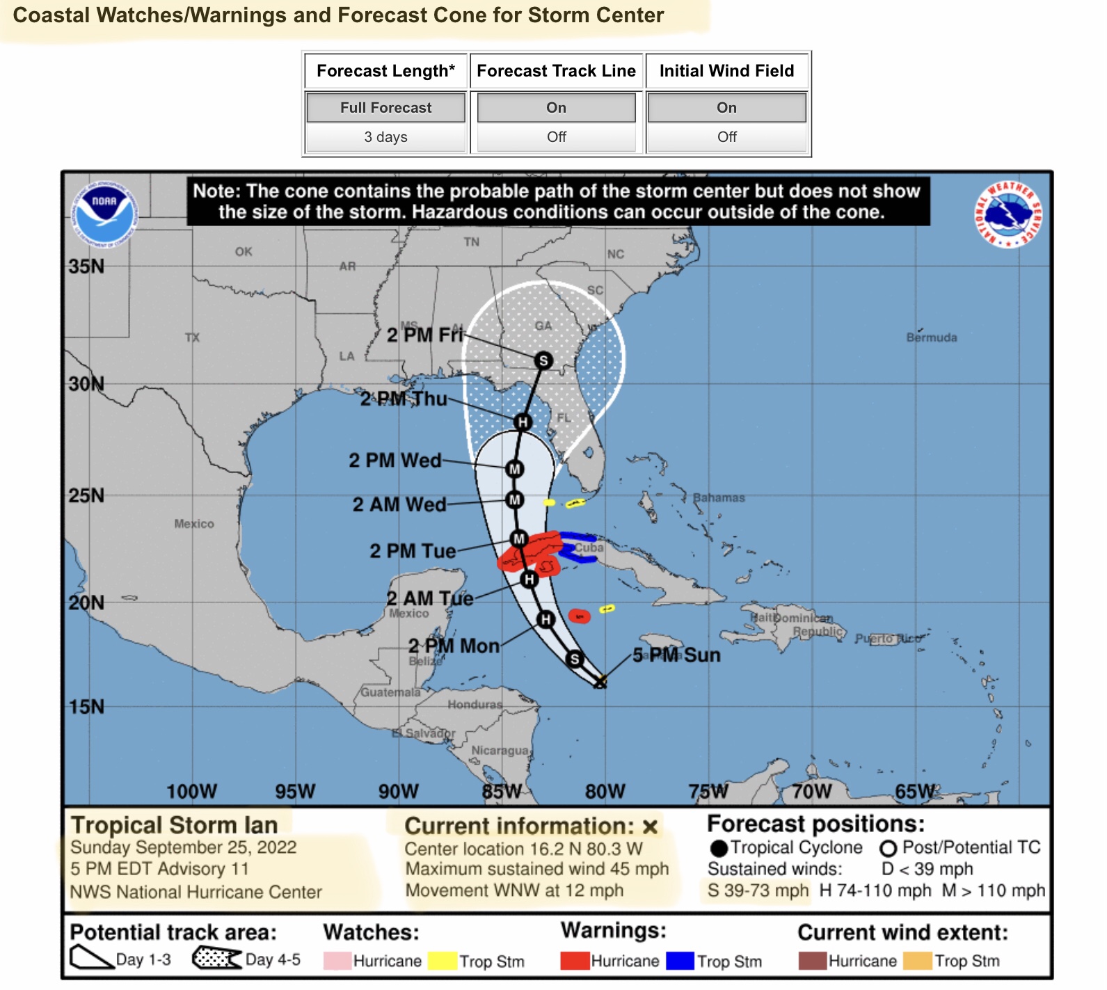
5pm EDT 9/25/2022 NHC Update on Tropical Storm Ian…
Sidney Sperry 25 Sep 2022 22:11 UTC
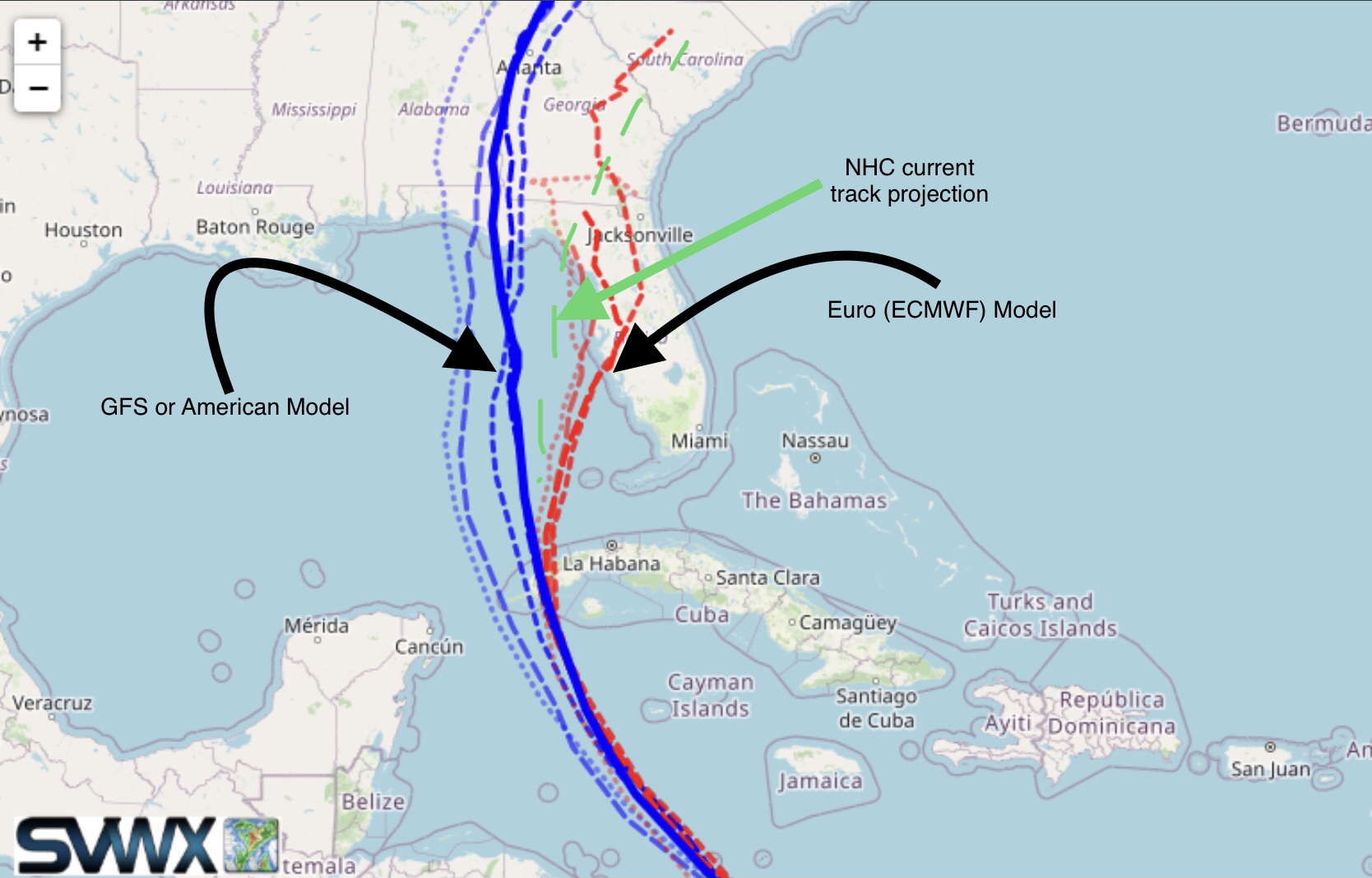
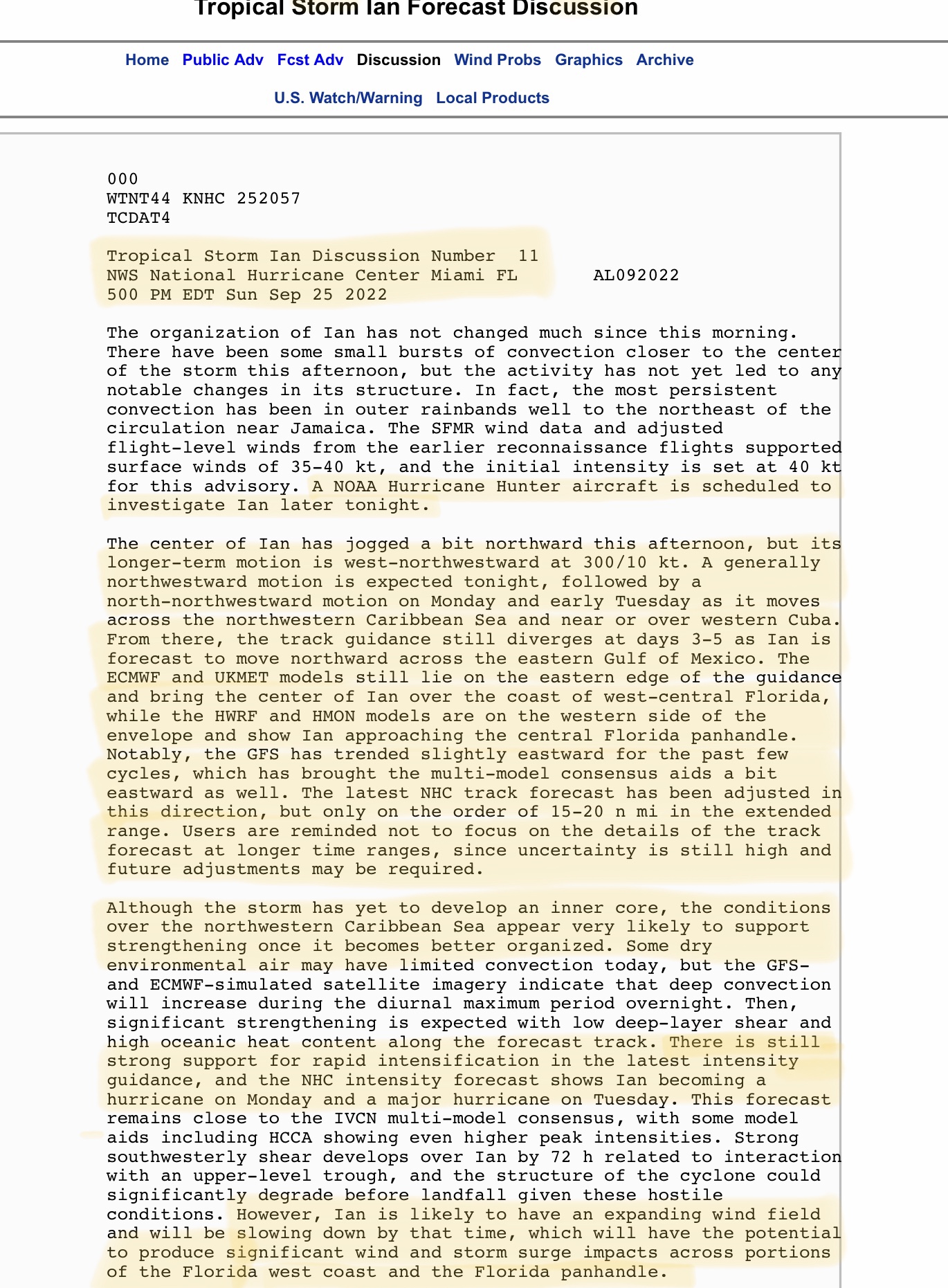
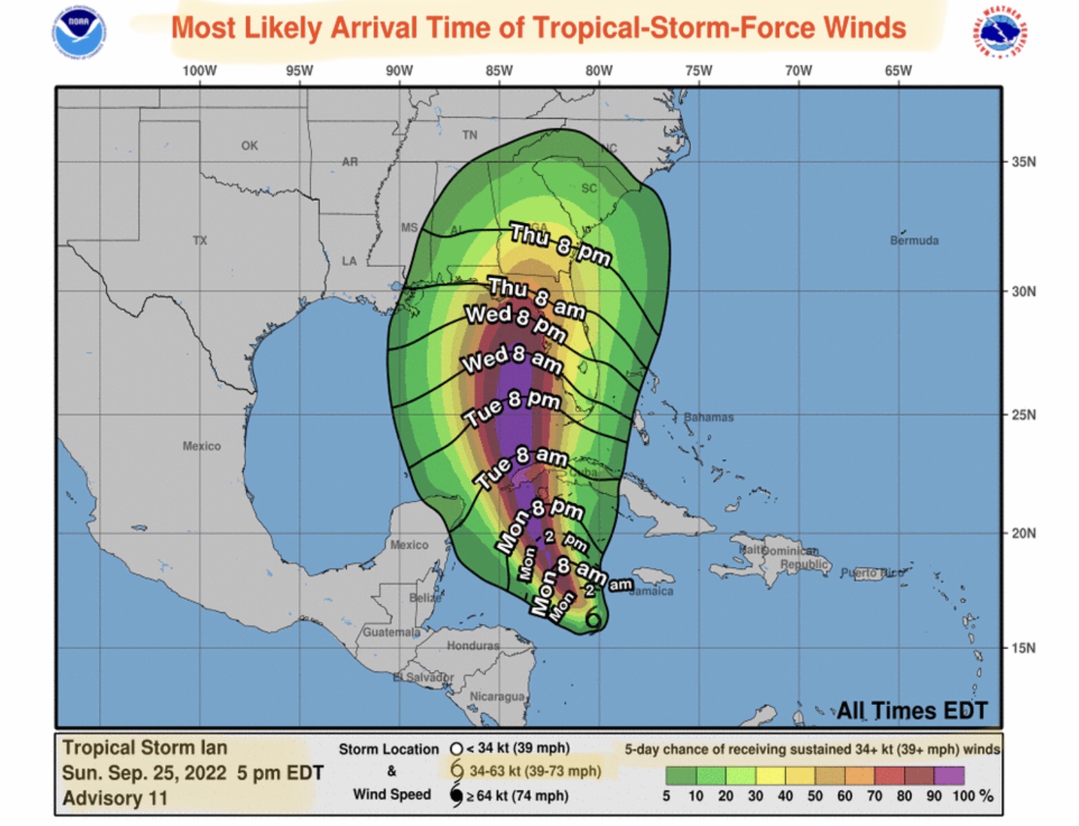
Slight track change to the east. NHC appears to be splitting the model guidance from the GFS (more to the west) and the Euro (ECMWF - more to the east) in their latest track projections. Still forecasting a strengthening into a Major Hurricane by Tuesday afternoon but some weakening in intensity prior to landfall late Thursday night or early Friday morning.
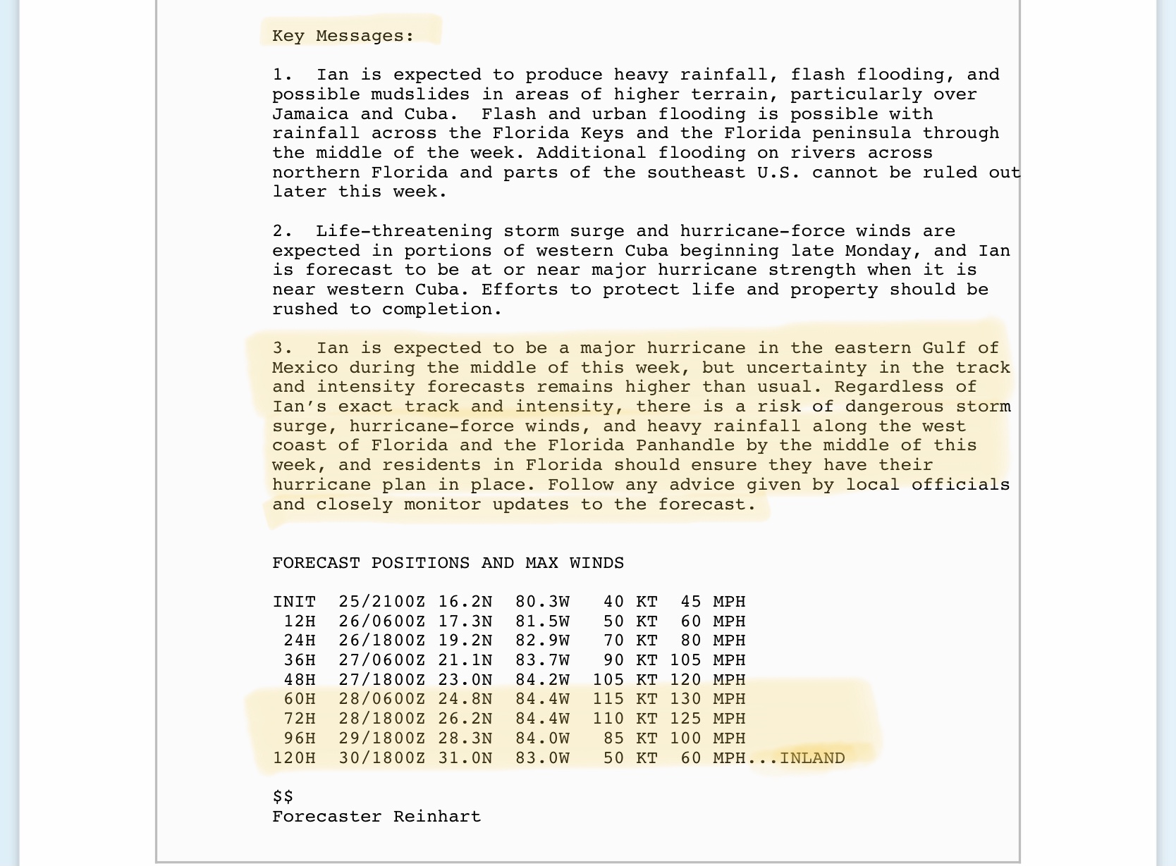
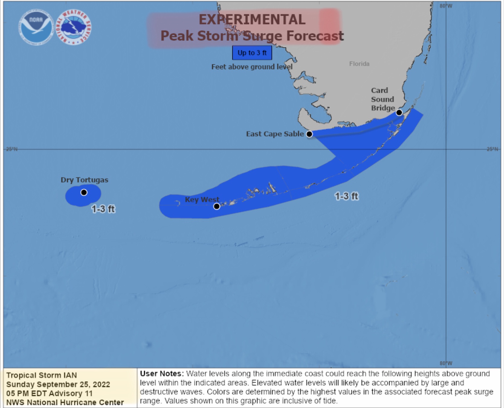
Hurricane and Tropical Storm Warnings issued for Cayman Islands and western Cuba. Tropical Storm Watch now issued for the Florida Keys.
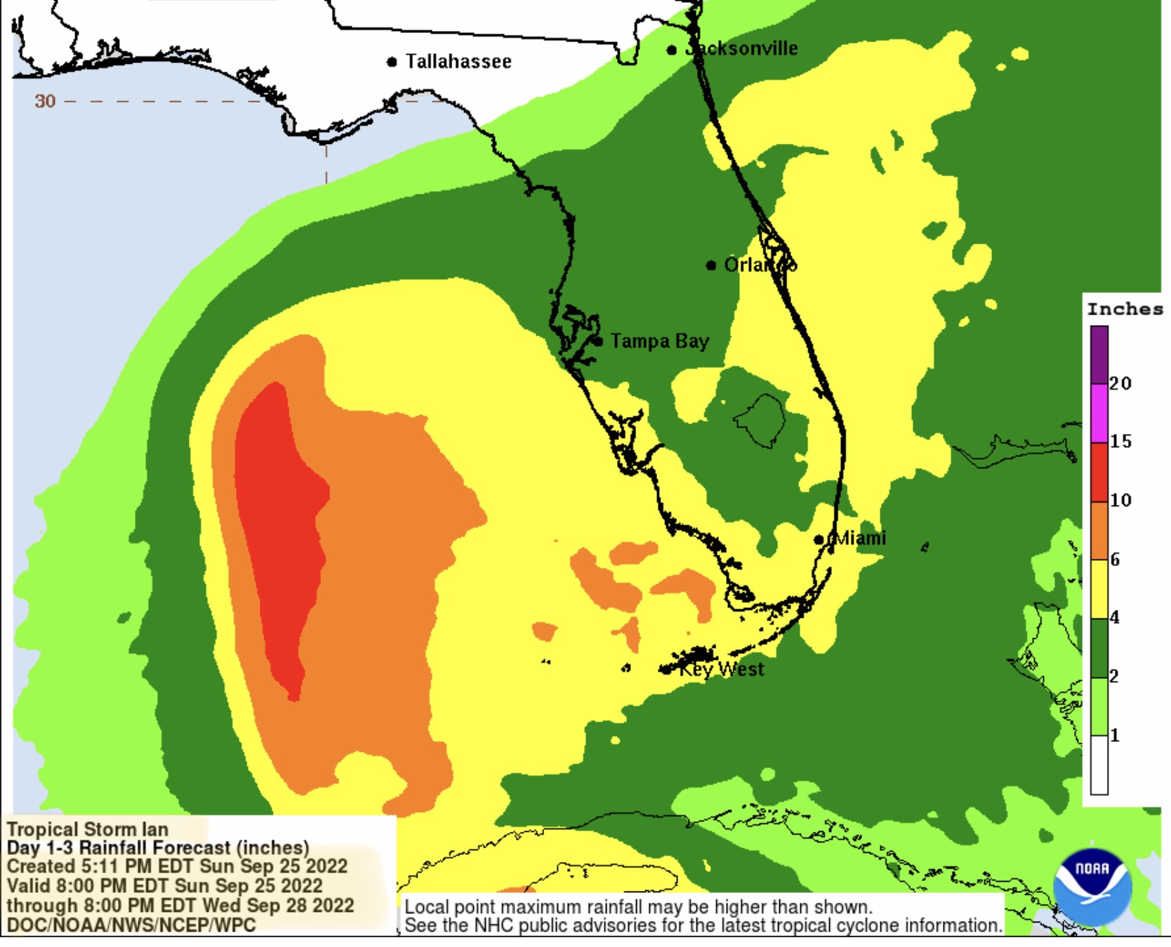
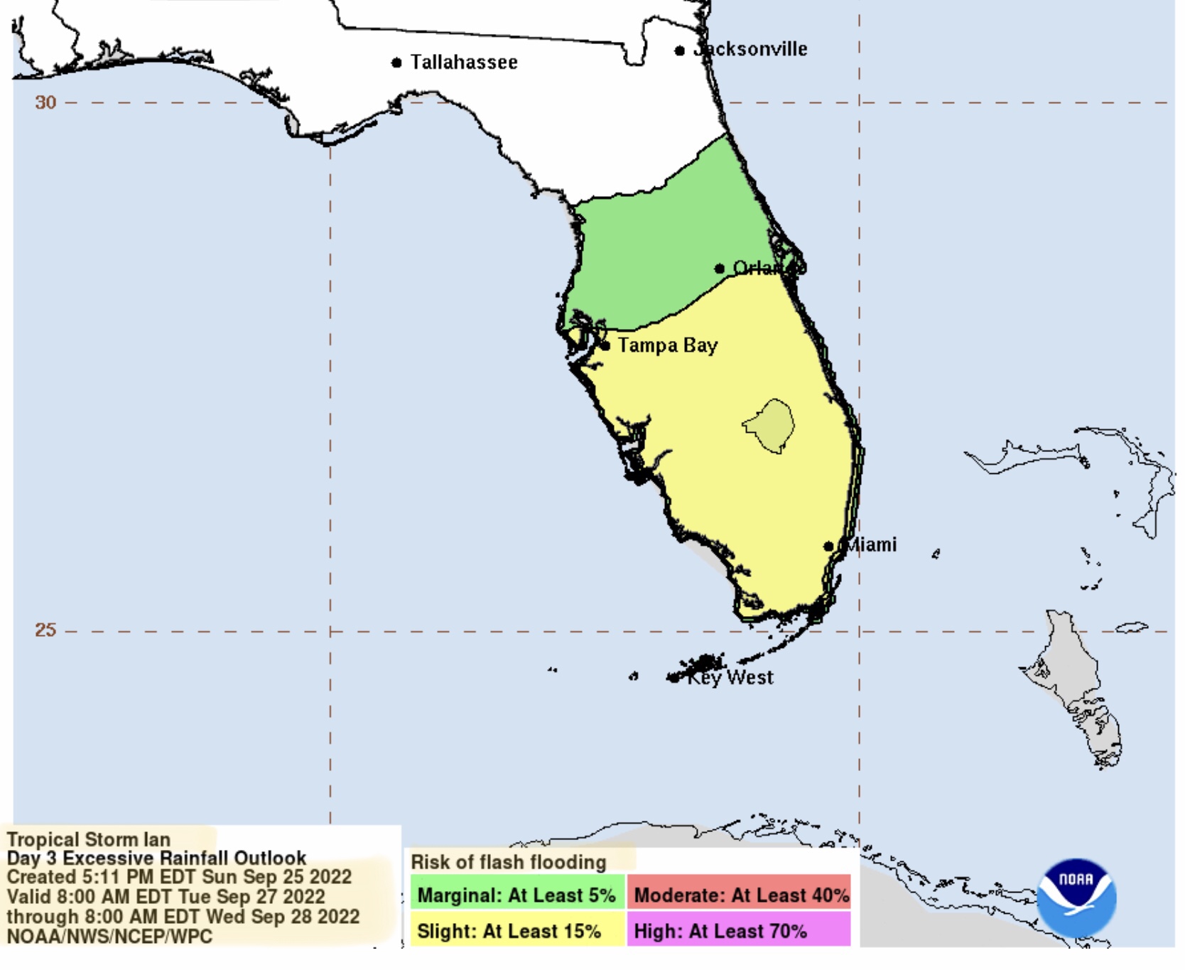
Wind potential on Thursday is in the 100 mph range at or just before projected landfall Thursday night or early Friday morning, a Category 2 hurricane if current intensity projections hold. Inland wind speeds after landfall decrease to 60 to 70 mph on Friday into early Saturday morning for parts of the FL panhandle, northern FL, southern GA, southeastern AL, and possibly southwestern SC. From 2” to 10” of rainfall across the FL peninsula by late Wednesday night is the current forecast.
Sid Sperry
President & CEO
SPIDI Technologies, LLC
SPIDItech.com
Cell: (405) 627-7754
Email: SidSperry@gmail.com

Sent from my iPad

 Show/hide attachments