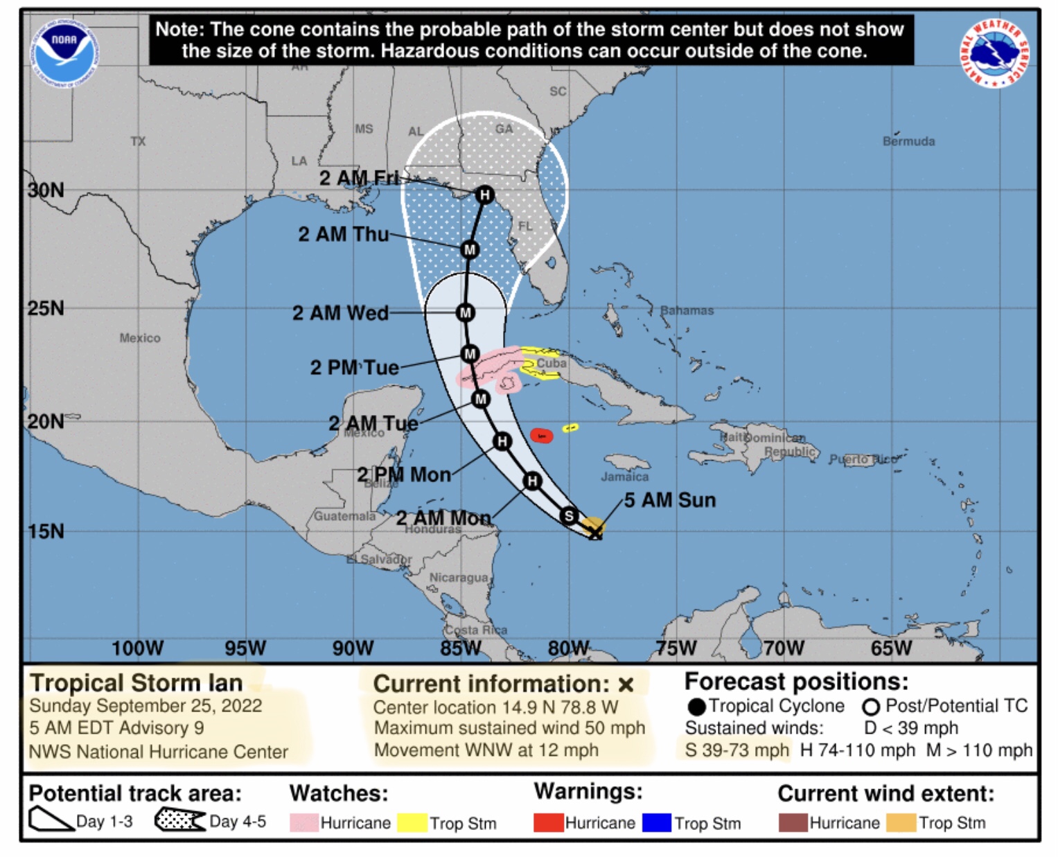
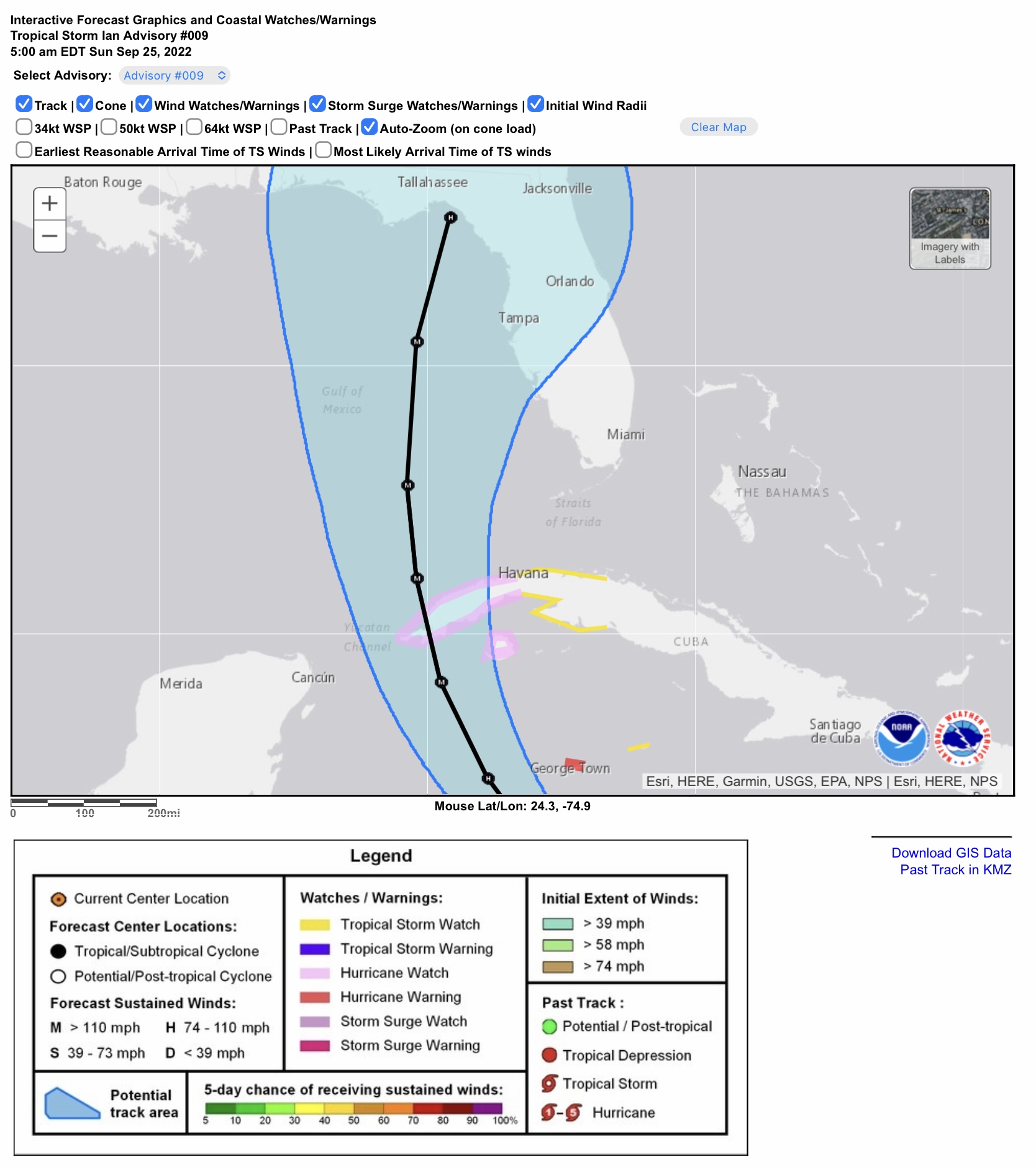
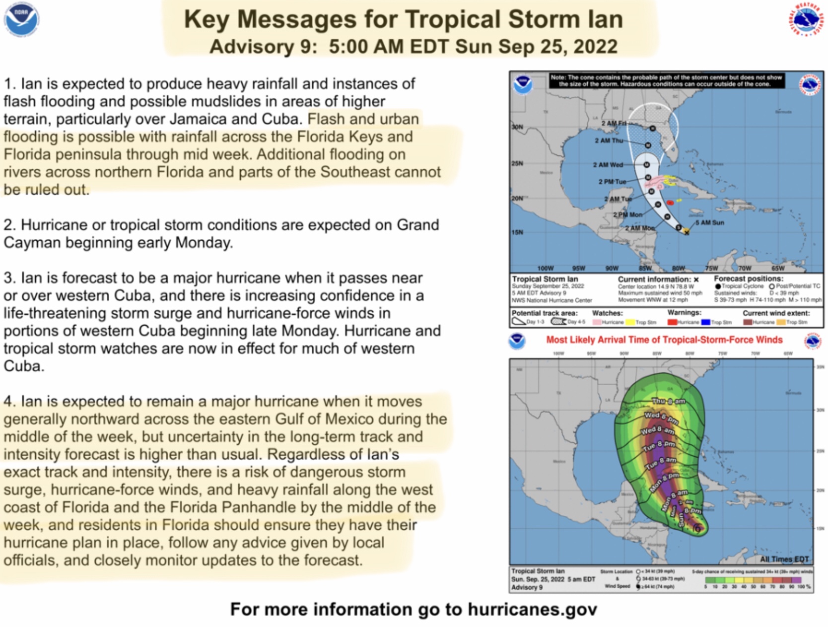
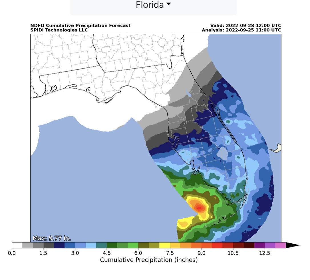
5am Update on Tropical Storm Ian from NHC. No significant track changes in last 6 hour forecast period. Cone of Uncertainty stretches from AL/FL border to Tampa Bay. Apalachee Bay still a potential landfall area…
Sidney Sperry 25 Sep 2022 12:05 UTC
FYI…
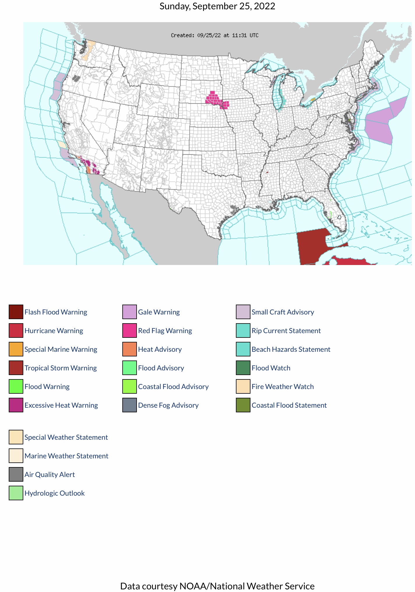
Hurricane Warnings have been posted for the Cayman Islands. A Tropical Storm Watch and Hurricane Watch have been posted for parts western Cuba. TS Ian currently has max sustained winds of 50 mph and has begun to turn west-northwest at 12 mph. Note that the NHC Forecast “Cone of Uncertainty” still reaches from the AL/FL border on the west to near Tampa Bay on the southeast. Still some uncertainty on track and intensity. Heavy rainfall across the Florida Keys and parts of south Florida expected over next 3 days as Ian enters the southeastern Gulf of Mexico as a likely Major Hurricane.
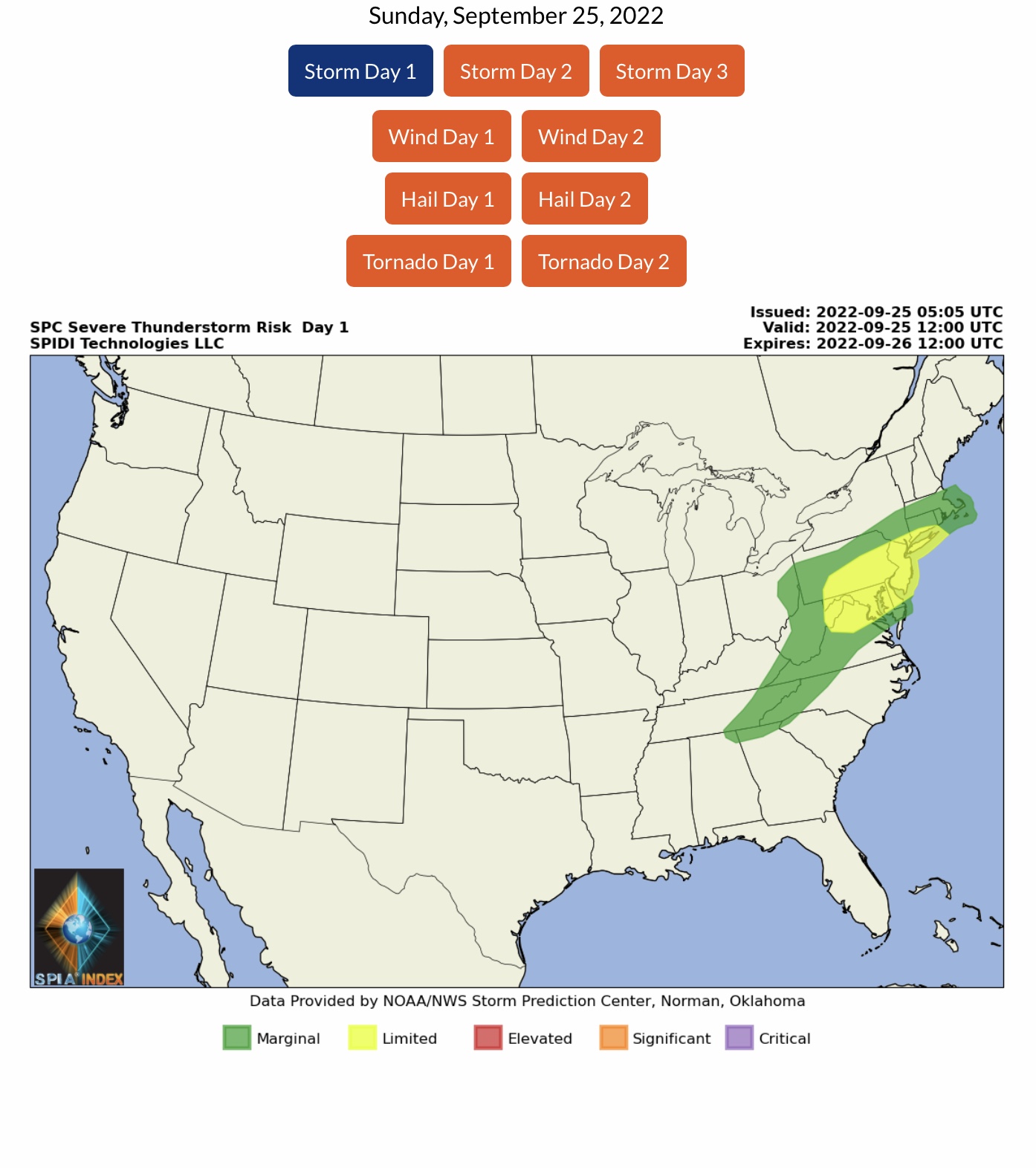
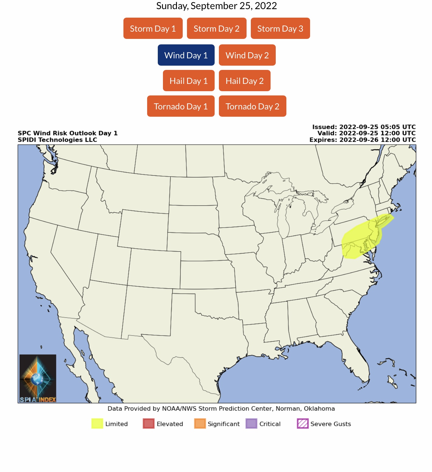
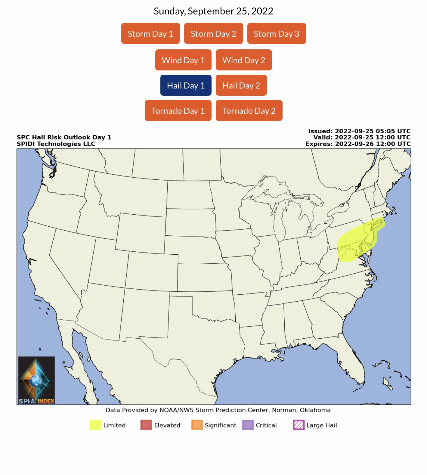
LIMITED Severe Thunderstorm Risk, Day 1, parts CT, NY, NJ, PA, DE, MD, WV & VA. Also includes a LIMITED High Wind Risk and LIMITED Hail Risk, Day 1.
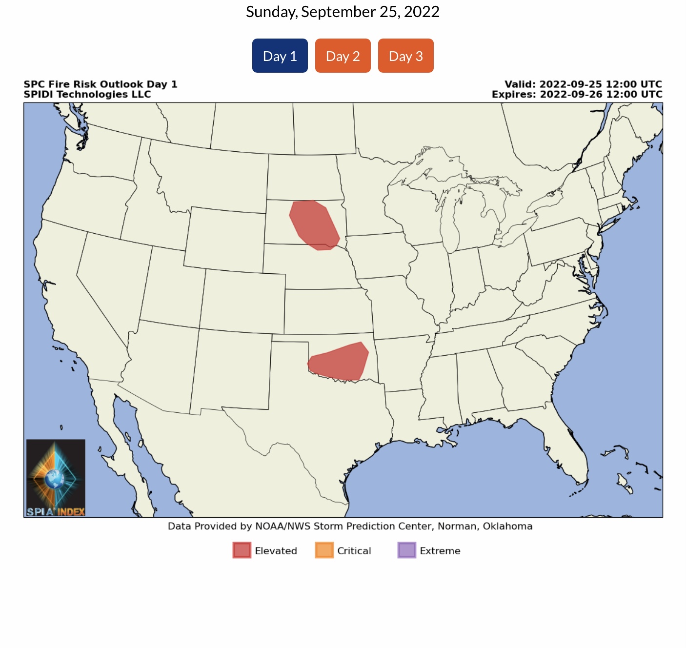
ELEVATED Fire Risk, Day 1, parts SD, NE & OK.
Sid Sperry
President & CEO
SPIDI Technologies, LLC
SPIDItech.com
Cell: (405) 627-7754
Email: SidSperry@gmail.com

Sent from my iPad

 Show/hide attachments