Latest (5pm EDT) NHC Updates on Tropical Storm Ian…
Sidney Sperry 24 Sep 2022 22:31 UTC
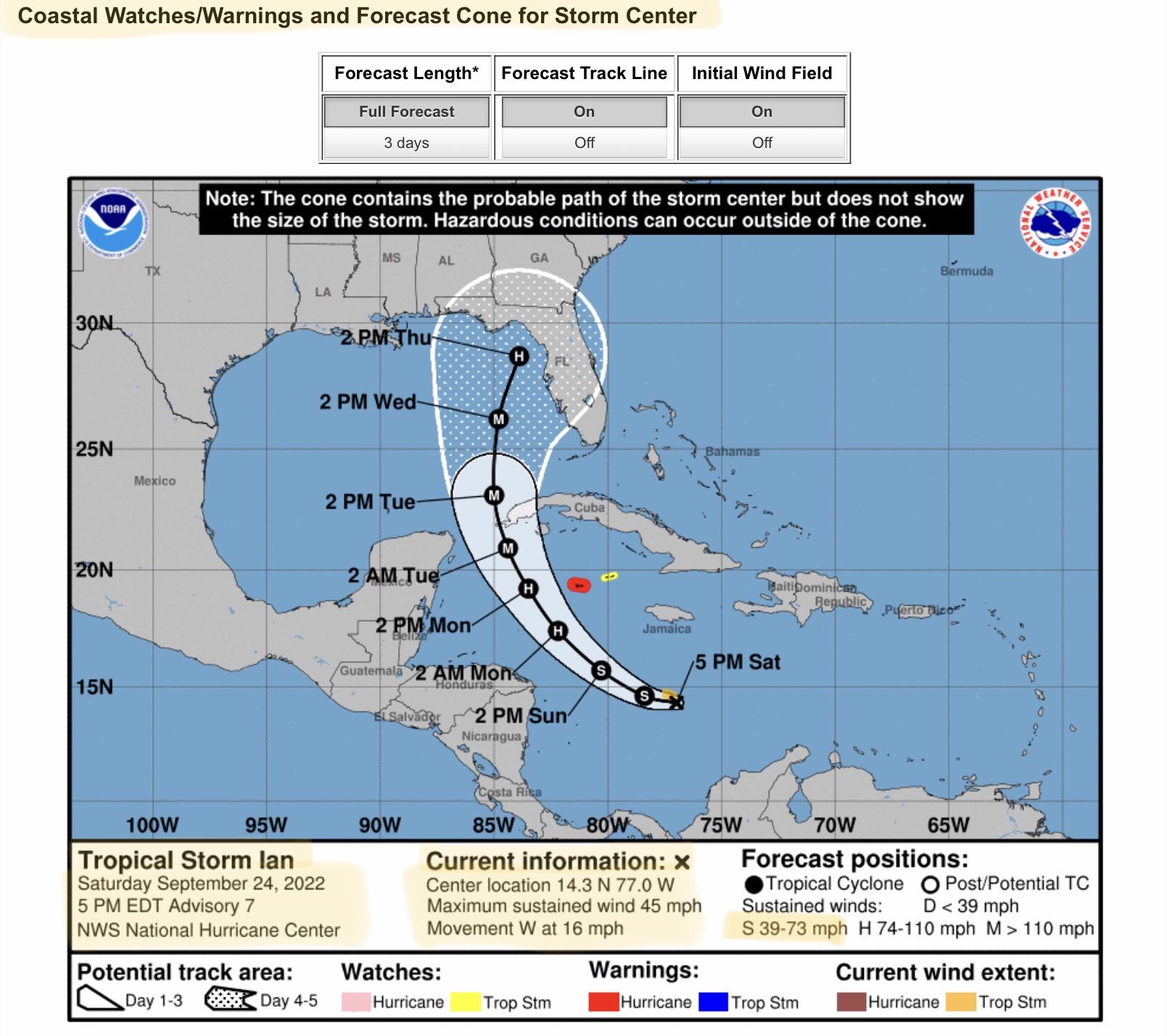
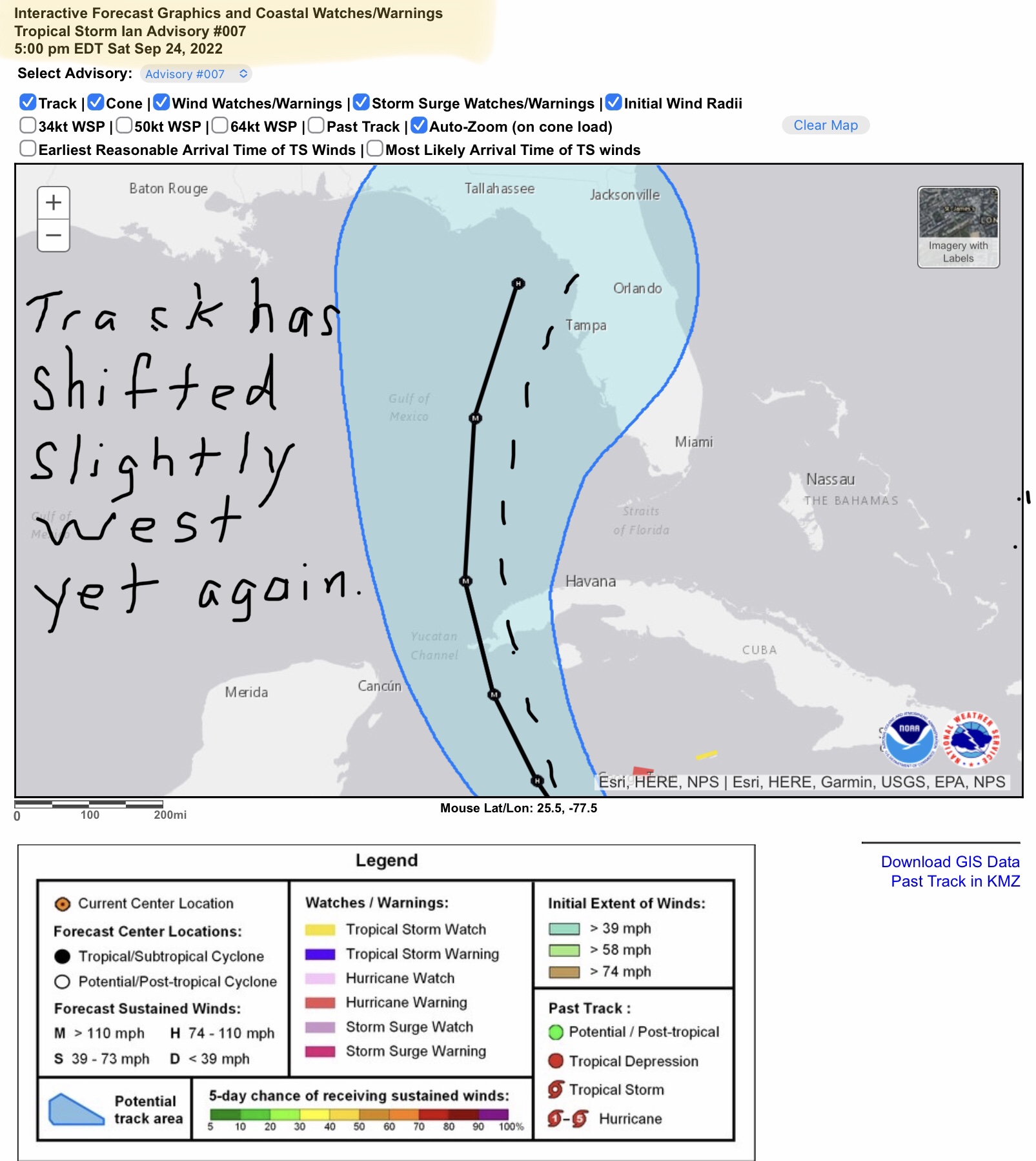
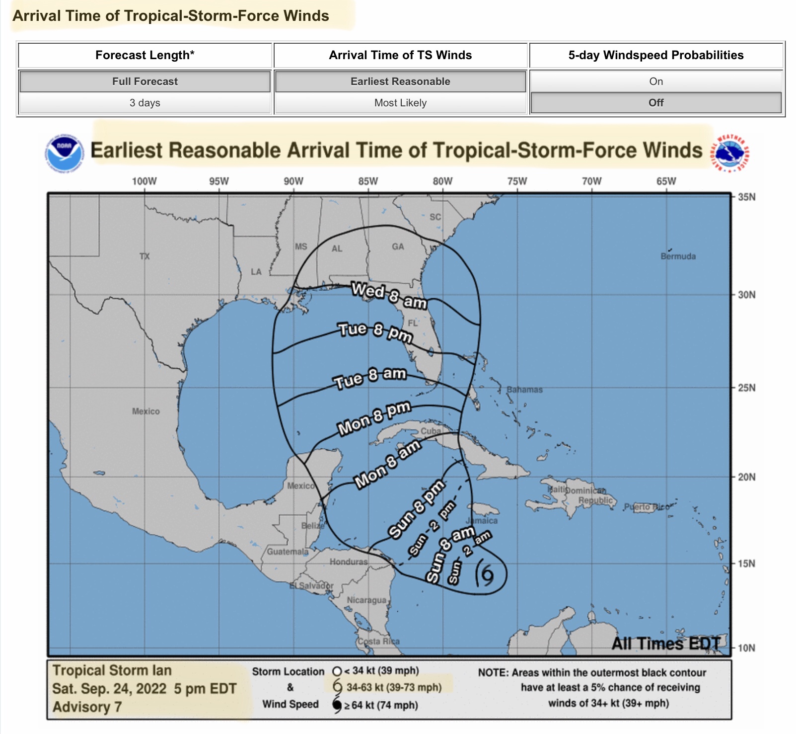
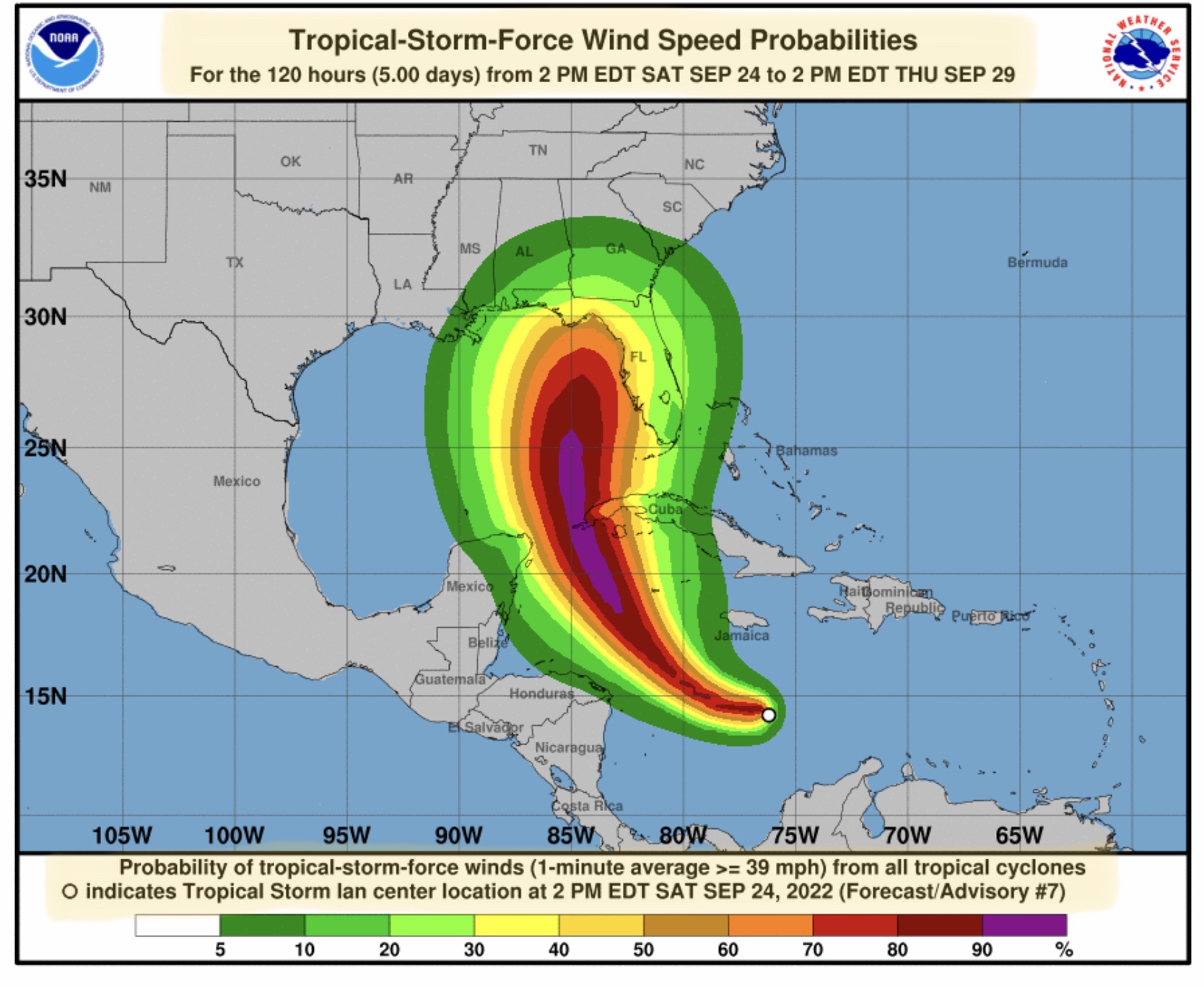
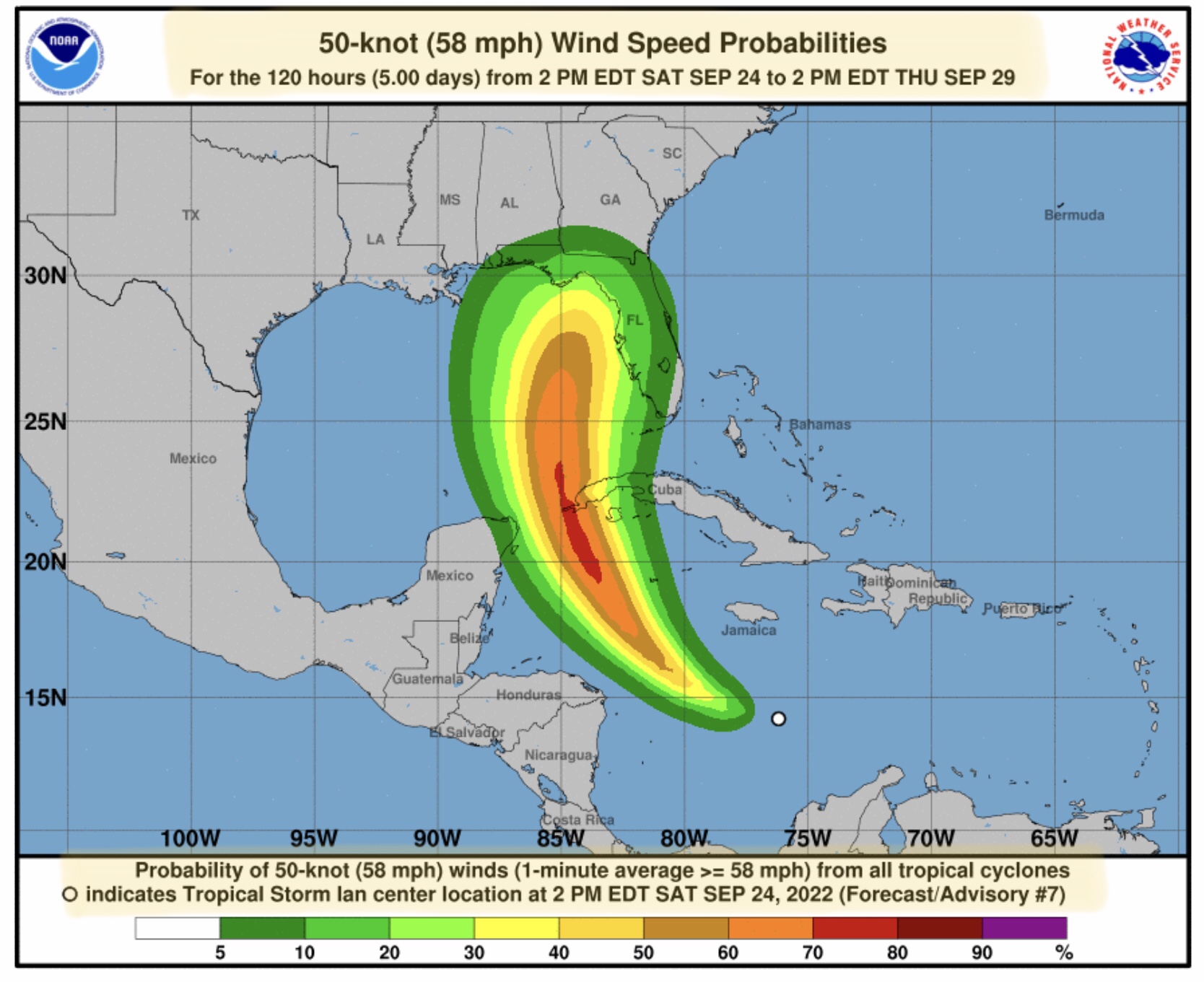
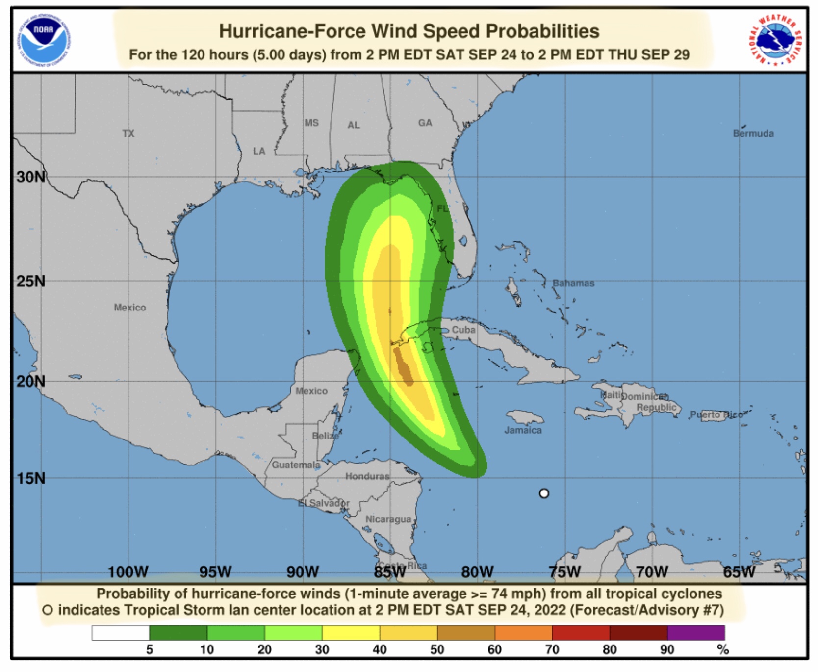
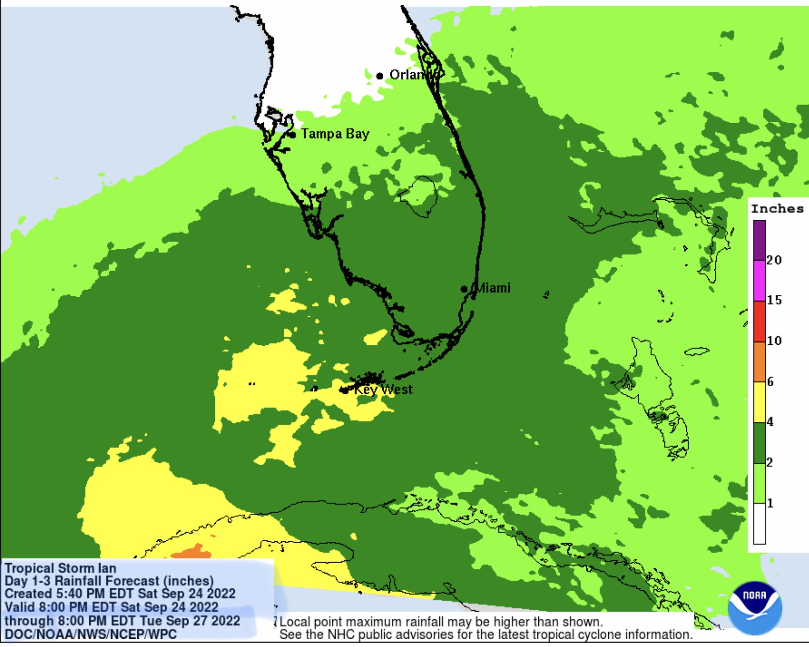
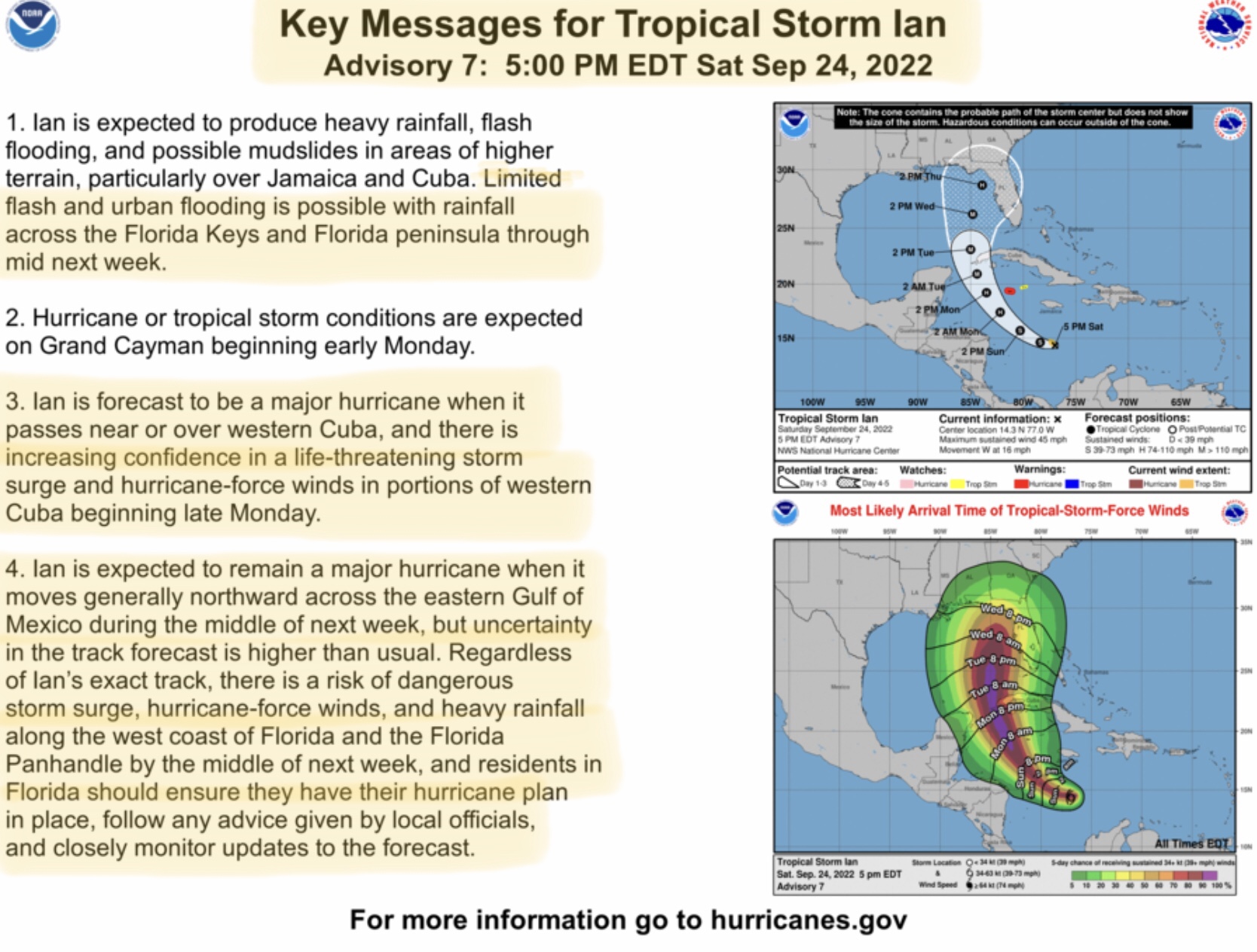
In the 5pm EDT NHC update, track projections have once again moved slightly to the west. NHC is now forecasting that Ian could become a Major Hurricane (sustained winds of 110 mph +) before reaching Cuba, and could possibly just clip the far western part of Cuban. Ian could remain a Major Hurricane until late afternoon Wednesday, when it could possibly lose some strength before a Thursday landfall due to interaction with a High Pressure system across the southeastern U.S. NHC is projecting a late afternoon or early evening landfall on Thursday, September 29, somewhere between the Big Bend area of the northwest FL peninsula and the Apalachee Bay south of St. Marks. Again, it is likely that the forecast track will change slightly in the next 3 to 4 days.

This westward shift could possibly bring some types of impacts (high winds and heavy rainfall, along with the threat of some tornadoes) to the states of MS, AL, FL, GA & SC. Additional impacts after landfall on Thursday could affect states to the north and east, such as TN, NC and VA.
Sid Sperry
President & CEO
SPIDI Technologies, LLC
SPIDItech.com
Cell: (405) 627-7754
Email: SidSperry@gmail.com

Sent from my iPad

 Show/hide attachments