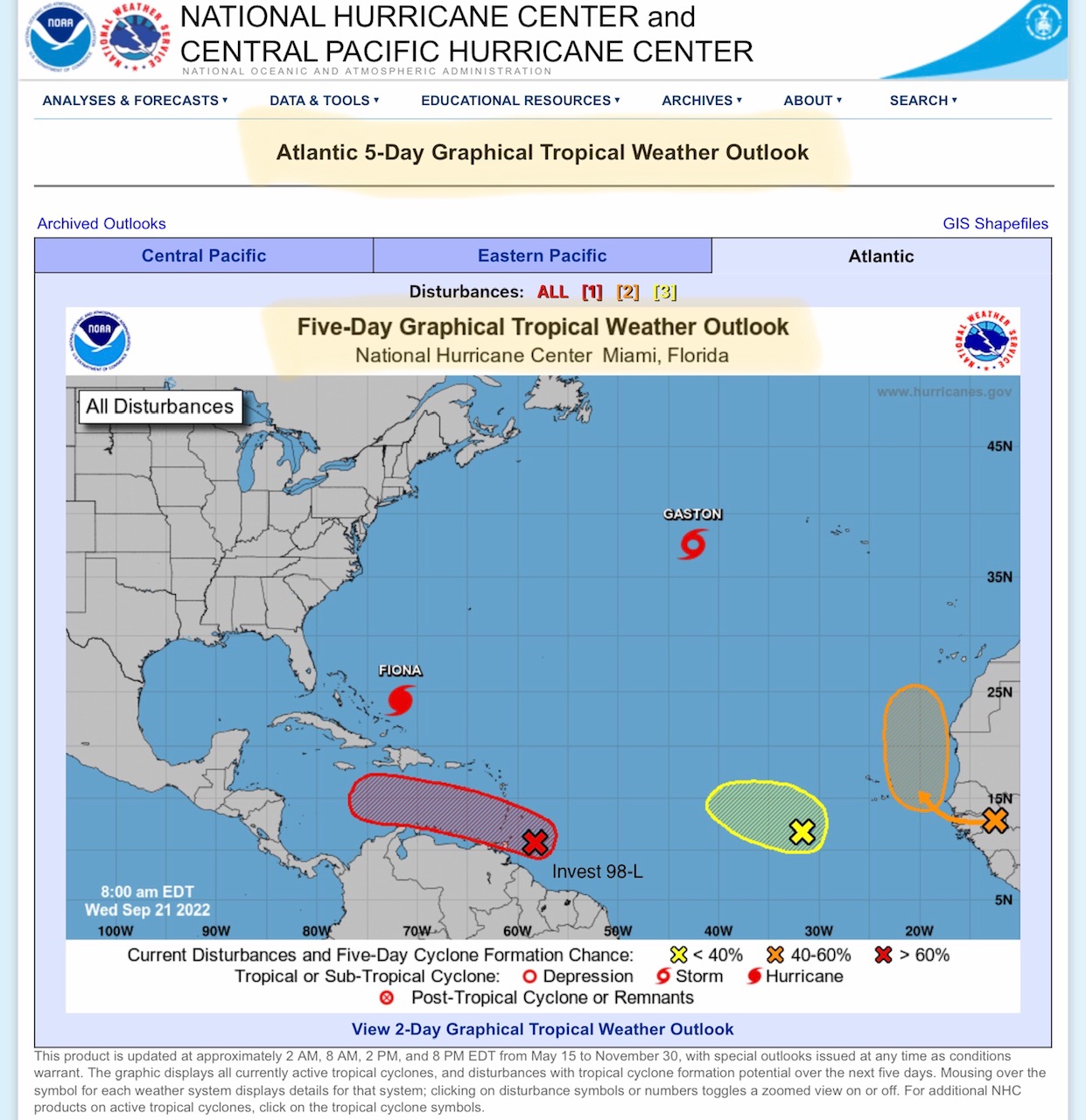
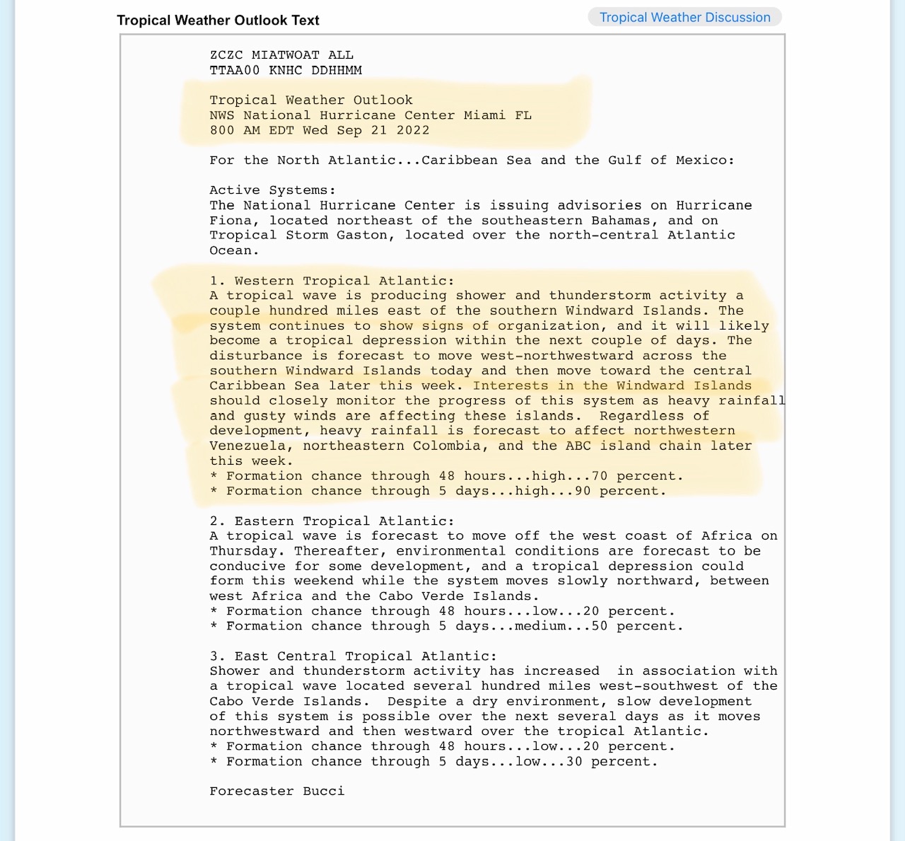
Invest 98-L, currently a Tropical Wave 200 miles east of the southern Windward Islands, is forecast by the NHC to move into the Caribbean Sea within next 3 to 5 days. There IS a possibility (via Spaghetti Models) that this system could ultimately move into the eastern Gulf of Mexico in the next 7-10 days as a hurricane…
Sidney Sperry 21 Sep 2022 13:16 UTC
FYI… keep a close eye on Invest 98-L this next 5 to 7 days. It will likely move into the Caribbean Sea and become a Tropical Depression, then strengthen into a hurricane. Current “Spaghetti Models” indicate a possibility that it could eventually move over western Cuba and into the eastern Gulf of Mexico. Certainly a developing system worth watching and preparing for.
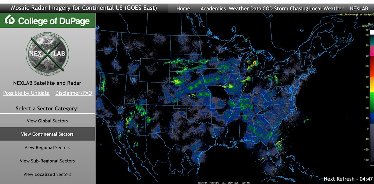
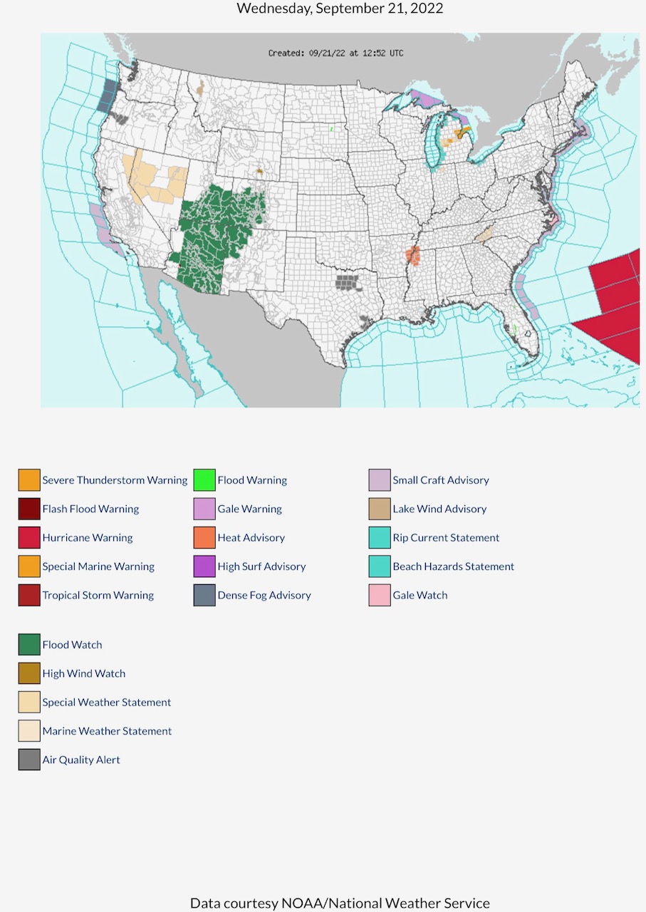
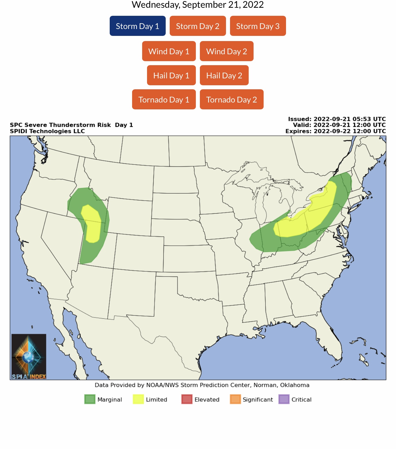
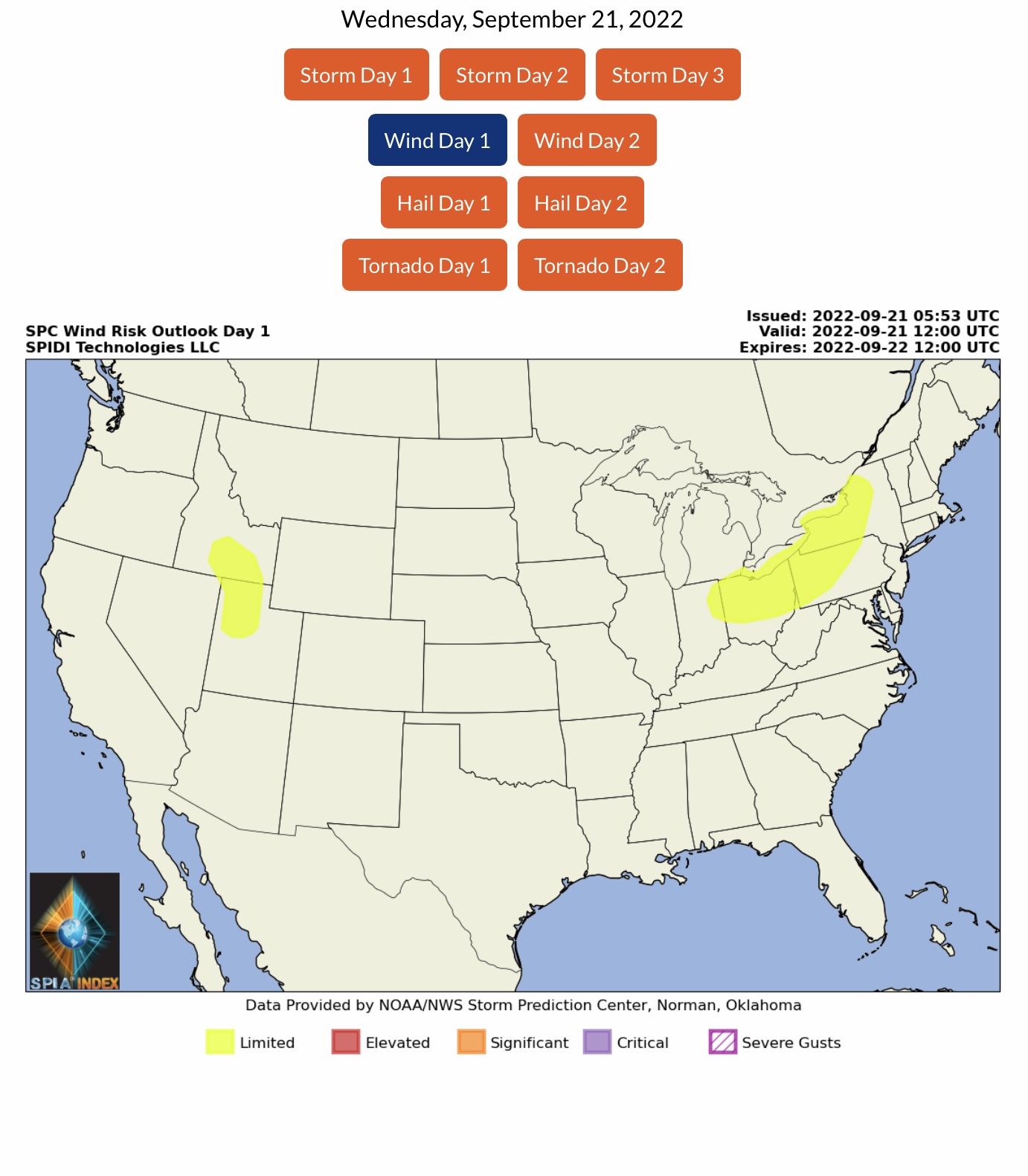
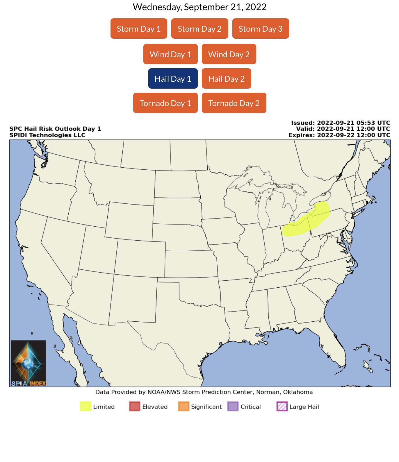
LIMITED Severe Thunderstorm Risk, Day 1, parts ID, UT, NY, PA, OH, WV, MI & IN. Includes LIMITED High Wind Risk in those states, plus a LIMITED Hail Risk for parts NY, PA, OH, WV, MI & IN.
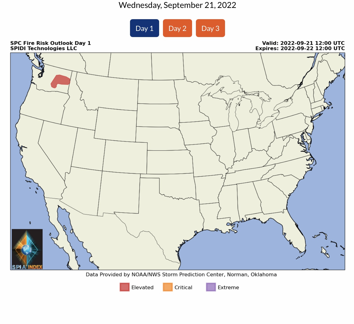
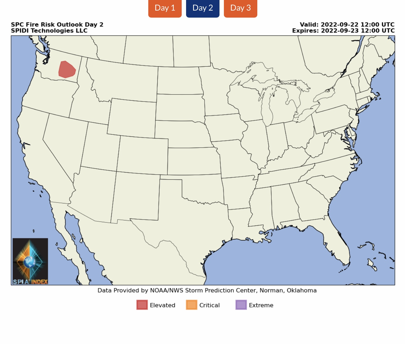
ELEVATED Fire Risk, Days 1 & 2, parts WA.
Sid Sperry

Sent from my iPad

 Show/hide attachments