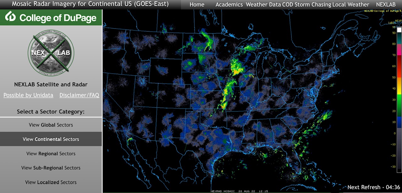
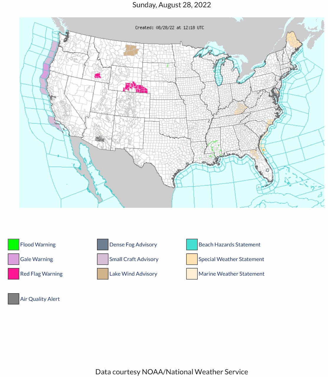
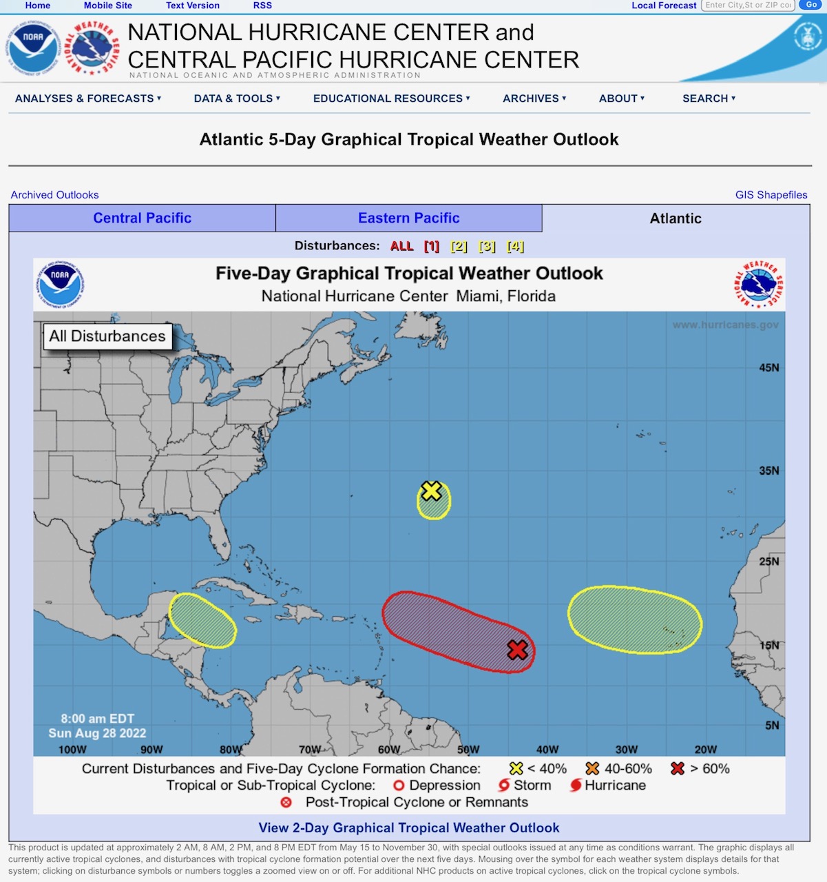
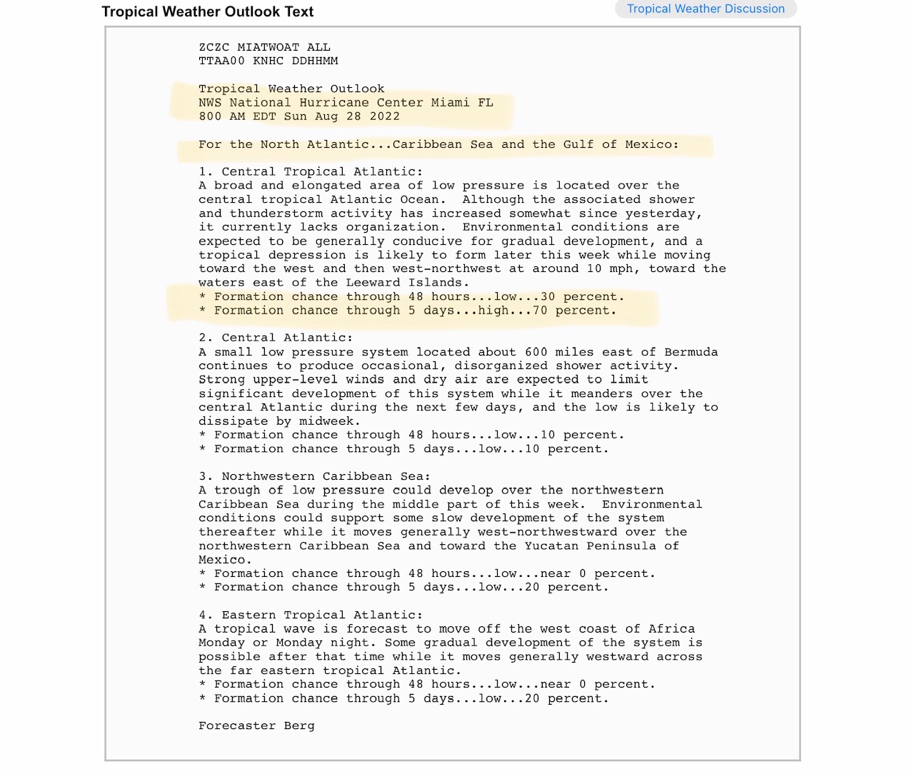
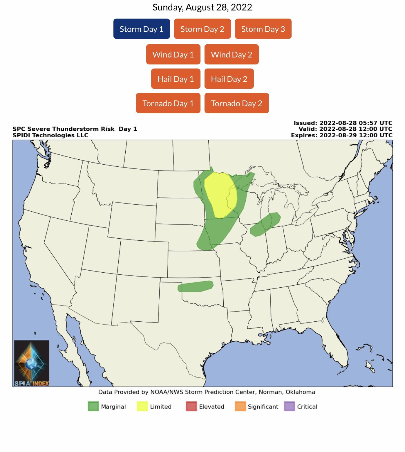
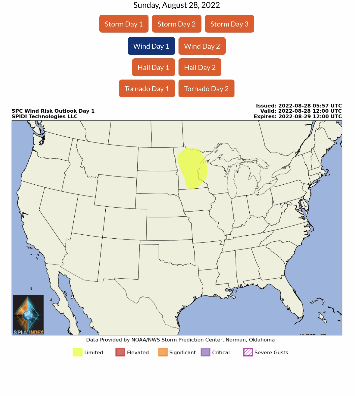
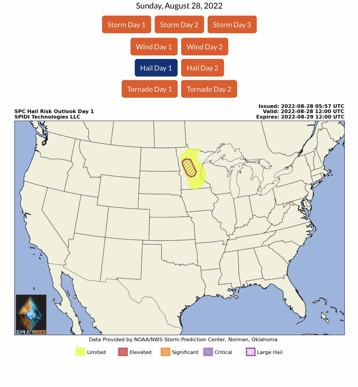
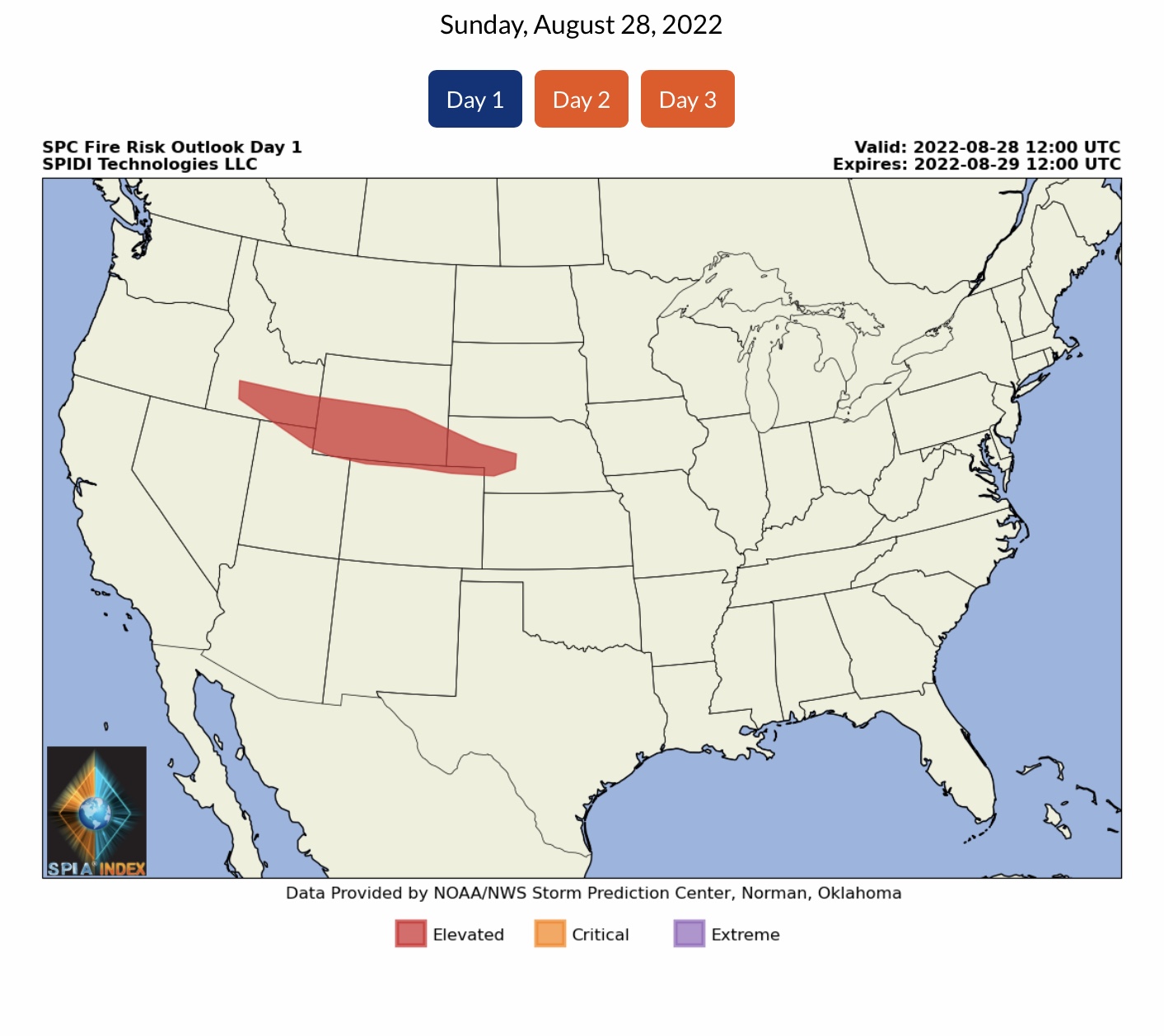
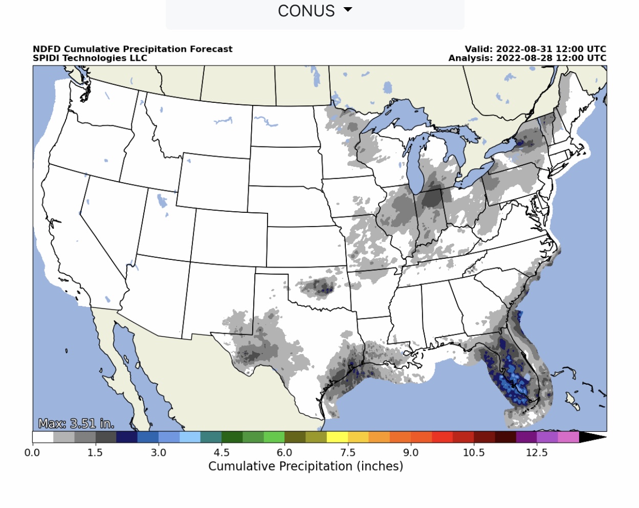
Current COD Mosaic Radar. Current NWS Watches, Warnings & Advisories. Note Red Flag Fire Warnings in parts ID, WY & NE. Note likely tropical depression development (forecast area in RED by NHC) over next 5 days is at 70 percent. LIMITED Severe Thunderstorm Risk with LIMITED High Wind & Hail/Large Hail Risk parts MN, WI & IA over next 24 hours.
Sidney Sperry 28 Aug 2022 12:39 UTC
Sid Sperry
President & CEO
SPIDI Technologies, LLC
SPIDItech.com
Cell: (405) 627-7754

Sent from my iPad

 Show/hide attachments