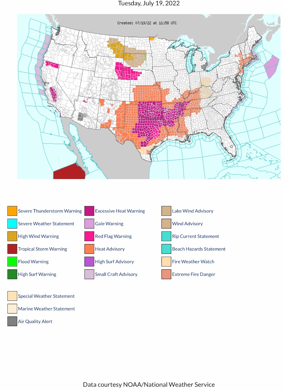
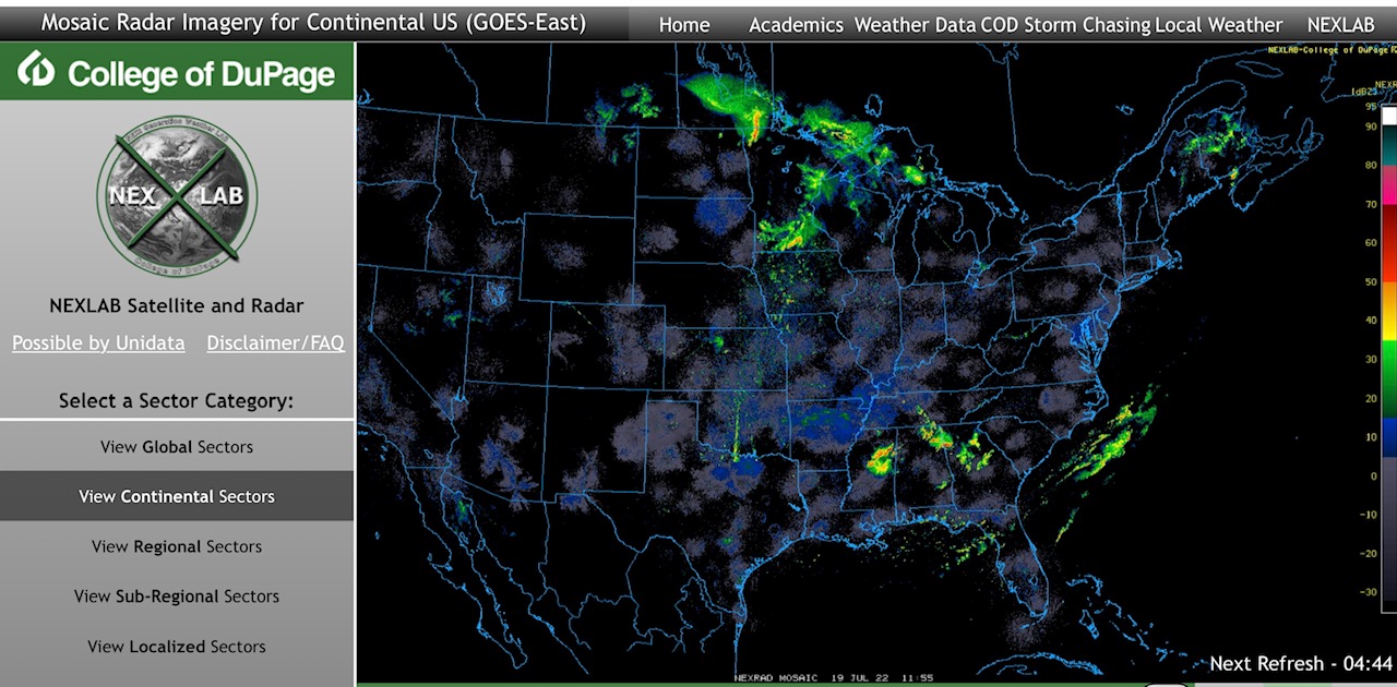
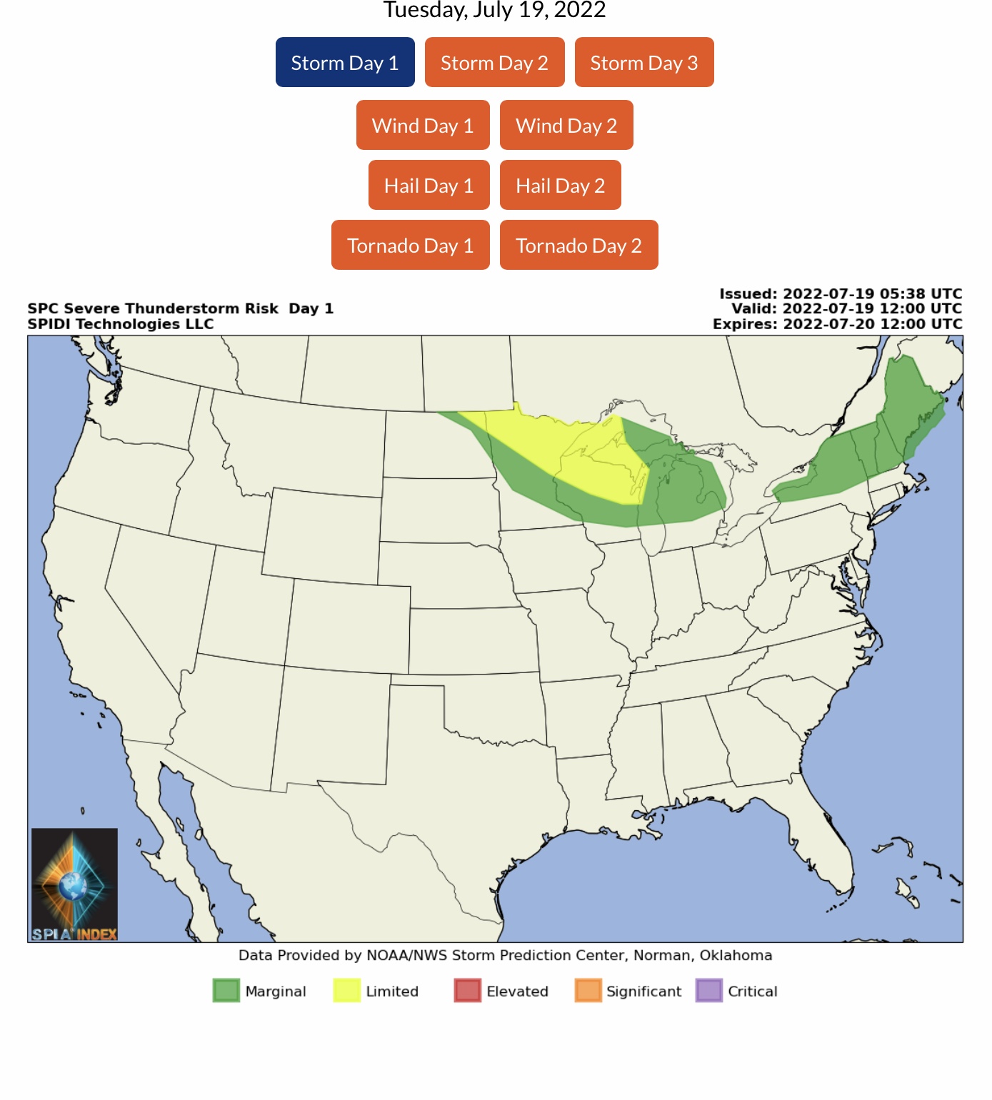
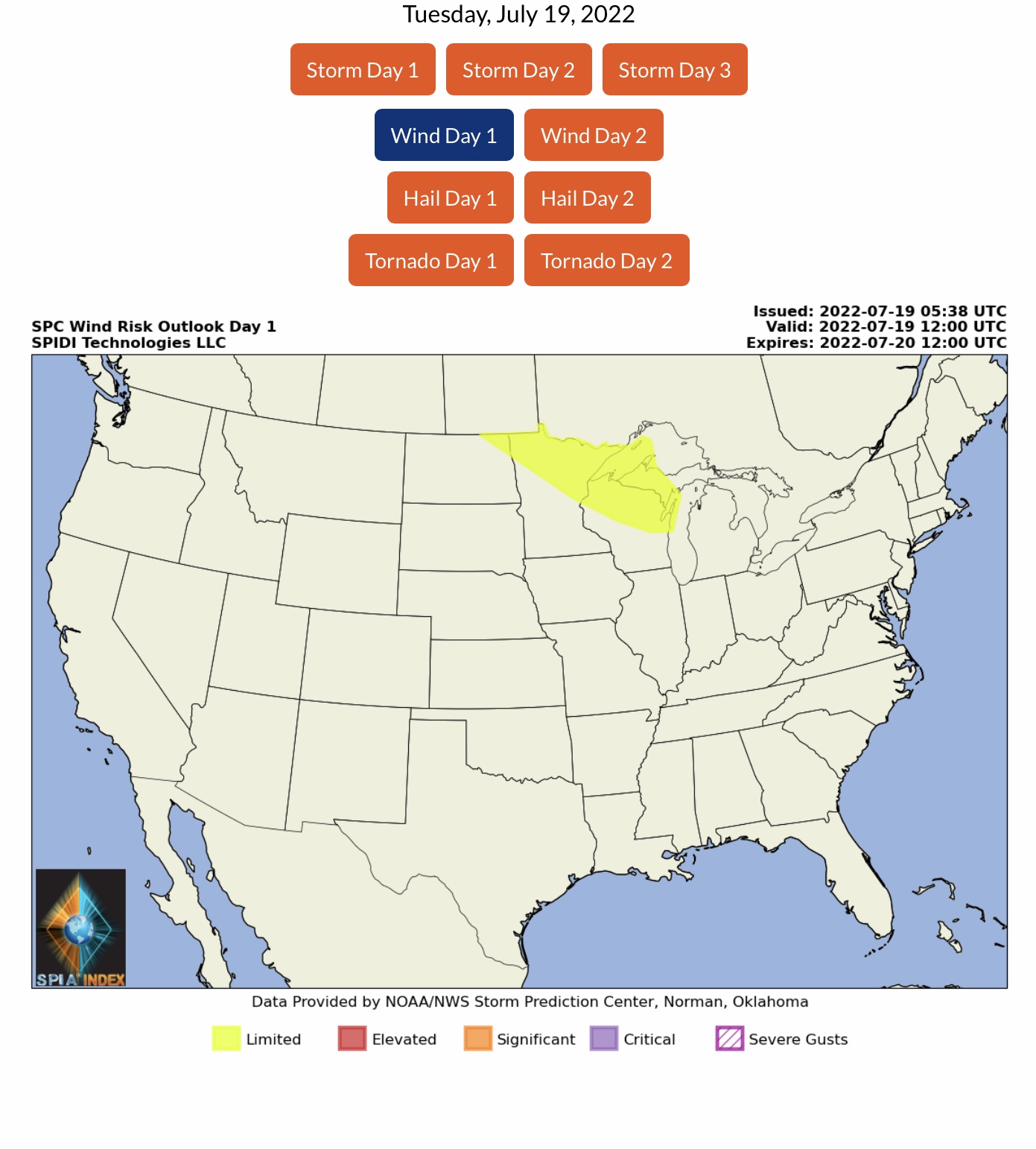
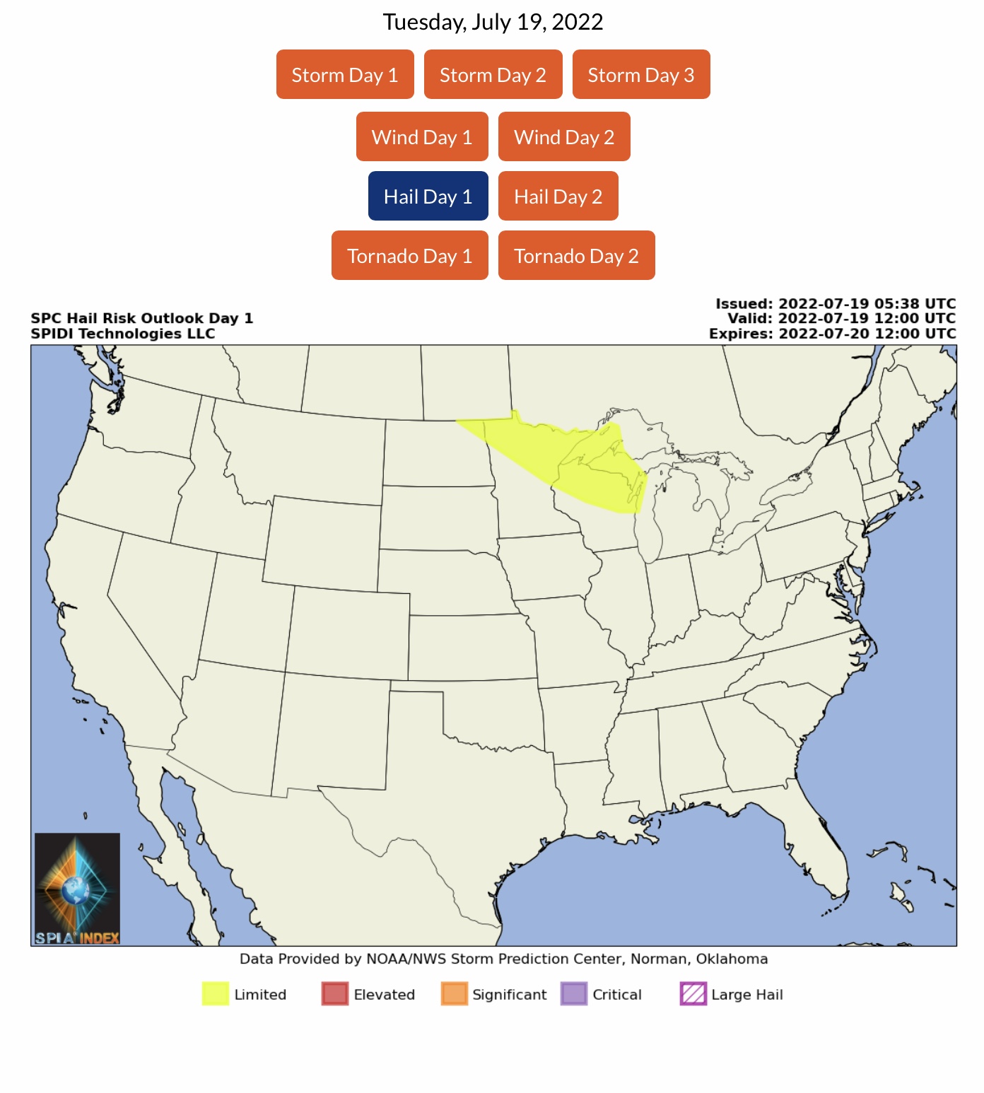
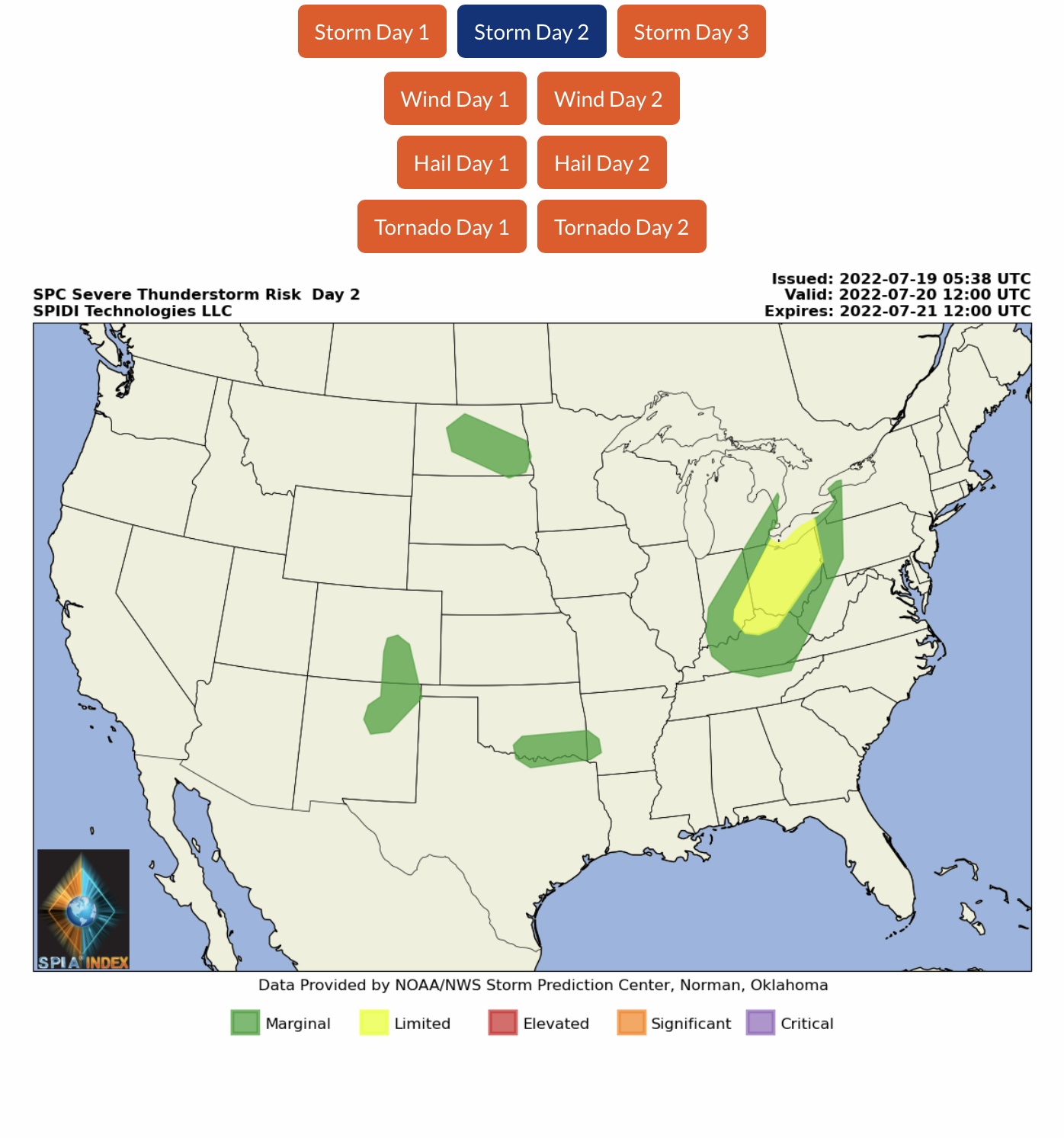
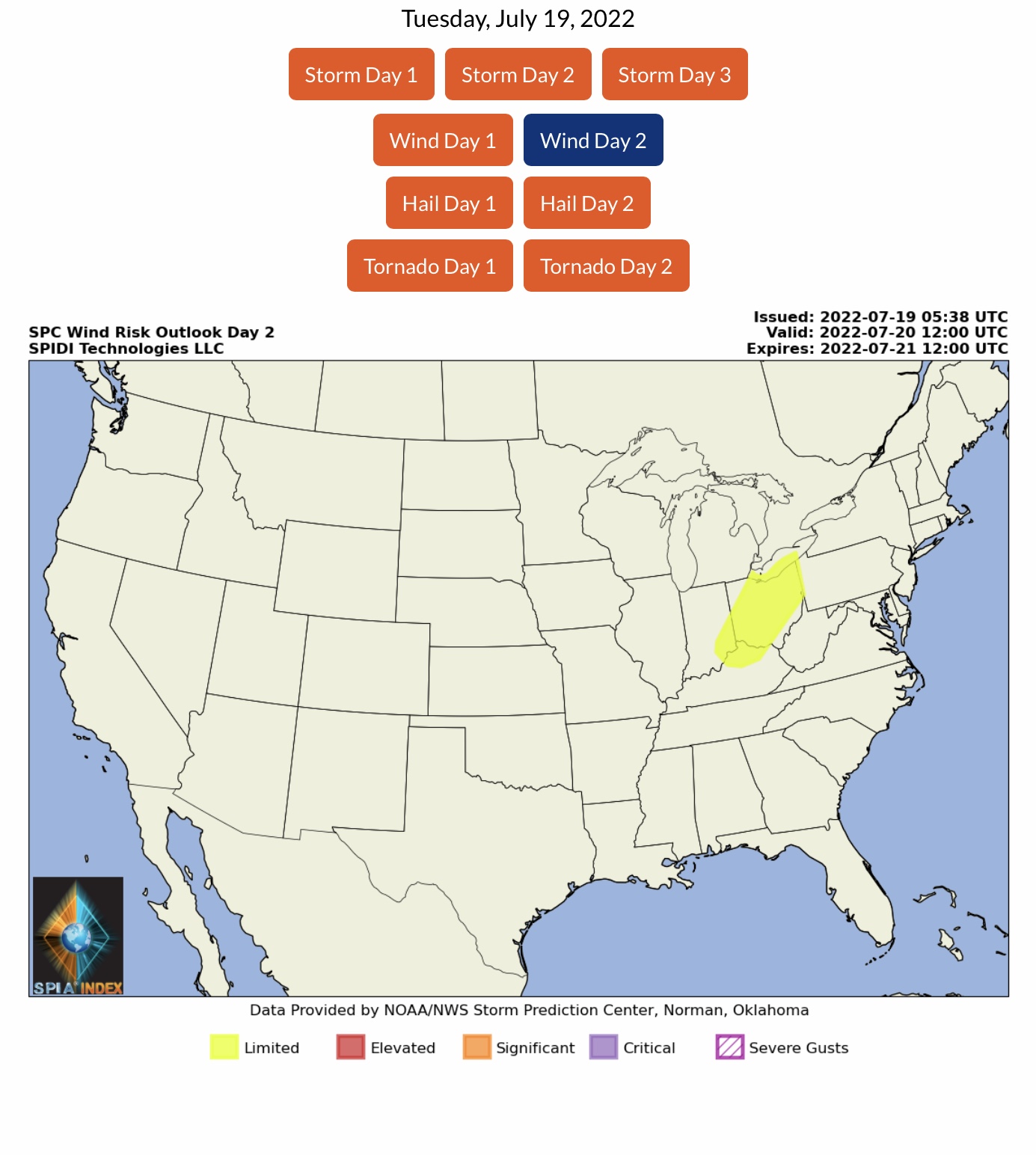
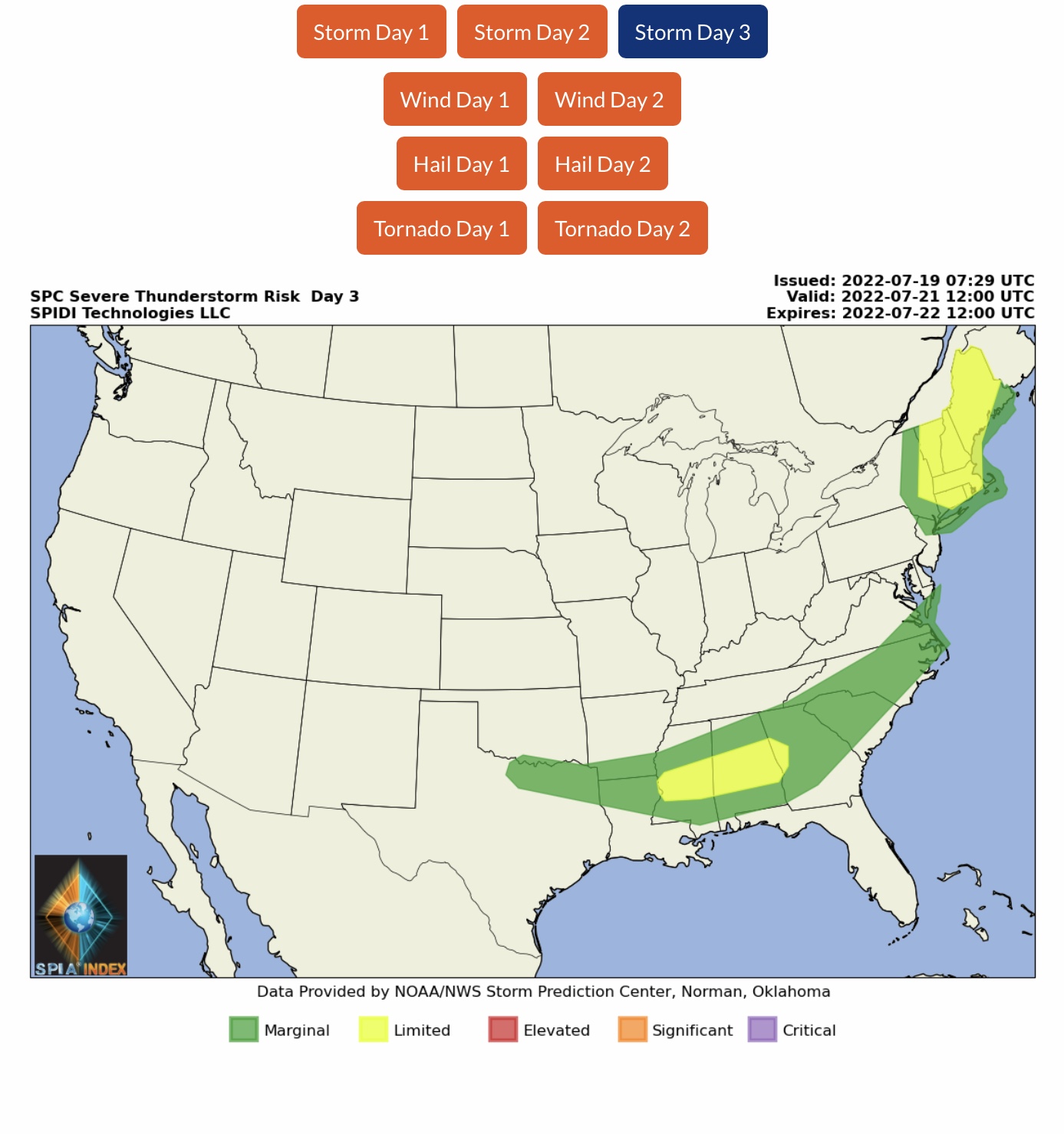
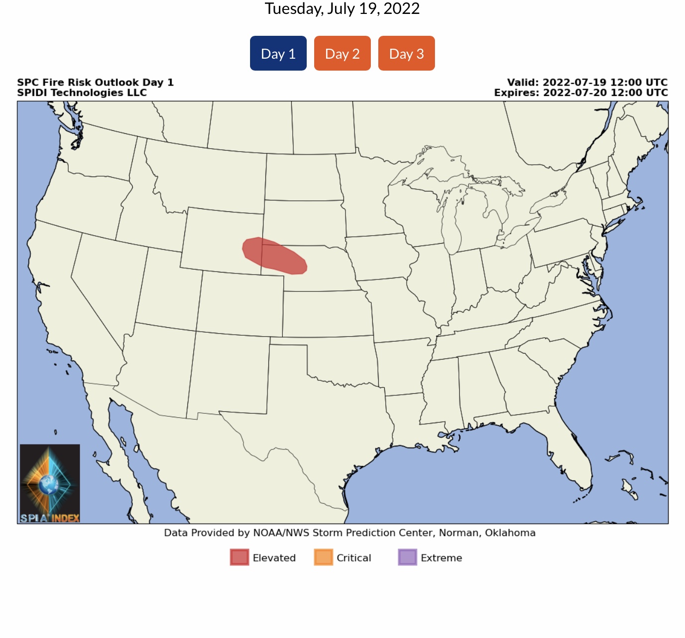
Current NWS Watches, Warnings & Advisories. Current COD Mosaic Radar. LIMITED Severe Thunderstorm Risk, Day 1, parts ND, MN, WI & MI Upper Peninsula, including LIMITED High Wind and Hail Risks. LIMITED Severe Thunderstorm Risk, Days 2 & 3, parts OH, IN, KY (Day 2) and parts ME, NH, VT, NY, MA, CT, RI, MS, AL & GA (Day 3)
Sidney Sperry 19 Jul 2022 12:29 UTC
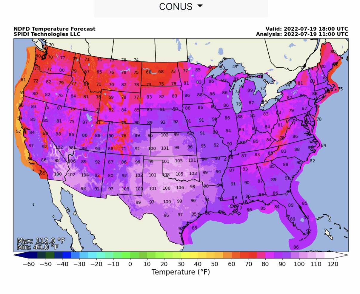
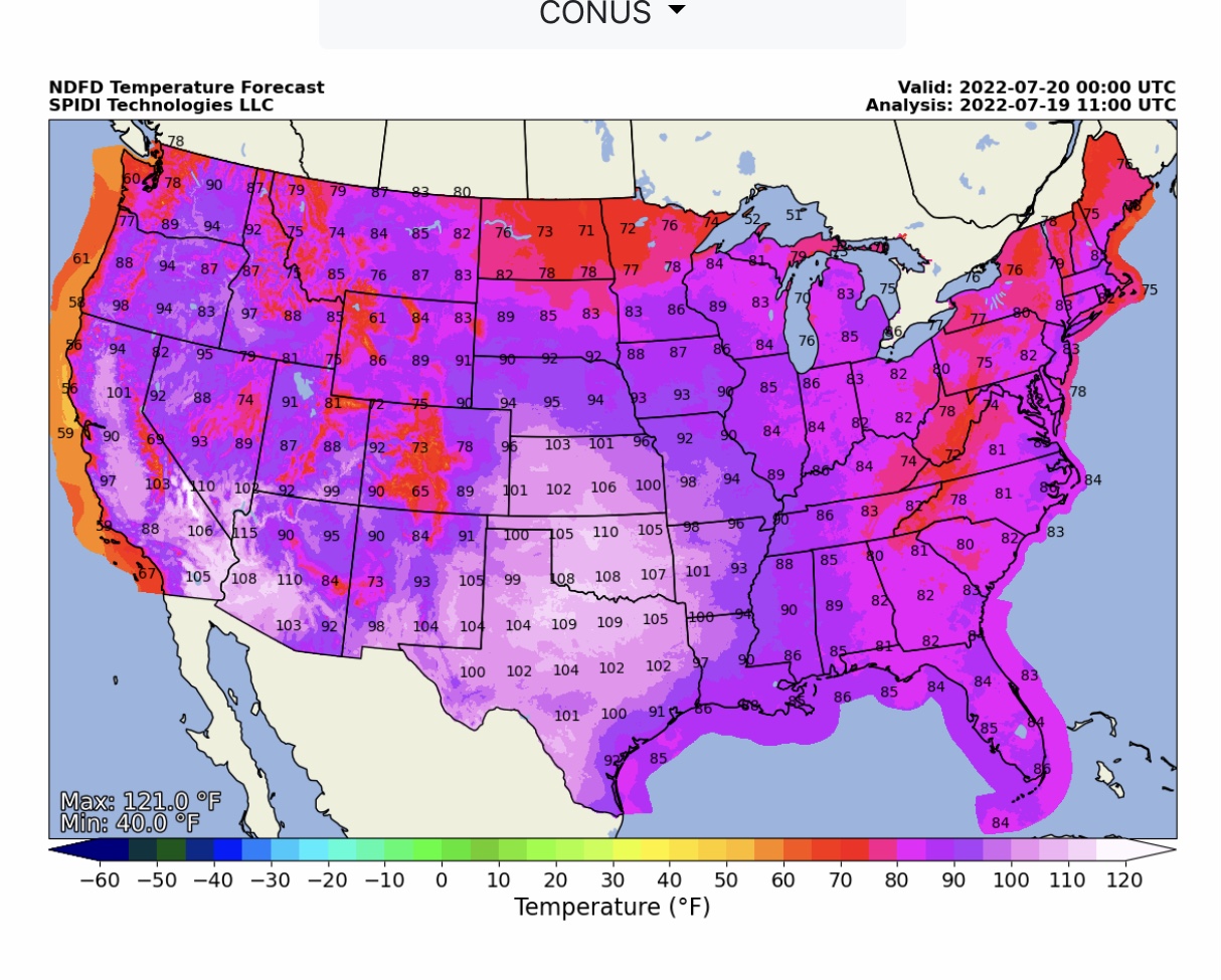
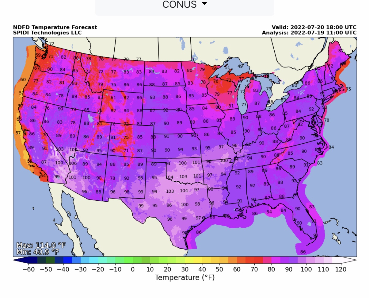
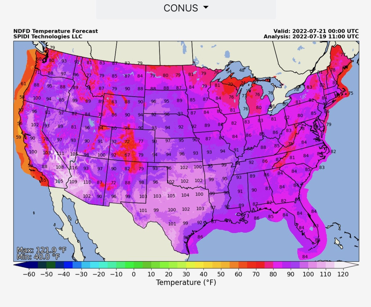
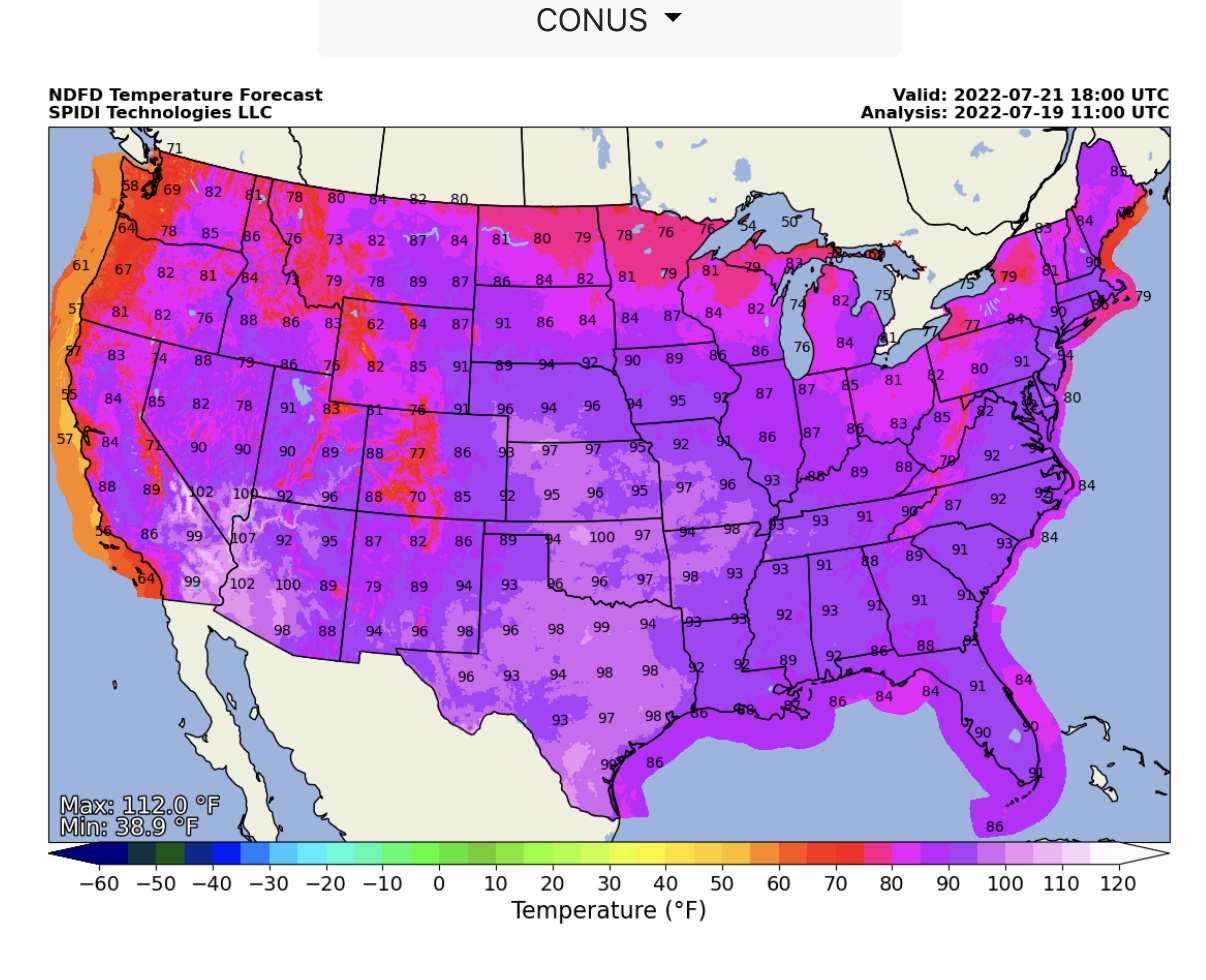
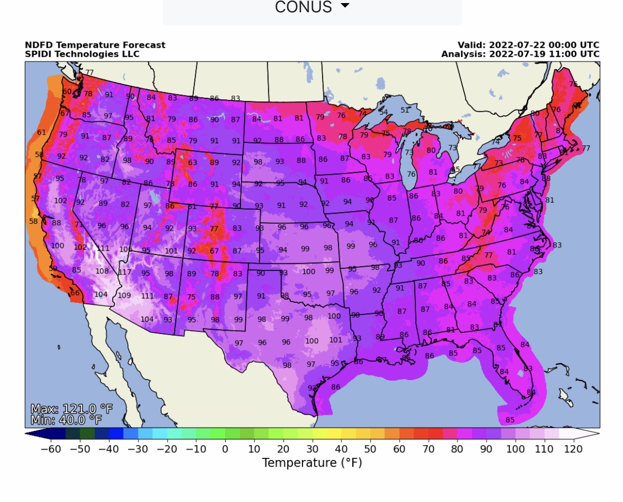
NWS NDFD Temperature Forecasts at 1pm and 7pm CDT for Tuesday thru Thursday.
Sid Sperry
President & CEO
SPIDI Technologies, LLC
SPIDItech.com
Cell: (405) 627-7754
Email: SidSperry@gmail.com  OR
           Sid.Sperry@spidiweather.com
URL(s): SPIDItech.com
              SPIA-Index.com
              NationalOutages.com (partner)

Sent from my iPad

 Show/hide attachments