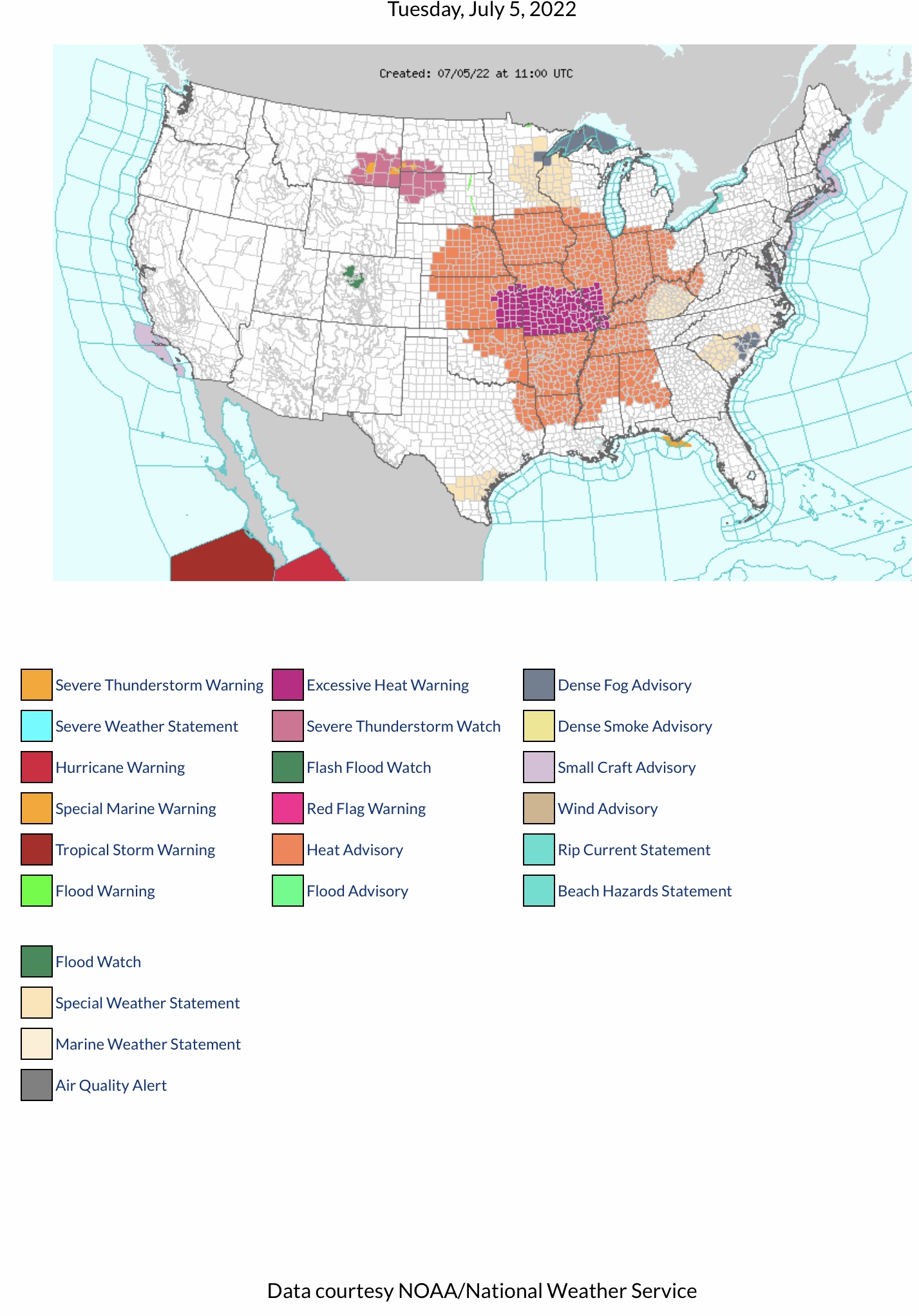
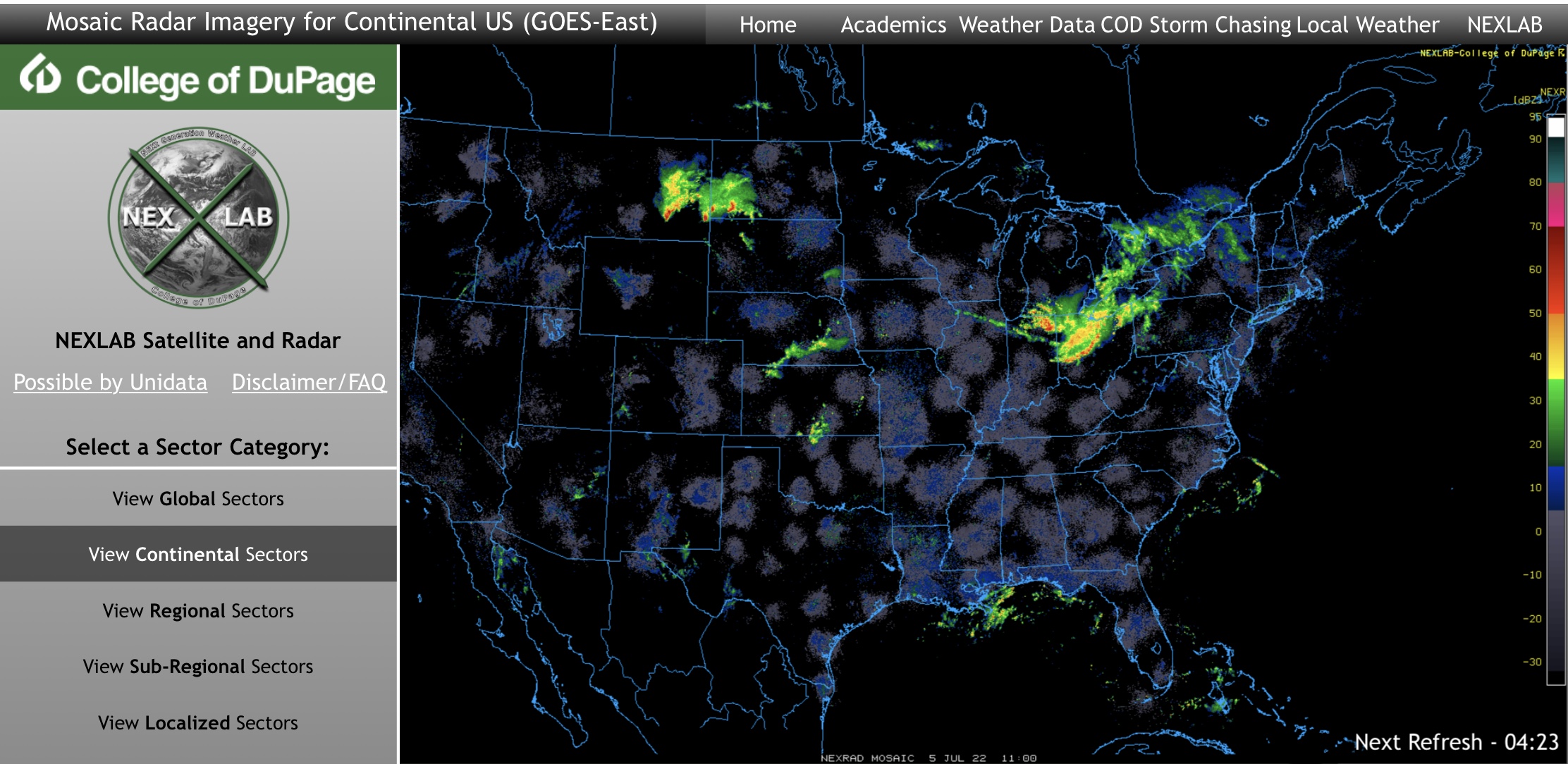
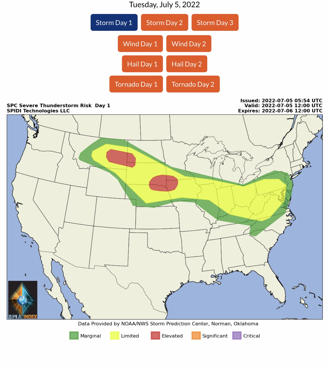
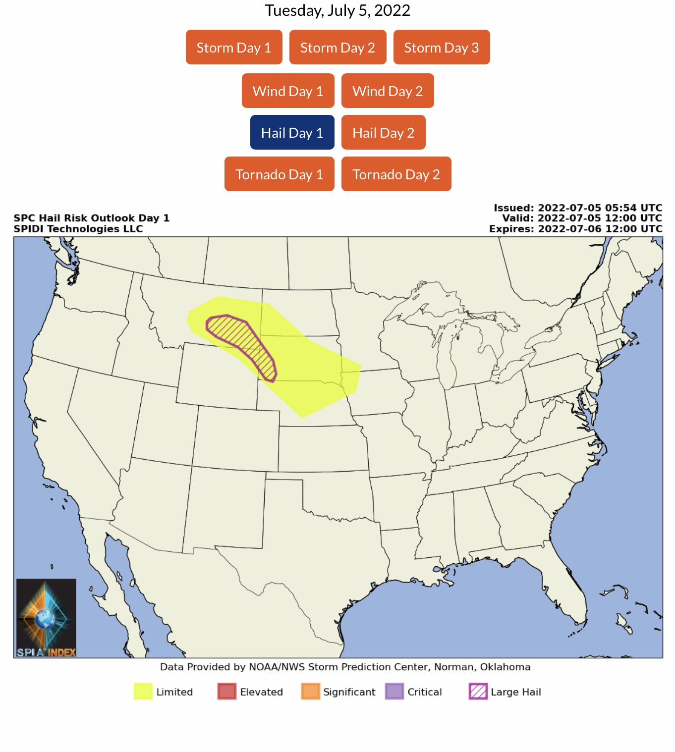
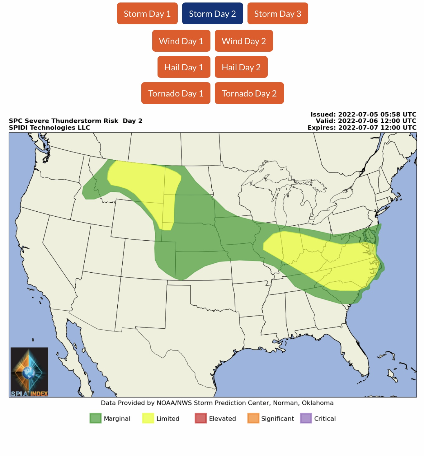
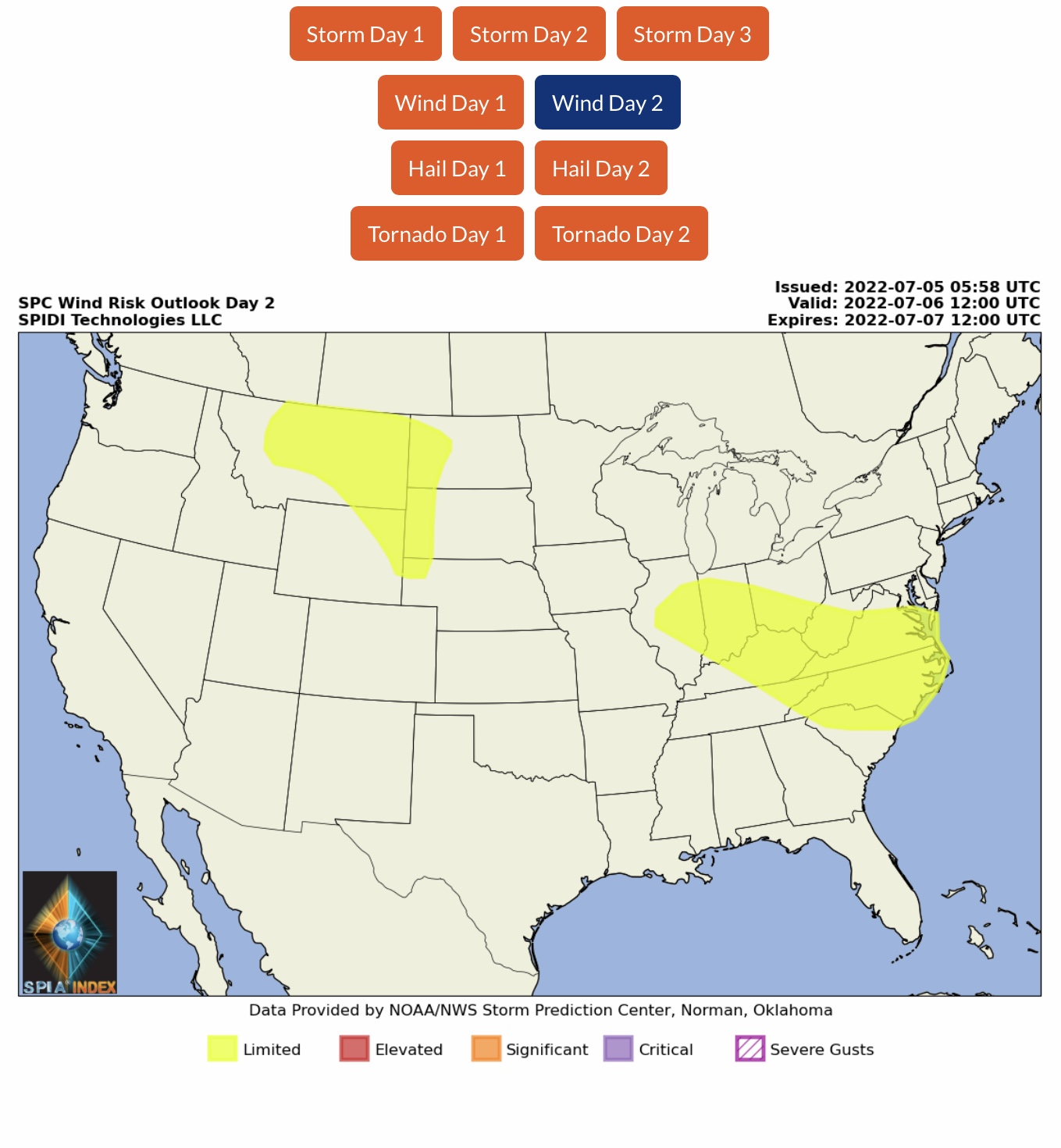
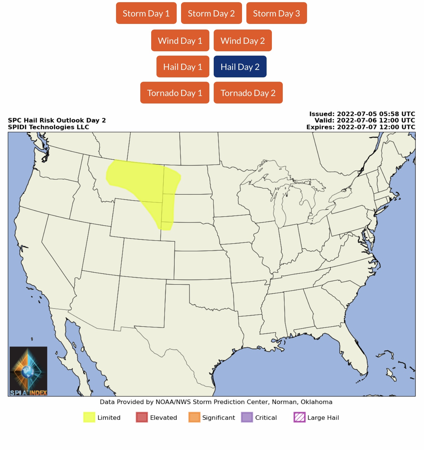
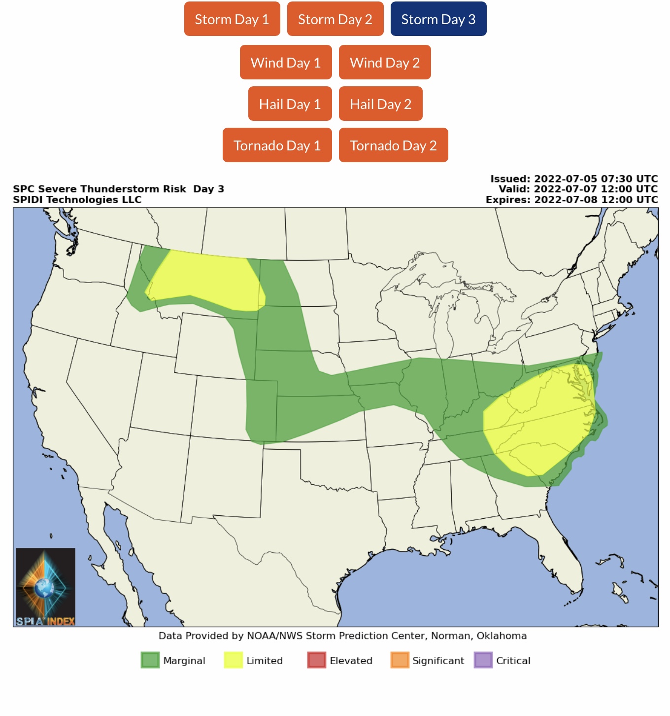
Current NWS Watches, Warnings & Advisories. Current COD Radar. ELEVATED Severe Thunderstorm Risk, Day 1 (Tuesday, 7/5), parts MT, ND, SD, MN, NE & IA, includes ELEVATED Risk for High Winds & Severe Gusts, and Hail/Large Hail. LIMITED Severe Thunderstorm Risk, Days 2 & 3 (Wednesday & Thursday).
Sidney Sperry 05 Jul 2022 11:39 UTC
FYI… Heat Advisories and/or Excessive Heat Warnings across parts of 20 states. Severe thunderstorms likely across southeastern MT, southwestern ND, northwestern SD, and much of northern IN and northern and western OH today. Temperature Forecasts and WBGT forecast in next email.
Sid Sperry
President & CEO
SPIDI Technologies, LLC
SPIDItech.com
Cell: 405-627-7754

Sent from my iPad

 Show/hide attachments