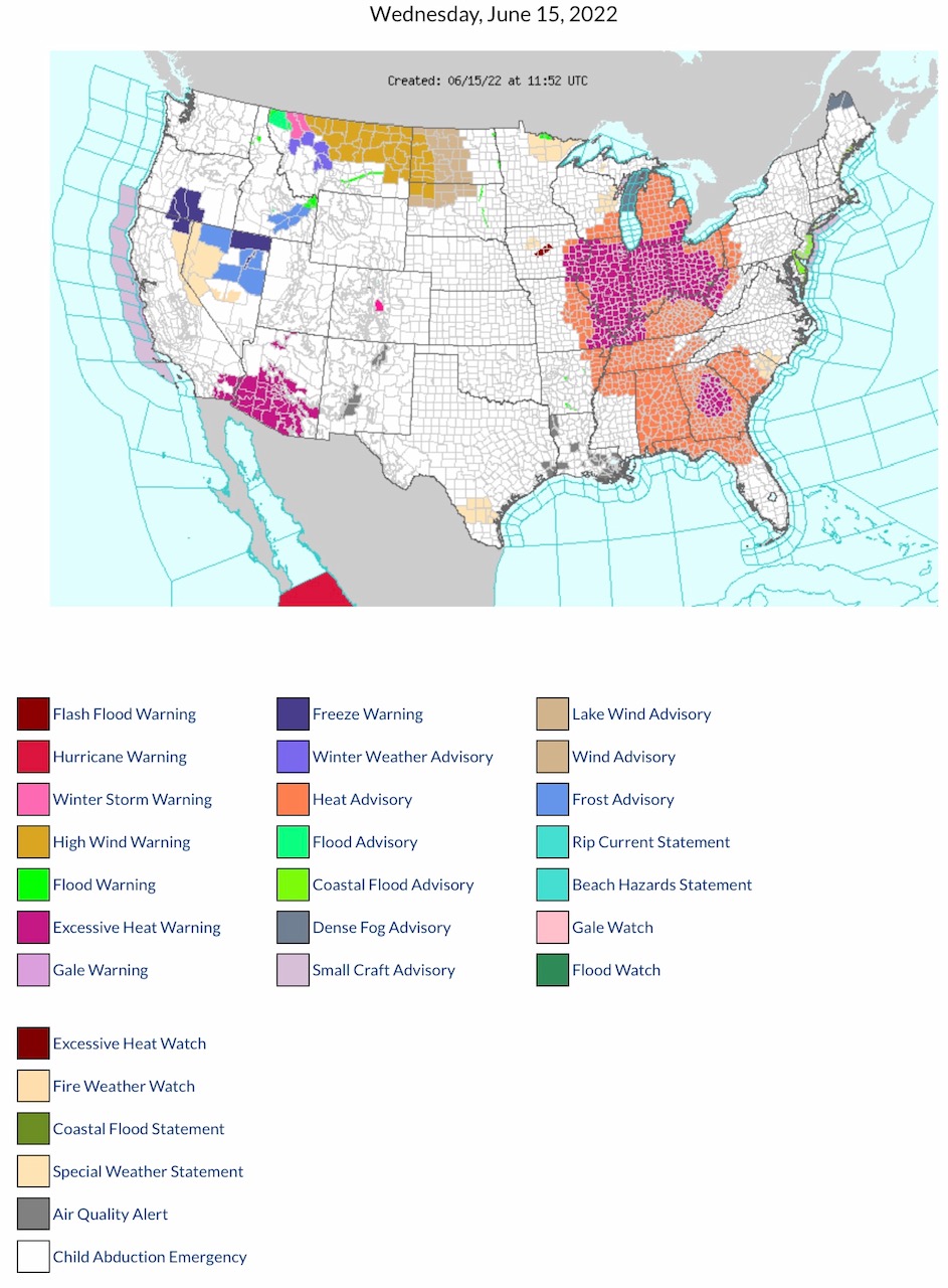
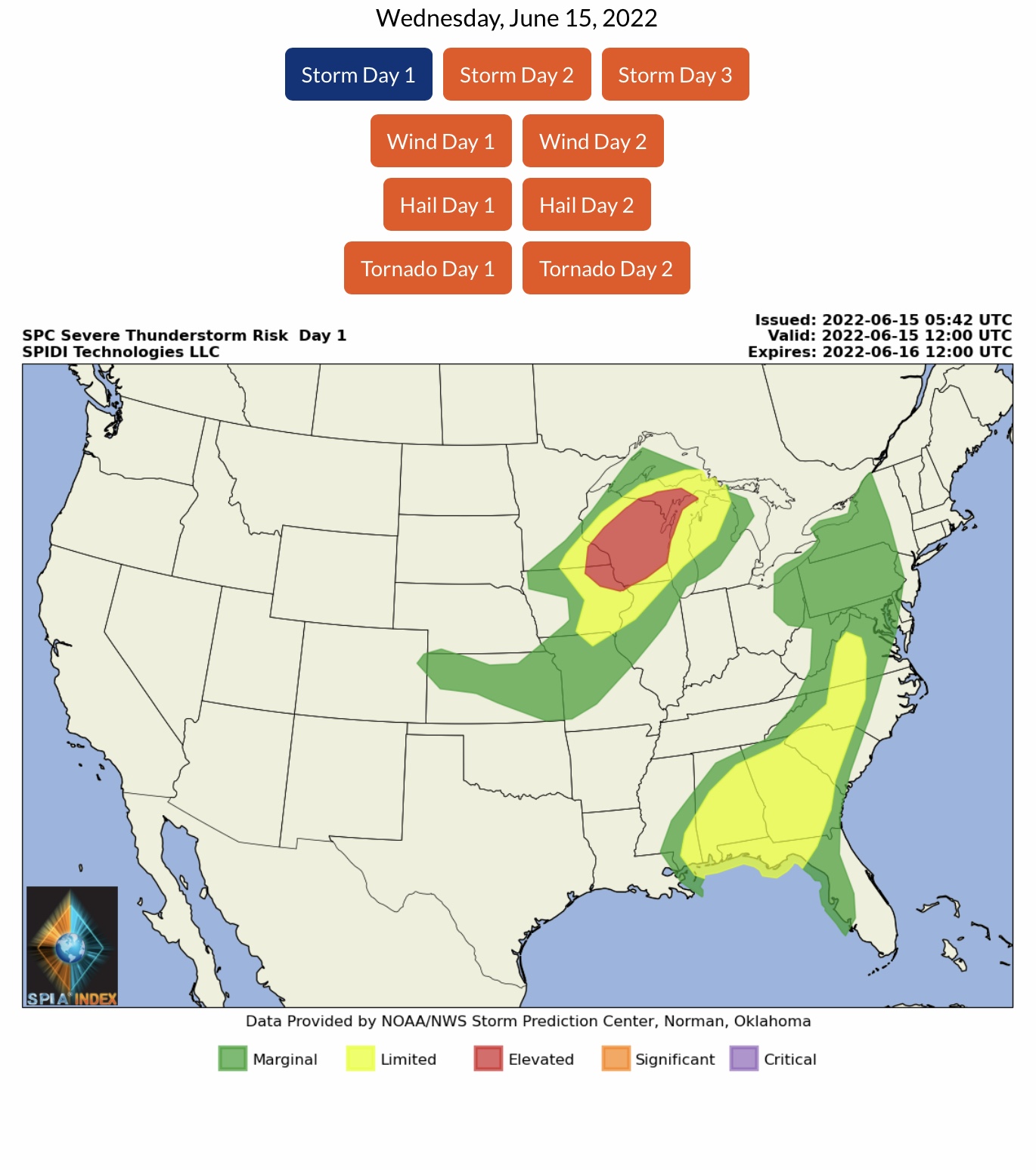
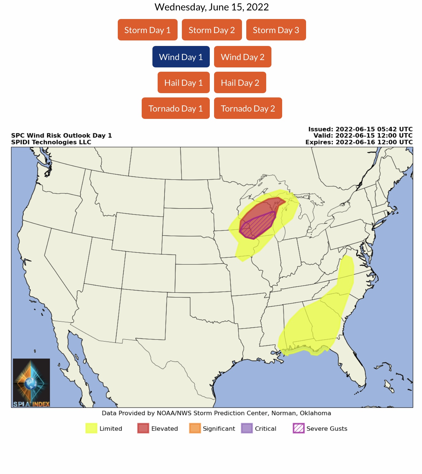
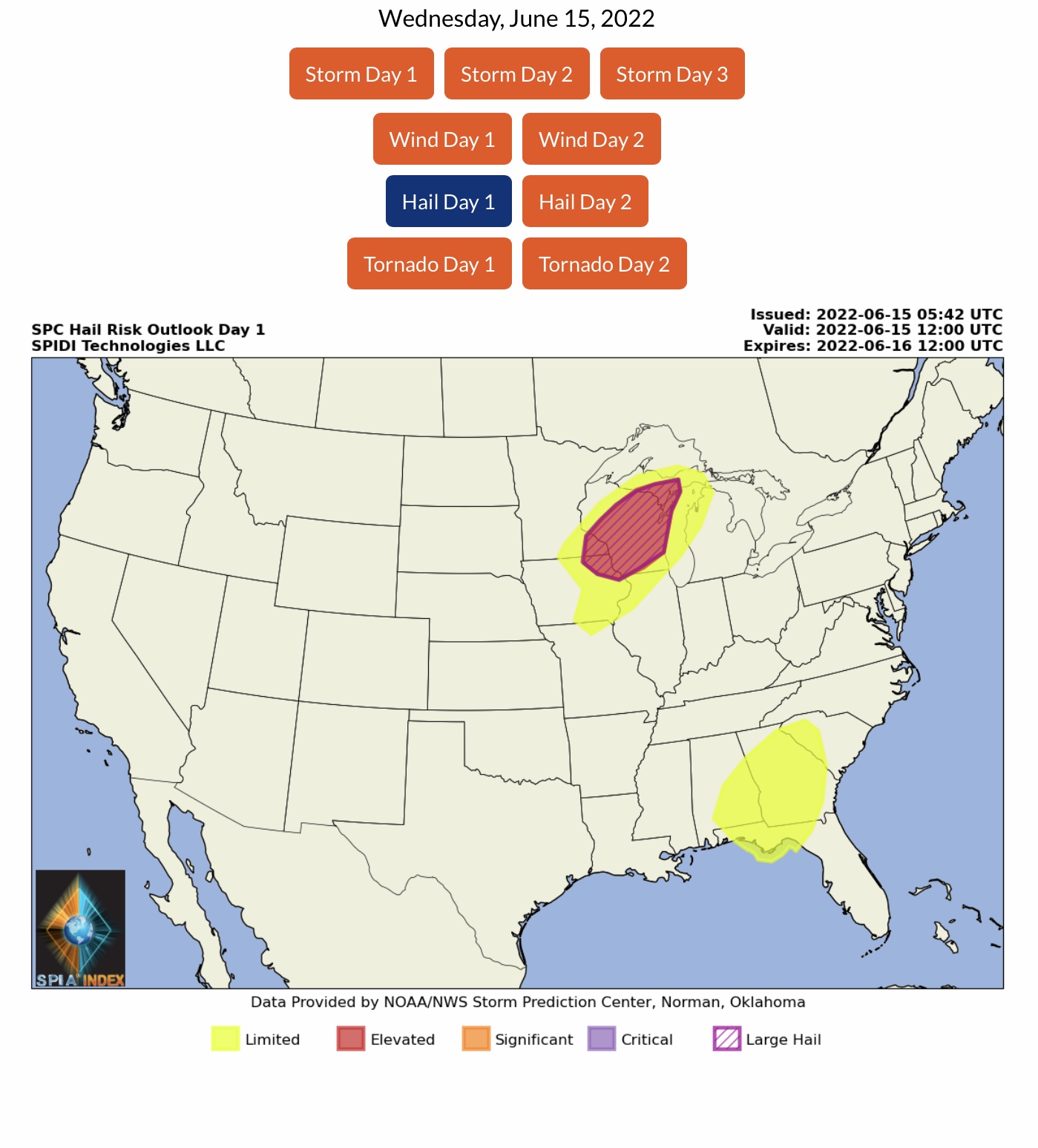
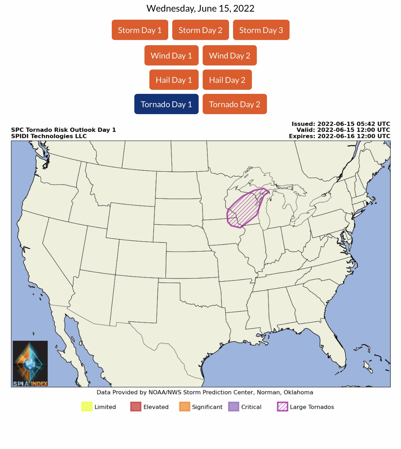
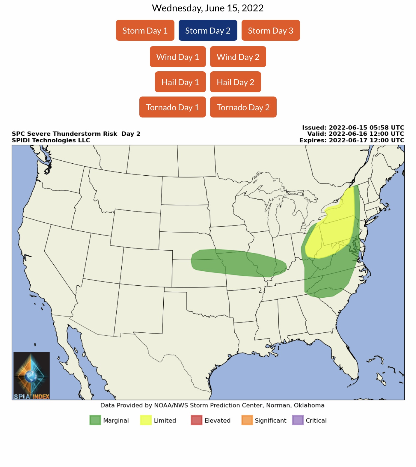
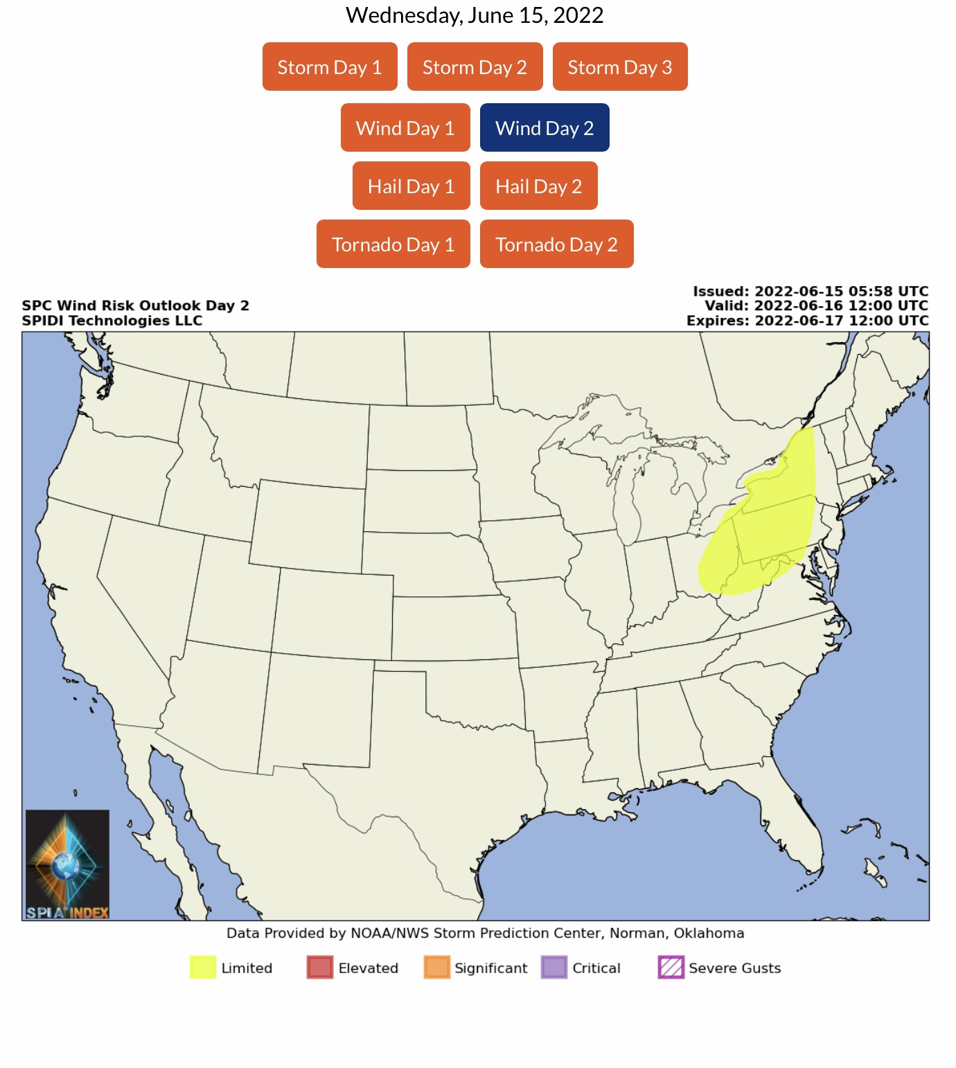
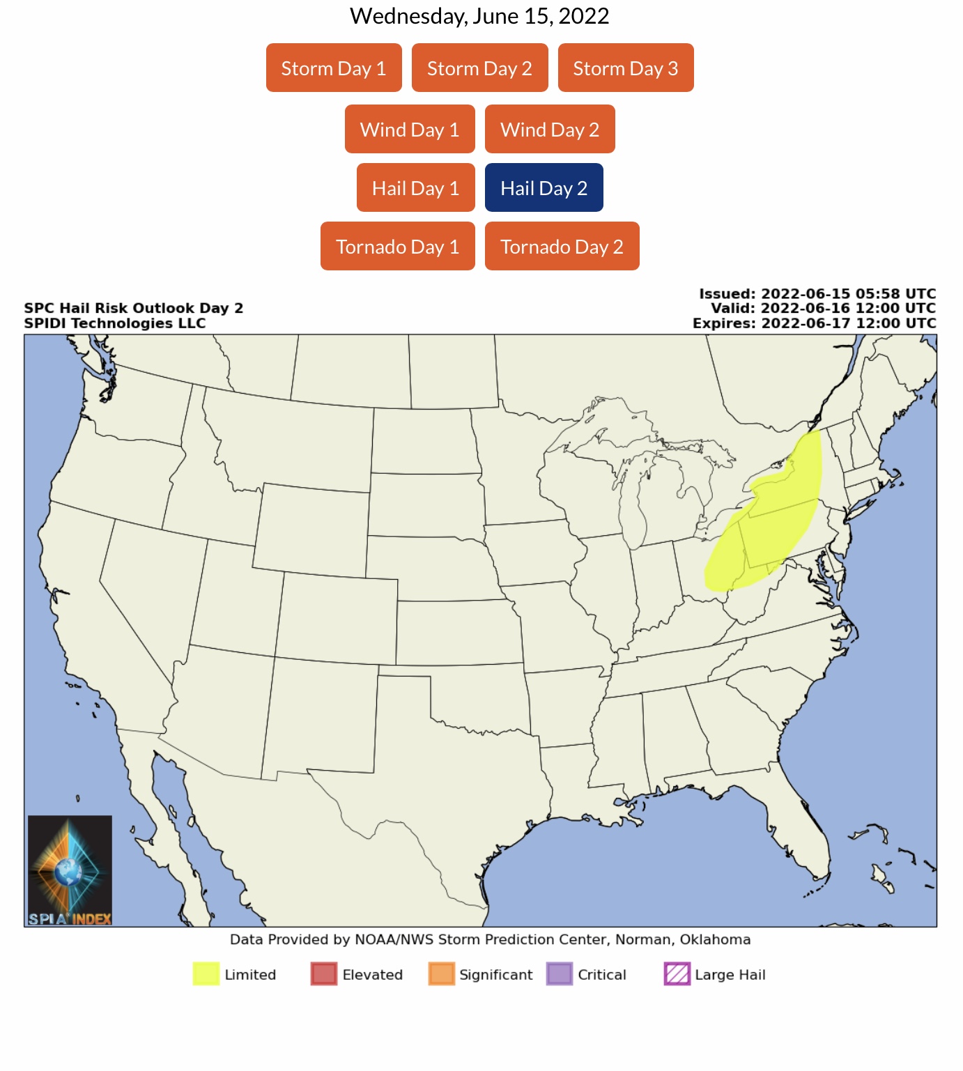
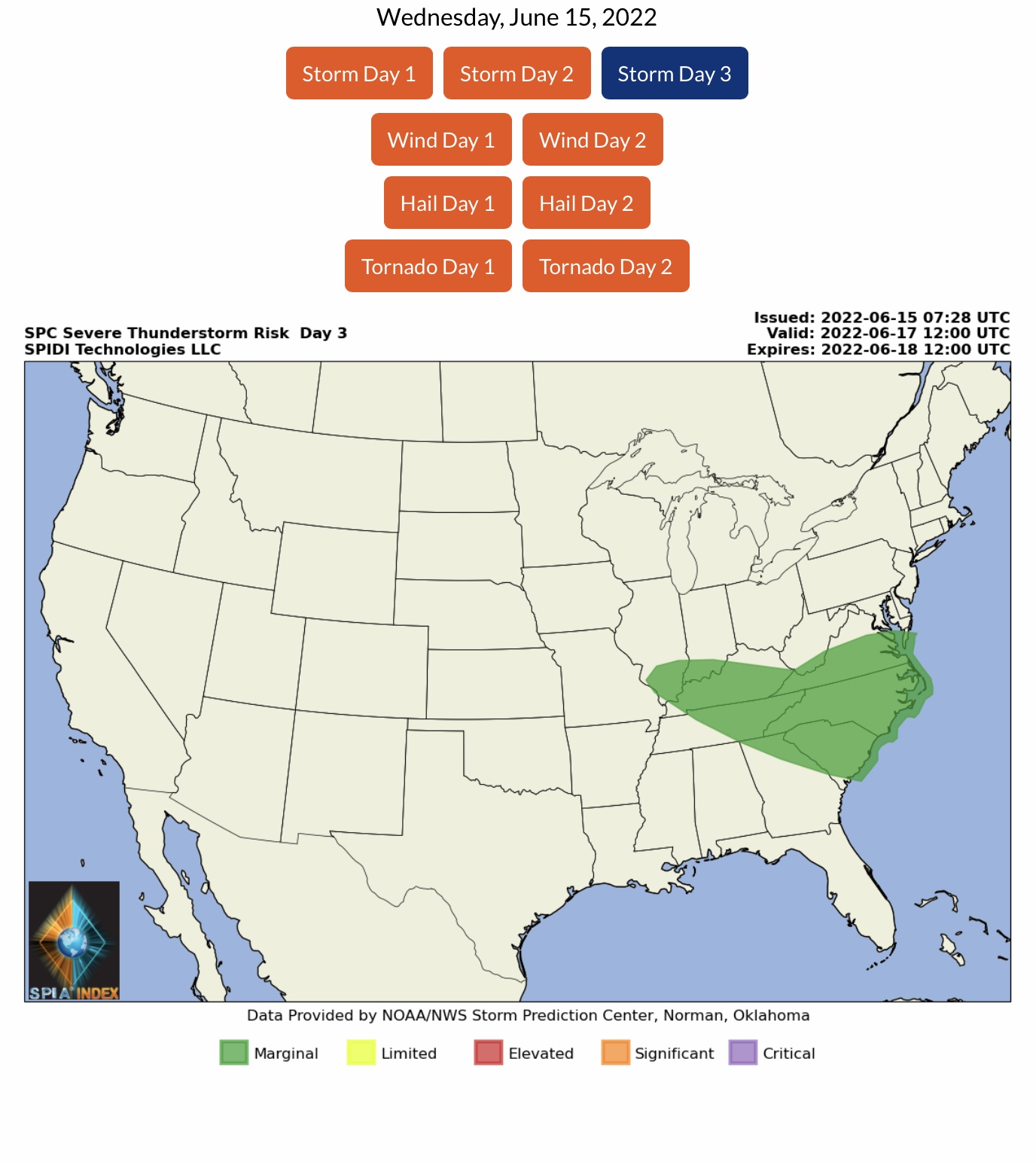
High Heat continues, spreading further East. Excessive Heat Watches & Warnings now in parts of 20 states. ELEVATED/ENHANCED Risk of Severe Thunderstorms, Day 1 (today, 6/15), parts MI Upper Peninsula, most of WI, southeastern MN and northeastern IA. Includes ELEVATED Risk for High Winds & Wind Gusts, Hail & Large Hail, and the possibility of some Large and Long-Track Tornadoes. LIMITED Risk for parts VA, NC, SC, GA, FL, AL & MS. Day 2 (Thursday) parts NY, PA, OH, WV, MD, VA.
Sidney Sperry 15 Jun 2022 12:25 UTC
Severe Thunderstorm Risk for parts MI Upper Peninsula, most of WI, southeastern MN and northeastern IA today. Risk is ELEVATED/ENHANCED for High Winds and Wind Gusts, Hail and Large Hail, Tornadoes and some Large, long-track Tornadoes possible.

Excessive Heat Watches and Warnings now posted by NWS across portions of at least 20 states, from CA & AZ to MO, IL, IN, MI & OH to southeastern states TN, MS, AL, FL, GA, SC, NC, KY and WV.

Second email to come with NWS Temperature Forecasts and Wet Bulb Globe Temperature (WBGT) Forecasts.

Sid Sperry

 Show/hide attachments