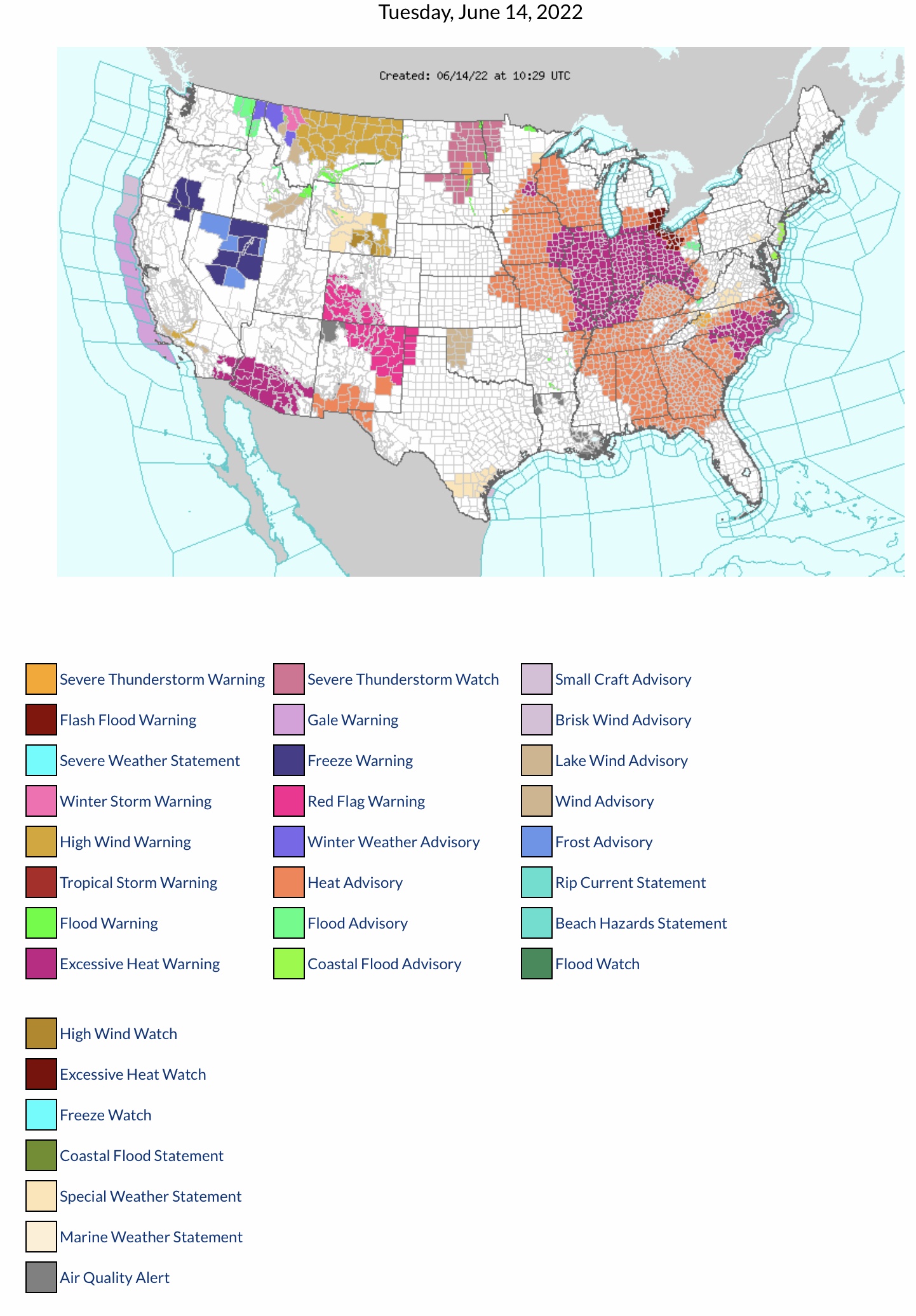
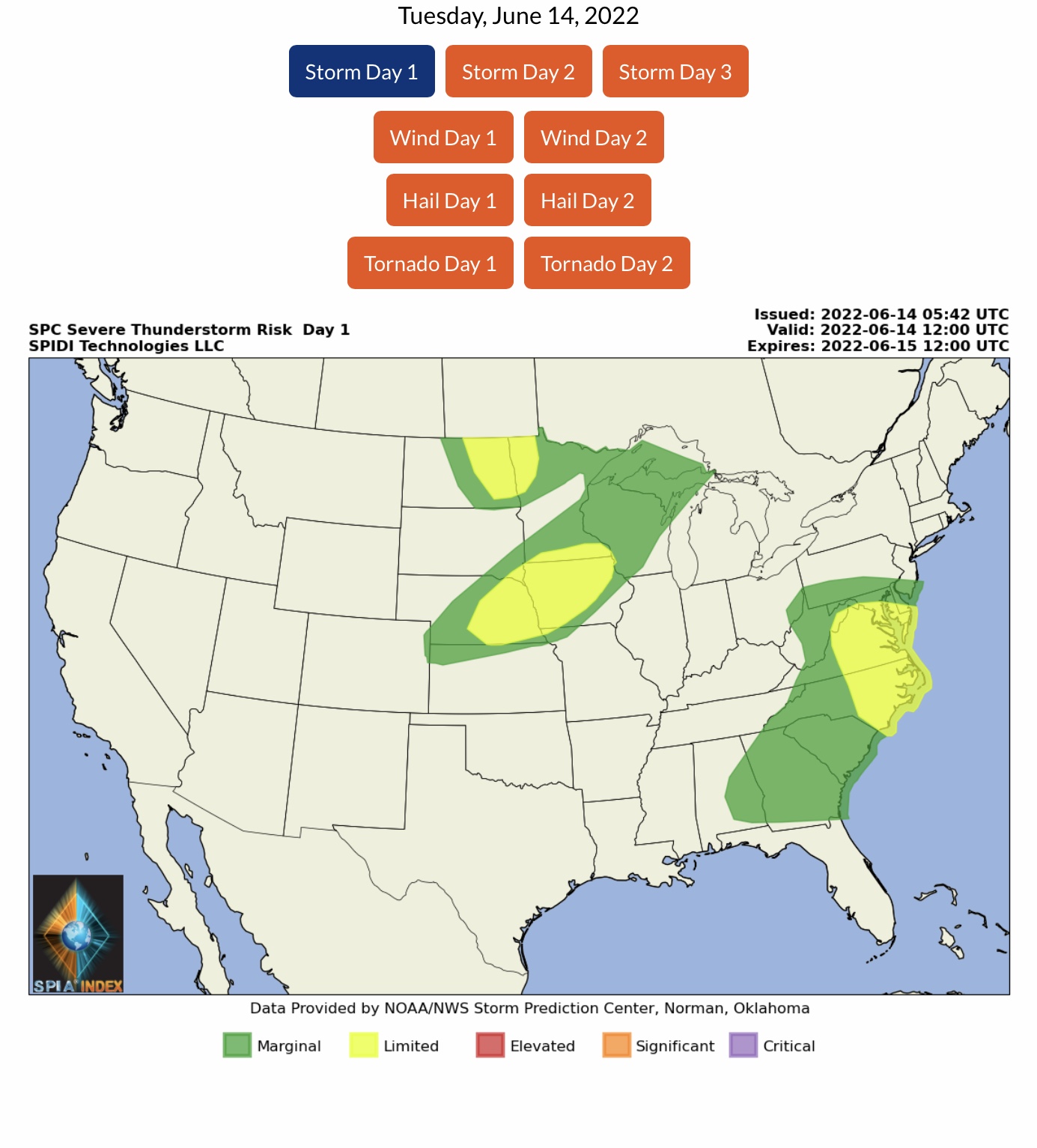
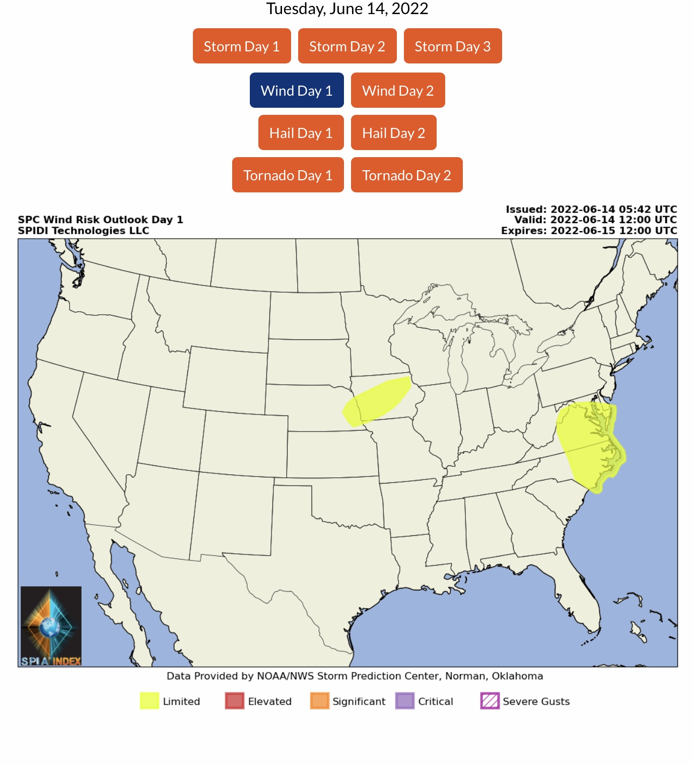
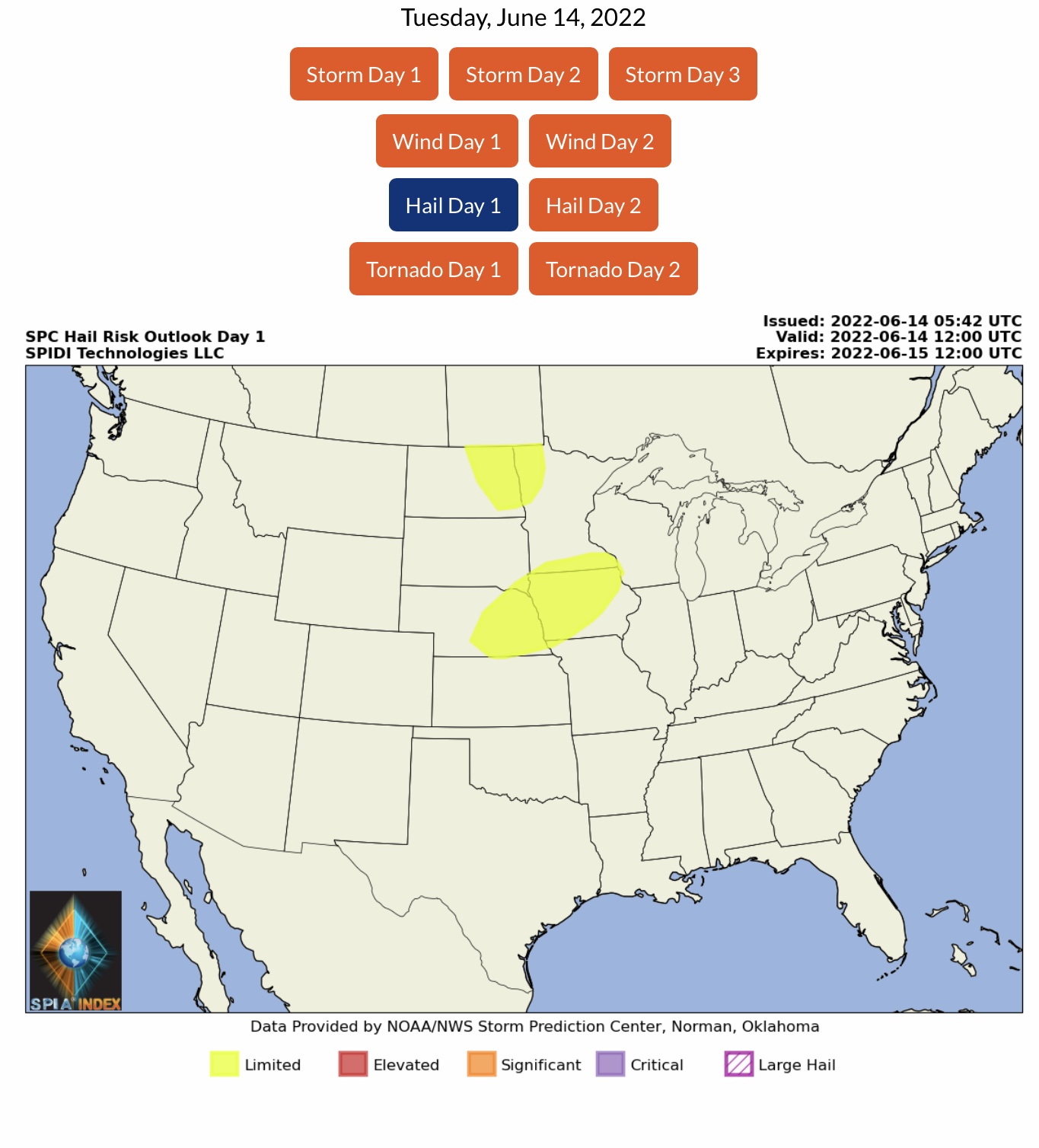
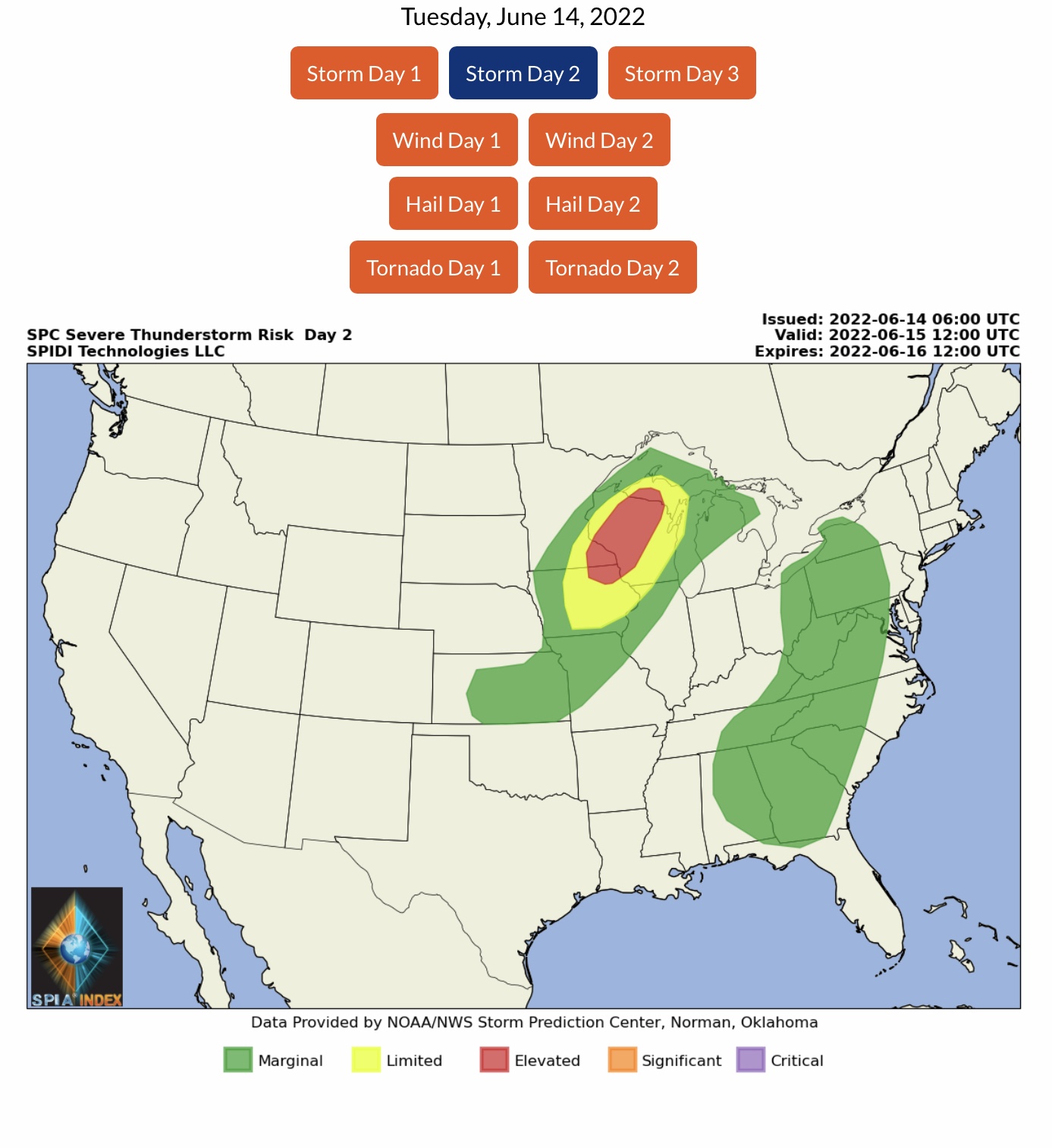
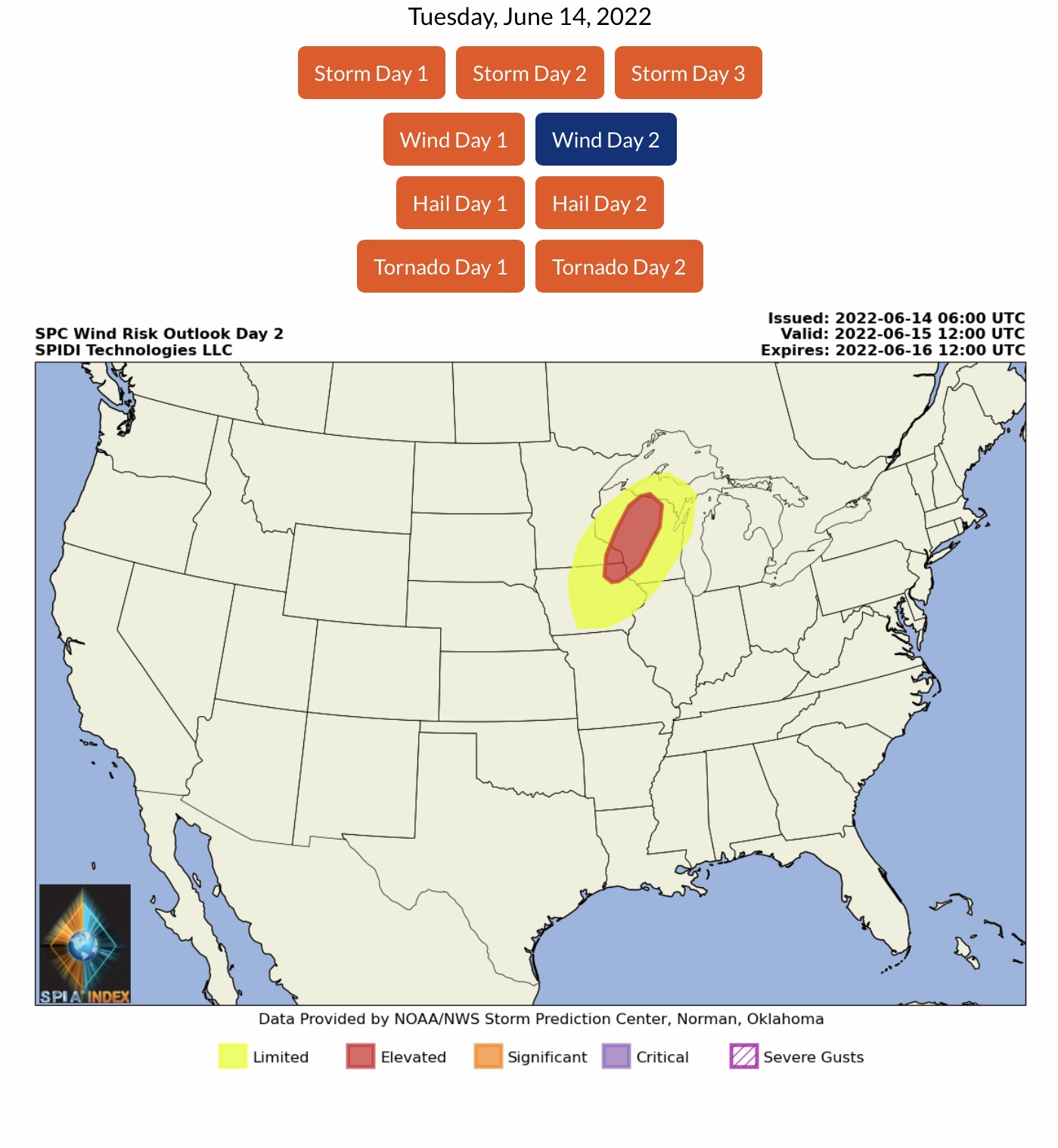
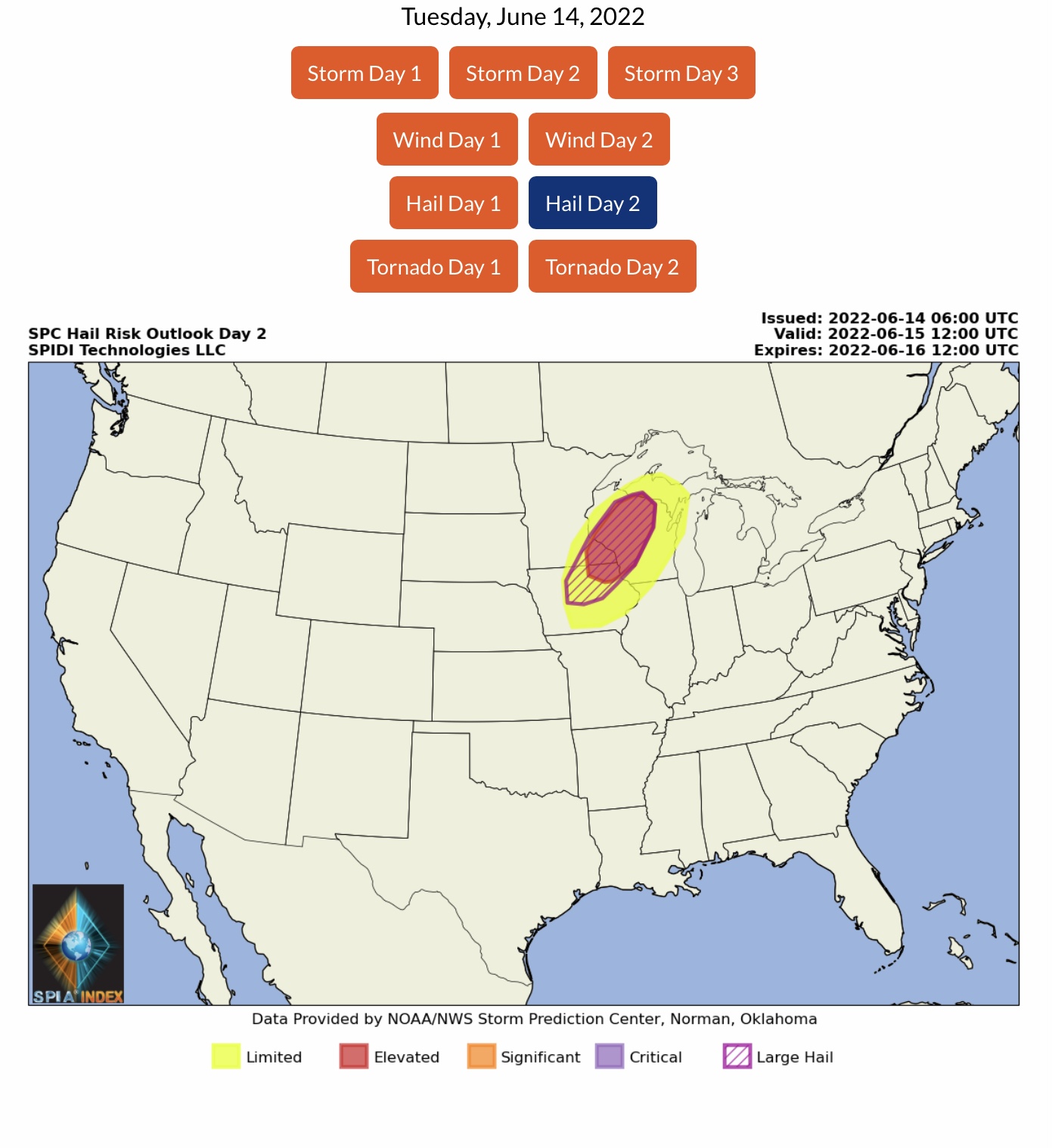
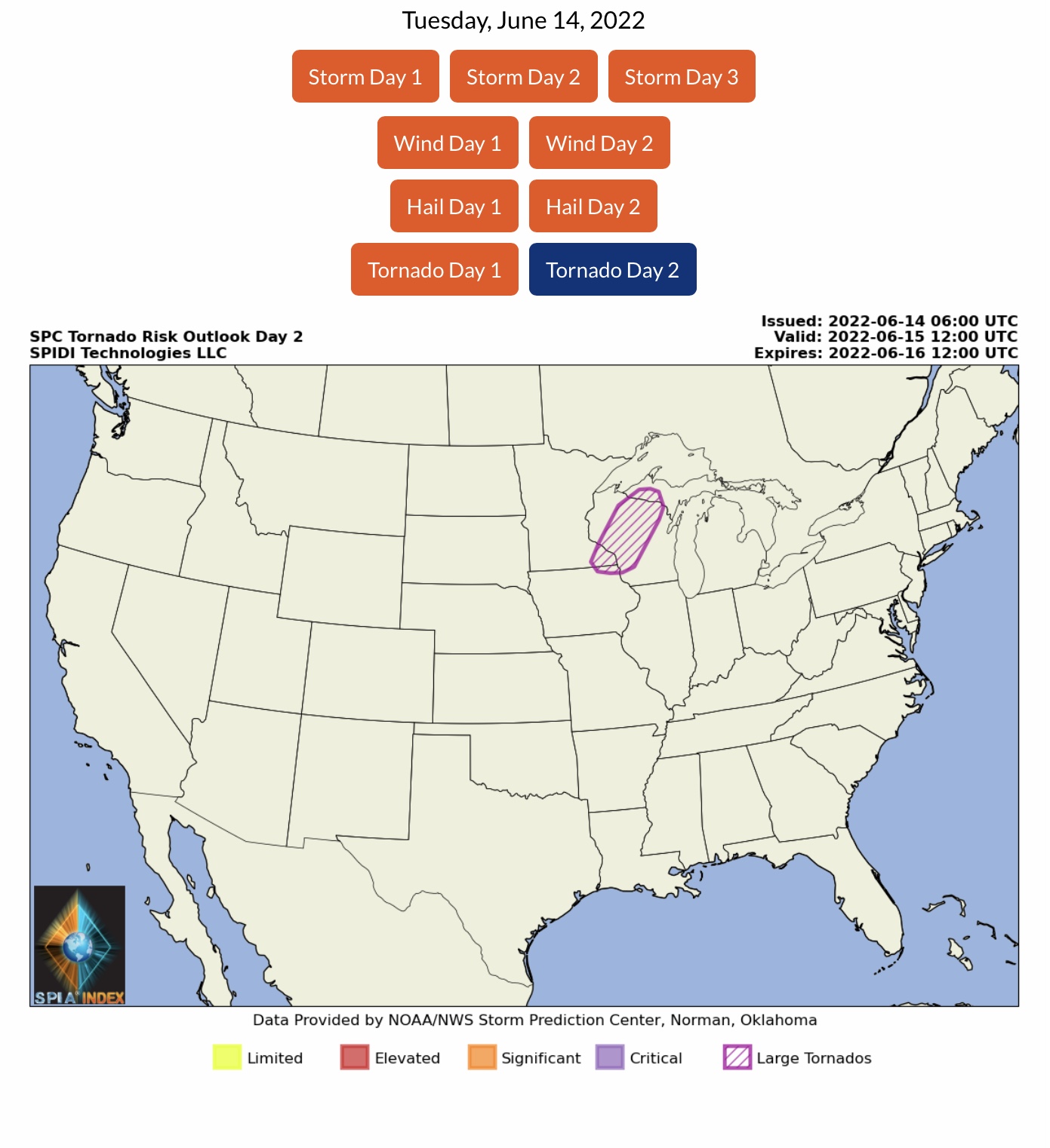
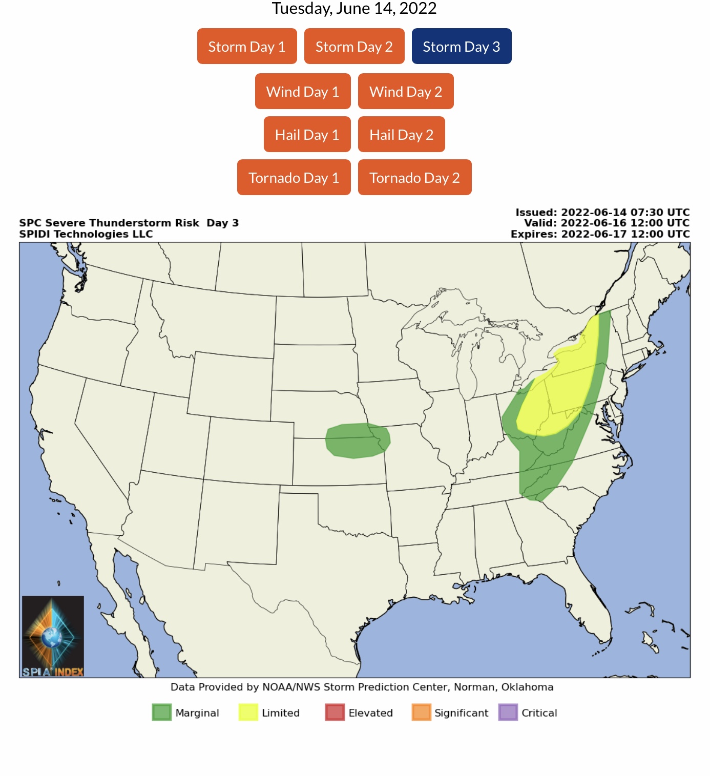
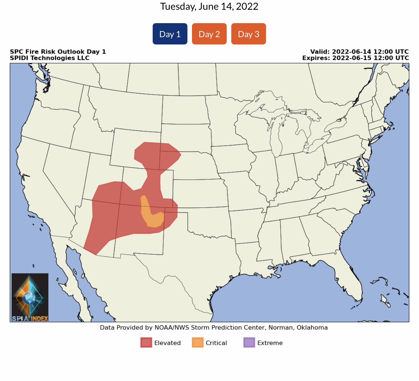
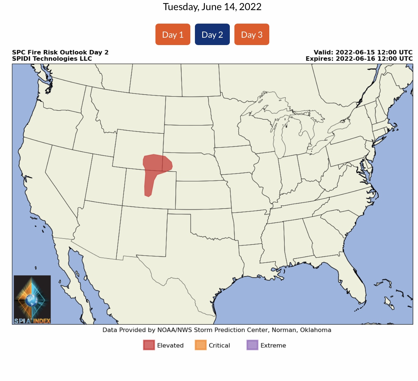
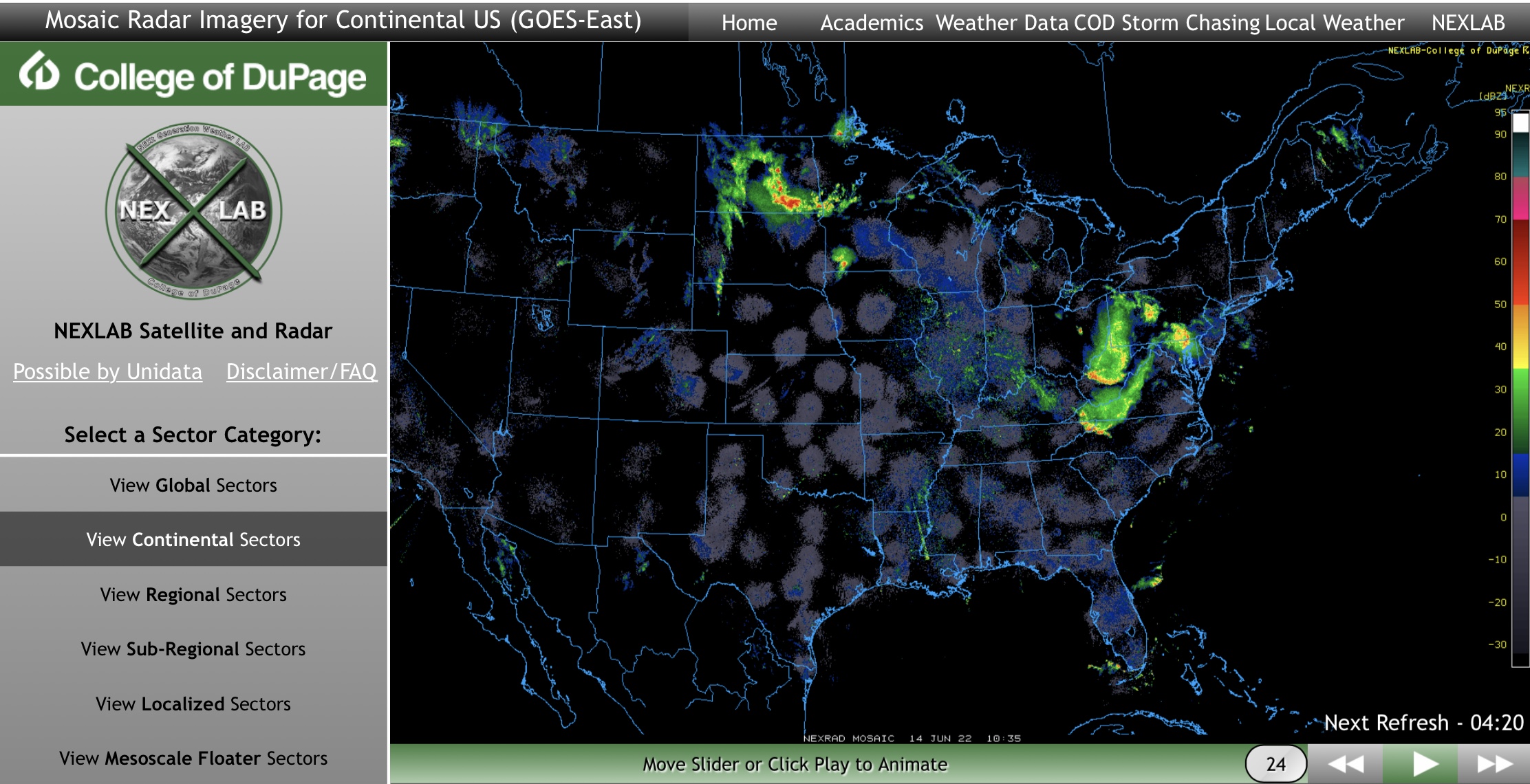
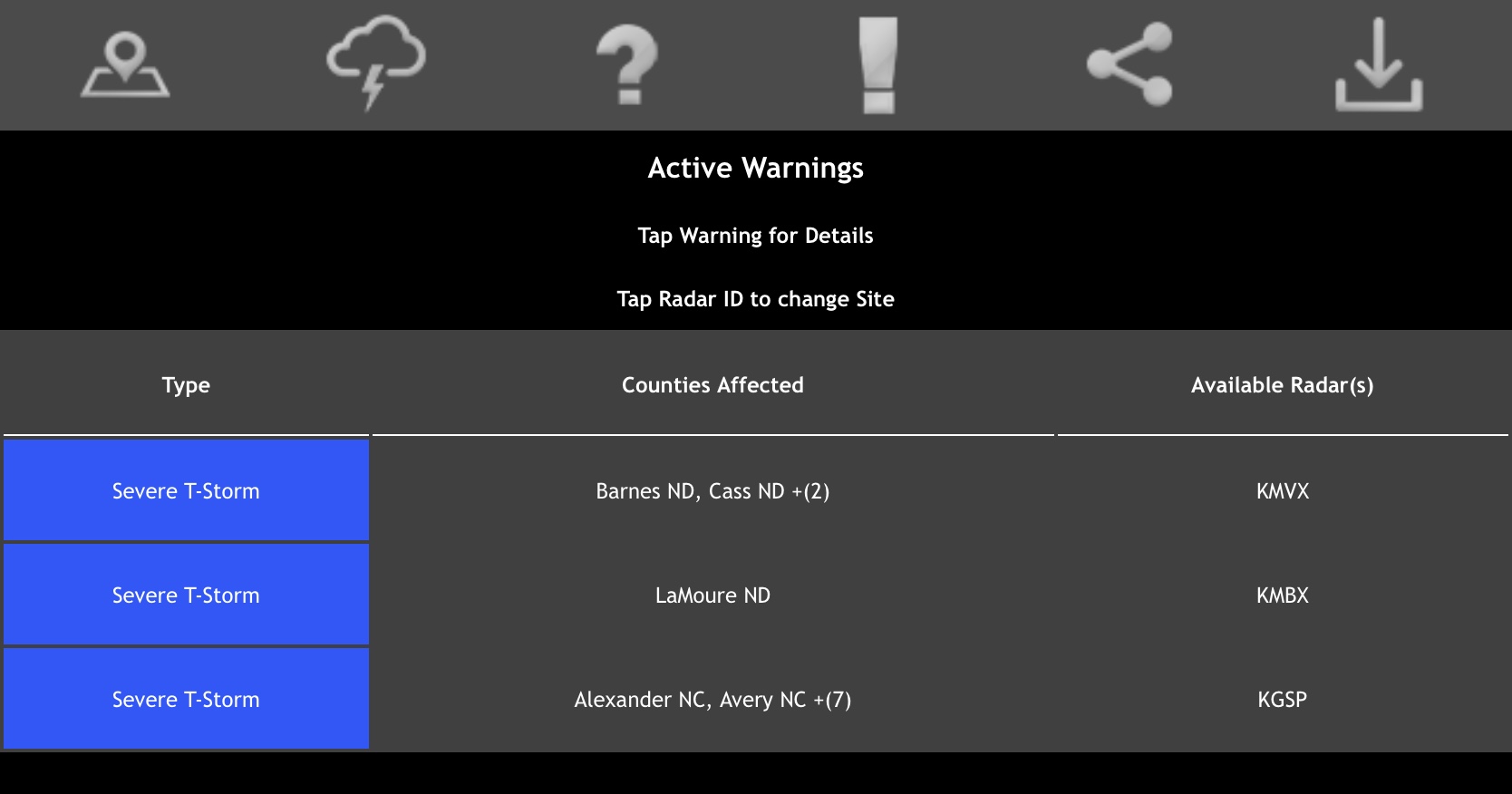
Heat Advisories and Excessive Heat Warnings dominate the Current NWS Watches & Warnings map. High Wind Warning across northern MT. LIMITED Risk of Severe Thunderstorms, Day 1 (today, 6/14), parts ND, MN, NE, SD, IA, MO, WV, MD, DE, VA, DC & NC. ELEVATED/ENHANCED Risk for Severe Thunderstorms, Day 2 (Wednesday, 6/15), including High Wind Risk, Large Hail Risk & Large Tornado Risk, parts MI Upper Peninsula, WI, MN and IA. LIMITED RISK, Day 3, parts NY, OH, PA, WV and MD. CRITICAL Fire Risk, Day 1, parts CO and NM…
Sidney Sperry 14 Jun 2022 11:17 UTC
FYI… First of two (2) emails. Note the SPC Severe Thunderstorm Risk Outlook for Day 2 (Wednesday) is already at the ELEVATED/ENHANCED level, including Risks for High Winds and Wind Gusts, Large Hail, and possibly some Large, long-track Tornadoes.
Heat Advisories and Excessive Heat Warnings are predominant across the East Region, Southeast Region, North Central Region, South Central Region, South Rockies Region, and Southwest Region. Next email will contain NWS Temperature Forecasts for today through Thursday, at 1pm and 7pm CDT, plus Wet Bulb Globe Temperature Forecasts for today through early Wednesday afternoon. - Sid Sperry

 Show/hide attachments