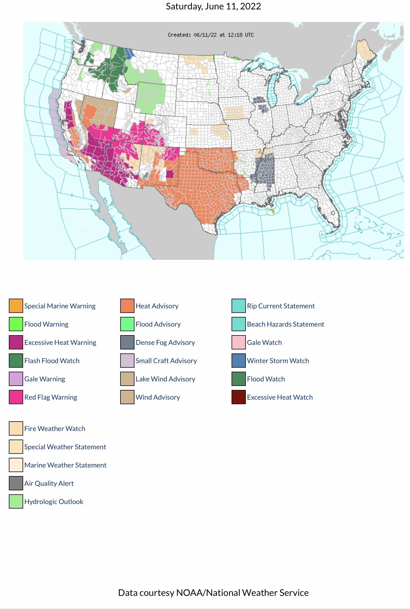
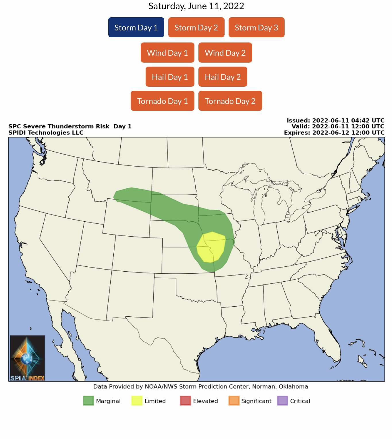
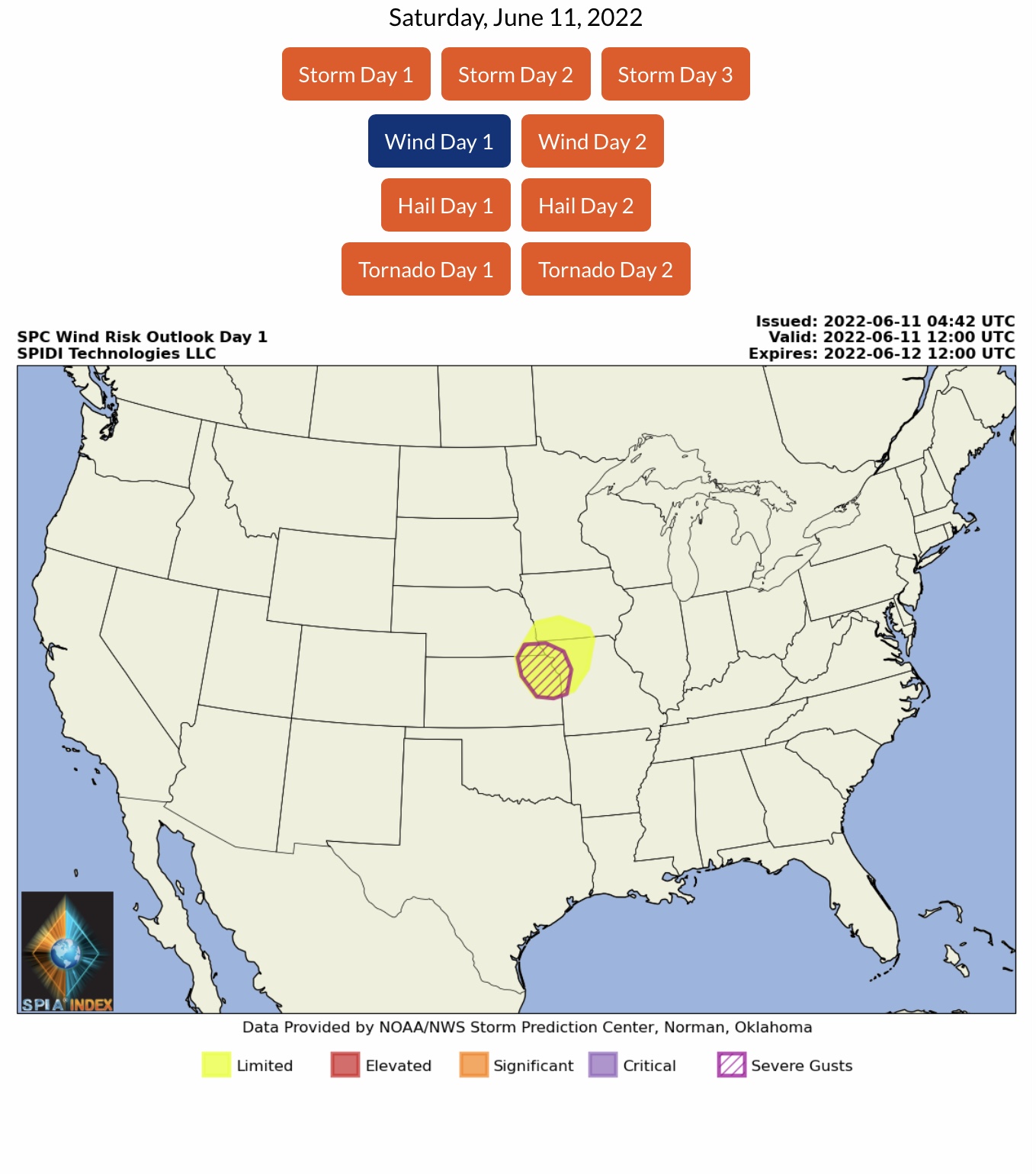
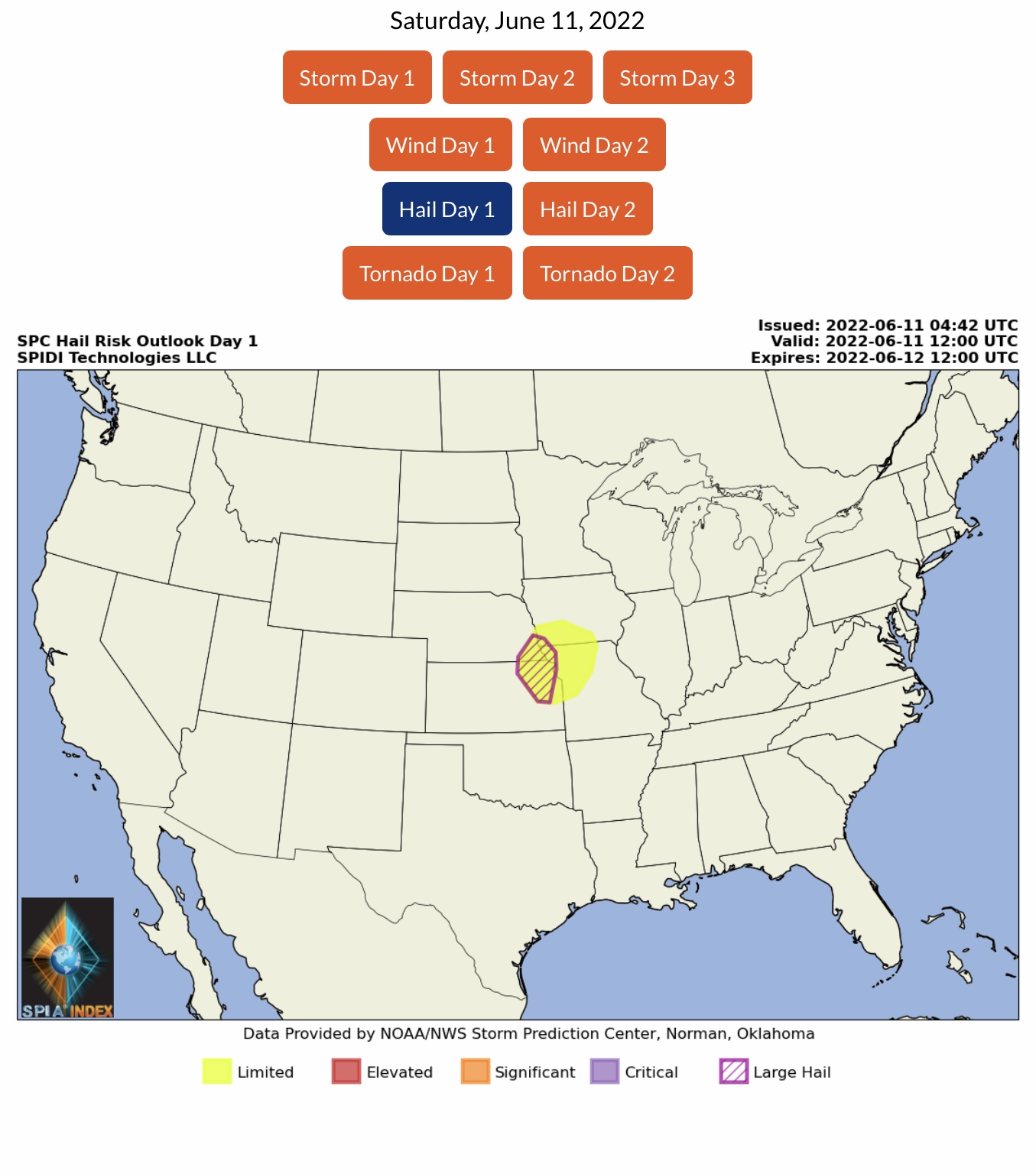
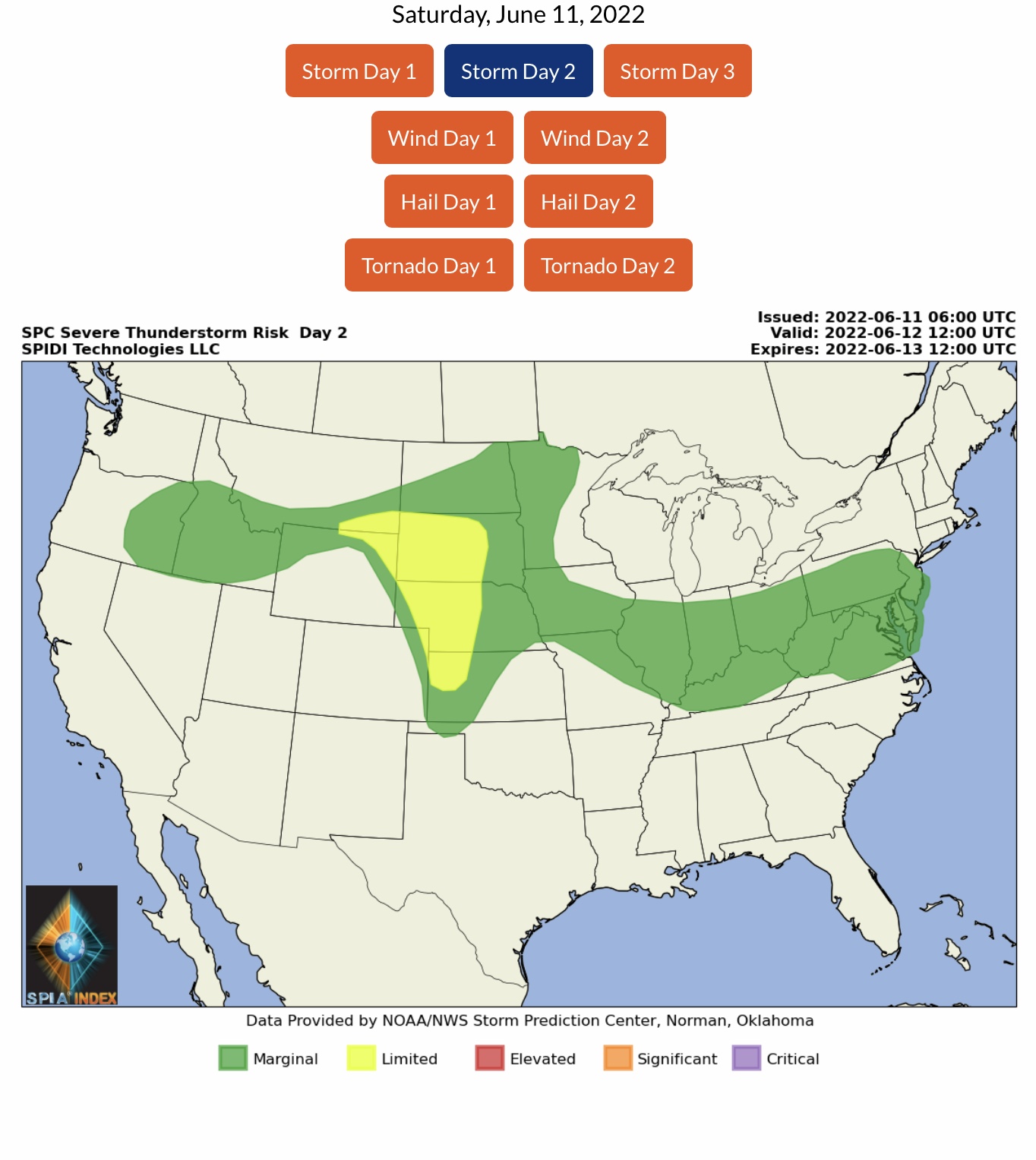
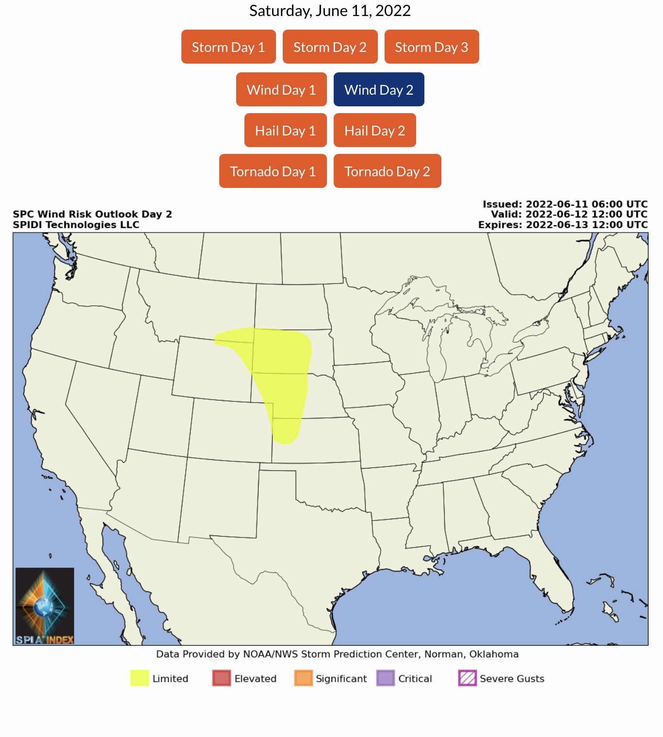
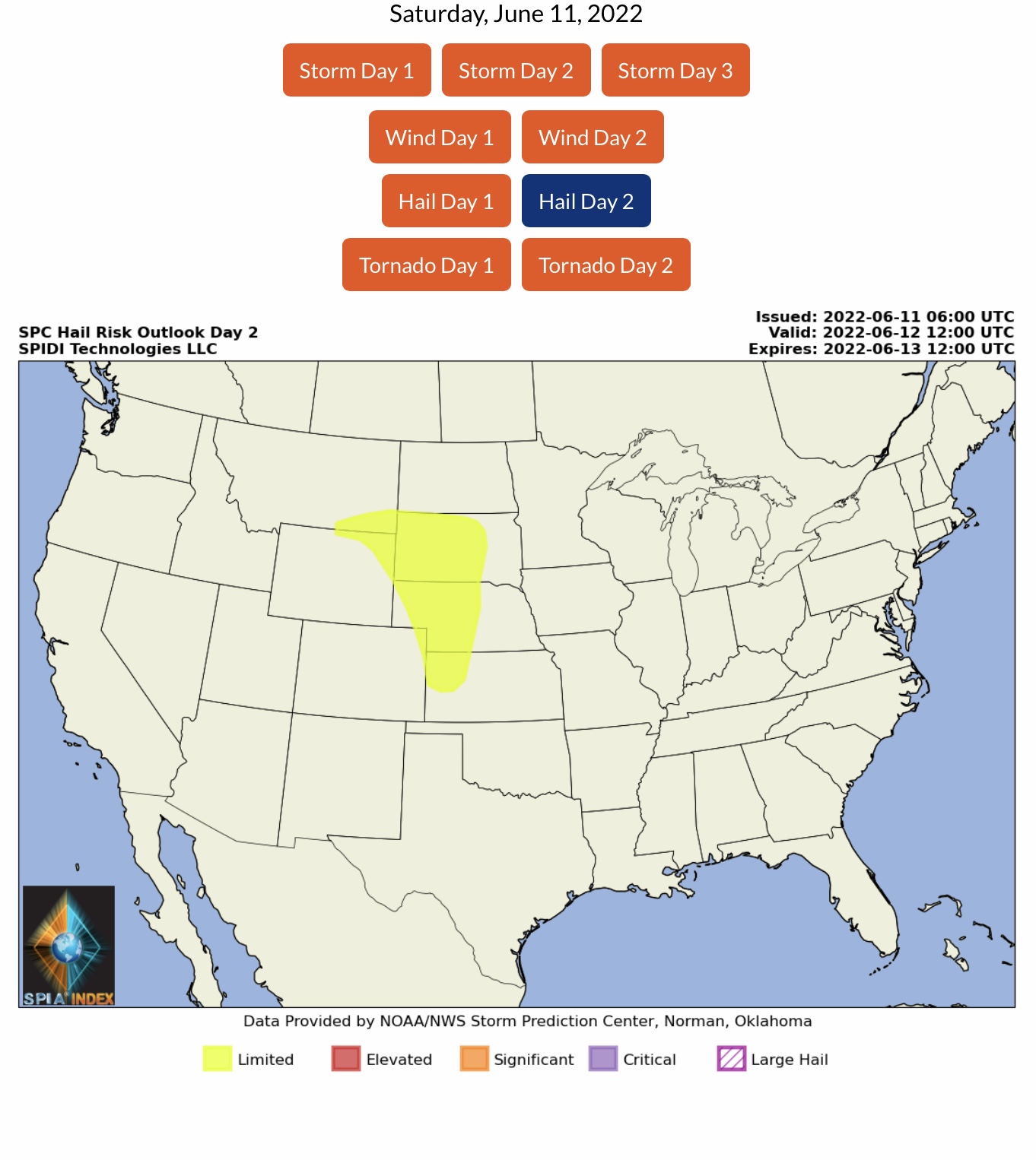
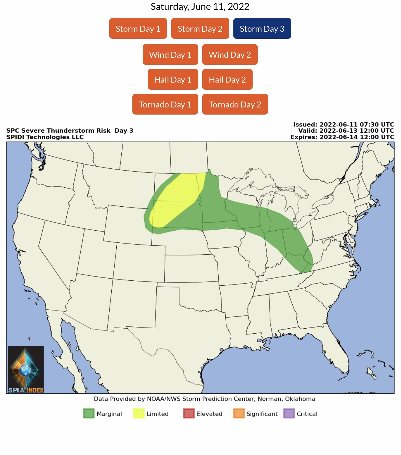
Current NWS Watches, Warnings & Advisories. LIMITED Risk of Severe Thunderstorms, Day 1 (Saturday), parts NE, IA, KS & MO, including Risk for Severe Wind Gusts & Large Hail; LIMITED Risk for Severe Thunderstorms, Day 2 (Sunday), parts MT, WY, SD, CO, NE & KS, including Risk of High Winds and Hail; LIMITED Risk of Severe Thunderstorms, Day 3 (Monday into Tuesday AM), parts ND, WY, SD, MN.
Sidney Sperry 11 Jun 2022 12:59 UTC
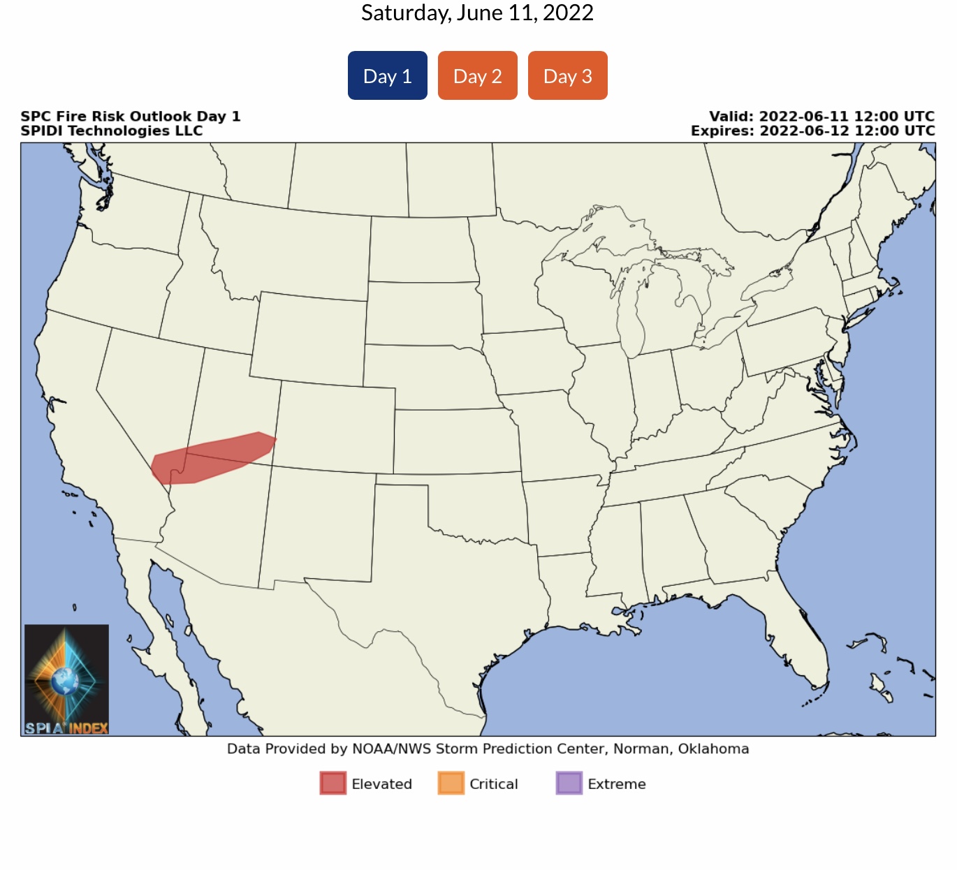
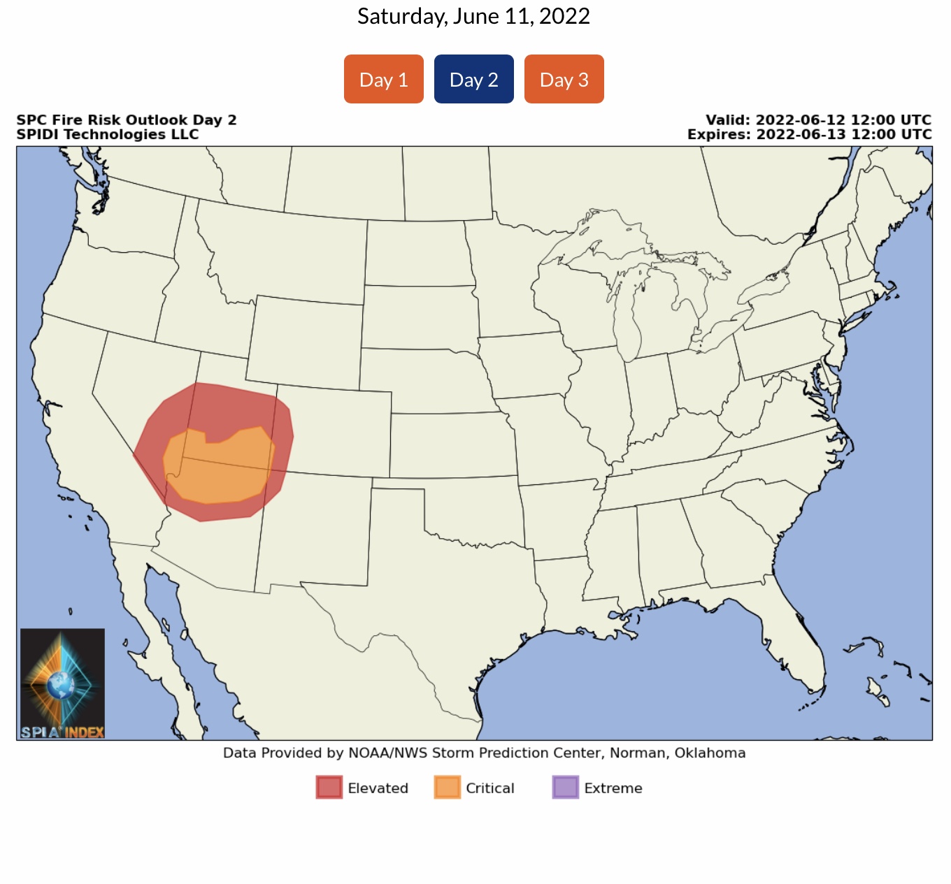
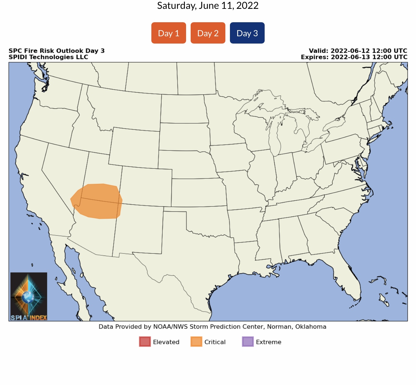
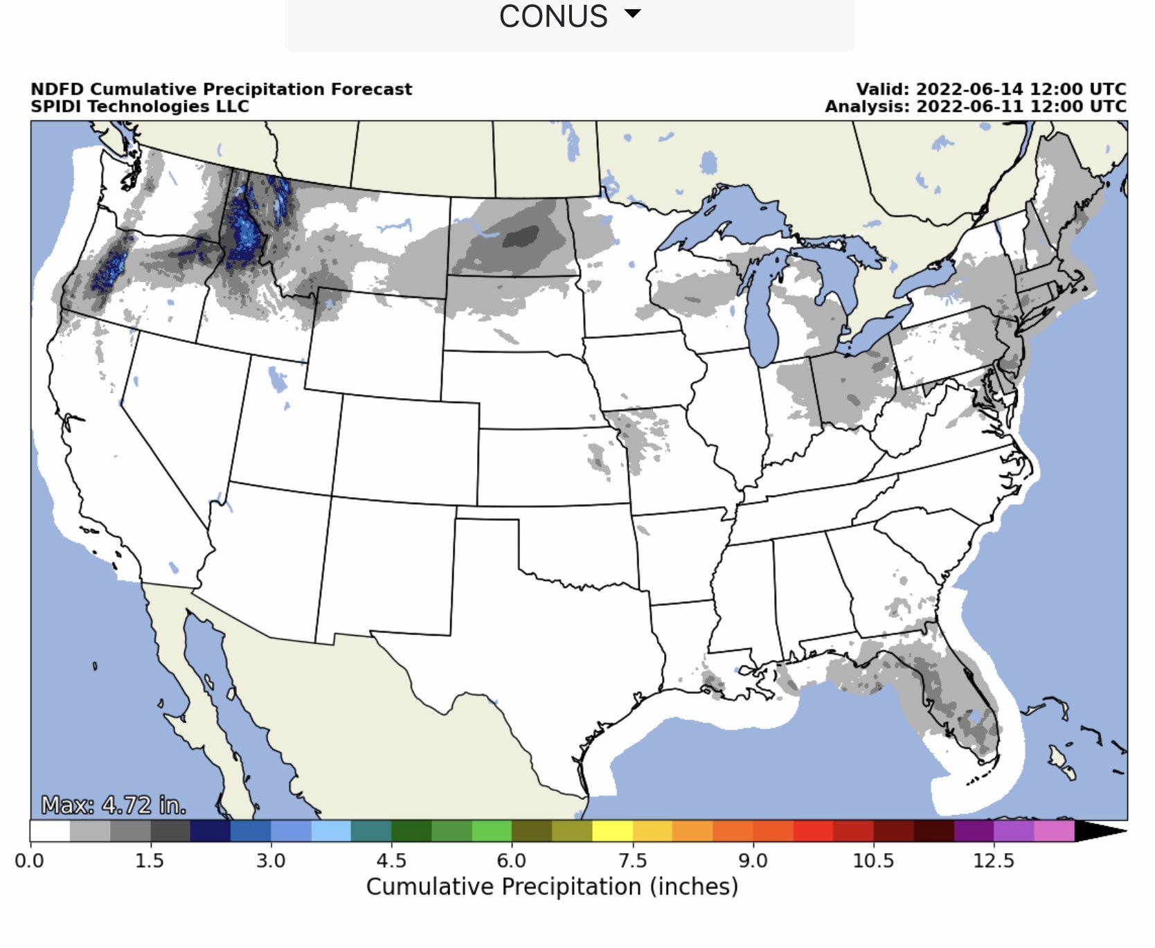
Heat Advisories, Excessive Heat Warnings, and Red Flag Fire Warnings dominate the South Central, South Rockies, and Southwest Regions the next few days. Drought conditions will intensify in these regions as well, since limited amounts of precipitation are expected over the next 7 to 10 days.

The North Central Region will likely see some Severe Thunderstorms over the next 3 days, with some Limited Risk for Severe Wind Gusts and Large Hail possible today across parts of NE, IA, KS & MO. Limited Risk of Severe Thunderstorms, including High Winds and Hail, across parts of MT, ND, MN, WY, SD, CO & KS through Tuesday AM.

ELEVATED to CRITICAL Fire Risk, Days 1 thru 3, parts NV, AZ, UT, CO & NM.

Temperature Forecasts and Wet Bulb Globe Temperature Forecasts in next email.

Sid Sperry

 Show/hide attachments