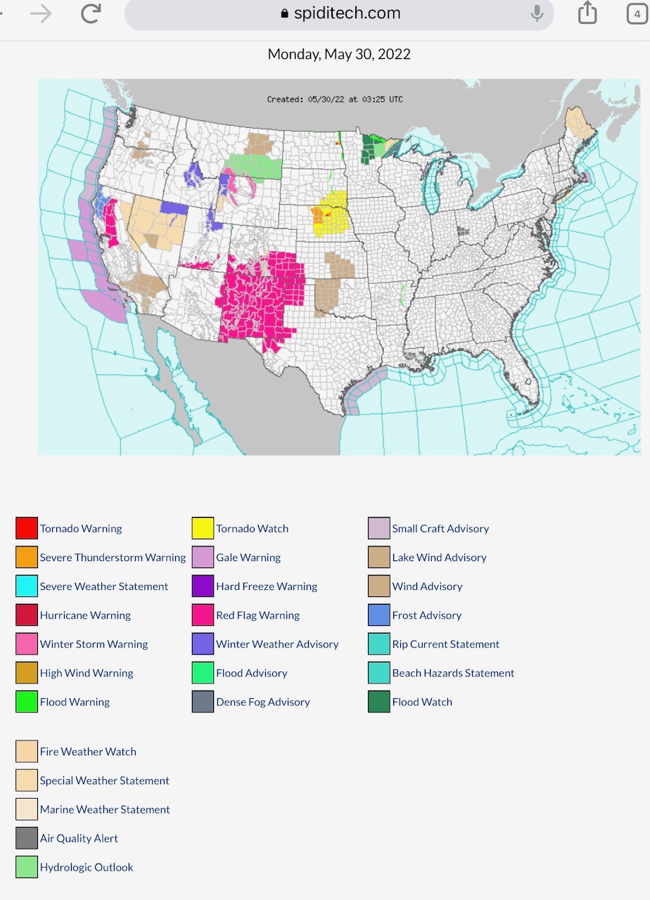
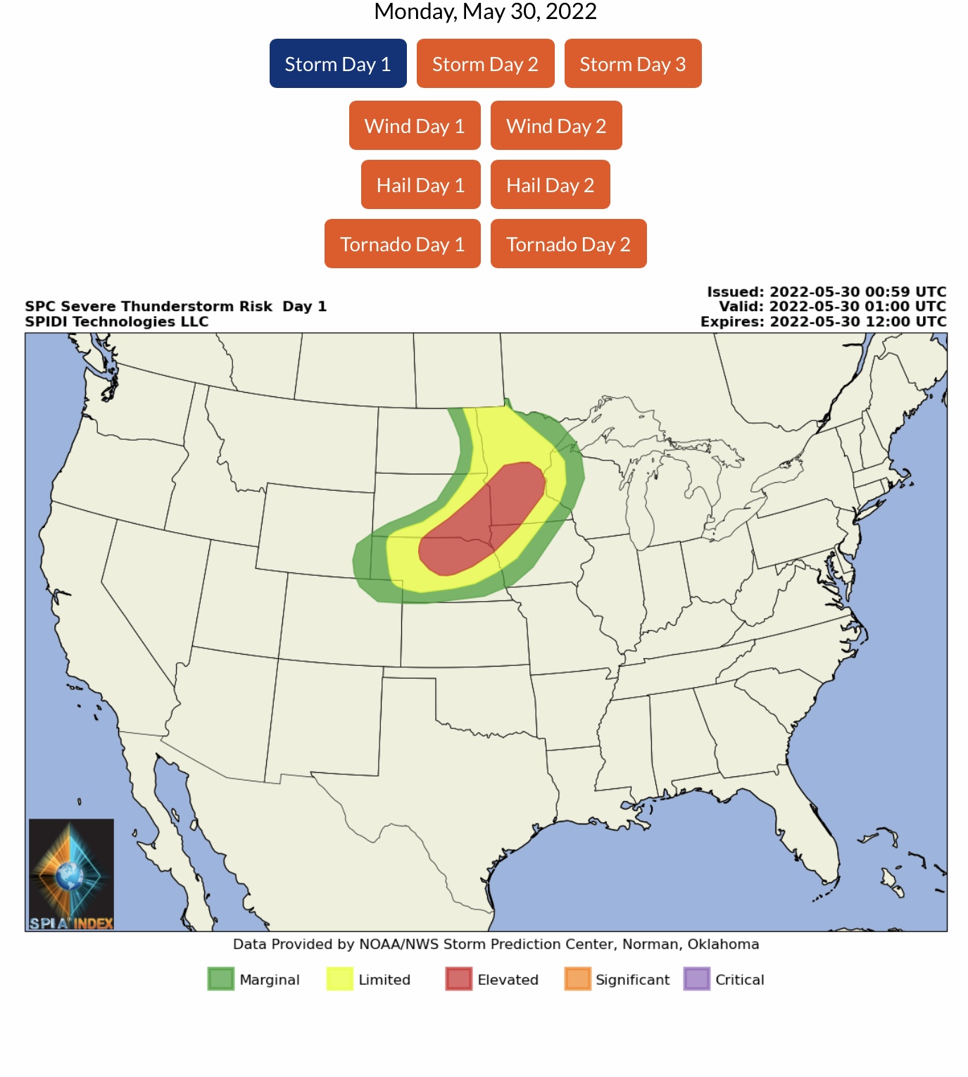
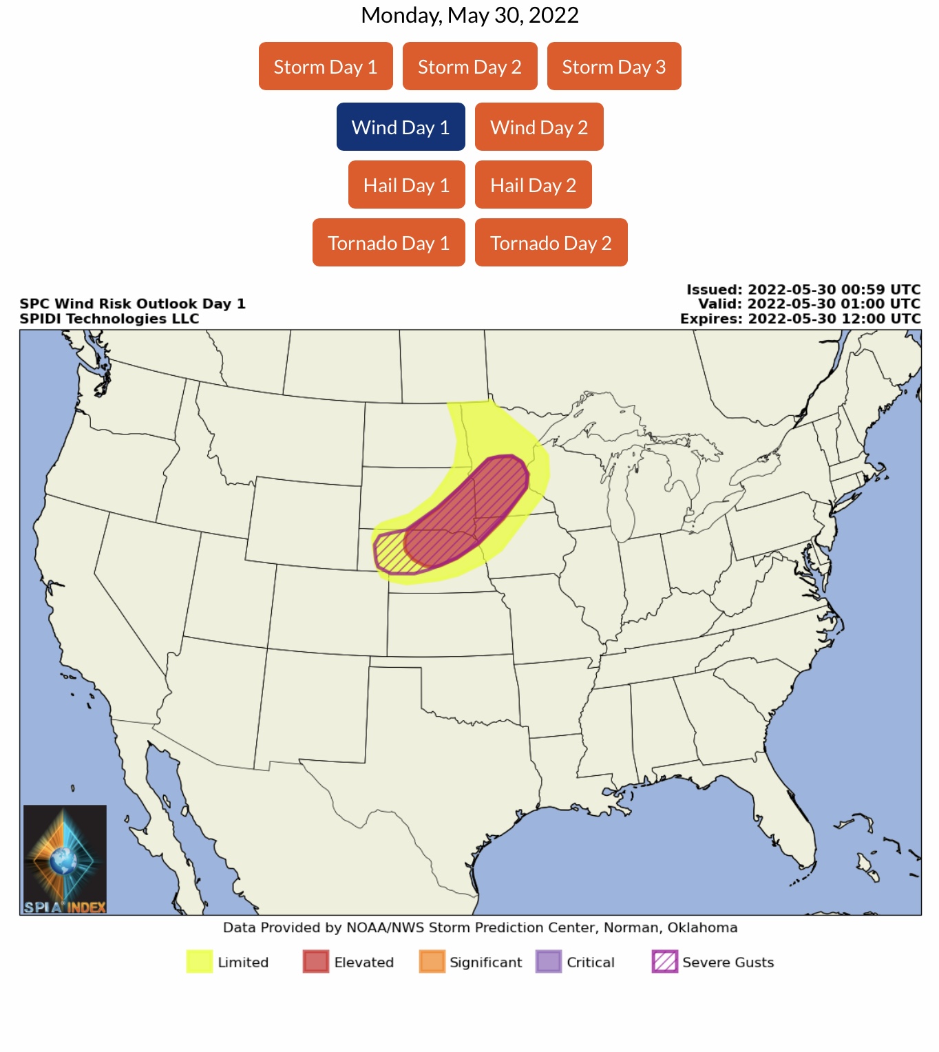
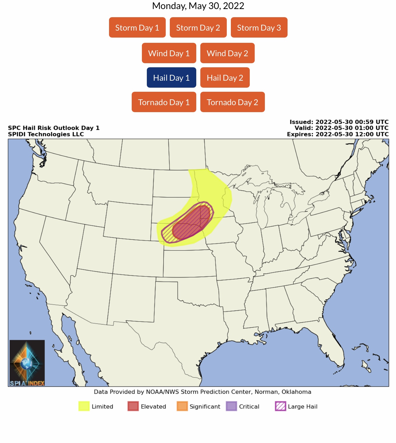
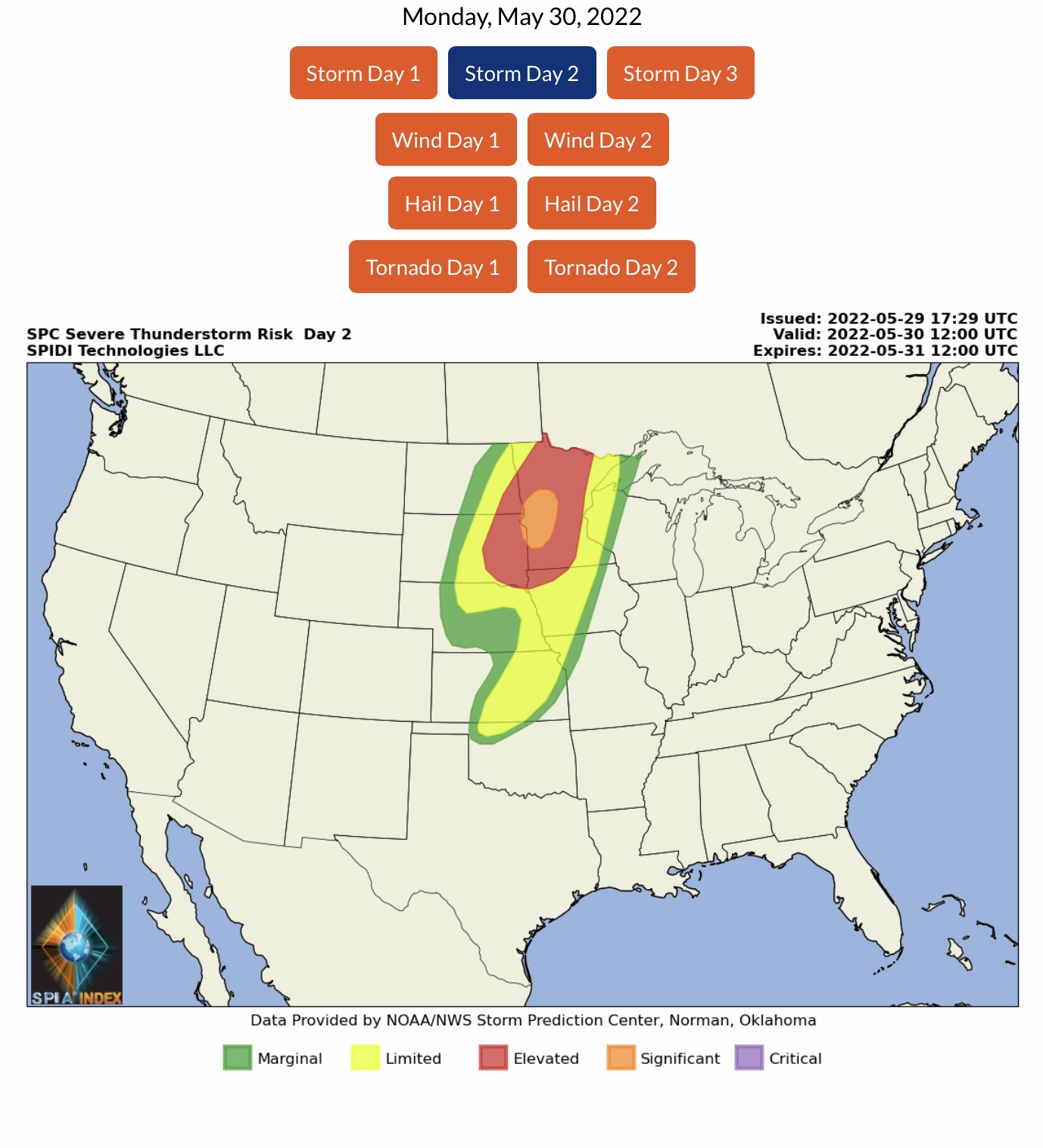
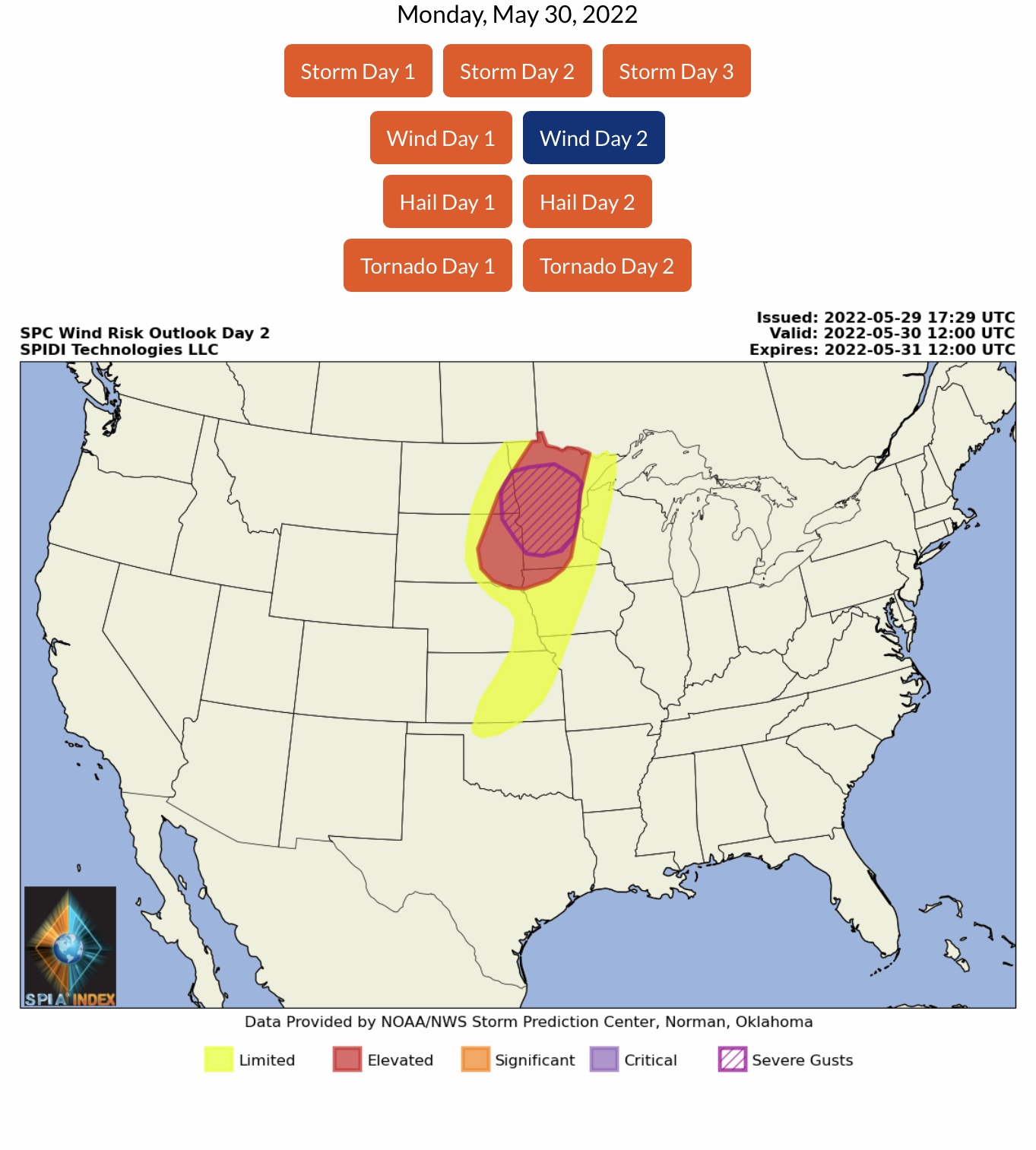
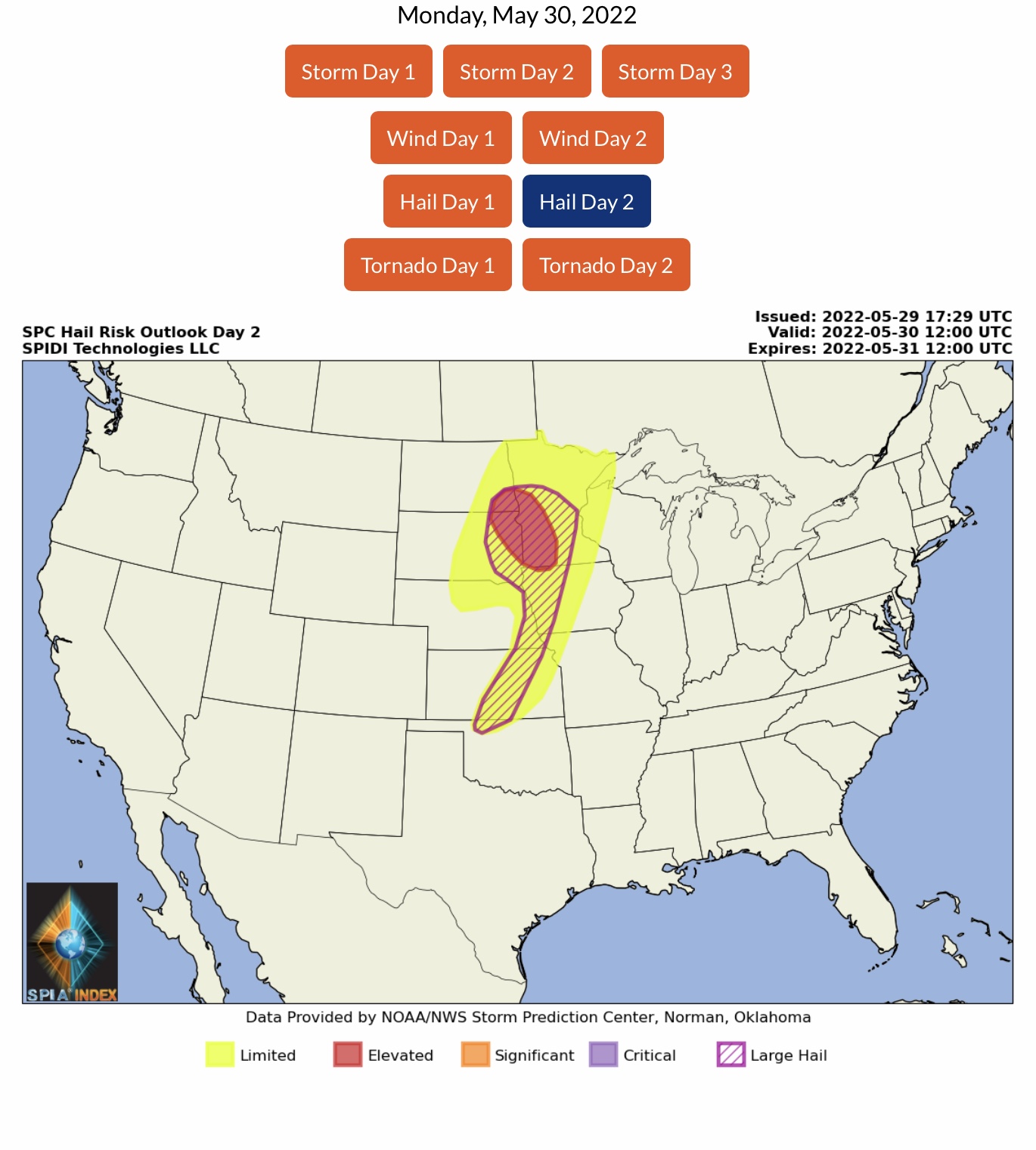
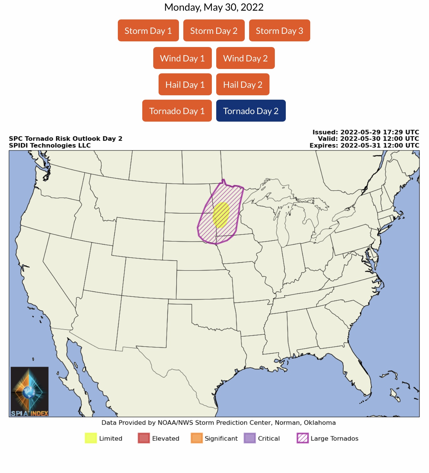
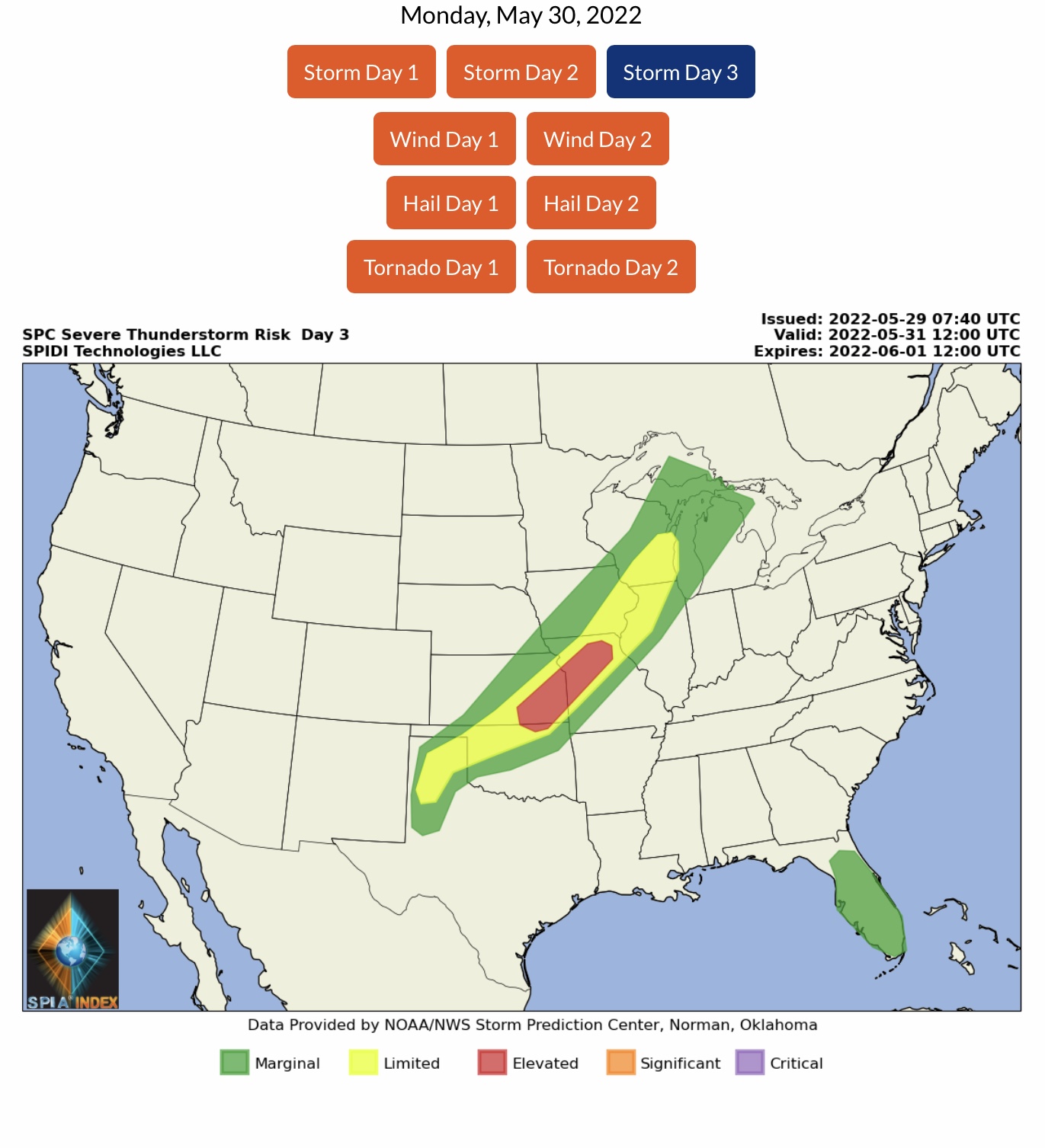
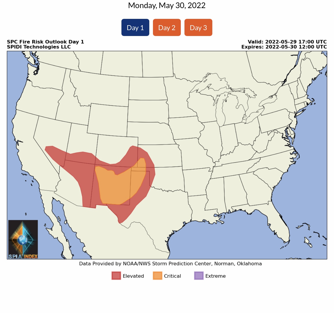
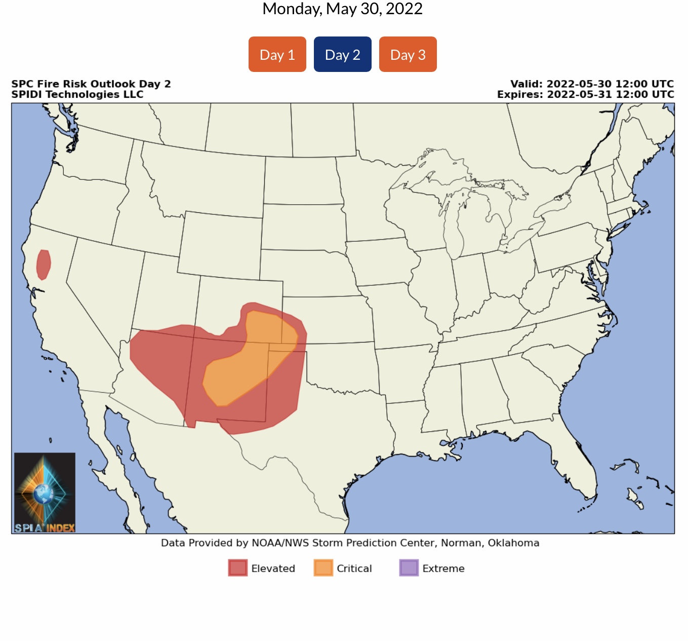
ELEVATED to SIGNIFICANT Severe Thunderstorm Risk tomorrow for parts MN, IA, NE, SD & ND. Extremely High Winds and Wind Gusts to 80 mph possible, along with extremely large hail, to baseball size and larger. Some tornadoes possible, and there is the possibility of some long-track, large tornadoes. ELEVATED Risk shifts to parts OK, KS & MO on Tuesday into Wednesday morning…
Sidney Sperry 30 May 2022 03:50 UTC
Growing concern for the potential of damaging winds, strong thunderstorms, large hail and some tornadoes - some long-track, large tornadoes possible - across parts of MN, IA, NE, SD & ND on Monday afternoon and evening. This could be an extremely damaging event to utility infrastructure in some areas during the Memorial Day holiday.

Sid Sperry
President & CEO
SPIDI Technologies, LLC
SPIDItech.com

 Show/hide attachments