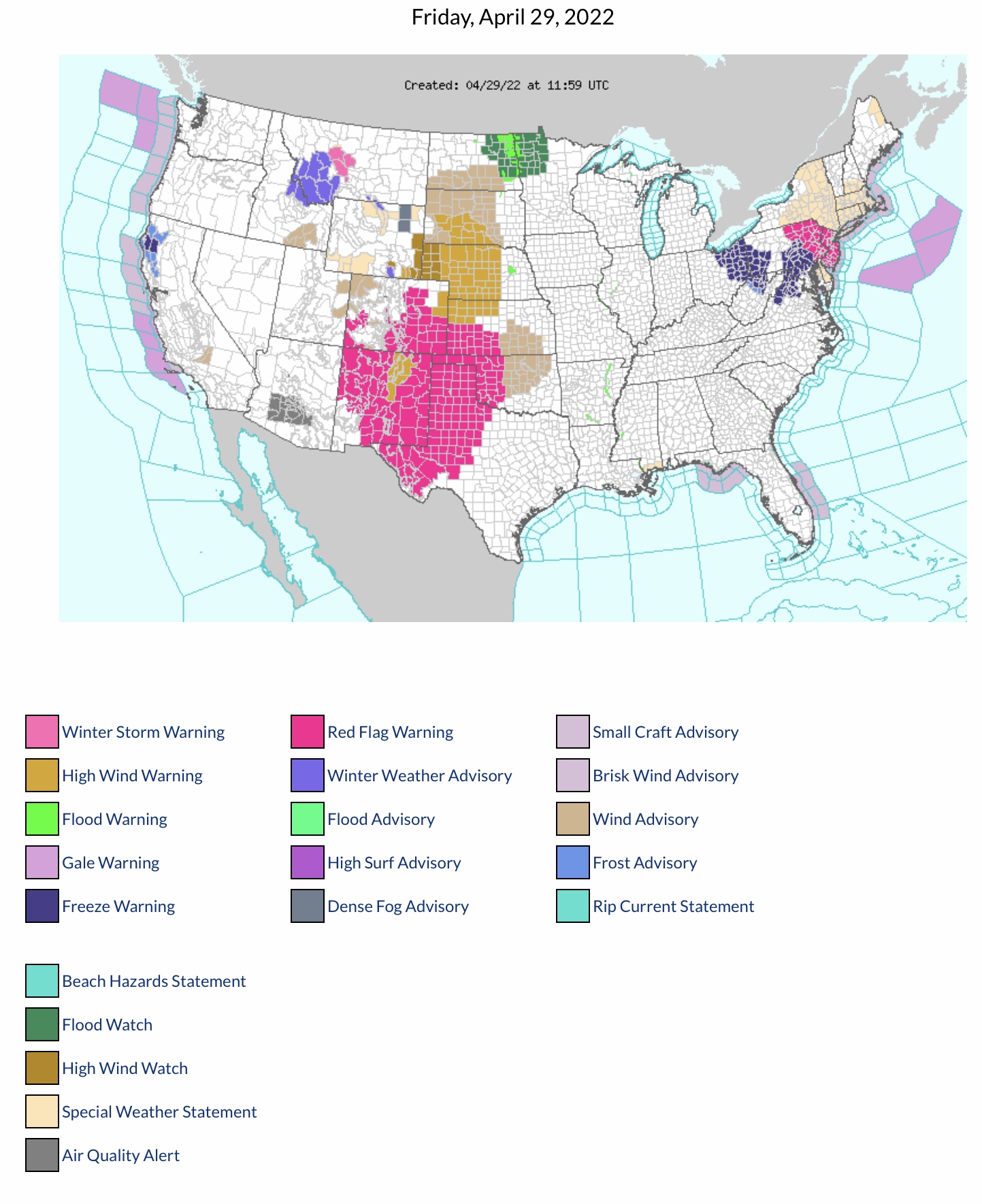
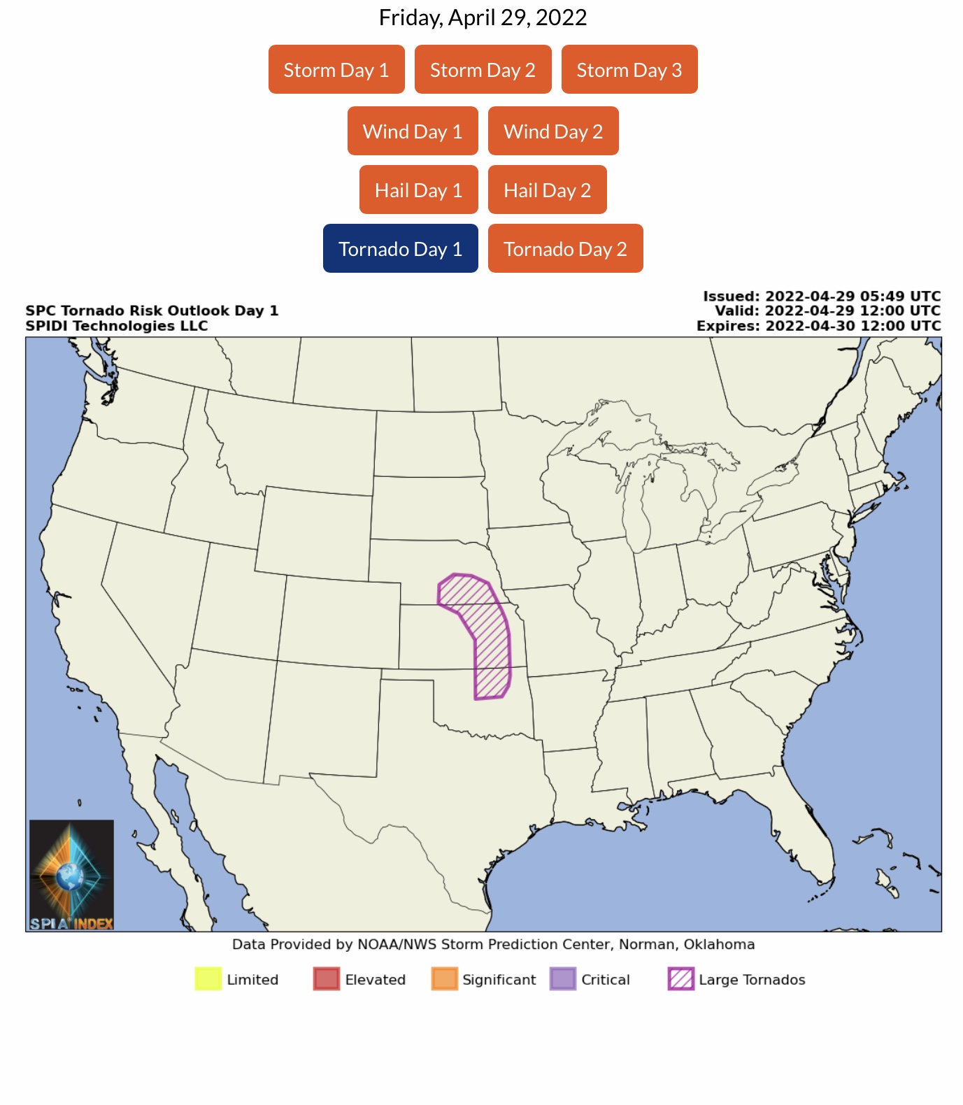
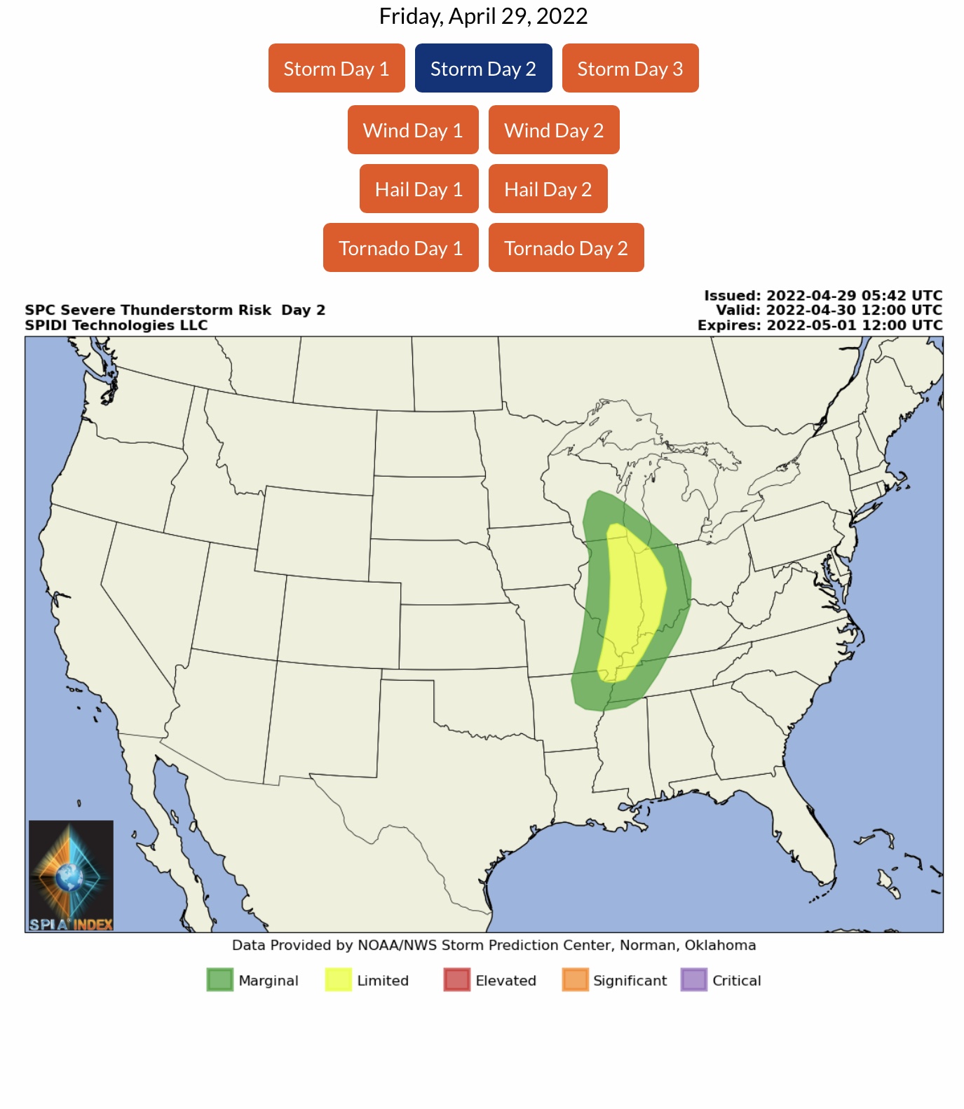
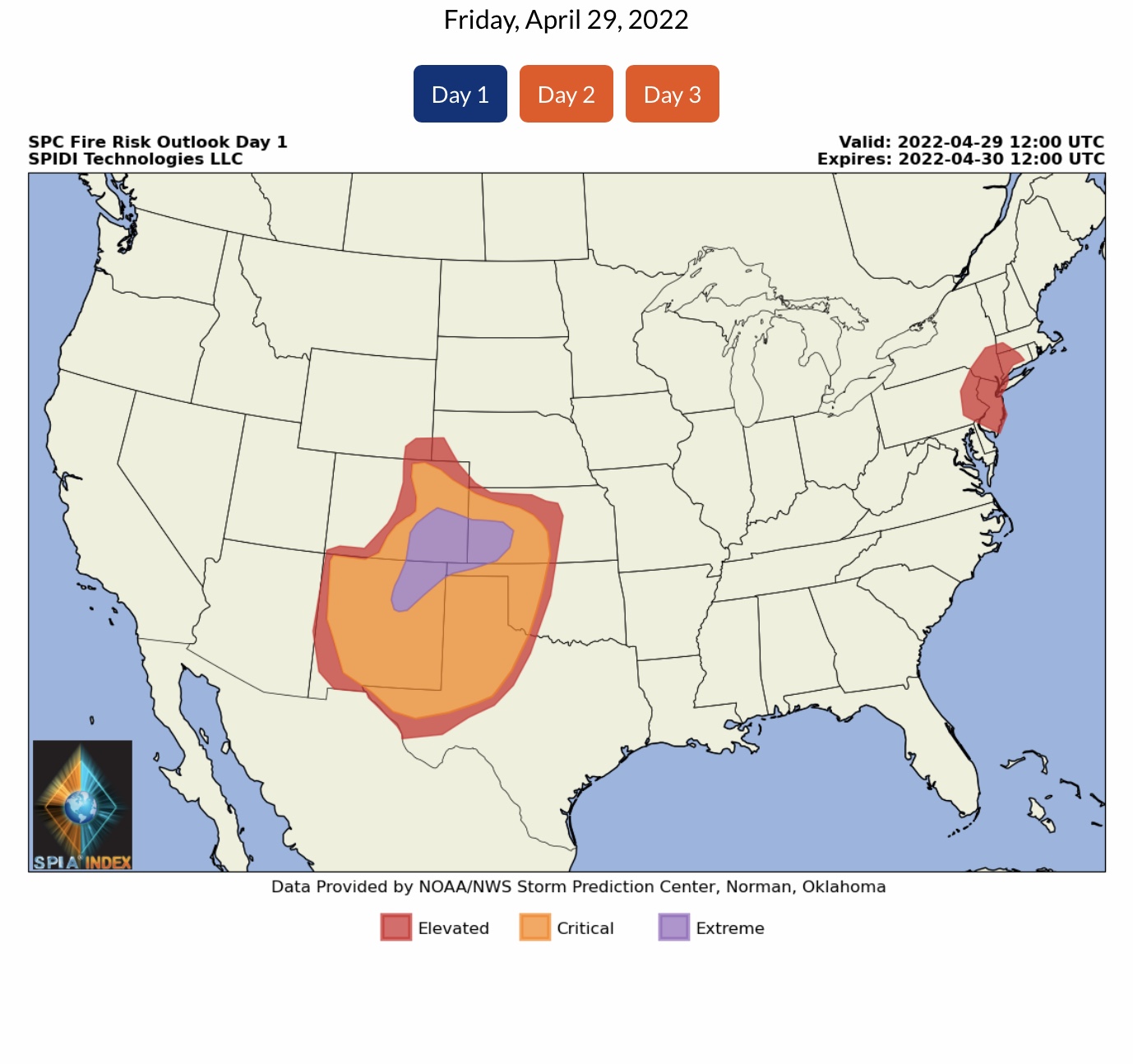
The U.S. mid-section and Mid-Atlantic areas will be the focus of an active weather pattern over the next 3 to 5 days. The Storm Prediction Center (SPC) has updated their Severe Thunderstorm Risk Outlook to ELEVATED from this afternoon to 6am Saturday for parts of NE, KS and OK. Potential exists for High Winds in excess of 60 mph, Large Hail to baseball and softball size, and some Large Tornadoes are possible. From early Saturday morning through Sunday morning, the Severe Thunderstorm Risk shifts east-northeast into the Mid-Atlantic area, with LIMITED Risks spanning parts of WI, IL, IN, MO, KY, AR and TN. A MARGINAL to LIMITED Risk for Severe Thunderstorms continues into Monday, potentially impacting parts of OH, PA, MD, WV, VA & KY in the east, and KS, CO, NM, OK & TX in the south central region. CRITICAL to EXTREME Fire Risk Outlooks today into early Saturday for parts CO, KS, NM, TX & OK due to high winds and low humidity levels. More rain expected in the forecast for U.S. mid-section next week.

Sid Sperry

 Show/hide attachments