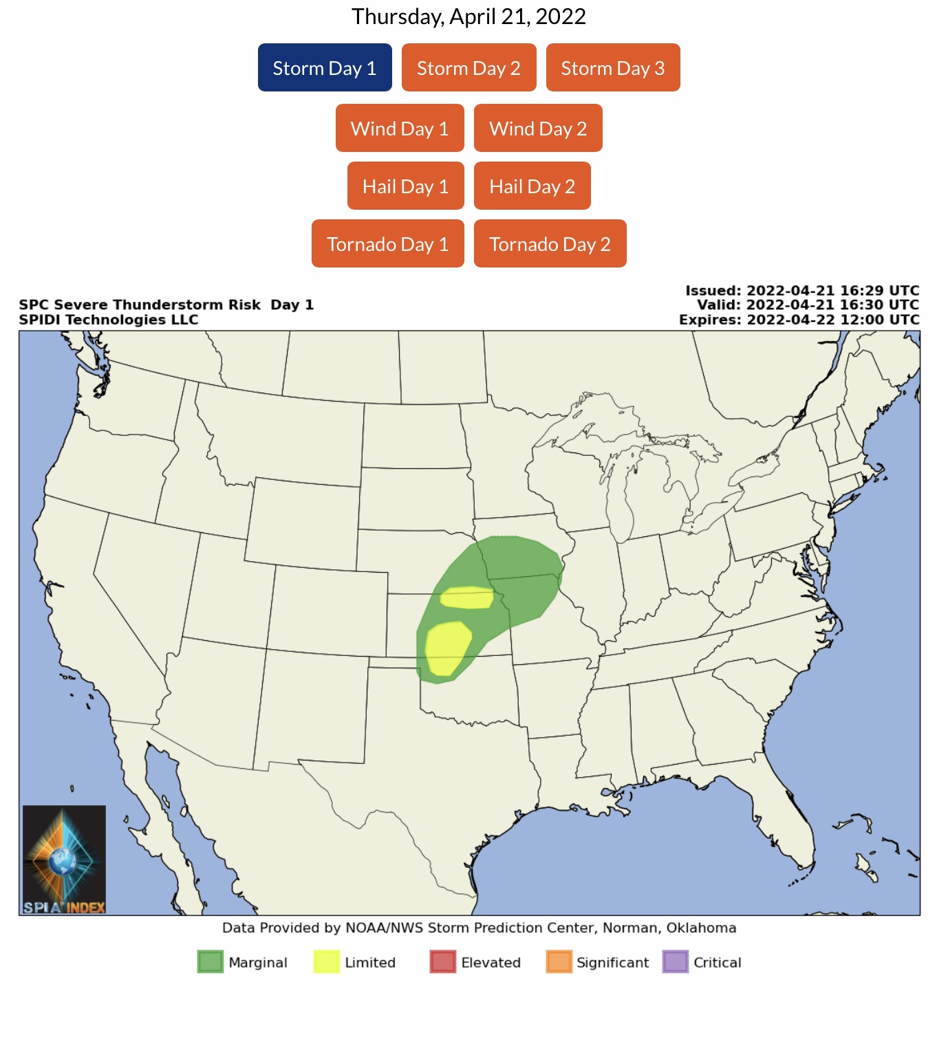
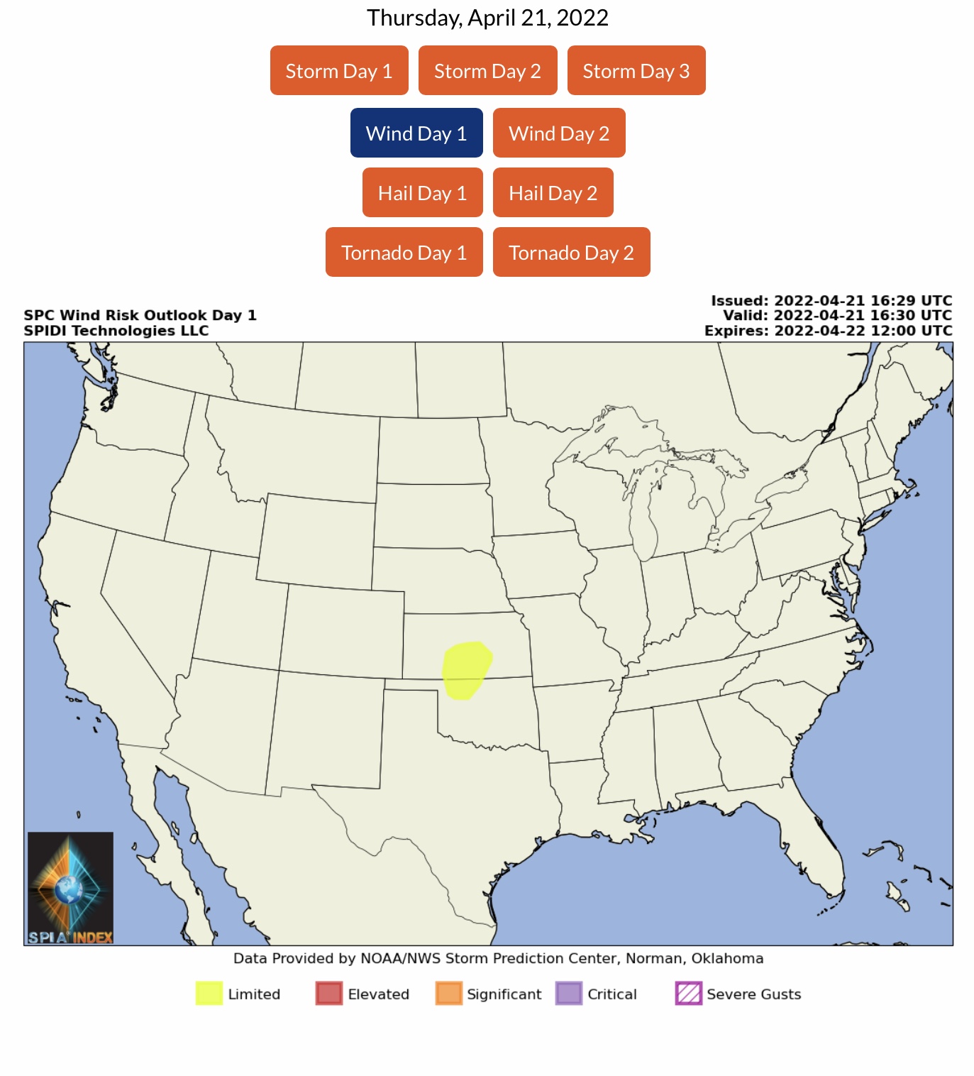
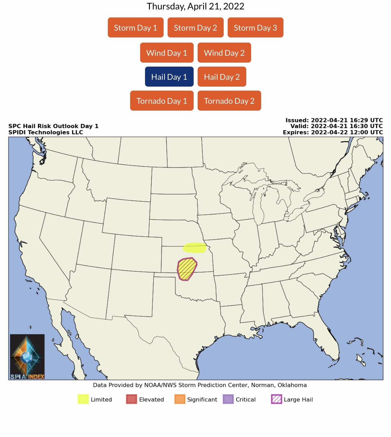
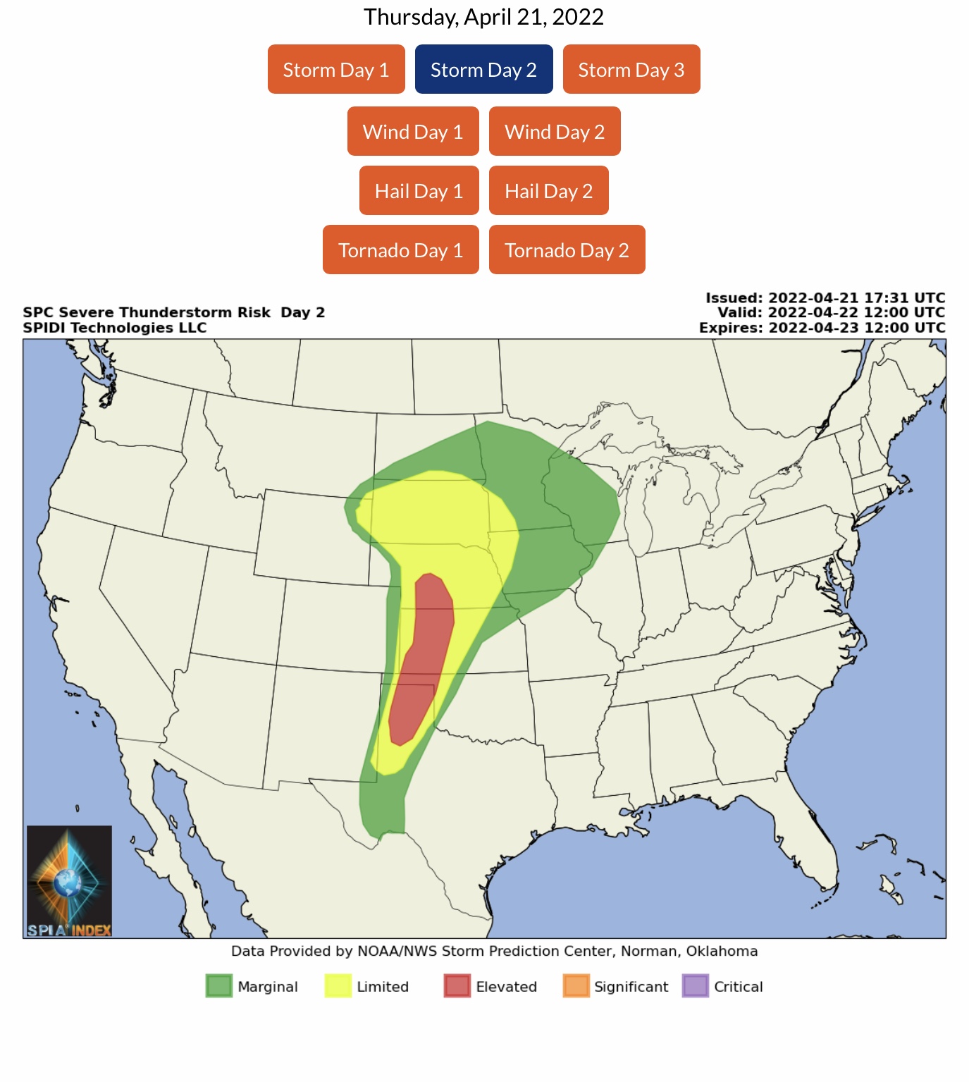
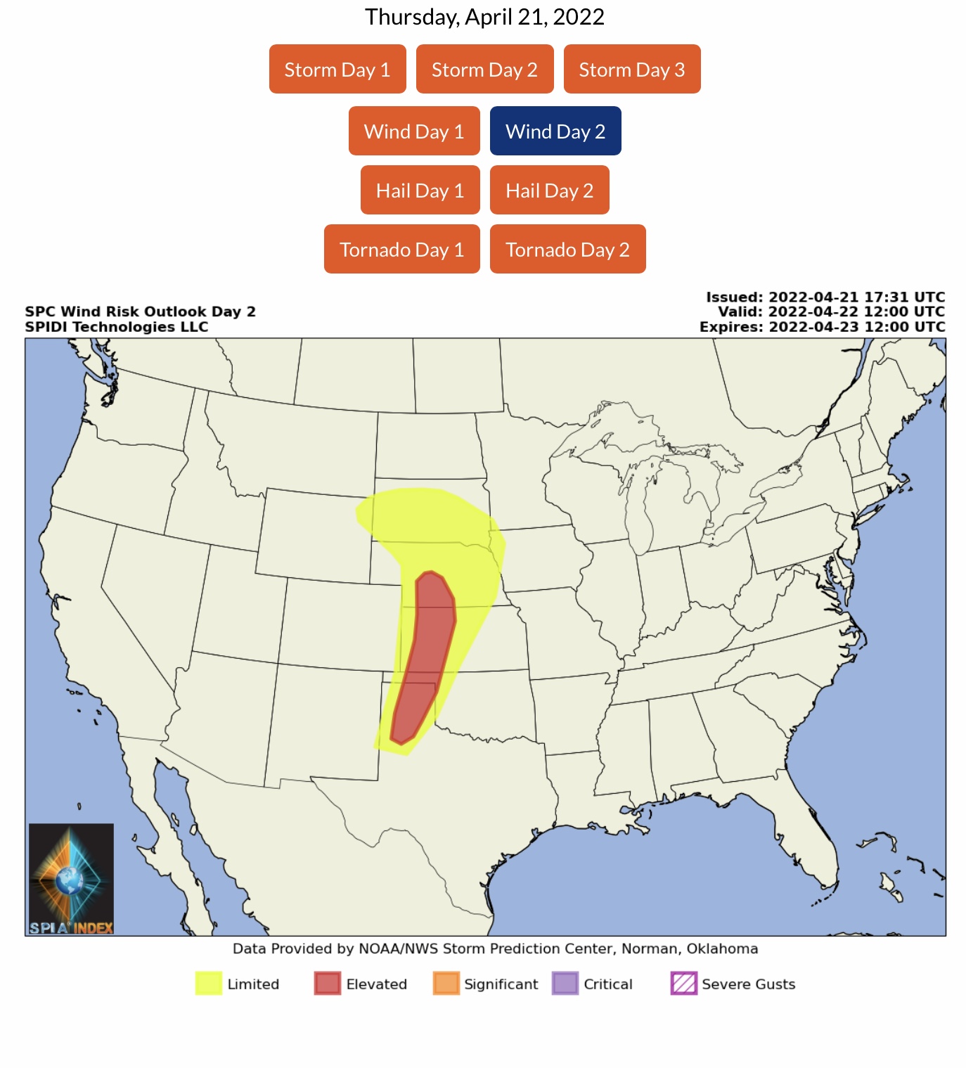
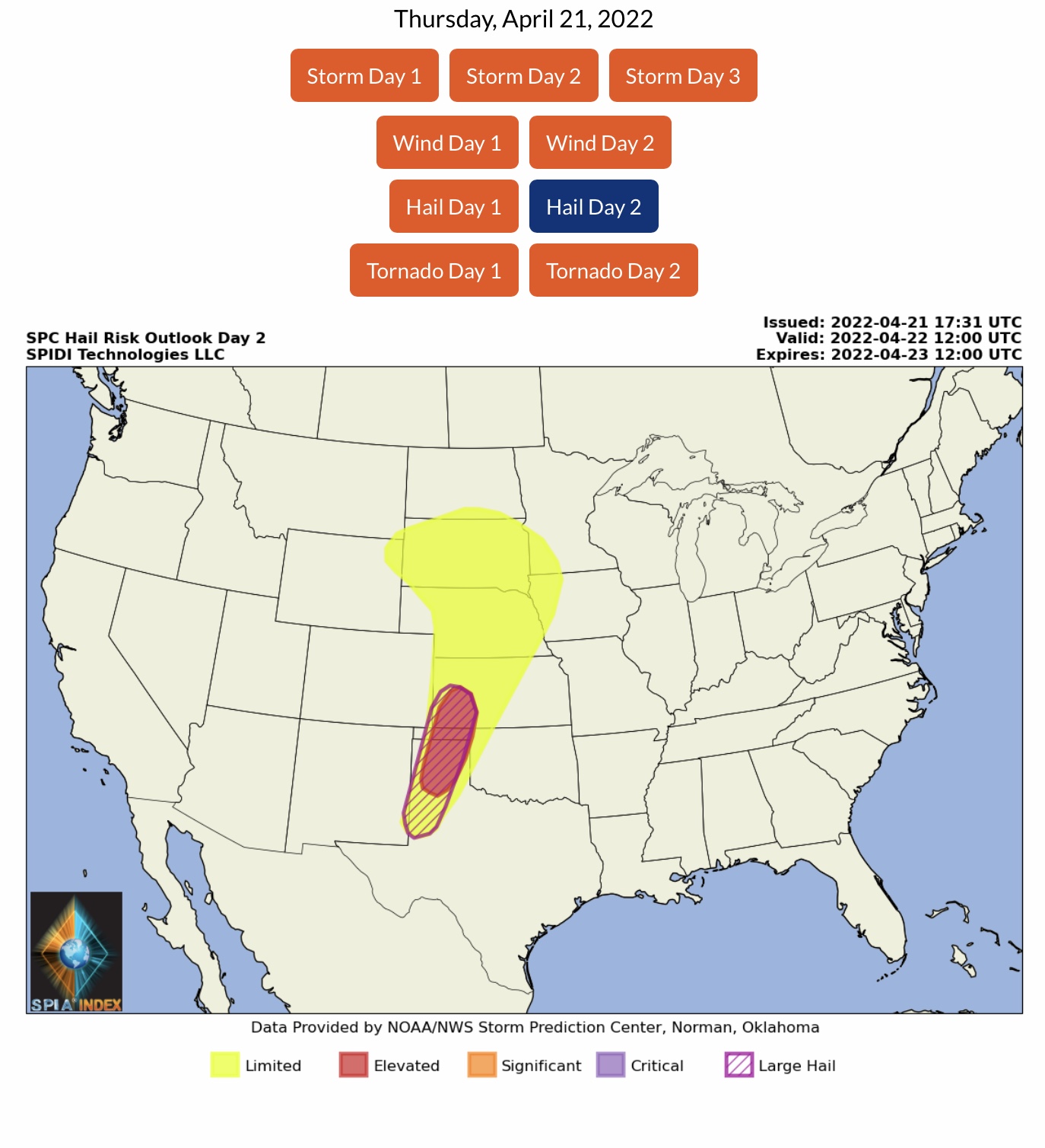
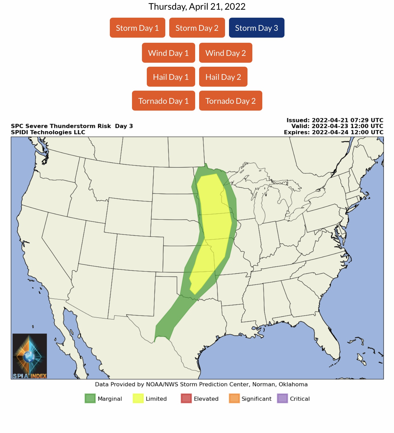
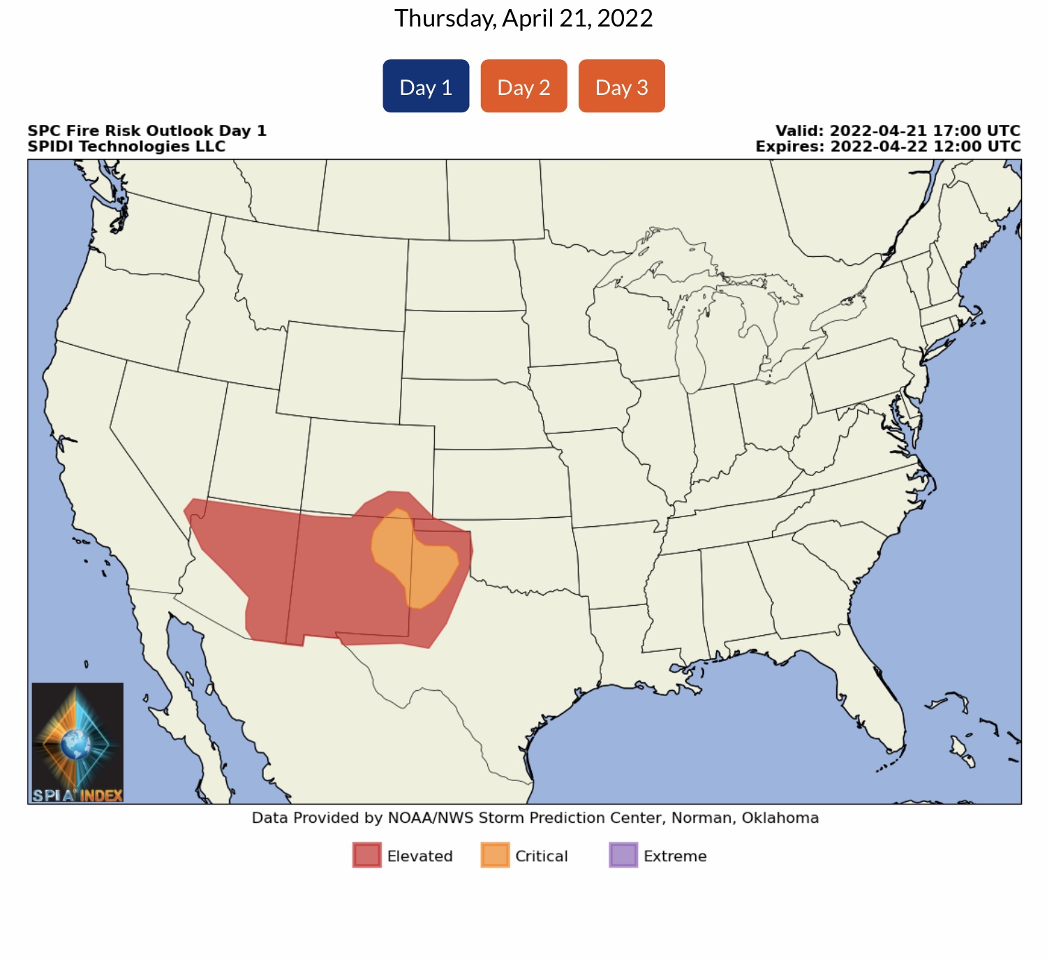
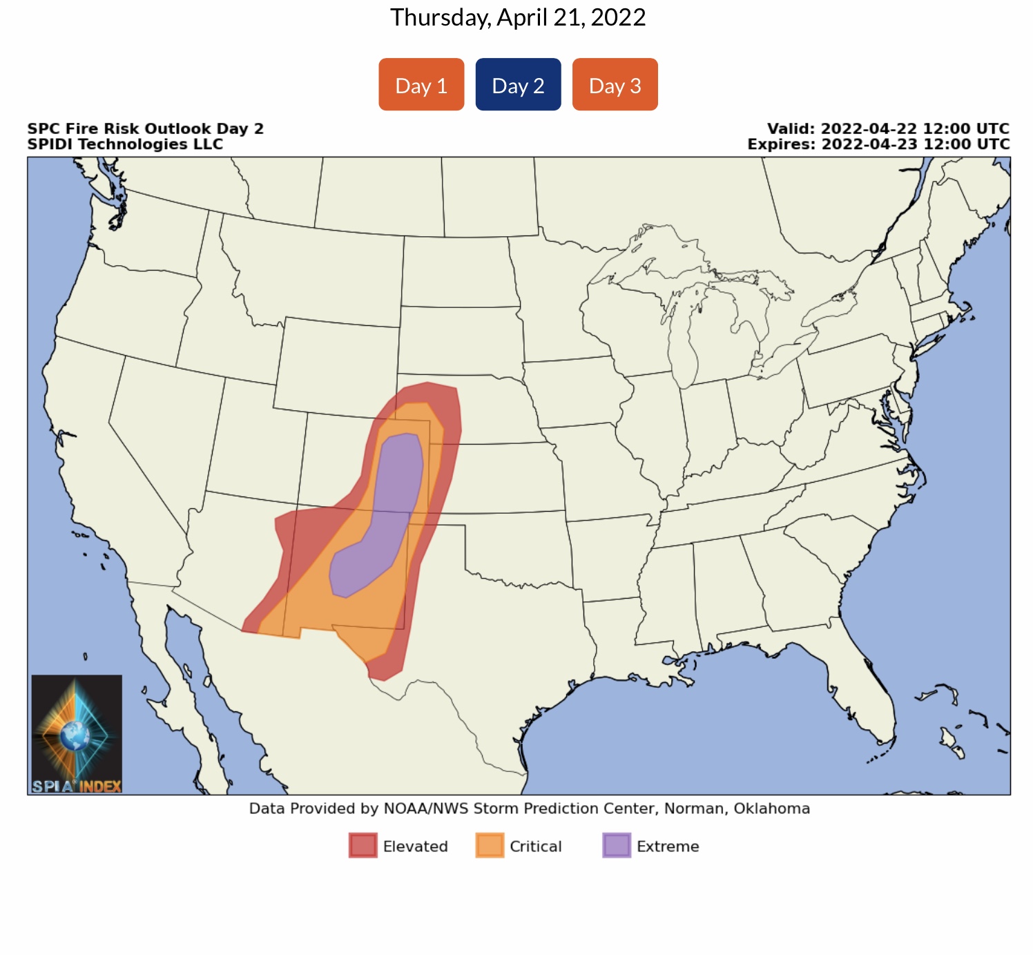
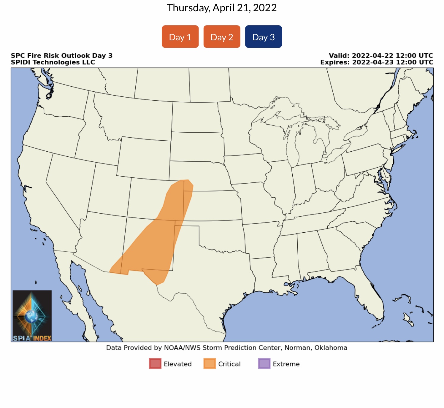
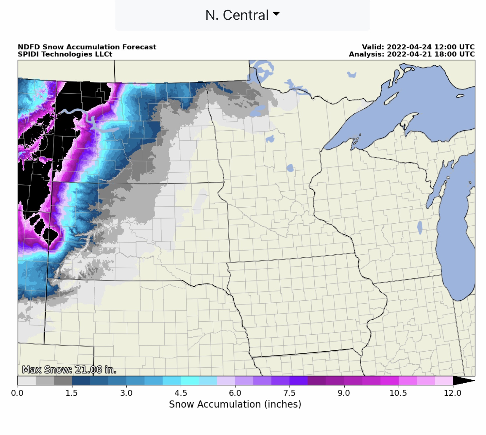
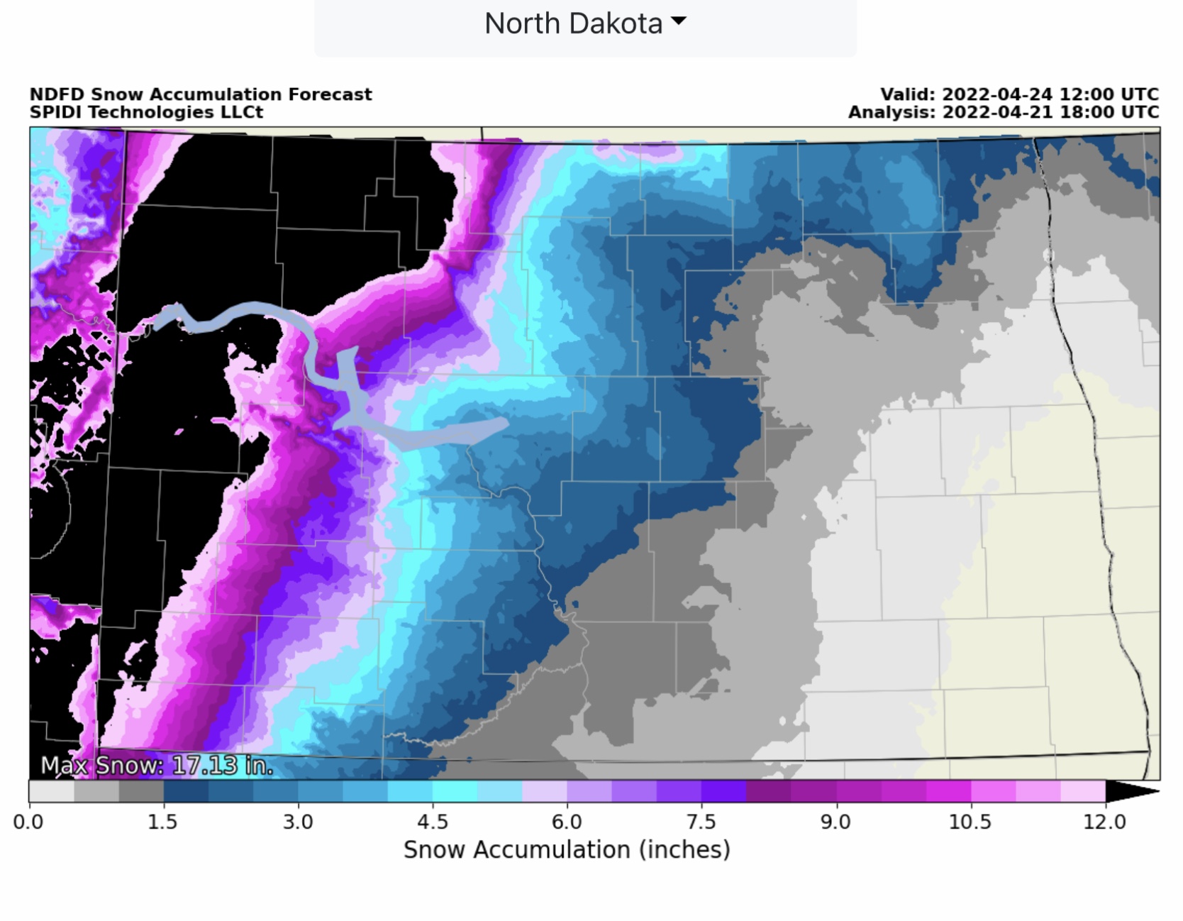
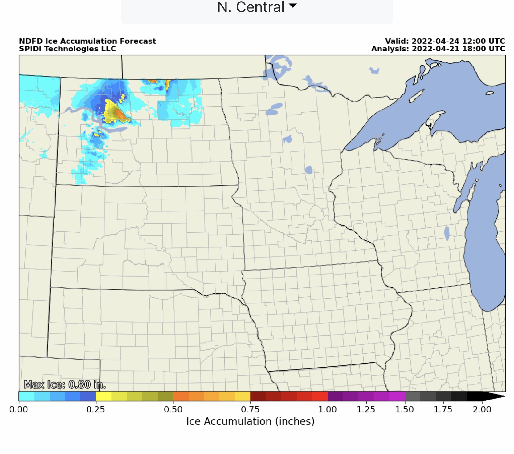
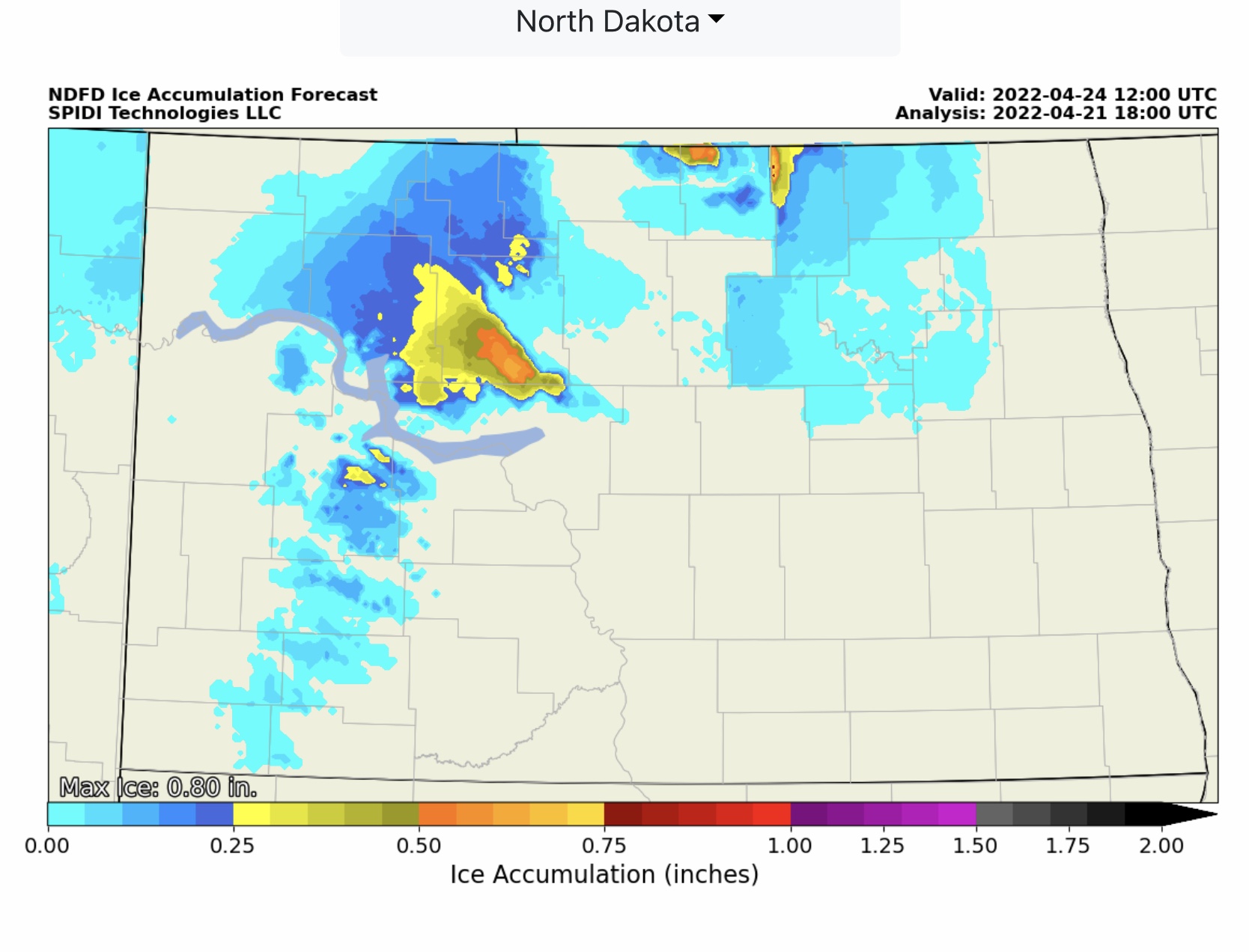
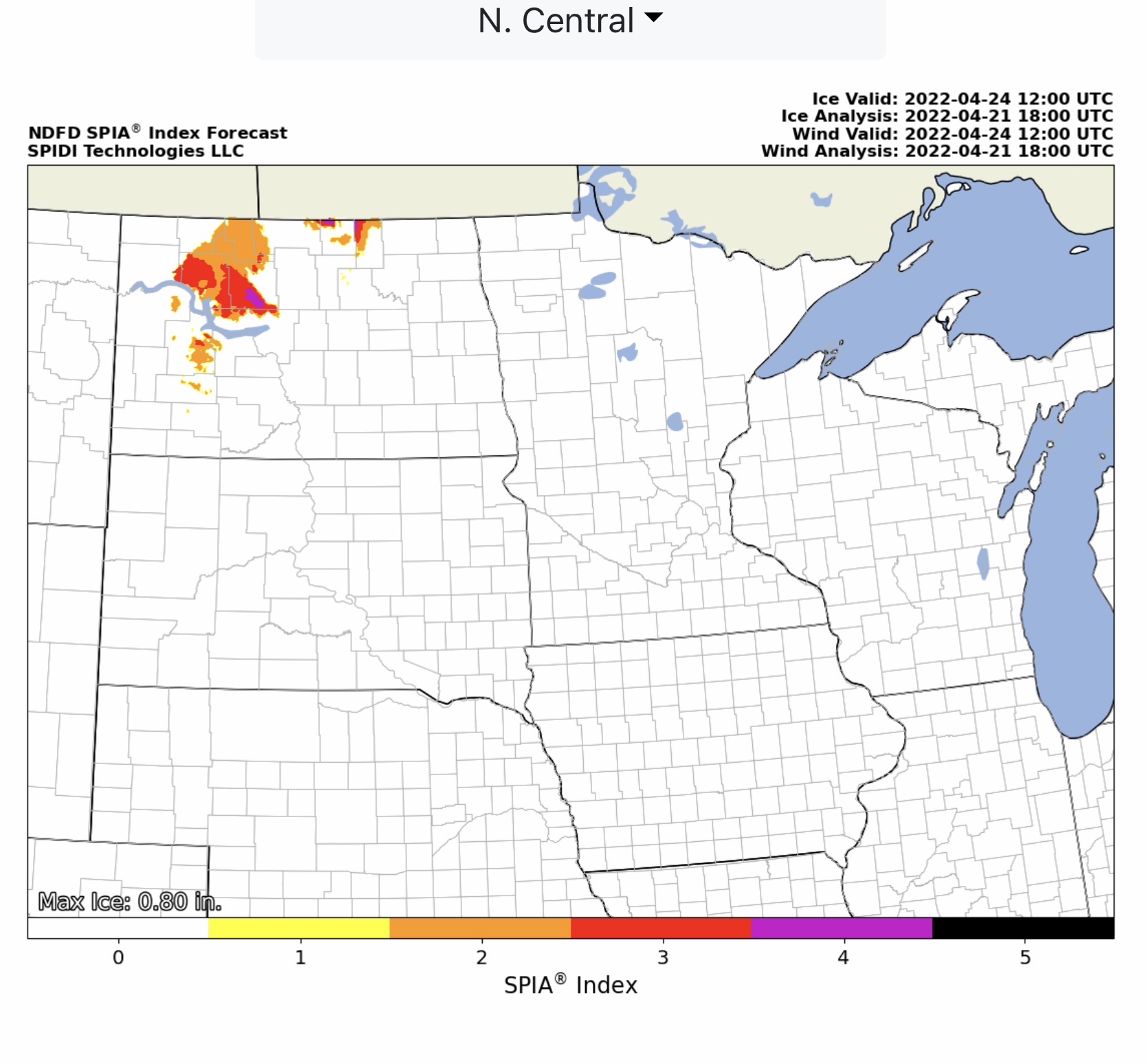
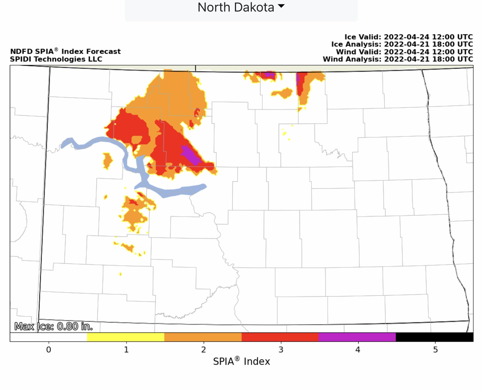
Latest Updates from Storm Prediction Center (SPC) for Severe Thunderstorm Risk Outlooks, Days 1 thru 3, and SPC Fire Risk Outlook, Days 1 thru 3. Plus, ND Snow & Ice Storm Friday through Sunday. Current Max Snow Forecast is 17.13” for western ND. Max Ice in NWS grids 0.80” parts western & northern ND. SPIA Index Levels 1-4.
Sidney Sperry 21 Apr 2022 19:03 UTC
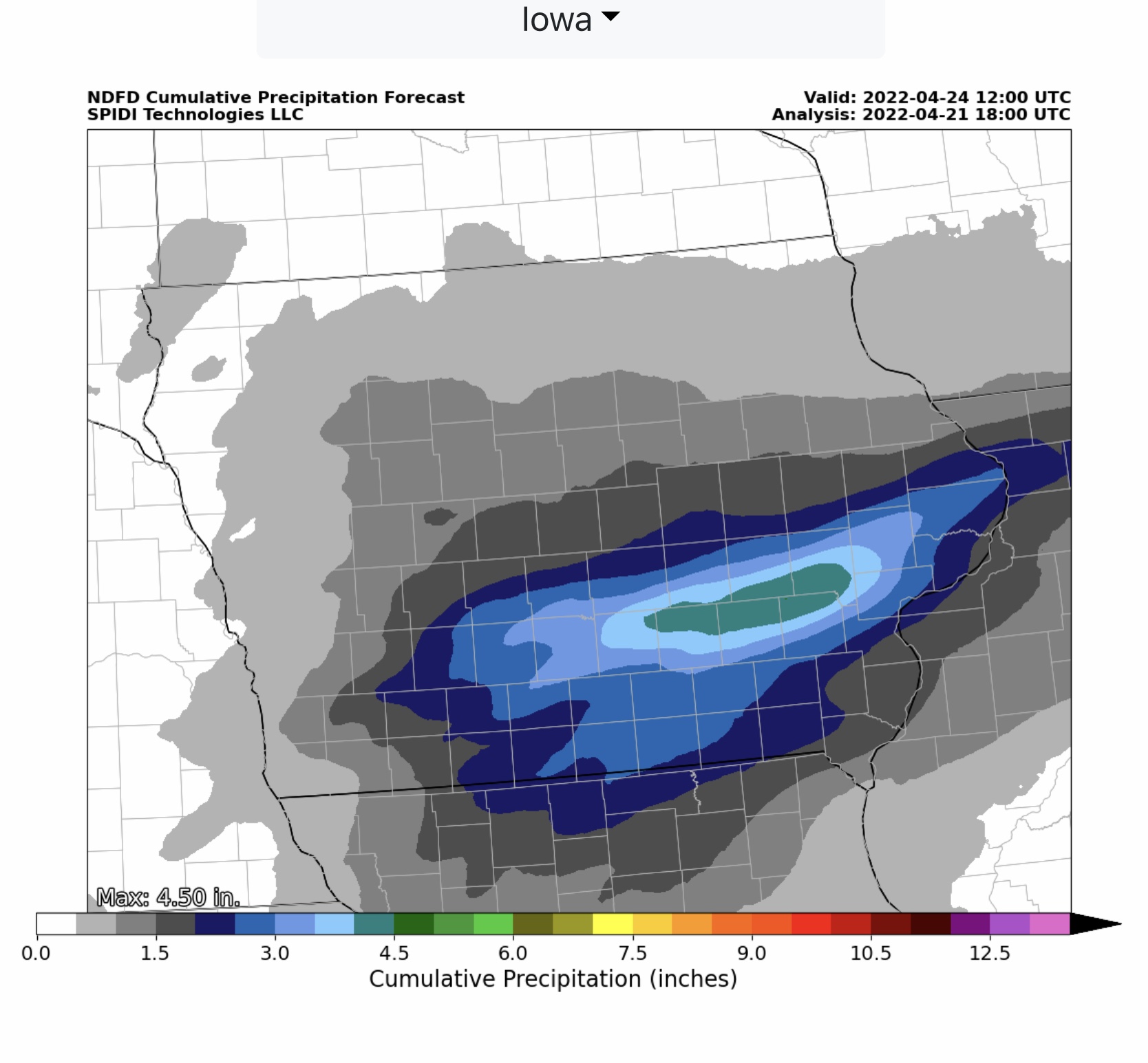
FYI… latest forecast updates from Storm Prediction Center (SPC) and NWS. In addition to the above, southern and southeastern Iowa could receive up to 4.5” of rainfall over the next 24-48 hours. Localized flooding and flash flooding is possible.

Sid Sperry
President & CEO
SPIDI Technologies, LLC
SPIDItech.com

 Show/hide attachments