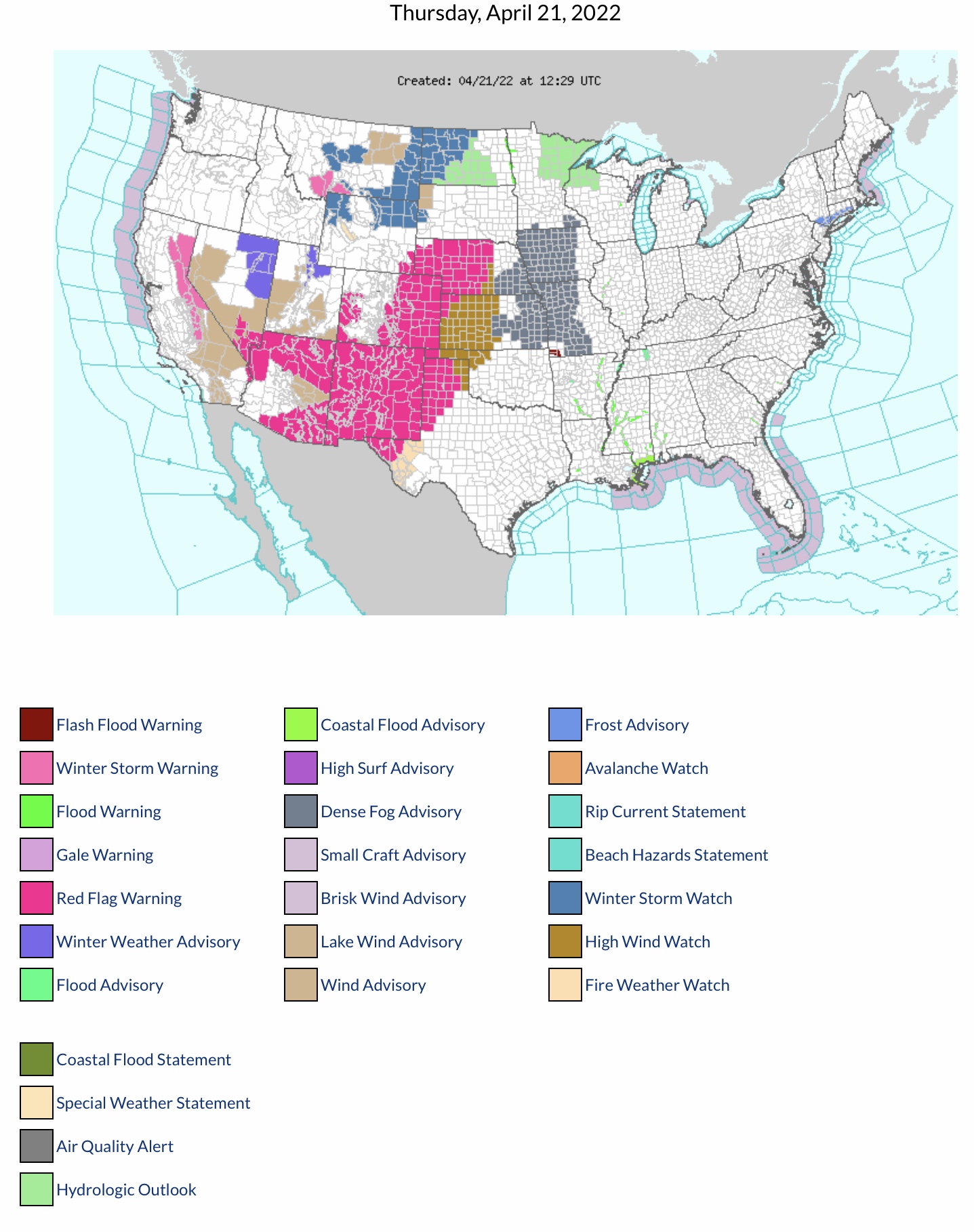
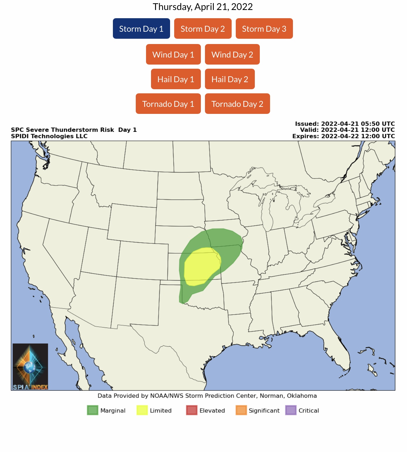
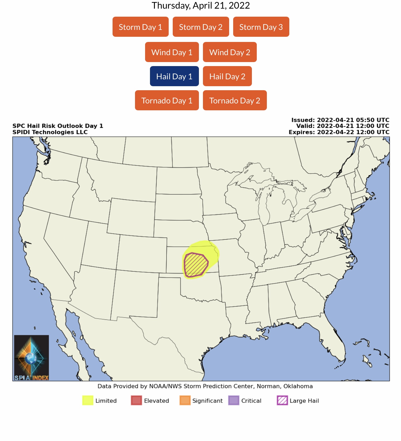
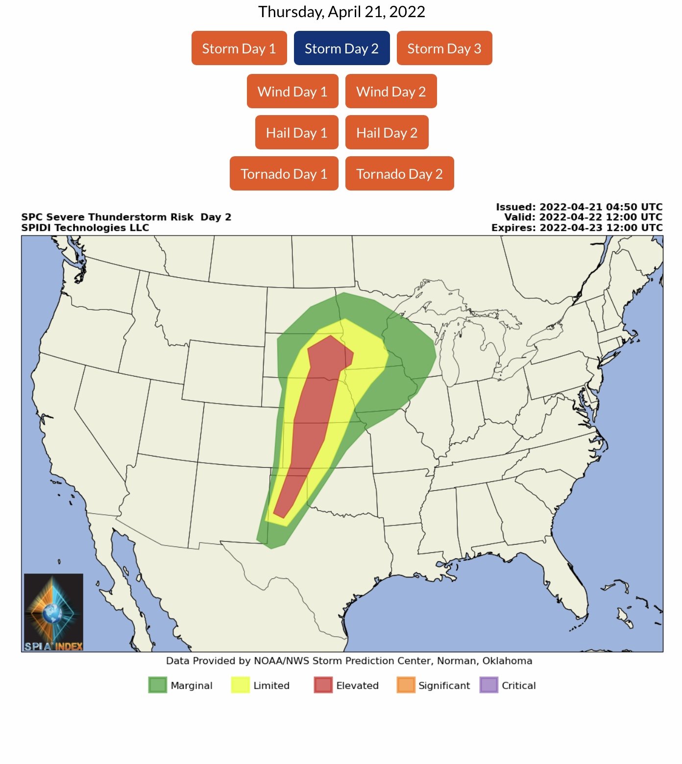
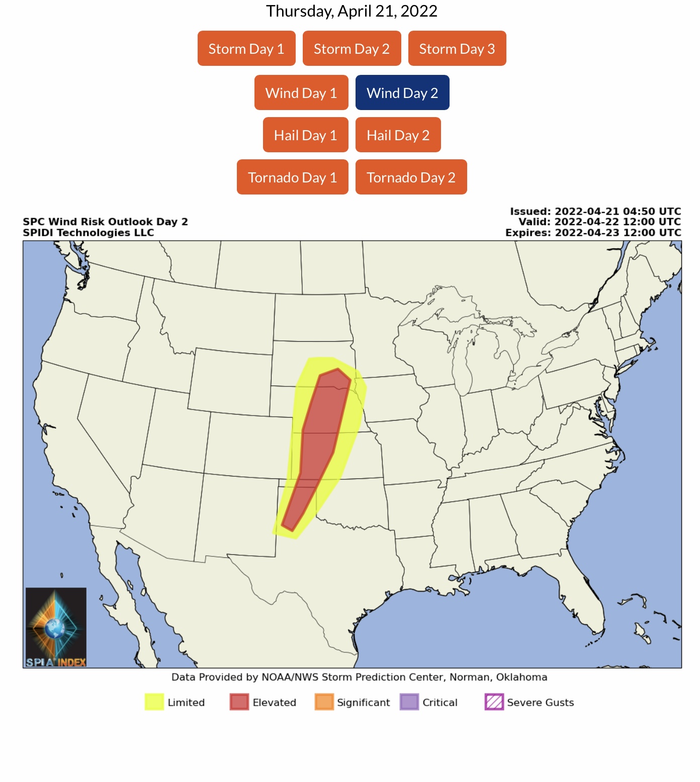
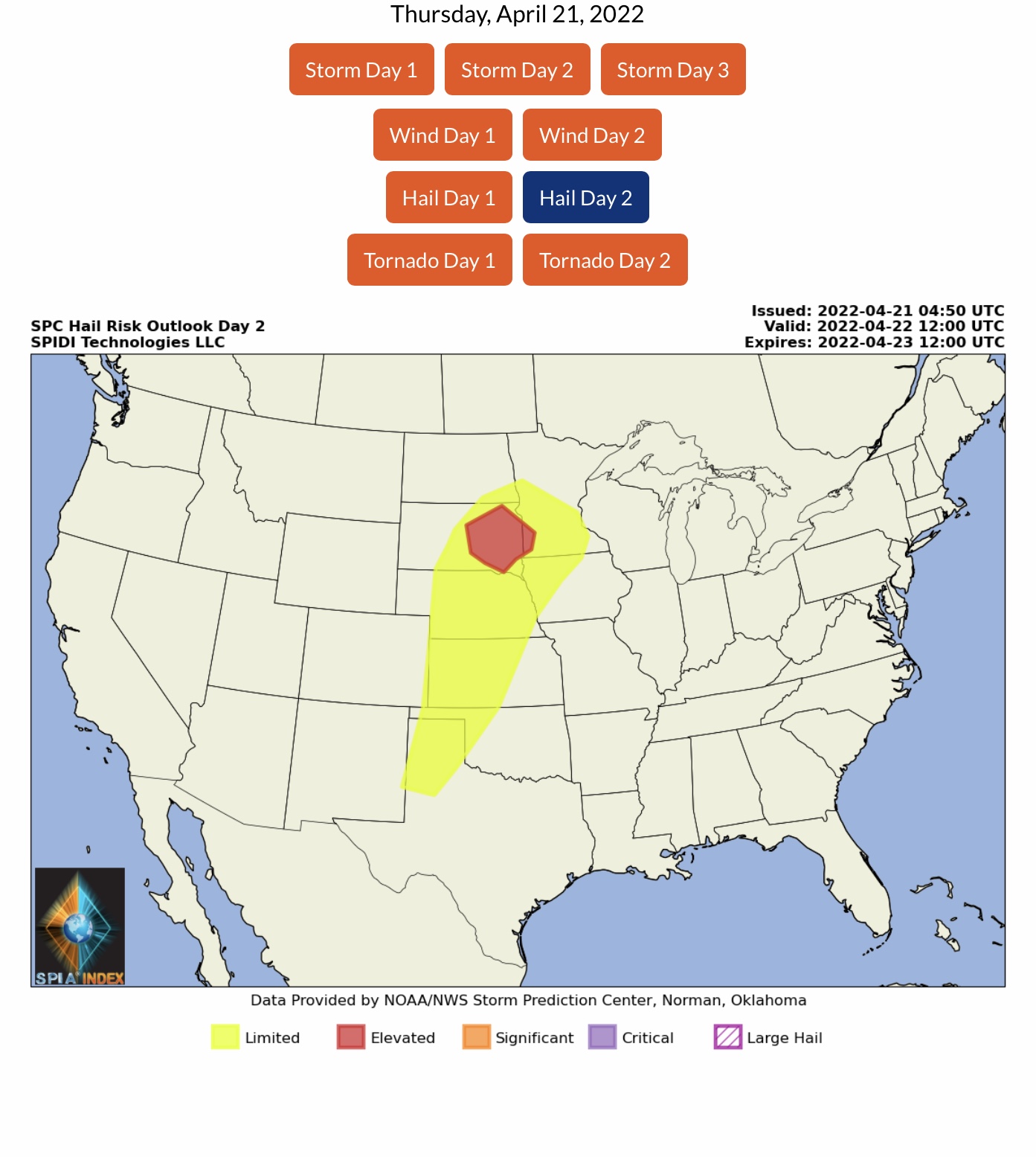
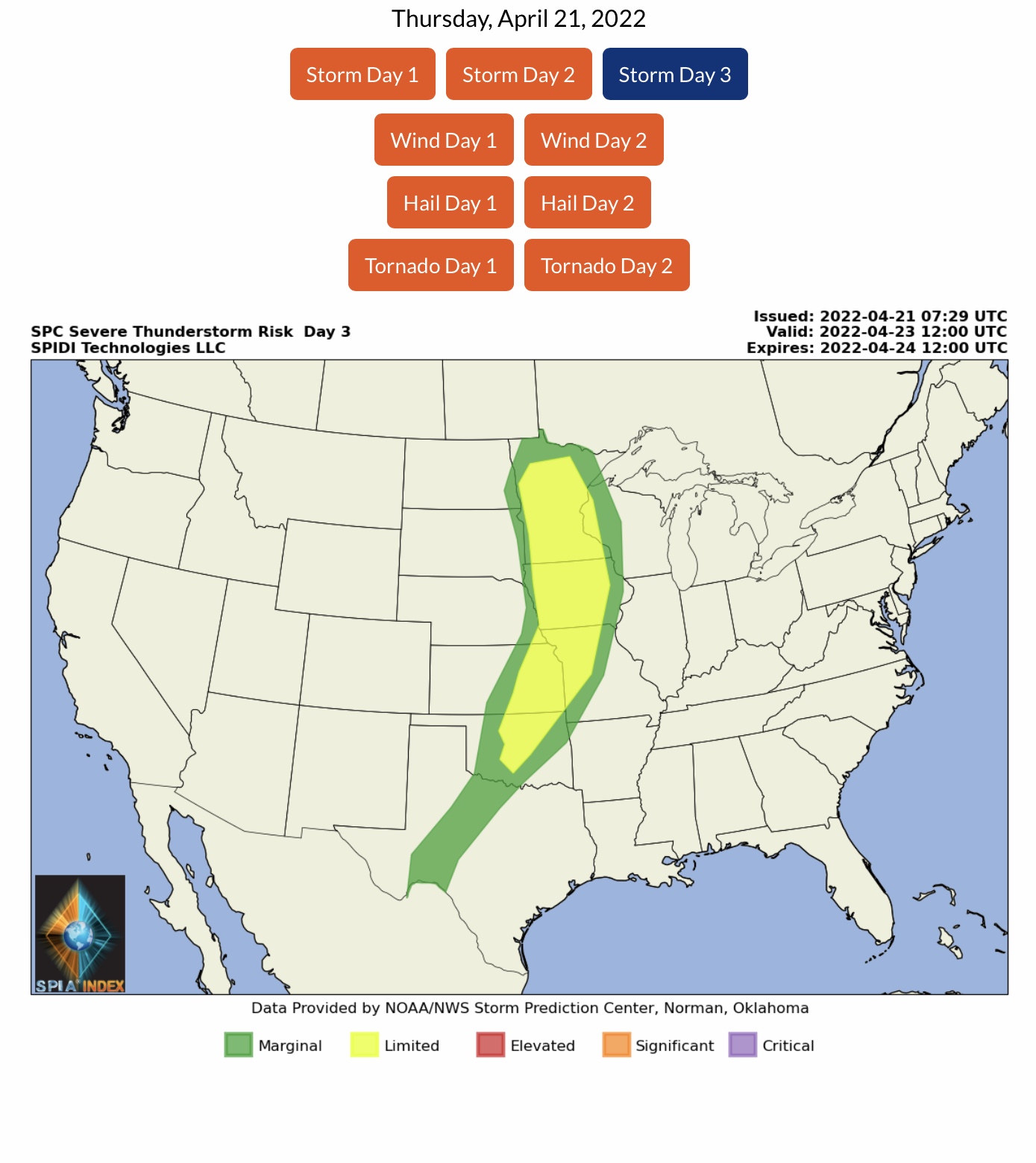
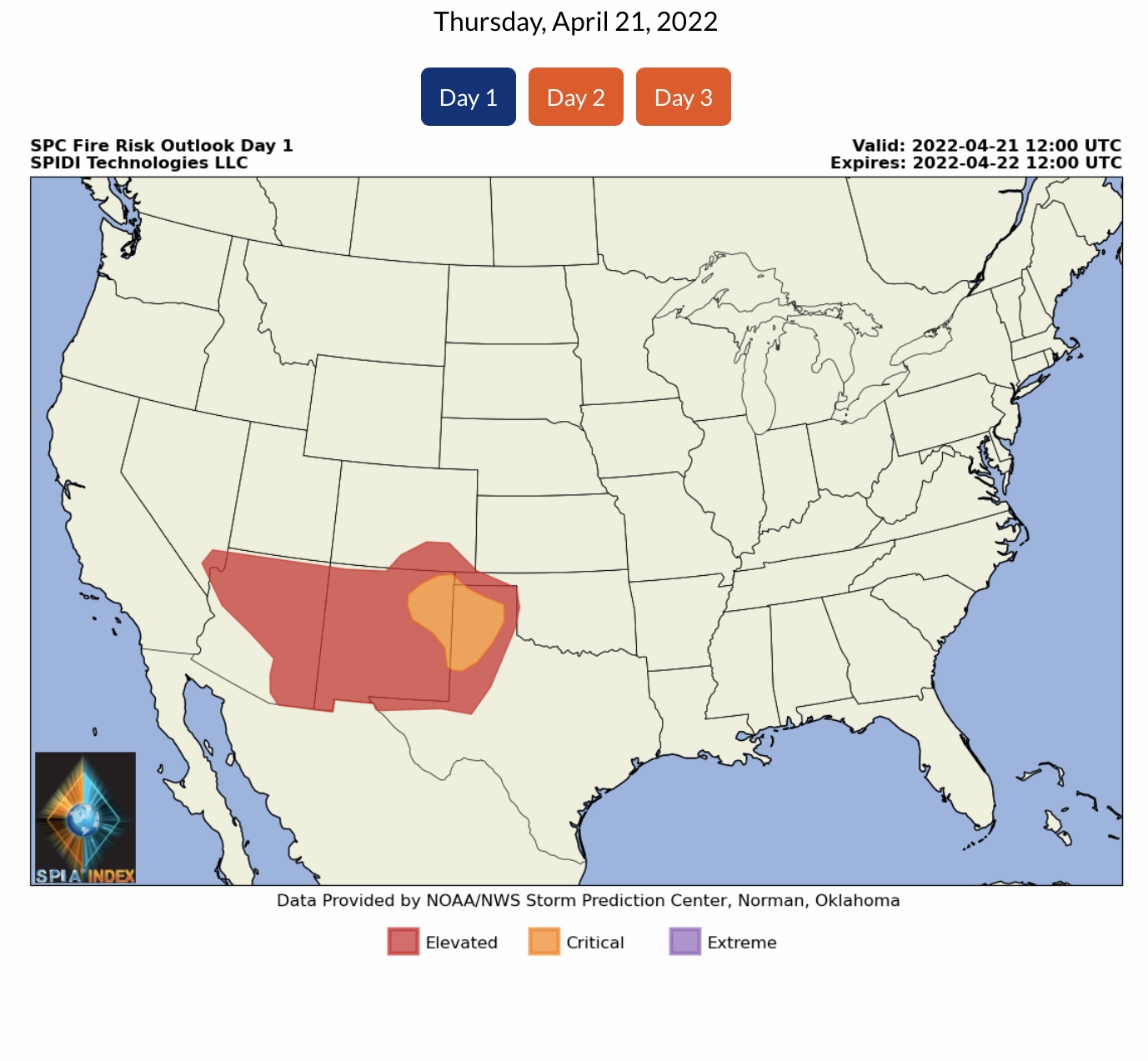
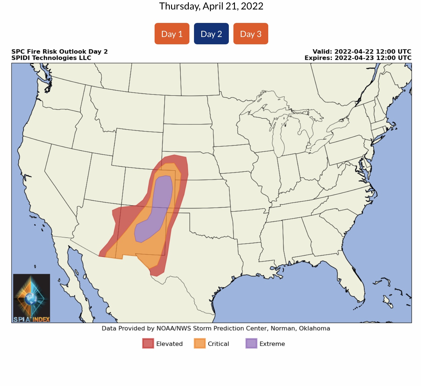
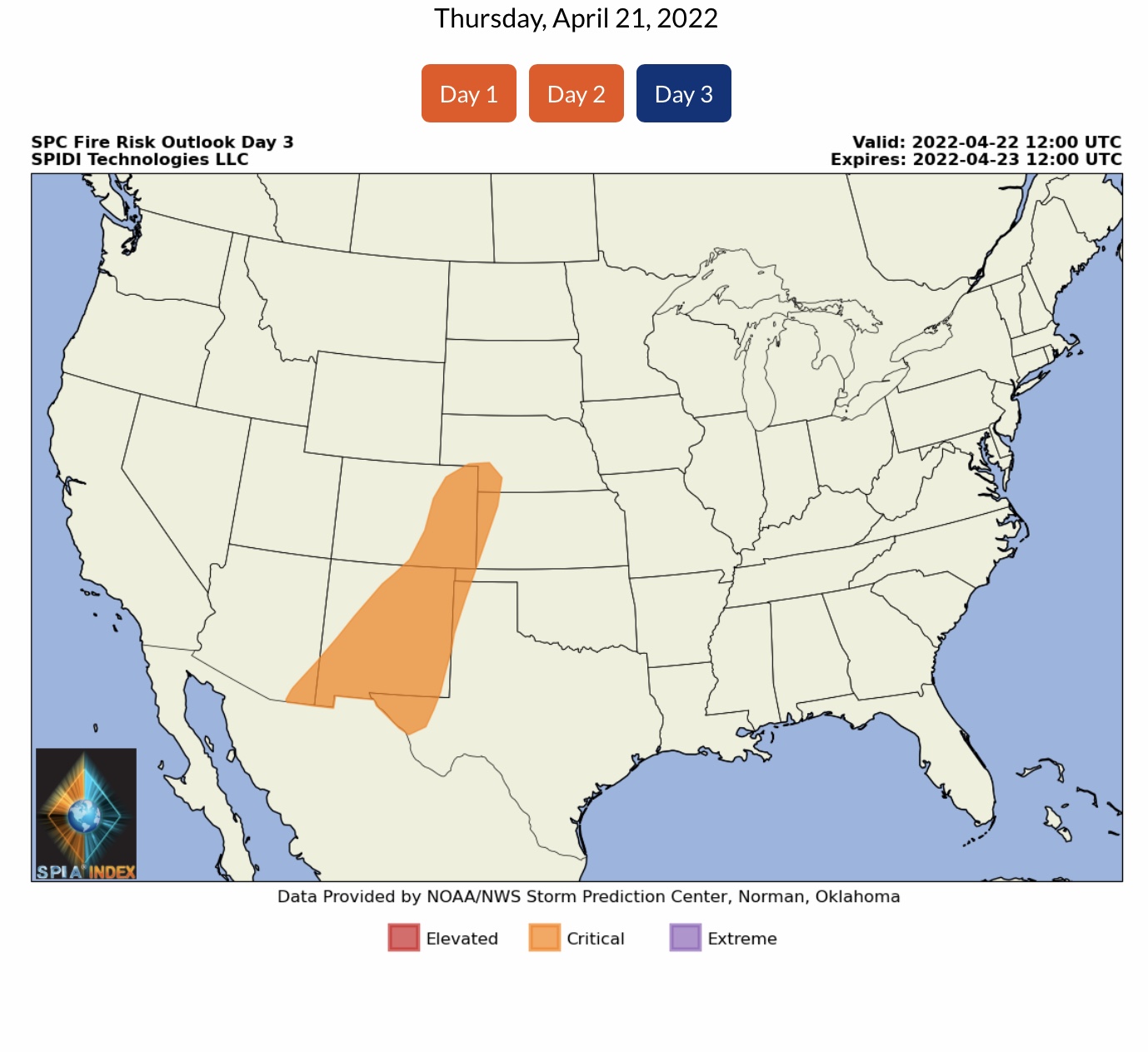
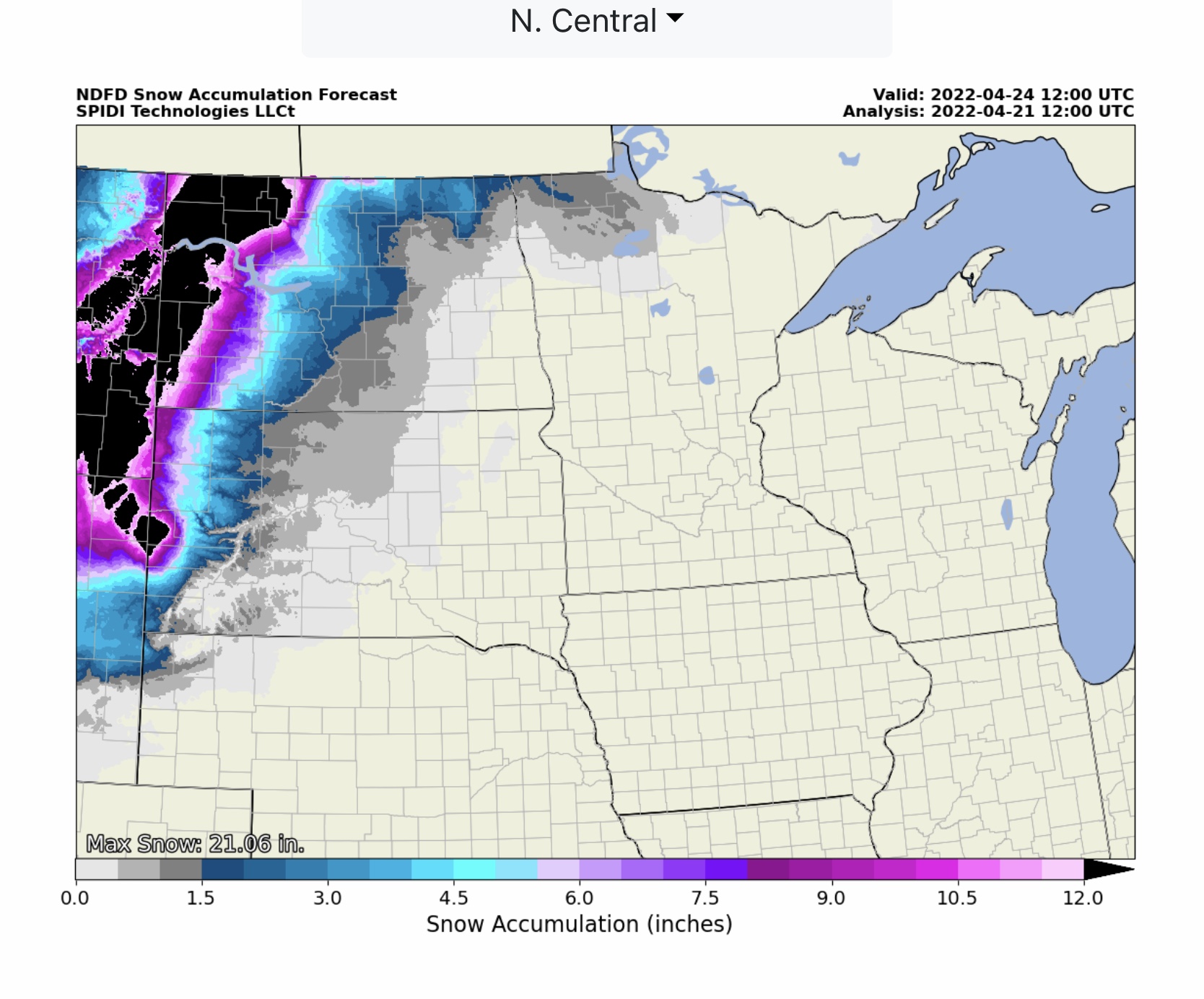
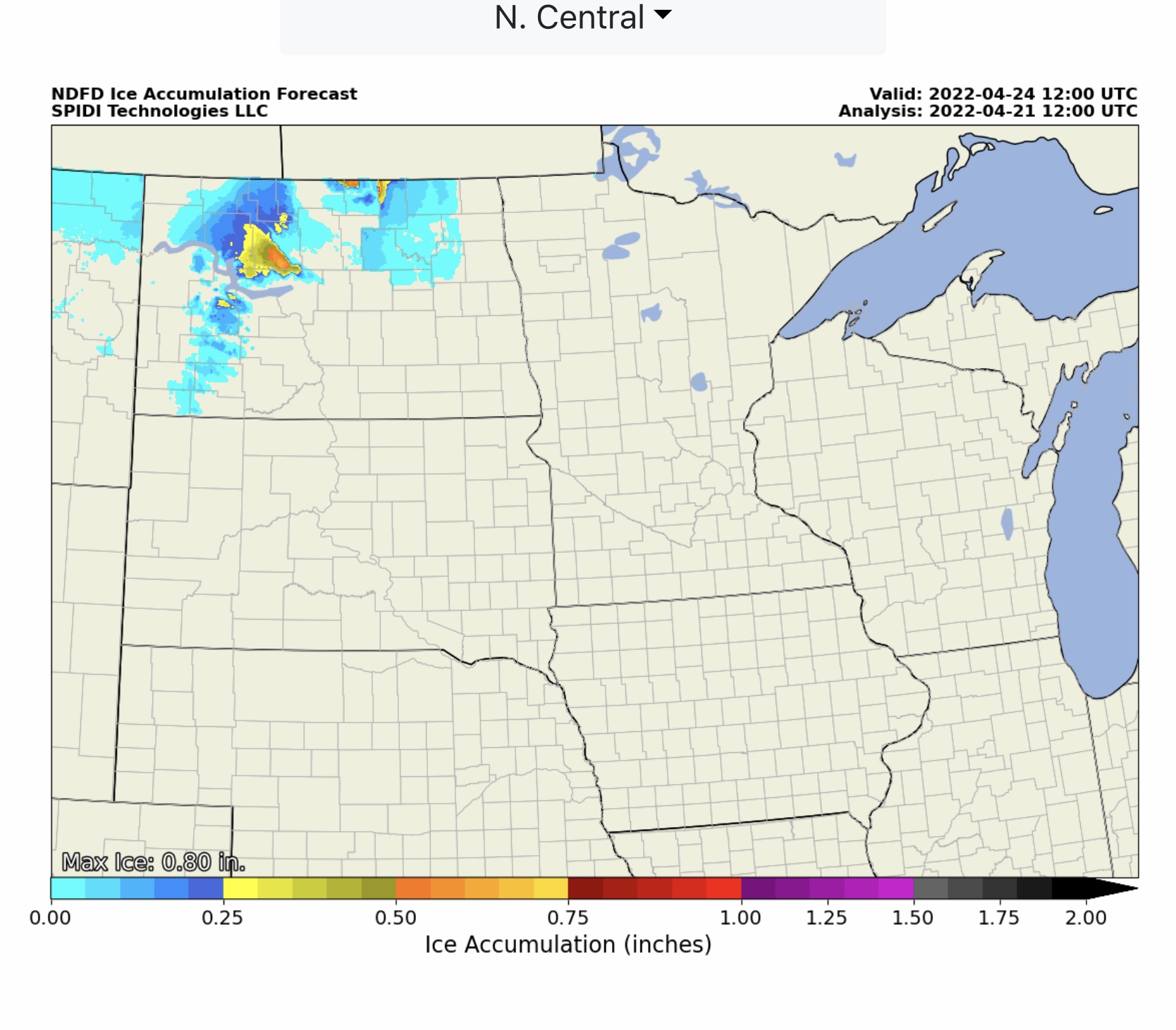
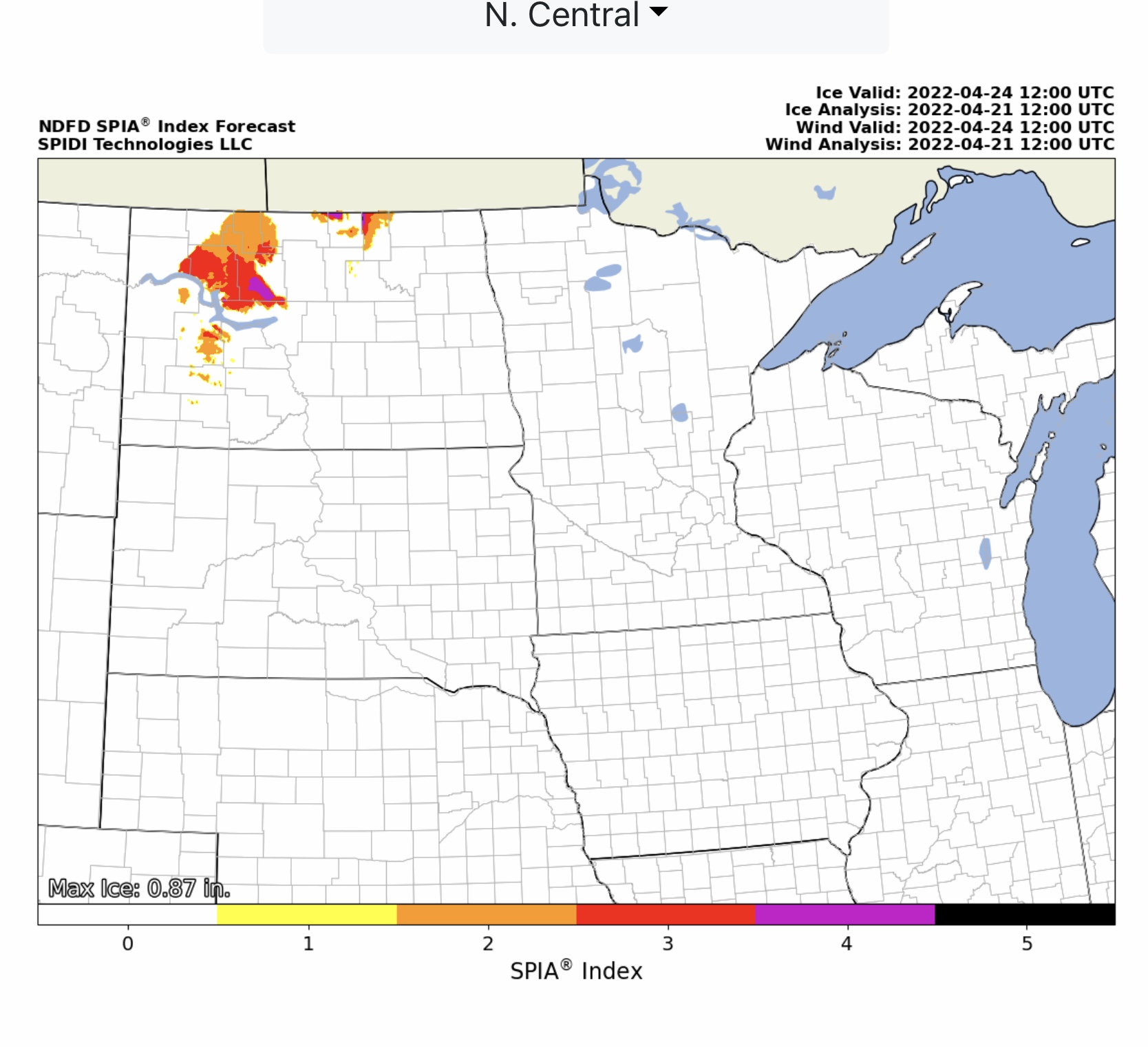
Significant Ice Storm Possible for Parts of North Dakota Beginning Late Friday thru Early Sunday. Max Ice in NWS Grids 0.80” to 0.87”. Sustained Winds in the 30 to 40 mph Range, Gusts to 50-55 mph. SPIA Index Levels 1 thru 4. Severe Thunderstorms with Large Hail possible for parts central & s-central KS, Day 1. ELEVATED Risk, Day 2, parts SD, MN, NE, KS, OK & TX. Extreme Fire Risk parts CO & NM.
Sidney Sperry 21 Apr 2022 13:01 UTC

 Show/hide attachments