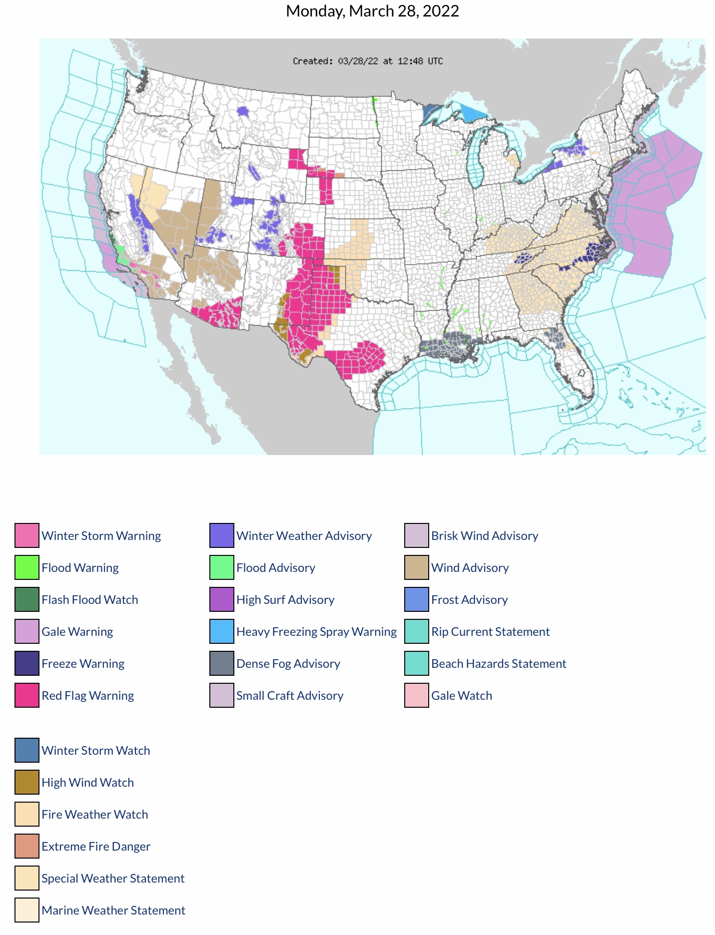
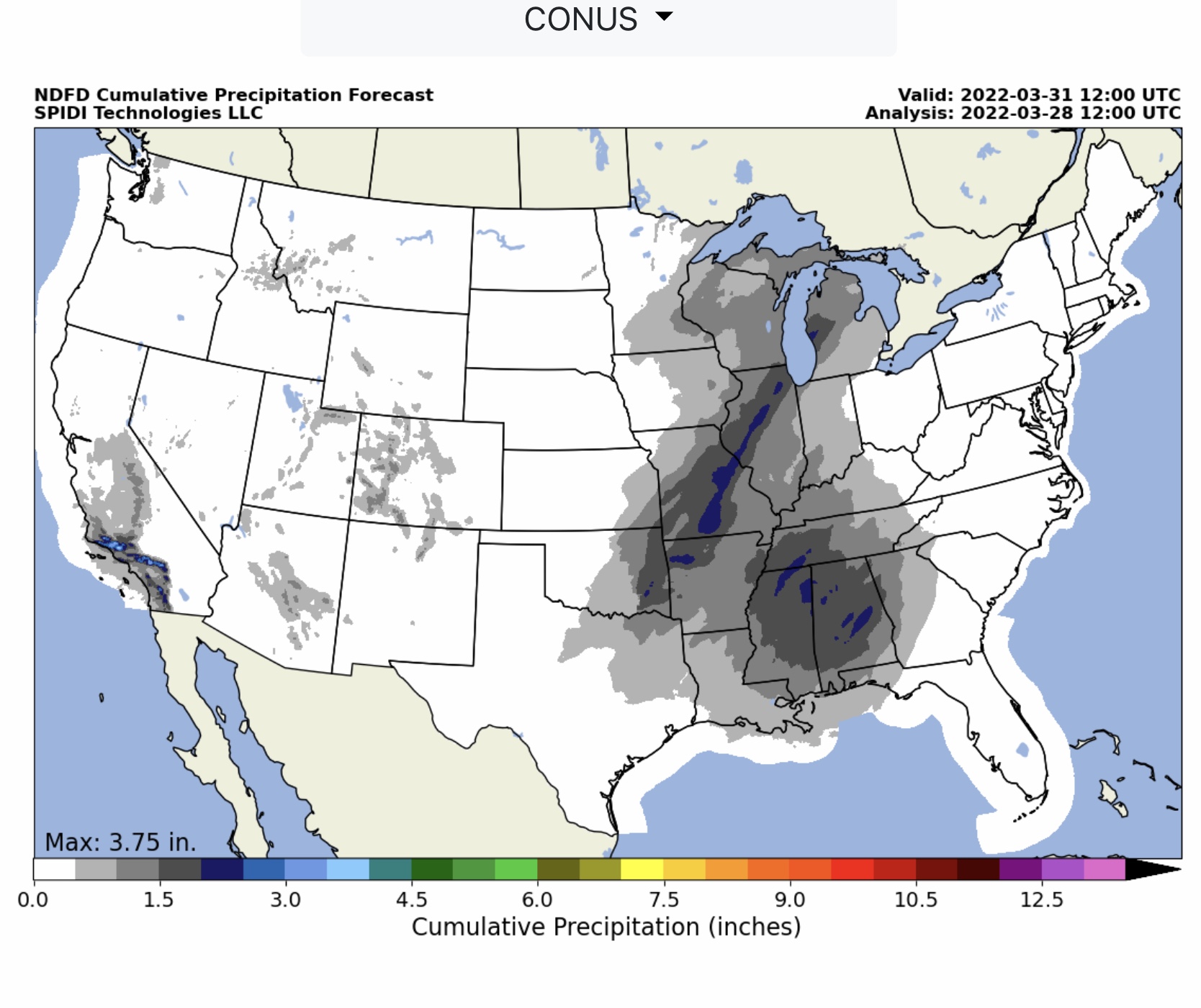
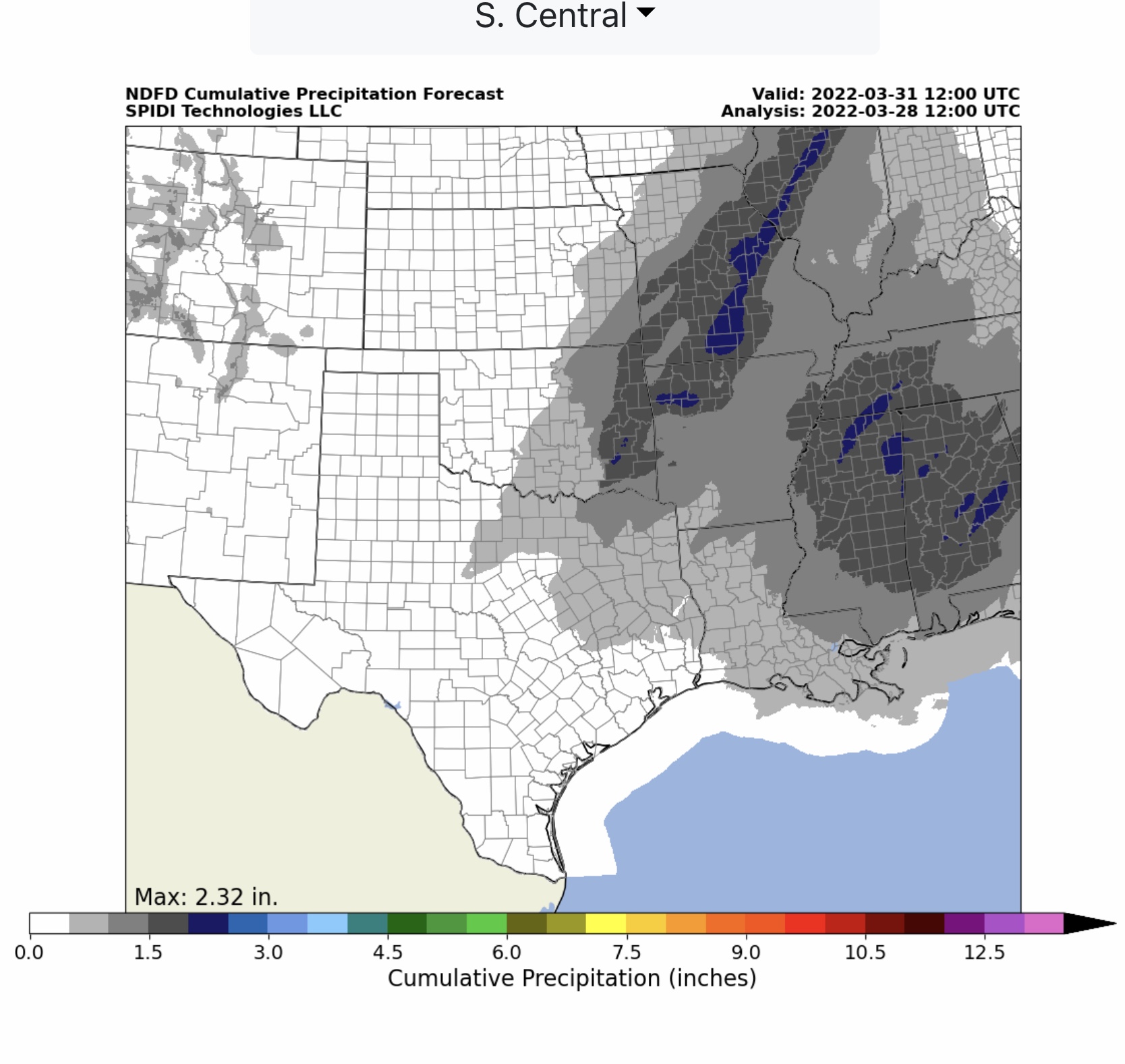
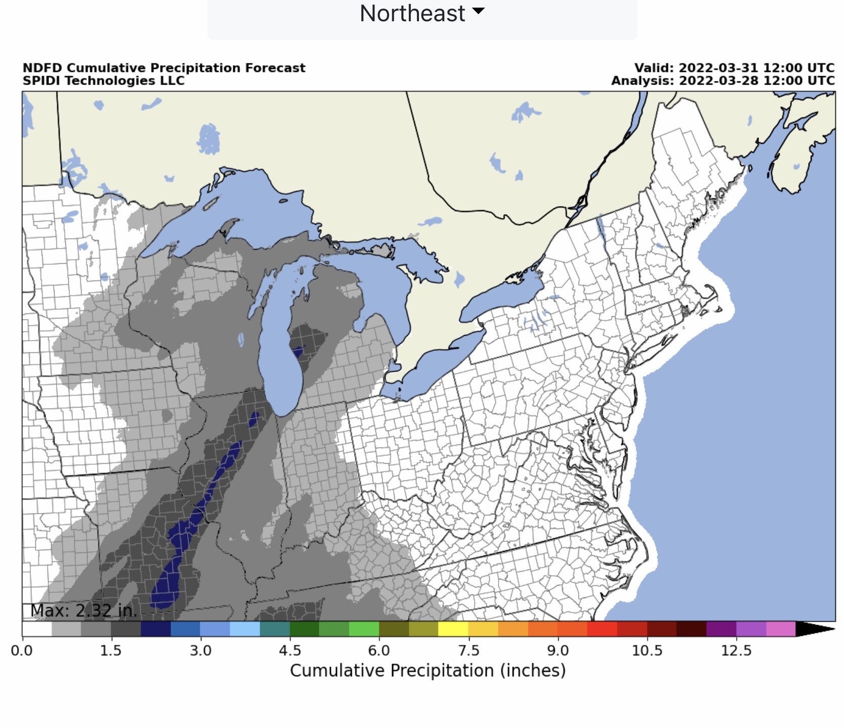
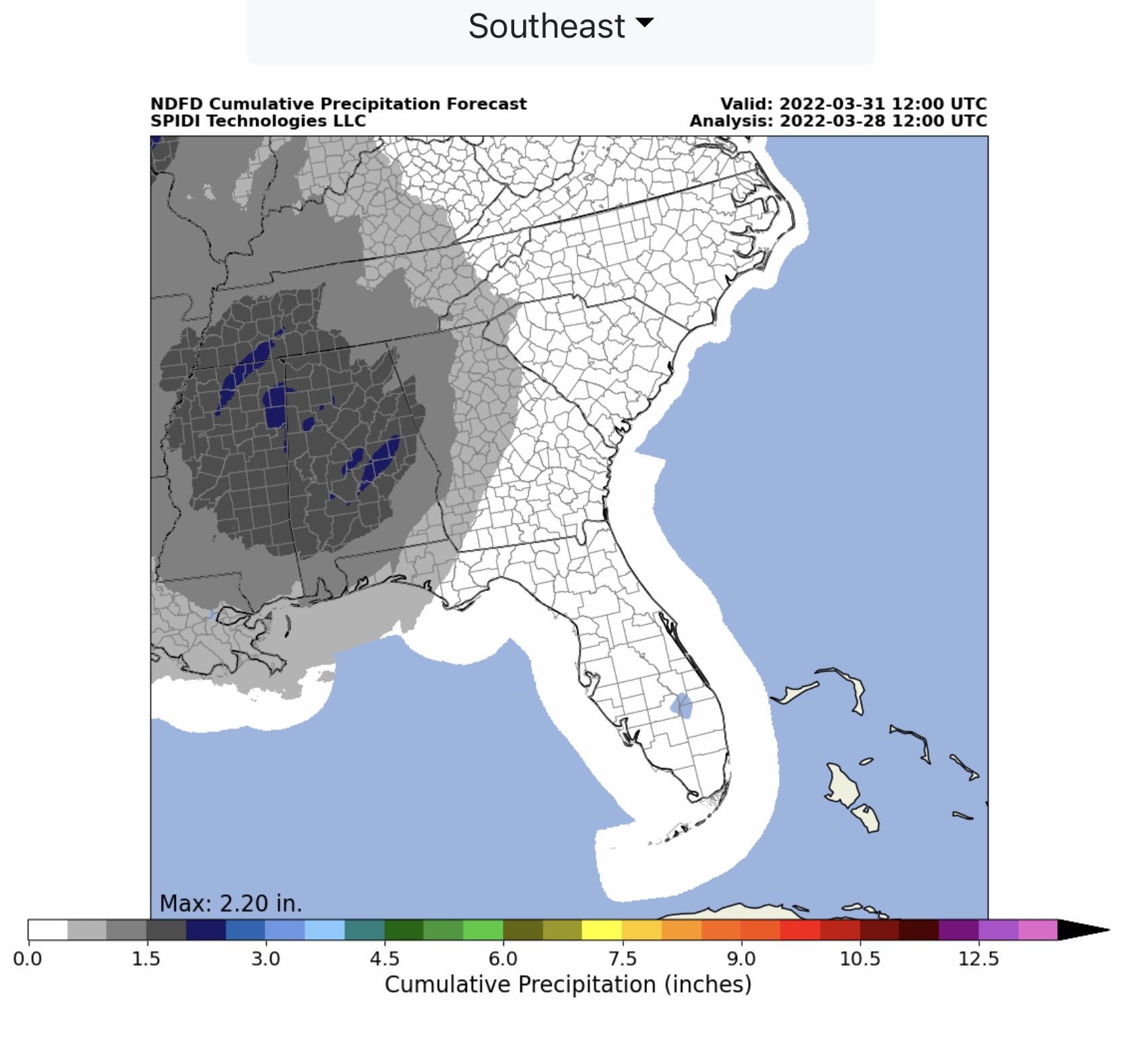
Monday through Thursday morning weather overview: Red Flag Warnings for Fire Risk in 8 states, with Fire Weather Watch & Special Fire Weather Statements in at least 9 more states. Ice storm Midnight Wednesday thru Thursday AM parts MN, WI, MI & MI Upper Peninsula. Severe Thunderstorms possible across South Central & Southeast Regions Tuesday night through Thursday…
Sidney Sperry 28 Mar 2022 13:25 UTC
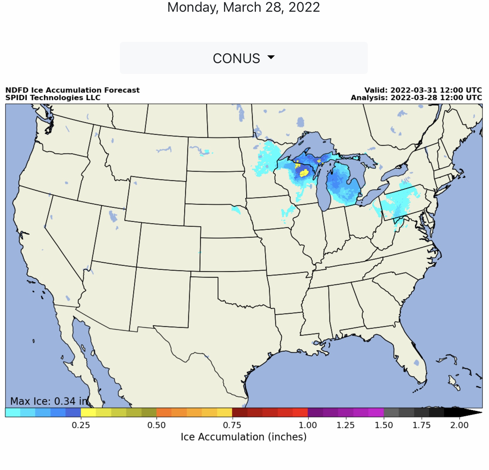
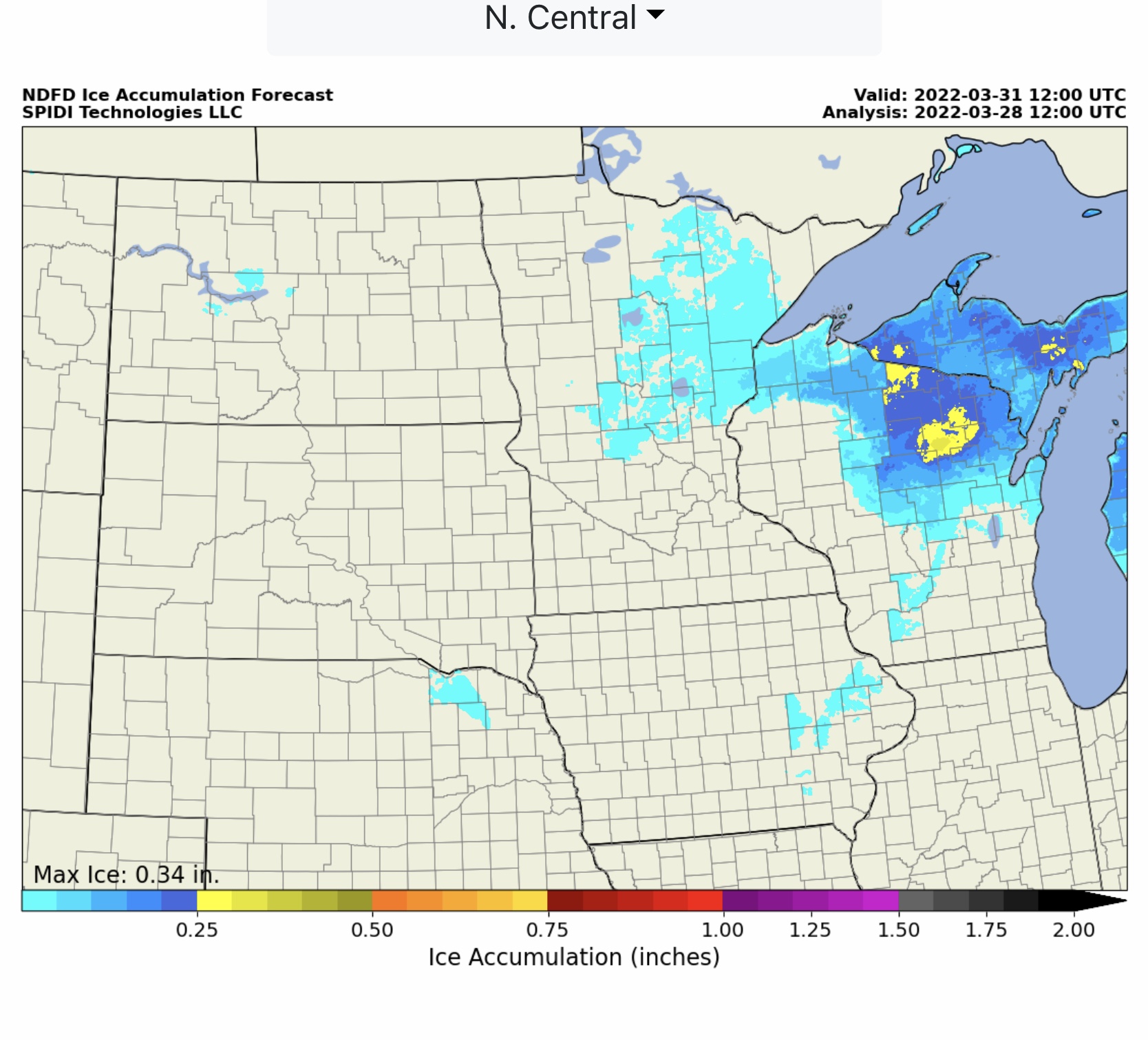
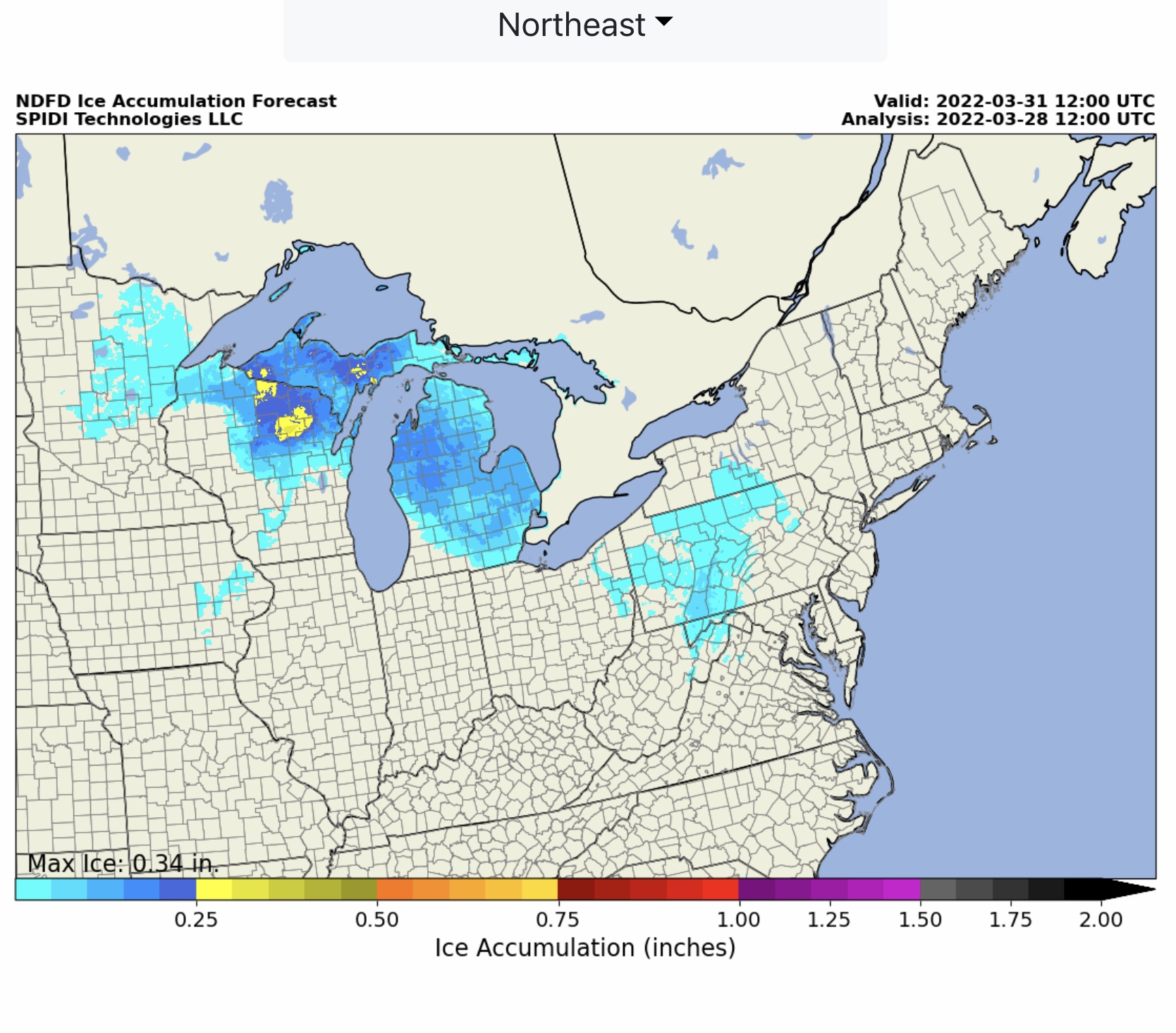
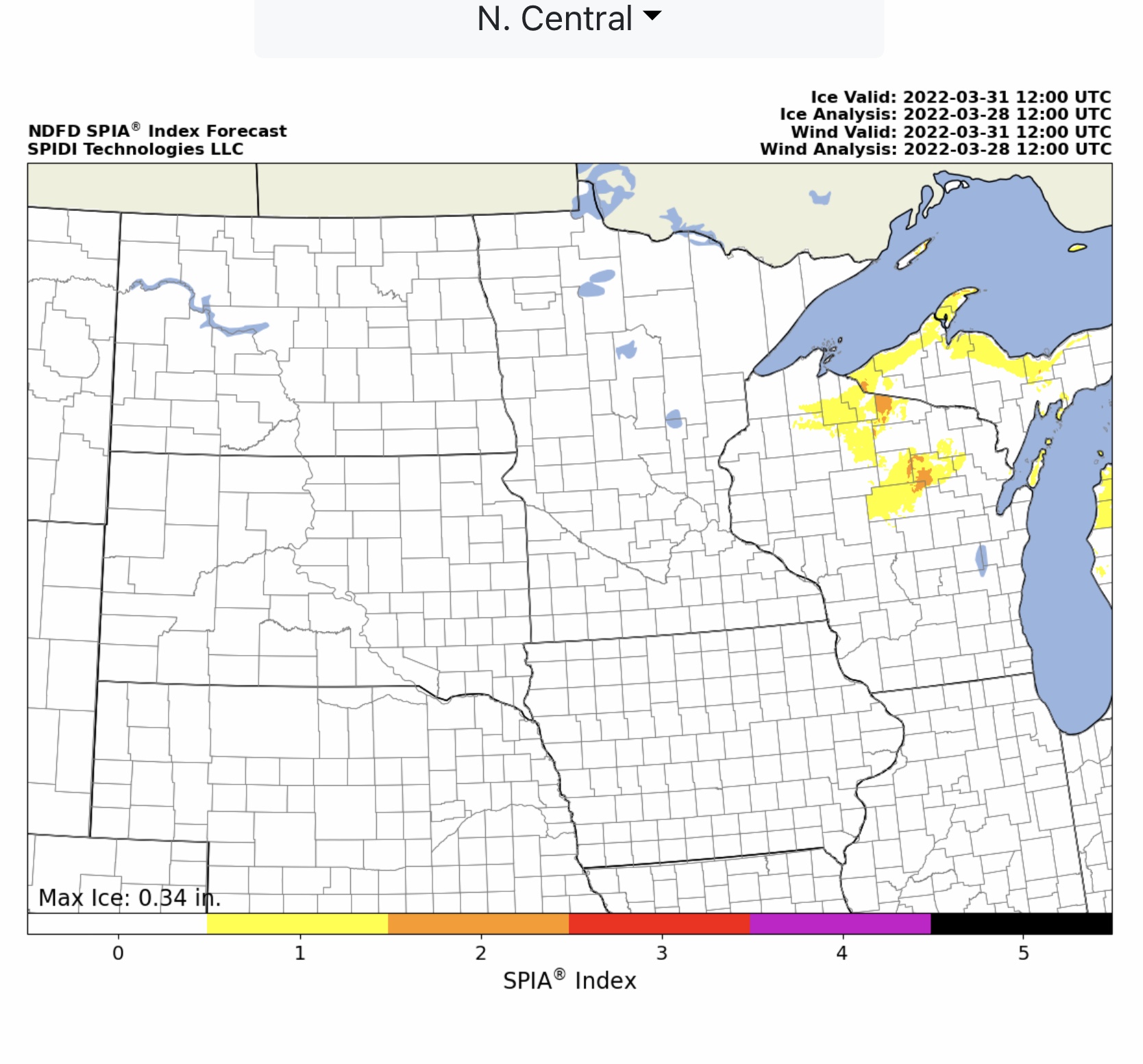
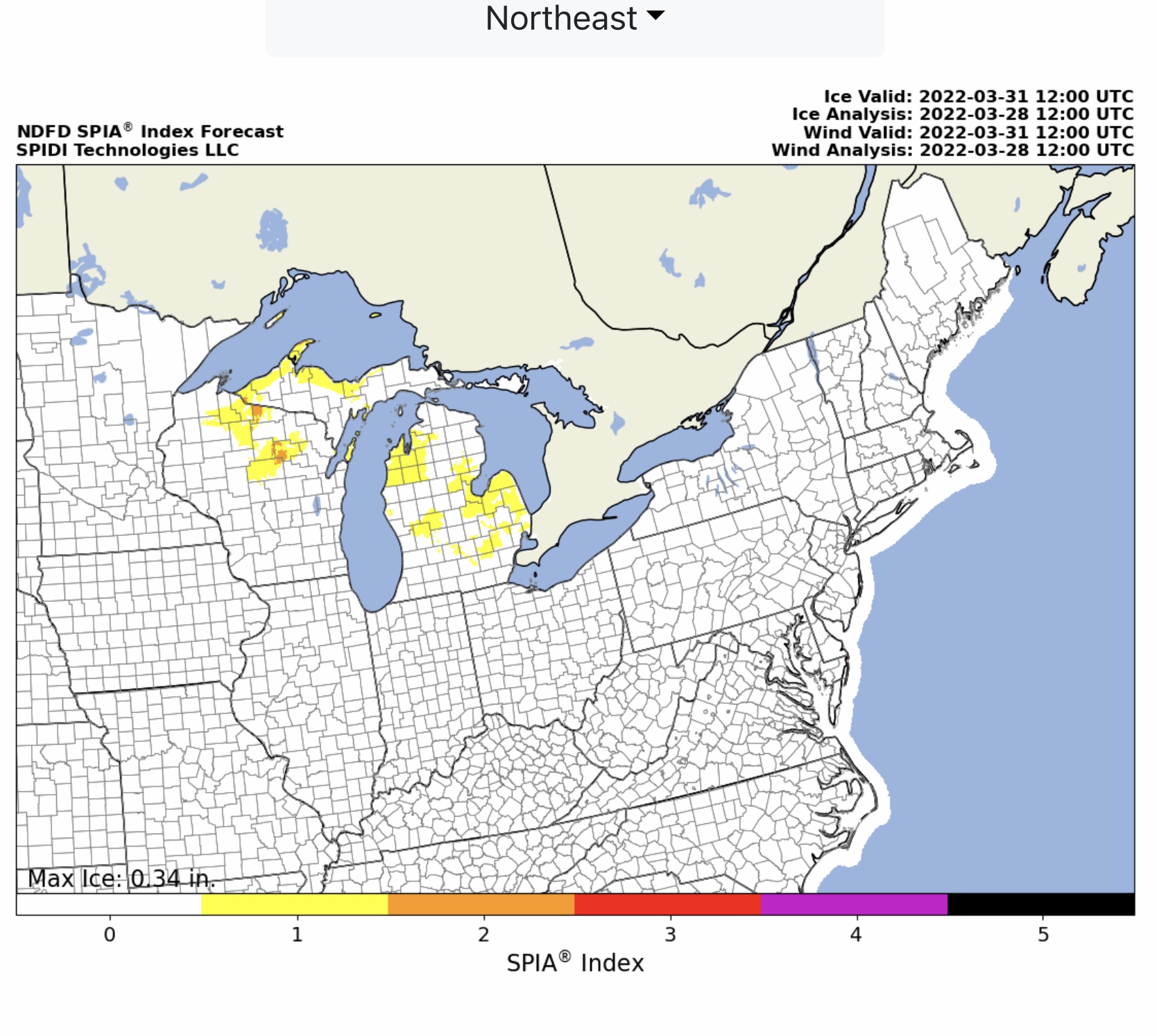
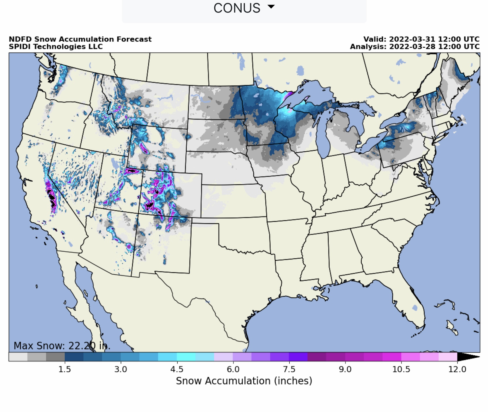
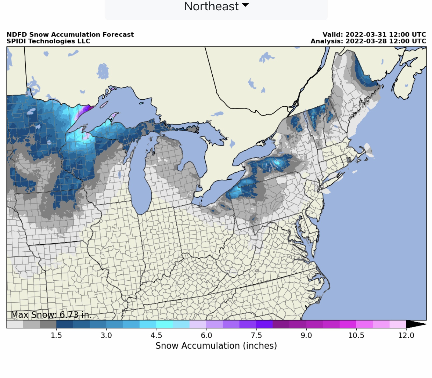
FYI… max ice in NWS grids 0.34” parts northeastern WI and MI Upper Peninsula. Current SPIA Index Ice Impact Forecast is at Levels 1 thru 3 for parts WI, MI & MI Upper Peninsula. Up to 9” of snow in forecast for MN Triangle. From 1” to 2.5” rainfall possible across South Central and Southeast Regions on Tuesday thru Thursday. Tornado Risk is Low, but High Winds and Hail to Golf Ball size will be possible with these storms. Severe Thunderstorm Risk Outlooks and Fire Risk Outlooks will be sent in next email.

Sid Sperry

 Show/hide attachments