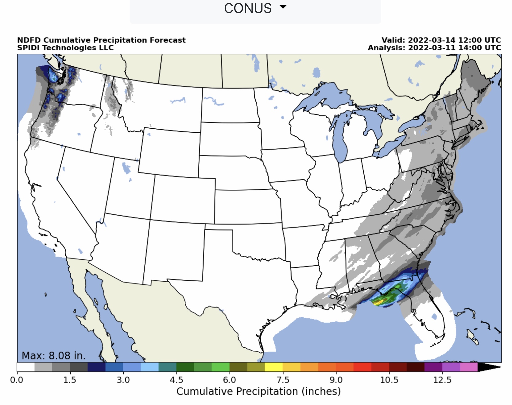
Latest NWS Total Ice Forecast, Total Snow & Sleet Forecast, Total QPF (Precip) Forecast, and SPC Severe Thunderstorm Risk Forecasts and Severe Wind Forecasts, Day 1 and Day 2, to 6am Sunday, 3/13/2022…
Sidney Sperry 11 Mar 2022 16:10 UTC
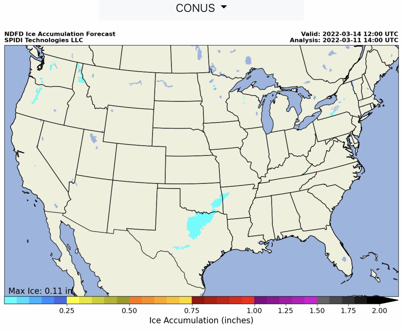
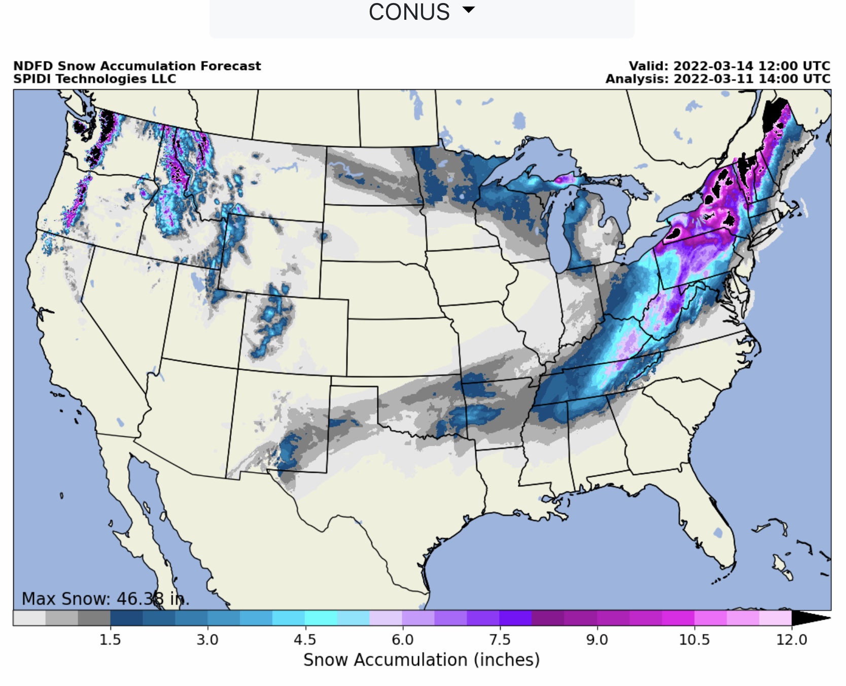
FYI… max ice in grids 0.11” parts WA & OR. (SPIA Index Level 0) Heavy snow in the Northeast Region, parts TN, KY, OH, WV, PA, NY, VT, NH and ME. From 4” to 9” in TN, KY, OH, WV & PA; from 12” up to 40”+ higher elevation areas of NY, VT, NH & ME.
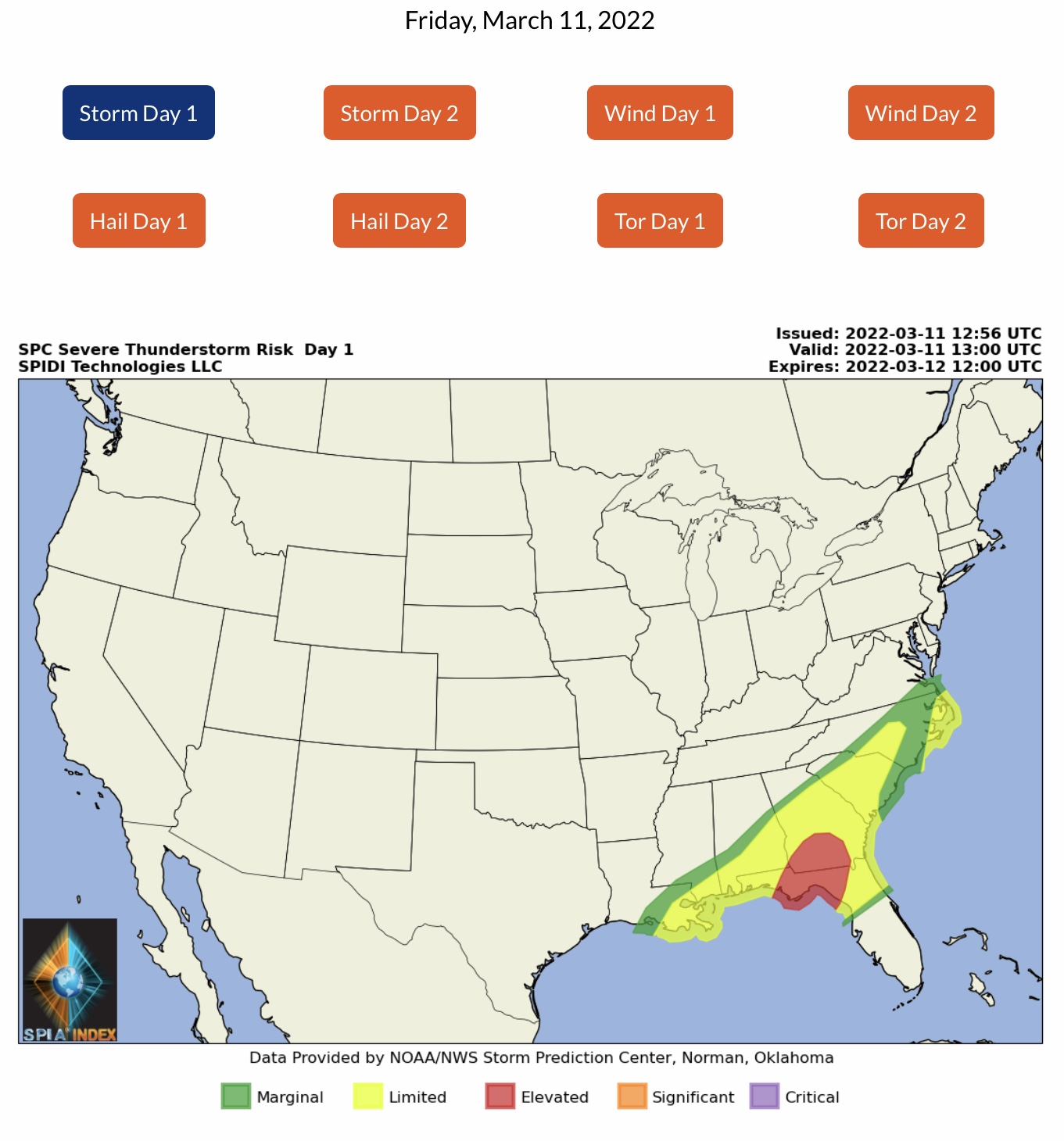
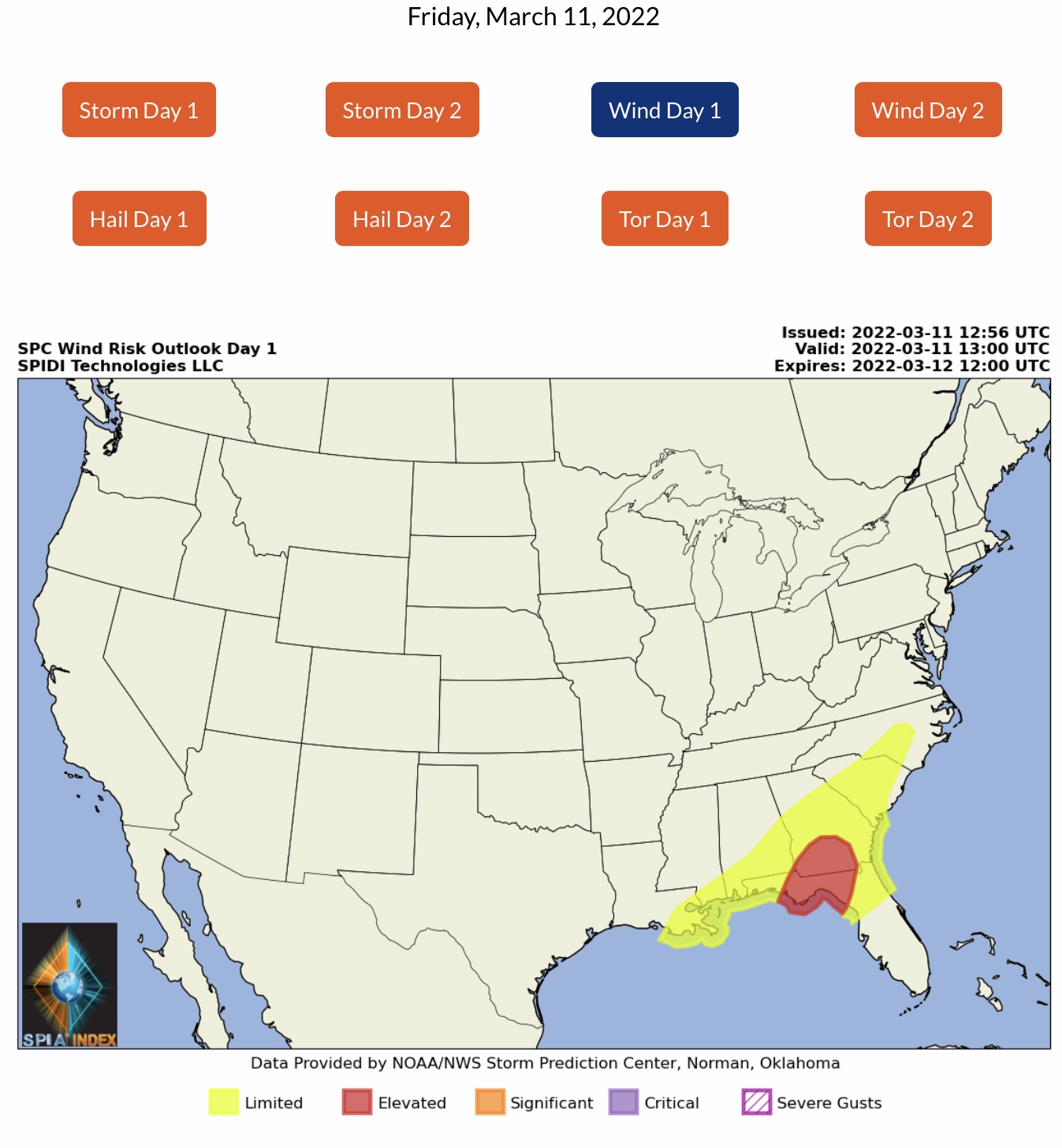
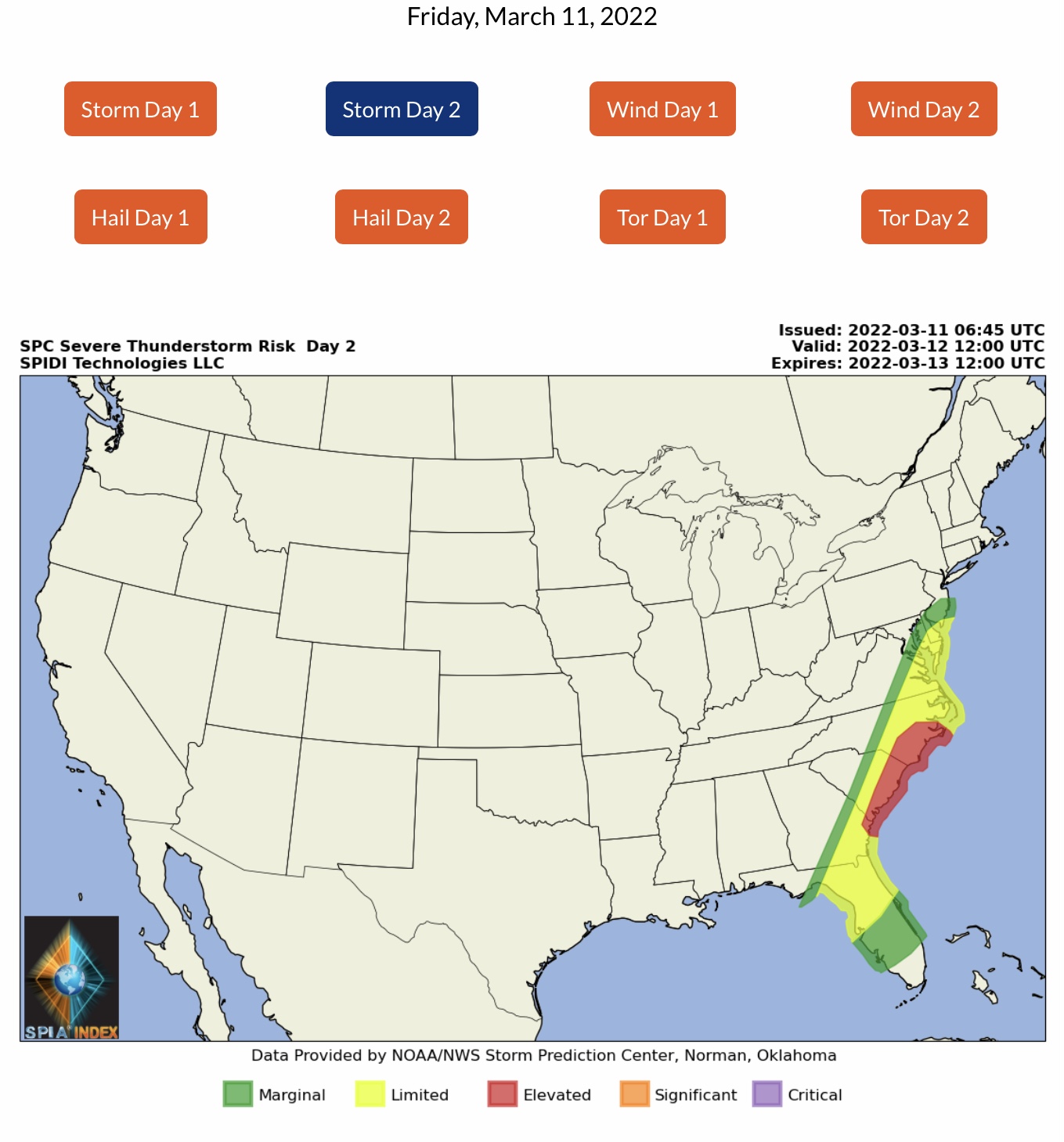
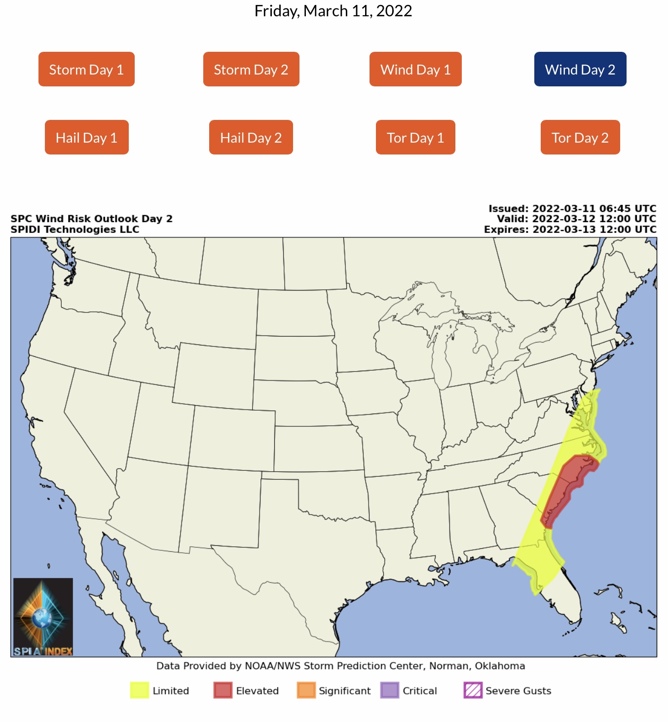
Severe thunderstorm risk is ELEVATED today and tomorrow for parts FL & GA, then SC and NC coastal areas on Saturday. Severe Wind Risk is also ELEVATED for parts FL & GA today, then SC & NC Saturday through Sunday morning (6am). - Sid Sperry

 Show/hide attachments