All,
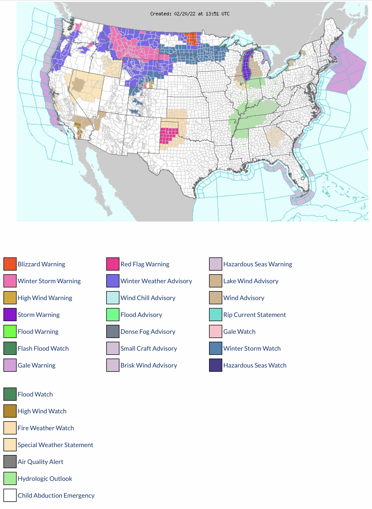
A significant ice storm and snow storm is developing now for parts of the North Central and Northeast states, and both will continue to develop toward the South Central states, with significant rainfall possible in the Southeast Region later next week.
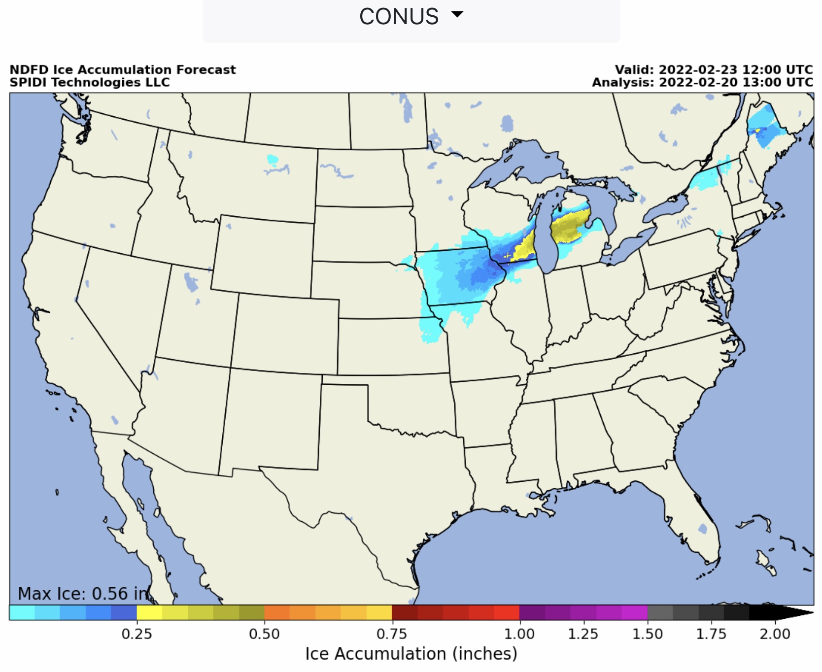
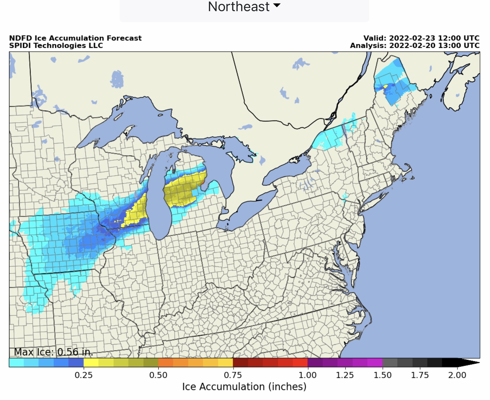
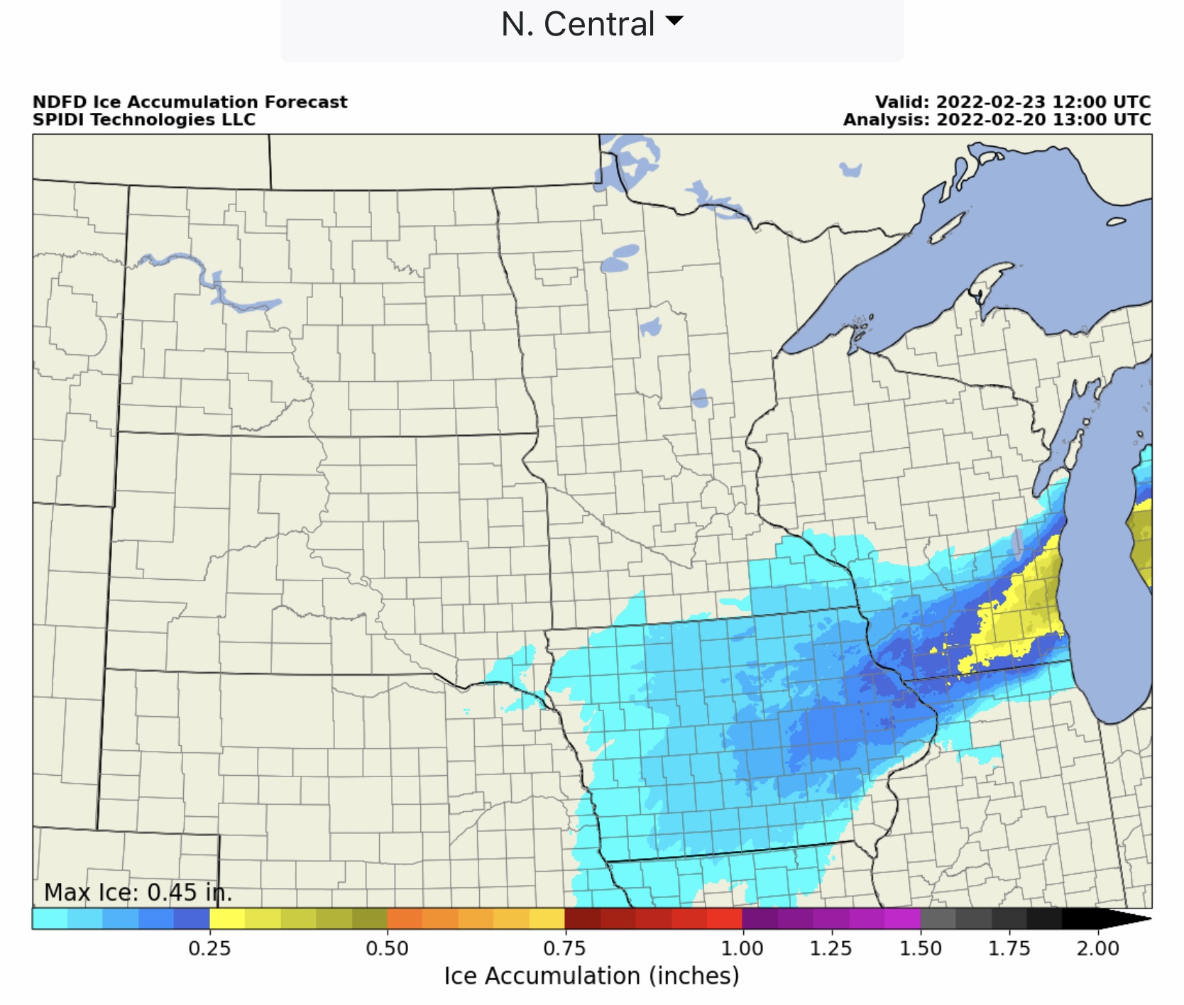
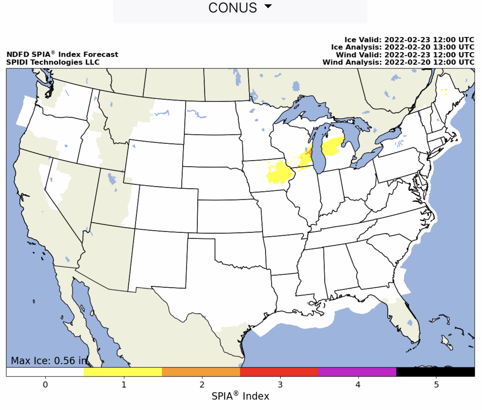
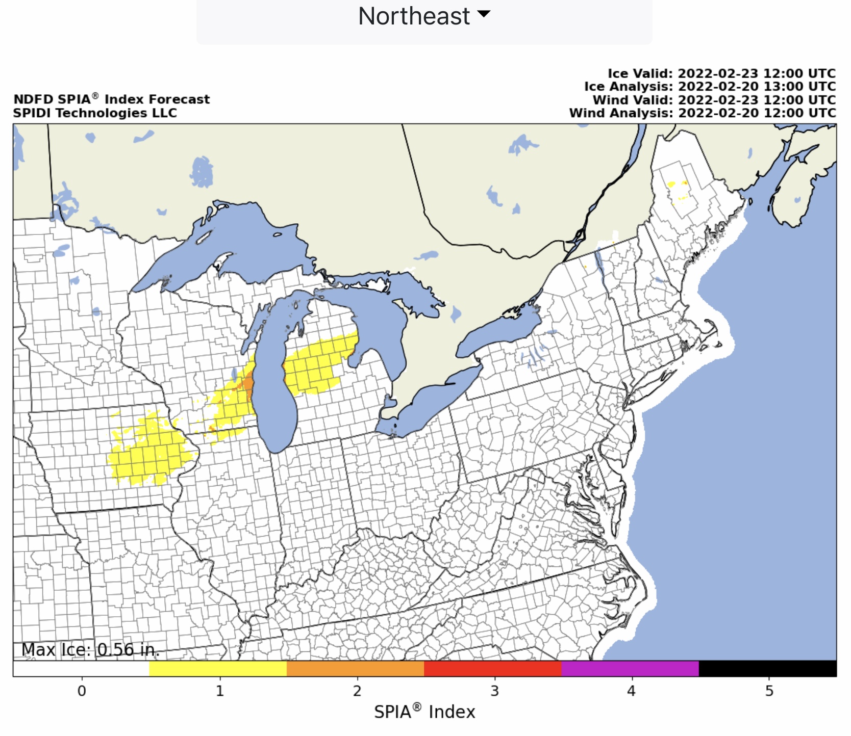
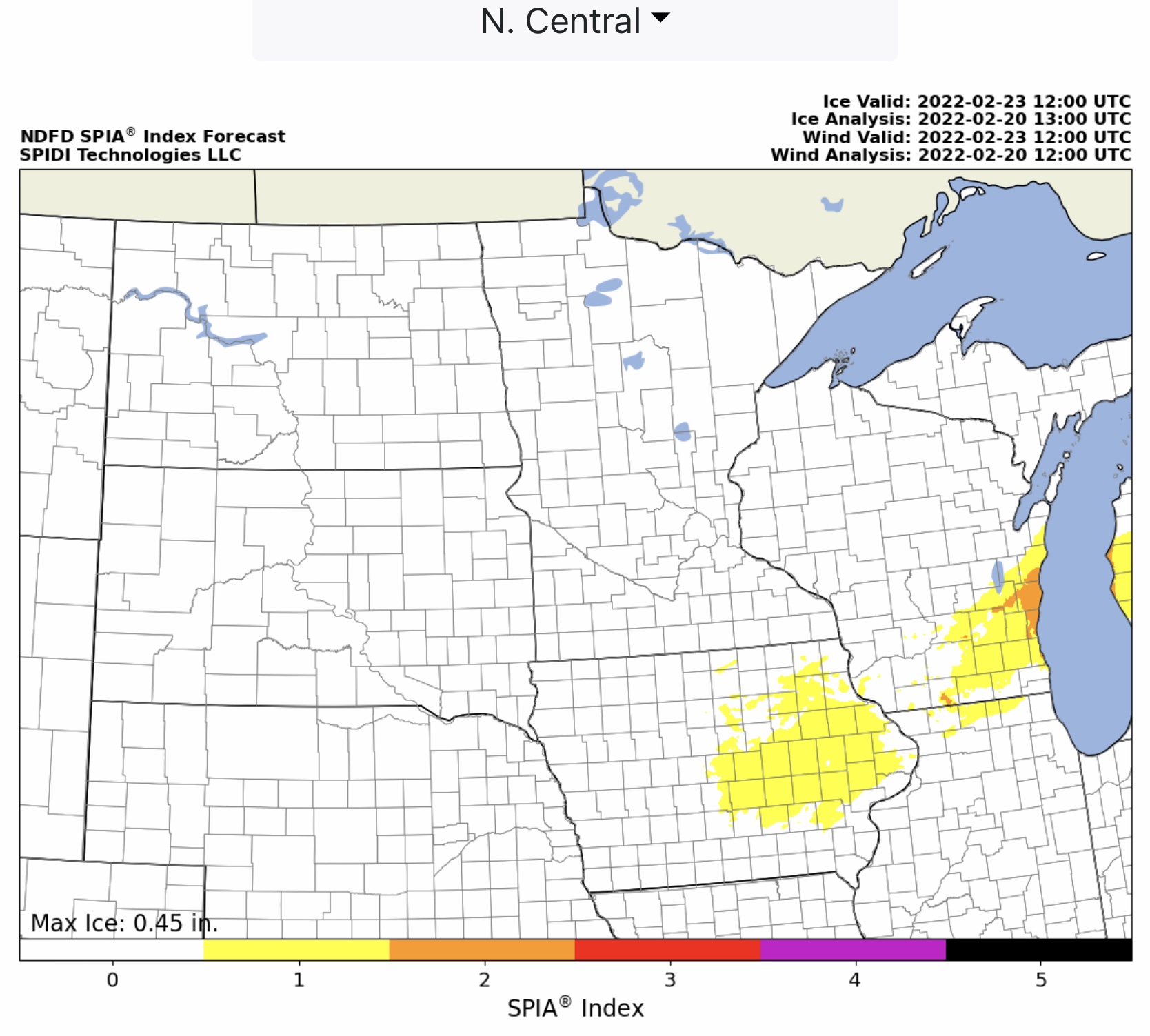
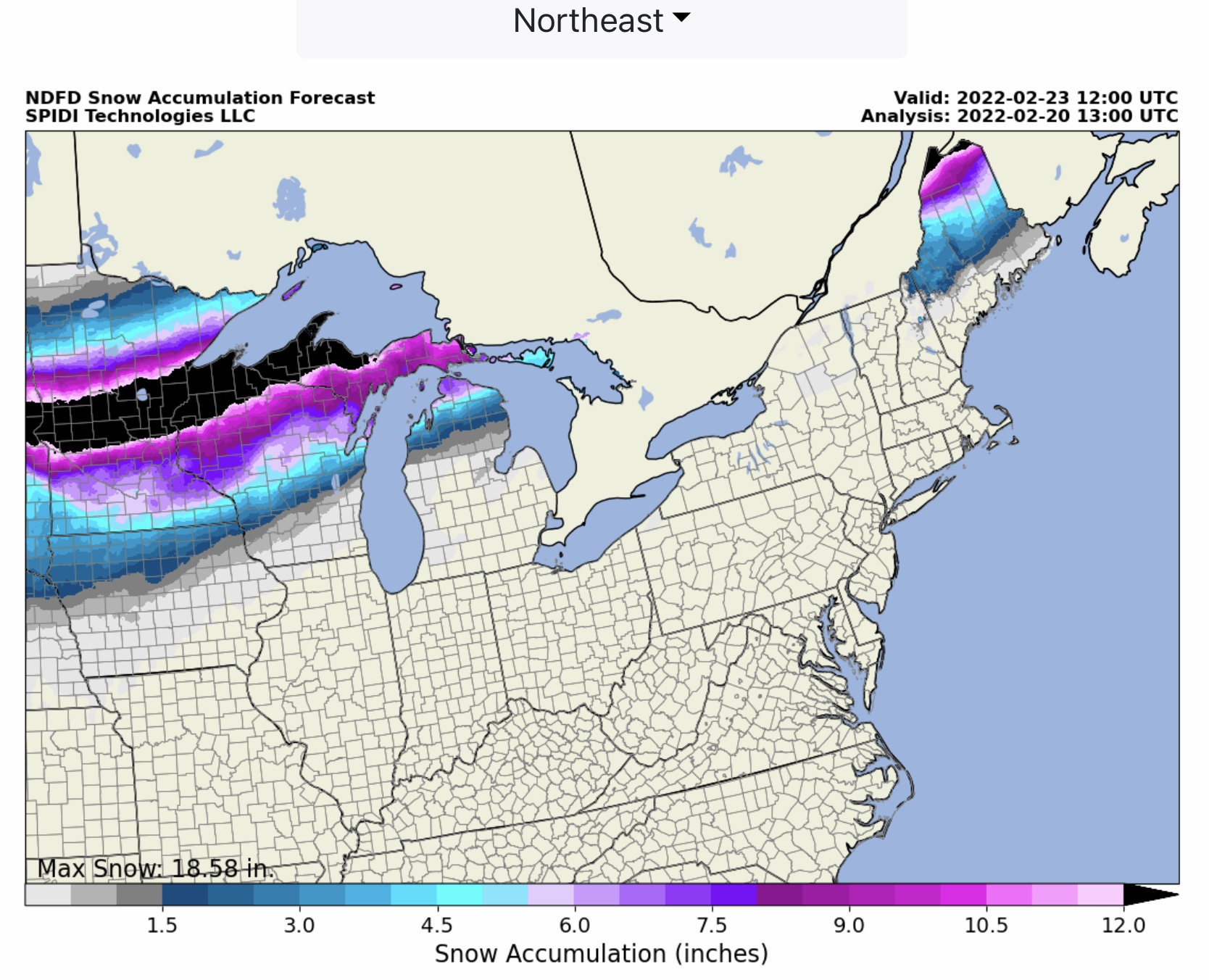
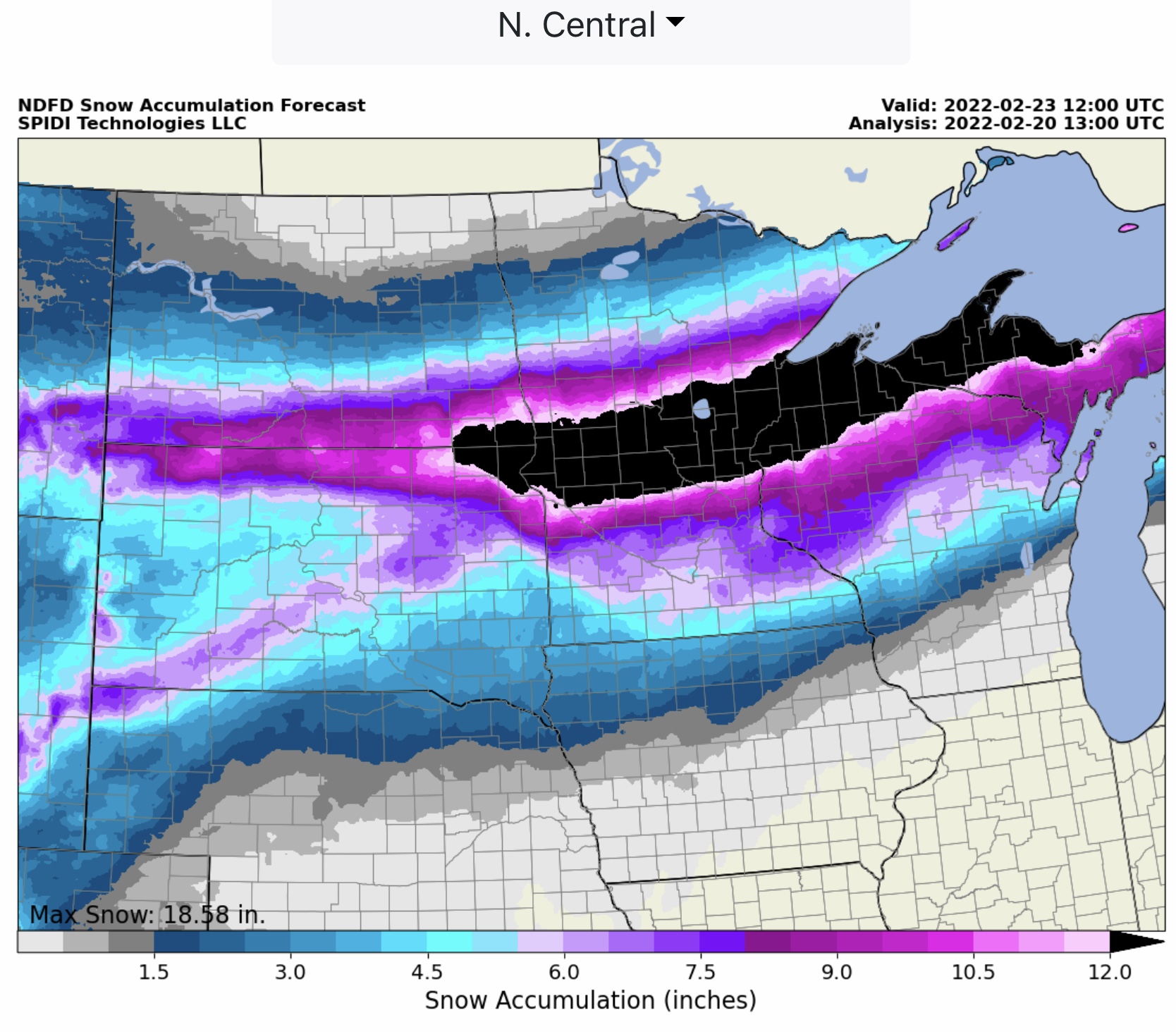
Currently, the max ice in the NWS grids is 0.56” in parts of west-central and east-central MI. In southeastern WI, ice forecast amounts are currently at 0.45”, and across parts of southeastern SD, much of IA, eastern NE, northeastern KS, and northern MO ice amounts currently are in the 1/10” to 1/4” range. Up to 1/4” ice is also possible in parts of NY, VT and ME. These forecasts are through 6am Wednesday morning.
The current SPIA Index Ice Impact Forecast is at Levels 1 through 3 in parts of west-central, central, and east-central MI. In parts of southeastern WI, the SPIA Index is forecasting Level 1 & 2 impacts, and Level 1 impacts are in the forecast for parts of northern IL and central and eastern IA.
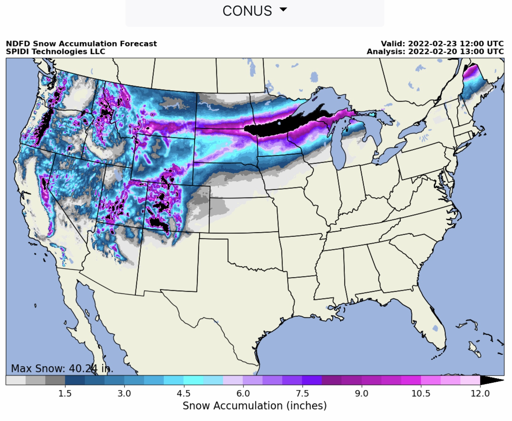
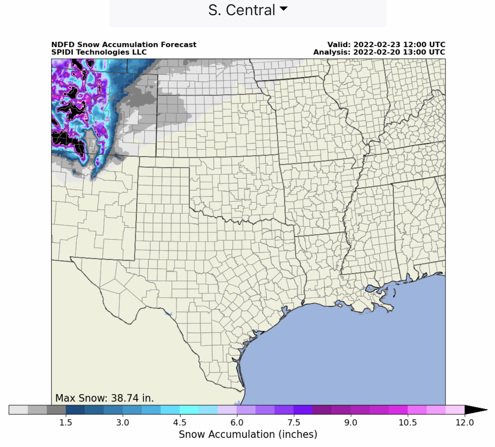
Heavy snow and very cold temperatures are forecast for parts of southern ND, northern SD, central MN, northern WI, northern MI and the MI Upper Peninsula, as well as northern ME. Up to 18.58” of snow is forecast for those areas. Heavy snow - up to 40.24” - is also forecast for the southern and northern Rockies, and the Cascades of OR and WA.
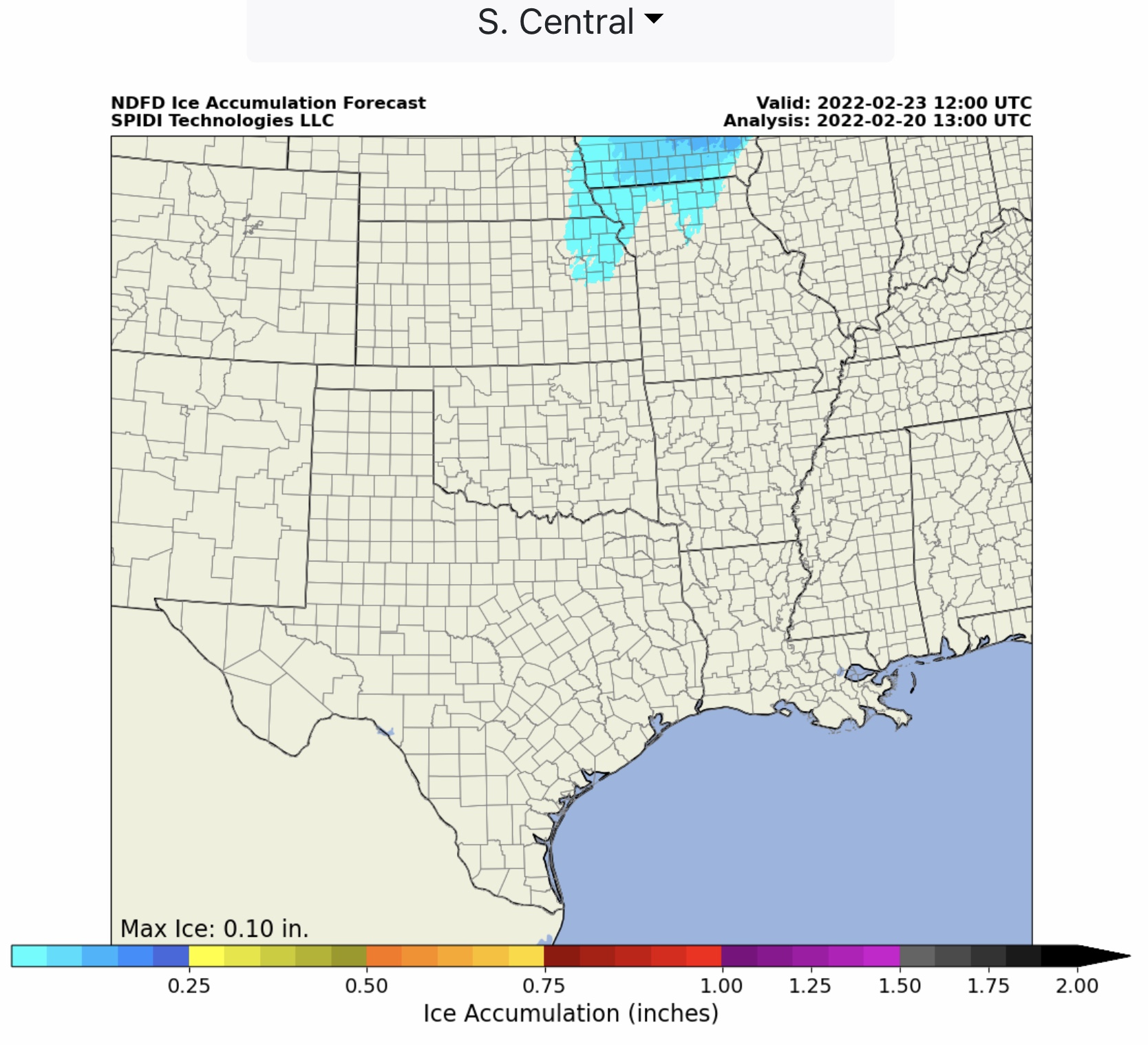
This storm system will continue to develop into the South Central states of KS, MO, OK, TX and AR later in the day Wednesday and through the entire day on Thursday.
Individual state forecasts to follow later…
Sid Sperry

 Show/hide attachments