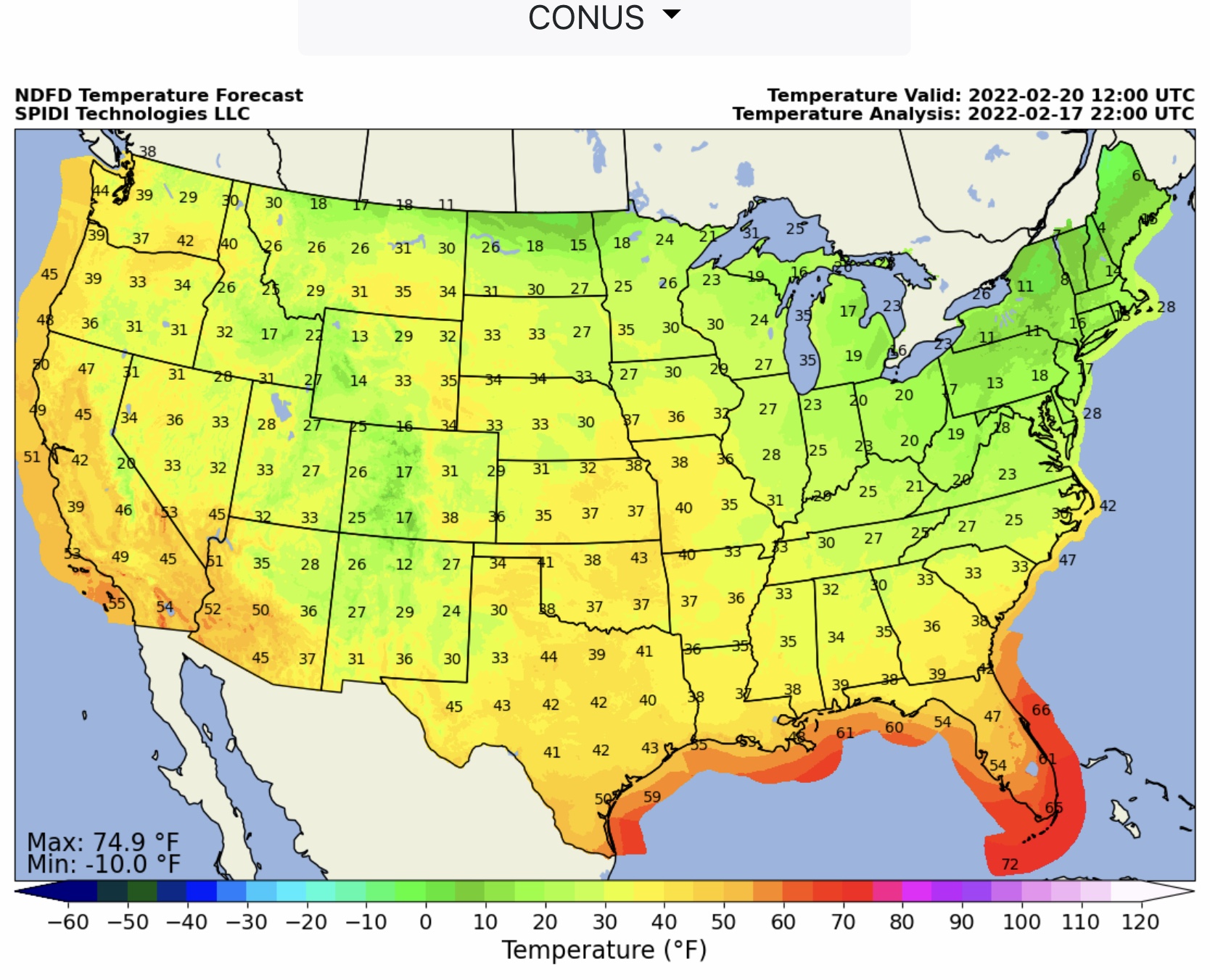
Latest NWS Forecasts for Total Ice, latest SPIA Index Forecast, and latest NWS Total Snow & Sleet and Total QPF Forecasts, plus Severe Thunderstorms & morning Temps Forecasts…
Sidney Sperry 17 Feb 2022 23:43 UTC
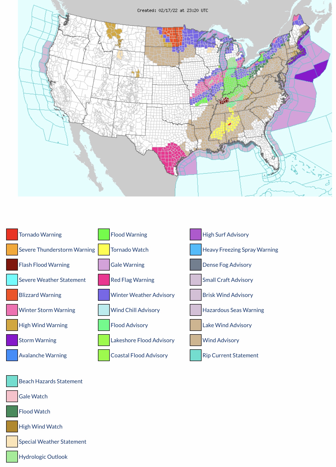
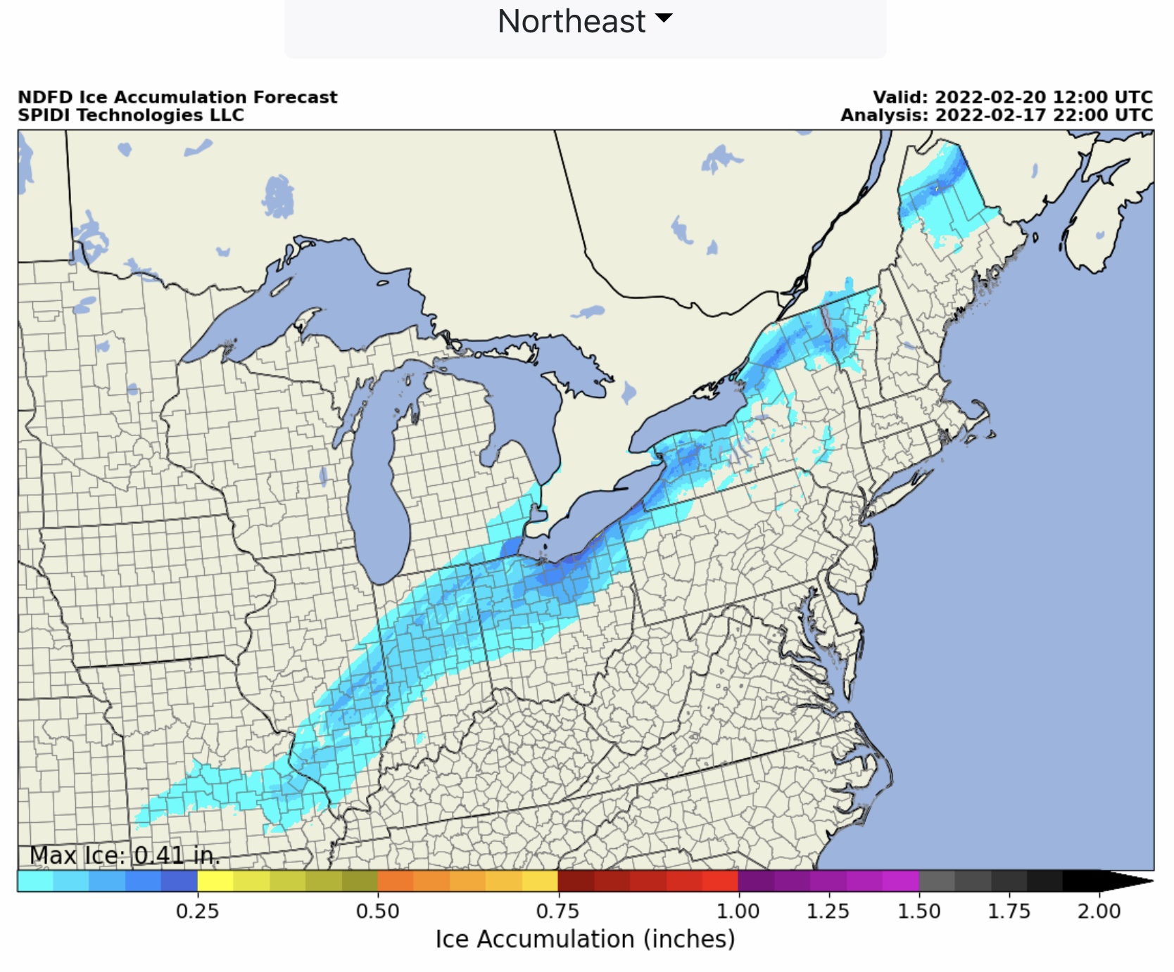
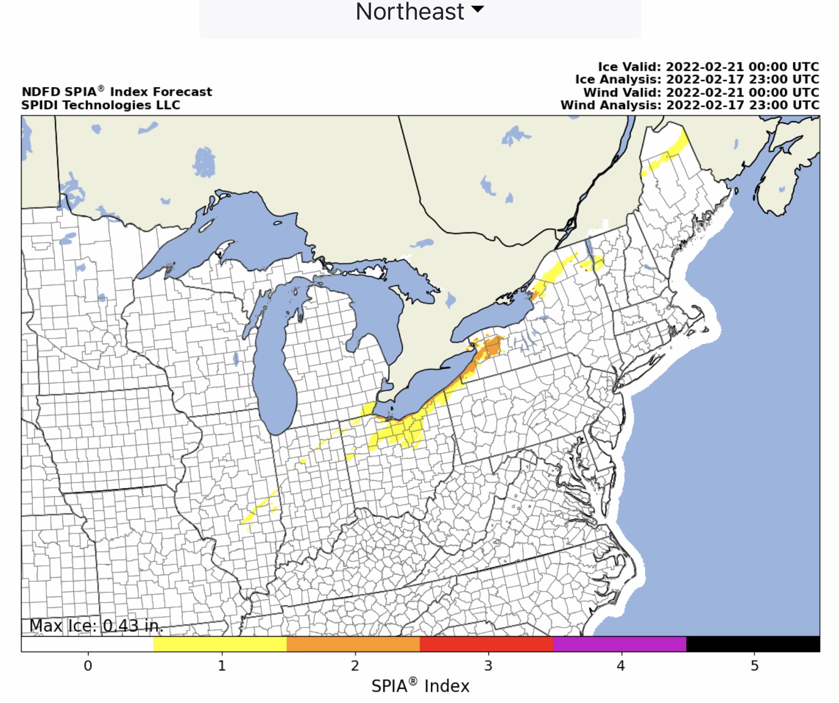
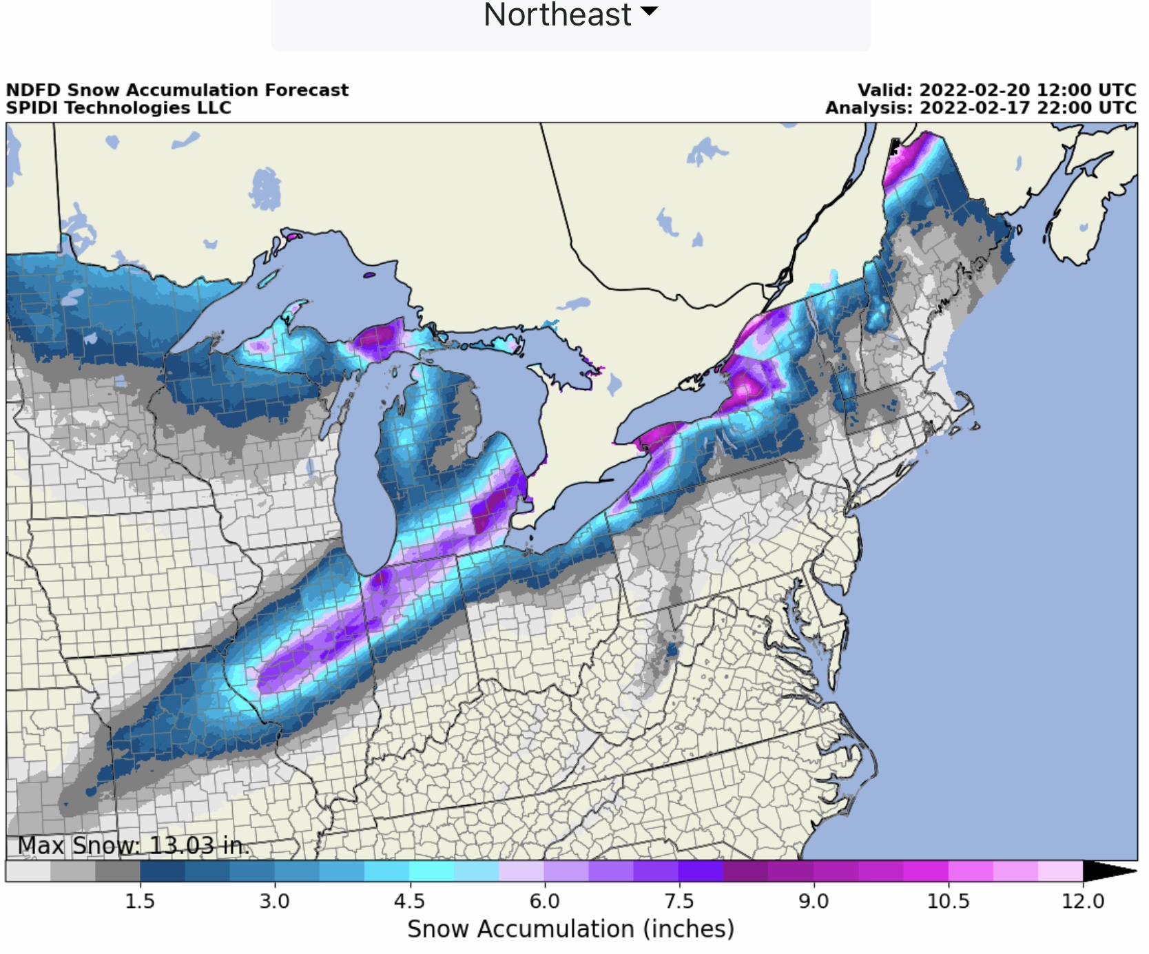
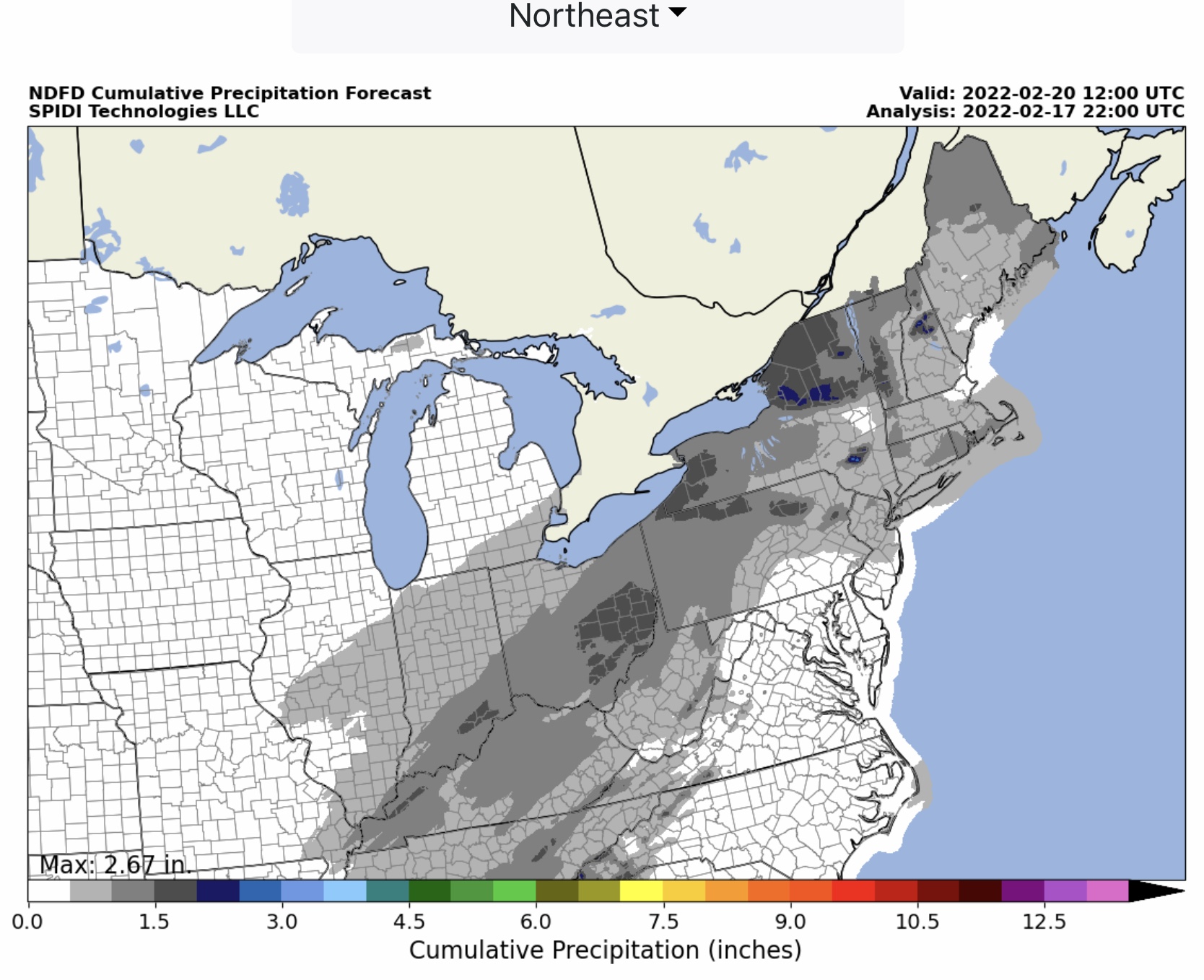
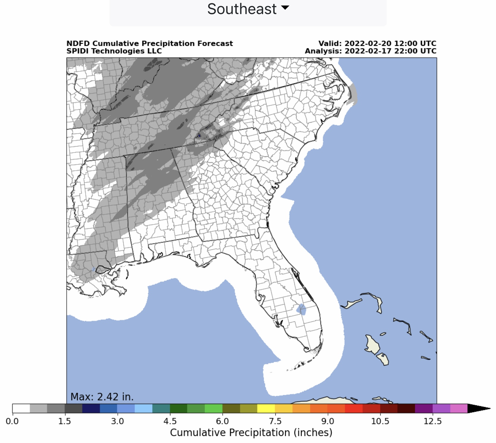
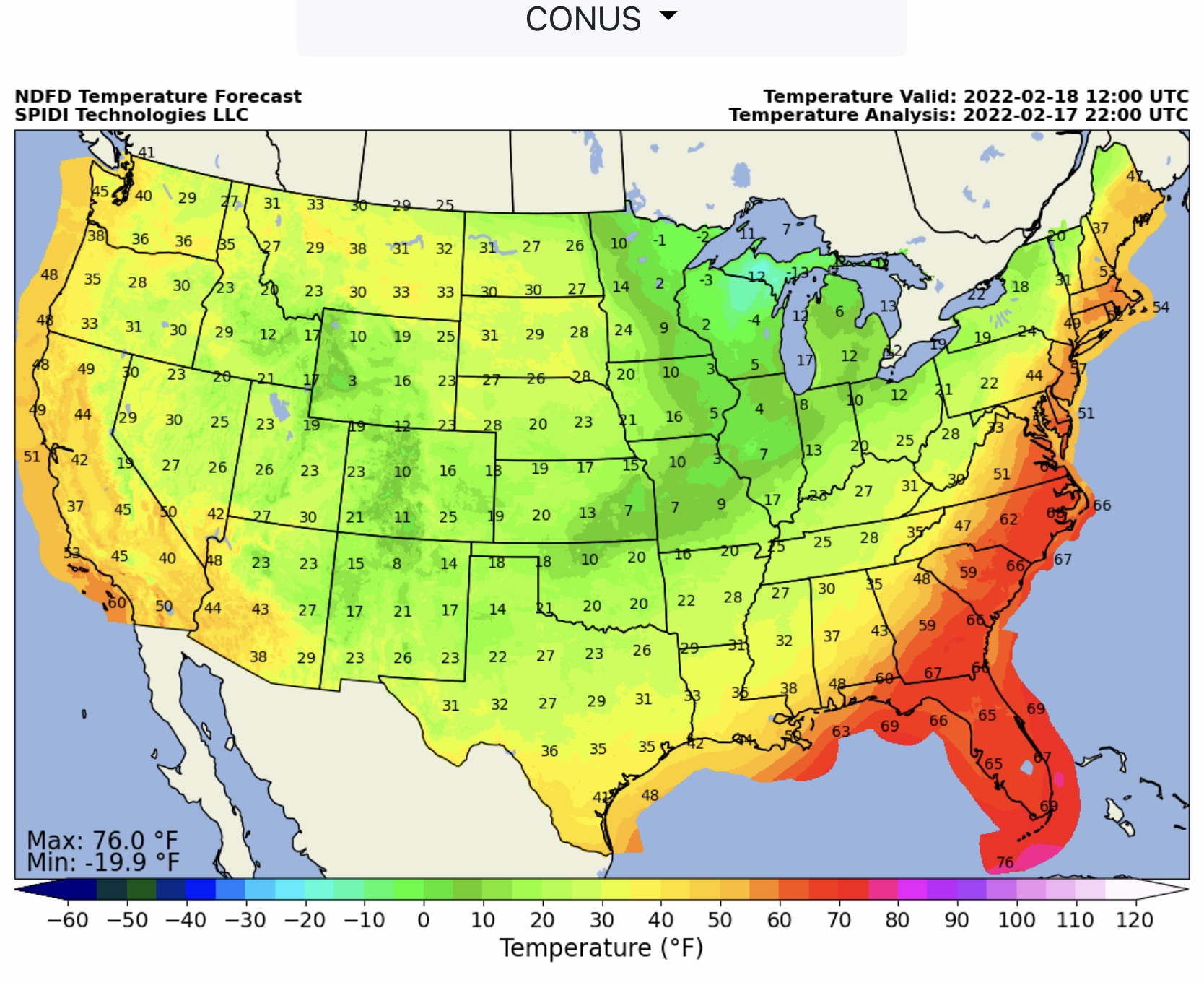
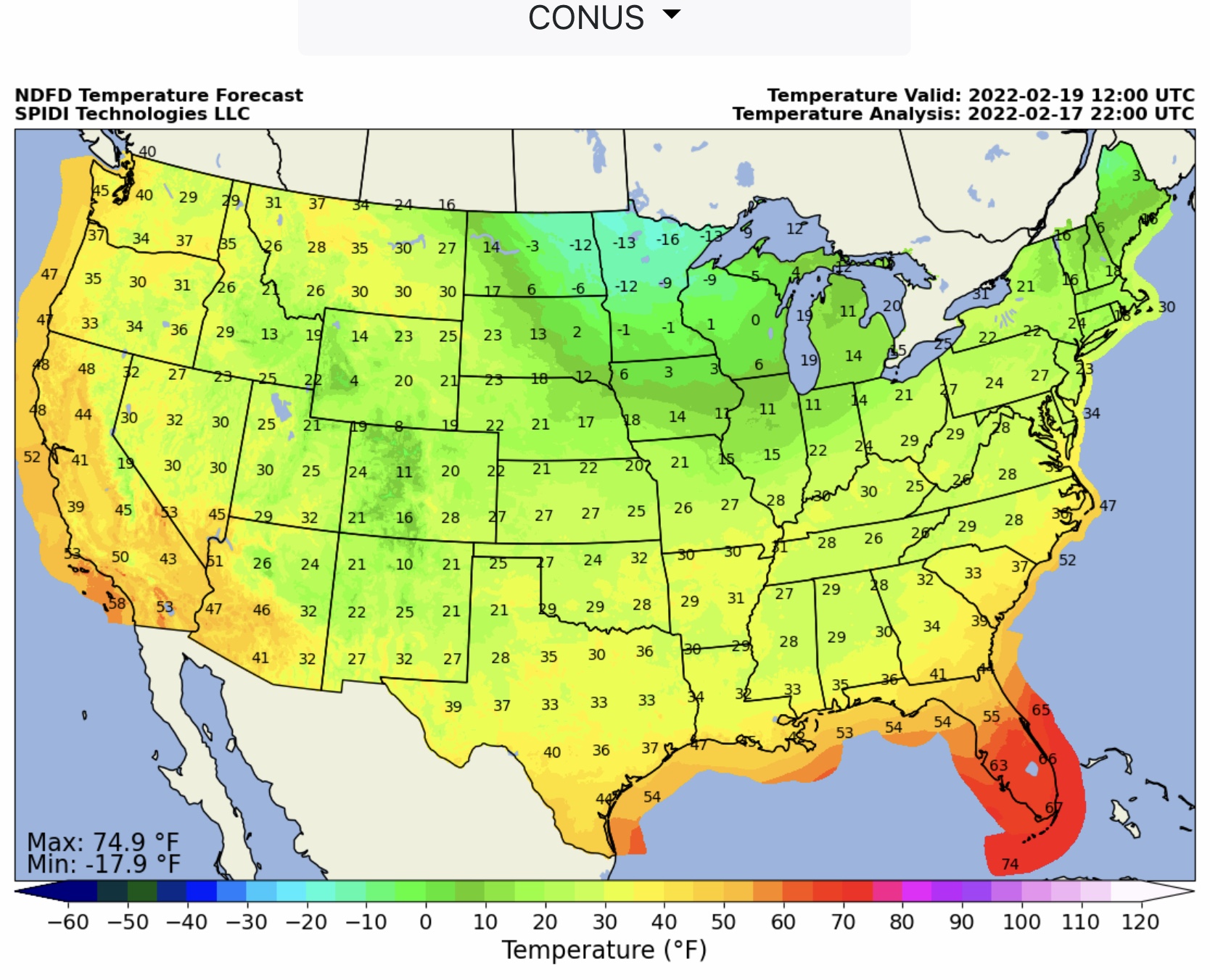
FYI…max ice in grids 0.41” parts northeast OH and northern ME. SPIA Index Ice Impact Forecast Levels 1 thru 4. Max snow 13.03” Max QPF - Northeast 2.67”; Southeast 2.42”.
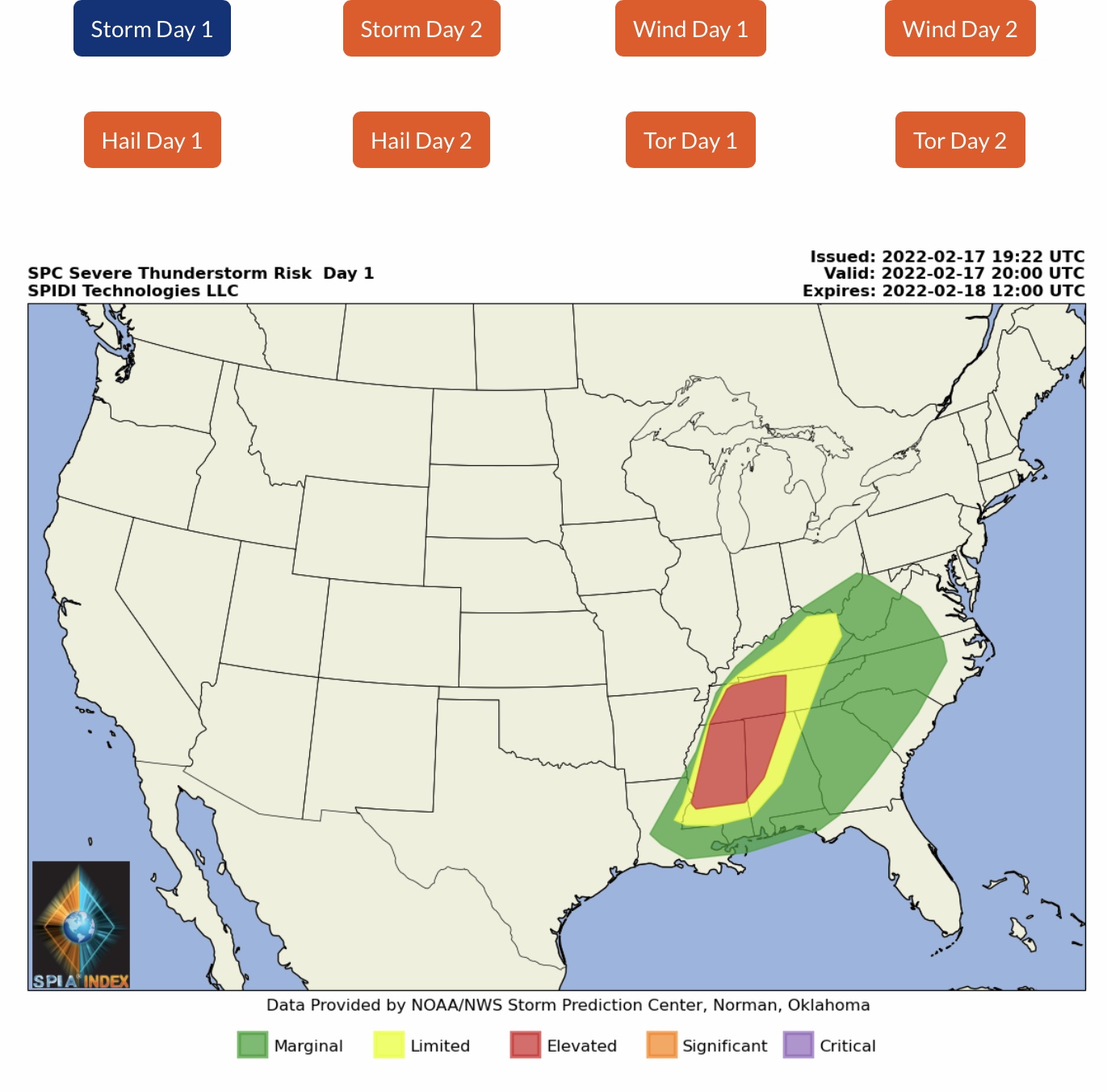
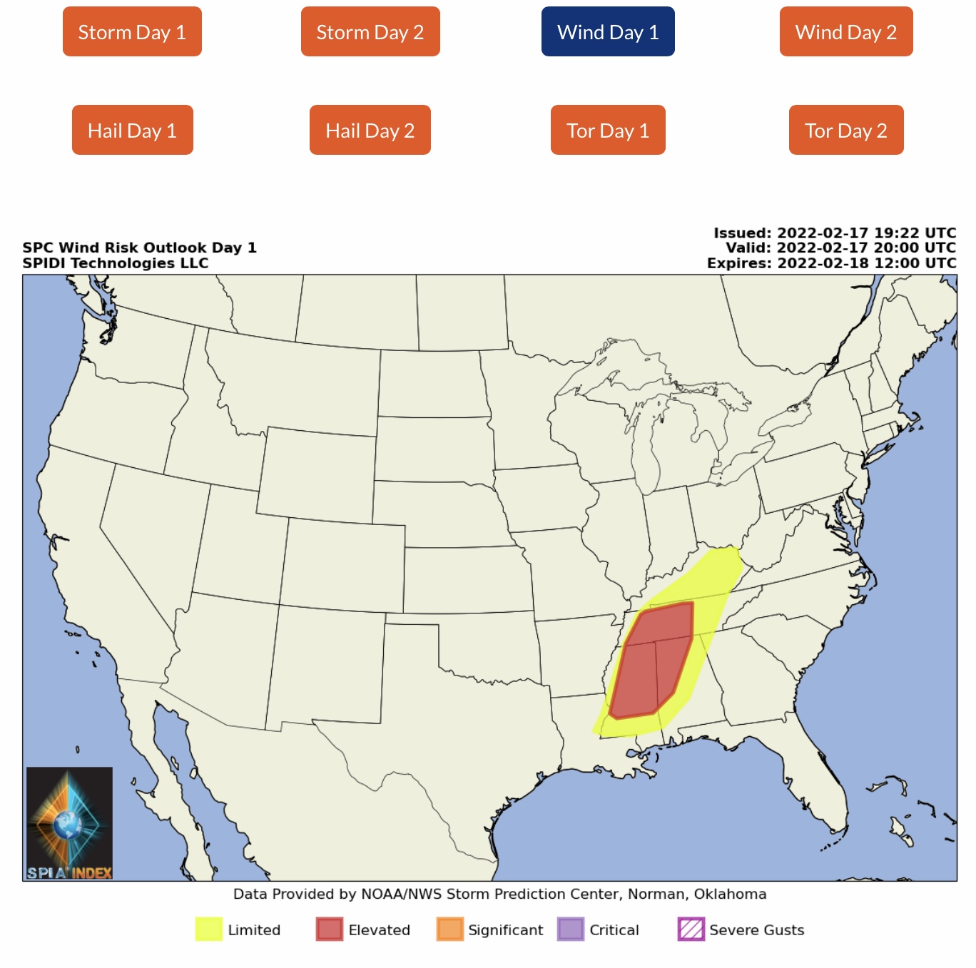
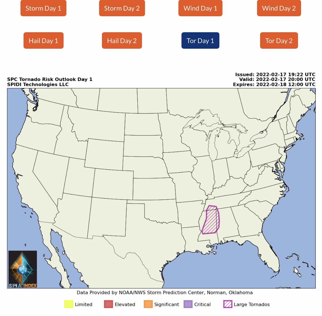
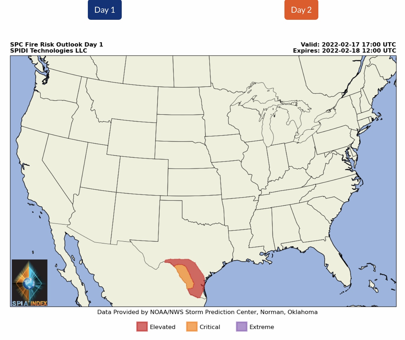
Severe Thunderstorm Risk today through 7am Friday, with the possibility of high winds, hail, and some tornadoes, and a chance of large tornadoes in the Southeast Region.

 Show/hide attachments