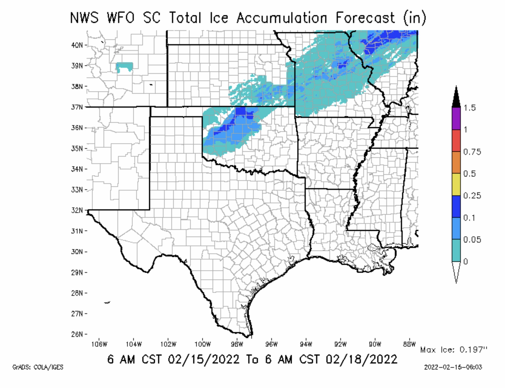
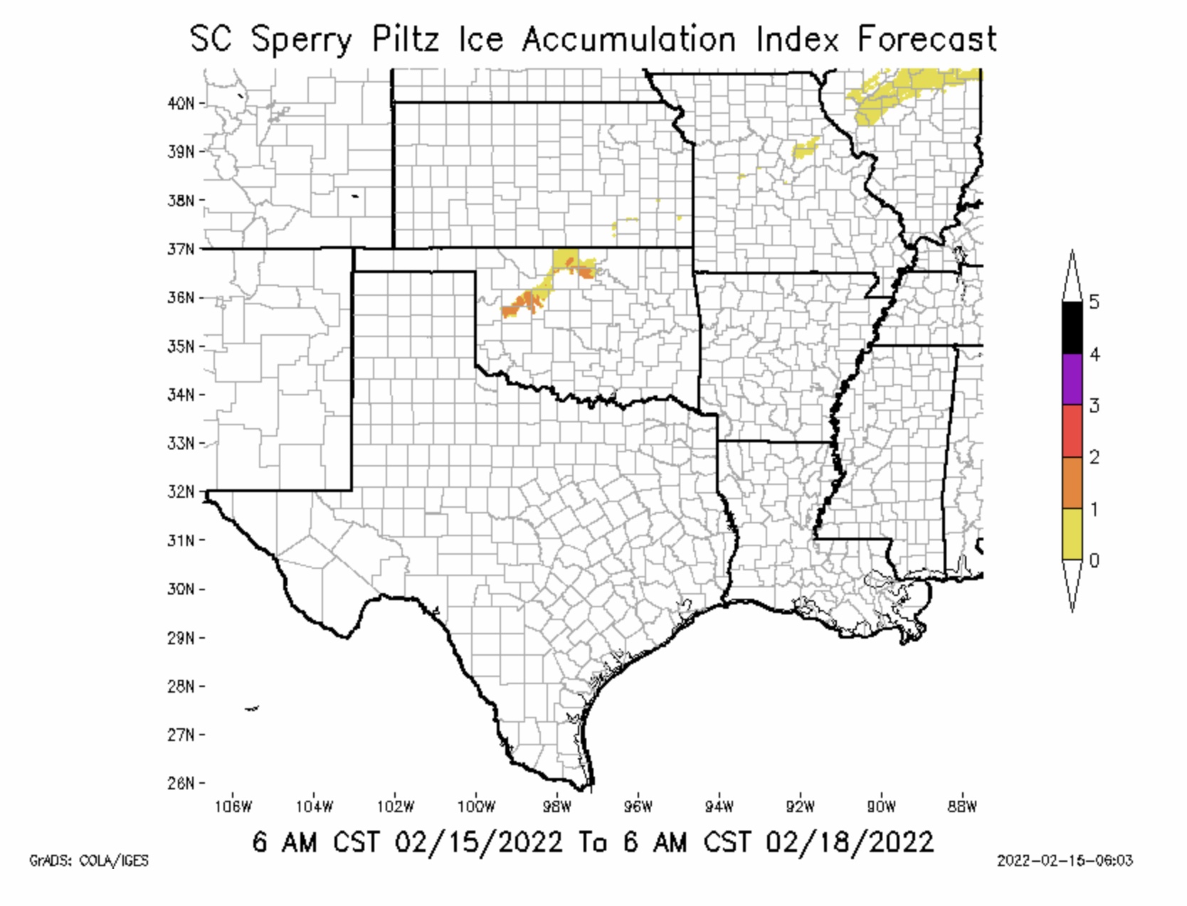
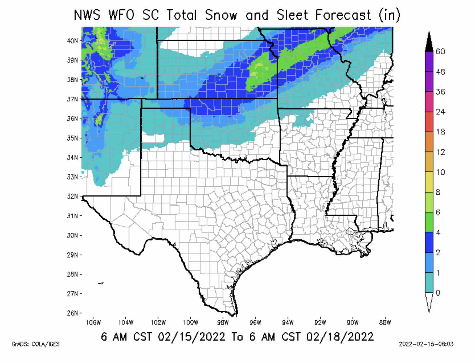
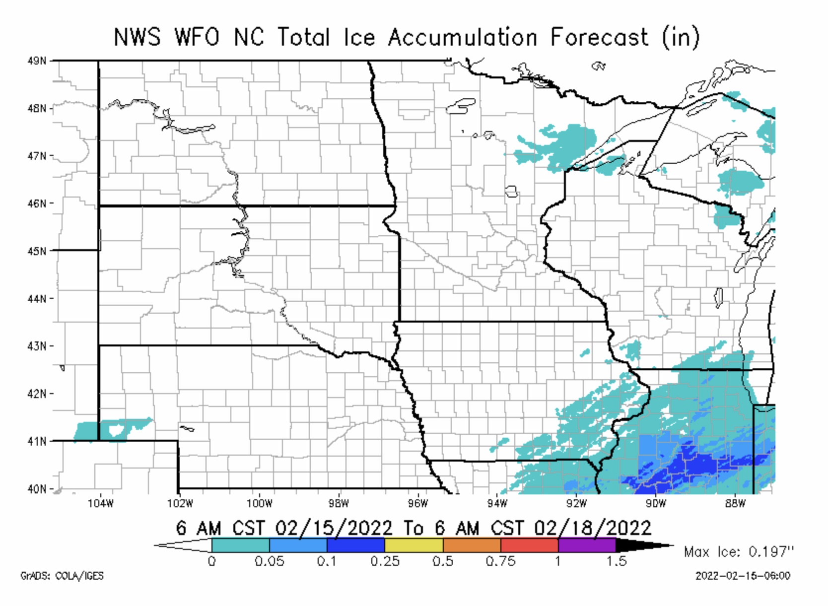
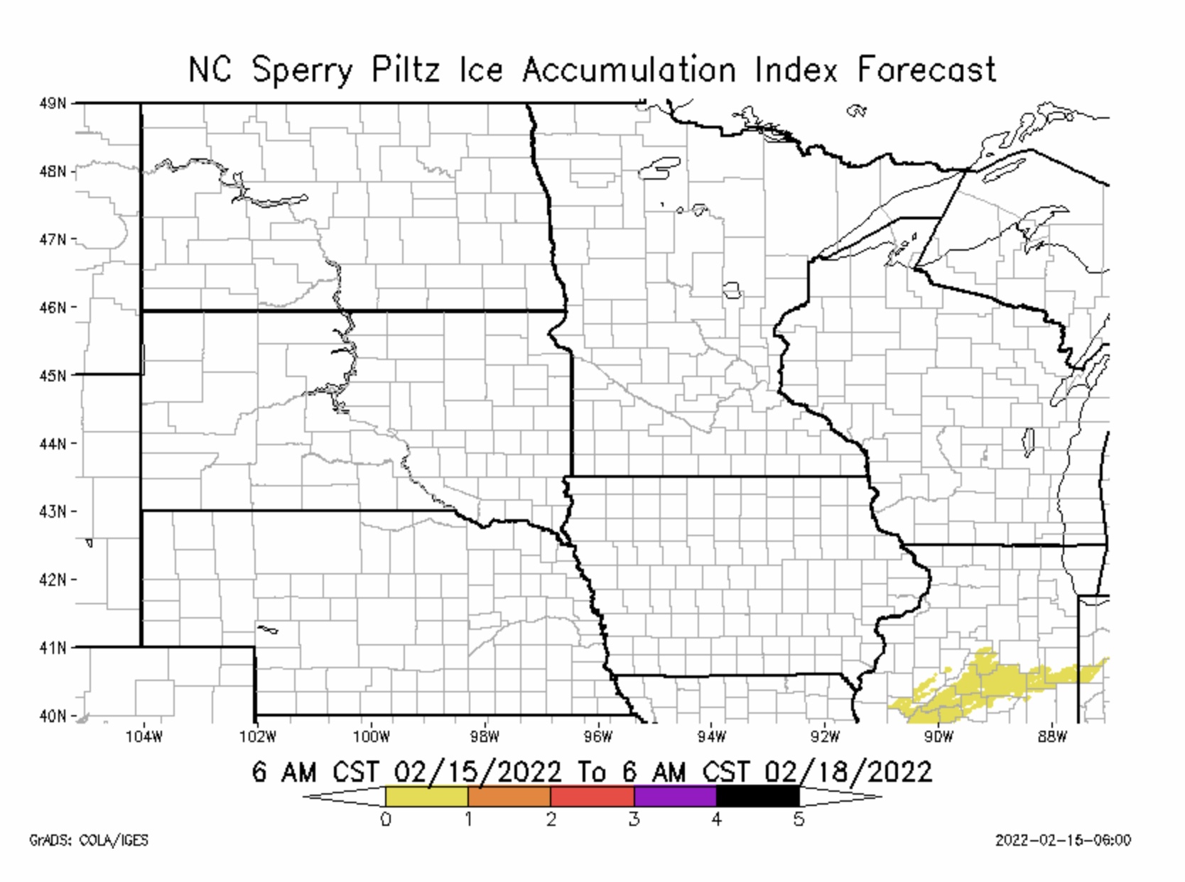
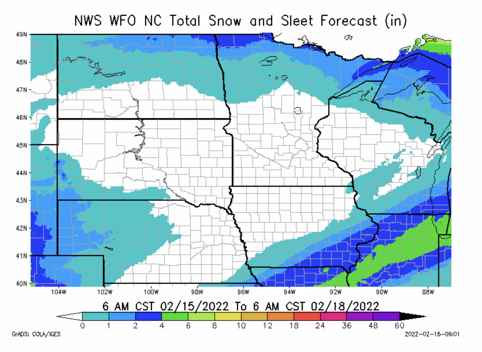
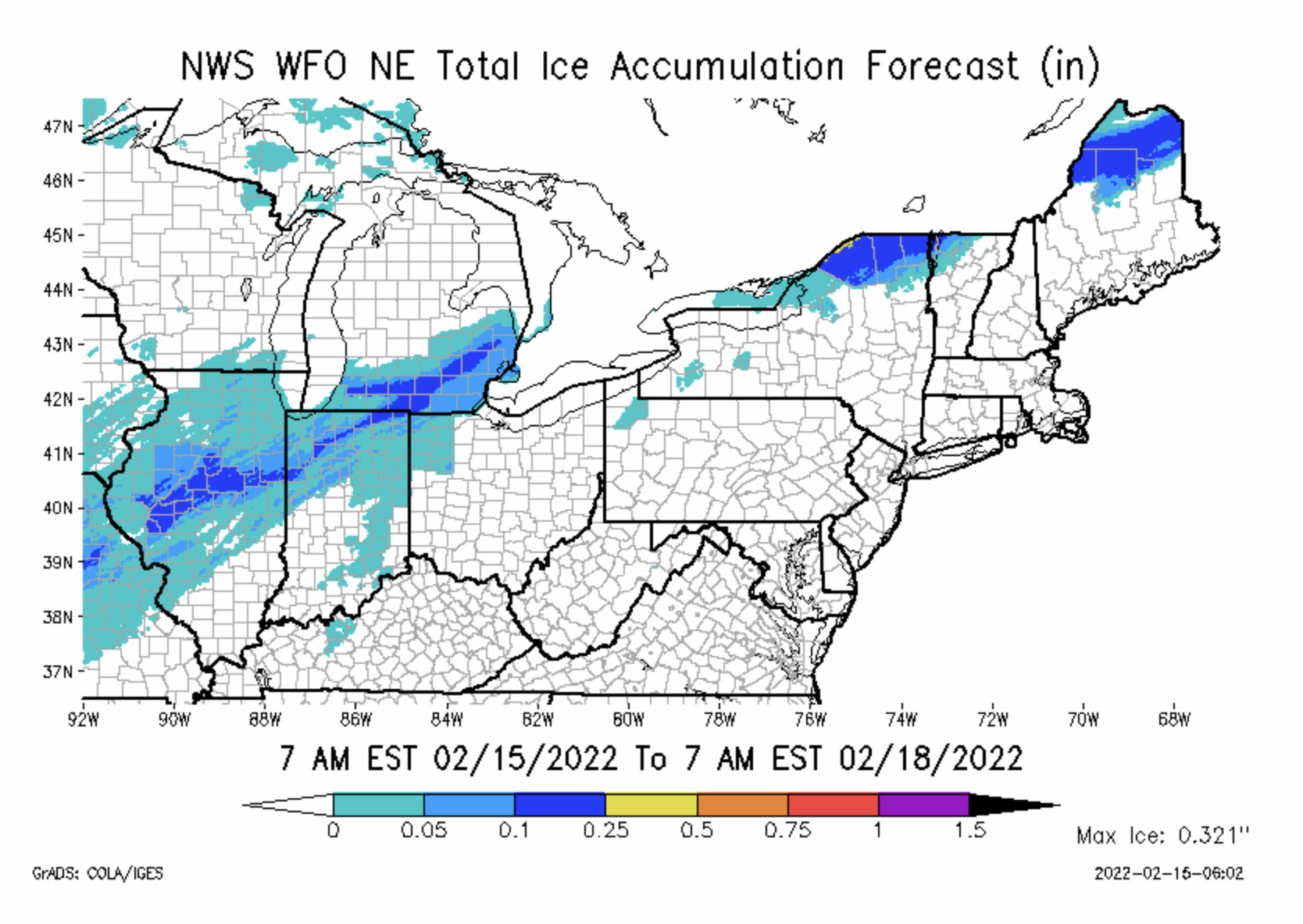
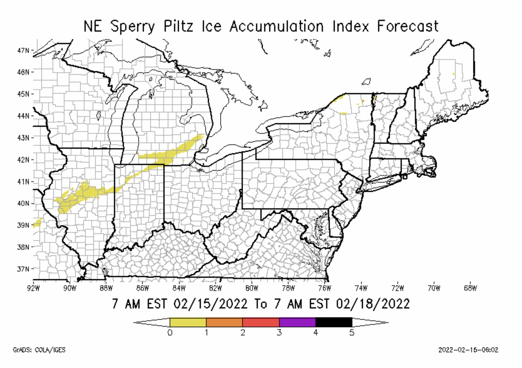
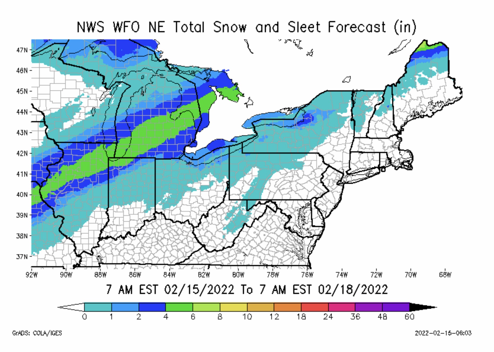
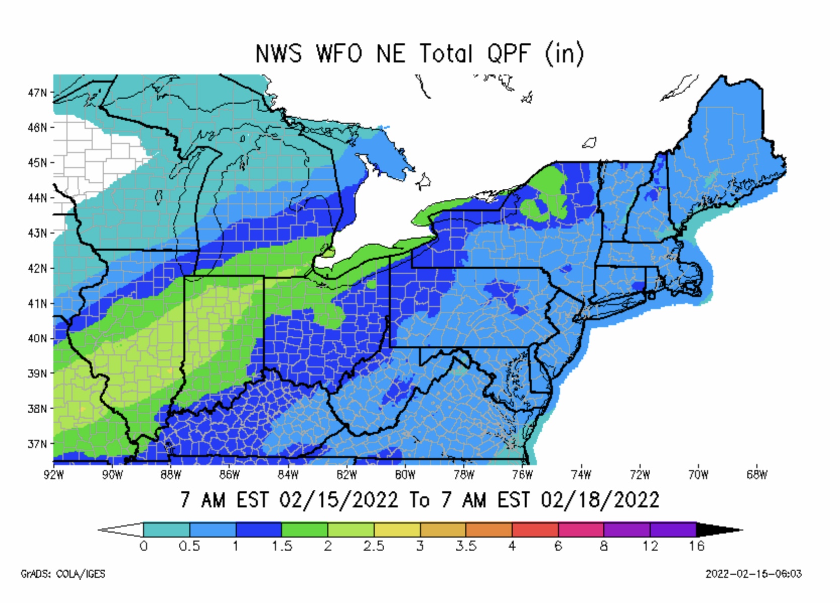
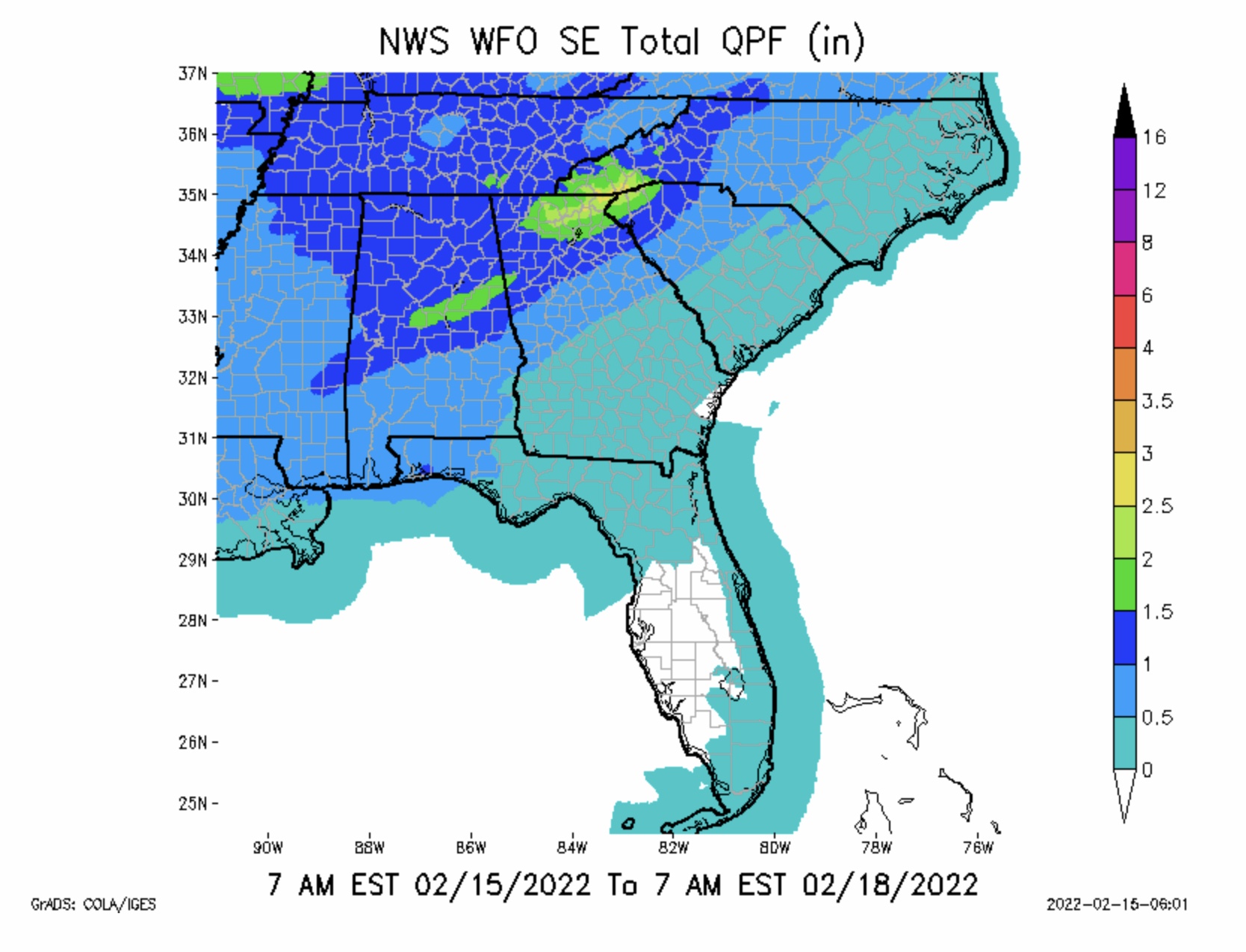
Max Ice in NWS Forecast Grids is 0.321” parts northern NY. SPIA Index Ice Impact Forecast is at Levels 1 & 2 across parts OK, KS, MO, IL, IN, MI & NY. Snow from TX-OK panhandles and northern OK to the MI thumb, with amounts ranging from 1/2” up to 8”.
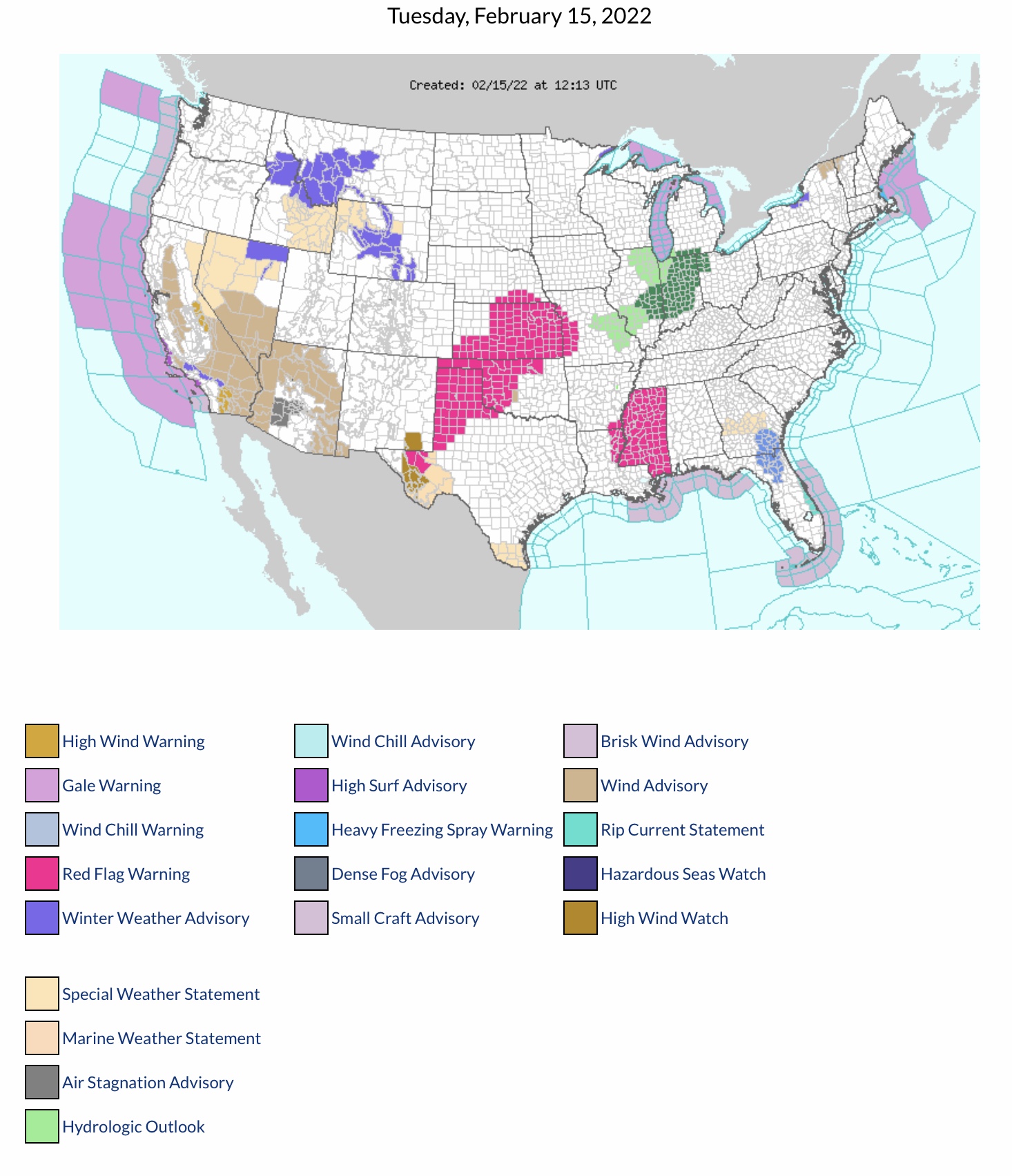
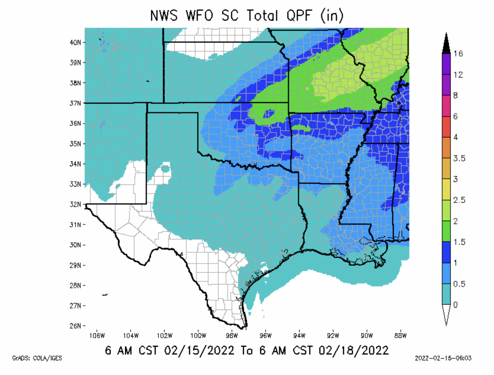
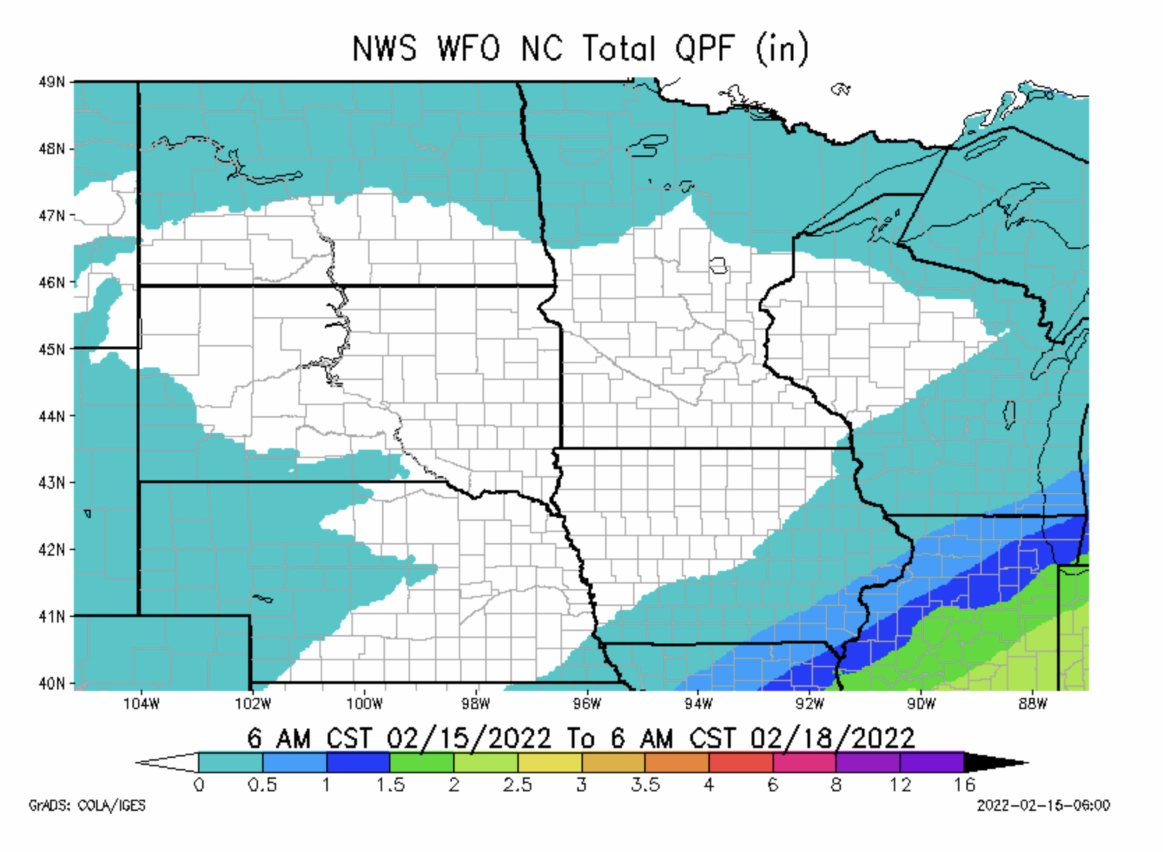
Severe thunderstorms possible Wednesday evening & overnight in parts northeast TX, most of OK, and western AR. High winds, lightning and hail are all possible with these storms, with a chance of a few tornadoes as well. A quick transition to freezing rain late Wednesday night into Thursday morning for OK, KS, MO, IL, IN and eventually MI, then Snow behind the ice as temperatures turn much cooler. Rainfall amounts from 1” to 3”+ in parts MO, IL & IN. For today (Tuesday) into tomorrow morning, an ELEVATED to CRITICAL Fire Risk and RED FLAG FIRE WARNINGS for parts TX, OK, KS, NE, MO, LA, AR and MS. Flood Advisories have been issued for parts IL, IN, MI and northwestern OH.
Individual state forecasts to come later this morning… - Sid Sperry

 Show/hide attachments