FYI…
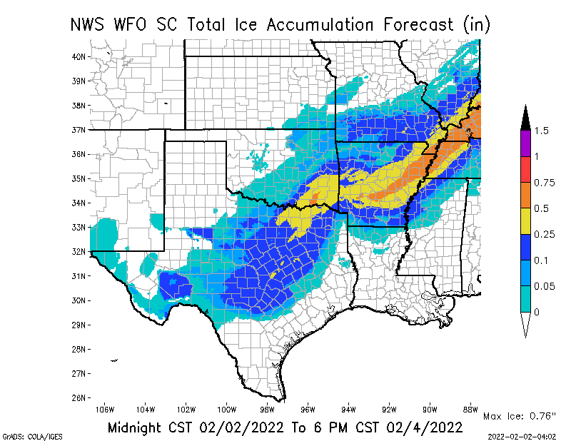
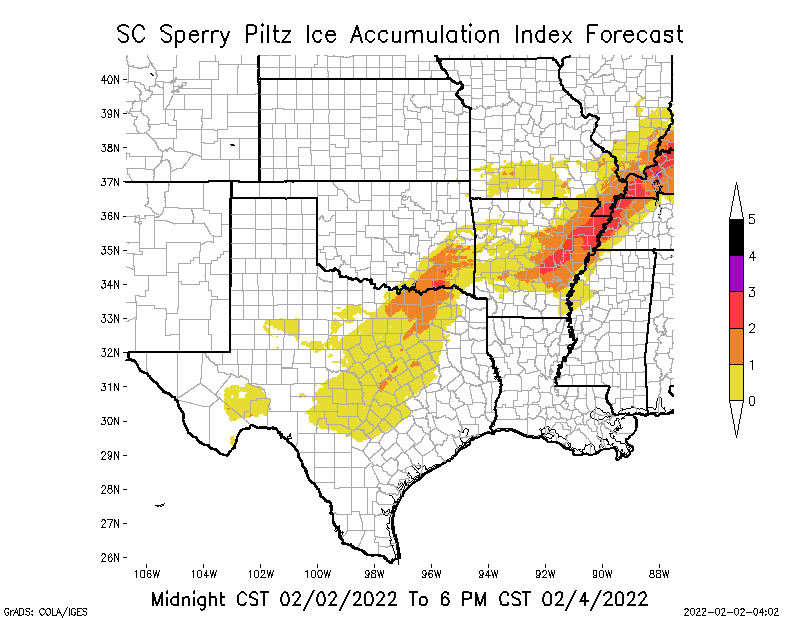
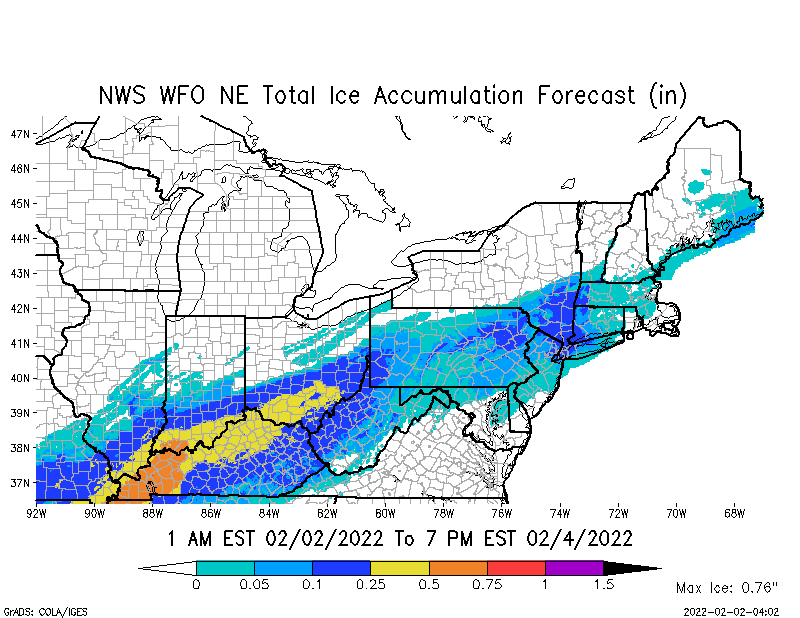
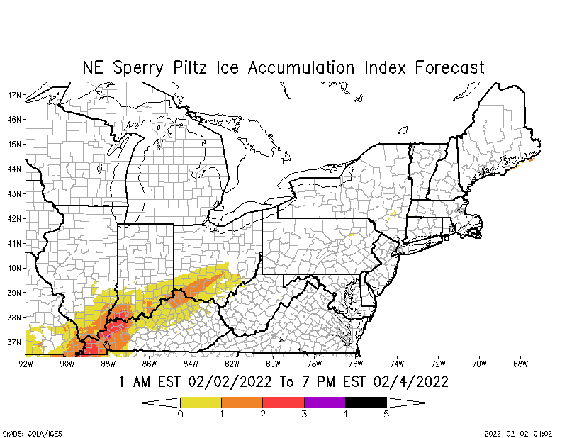
Max ice in NWS grids is currently at 0.76” in parts of far western KY. From 1/4” up to 3/4” ice accumulation possible across parts of TX, OK, AR, MO, IL, KY, TN & MS. The current SPIA Index Ice Impact Forecast is at Levels 1 thru 4, with a small area of projected Level 4 impacts in far western KY, and significant areas of projected Level 3 impacts in parts of southeastern OK, eastern & northeastern AR, the MO boot heel, far western TN, far western KY, and now southwestern IN. I’ve included a refresher graphic of our SPIA Index for those of you who may not be familiar with our ice impact scale and algorithm.
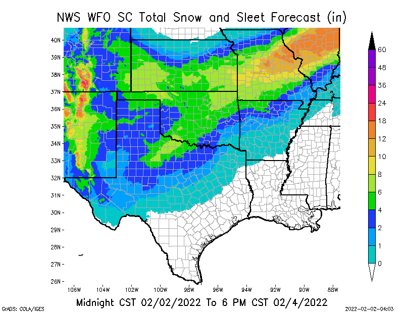
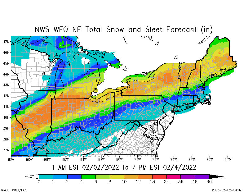
In the South Central Region, snow amounts are currently being forecast to be in the 2” up to 18” range, with amounts above 10” possible in CO, NM, MO & IL. In the Northeast Region, snow amounts are currently projected to be in the 2” up to 18” range, with amounts greater than 10” possible in parts of IN, MI, OH, PA, NY, VT, NH & ME.
I will send a separate email showing 6-hour increment Ice Accumulation and Sustained Wind Speed forecasts for both Regions. This allows you to see what period of time the greatest amounts of ice are predicted in 6-hour increments in the respective Regions, and what the Sustained Wind Speeds are predicted to be at the same time.
Sid Sperry
President & CEO
SPIDI Technologies, LLC
SPIDItech.com
Cell: 405-627-7754
Email(s): SidSperry@gmail.com OR Sid.Sperry@spidiweather.com

 Show/hide attachments