Key Messages from NWS on February 1-3 Winter Storm…
Sidney Sperry 30 Jan 2022 22:13 UTC
All,

I’m sharing these graphics for a couple of reasons. First, the NWS has released the first graphic below highlighting “Key Messages” concerning this week’s Winter Storm. Note their lead sentence: “Potentially significant snow and ice across the Central U.S. for the middle of the week,” and their 3rd bullet point, “There is increasing confidence in significant snow accumulations from the southern Rockies through the eastern Great Lakes. A corridor of ice accumulation is possible from Texas through the Ohio River Valley.” These are similar messages that we here at SPIDI Technologies have been passing along to you for the past couple of days.

Second, the NOAA Weather Prediction Center (WPC) introduced a new impact index for Winter weather about 3 years ago. It is called the “Winter Storm Severity Index” or WSSI. I’ve included a 4-day out graphic from the WPC for this incoming Winter Storm for mid-week. Note the similarity in the WSSI “Impact Scale” to the SPIA Index Impact Scale that has been in existence since 2010, or more than 12 years.

Long story short, with the aid of Congressman Frank Lucas’s legal staff two years ago, we were able to secure a “NOTE” that is buried in their WSSI Ice Impact Forecast descriptions, which gives the two original founders of the SPIA Index, myself and Steve Piltz, some credit where credit was due, specifically as it relates to ice impacts.

Yes… the WSSI Index is eerily similar to the SPIA Index. Just wanted you all to see Note from officials at NOAA and the WPC.  -  Sid Sperry
Sid Sperry
President & CEO
SPIDI Technologies, LLC
Guthrie, OK 73044-9442

Sent from my iPad

 Show/hide attachments
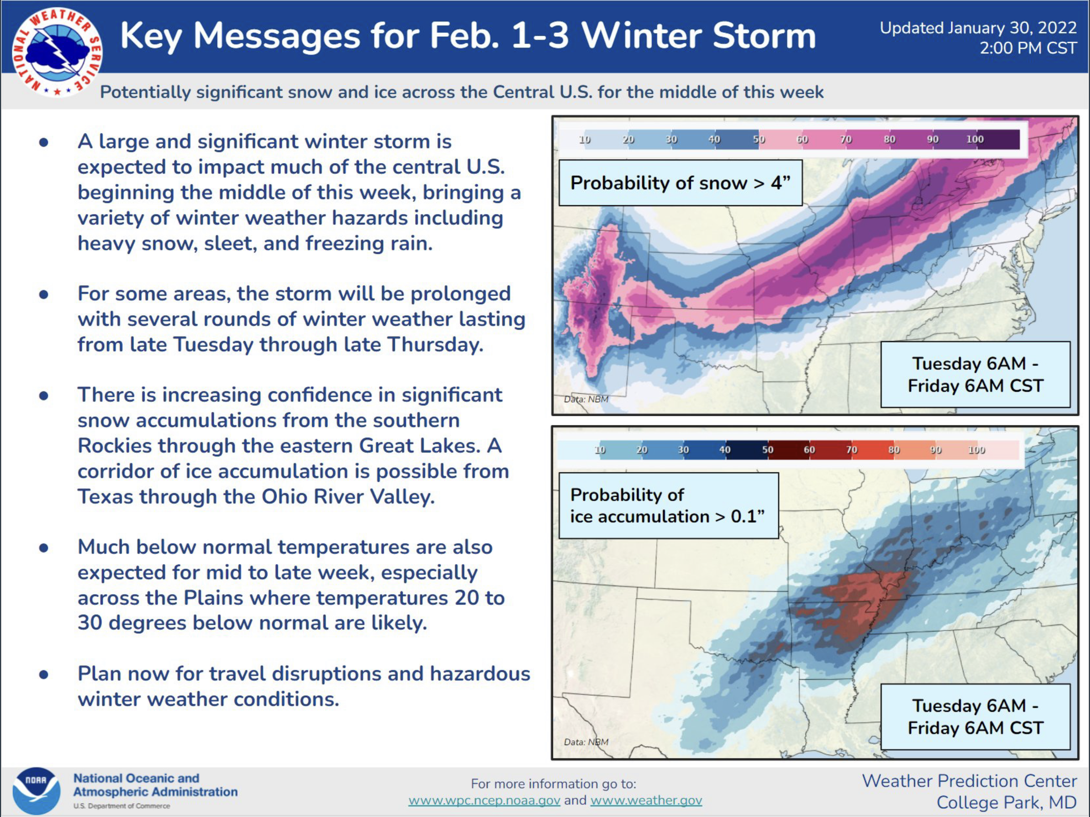
