|
Severe Weather to start the New Year 2022: Ice, Snow, Severe Thunderstorms, Hail, Strong Winds, and yes: Tornadoes and Flooding are all in the mix over next 3 days… Sidney Sperry (31 Dec 2021 12:48 UTC)
|
 Show/hide attachments
IMG_4622.jpg (305K)
IMG_4623.jpg (288K)
IMG_4624.jpg (269K)
IMG_4625.jpg (272K)
IMG_4626.jpg (277K)
IMG_4627.jpg (312K)
IMG_4628.jpg (314K)
IMG_4629.jpg (347K)
IMG_4630.jpg (275K)
IMG_4631.jpg (354K)
IMG_4633.jpg (284K)
IMG_4634.jpg (283K)
IMG_4635.jpg (275K)
IMG_4636.jpg (281K)
IMG_4637.jpg (282K)
IMG_4638.jpg (282K)
IMG_4639.jpg (291K)
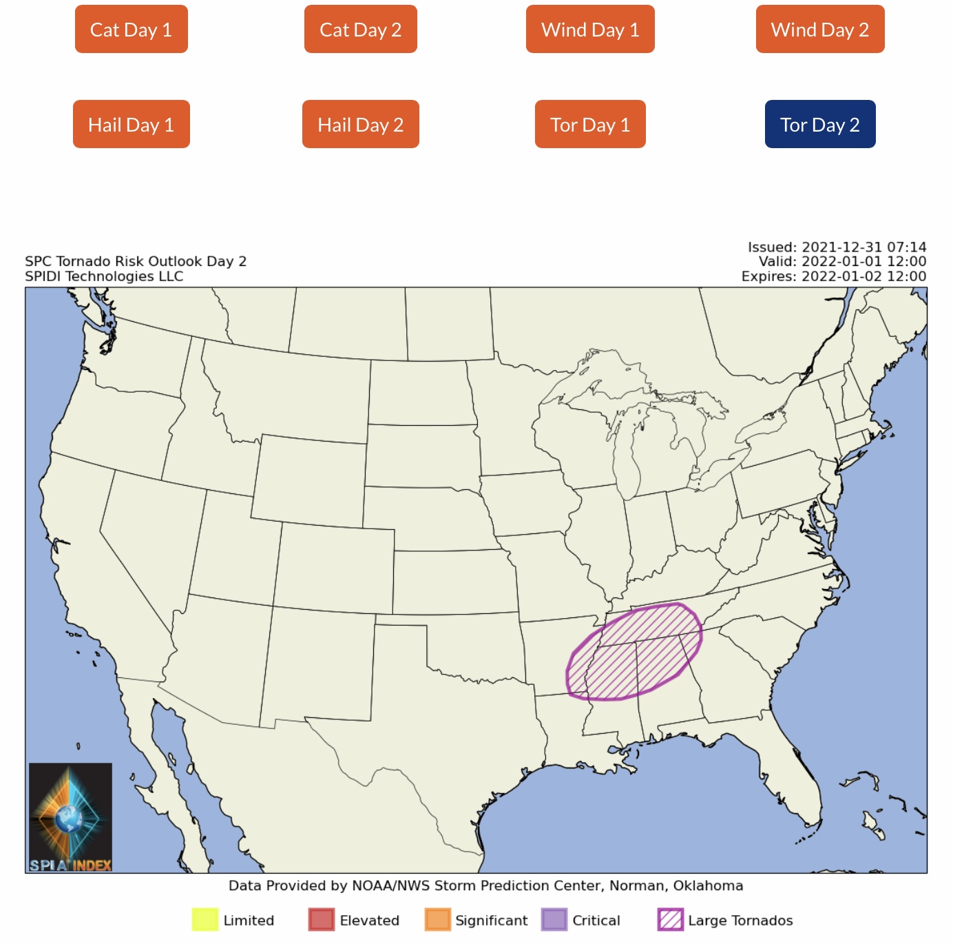
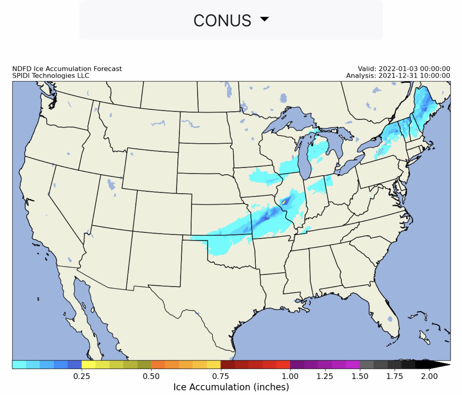
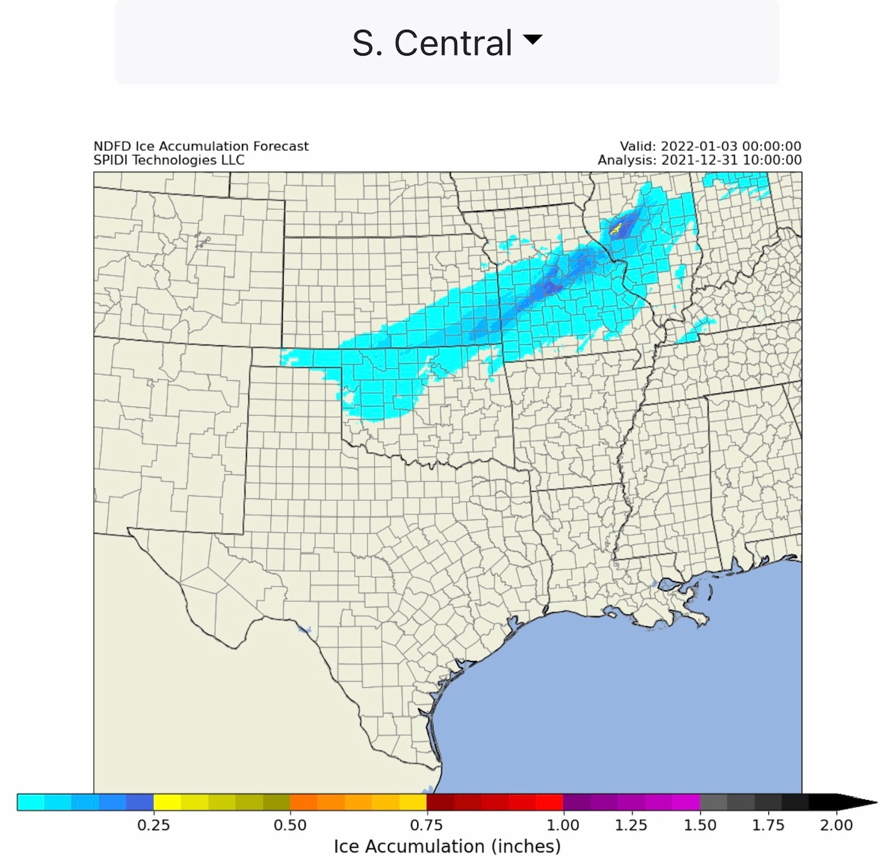
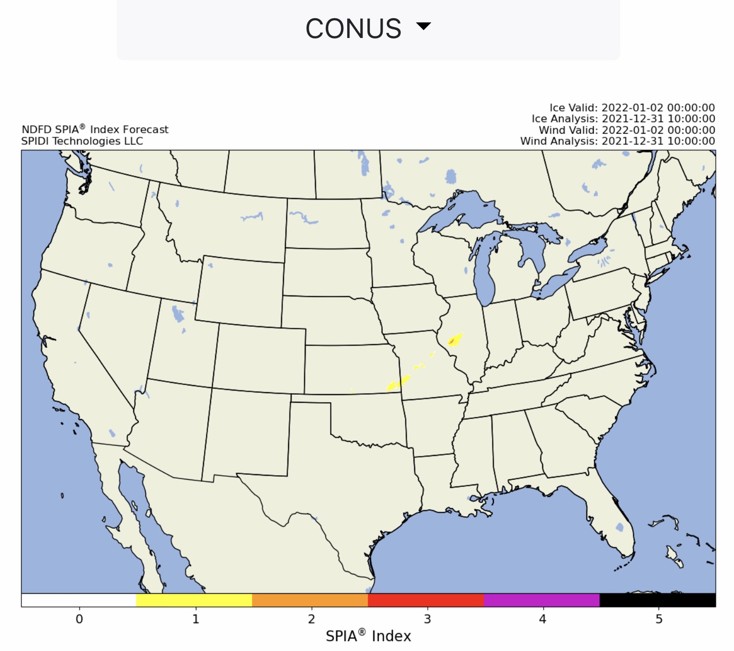
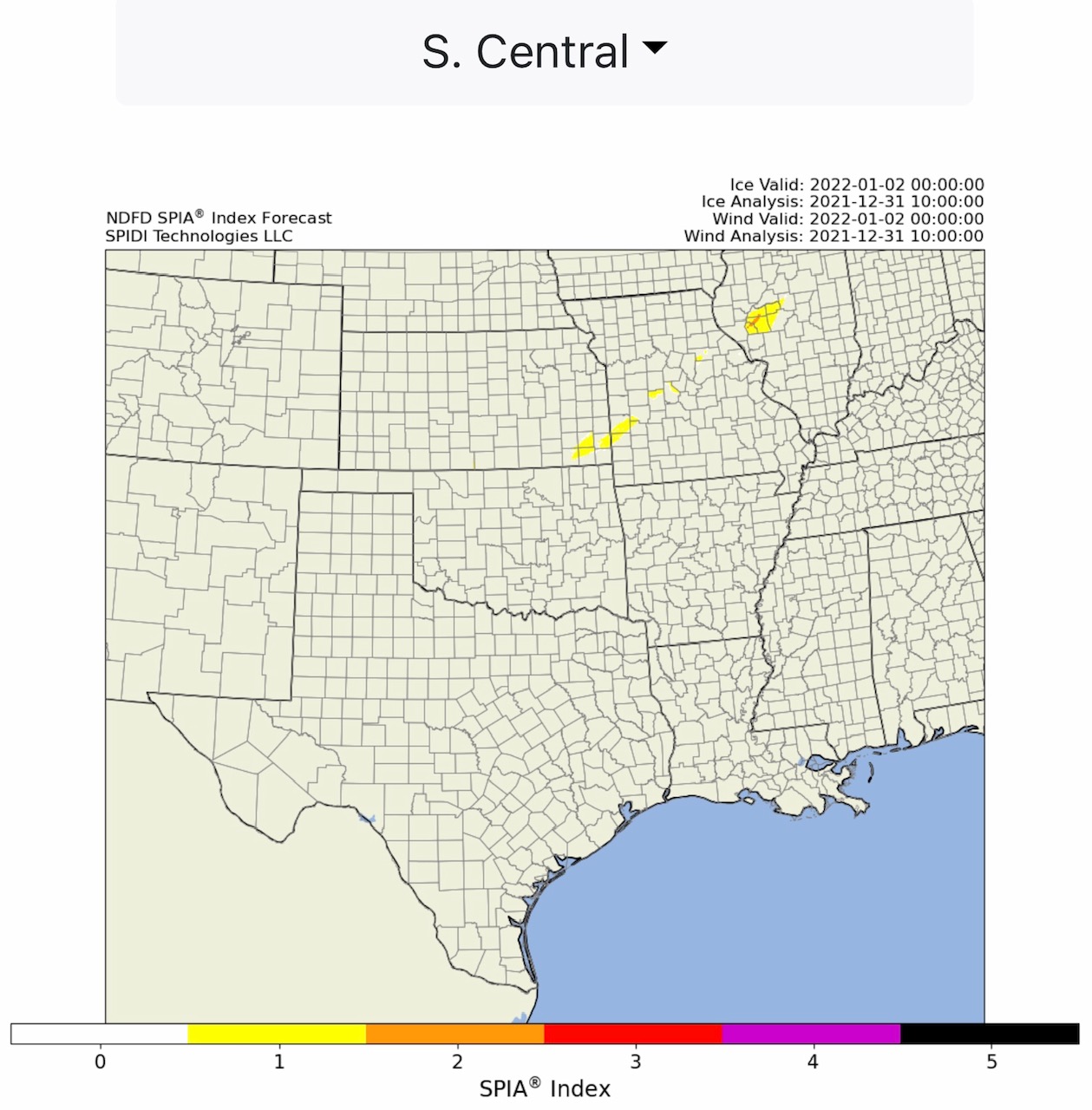
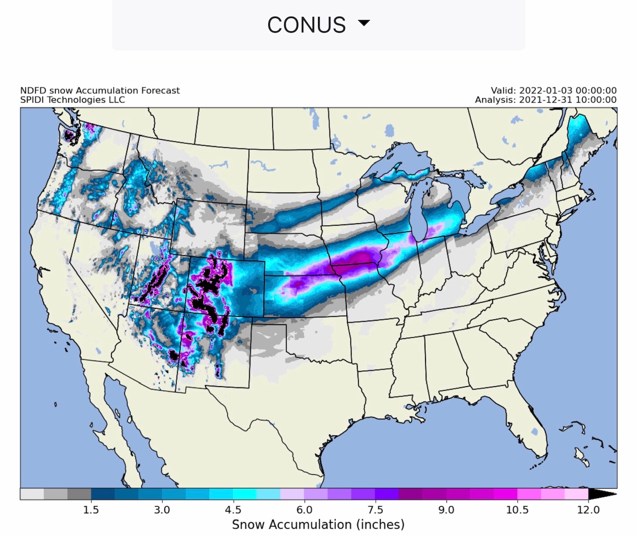
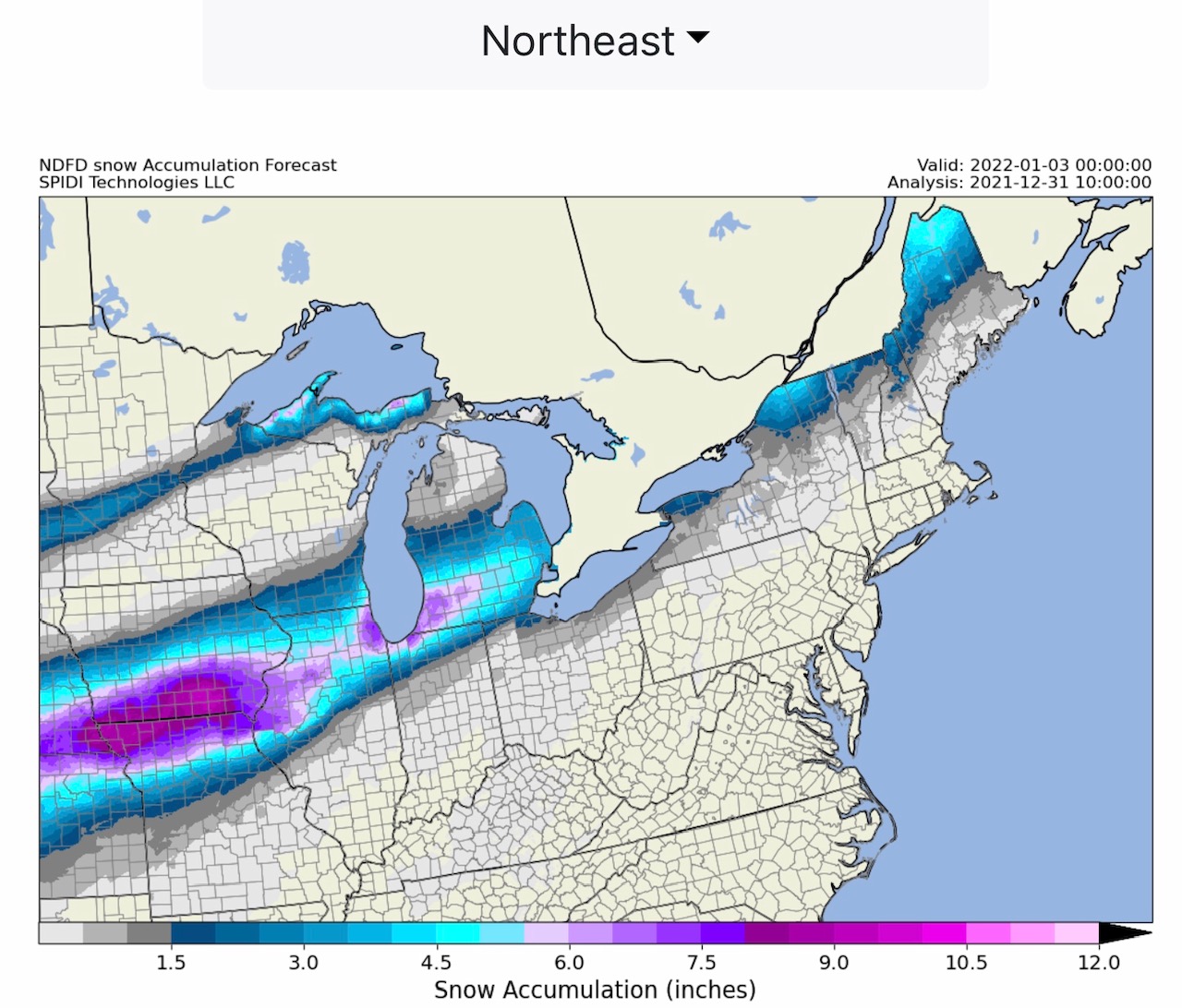
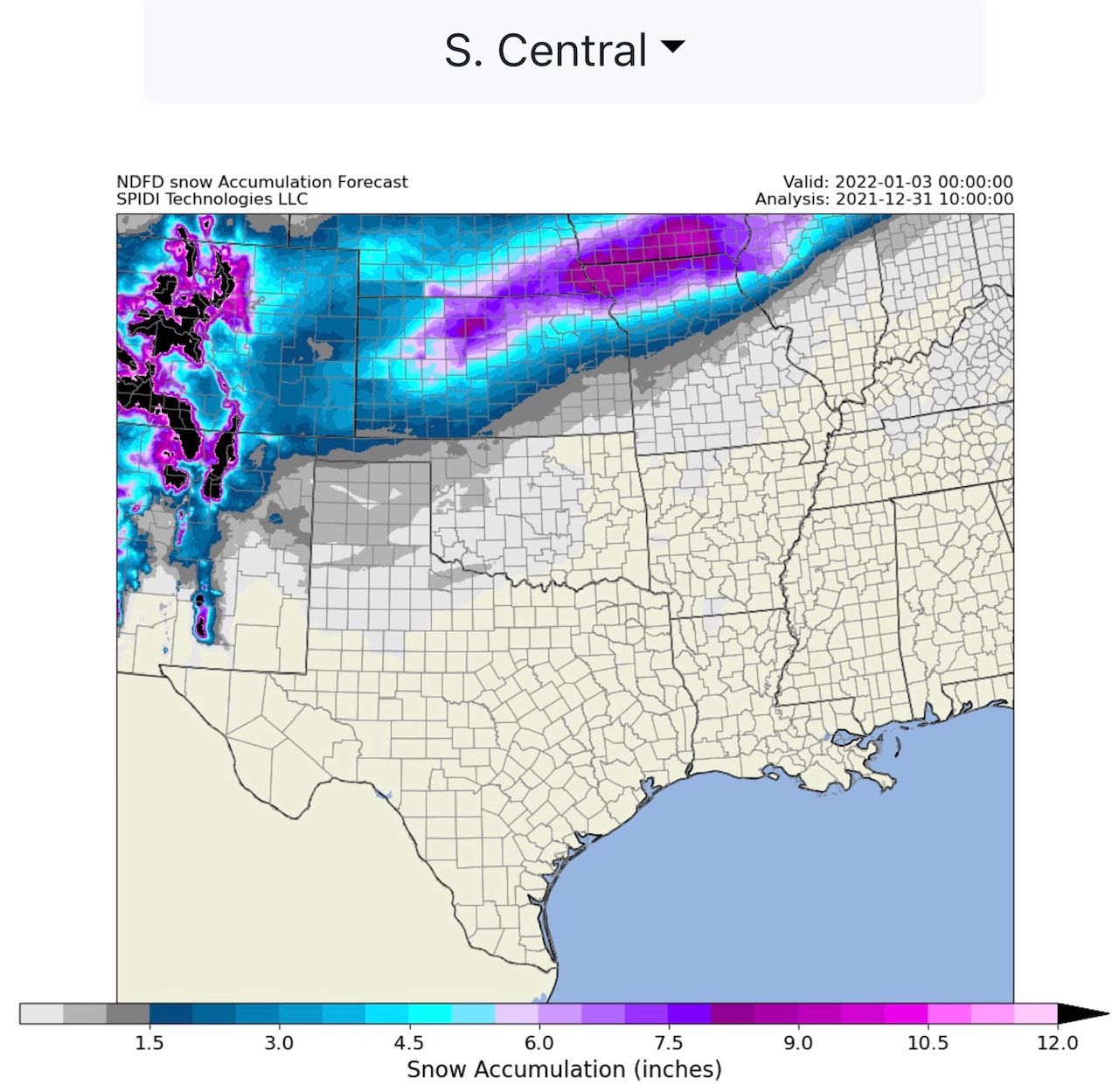
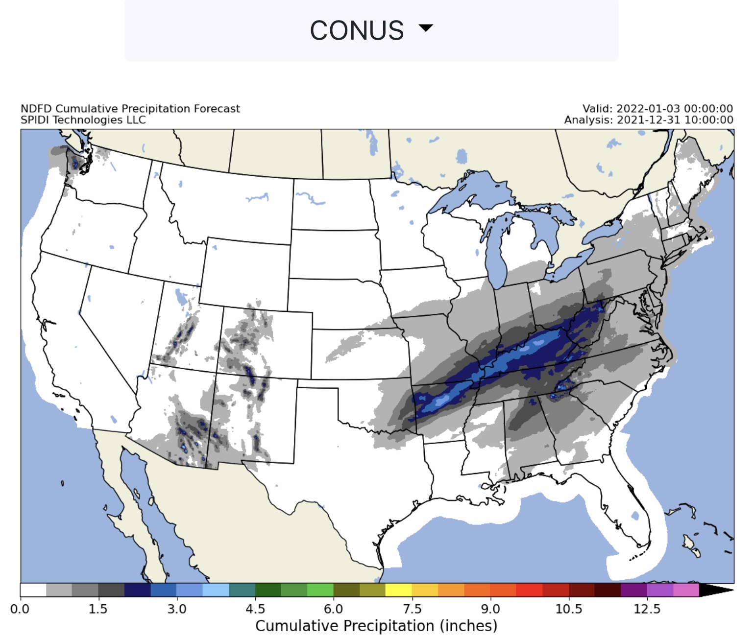
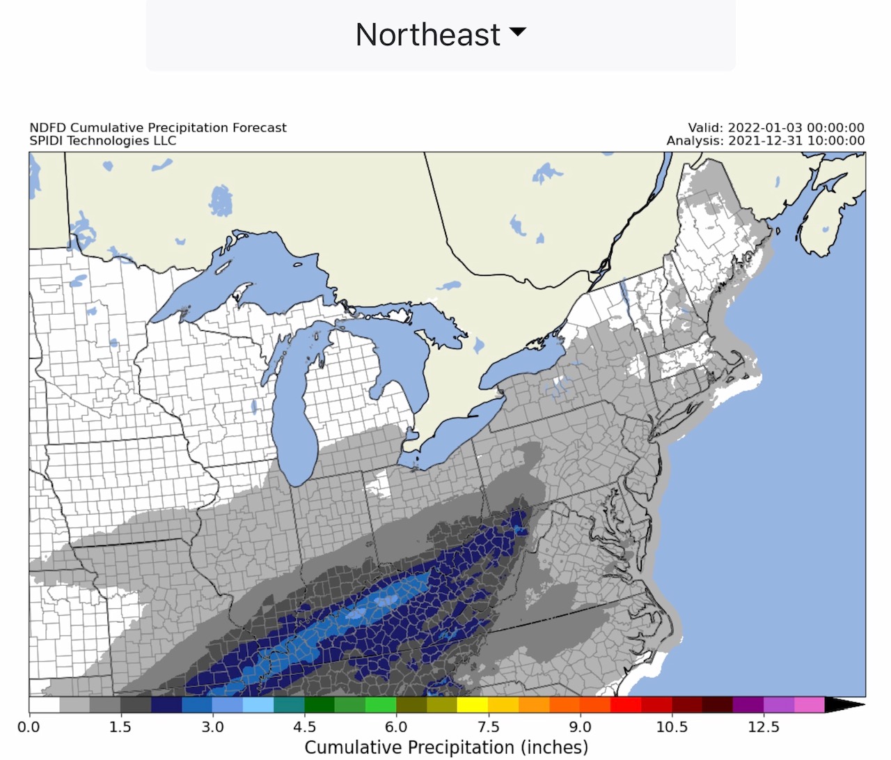
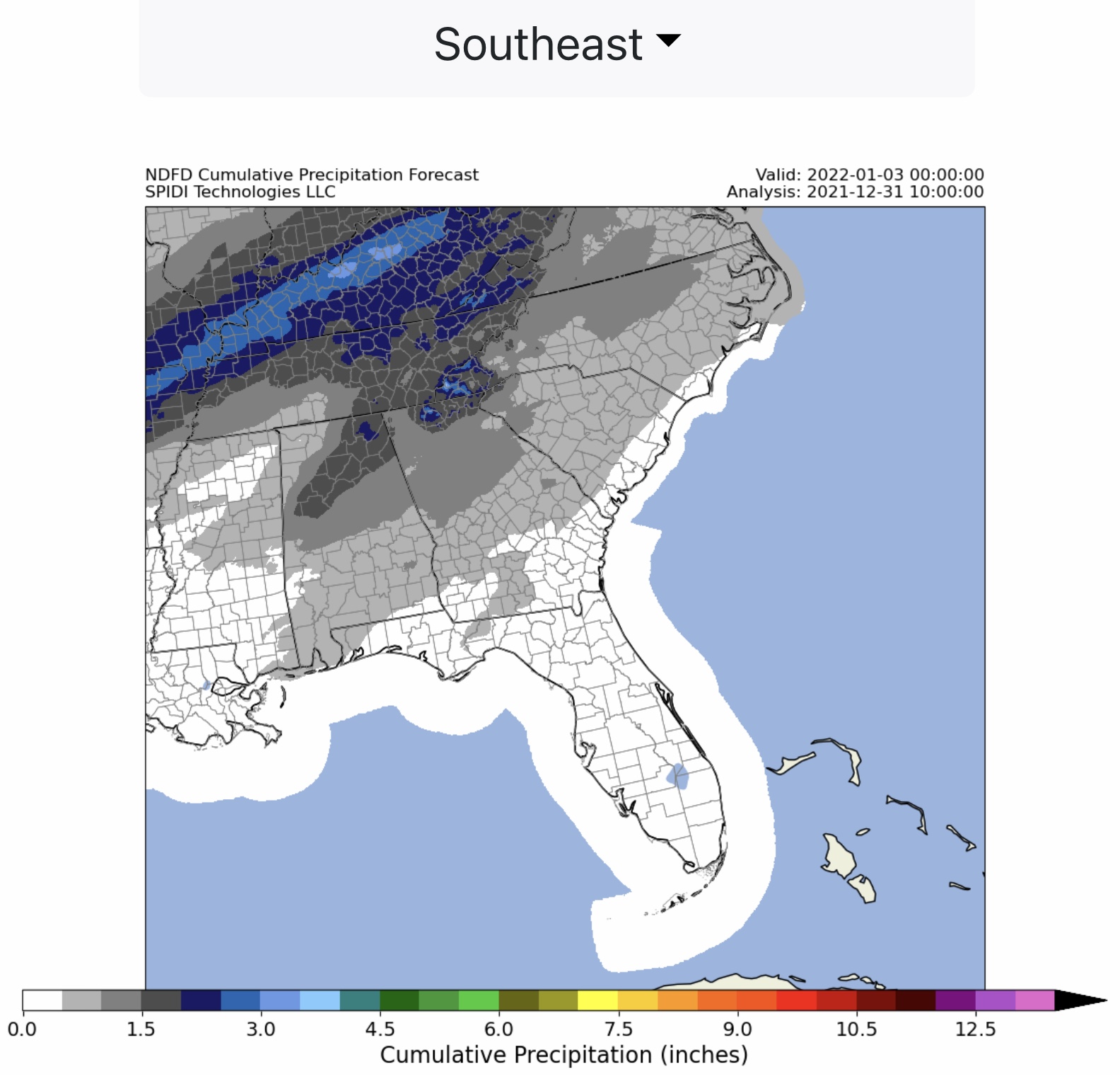
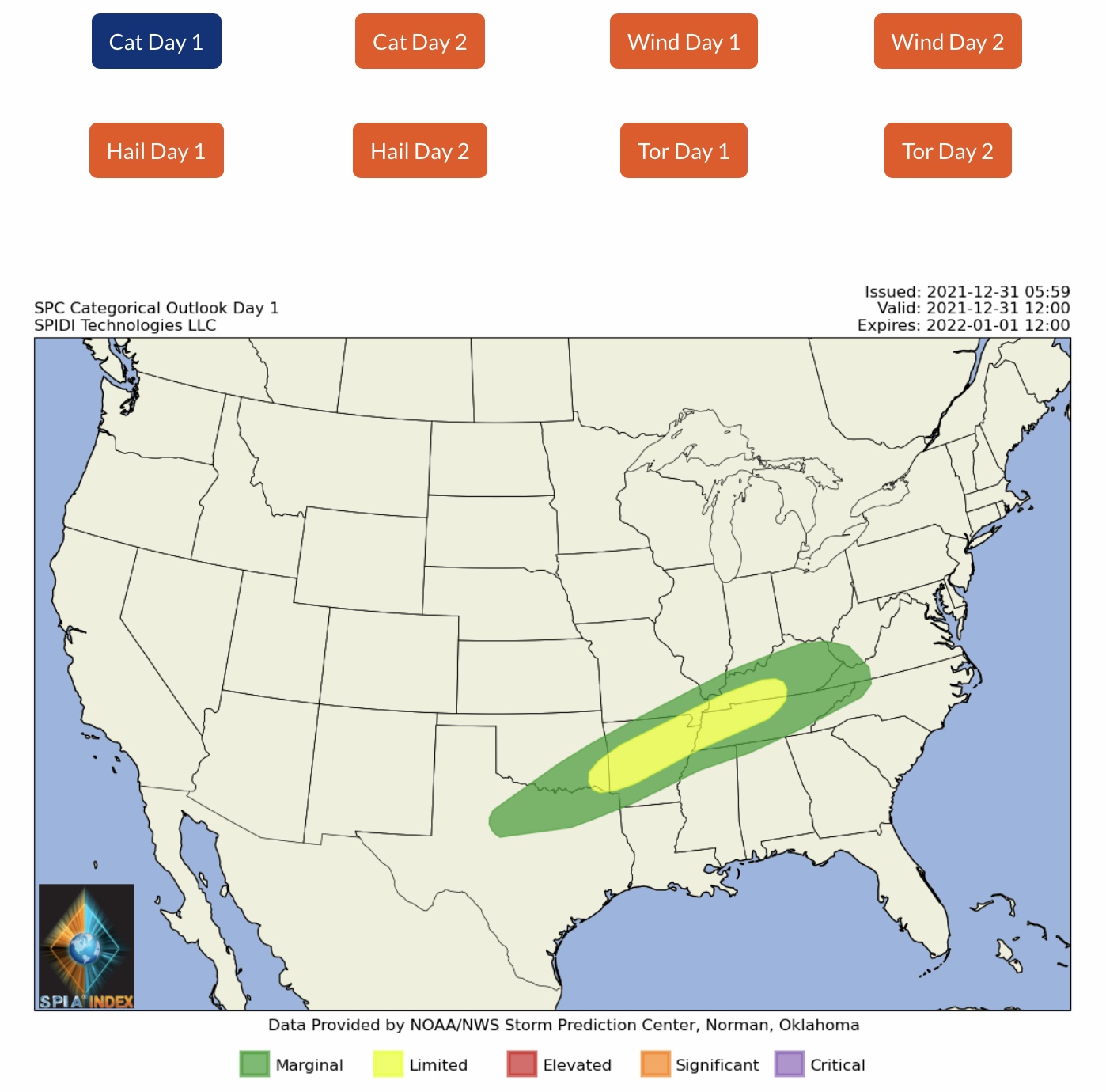
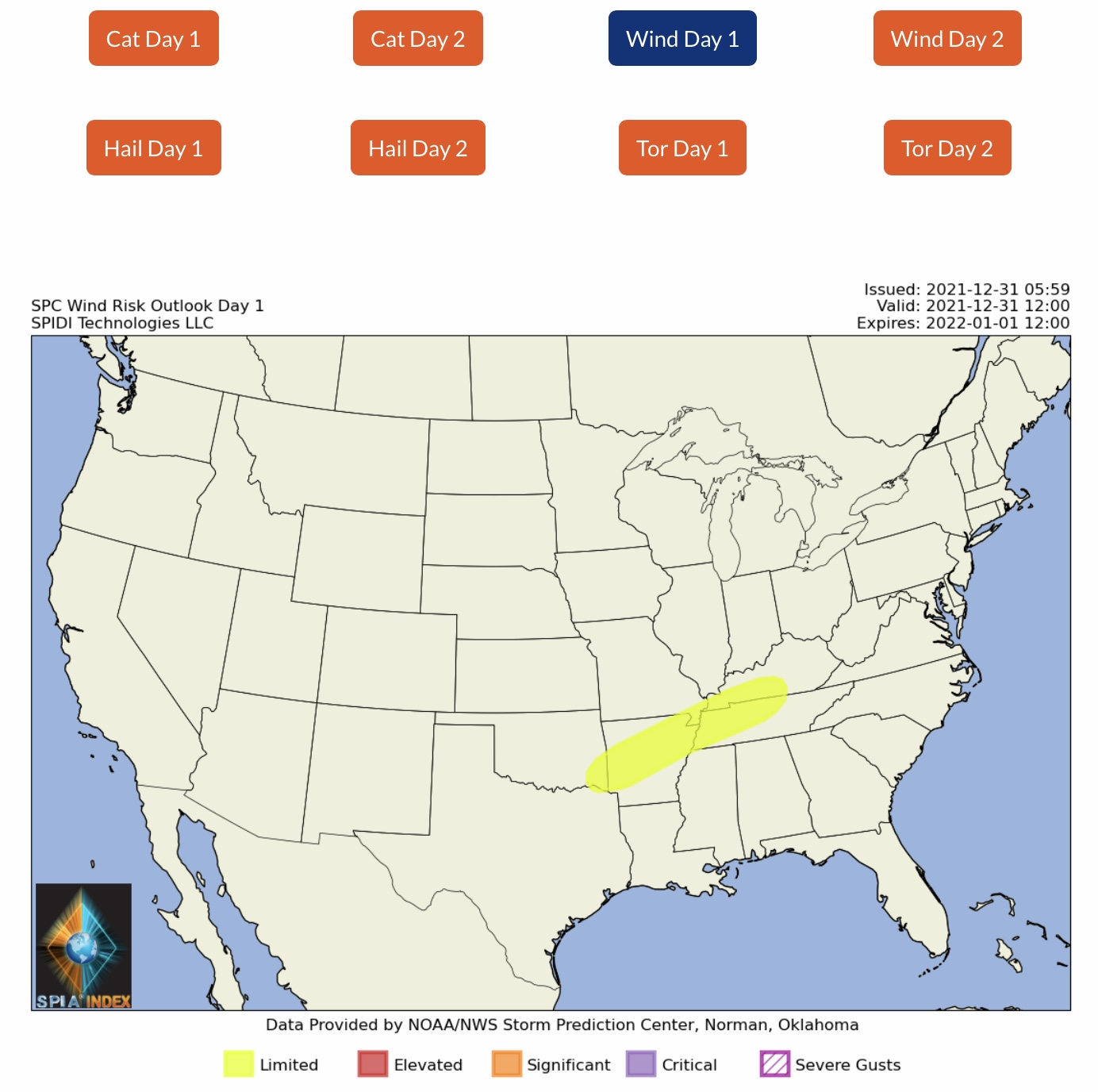
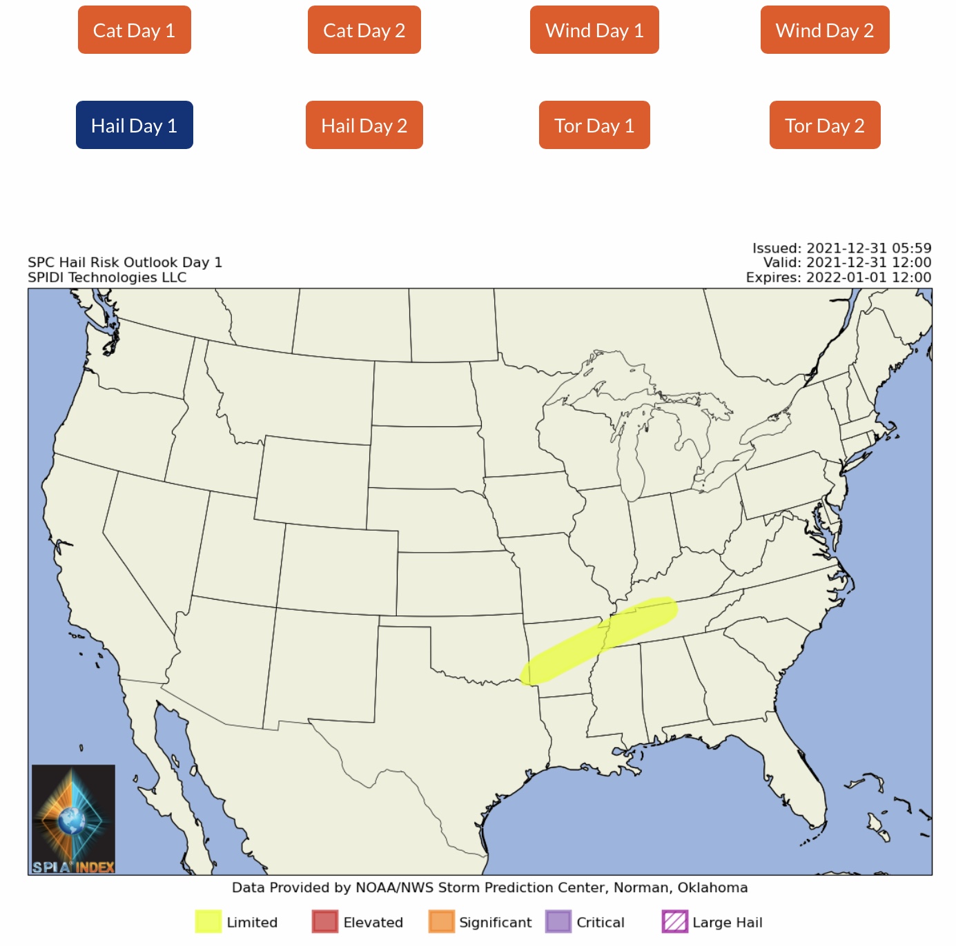
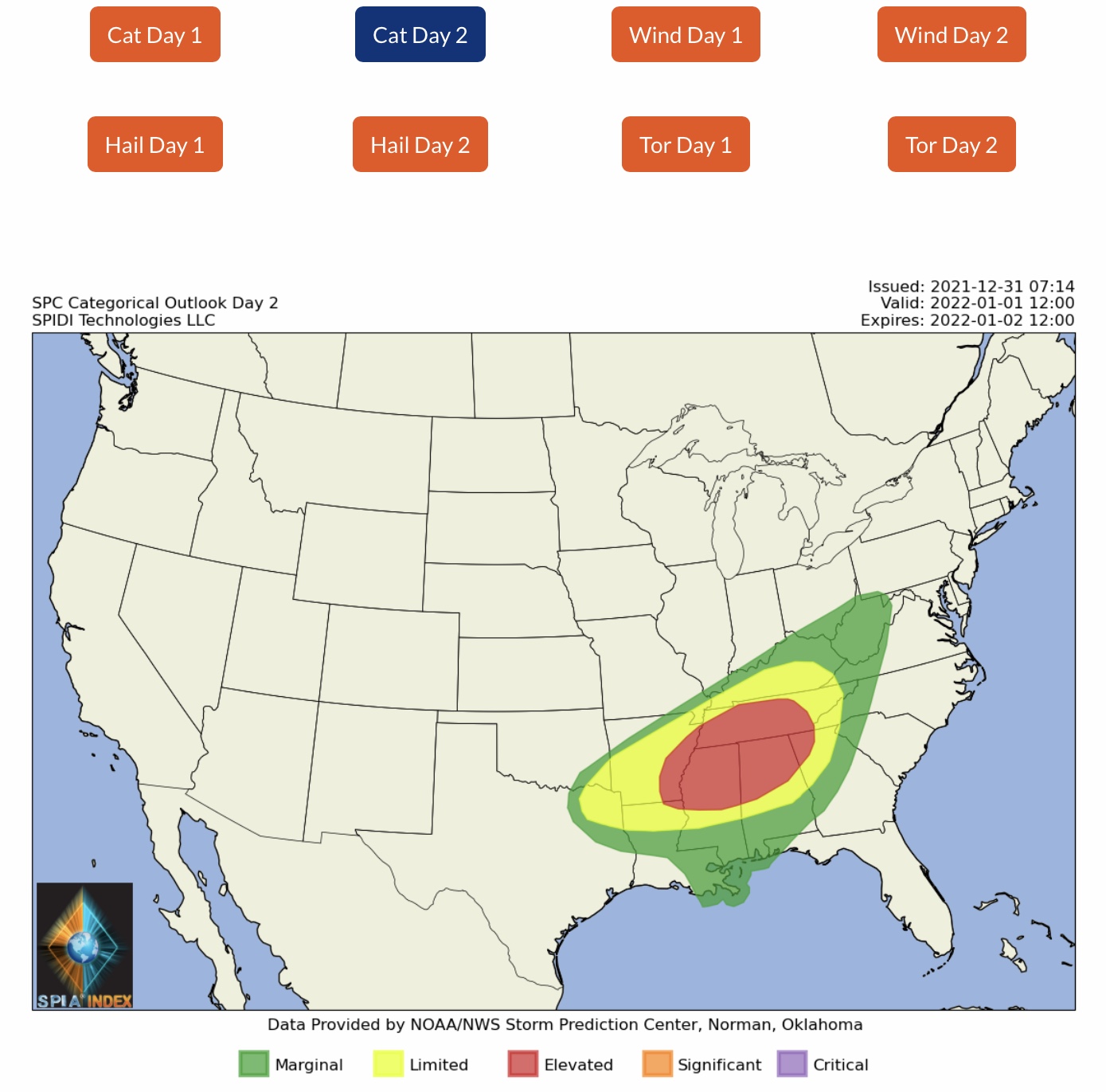
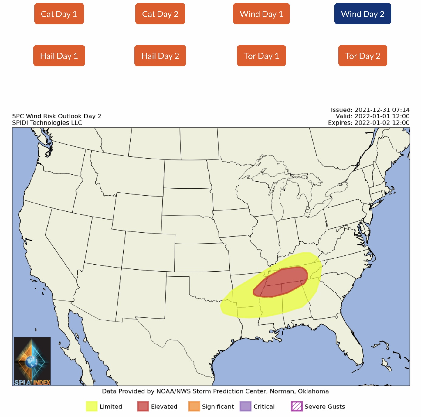
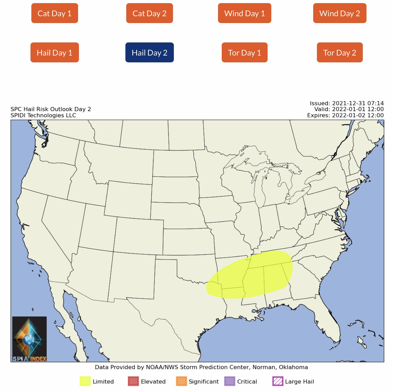
Good Friday morning, everyone, and Happy New Year’s Eve!

Unfortunately, it’s going to be a sad start to the New Year to thousands of residents of Boulder, Superior, Louisville, and Broomfield, CO. Yesterday’s devastating wildfires - whipped and fanned by sustained winds of 60 to 70 mph with gusts to over 100 mph - caused the loss of over 750 homes and businesses in those communities so far. Drought conditions played a huge part in the catastrophe that unfolded quickly early yesterday afternoon, with Front Range winds causing major infrastructure damage that could have been the cause of some wildfires. It was a horrific scene yesterday as fire Fighters rushed to evacuate thousands of citizens and had to abandon efforts to fight the flames due to continuing high winds and wind gusts. Please pray for the people of Colorado, as they not only deal with devastating fire losses, but now heavy snow in the forecast over the next 2 days.

As shown in the forecast images below, Freezing Rain will begin later tonight and over the next 3 days impact parts of OK, KS, MO, IA, IL, WI, IN, MI, OH, NY, VT, NH & ME. Max ice in the NWS grids is just under 1/2” in west-central IL. The SPIA Index Ice Impact Forecast is currently at Levels 1 & 2 for parts OK, KS, MO and IL.

Heavy snow continues to be in the forecast for the Northwest Region over the next 2 days, and the higher elevation areas of UT, CO, AZ & NM could receive well over 1’ of snow. In the nation’s mid-section, snow will extend from western KS into southeastern NE, northern MO, southern IA, and northern IL. Snowfall amounts are forecast to be in the 2” up to 10” range in these states.

Of great concern over the next 2 days is the ELEVATED RISK on Saturday of Severe Thunderstorms across the Southeast Region, from TX to OK, AR, LA, MO, TN, MS, AL, KY, GA and by Sunday, January 3, into SC, NC and VA. Saturday’s storms will bring the threat of heavy rainfall across northern AR, southeast MO, and across much of KY, where residents are still recovering from the devastating tornadoes just 2 weeks ago. Flooding, strong damaging winds, large hail, and the possibility of some large tornadoes are all in the forecast from early Saturday morning through the day on Sunday.

And last but not least, extremely COLD TEMPERATURES will extend from ND to TX as a strong Arctic cold front continues its march southward over the New Year’s weekend.

Wishing everyone a SAFE and BLESSED New Year in 2022!

Sid Sperry
President & CEO
SPIDI Technologies, LLC
Guthrie, OK
Sent from my iPad
