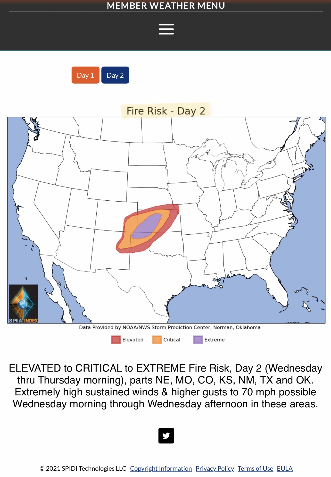
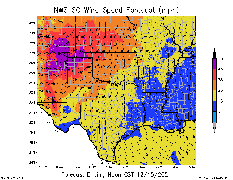
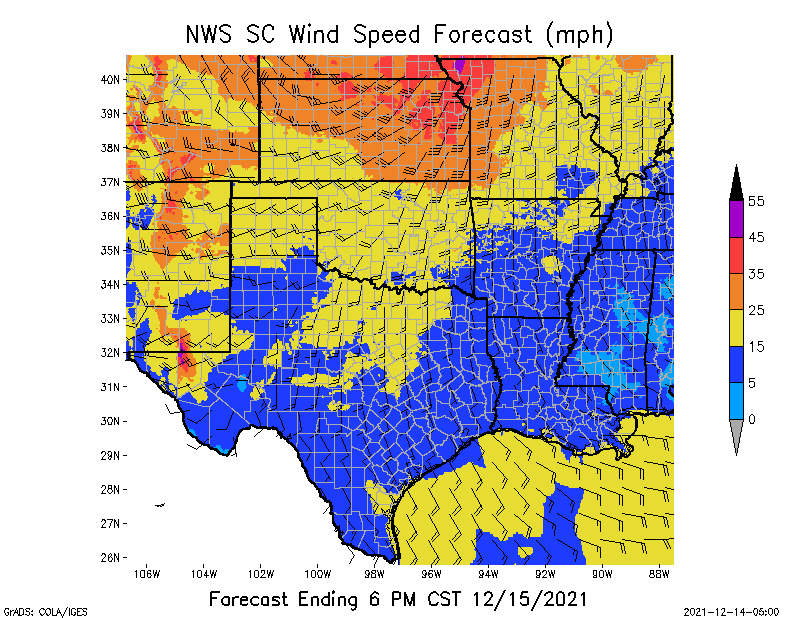
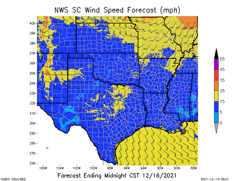
Extreme Fire Risk Day 2 (Wednesday thru Thursday morning), parts NE, MO, CO, KS, OK & TX. Sustained winds of 45-55 mph w/gusts to 70 mph possible. Rain in tornado ravaged areas of AR, TN and KY. Light icing w/high winds in MN, SD, IA, WI. Finally, much-needed Rain and Snow in southwest states of CA, NV, UT and AZ…
Sidney Sperry 14 Dec 2021 12:47 UTC
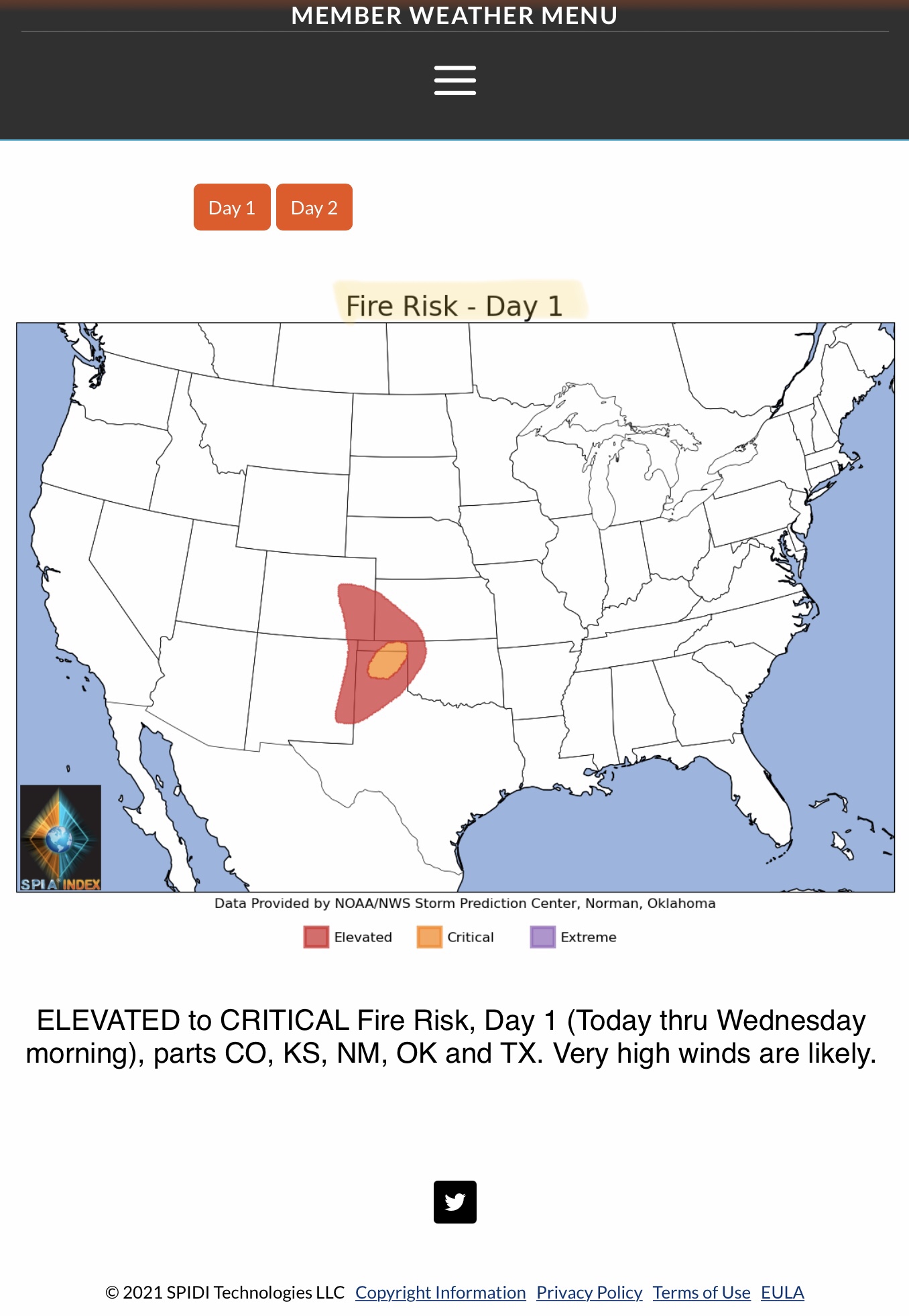
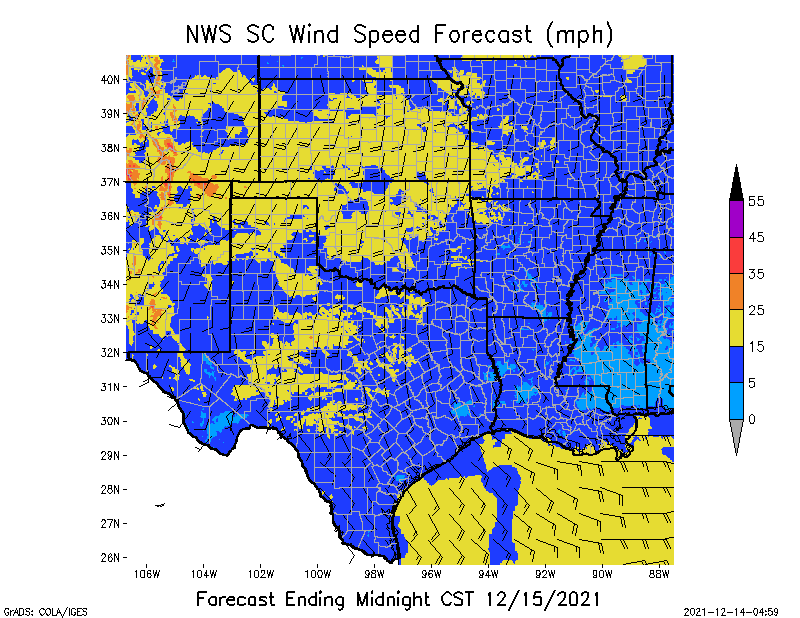
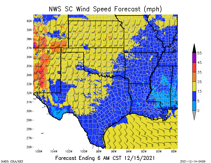
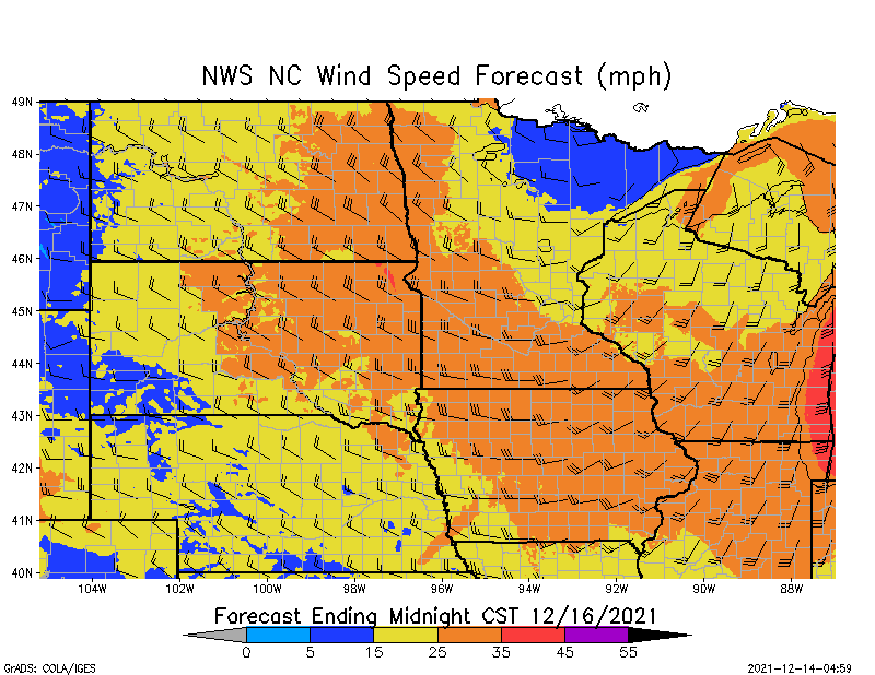
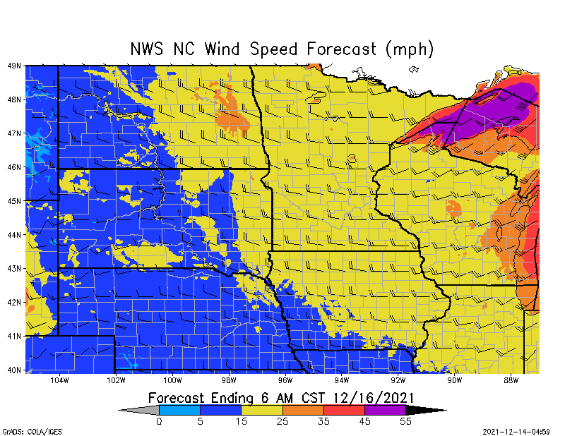
Over the next 2 days, extreme weather will impact several areas of the U.S. Beginning late tonight through Wednesday morning and to Noon on Thursday, the NWS is forecasting CRITICAL to EXTREME Fire Risk for parts of NE, MO, CO, KS, OK and TX. This is due to extremely high sustained winds of 35 up to 55 mph, with gusts up to 65 or 70 mph possible. Extremely dry vegetation and very low humidity levels are also contributing to this Extreme Fire Danger situation across the South Central states.
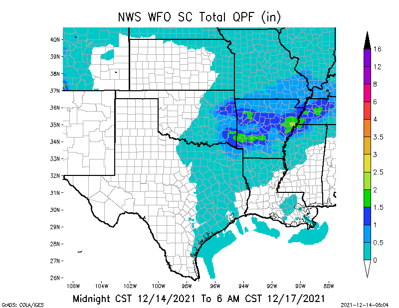
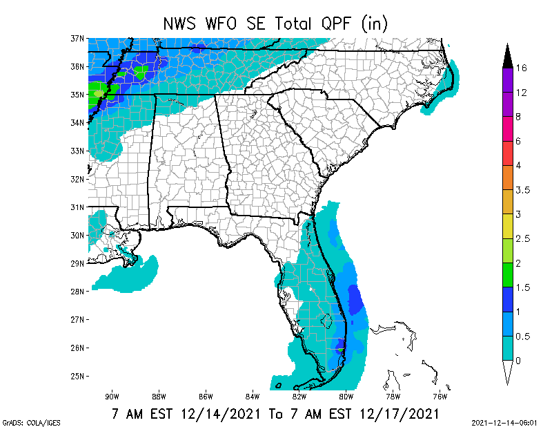
Also in the South Central Region, rain will slow recovery and power restoration efforts in parts of AR, TN and KY that were ravaged by tornadoes on Friday and Saturday of last week. From 1” up to 2.5” of rainfall is forecast locally for some of these areas.
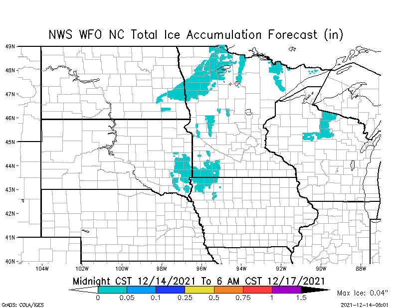
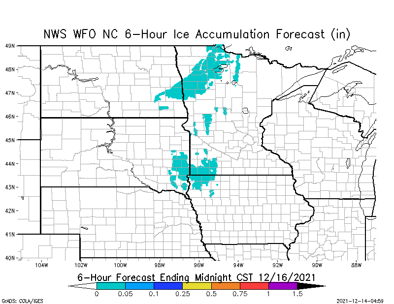
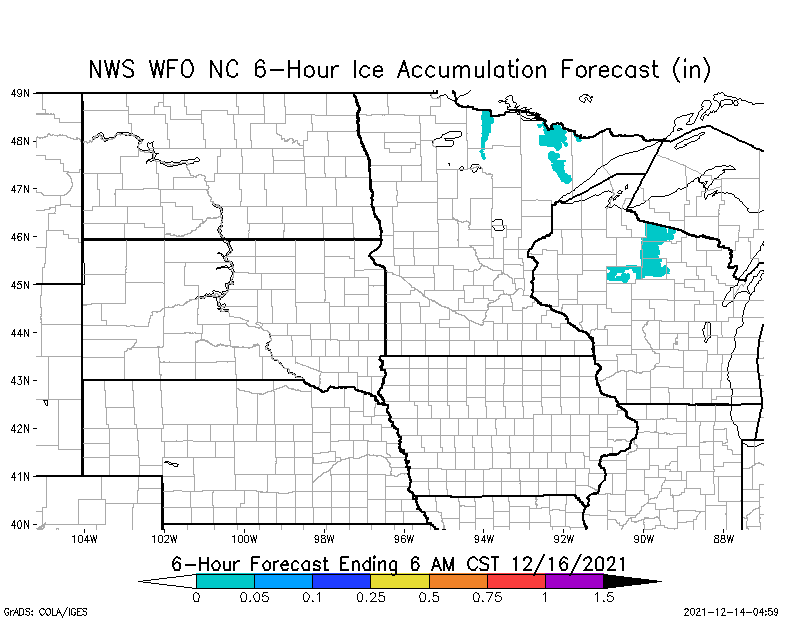
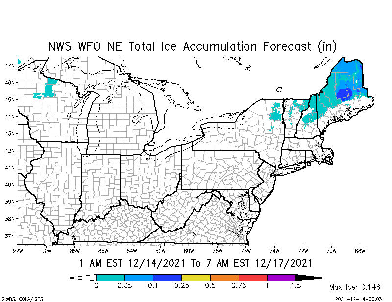
Further north, parts of MN, SD, IA and WI are forecast to receive some very light (0.04”) icing and freezing rain over the next 36 to 72 hours. While the amounts are not in any way significant, the accompanying high winds of 35 to 55 mph could cause some conductor galloping that may result in short-term outages in these states.
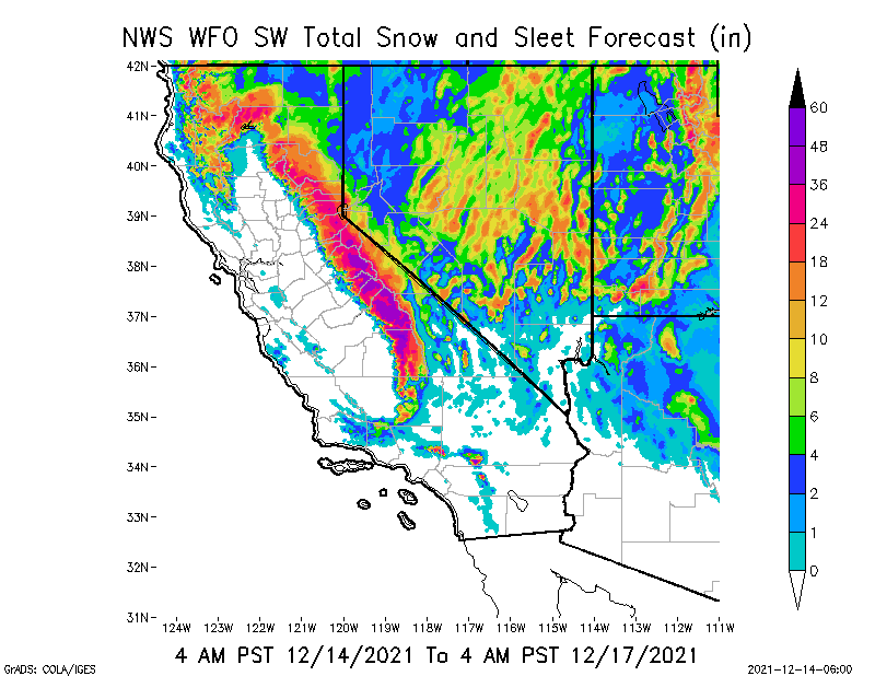
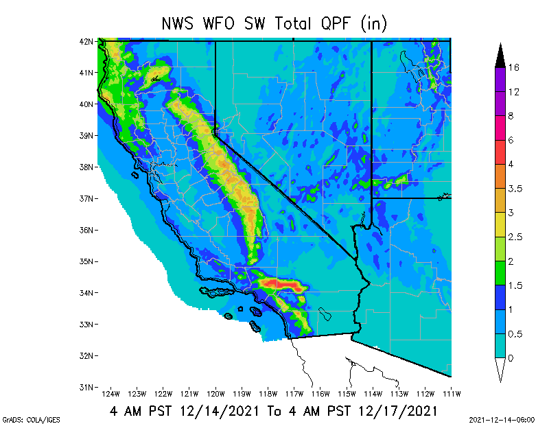
Lastly, the southwestern states of CA, NV, UT and AZ are forecast to receive some much-needed rain and snow over the next 3 days. While not drought-ending, this moisture will certainly help ease fire spread conditions that exist across the Southwest.
Sid Sperry

 Show/hide attachments