|
Fire Risk, Days 1 & 2; Severe Thunderstorms Risk, Days 1 thru 3; Snow Forecast next 72-hours…
Sidney Sperry
(08 Dec 2021 13:18 UTC)
|
|
Re: Fire Risk, Days 1 & 2; Severe Thunderstorms Risk, Days 1 thru 3; Snow Forecast next 72-hours… Reeves, Harry (08 Dec 2021 13:21 UTC)
|
|
Re: Fire Risk, Days 1 & 2; Severe Thunderstorms Risk, Days 1 thru 3; Snow Forecast next 72-hours…
Nick Adams
(08 Dec 2021 15:36 UTC)
|
 Show/hide attachments
IMG_3952.jpg (303K)
IMG_3953.jpg (314K)

IMG_3954.jpg (878K)
IMG_3955.jpg (820K)
IMG_3956.jpg (817K)
IMG_3957.jpg (984K)
IMG_3958.PNG (32K)
IMG_3959.PNG (24K)
IMG_3960.PNG (31K)

IMG_3961.jpg (157K)
IMG_3962.jpg (134K)

IMG_3963.jpg (106K)

IMG_3964.jpg (113K)

IMG_3965.jpg (111K)
IMG_3966.jpg (137K)
IMG_3967.jpg (144K)
IMG_3952.jpg (303K)

IMG_3953.jpg (314K)
IMG_3954.jpg (140K)
IMG_3955.jpg (141K)
IMG_3956.jpg (139K)
IMG_3957.jpg (140K)
IMG_3958.PNG (32K)

IMG_3959.PNG (24K)

IMG_3960.PNG (31K)
IMG_3961.jpg (157K)

IMG_3962.jpg (134K)
IMG_3963.jpg (106K)
IMG_3964.jpg (113K)
IMG_3965.jpg (111K)

IMG_3966.jpg (137K)

IMG_3967.jpg (144K)

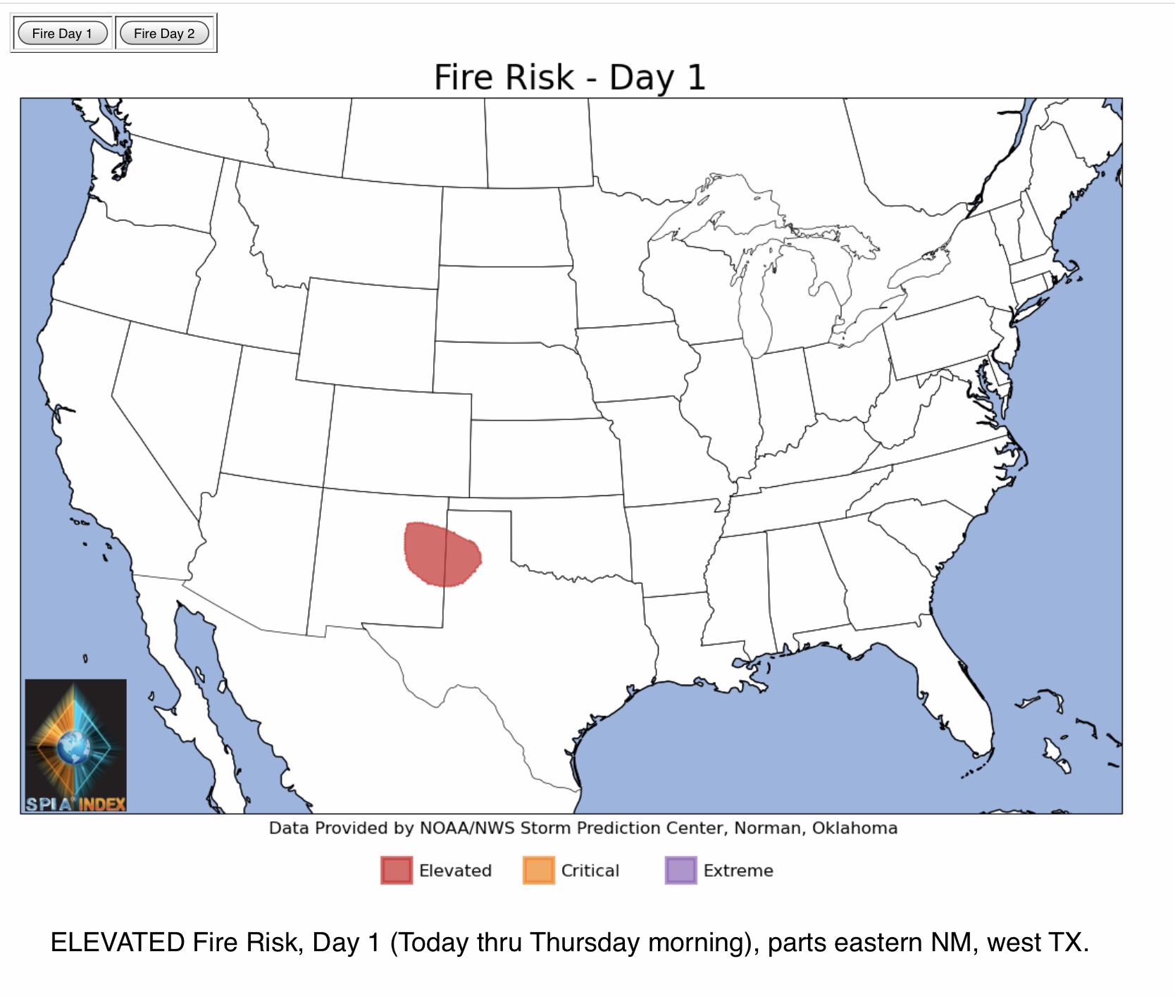
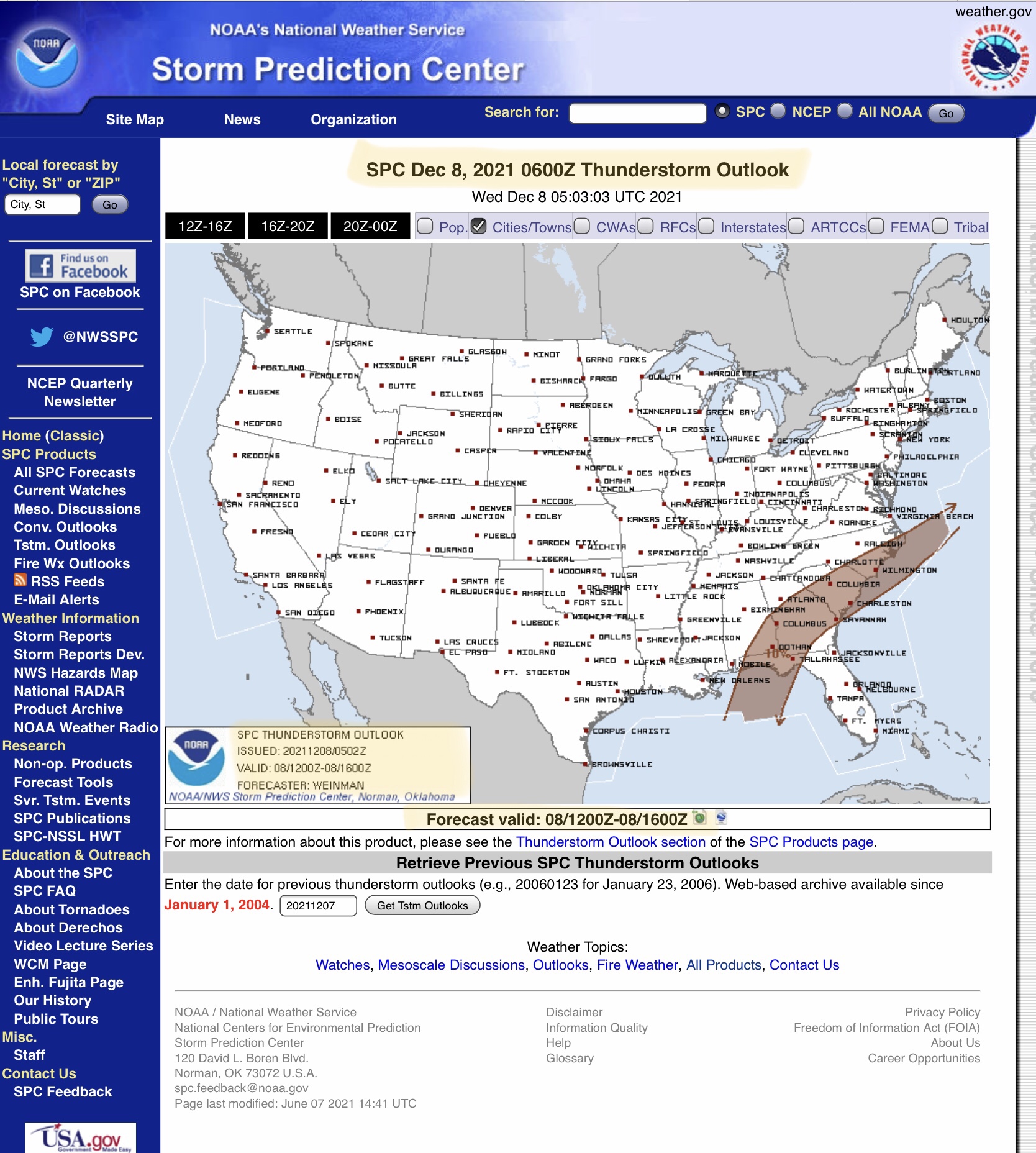
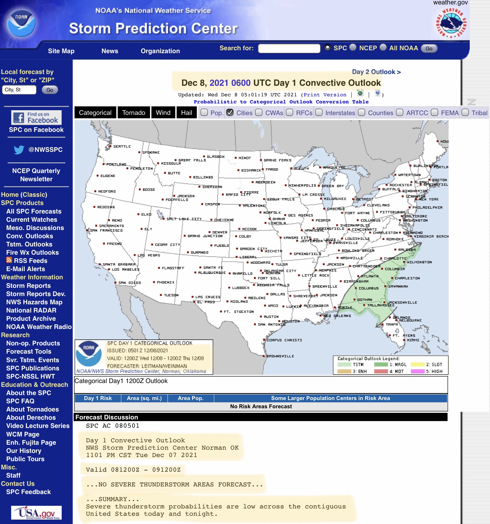
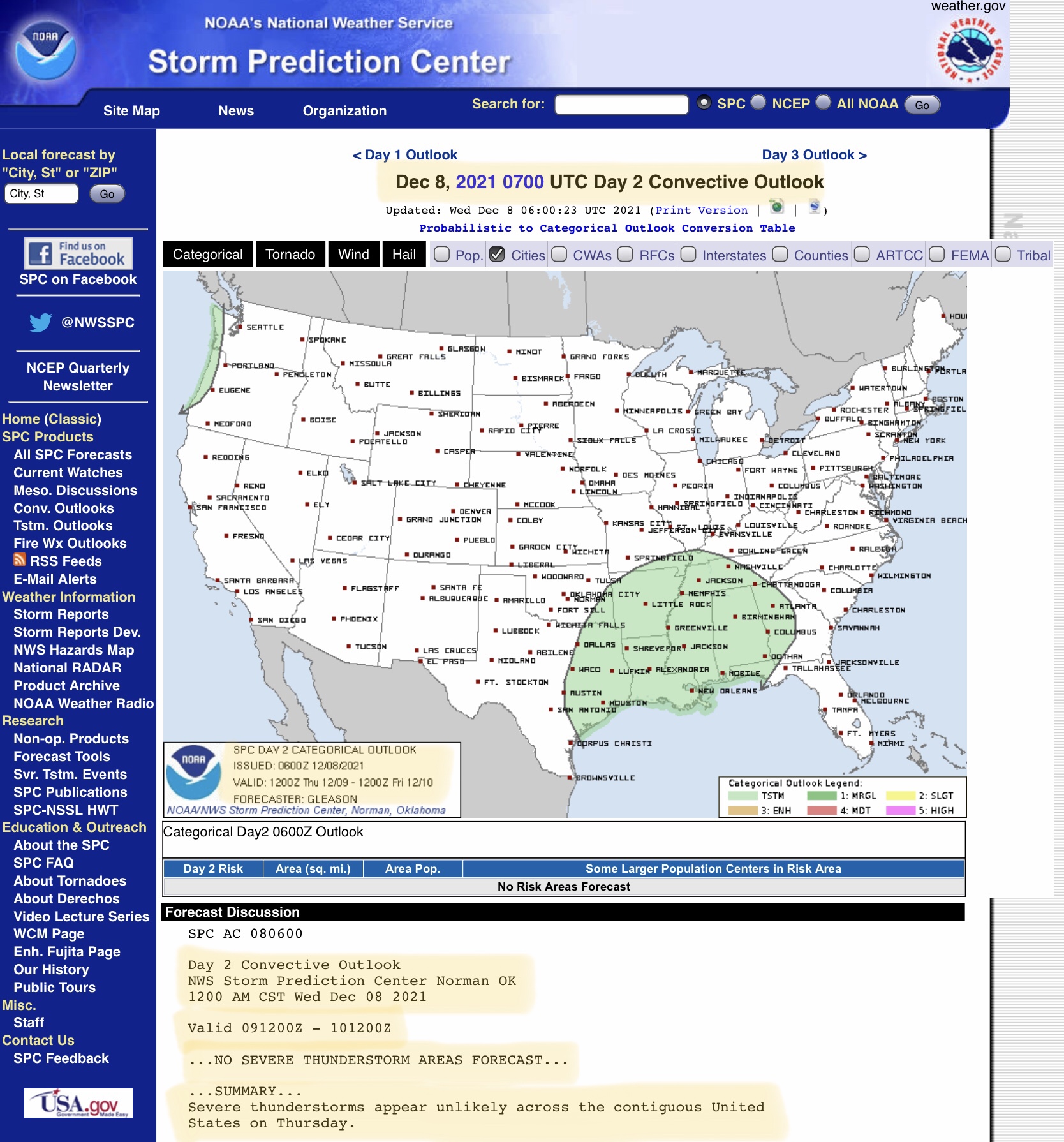
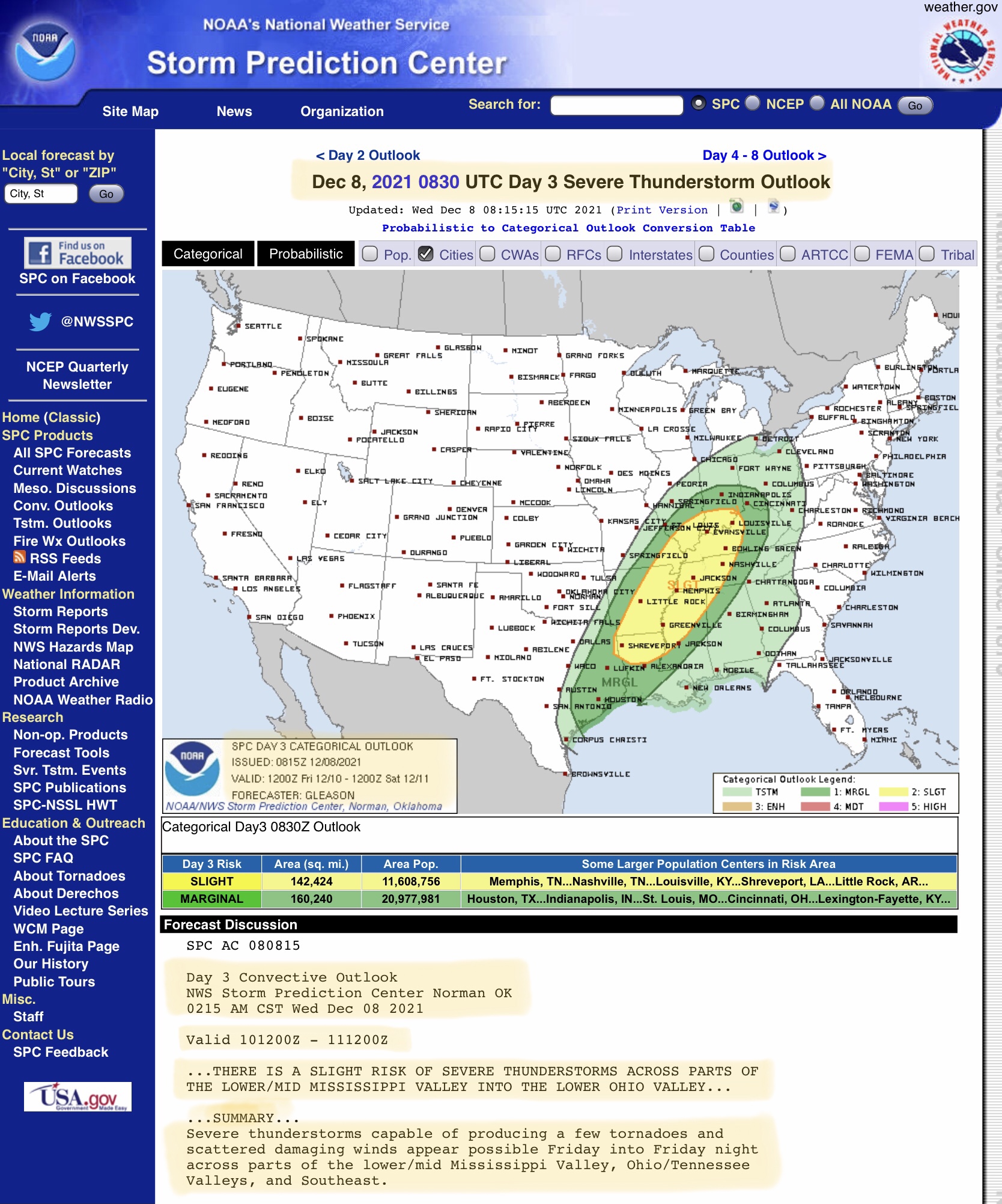
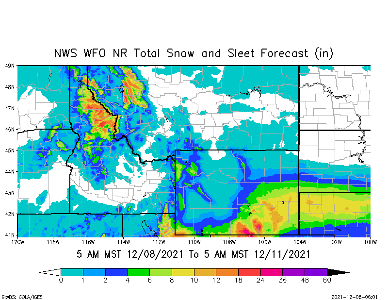
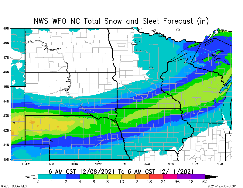
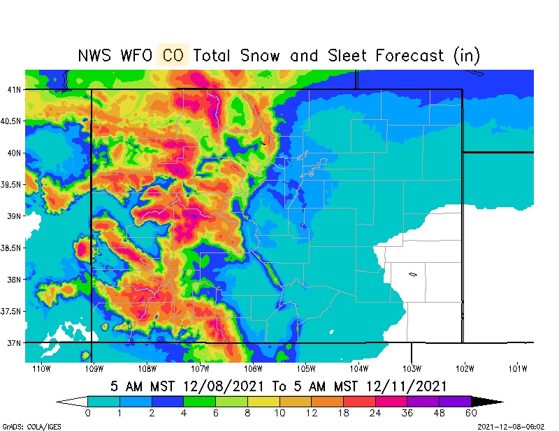
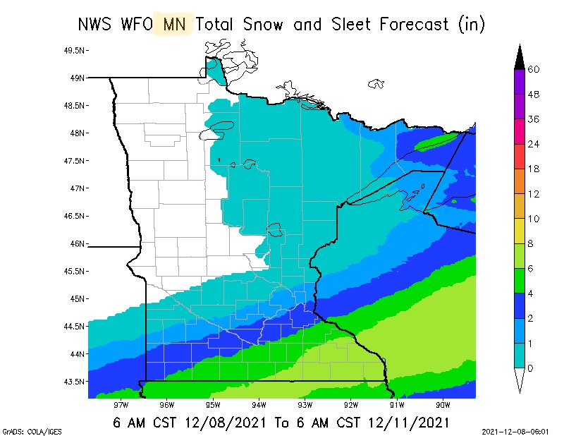
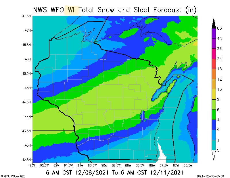
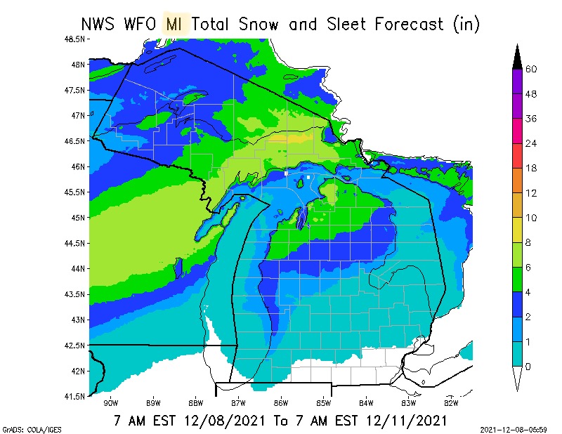
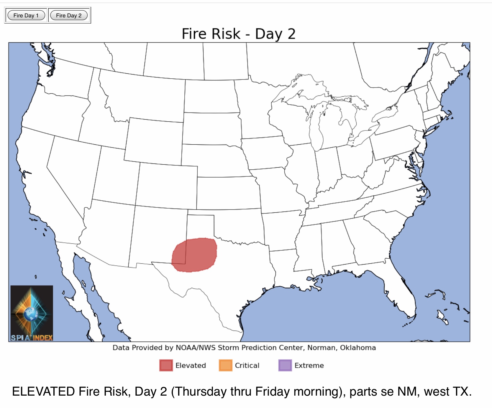
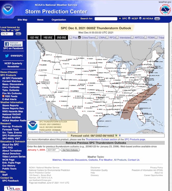
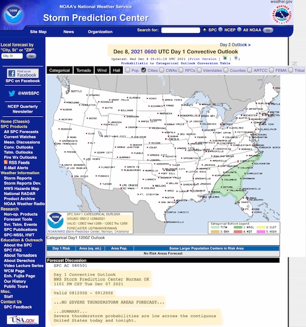
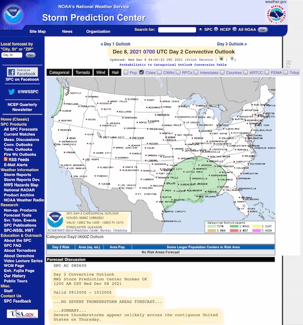
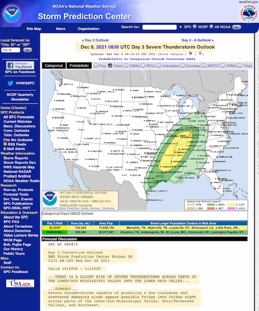
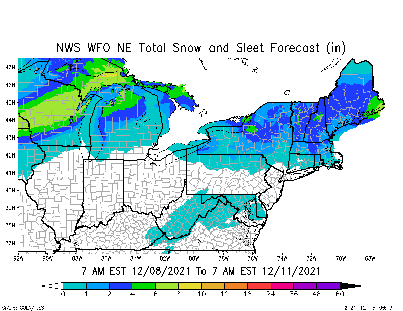
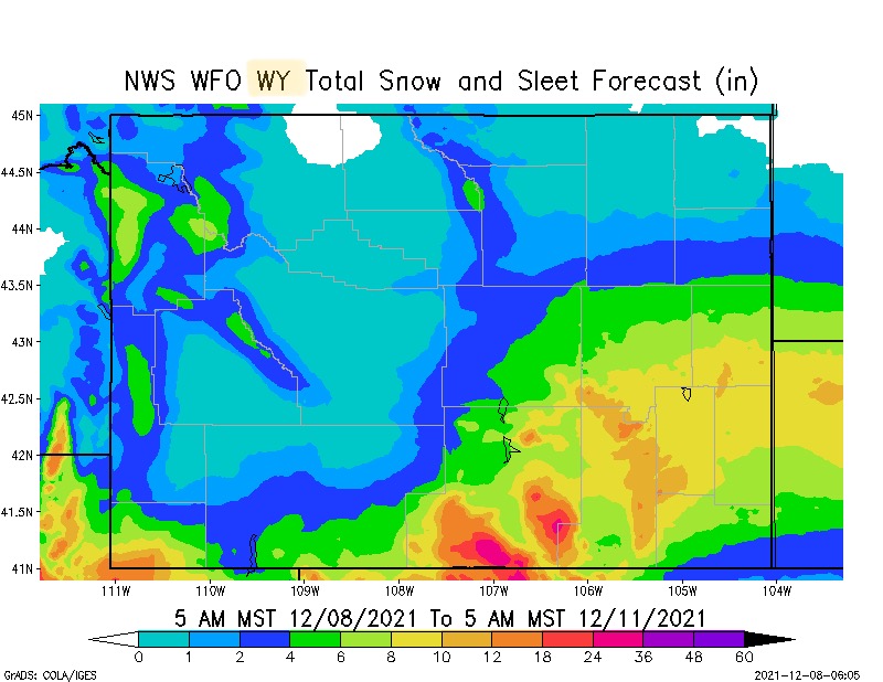
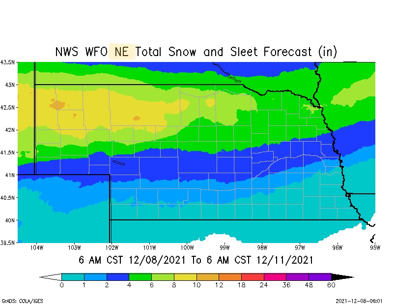
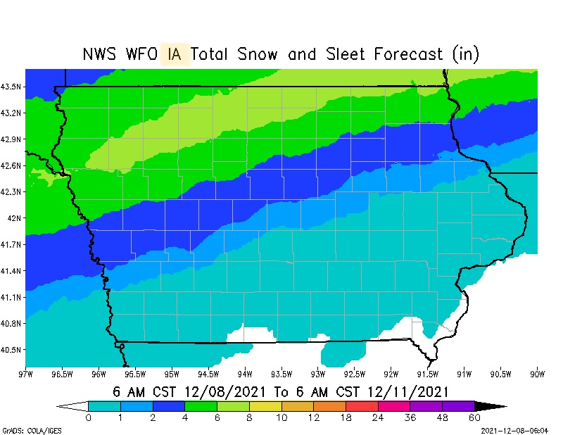
Thanks Sid busy times!!!! Hope you are doing well!!!

Harry Reeves
Vice President, Training, Education & Safety
955 Rumble Road<x-apple-data-detectors://0/0> |<x-apple-data-detectors://0/0> Forsyth, GA 31029<x-apple-data-detectors://0/0>
(478) 992-6136<tel:(478)%20992-6136>| Office
(678) 588-3026<tel:(678)%20588-3026> | Cell
www.georgiaemc.com<http://www.georgiaemc.com/>
[cid:image001.jpg@01D0D100.95CE8810]

On Dec 8, 2021, at 8:18 AM, Sidney Sperry <sidsperry@gmail.com> wrote:


*External E-Mail*
Good Wednesday morning to all! I hope your week is going well, and that you’ve at least STARTED your Christmas shopping! (With 16 grandkids, I started in June!)

The next 3 days will see a variety of weather risks across parts of the U.S.  Starting in NM and TX, there is an ELEVATED Fire Risk for Days 1 & 2 (Today thru Friday morning).

There is also a chance of Thunderstorm activity today for parts of the FL panhandle, southeastern AL, southern and central GA, most of SC, and southeastern NC.

Convective Outlooks for Days 1 & 2 bring a chance of rain further west, from east TX, southeastern OK, most of AR, LA, MS & AL and parts of the western FL panhandle, western GA, western TN, the boot heel of MO, and far western KY. No severe thunderstorms are expected through Thursday evening, however.

By early Friday morning through Saturday, there is a SLIGHT Risk of Severe Thunderstorms across parts of LA, MS, AR, western TN, southeastern MO, western KY, southern IL and southern IN. This risk includes the possibility of damaging winds, hail, and some tornadoes.

For northern and north-central states, it’s all about the SNOW. Over the next 24-72-hrs, moderate to heavy snowfall accumulations are expected from CO and WY in the west through parts of NE, SD, IA, MN, WI and MI and the MI Upper Peninsula. Snowfall amounts could range from 2” up to 10”+ across parts of these states over the next 3 days. In the northeast, from 2” to 6”+ of snow is expected across parts of NY, VT, NH, MA and ME. Some heavy snow is also in the forecast for parts of northern NM.

Sid Sperry

[cid:C3B10BBE-B333-4BCF-BB32-FF93F4A121B8]

[cid:0225F37D-E90D-45F1-B723-A6C431067E29]

[cid:95386B30-5F97-4FE5-A1EB-C966A53D3BF5]

[cid:65E46447-6DCB-4FFA-A23A-A6B7C2674EBD]

[cid:6E962938-3A19-4C88-94E8-3B9E0D958F3E]

[cid:BDF5B753-A83F-4963-A31F-290C3BC20DC4]

[cid:3082407B-4A24-4C6B-B22D-6CACF7620572]

[cid:6D1970A5-6119-4B23-90E0-02DC9EC65E1C]

[cid:729780F1-D569-44B4-B32D-B30954F0C949]

[cid:CE14D344-B18A-452D-8B7D-43507643093C]

[cid:45007064-3AC3-4F9D-AC55-2539F790E768]

[cid:89E31989-A74D-4973-9C63-5C5045C53241]

[cid:7C30F4A7-7E76-4A32-9FF8-C394F365F4B1]

[cid:807E6E38-29F5-4FB0-BEC2-7BC4C0F5DABB]

[cid:80C64F0E-2E92-4051-BA50-1B371B2103CF]

[cid:24A76D88-E949-479F-BC70-7619DFA0FBF6]

Sent from my iPad
