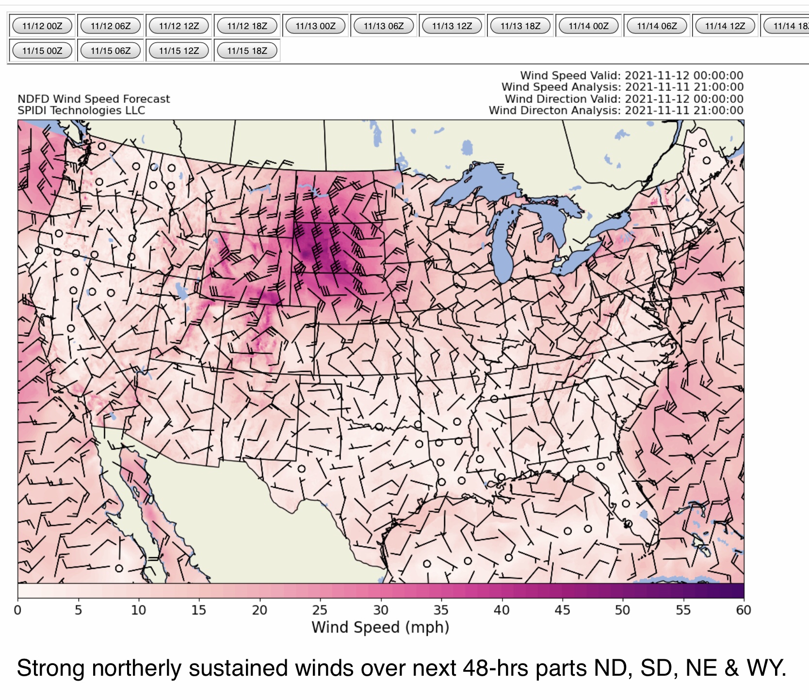
Fire Risk and Weather Outlooks, Day 2 (Friday into Saturday morning)…
Sidney Sperry 11 Nov 2021 22:57 UTC
FYI…
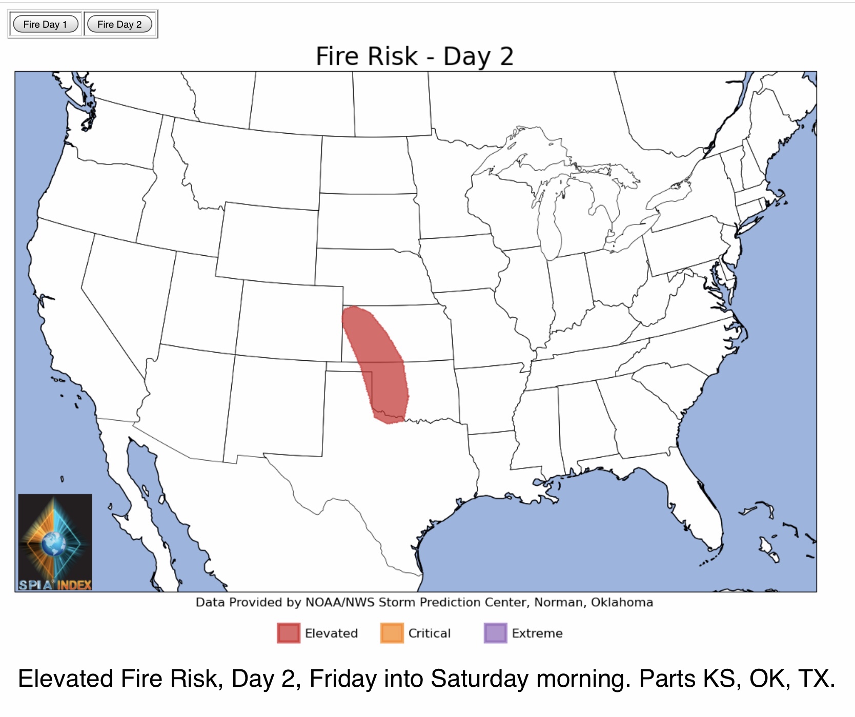
Elevated Fire Risk, Day 2 (Friday into Saturday morning), parts western KS, western OK, far northeastern TX panhandle and Wichita Falls, TX area.
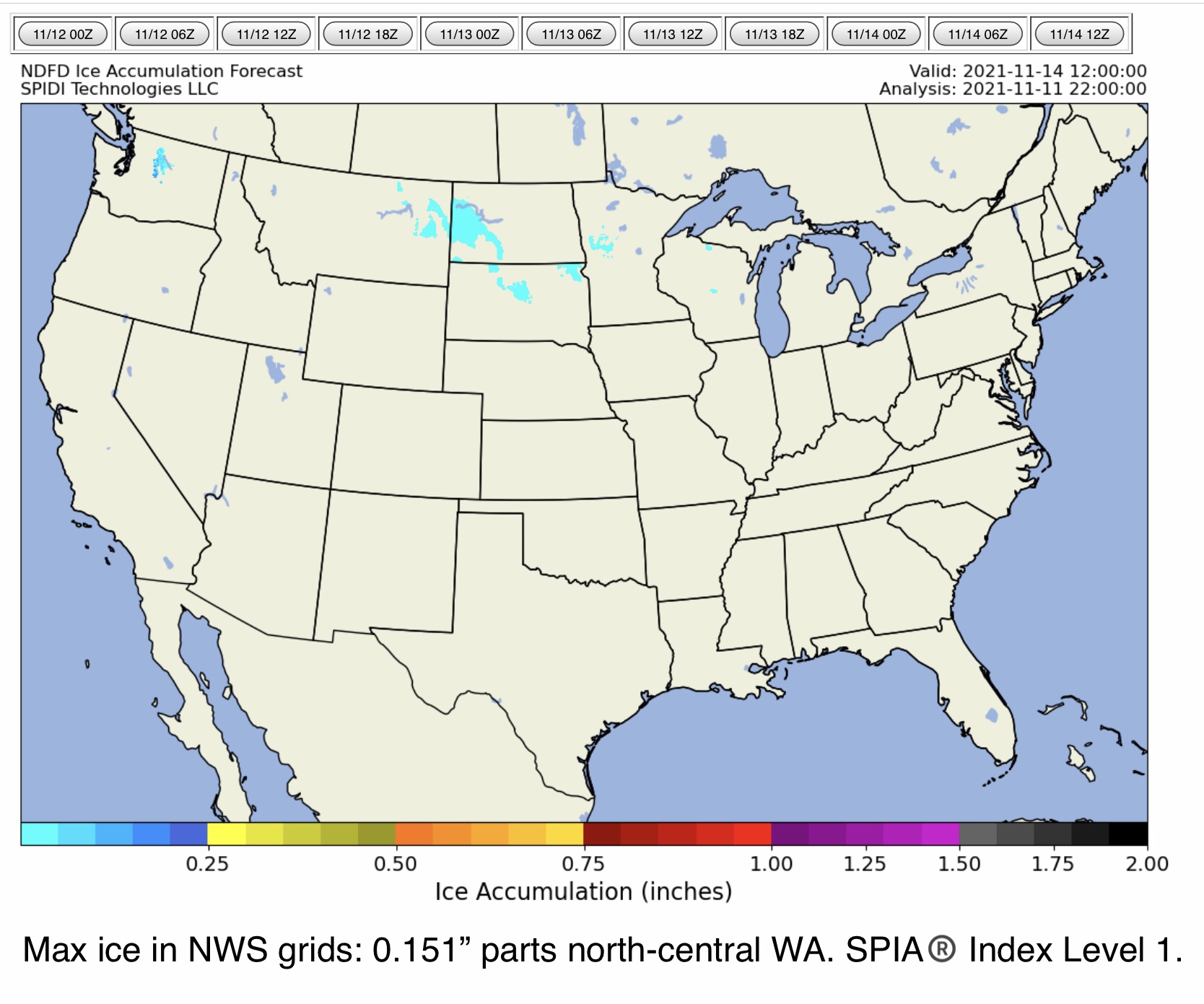
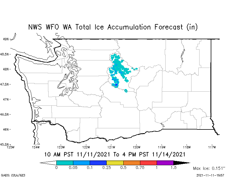
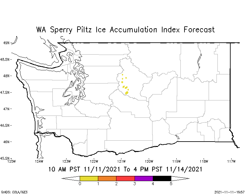
Max ice in NWS Forecast grids: 0.151” parts north-central WA, higher elevation areas.
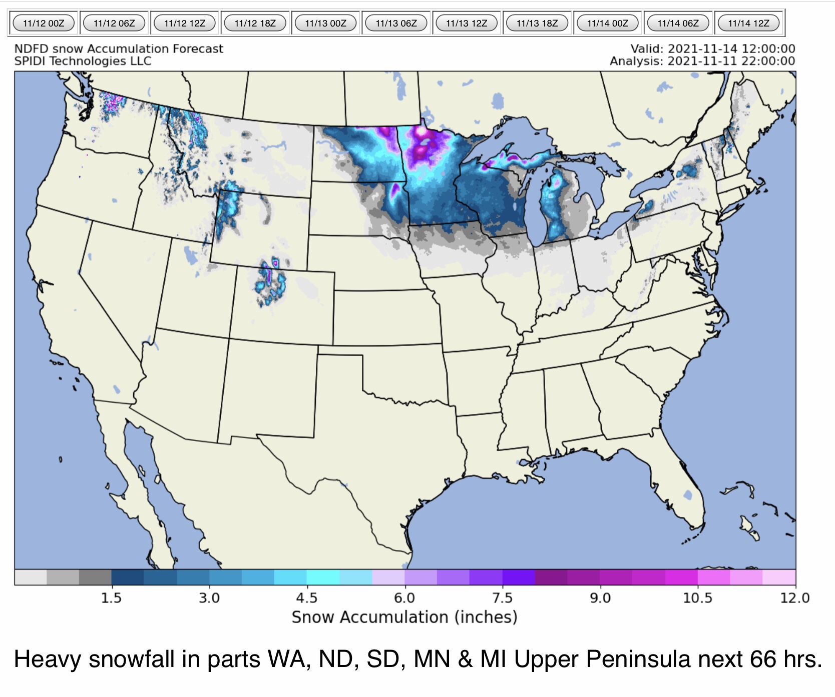
From 4” to 10”+ snow possible over next 66 hours parts WA, ND, SD, MN, WI and MI Upper Peninsula.
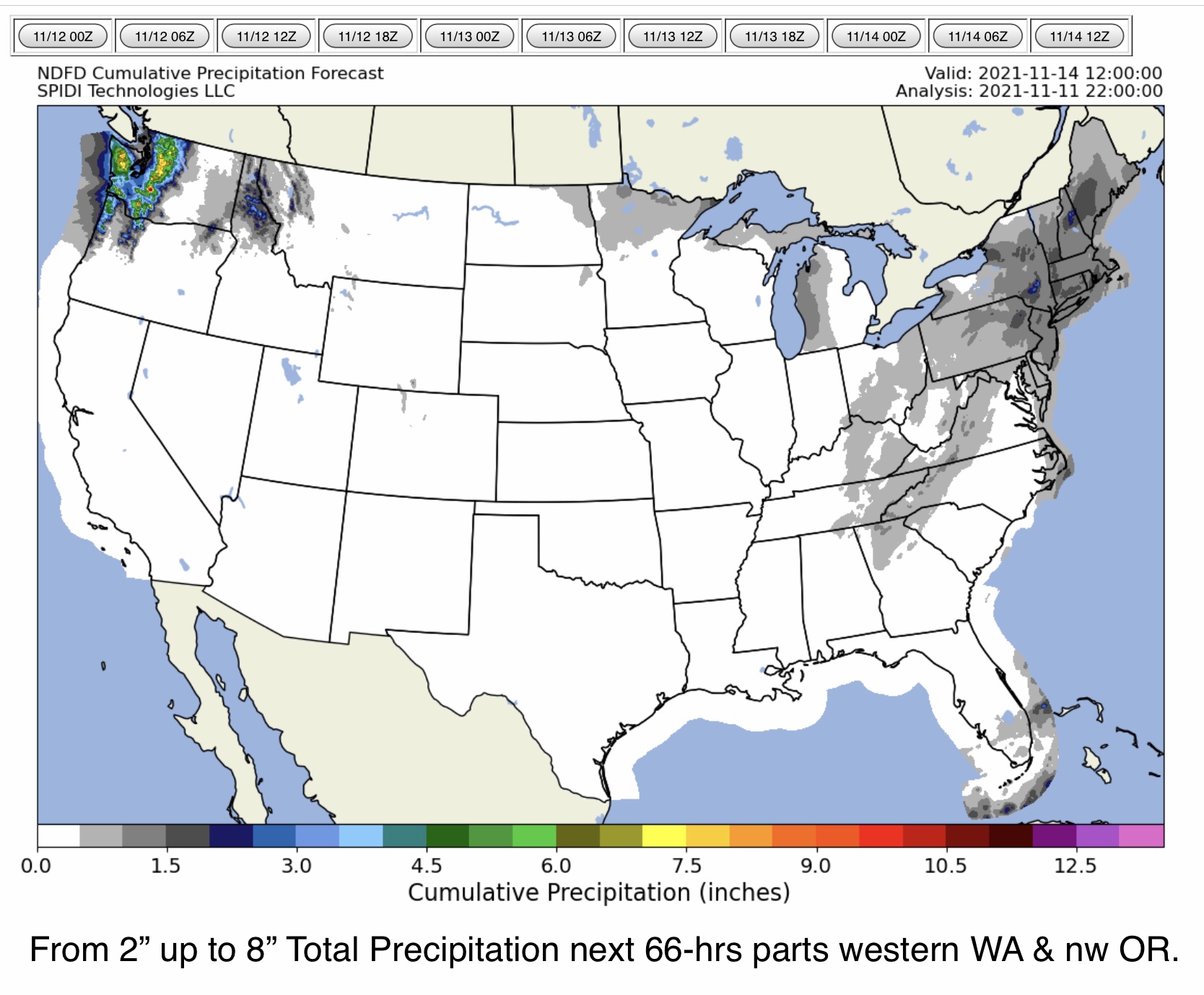
From 2” up to 8” Total QPF (total precipitation) parts western WA, northwestern OR.
Sid Sperry
From 2” to 8” Total Precipitation possible parts western WA, nw OR

 Show/hide attachments