Tropical Depression likely to develop over next 3-5 days in eastern Atlantic; track is westward at this time, and worthy of keeping an eye on. Elsewhere, lots of rain in northeast and parts of southeast next 72-hrs. And… SNOW in the Rockies!
Sidney Sperry 21 Sep 2021 12:03 UTC
Good Tuesday morning everyone!
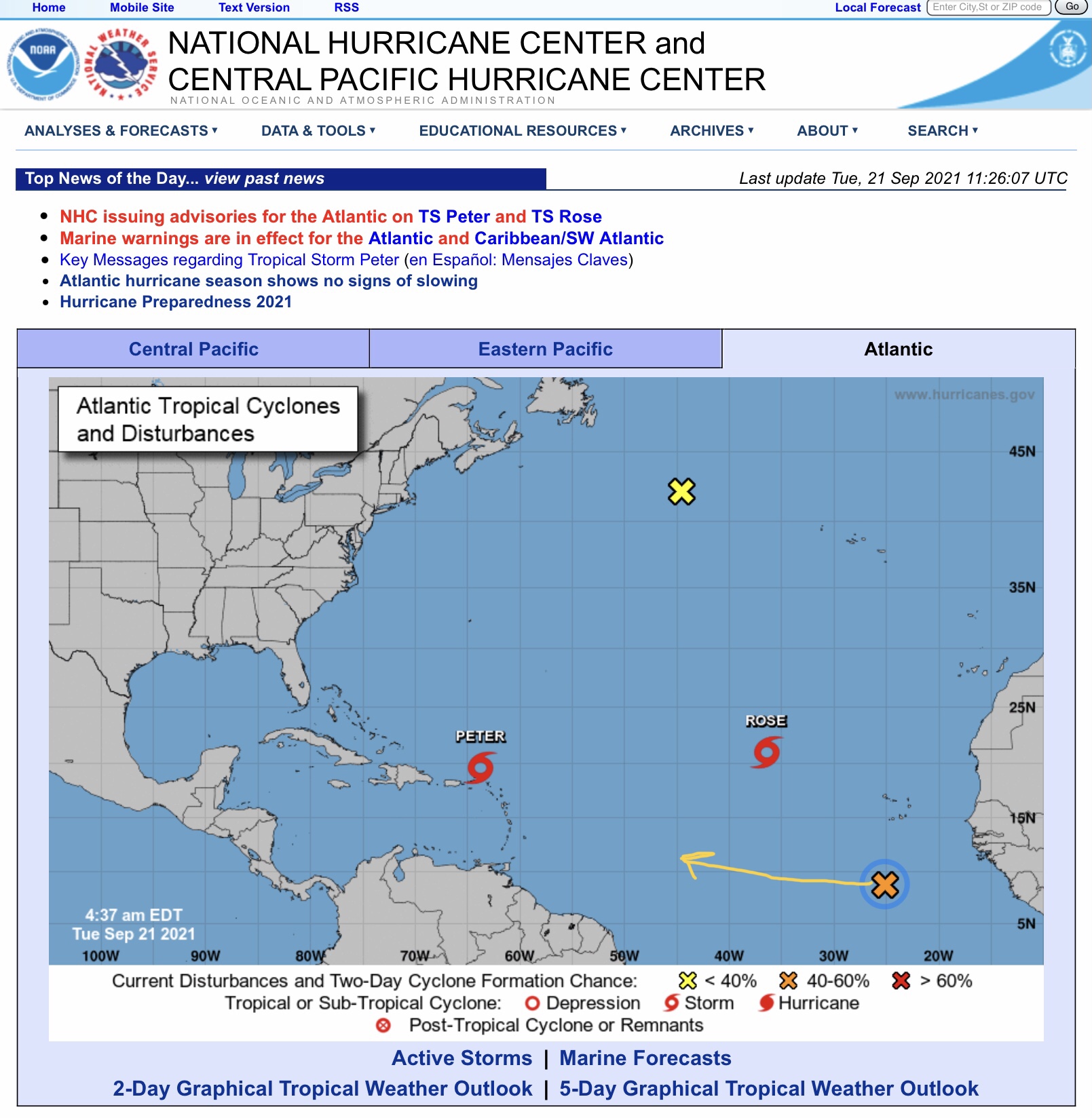
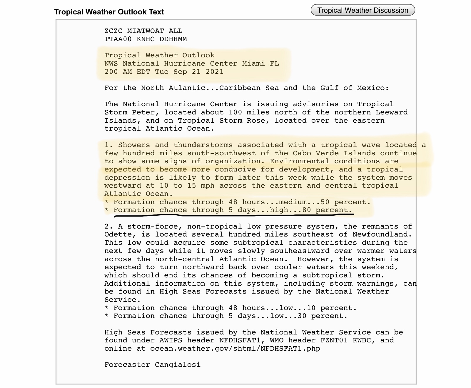
While things in the Atlantic continue to stir up tropical disturbances, there is one more such system developing now off the western coast of Africa (circled in blue below) that bears watching, mainly because of its nearly straight westward track at this time. Should this system continue to develop into a Tropical Depression or Tropical Storm, it would be named “Sam,” the 18th named storm of this hurricane season. We will watch it closely over the next 5 days. NHC forecasters are giving it an 80% chance of TD formation within the next 5 days - and a 50 percent chance within the next 48 hours.
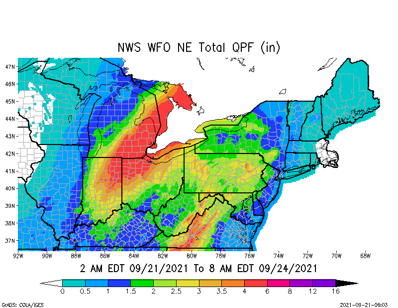
Meanwhile, parts of the northeast, including areas of MI, IN, OH, NY, PA, WV, MD and VA are forecast to receive from 1” up to 6” of rainfall over the next 72-hrs. Some flooding and flash flooding are likely in some areas due to heavy rainfall.
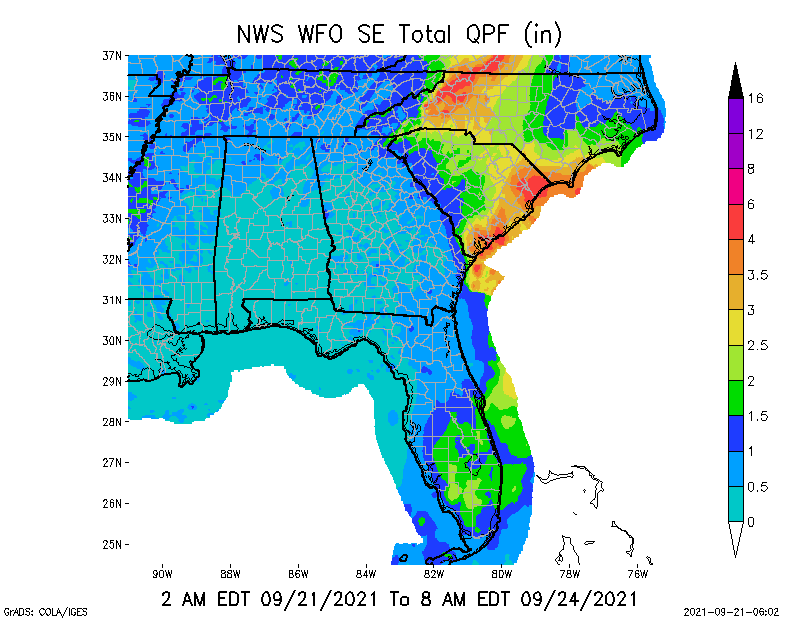
In the southeast, the Carolinas will also see plenty of rain over the next 3 days, specifically parts of western and southern NC, and southern and eastern SC. From 1” up to 6” of total rainfall over the next 72-hrs is possible.
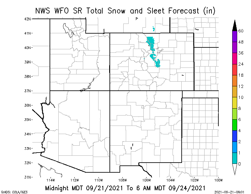
And… there is some light snow forecast in the Colorado Rockies! (Even some ice in the forecast for higher elevation areas of Oregon!) Yes, fall IS on the way… with winter types of weather not that far away.
Stay safe this week!
Sid Sperry

 Show/hide attachments