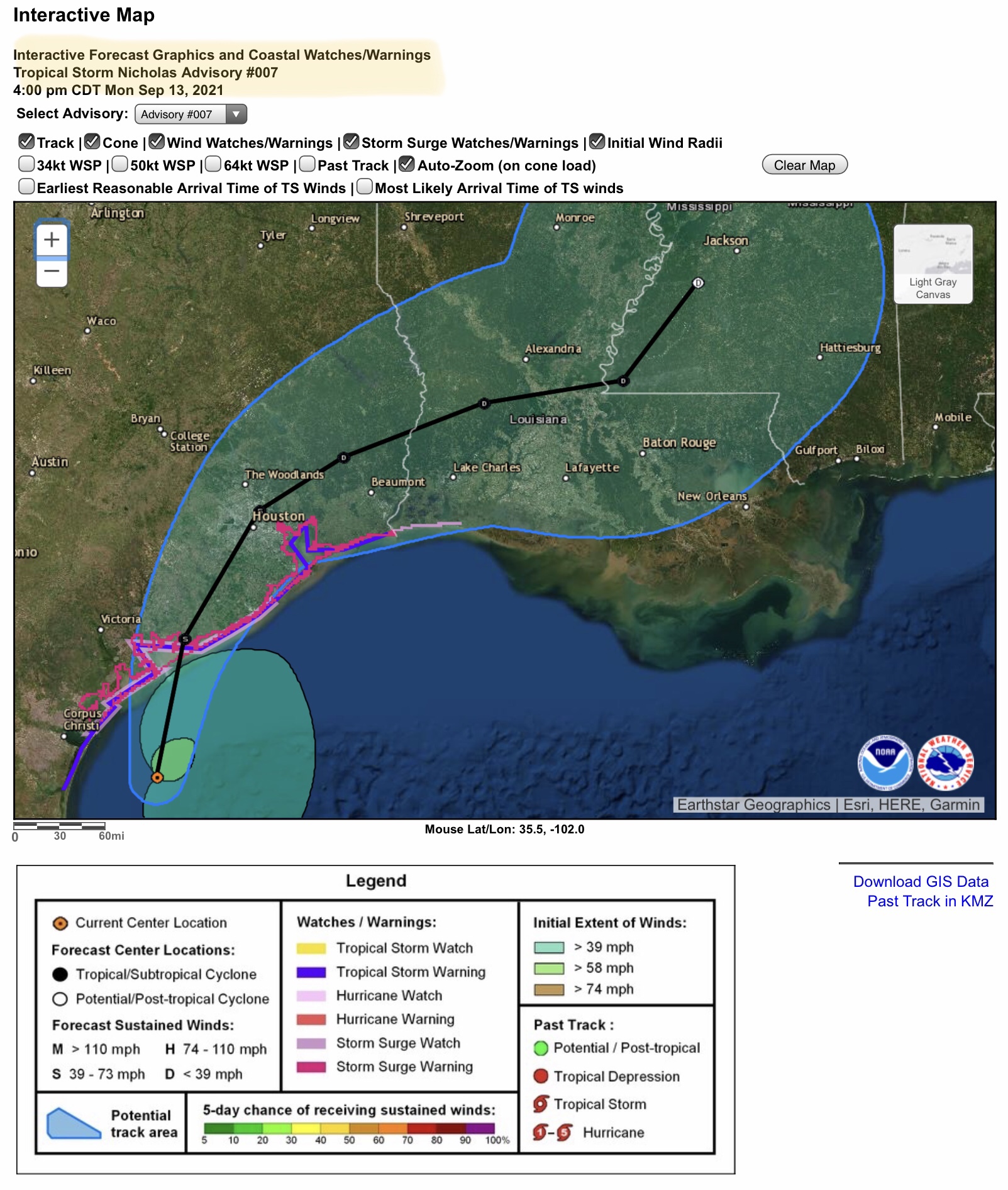
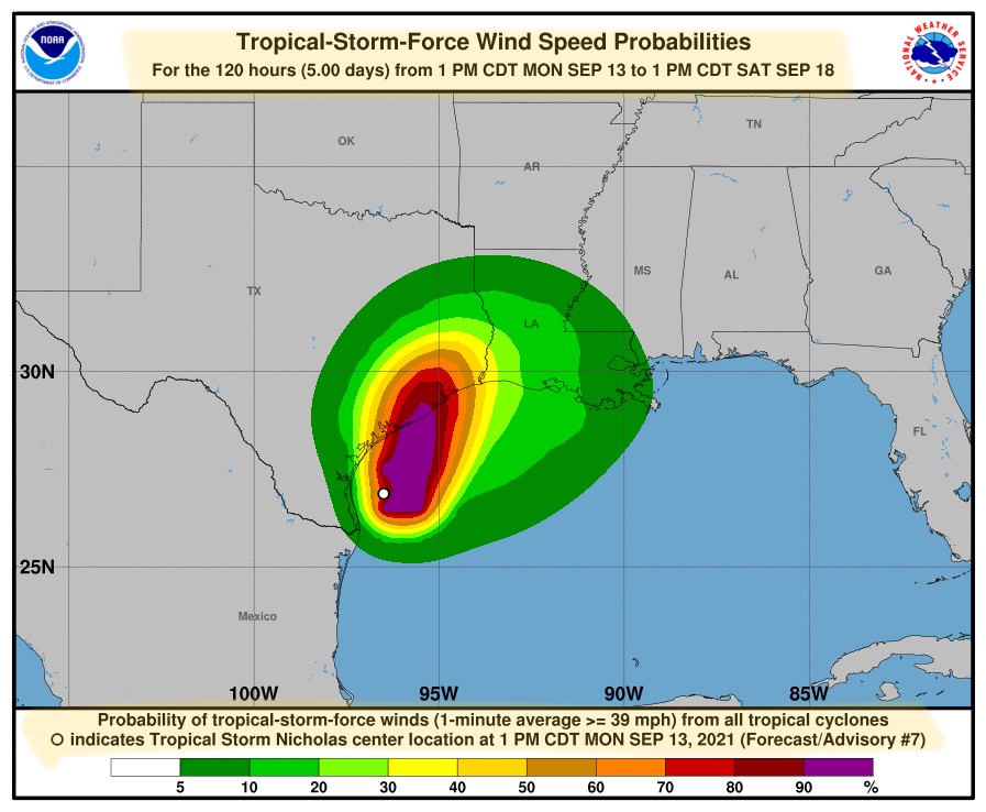
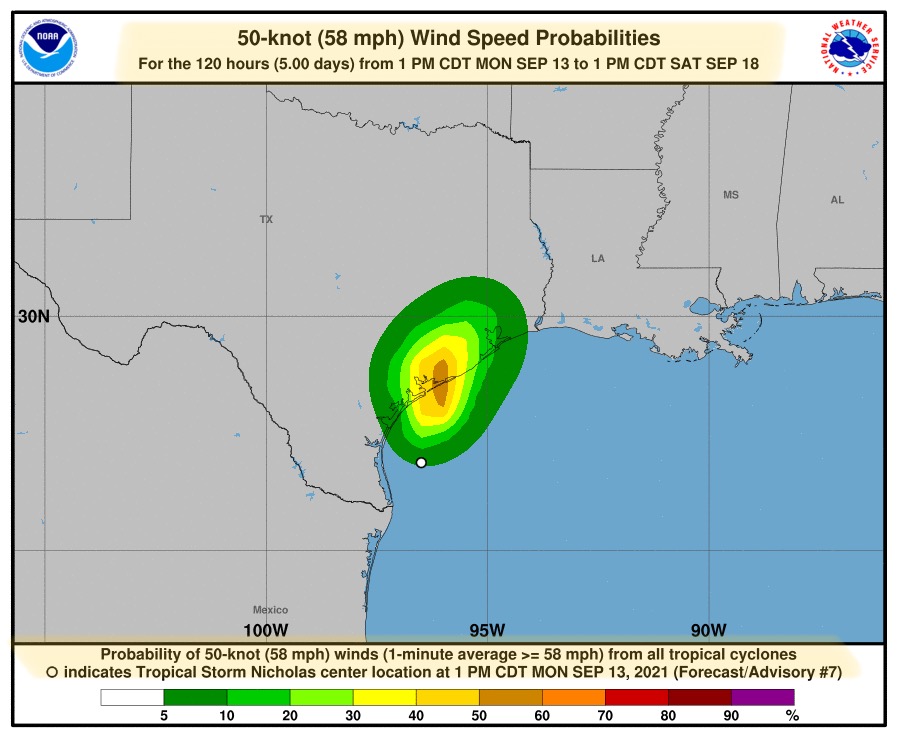
Tropical Storm Nicholas expected to make landfall early Tuesday morning along the central TX coast, possibly near Matagorda. Will likely NOT reach hurricane strength.
Sidney Sperry 13 Sep 2021 23:56 UTC
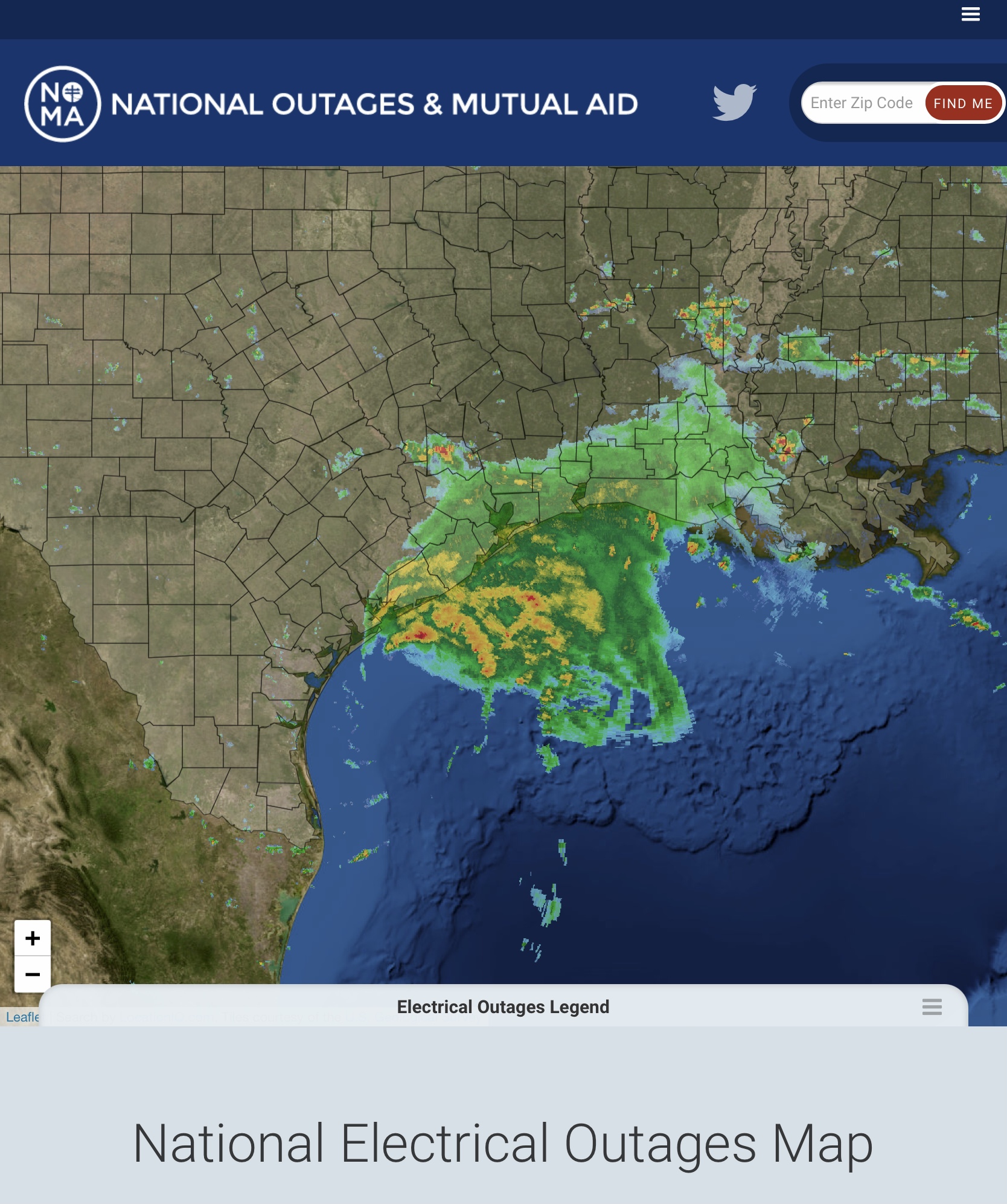
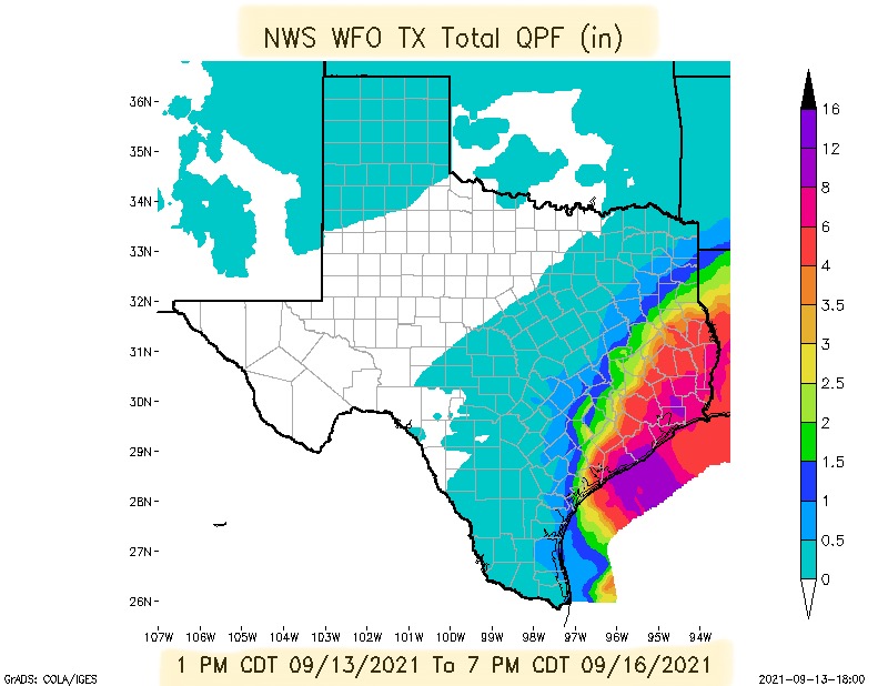
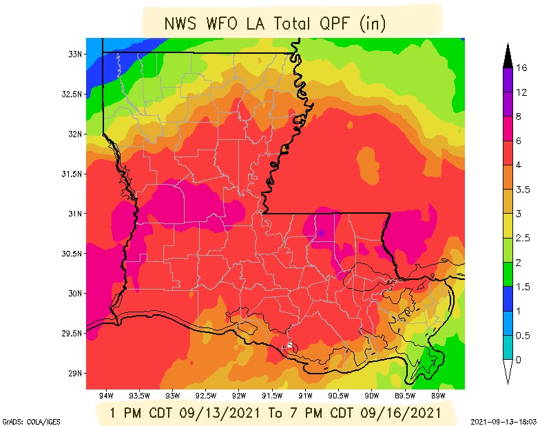
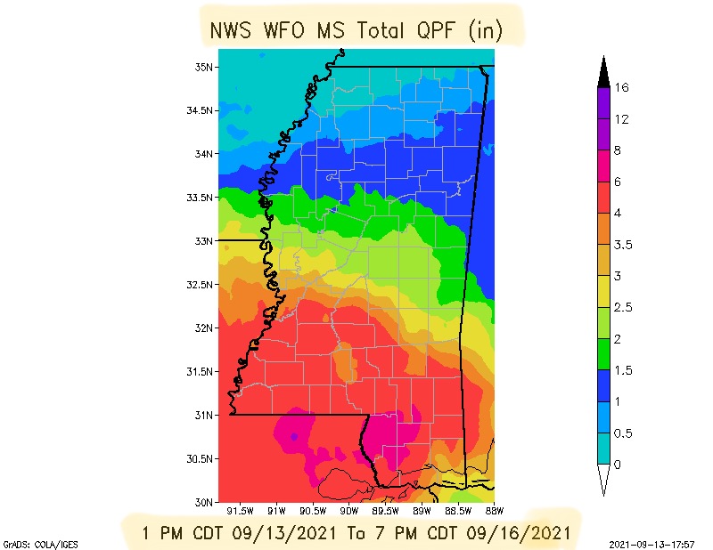
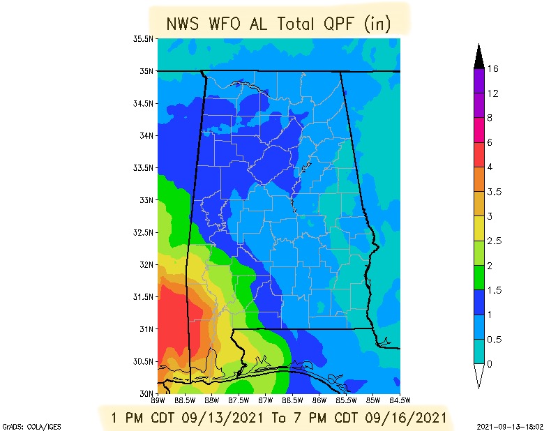
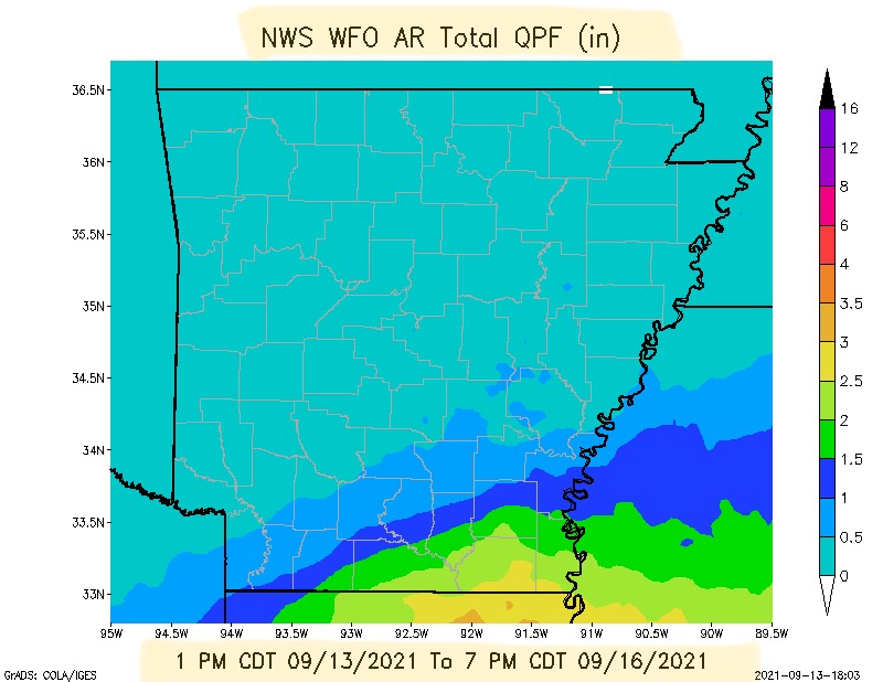
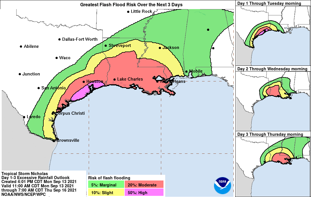
FYI… here is the most recent radar image of Tropical Storm Nicholas. It is expected to make landfall near Matagorda and the central TX coast around 1:00 or 2:00 a.m. Tuesday morning. As you can see from the radar, Nicholas is bringing heavy bands of rainfall to parts of south TX and southwestern LA at the present time. Over the next 3 days, Parts of southern and southeastern TX and much of LA and MS are expected to get between 2” and 12” of total rainfall (see Total QPF forecasts for several states below) along with flooding and flash flooding in several areas. Nicholas is NOT expected to reach hurricane strength (>/= 74 mph sustained winds) when it comes ashore, but sustained winds are likely to be in the 55 to 65 mph range with occasional gusts to 70 mph. An Excessive Rainfall and Flood Risk Forecast Map is also shown below. Widespread total rainfall through Thursday is expected to be in the 4” to 8”+ range for much of LA and parts of southern MS, reaching into far southwestern AL. - Sid Sperry

 Show/hide attachments