Tropical Storm Nicholas intensifying as it approaches south Texas coastline this morning. Biggest impacts: extremely heavy rainfall, near hurricane strength winds, storm surge, and flooding/flash flooding…
Sidney Sperry 13 Sep 2021 11:59 UTC
Good Monday morning to all.
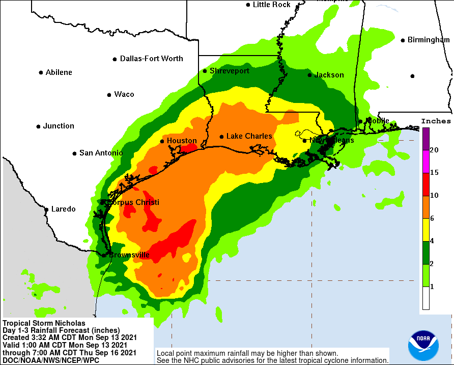
Tropical Storm Nicholas is approaching the south Texas coastline this morning with increasing winds and intensity. There are increasing probabilities that the middle TX coast will be impacted not only with extremely heavy rainfall, but by sustained winds that will likely be in the 58 to 75 mph range, perhaps reaching Category 1 hurricane strength shortly before landfall near the Sabine Pass area. This will also cause an increase in storm surge.
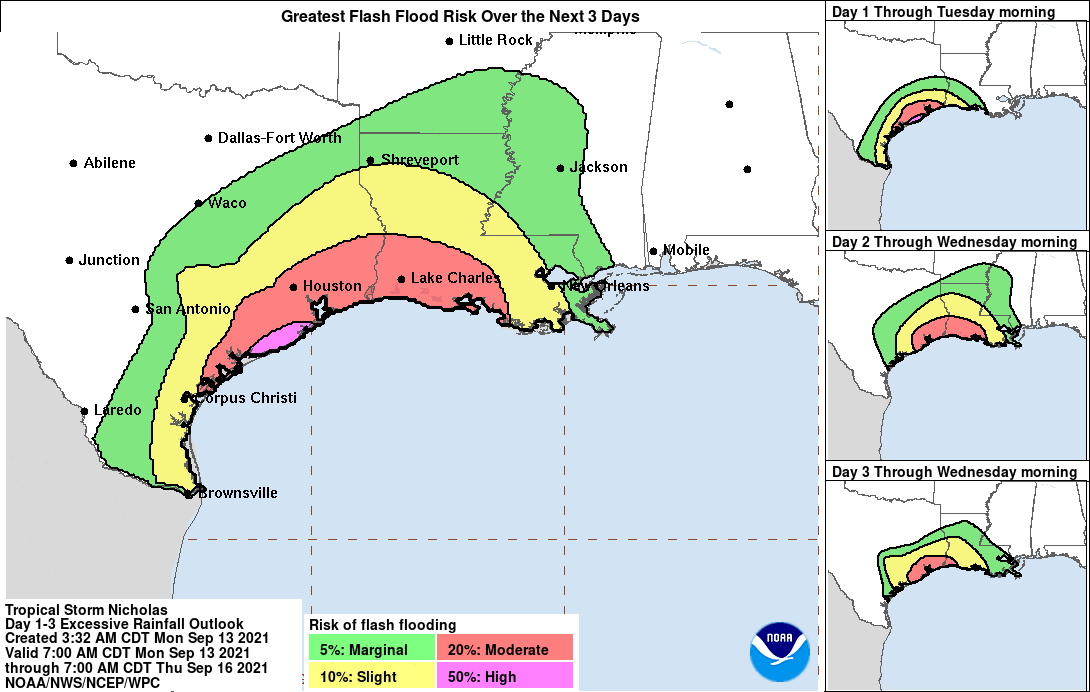
Extremely heavy rainfall is being forecast with this storm. Total 3-day rainfall amounts in parts of southeastern TX will likely be in the 4” up to 16” range, and in western, southwestern, and southeastern LA from 3” to 12”. Flooding and flash flooding will occur.
Storm surge of from 1’ up to 5’ or more is now being forecast for parts of the TX coast. A Hurricane Watch has been issued for parts of the middle TX coastline this morning, due to the increasing intensity of Tropical Storm Nicholas.
More information on the tropical disturbance currently approaching the Bahamas and that could impact the coastal Carolinas by late this week in my next email later today.
- Sid Sperry

 Show/hide attachments