Tropical Atlantic is at its height in activity with 5 disturbances now being monitored by the NHC. Two could be of immediate concern…
Sidney Sperry 12 Sep 2021 11:20 UTC
Good Sunday morning to everyone.
As you can see from the first NHC graphic, the Tropical Atlantic is at its height in activity right now - not at all unusual for mid-September. While there are 5 disturbances currently being monitored by the NHC, there are 2 (circled in yellow below) that we will be keeping a close eye on because there could be impacts to some areas of the U.S.
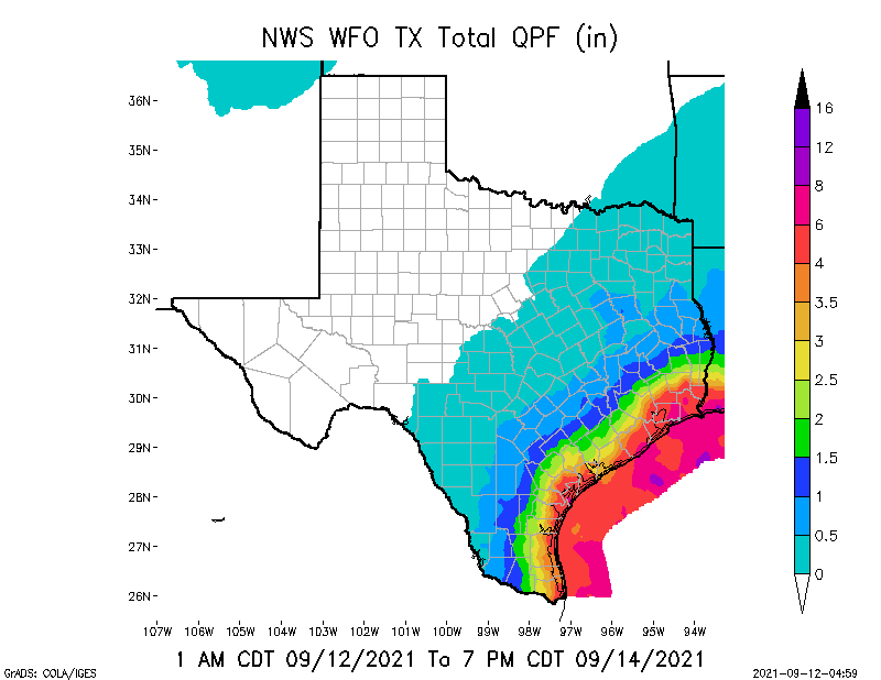
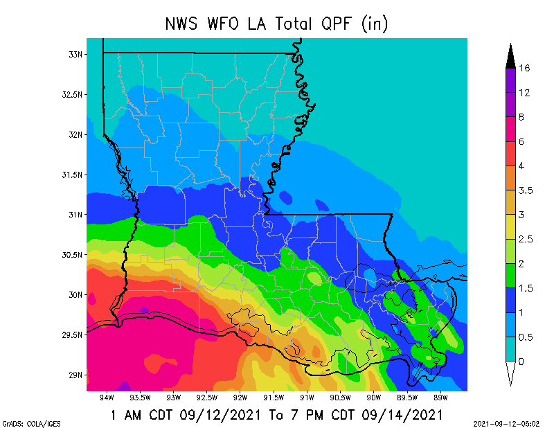
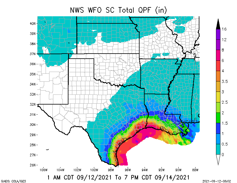
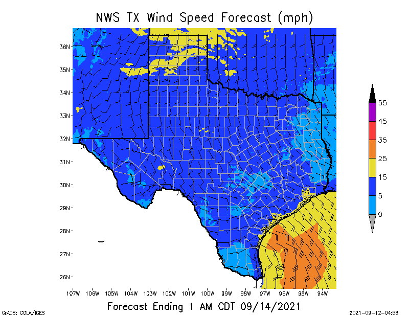
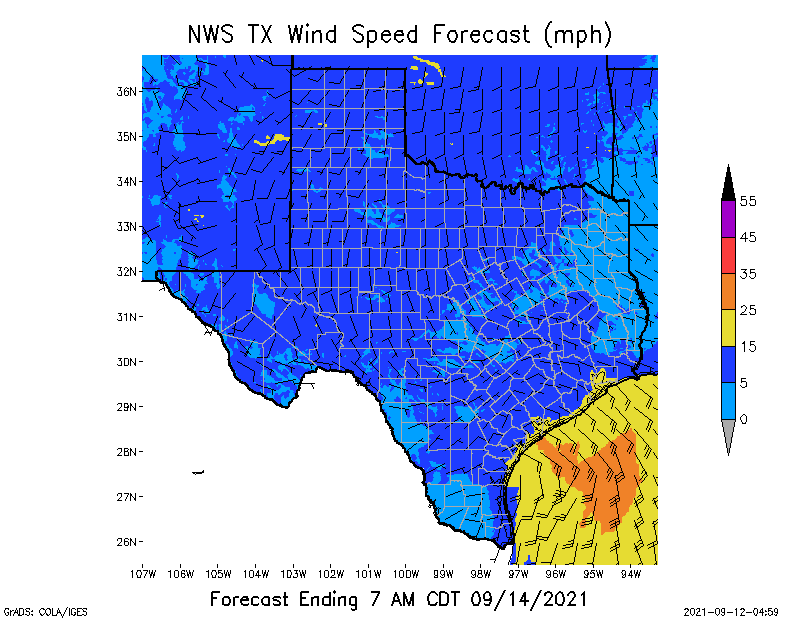
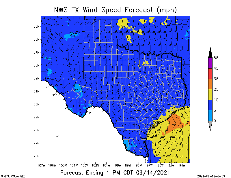
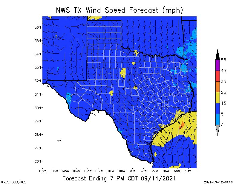
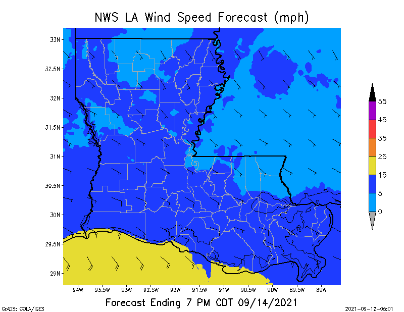
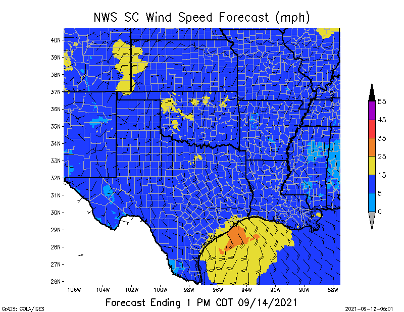
Invest 94L is now moving out of the Bay of Campeche and into the far southwestern Gulf of Mexico. It is expected to form into a Tropical Depression (TD) by this afternoon or this evening. If and when it forms into a TD, it will be named “Nicholas,” the 14th named storm of this hurricane season. This system is expected to move northward today, and beginning late tonight it could cause heavy rainfall in southern and southeastern TX and southwestern and south-central LA. This heavy rainfall is forecast to continue through Wednesday along the TX coast, and into early Thursday along the LA coastline. Total rainfall in parts of TX and LA could be in the 2” to 8”+ range over a 4-day period of time, with some localized area amounts even higher. If this system develops into a Tropical Storm, it could have sustained winds in the 35 to 45 mph range.
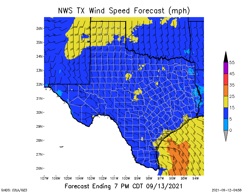
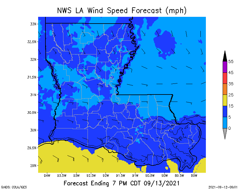
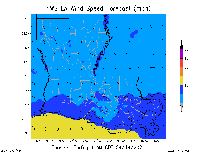
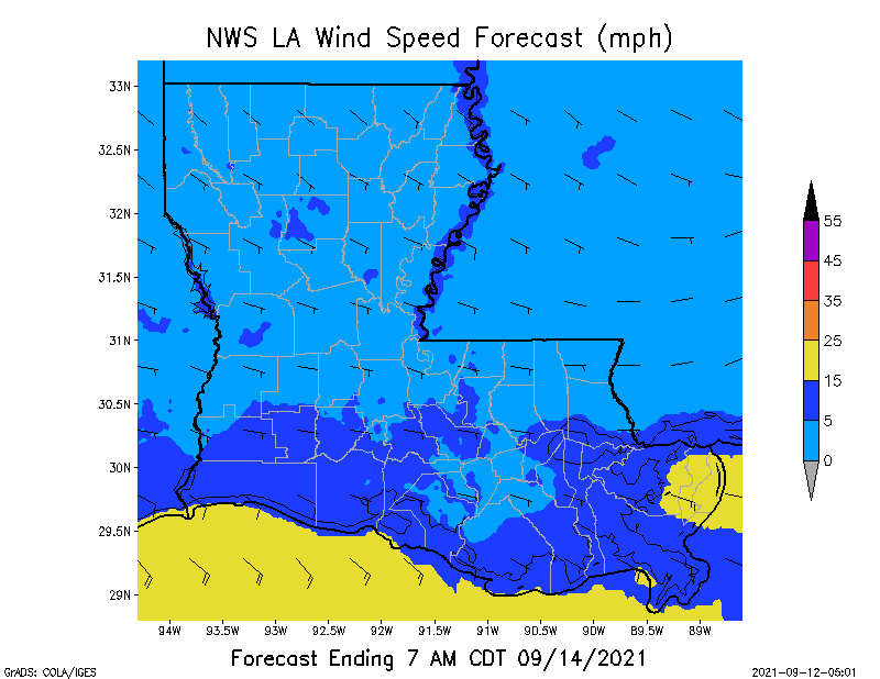
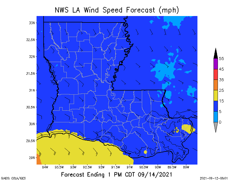
A second area of concern is a Low Pressure system that has formed near the Bahamas. It could develop into a Tropical Depression by the middle of this week, and it could move northwest toward the Carolinas. Again, this will be a disturbance to watch closely this upcoming week. Attached are Forecast Total Rainfall (QPF) graphics for TX and LA through Tuesday night, and 6-hour sustained wind speed forecasts through 7pm Tuesday for TX and LA as well. For crews working in southern and southeastern LA, it will likely be a wet week ahead, but winds should not be too much of a problem, so far.
Sid Sperry

 Show/hide attachments