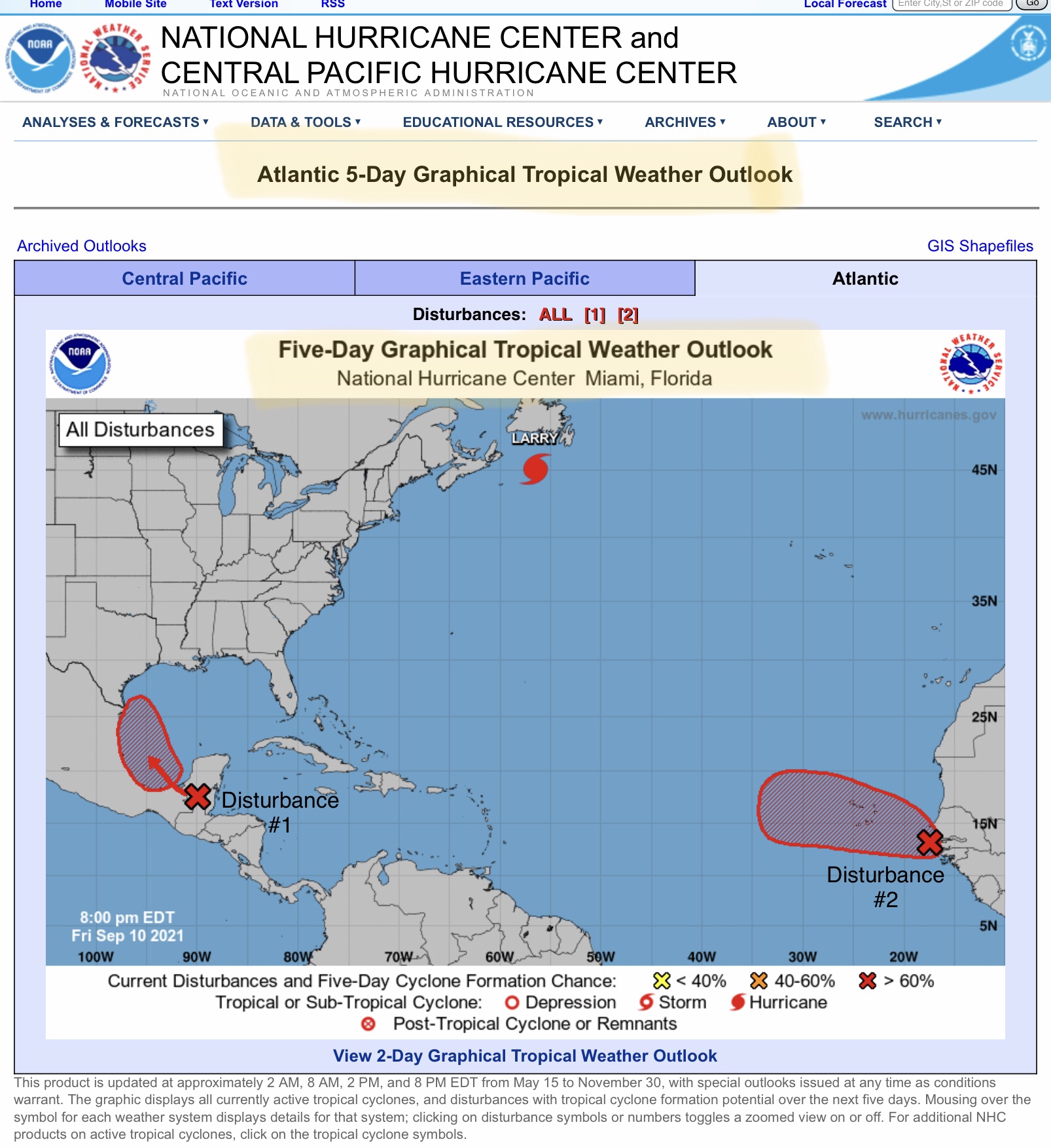
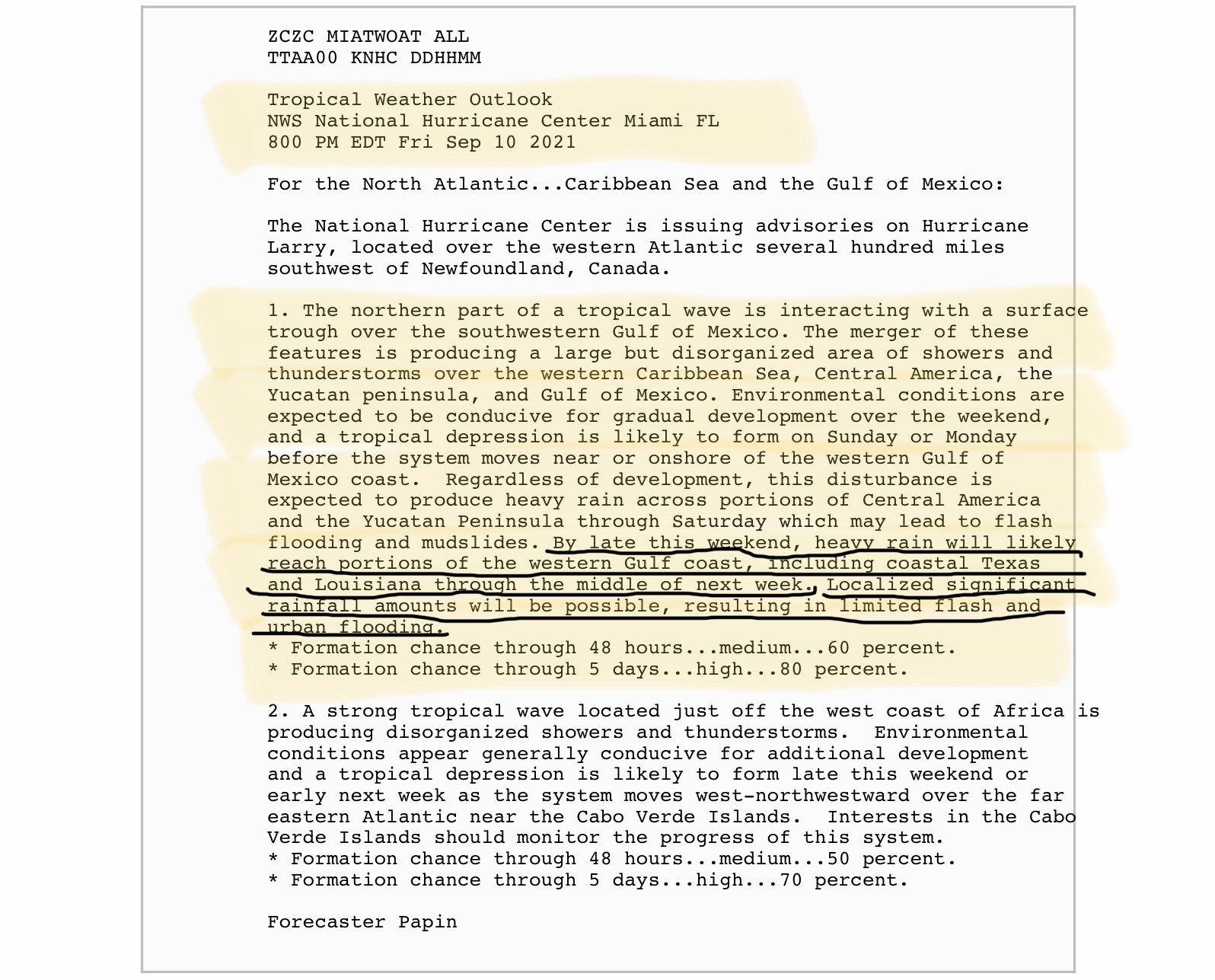
Tropical Depression or Tropical Storm Formation in western Gulf of Mexico highly likely over next 2 days; NHC gives 60% chance in 2 days, 80% chance in 5 days.
Sidney Sperry 11 Sep 2021 02:04 UTC
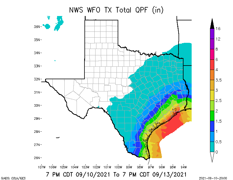
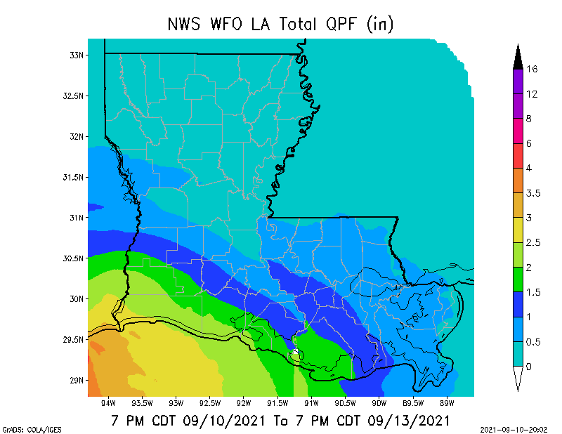
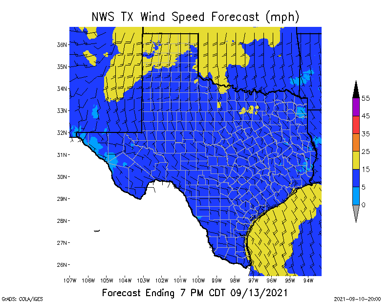
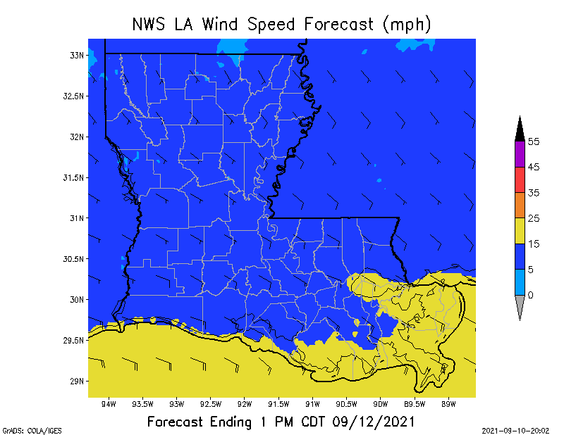
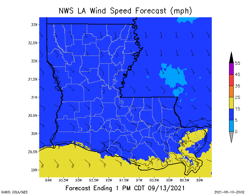
Tropical Disturbance #1 will move northwest from the Yucatán Peninsula this weekend and could form into a Tropical Depression or a Tropical Storm in the next 24-48 hours. Heavy rainfall of from 2” to 6” plus will be possible from the far southern TX coastline to just east/southeast of Houston, TX. Rainfall over the next 72-hrs along the LA coastline and inland approximately 40-50 miles could be in the 2” to 4”+ range. Sustained winds of 15 to 25 mph will be common all along the southern and southeast TX coast, as well as the southern coast of LA. Should this disturbance form into a Tropical Storm, sustained winds could reach the 35 to 45 mph range in some areas of TX and LA. Winds will generally be from the southeast to the northwest as this disturbance moves along the Mexico east coast and into far south TX over the next 3 to 5 days. Those crews working at SLECA could see a lot of rain (from 1” up to 3”) possibly beginning Sunday evening and continuing through Tuesday. I will update over the weekend. - Sid Sperry

 Show/hide attachments