Now Tropical Depression “Mindy” is bringing rain & gusty winds to parts SC & GA…
Sidney Sperry 09 Sep 2021 12:15 UTC
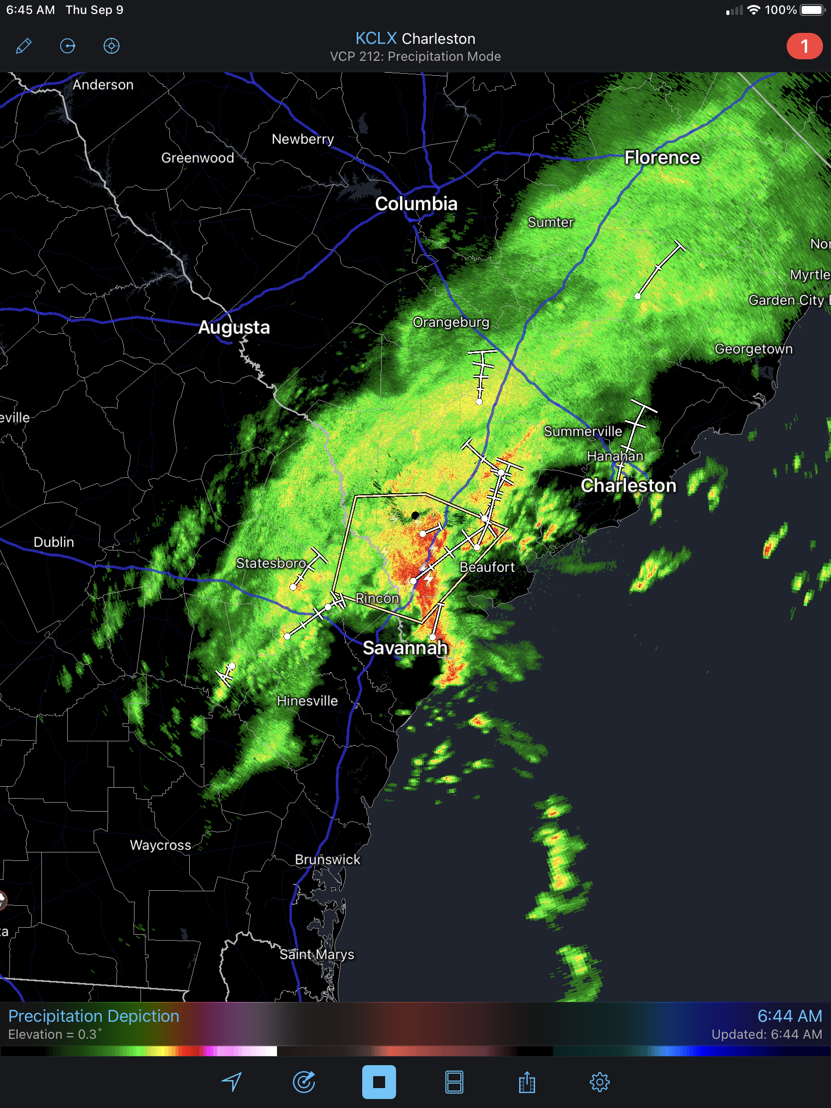
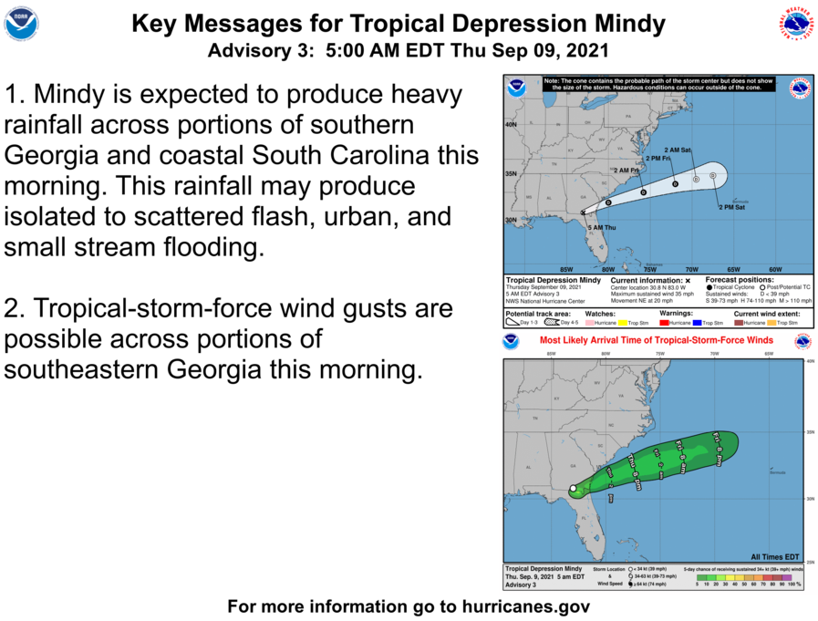
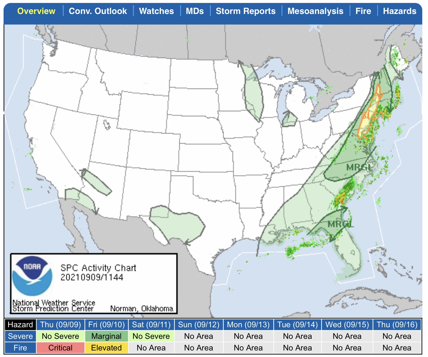
Tropical Storm “Mindy” has been downgraded to a Tropical Depression this morning by the NHC. Heavy rainfall is occurring in parts of southeastern GA and southern and eastern SC this morning (see screenshot of Charleston, SC, radar below), and the National Weather Service has issued a Special Weather Statement for parts of eastern SC due to gusty winds that could reach 45 to 55+ mph. Tropical Depression “Mindy” is moving very quickly to the northeast, and should be mostly back out into the Atlantic by this afternoon. There is still a marginal risk for severe thunderstorms associated with the remnants of “Mindy” for parts of far northern FL, southern GA, and southern & eastern SC. Some flooding and localized flash flooding is also possible in some areas. Rainfall amounts could range from 1” up to 6”.

Meanwhile, more rain and flooding is expected across much of the Northeastern U.S. over the next 2 days as a storm system moves eastward from Ohio and Pennsylvania.

And… two more “disturbances” are showing in the 5-day forecast maps from the NHC, one near the Yucatán Peninsula has a 20% chance of further development over 2 days, and another disturbance is now developing off the western African coast. NHC gives this second disturbance a 50% chance for further development over the next 2 days.

Needless to say, things are still “active” in the Tropical Atlantic. - Sid Sperry

 Show/hide attachments