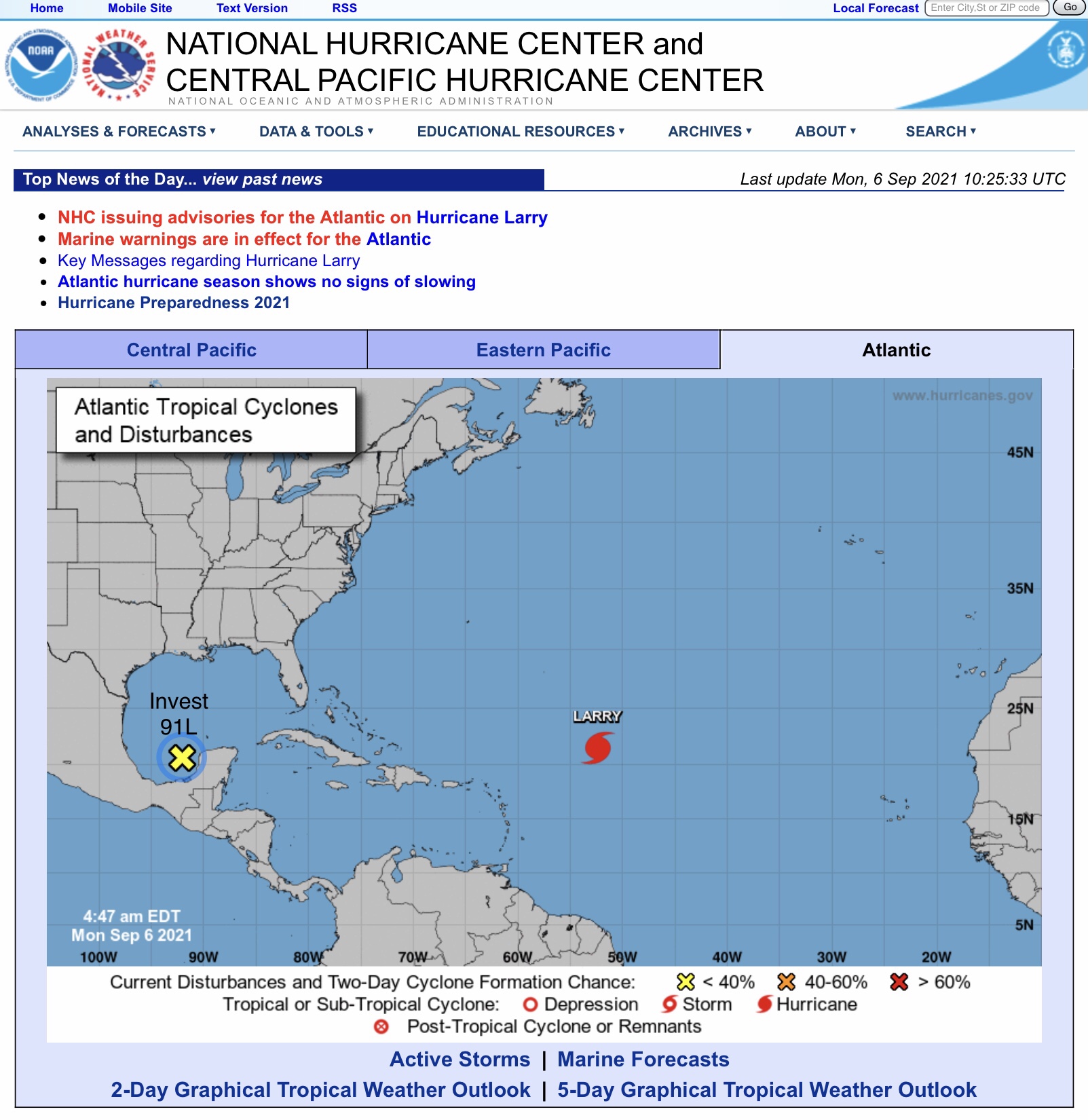
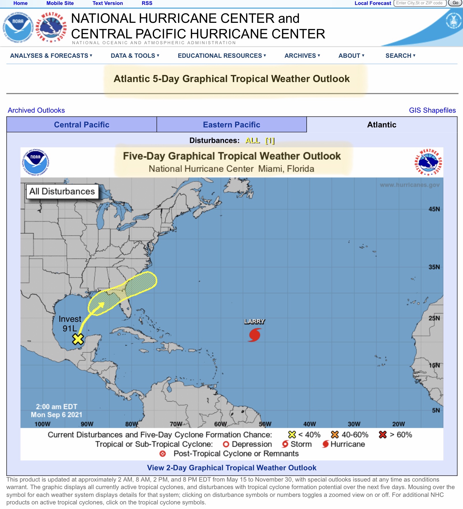
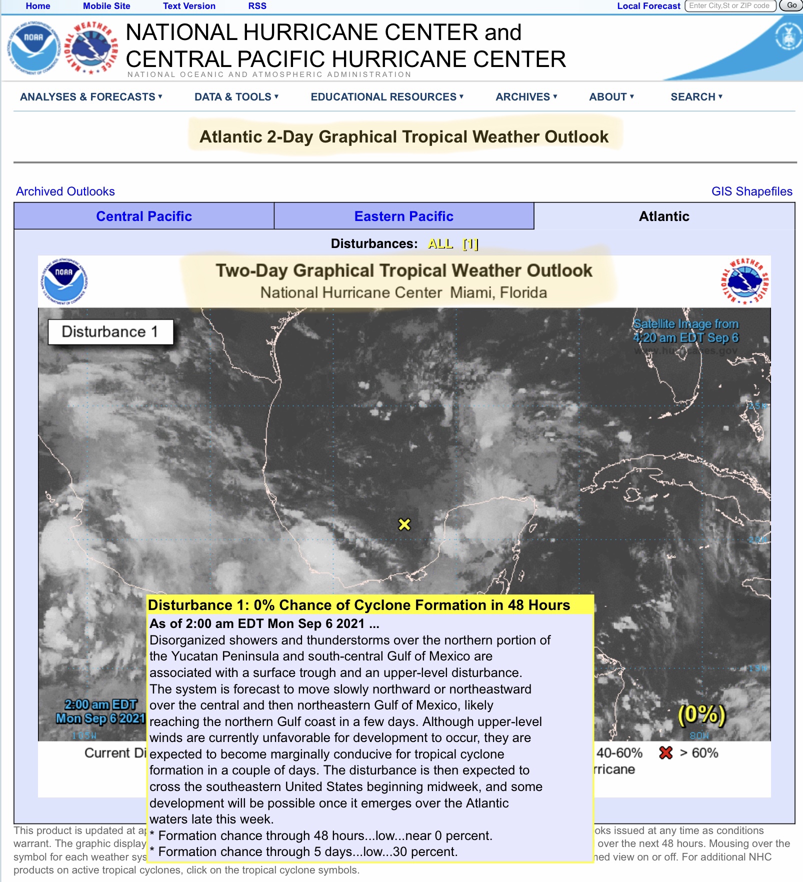
Good Monday morning to everyone. Invest 91L, the tropical disturbance that has now entered the southern Gulf of Mexico/Bay of Campeche region, is still a disorganized storm system. Forecasters are now predicting that Invest 91L will move north/northeast over the next 3 to 5 days, likely bringing from 1” up to 4” of rain to southern AL, much of northern FL and the FL Panhandle, southern GA, and, by Friday or Saturday, parts of southern SC. Invest 91L could develop into a tropical storm after it re-emerges in the Atlantic, but that won’t be until this coming weekend, at the earliest.
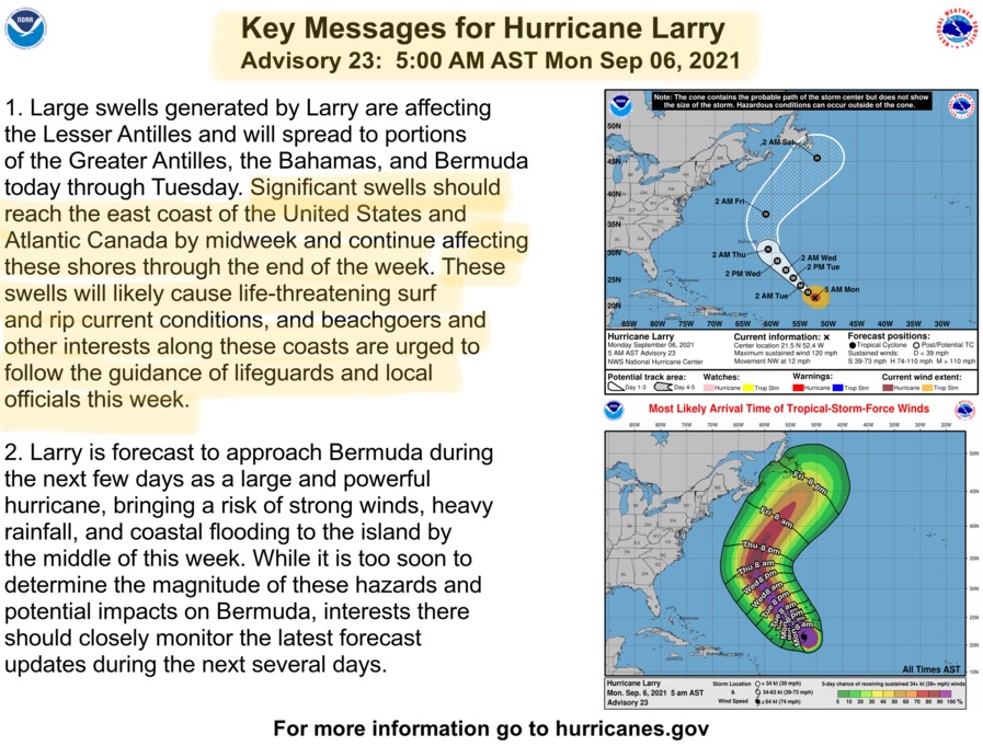
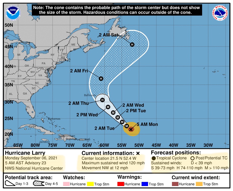
As for Hurricane Larry, it continues moving to the northwest at about 12 mph, and is still a major hurricane with sustained winds of 120 mph. Larry is forecast to skirt just to the east of Bermuda, but tropical storm force winds and large swells will likely cause some impacts to the island. Large swells could also cause some impacts to the east coast states, such as NC, VA, MD, DE, NJ, NY, CT, RI, MA, NH and ME by this weekend, before finally turning to the northeast, away from the Continental U.S.
There are no additional tropical concerns at this time.
Sid Sperry

 Show/hide attachments