4:00 pm Forecast Update from NHC and NWS on Hurricane Ida…
Sidney Sperry 28 Aug 2021 21:30 UTC
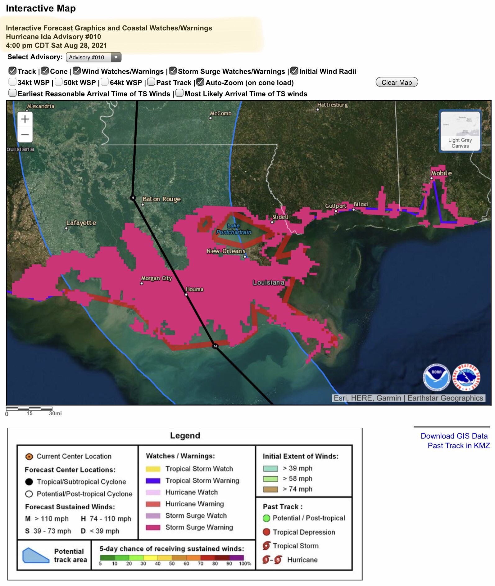
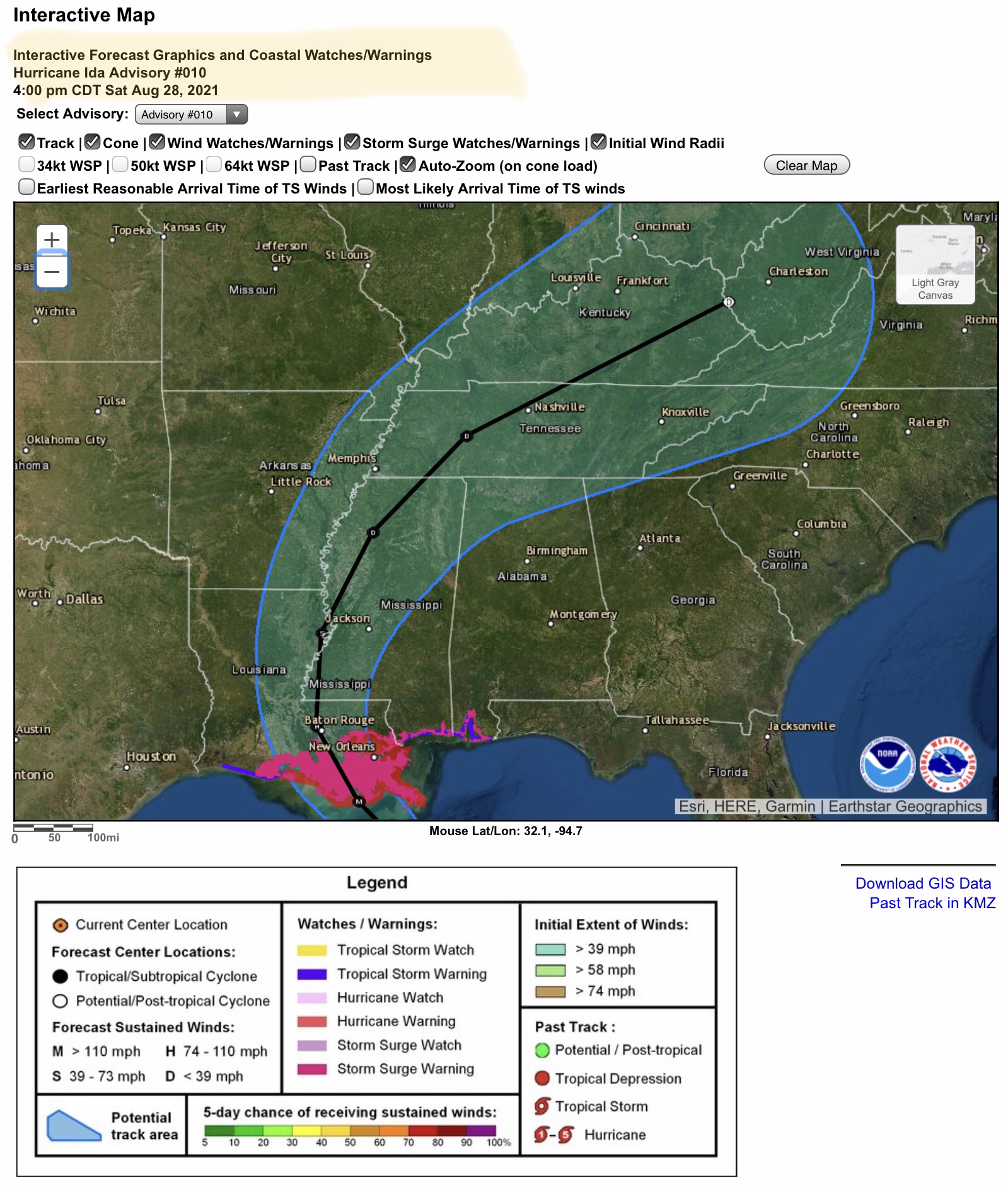
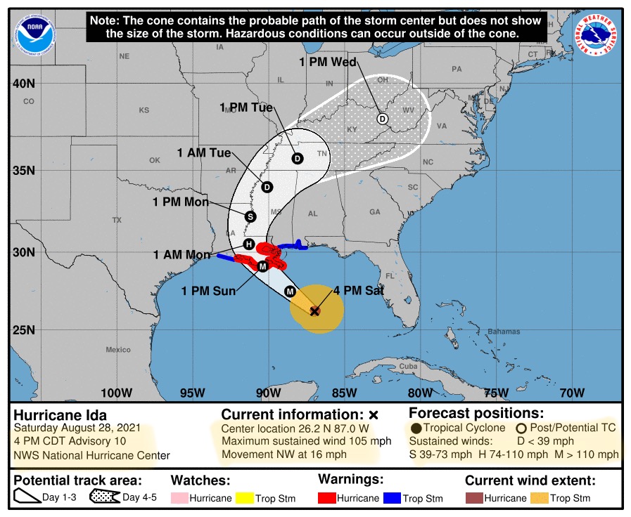
Hurricane Ida is now a Category 2 hurricane with sustained surface winds of 105 mph. Track has shifted slightly to the east, and some models continue to show an easterly trend in the track. If so, this would mean increasingly devastating impact possibilities for the large metropolitan area of New Orleans. Also at this time, Baton Rouge is still on the east side of the current track. However, Morgan City is on the west side, and Houma is near the center-line track of the projected eyewall. Ida is expected to increase in strength to a Category 3 major hurricane later tonight, and possibly to a Category 4 hurricane on Sunday before landfall. Mobile Bay (AL) has just now been placed under a “Storm Surge Warning,” partly due to this shift in the forecast track. More after 8:00pm tonight. - Sid Sperry

 Show/hide attachments